|
A "grudge peak" no more, we summited Norton Peak this time in the Smokys, a mountain range that has less visitors and more solitude than its illustrious neighbor to the north - the Sawtooth Mountains. Related: Miner Lake - Smoky Mountains, Idaho 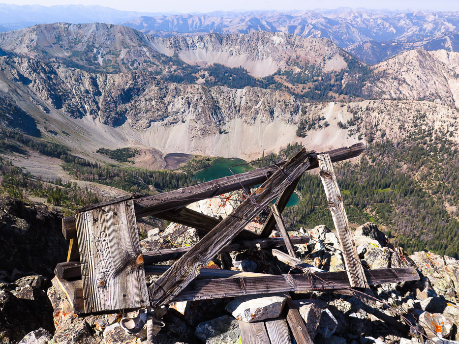 Norton Peak is a triangulation station for the Geodetic Survey; this wooden triangle-shaped tower with "10,336" engraved on it could have been placed on the summit to signify this fact. The brass disc marker was placed in 1967 (see below). Trip Stats: Location: The Smoky Mountain Range is located west and northwest of Ketchum, Idaho. Its northern boundary meets with the Sawtooth Mountains, its southern border extends to the Camas Prairie. Its eastern boundary is at the Big Wood River just west of Highway 75, the west border is the South Fork of the Boise River and the Soldier Mountains. It is administered by the Sawtooth National Forest (south) and Sawtooth National Recreation Area (north). Distance: 11.6 miles out and back (5.8 miles trailhead to summit). Elevation gain: Trailhead = 7,500', Summit = 10,336': Total gain = 2,836'. Difficulty: First 2.3 miles to Miner Lake trail intersection is easy-moderate Class 1. Climbing up Miner Canyon to Miner Lake at 4.1 miles is moderate with a few short strenuous intervals. From Miner Lake to Norton Peak summit is strenuous Class 1 with short distance of Class 2 at top of ridge crest. Trail more faint from Miner Lake to top, but can be followed with attention to tree blazes. Trails: #134 from TH to intersection, #135 from intersection to saddle that divides the Miner Lake and Norton Lake drainages. Spur trail to summit. Permit: No permit needed at Prairie Creek trailhead: there is a sign-in sheet. For info: Sawtooth NRA Headquarters (208) 727-5000. Map: Sun Valley, Idaho Trail Map - Adventuremaps.net. Interactive Map: Prairie Creek Trailhead, Sawtooth National Forest. Date hiked: 9/6/2019. Considerations: Last 0.35 miles on ridge; exposure to lightning if threat of storms. Potential high run-off at Prairie Creek crossing in early season. Water can be pumped from Prairie Creek. Dogs not required to be on leash, however it is a good practice due to multiple-use of this trail. Fishing: Idaho Fish and Game stocked Miner Lake with Westslope cutthroat trout 8/27/19. Driving directions: Drive 20 miles north from Ketchum on Highway 75. Turn left on Prairie Creek Road (FS 179) and drive 2.5 miles on good gravel road (passenger cars ok) to trailhead with large parking area. Hike directions: Cross West Fork Prairie Creek within a few hundred yards of trailhead, walk on a moderately-used trail for 2.3 miles on the west side of Prairie Creek to intersection of Trail #135 to Miner Lake. Hike Trail #135 for 1.8 miles to Miner Lake. From lake, hike southeast on Trail #135 for 1.2 miles to saddle that divides Miner Lake and Upper Norton Lake, seen from across the lake to the southeast. Trail faint near lake shore; look for tree blazes. From saddle, climb northeast up to ridge and then north along ridge to Norton Peak for 0.5 miles, going past a stand of pines, leveling off with an extended walk across exposed ridge to summit. Option: instead of hiking back to Prairie Creek Trailhead, hike down to saddle and continue walking on Trail #135 southeastward past Norton Lakes to Baker Creek trailhead: a car shuttle would have to be arranged in this case. Lat/Long: Trailhead: 43.7897 N -114.6604 W Norton Peak: 43.7620 N -114.6534 W 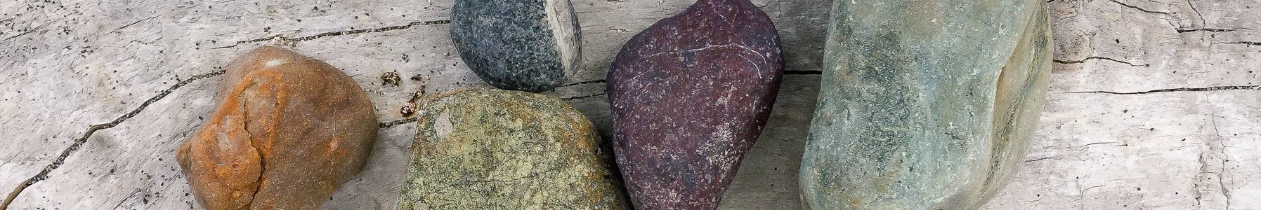
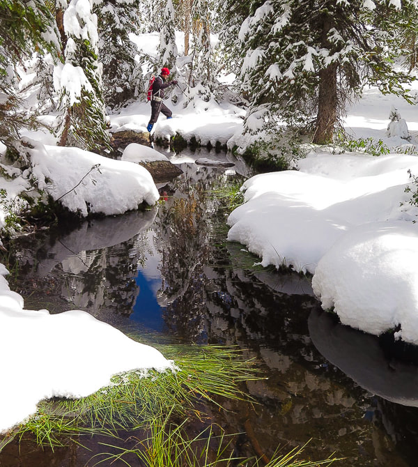
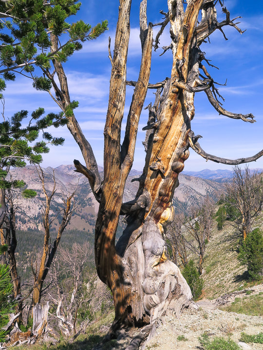
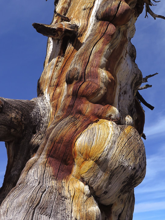
Geology and Mining History of Idaho's Smoky Mountains 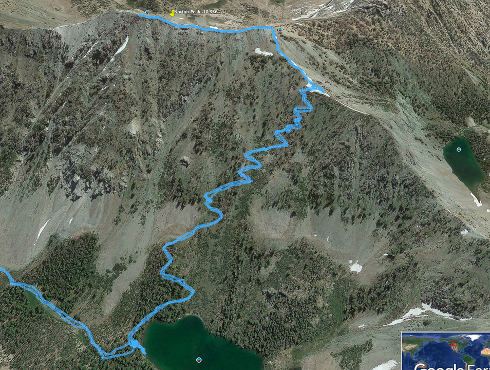 Our GPS tracks from Miner Lake to switchbacks up to saddle overlooking Norton Lakes to the right, to Norton Peak summit along ridge more maps below Our Hike Norton Peak became somewhat of a "grudge peak" after a failed attempt to summit it two years ago when a September storm left heavy snow and we got only as far as Miner Lake. Even without snow, the trail was reportedly faint, so we decided not to continue on to the summit not knowing where it was in 1-2 feet of snow. The contrast of fresh snow surrounding a green Miner Lake, thickly layering late summer's green vegetation was memorable. Norton Peak, the third highest point in Idaho's Smoky Mountains is a great hike for so many reasons: there's a potential of seeing mountain goats, there are few people on the trails, its meadows and streams are beautiful, its summits are challenging Class 2 scrambles, and you have the opportunity to celebrate in Ketchum afterward with great food, drink, and fun. The best of both worlds - that's why we love Ketchum. Across the valley to the northeast you get a great perspective of the entire Boulder Mountain range and emerald lakes. Both sides of the ridge as you approach the summit drop down steeply, so there is a feeling of walking on top of the range. Perhaps the Smokys are over-shadowed by the more famous and extolled Sawtooth Mountains just to their north, and as a result, there are less visitors. I was pleasantly surprised at their beauty and solitude. We have seen mountain bikers and horse-riders on this trail, as well as motorbike riders on Trail #134 to Prairie Lakes, so it is an area that is enjoyed by various modes of transportation. Trail #135 to Miner Lake prohibits motor vehicles. The Sawtooth National Recreation Area was created in 1972 by Congress as a result of national protests over the development of a proposed molybdenum mine with roads and an open pit at the base of Castle Peak, the highest in the White Cloud Mountains. The law established the SNRA, covering 756,000 acres and banned mining. Norton Peak and Prairie Creek trailhead are near the southern border of the SNRA. Trailhead (7,500') to Miner Lake (8,776') After spending the night in Wood River Campground, north of Ketchum, we drove to the Prairie Creek trailhead, happy that we had a clear day ahead of us. The morning was crisp as we made our way through a frosted and shaded forest - temperature 37 degrees. The first 2.3 miles on Trail #134 is a level hike along Prairie Creek through shade, except for a large meadow where steep eastern talus slopes caused by faulting are revealed. Prairie creek riffles over rocks making small waterfalls, even in September. Take the less-traveled Trail #135 to Miner Lake at the intersection. It will soon come to Prairie Creek with a wide crossing under large firs and pines. 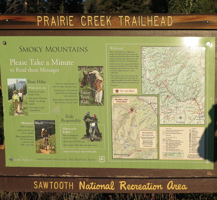 Hikers, bikers, horse riders, and motorcycle riders enjoy this area of the Smoky Mountains 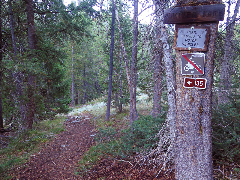 Intersection of Trail #134 to Prairie Lakes and Trail #135 to Miner Lake 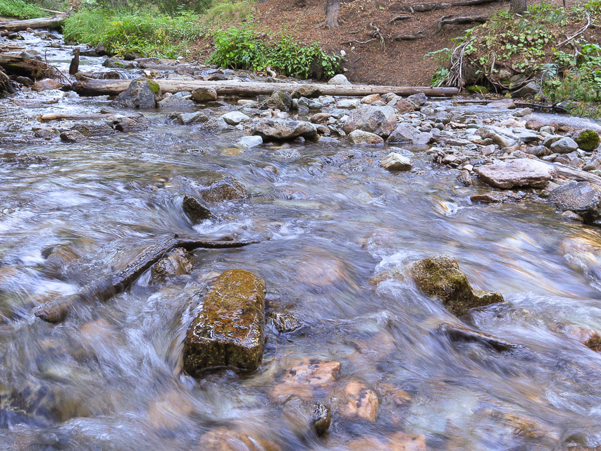 Prairie Creek crossing on Trail #135 to Miner Lake just after intersection with Prairie Creek Trail #134, 2.3 miles into hike After crossing Prairie creek at 7,640' elevation, climb 1.8 miles to Miner Lake at 8,780', making a 1,140' gain. The trail crosses over the creek running through Miner Canyon, then climbs up to overlook the deep canyon far below to the east with at least one waterfall. A few steep pitches up this part, then the trail crosses the point where an open meadow meets with the mouth of the canyon, and it emerges from the trees for the first view of Norton Peak to the southeast. It was here that our walk in the snow two years ago became unforgettably beautiful. Steep, gray talus slopes tumble down a U-shaped valley. Firs and pines tower as you head south toward Miner Lake. A few small crossings over the creek draining Miner Lake, a silent and pine-needle padded walk on level ground past some well-kept campsites, and you are at the edge of a steep-walled green lake. What a difference 1,140 feet of elevation can make! A photo below of our Miner Lake trip in the snow two years ago.... 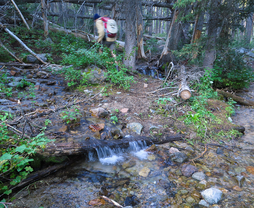 After Prairie Creek crossing, heading up Miner Canyon 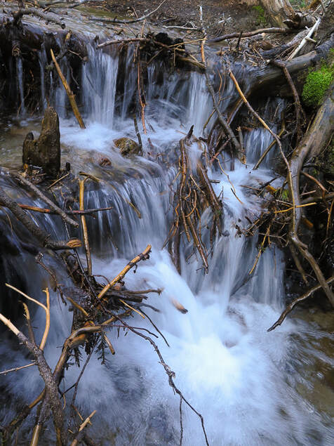 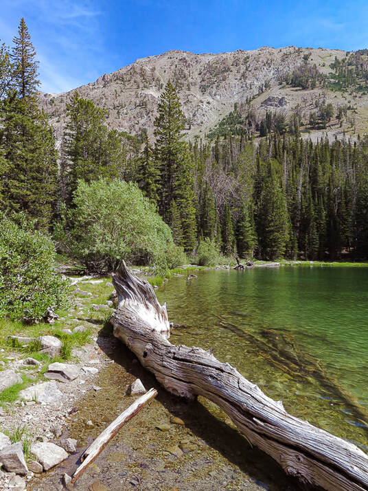 Miner Lake and Norton Peak on horizon 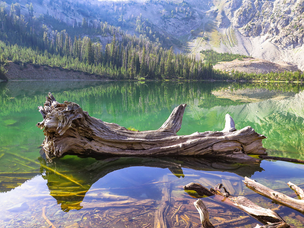 Miner Lake - Smoky Mountains, Idaho Walking through the shaded forest, a small bright light ahead slowly becomes more prominent, and as you emerge from the shade to the open shore, one by one the features of this beautiful lake come into focus. Dense stands of fir from the ridge overlooking the lake curve down to water's edge, interspersed with the raw, bare rock and talus slopes of the Idaho batholith. Bleached tree trunks lie horizontally, surrounded by reflections. But it's the jade green color that is so striking. On this morning, the lake is perfectly still, with nothing to disturb its glassy surface. Miner Lake to Norton Peak Return to Trail #135 on the east side of the lake to follow tree blazes marking the trail and traverse steeply through switchbacks of alternating tree stands and rocks. We reached the saddle, coming out of the shade of Miner Lake's cirque wall to full sunlight and a view of Norton Lakes on the other side to the southeast. From the saddle, take a left off Trail #135 (north/northwest), and head up a narrow, but well-defined trail to Norton Peak's south ridge. Trail #135 continues over the saddle and descends to Norton Lakes and ultimately to the Baker Creek trailhead. Although I had read that this was one of the best places in Idaho to see mountain goats, we saw none. We saw three other people on the summit that had hiked up from Norton Lakes. 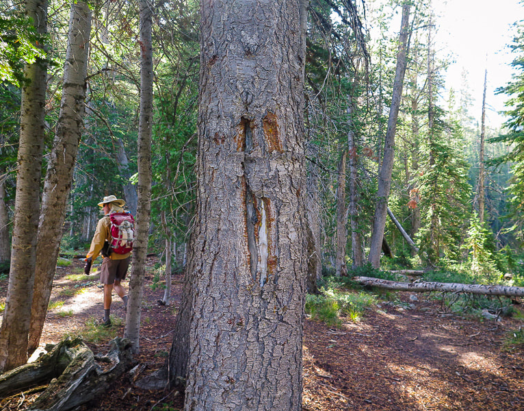 Tree blazes mark trail 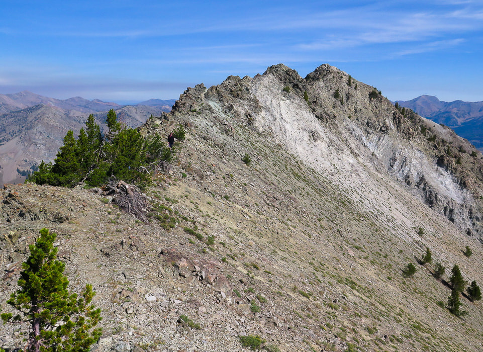 After the climb up from the saddle to the ridge along a defined trail, Class 2 scramble along ridge to Norton Peak (furthest right) A defined trail leads to the "sawtooth" rocks where there is mild-moderate exposure on the ridge. A three-foot tall wooden structure with "10,336" carved on it lies on its side at the summit, along with the peak register. The most striking view is that of the Boulder Mountains to the northeast, where a long hike will take you to the interesting remnants of the Golden Glow mine and the Boulder Historic Site, where galena ore (AKA lead sulfide) was mined. Supposedly the Smokys got their name from frequent forest fire smoke in the region. On the summit, we had time to sign the register, identify the surrounding mountain ranges, and celebrate; Norton was no longer a grudge peak! I spotted an interesting rock between the saddle and the ridge that looked like limestone. After research of the rock layers in the Smokys, I thought the rock was a sandy limestone of the Wood River Formation of Paleozoic sedimentary rocks. This was confirmed by a geologist at the Idaho Museum of Mining and Geology. This rock exhibits calcite crystals (Geology and Mining History of Idaho's Smoky Mountains). On the way down, we got a good look at Norton Lakes on the other side of the saddle. The next hike to Norton Peak will be via these lakes and Baker Creek trailhead. So much to explore, so little time! We celebrated in Ketchum with a juicy rib-eye, a whiskey sour (for me) and a Manhattan (for Fred). Life is good here in Idaho. I think I will stay awhile. 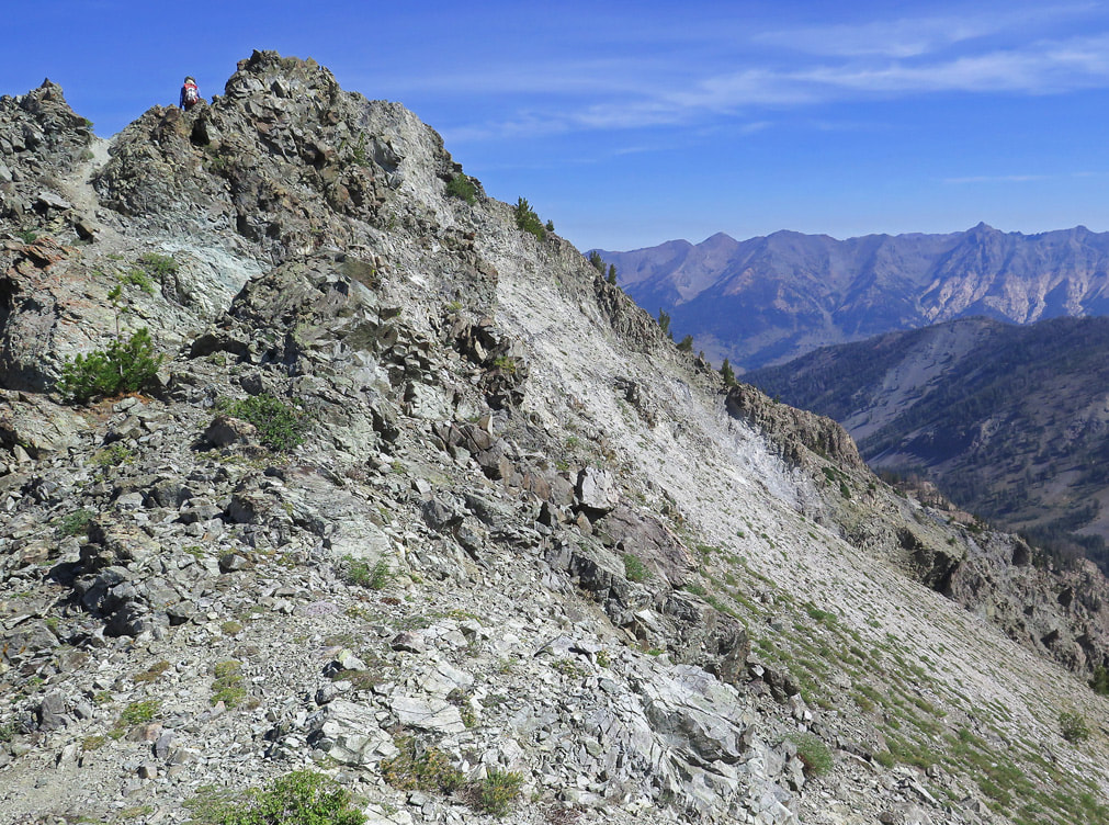 Trail on ridge is defined 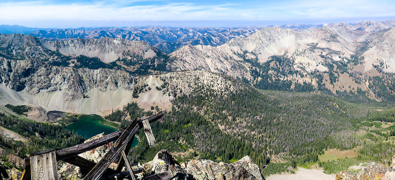 View of Miner Lake and western Smoky Mountains from Norton Peak summit 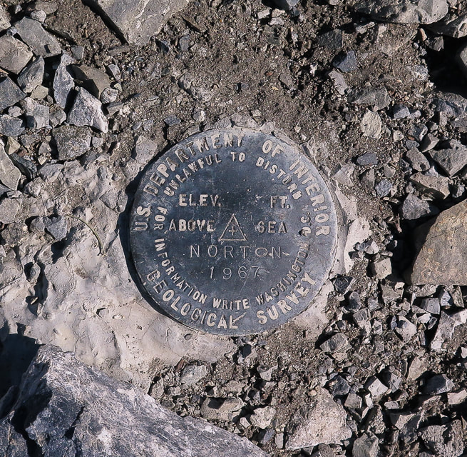 Norton Peak is a triangulation station as noted by the triangle on this geodetic brass disc. There are three reference markers that have arrows engraved on them on other high points that point back to this station. They are used for map-making. 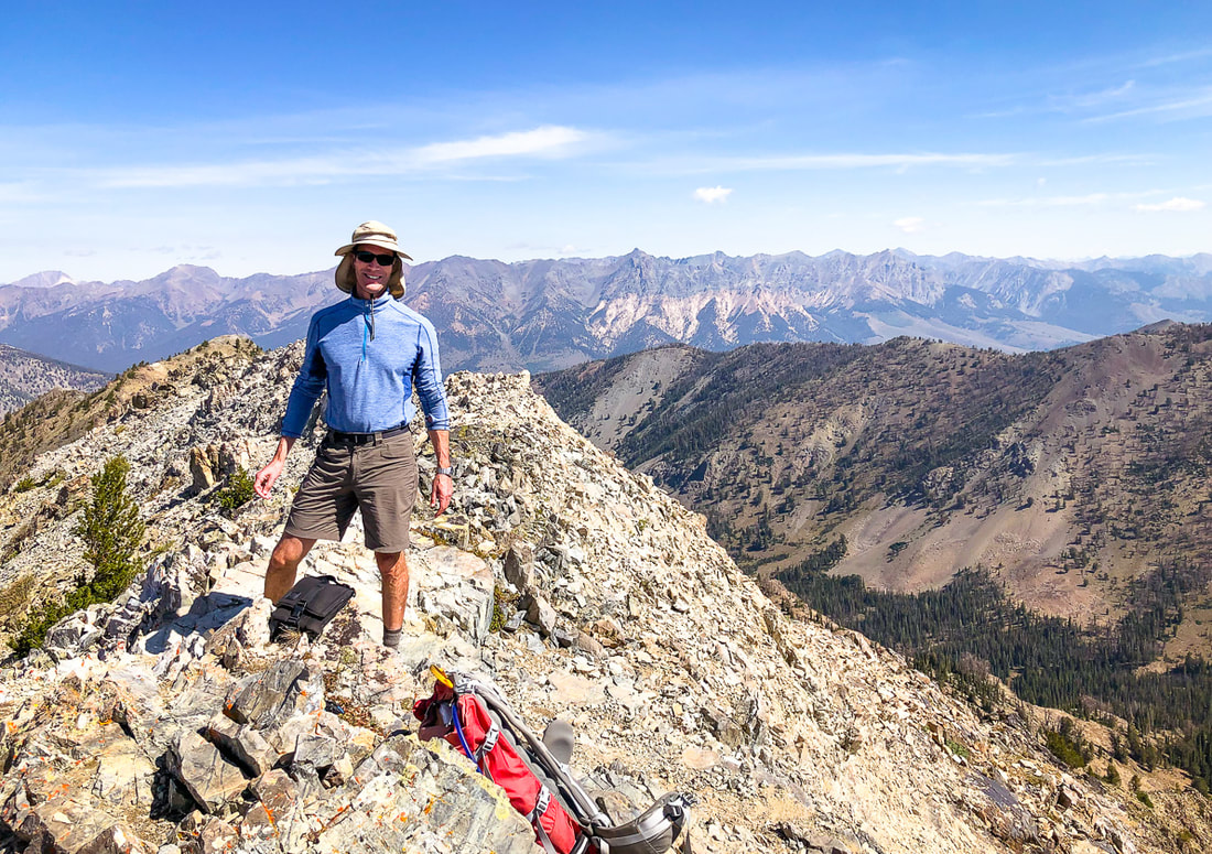 Boulder Mountain range and Castle Peak in the White Cloud Mountains (furthest left peak on horizon) behind Fred. 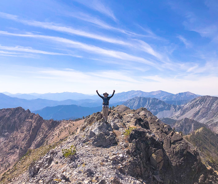 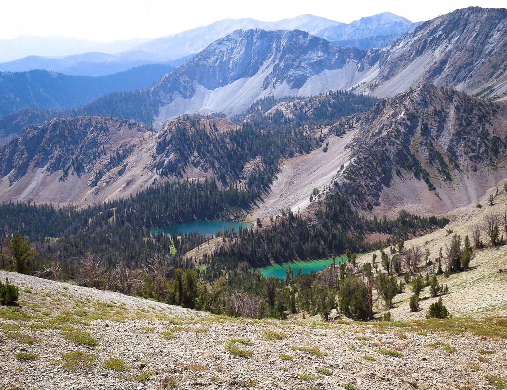 Norton Lakes on other side of saddle from Miner Lake. Trail #135 treks over the saddle, connecting these lakes 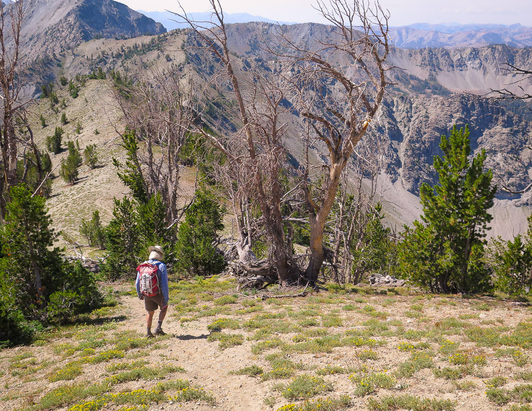 Descending toward saddle
L'arbre est tres magnifique! 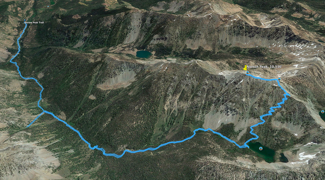 Tracks from trailhead (north) to Norton Peak; hike distance = 5.8 miles to summit Miner Lake lower right, switchbacks to saddle, then north on ridge to the summit (Top of image is east). 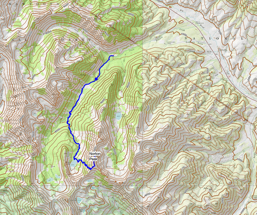 GPS tracks from trailhead to Norton Peak Click on map for larger view References:
Wutz, Katherine. 2010. In Late 1800's, Mining was King: Remnants of Silver Boom dot the Wood River Valley. Idaho Mountain Express. (Internet). USDA Forest Service - Sawtooth National Recreation Area Structural and Stratigraphic Transect of South-Central Idaho: A Field Guide to the Lost River, White Knob, Pioneer, Boulder, and Smoky Mountains. citeseerx.ist.psu.edu/viewdoc/download?doi=10.1.1.731.8163&rep=rep1&type=pdf Additional references on Geology and Mining History of Idaho's Smoky Mountains page.
8 Comments
Valerie Estabrook
10/31/2019 10:37:21 pm
Another good one Sue! Really enjoyed reading about this hike. As usual your photos are wonderful! Glad you bagged the "Grudge peak"! Looking forward to our next hike together!
Hi Val!
Bob Kuhnau
11/1/2019 12:09:36 am
Another good one Sue. I enjoyed the comentary and the beautiful pictures. I'm jealous of these hikes, but at 83 I think I'll just enjoy your explorumentarys.
Hi Bob,
Lynn K
11/3/2019 07:21:42 pm
Looks like a wonderful place! Thanks, Sue!
Linda, Leave a Reply. |
Categories
All

Sue and Fred

About this blogExploration documentaries – "explorumentaries" list trip stats and highlights of each hike or bike ride, often with some interesting history or geology. Years ago, I wrote these for friends and family to let them know what my husband, Fred and I were up to on weekends, and also to showcase the incredible land of the west.
To Subscribe to Explorumentary adventure blog and receive new posts by email:
Happy Summer!

About the Author
|