EXPLORUMENTARY
  • Home
    • Cactus to Clouds Hike
    • More Quotes
    • Ann Zwinger Quotes
    • Mary Oliver Poems
  • Hikes by State
    • Idaho
    • Southern Utah
    • Arizona
    • California Desert
    • Nevada
    • Wyoming
  • BLOGS
    • Adventure Blog
    • Women and the Land
  • GALLERY
    • DESERT PLANTS >
      • Beavertail cactus
      • Brittlebush
      • Christmas Cactus
      • Arizona Barrel Cactus
      • Parry's penstemon
      • Agave
      • Arizona Rainbow Hedgehog
      • Claret Cup Hedgehog
      • Desert Agave
      • Palmer's Penstemon
      • Silver Cholla
      • Cristate Saguaro
      • Indian Paintbrush
      • Ocotillo
      • Santa Rita Prickly Pear
      • Spiny Cliffbrake
      • California Barrel Cactus
      • Engelmann Prickly Pear
      • Velvet Mesquite
      • Joshua Tree
      • Buckhorn Cholla
      • Hedgehog Cactus
      • Fishhook cactus
      • Thompson's Woolly Locoweed
    • NATURE
    • BOISE
    • EARTH + SKY
    • URBAN
    • WATER
    • PATRIOT
    • ORCHIDS
  • Fit After 50
    • Brian Holgate
    • Fred Birnbaum
    • Dave Brasuell
    • Bus' Little Black Book
    • Mike Carlson
    • Ray Wilson
    • Bryan Krouse
    • Vickie Kearney
    • Maria Keezer
    • DOUG TRAUBEL
    • Boise Cross Fit Masters Ladies
    • Tim Clemens
    • Marcia Bondy
    • Becky Borczon Blake >
      • Becky B Downtown
    • Jennifer Cera and Sue Birnbaum
    • Dave Brasuell
    • Vance Powell
  • About
    • CONTACT

Hike Signal Peak, 10,369' - Pine Valley Mountain Wilderness, Utah

11/4/2022

2 Comments

 
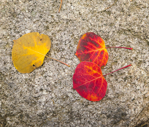
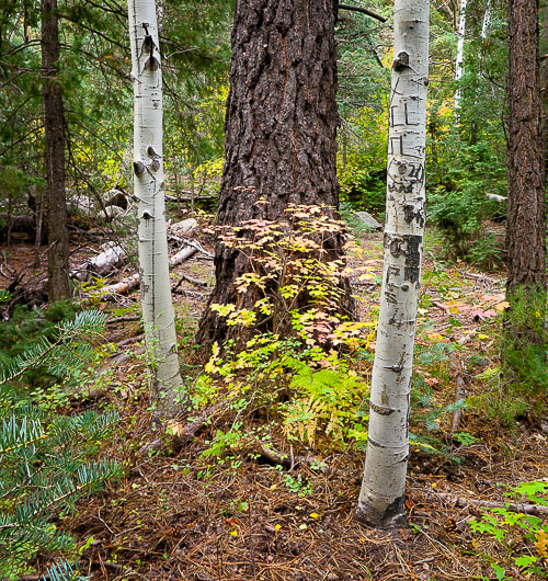
Outstanding autumn foliage in an aspen-filled forest on a long hike to the highest summit in Utah's Pine Valley Mountains.
​We've still got it in us!
Related:
Burger Peak, 10,320' - Pine Valley Mountains 
Gardner Peak, The Summit Less Traveled
List of Utah Hikes
Picture
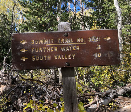
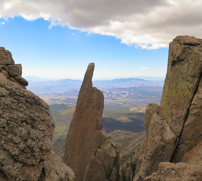
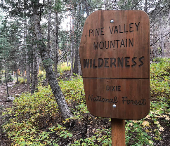
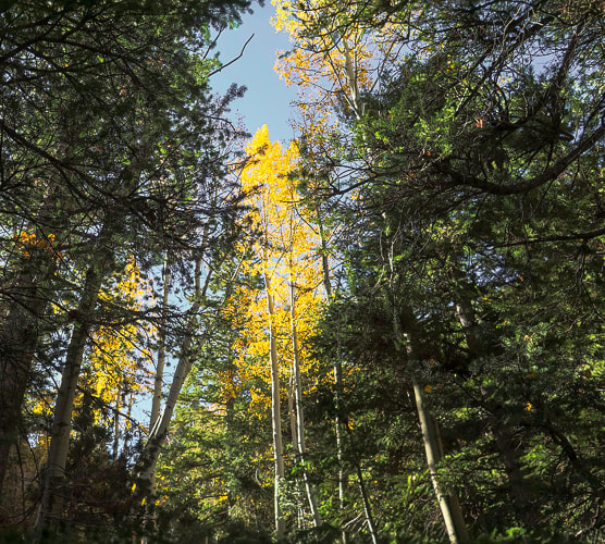
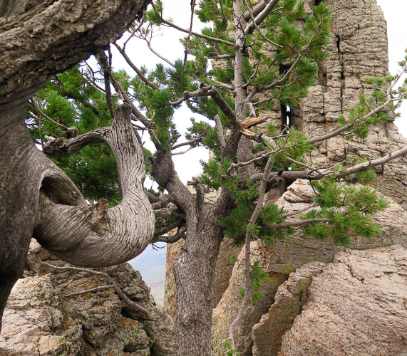
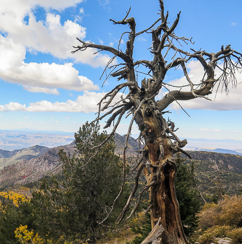
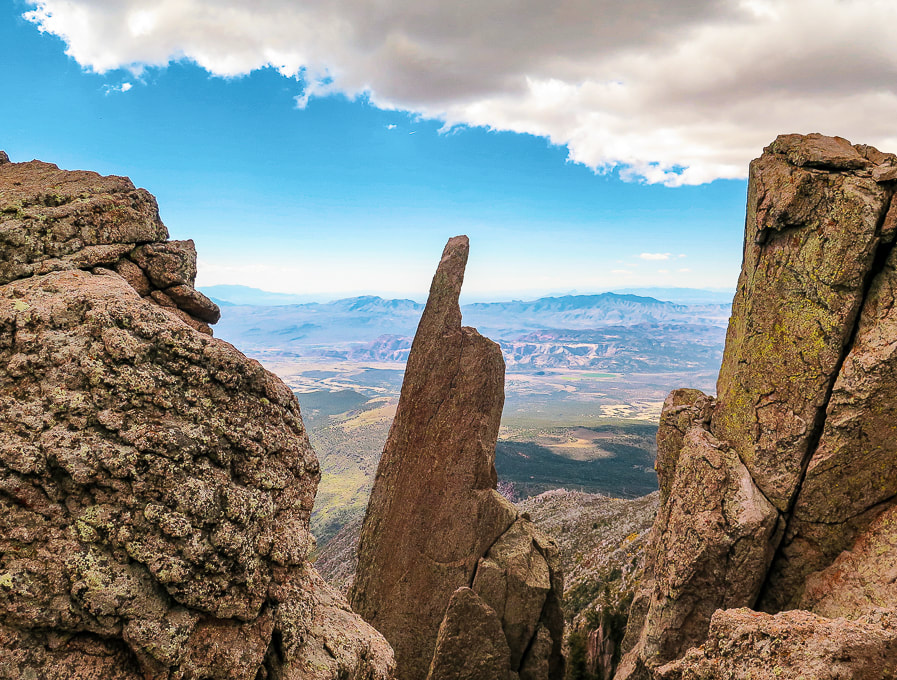
View south toward St. George and Red Cliffs National Conservation Area from Summit Trail in Pine Valley Mountains.
Trip Stats - via Forsyth Trail
Overview: 
Hike to the high point of Utah's fourth largest wilderness that has the most diverse flora of any other Utah range (1,000 species).  You can summit Burger Peak on the way to forested Signal Peak.  Start in mountain mahogany, walk along Forsyth Creek through aspens and ponderosa pines to summit of firs and pines.  A spectacular view of the Red Cliffs National Conservation Area and mountains in Arizona is seen as you climb out of the forest near the base of Burger Peak.  
Location:  Dixie National Forest, Pine Valley Mountain Wilderness, out of Pine Valley, north of St. George, Utah.
Distance/Elevation gain:  14 miles out and back/3,900' cumulative gain.  Trailhead = 6,650', Summit = 10,369'.
Difficulty:  Moderate - Strenuous on Class 1 to base of Signal Peak; Class 2 to summit (no trail).
Prominence:  4,485'.
Coordinates:  Forsyth Trailhead = 37.38331   -113.50682.  Signal Peak:  37.3197, -113.49162.
Trails:  Forsyth Trail (#31012) to Summit Trail (#31021).
Maps and Apps:  Trails Illustrated #715 - St. George-Pine Valley Mountains, Garmin GPS, Avenza (St. George/Springdale/Hurricane map).  
Date Hiked:  10/7/22
History:  Pine Valley was 
discovered by Mormon pioneers Gunlock Bill Hamblin, Jacob Hamblin, and Isaac Riddle when they were moving cattle north of Santa Clara for summer grazing.  A sawmill to process lumber was erected in 1856.   The tall white Pine Valley Chapel stands out as you drive through town.  Built in 1868 according to Ebenezer Bryce's plan, it is the oldest meetinghouse in continuous use of the Church of Jesus Christ of Latter Day Saints.  Bryce reportedly followed a lost cow later into a beautiful canyon - the now famous Bryce Canyon National Park.  Bryce's experience in Scotland as a shipbuilder was the impetus for the well-constructed chapel.
Geology:  The Pine Valley Mountain range is the largest laccolith in the U.S., and perhaps the world.  Molten rock was injected into existing strata 20 million years ago; top layers eroded to reveal this large body of monzonite rock (similar to granite).  This monzonite porphyry (coarse-grained) rock was deposited over the famous Claron formation, the rock that is seen in the form of hoodoos in Bryce Canyon.
Picture
Picture
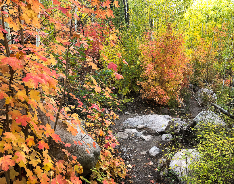
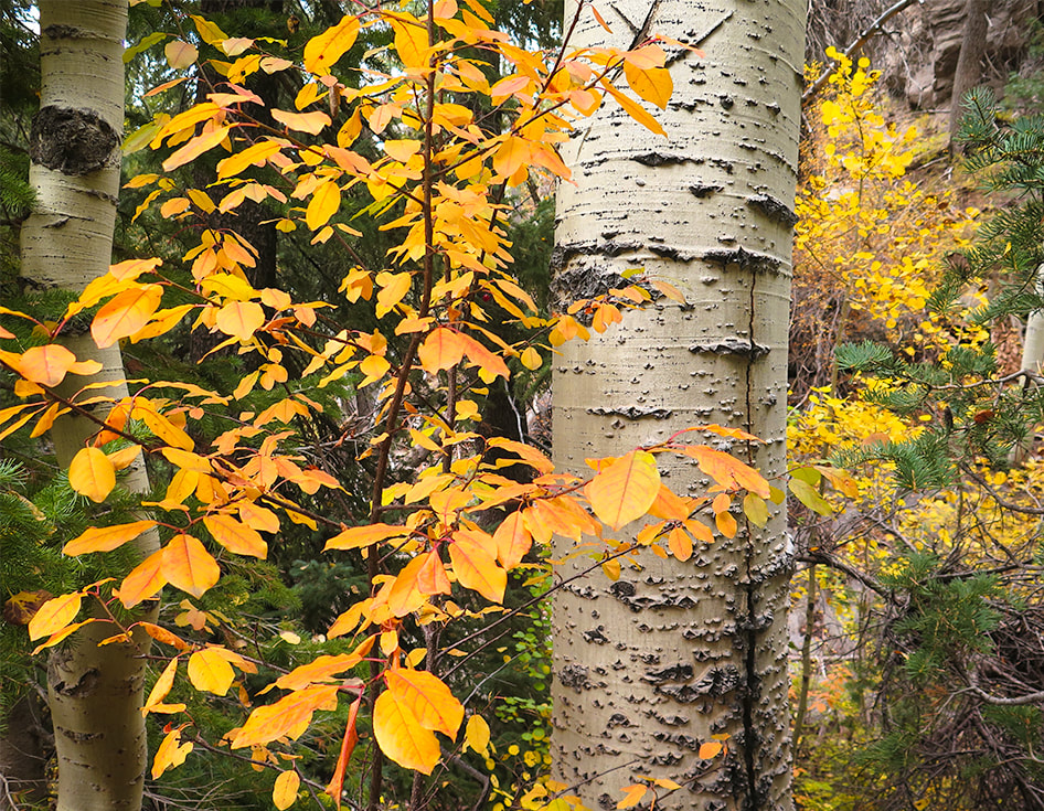
Our Hike
If you ever happen to be in southwestern Utah the first week of October, I highly recommend this hike.  The onset of autumn makes an enchanting forest in the Pine Valley Mountains; it reminds me of the spectacular autumn foliage we saw when we lived in New Hampshire.
​

​In my last post, I indicated that most people aren't aware of the hidden, magical world of southern Utah's Ashdown Gorge beneath the highway out of Cedar City.  It's the same with the steep and rugged Pine Valley Mountain Wilderness just north of St. George.  In this case, you can see this "sky island" rising like a hulk over red sandstone and black cinder cones, but it's not until you actually get into the heart of this wilderness that you realize its extraordinary beauty and find solitude.  
​
​We timed our hike to the highest point in the Pine Valley Mountains - Signal Peak - perfectly.  The autumn colors were at their optimum, adding variety and depth to this dense forest.  We had already summited Burger Peak, the second-highest in this beautiful, lightly-traveled mountain range, navigating deep snow banks in the spring.  Lucky for me, afternoon clouds provided the best light that made these colors glow, so I spent a lot of time yelling ahead to Fred that I had stopped to photograph.  We saw only three other hikers who were also enjoying the "zen" of this enchanting forest.

We are frequent visitors to this range that is remarkable for having the most botanical species than any other Utah mountain range - including three new species to Utah recently identified.  We hiked Gardner Peak, a summit not often traveled a few months ago with friends.  


​Striking rock formations growing gnarly old trees form steep cliffs with almost vertical valleys that drop toward the south when you finally emerge from the forest for a huge view of Southern Arizona and the red and yellow rocks near St. George at about 10,000 feet elevation.  It's a brief view near the base of Burger Peak, and then it's back into the forest for the one-mile walk to  Signal Peak summit.  The spur trail to Burger Peak, ~ one mile before Signal Peak, is marked by an easy-to-miss two-rocked duck.  
Hike Summary
  • 1.5 miles from Forsyth Trail trailhead, enter the Pine Valley Wilderness and walk along Forsyth Creek. 
  • At ~ 2.0 miles, the trail crosses the creek and begins a steep switchback climb; trail continues southward.
  • At ~ 5.0 miles, intersection with Blake-Gubler Trail (South Valley on trail sign).  Keep left on Summit Trail #3021.  
  • At ~ 6.0 miles intersect with climber's trail to Burger Peak Summit. View to the south.
  • At ~ 6.6 miles we left Summit Trail.
  • At  7.0 miles reach Signal Peak.
Picture
Scramble from Summit Trail to Signal Peak Summit
We found Summit Trail to be well-marked with cairns and tree blazes. I took a waypoint on my Garmin as we left the Summit Trail to make sure we would catch it again on the descent.  There is no marked trail to the summit.  If you pay attention on your descent from Signal, you will see Summit Trail, but it may not be obvious. I used Avenza app to find the summit.  The peak is forested, so there's no great view.
It had been awhile since Fred and I had hiked 14 miles with such a gain.  Doubts about whether I could do this hike with the same pace I have in the past crossed my mind.  Even though we are 61, we hiked as we had 20 years ago.  Well, maybe I was a bit more tired than I would have been 20 years ago.  Guess our legs are so used to it.  I believe our bodies, in many instances, can be pushed more than we think.  And there are usually rewards that come with challenges:  a stronger and happier body and mind!                             
​Don't wait - just go!  -  Next post:  Adventures in Kanab
“There’s a constant tension in climbing, and really all exploration, between pushing yourself into the unknown but trying not to push too far. The best any of us can do is to tread that line carefully.”
– Alex Honnold, the first person to free solo El Capitan in Yosemite National Park

Picture
Picture
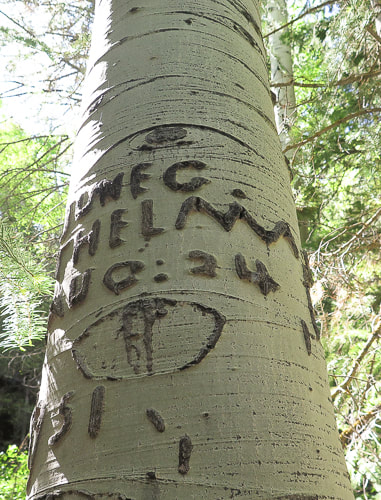
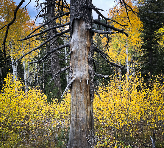
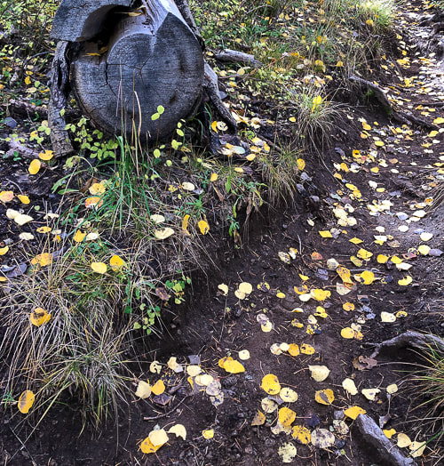
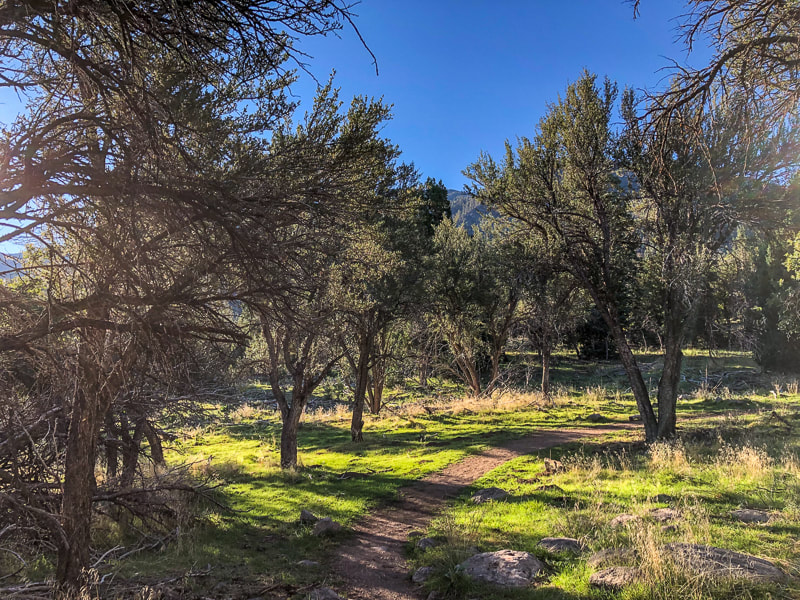
Mountain Mahogany lines the first mile of the Forsyth Trail.
Picture
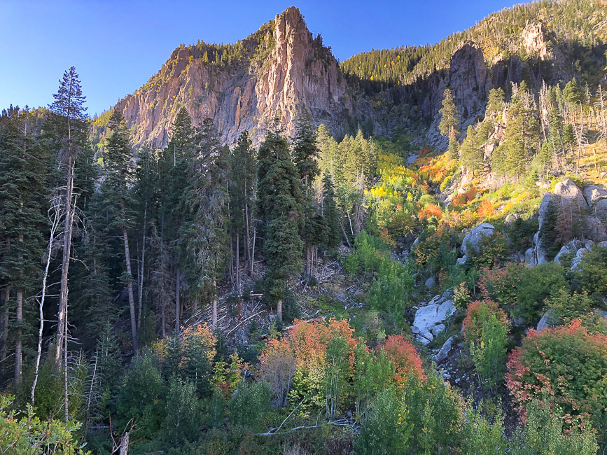
Ascending Forsyth Canyon - these cliffs are seen from the town of Pine Valley.
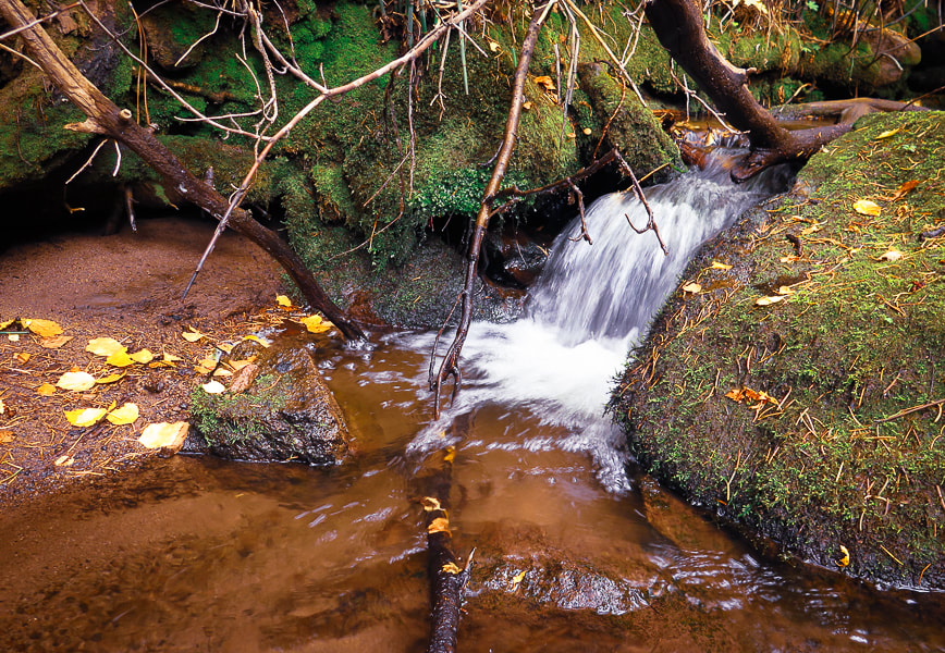
Picture
Forsyth Creek
Picture
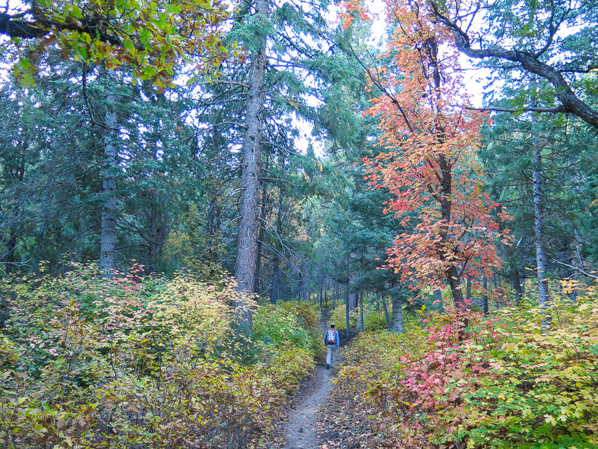
Almost at Pine Valley Wilderness boundary.
Picture
View south to St. George and Arizona
Carving of "August 24, 1951"; also appears to be carving of mountain range with moon or sun above.
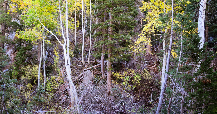
Some cool stuff on the trail.
Picture
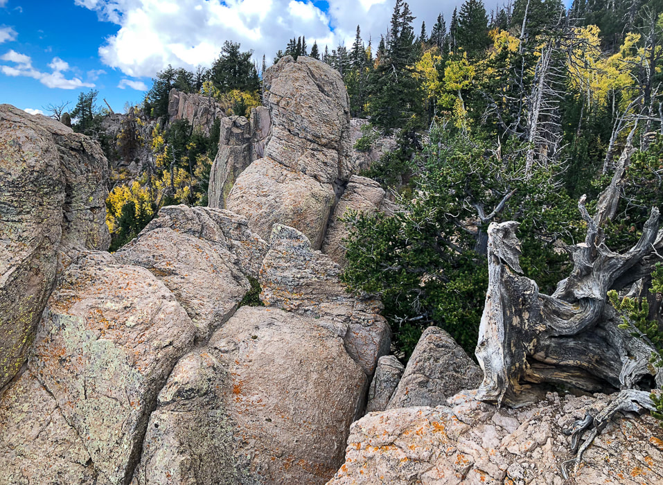
Rocks of Pine Valley Mountain range are monzonite porphyry, a coarse-grained intrusive rock from molten lava.  It is deposited over the Claron Formation, the rock famous for hoodoos in Bryce Canyon National Park.
Picture
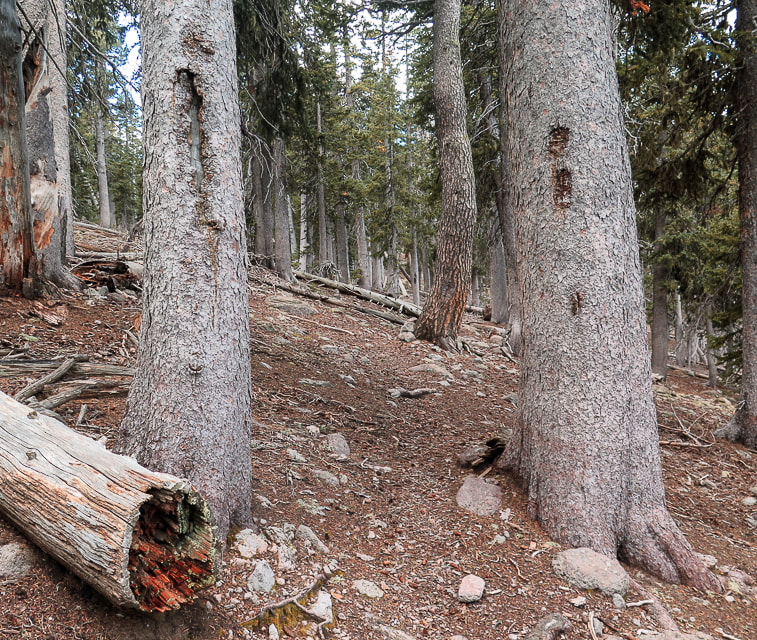
Tree blazes on the lightly-traveled Summit Trail that links Pine Valley Mountain range's highest peaks.
Picture
Picture
Picture
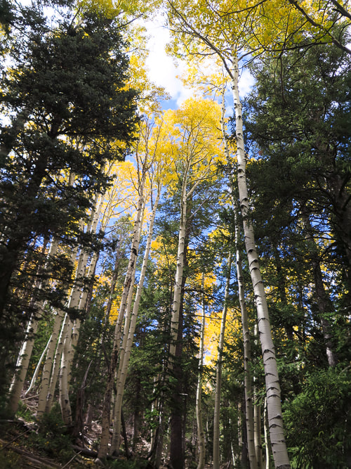
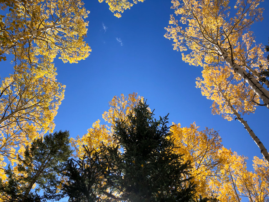
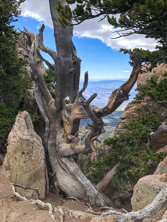
Large stands of Engelmann spruce exist on the southern portion of the Pine Valley Wilderness, near Signal Peak.
Picture
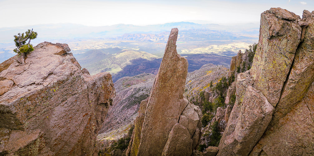
The beautiful monzonite porphyry! - Oh, and the lava flows and red rocks to the south near St. George.
Picture
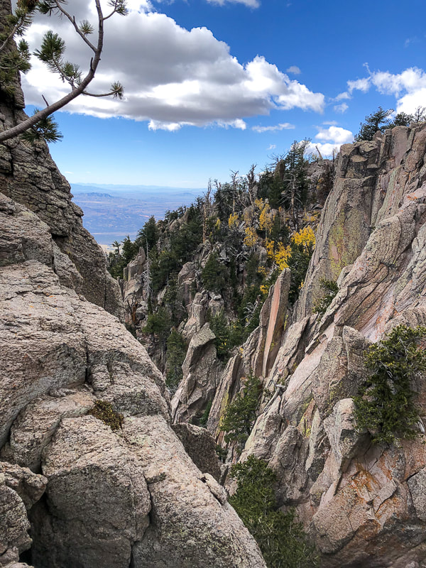
Views from Summit Trail between Burger and Signal Peaks.
Picture
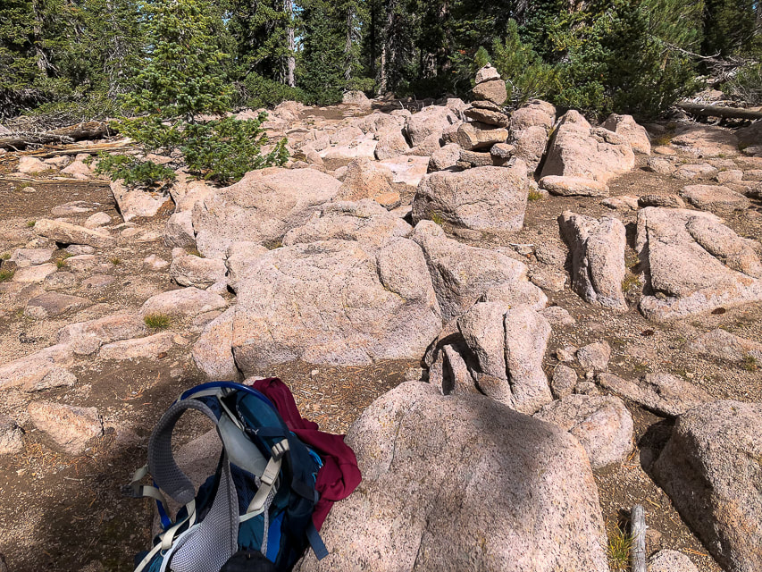
The rock cairn that marks summit of Signal Peak.  I could not find a peak register.
Picture
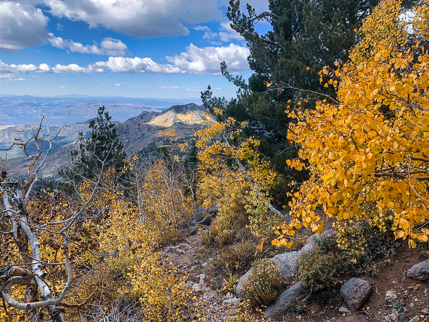
Near the highest elevation of the Pine Valley Mountains looking west at patterns of clouds/sun changing light on the landscape.
Picture
Picture
Picture
Picture
Picture
Picture
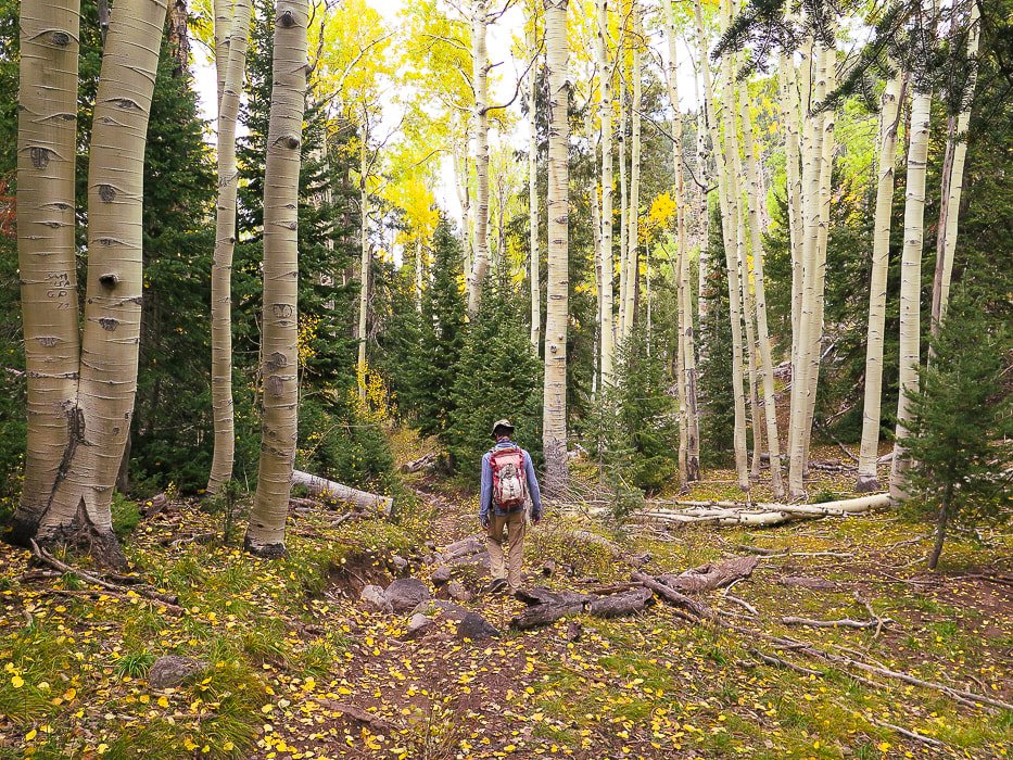
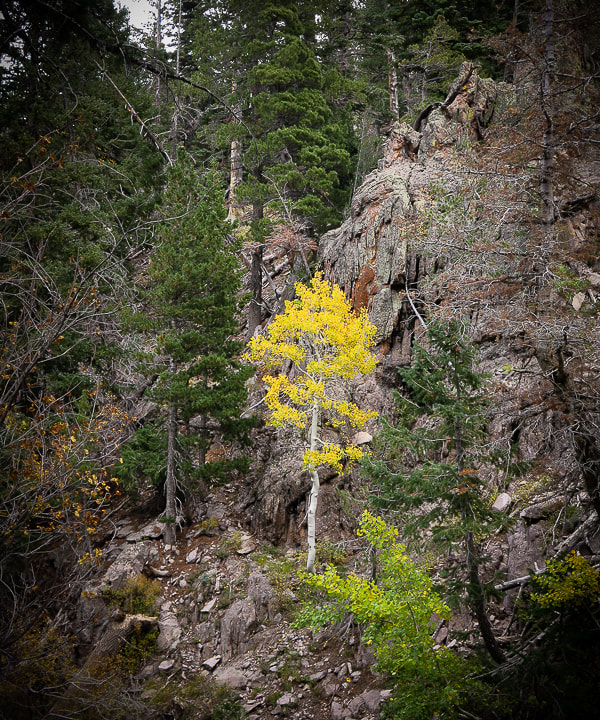
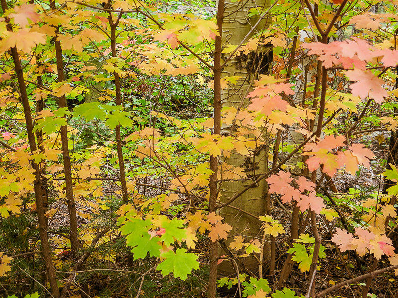
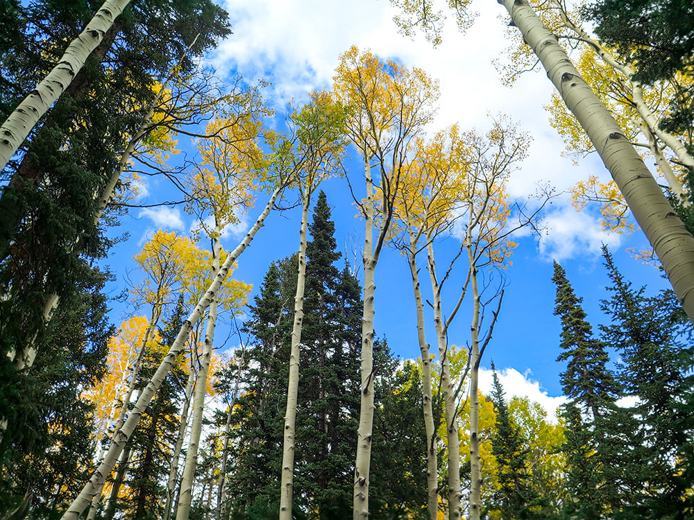
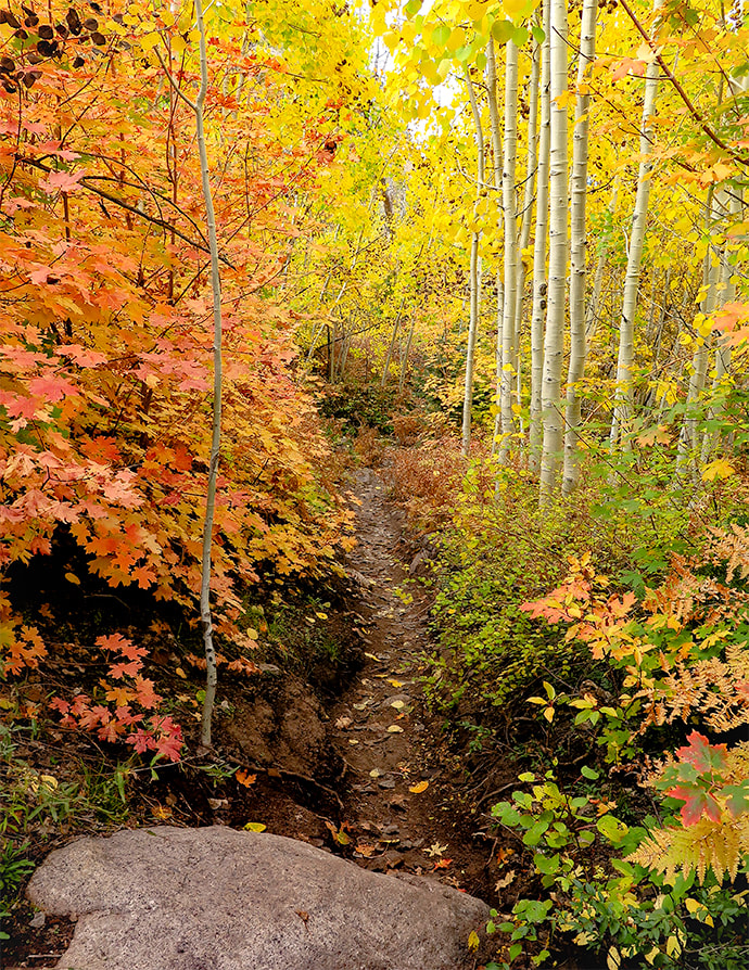
Temperature perfect.  Light perfect.  Beauty surrounding the trail.  Wish I could stay longer!
Picture
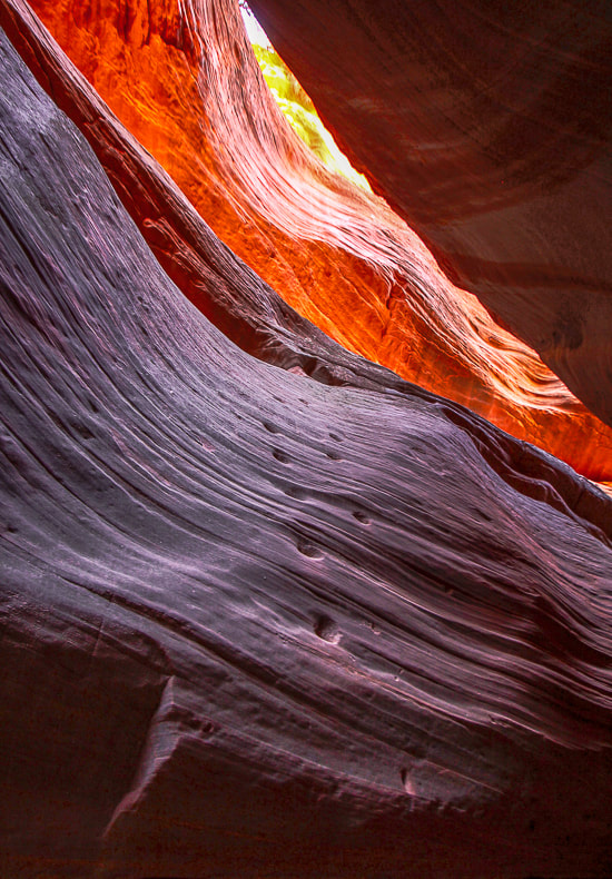
A look at my next post:  Adventures in Kanab.
Peakaboo slot canyon

Picture
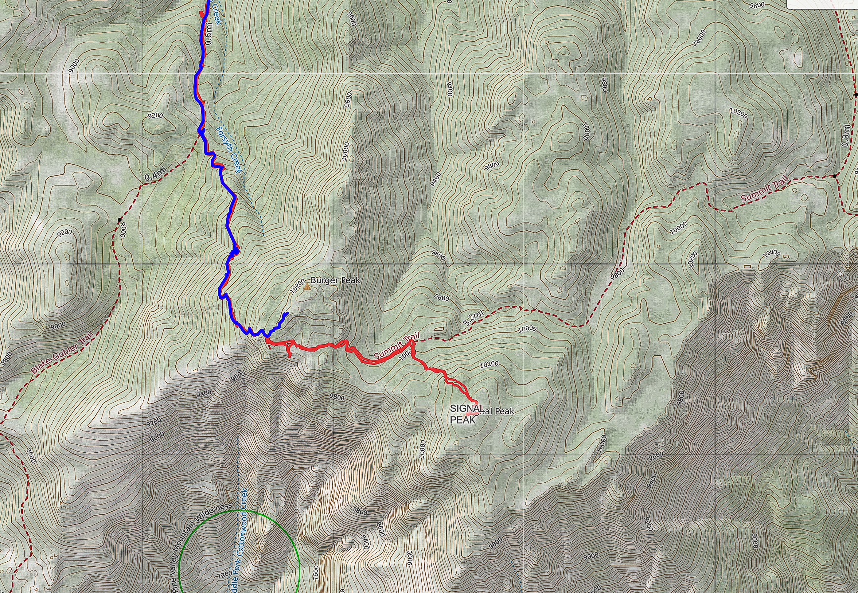
Our GPS tracks to Burger Peak (previously in blue), as it becomes Summit Trail after intersection with Blake-Gubler Trail.  Our tracks to Signal Peak, highest elevation in Pine Valley Mountains are in red.
Click for larger image
Picture
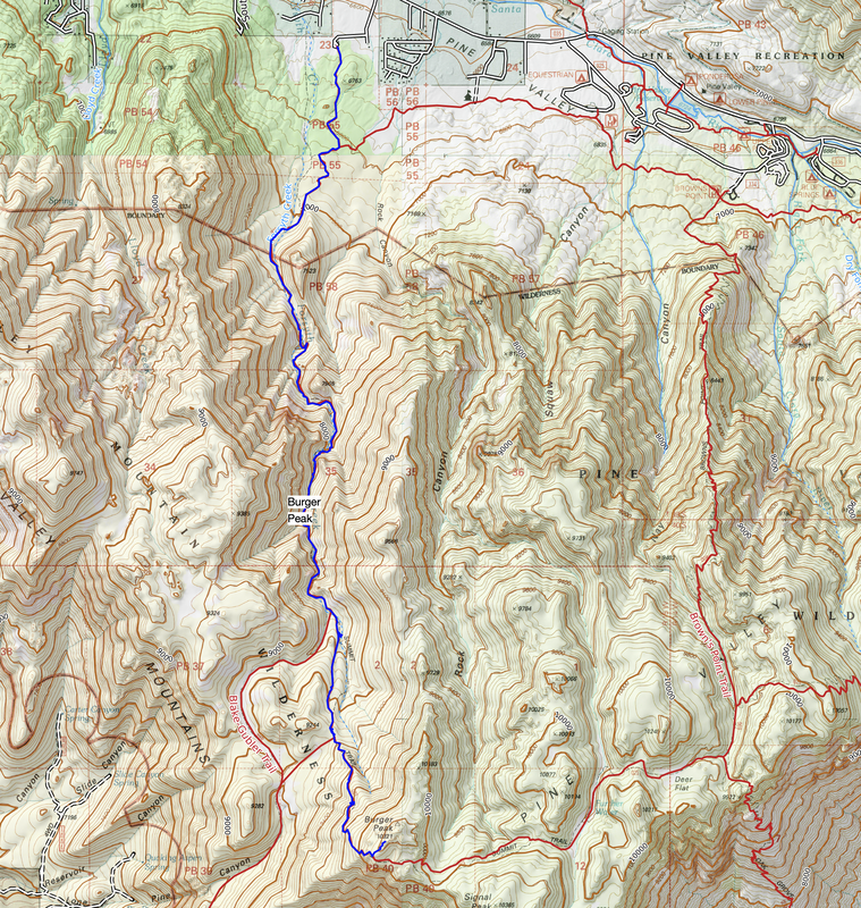
Our GPS tracks for the previous Burger Peak hike on Forsyth Trail.  Forsyth trailhead on top of map (north).  Signal Peak is located on bottom of map.
For Google Earth view of our tracks, click Burger Peak post.
References
Miller, Rick.  Our Geological Wonderland:  The Pine Valley Mountain Laccolith.  The Independent.
2 Comments
Linda Paul link
11/10/2022 12:57:48 pm

My god, what stunning photographs! I love the monzonite porphyry marking the view of St. George. Such striking rock formations. And I also love how you captured the light on the cliffs ascending Forsyth Canyon. The foliage shots are breathtaking. You guys are masters of finding the path less traveled, thanks to the wilderness areas that are not so inviting to the less intrepid human visitors.

You're right about pushing the body. It is amazing what we can do, when the challenge arises. Although, I could never have made this 14 mile hike which included steep ascent! I am, however, always amazed at what my body can do when I get started. I usually take my challenges in small doses, presuming I'm not up to big doses. But adrenaline is a wonder drug.

Even working behind the scenes on election night, I realized I was working circles around the 20/30 somethings I was paired with at the Ada Co Elections warehouse. Feels pretty good to be 6 weeks shy of 70, dealing with cancer, and still able to work an energetic and hardworking youngster into the ground. Poor girl was even getting blisters on her hands. The human body is an amazing engine.

Reply
Sue link
11/10/2022 01:44:57 pm

Linda! I didn't know you were dealing with cancer! I looked on your site but could not find a mention of it unless I am not looking in the right place. Well, it sounds like you are beating it and I sincerely hope you are!

I think you are a good example of being strong and having confidence that you can achieve physical challenges - for example your post on the last hike you took near McCall. Good point - adrenaline helps. Being active and in our 60's, we have built up fitness and energy - it is weird that some young people seem to not have as much energy. You set a good example for your co-volunteer. That's a good story!

Thank-you for you comments on my photos. It really was the light that day - light cloud cover so there wasn't too much contrast and the colors were absolutely glowing - I won't forget that. Almost felt like I was enclosed in this magical world with all hues of autumn around us for miles!

Reply


Leave a Reply.

    Categories

    All
    Arizona Hikes
    California Desert Hiking
    Idaho Summits
    Nevada Hikes
    Snowshoe Hikes
    Southern Utah Hikes/Bikes

    Complete list of Hikes/Bikes on HOME page
    Picture
    Sue and Fred
    Picture

    About this blog

    Exploration documentaries          –  "explorumentaries"  list trip stats and highlights of each hike or bike ride, often with some interesting history or geology.  Years ago, I wrote these for friends and family to let them know what my husband, Fred and I were up to on weekends, and also to showcase the incredible land of the west.  

    To Subscribe to Explorumentary adventure blog and receive new posts by email:

    submit
    Picture
    Happy Spring!
    Picture

    About the Author
    Sue Birnbaum

    A  trip to Jumbo Rocks Campground in Joshua Tree National Monument 38 years ago sparked my passion for hiking, exploring, and learning about desert ecosystems.  For the past 25 years, my husband Fred and I have explored the American West together; we love this land and I hope to inspire you to get out and explore through my photographs and trip descriptions.
    In 1992, Ray Wilson and I conceived the first Cactus to Clouds hike which climbs over 10,000 feet in one day to the summit of Mt. San Jacinto near Palm Springs, California.
    CACTUS TO CLOUDS HIKE 
    READ MORE
    ABOUT SUE

    Archives

    February 2023
    January 2023
    December 2022
    November 2022
    October 2022
    September 2022
    August 2022
    July 2022
    June 2022
    May 2022
    April 2022
    February 2022
    January 2022
    December 2021
    November 2021
    October 2021
    August 2021
    July 2021
    May 2021
    March 2021
    February 2021
    January 2021
    November 2020
    October 2020
    August 2020
    July 2020
    June 2020
    April 2020
    March 2020
    February 2020
    January 2020
    November 2019
    October 2019
    September 2019
    August 2019
    July 2019
    June 2019
    May 2019
    April 2019
    February 2019
    December 2018
    November 2018
    October 2018
    September 2018
    July 2018
    June 2018
    May 2018
    April 2018
    March 2018
    February 2018
    January 2018
    December 2017
    November 2017
    October 2017
    September 2017
    August 2017
    July 2017
    June 2017
    April 2017
    February 2017
    November 2013
    August 2013
    July 2013

    Some of my favorite websites:
    Awkward Botany
    ​citizen botany for the phytocurious

    Bird and Hike

    ​"Intended to encourage people to visit, learn about, and fall in love with the desert."
    ​

    Draw and Shoot
    Beautiful Photography

    Earthline: The American West
    Debra "writes to extol our beloved Earth." Detailed hike info, excellently written.
    ​

    Geologypics.com
    Geology and Geologic Time through Photographs

    Glenn Suokko
    Vermont artist's paintings "inspired by a place based on the land .... drawn to painting the representation and abstraction of nature."

    In the Company of Plants and Rocks
    ​A natural history blog about botany, plant ecology, and geology.

    Nature's Depths

    Walking through nature with John Palka, a neuroscientist who loves plants and ponders big questions

    Rangewriter - What Comes Next?
    ​With excellent writing, Linda tells the story of her unique mother's life including WWII era; with beautiful photographs.

    SeekingLost - Hiking and Backpacking Adventures.

    Stav Is Lost- Unconventional, out-of-the way hikes in the American West.


    Uprooted Magnolia
    ​Leah Yetter's beautiful "photo journal on life, love, and the spirit of Wyoming."
HOME

Cactus to Clouds Hike
More Quotes
HIKES BY STATE

Idaho Hikes
Utah Hikes/Bikes
​Arizona Hikes
​California Desert Hikes
​Wyoming Hikes
​Nevada Hikes

BLOGS

Adventure Blog
Women and the Land
GEAR REVIEWS
FIT AFTER 50
Fred Birnbaum
Dave Brasuell
Bus' Little Black Book
​Mike Carlson
​Ray Wilson
​Marcia Bondy
Bryan Krouse
​Maria Keezer
​Tim Clemens
​Doug Traubel
​Brian Holgate
​
Becky Borczon Blake
​Jennifer Cera and
​Sue Birnbaum

​Vance Powell
​Boise Cross Fit Masters Ladies
​Vickie Kearney

GALLERY

Desert Plants
Nature
Earth + Sky
Urban
Water
Patriot 
​Orchids
Boise
​
  ABOUT
    Contact

​
© 2017 - 2023 by Sue Birnbaum.  Photos on this website are the sole property of Sue Birnbaum unless otherwise indicated.  Please receive permission before publishing my trip reports and photos.
I try my best to be accurate with my hike descriptions; please research your adventures, always bring a map and compass and know how to read them, be prepared!  All of these hikes can be dangerous; hike at your own risk.  ALWAYS carry the Ten Essentials with you on hikes. 
​Please feel free to contact me with comments or questions, or if you see any errors that need attention.
Thank-you for stopping by!


EXPLORUMENTARY.com
  • Home
    • Cactus to Clouds Hike
    • More Quotes
    • Ann Zwinger Quotes
    • Mary Oliver Poems
  • Hikes by State
    • Idaho
    • Southern Utah
    • Arizona
    • California Desert
    • Nevada
    • Wyoming
  • BLOGS
    • Adventure Blog
    • Women and the Land
  • GALLERY
    • DESERT PLANTS >
      • Beavertail cactus
      • Brittlebush
      • Christmas Cactus
      • Arizona Barrel Cactus
      • Parry's penstemon
      • Agave
      • Arizona Rainbow Hedgehog
      • Claret Cup Hedgehog
      • Desert Agave
      • Palmer's Penstemon
      • Silver Cholla
      • Cristate Saguaro
      • Indian Paintbrush
      • Ocotillo
      • Santa Rita Prickly Pear
      • Spiny Cliffbrake
      • California Barrel Cactus
      • Engelmann Prickly Pear
      • Velvet Mesquite
      • Joshua Tree
      • Buckhorn Cholla
      • Hedgehog Cactus
      • Fishhook cactus
      • Thompson's Woolly Locoweed
    • NATURE
    • BOISE
    • EARTH + SKY
    • URBAN
    • WATER
    • PATRIOT
    • ORCHIDS
  • Fit After 50
    • Brian Holgate
    • Fred Birnbaum
    • Dave Brasuell
    • Bus' Little Black Book
    • Mike Carlson
    • Ray Wilson
    • Bryan Krouse
    • Vickie Kearney
    • Maria Keezer
    • DOUG TRAUBEL
    • Boise Cross Fit Masters Ladies
    • Tim Clemens
    • Marcia Bondy
    • Becky Borczon Blake >
      • Becky B Downtown
    • Jennifer Cera and Sue Birnbaum
    • Dave Brasuell
    • Vance Powell
  • About
    • CONTACT