Jackson Peak Trail - Boise National Forest
Jackson Peak Trail Map PDF
USDA Forest Service Jackson Peak Trail info
Waypoints:
Jackson Peak Trail Map PDF
USDA Forest Service Jackson Peak Trail info
Waypoints:
- Trailhead: 44.1092 -115.4140
- Summit: 44.1094 -115.41413
Driving Directions:
From Boise, Idaho, travel north along State Highway 55 to Banks, Idaho approximately 38 miles.
At Banks, turn right (east) onto State Highway 17 (Banks-Lowman Road) and proceed 31 miles to Lowman, Idaho.
At Lowman, turn left at the intersection of State Highway 17 and State Highway 21. Proceed northeast approximately 11 miles along State Highway 21.
After mile marker 85, there is a sign for Jackson Peak Trail and Tenmile Trail. Turn right onto Forest Service (FS) Road 021NB and cross the South Fork of the Payette River to the Lowman Ponds. There is an outhouse and large parking lot for the ponds. 4 WD vehicle required after this point unless the road has been graded and is not rutted. You can park at this lot, but it adds another one mile walk to get to the trailhead. If driving to the trailhead, take a right at parking lot and follow dirt road 530. Take left at intersection with road 530 (Richards Creek) and Road 025NB. Large parking area and trailhead reached shortly.
Hiking Directions:
From trailhead at 4,652', hike straight up for 0.75 miles until the first switchback that leads away from Richards Creek to the west.
At 1.8 miles from trailhead, switchbacks end and trail goes along ridge leading up to Jackson Peak.
Hike additional 2.5 miles along ridge to intersection with Forest Road #598. This is 4.3 miles from trailhead.
Walk around metal gate 0.35 miles to Jackson Peak Summit - 8,124' with lookout building and radio towers.
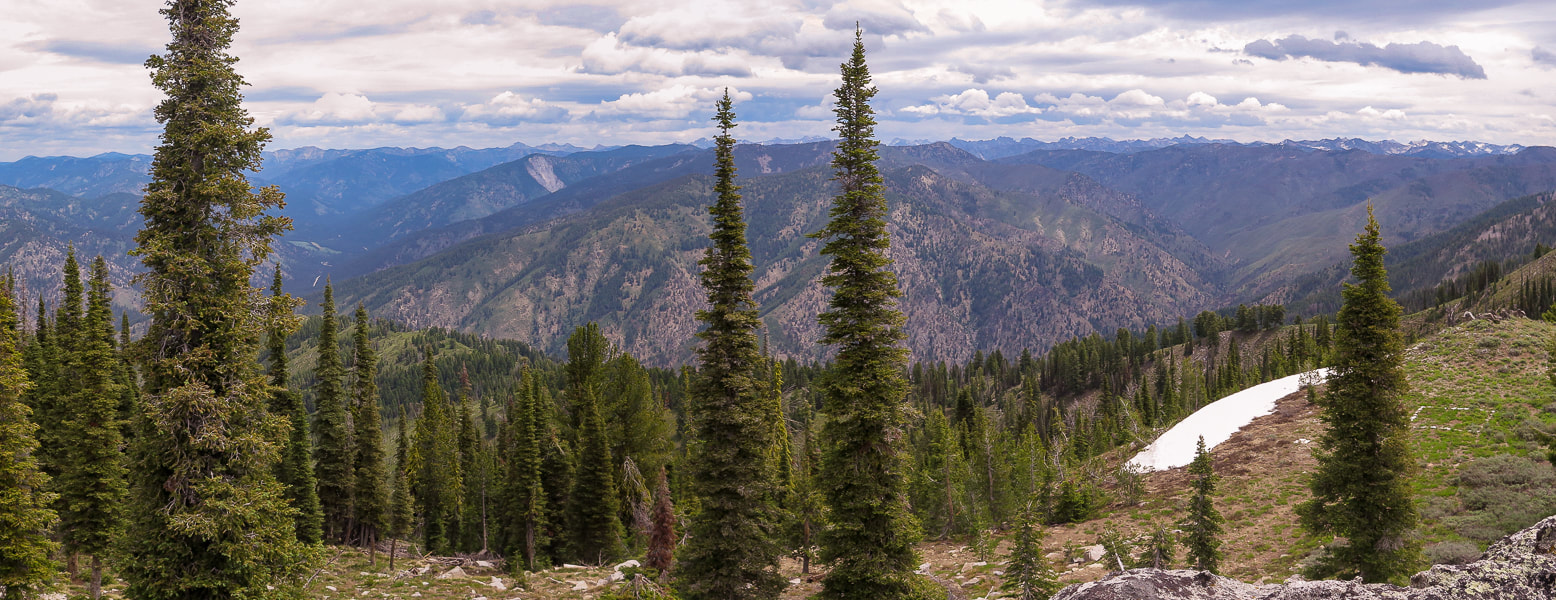
Jackson Peak Summit - 8,124' looking northeast toward Sawtooth National Forest
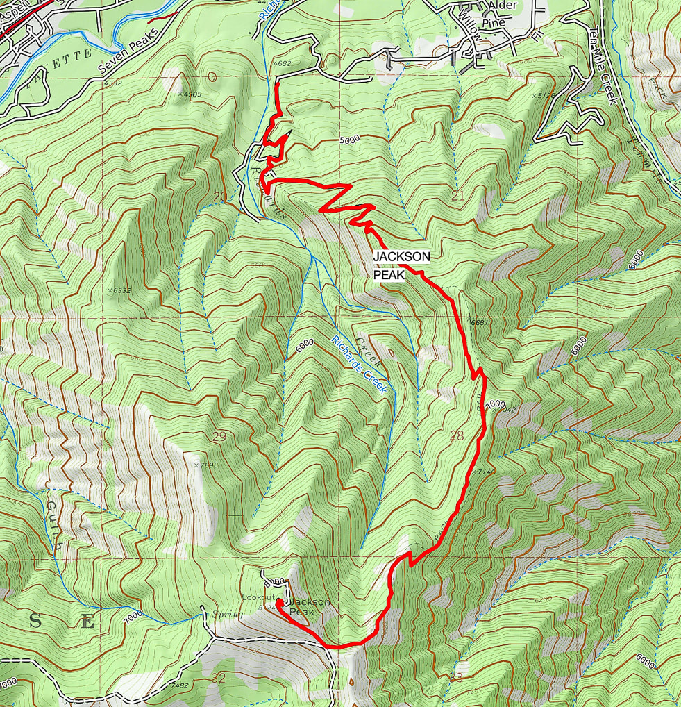
Our GPS tracks