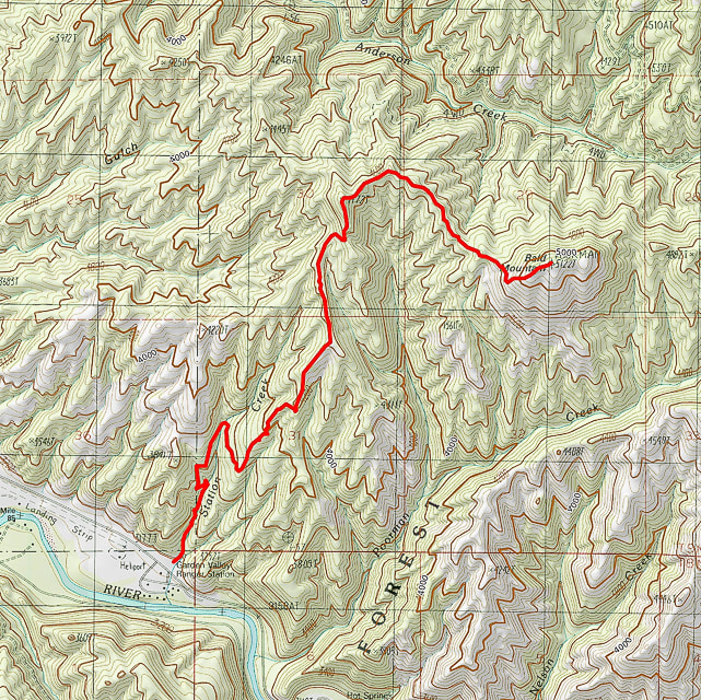
Station Creek Trail #152 to Bald Mountain
near Garden Valley, Idaho
near Garden Valley, Idaho
- Trailhead parking just opposite Garden Valley Ranger Station and heliport on Banks-Lowman Highway just after MM 12. Drive on short gravel road to parking near brown trailhead sign. Elevation = 3,190'.
- Hike north along Station Creek on single-track. The trail switchbacks up out of the creek and then crosses it at mile 0.8
- The trail climbs to the ridge separating Station Creek and Poorman Creek, topping the ridge at 3,800 feet.
- Continue on ridge to Point 4,774, the highest point on the ridge for a total of 2.6 miles from trailhead. A clear view of Bald Mountain to the east is seen across a valley of ridge and drainages.
- Hike 1.2 miles to the summit, the final climb is straight up Bald Mountain's west slope. Elevation = 5,134 feet.
