|
Spectacular adventure with beautiful scenery throughout, this is a tough hike/scramble to the second highest mountain in the rugged Pioneers with a breathtaking view and steep drop-offs at your feet. 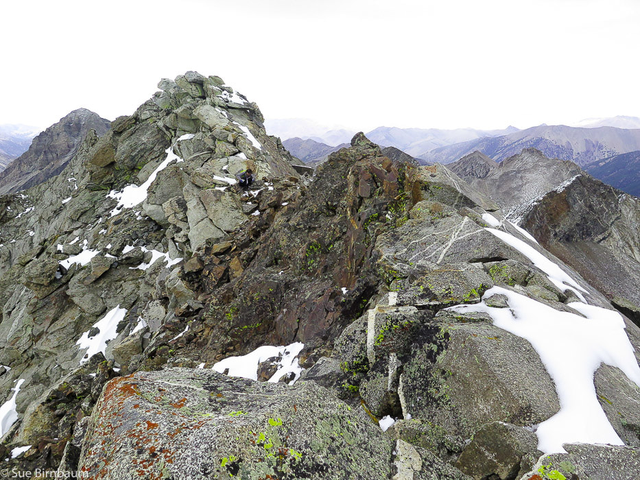 Goat Mountain - 11,913 feet - second highest peak in the Pioneer Mountain Range near Ketchum, Idaho Trip Stats: Distance: 7.7 miles one way. Elevation gain: 4,800 feet. Elevation at trailhead = ~7,100 feet, summit = 11,913 feet Location: Main crest of the Pioneer Mountain Range northeast of Ketchum, Idaho. UTM: 11T 070003 E 4850760 N Maps: USGS 7.5 min topos Phi Kappa Mountain, Hyndman Peak. Difficulty: Class 3 (Climbing using hands to propel up boulders). First 3 miles moderate hike, last 1.5 miles is a very strenuous hike/climb of 2,000 feet. Hike directions - south slopes: 1. Hike FST-165 for 3 miles north along North Fork of Hyndman Creek to intersection with trail that turns left (west) to Pioneer Cabin. The trail to Goat Mountain continues straight and had branches across its entrance. 2. View opens to a valley with pointed Handwerk Peak on the horizon, continue ~ .7 miles to confluence of N. Fork of Hyndman Creek and the unnamed creek (~8,800 feet) that flows out from basin between Handwerk Peak and Duncan Ridge. 3. At the large white cliffs, hike through the gully that separates the cliffs to a shelf above the cliffs, heading in a northeast direction to the right of Handwerk Peak. 4. Stay to the left (west) side of unnamed creek toward base of Handwerk Peak. 5. We crossed this creek when we saw open meadow to the east, then followed the meadow past the base of Handwerk Peak on its south side. 6. Head toward large granite rock fin on horizon ("Florian's Nudl"). Goat Mountain is located to the left of this. Boulder field is large but stable. When viewing boulder field, the route leading around the east side with more grassy areas may be less technical than straight up boulder wall. 7. Terrain becomes less steep; hike to the north (left) of Florian's Nudl to the steep climb of Goat Mountain. Driving directions: From ID-75 4 miles south of Ketchum, turn east onto East Fork Road. Trailhead for Goat Mountain hike is 11.2 miles from this turn. Travel 5.2 miles on paved road to Triumph: from this town it is 6 miles to trailhead. Road forks 1.3 miles after Triumph: stay on Road 203 (taking left turn) toward Hyndman campground and North Fork Hyndman Creek. At 10.1 miles, see sign "Road Closed 1 Mile". Drive ~ 1.0 more mile to parking for Hyndman Peak trailhead. Continue through this ~ 0.1 more mile to a second grassy parking area for trailhead leading to Pioneer Cabin and Goat Mountain. Geology: Pioneer Range Metamorphic Core Complex consists of a lower plate of Precambrian gneisses (2 Ga) and Cretaceous to Early Paleogene granitic rocks, and an upper plate of Paleozoic sedimentary rocks overlain by Challis Volcanics. When crustal extension started in the west (50 Ma), the Wildhorse detachment fault developed and separated these two plates and Challis Volcanics was part of this extension. Low-angle faults developed in the upper, brittle layer, removing them, exposing the lower layer of metamorphic rocks (core complex) up to 2.3 billion years old. CAUTION: Become familiar with this route using a good topo map, as there is no marked trail beyond crossing of North Fork Hyndman Creek at the white cliffs. 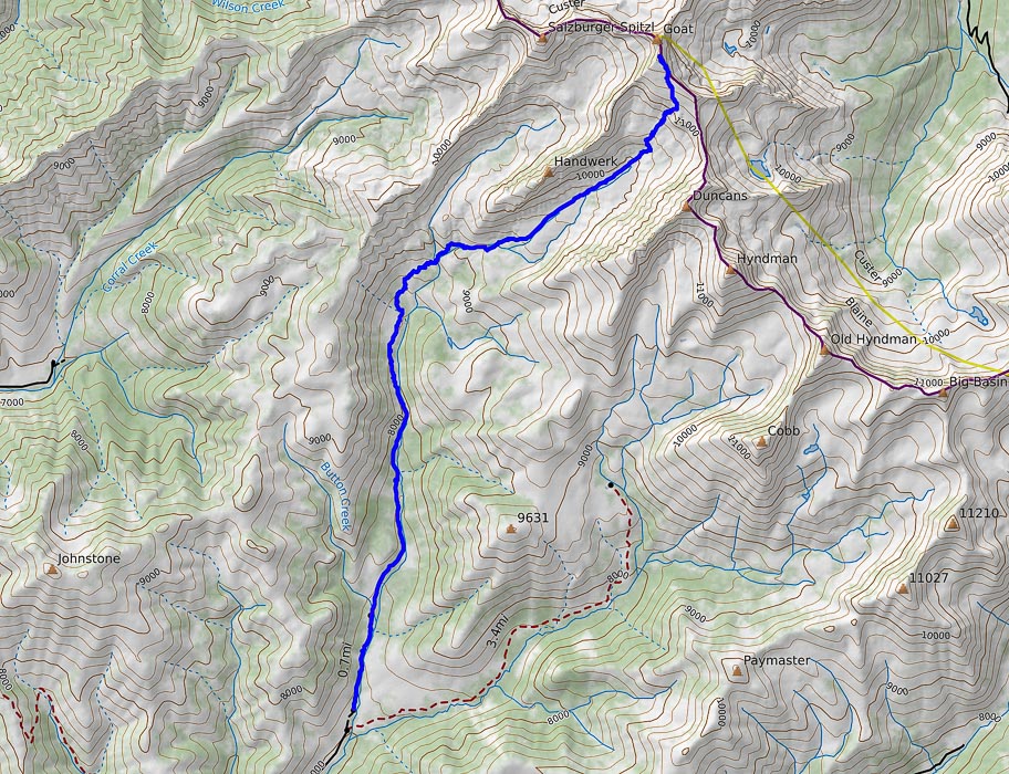 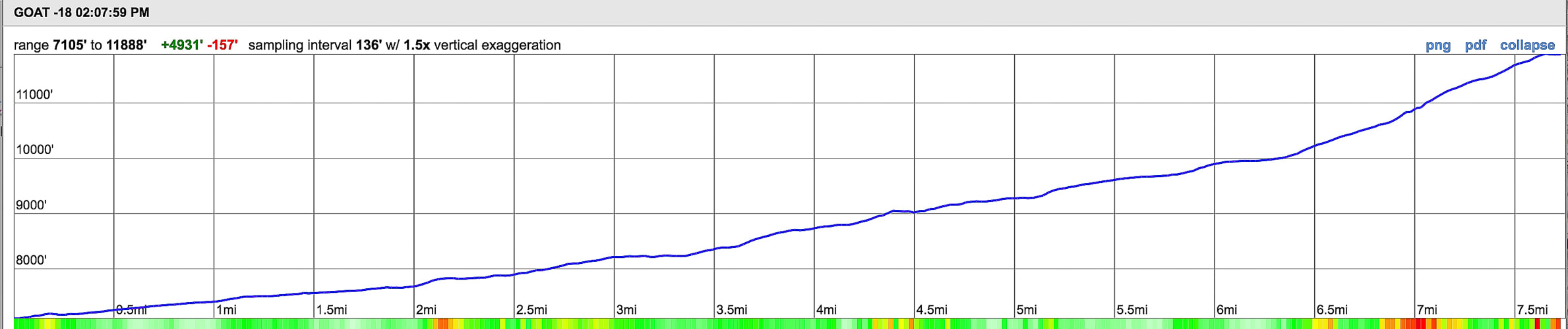 Our route (in blue) and elevation/mileage profile for Goat Mountain, Pioneer mountain range, Idaho Elevation range: from 7, 105 feet to 11, 900 feet in 7.7 miles "The love of mountains is best." - inscription carved in Greek, found on a summit rock in the Alps by a Swiss adventurer in 1558. When our friends John and Val asked us to climb Goat Mountain with them, we seized the opportunity. Fred and I usually do these adventures by ourselves, so it was that much more fun to be with fellow climbing enthusiasts, especially since they had been to Goat before, so we could be able to cover the 7.7 miles to the summit expediently. Ask anyone who has hiked and climbed in the heart of the Pioneer Mountain Range, and you may see their countenance change to a look of knowing bliss and reverence as they tell you about its sheer beauty and wildness. Granite crags, spires and domes hang raw and exposed over glaciated basins dotted with car-sized boulders and wildflowers in meadow grasses. Hike to Pioneer Cabin, built high on a bench at 9,400 feet and get a spectacular view of the main Pioneer crest to the east. The following photo of Pioneer Cabin was taken a few years ago, and now I can say that I have walked up that wide valley to the top of Goat Mountain, the peak situated on the left horizon in this photo. 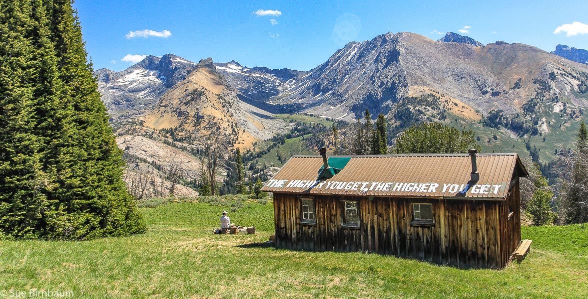 Pioneer Cabin (elevation 9,400 feet), built in 1937 looks to the east at Duncan Ridge, Handwerk Peak and Goat Mountain The southern route to Goat Mountain ascends the wide basin seen in this photo 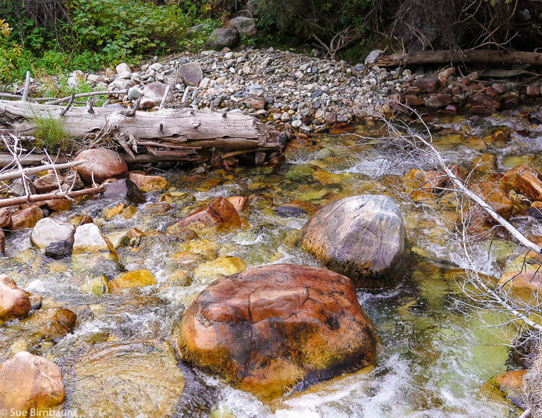 North Fork Hyndman Creek The weather forecast said it was to rain in the afternoon. John, Val, Fred and I started on the trail under blue skies and found ourselves pummeled by frigid winds and ice pellets when we got to the summit of Goat Mountain. Not a fun time to take photos, however it adds excitement to the trip and knowing that not many people get to experience the sudden advancing of fall and winter in mid-September at nearly 12,000 feet on a precipice. We got down the main crest pretty quickly. The first 3 miles of this hike treks along the west side of North Fork Hyndman Creek with its colorful quartzite boulders and crystal clear water to an intersection with the trail that leads to Pioneer Cabin at 8,200 feet. Continue straight into the valley ahead, walking over branches placed across the trail to steer Pioneer Cabin hikers to the trail that takes off to the left. The pointy, fang-like Handwerk Peak appears as you walk through a sagebrush and bunchgrass valley to a crossing of the North Fork Hyndman Creek, another 0.6 miles past the intersection. Then, climb through the white cliffs, through an obvious gulley that separates the cliffs to a shelf above. Stay to the left (west) of the creek whose water sources from the unnamed basin between Handwerk Peak and Duncan Ridge. Our party accessed this basin two different ways: Val, Fred and I hiked the west side of the creek to near the base of Handwerk Peak. John crossed the creek earlier and ended up waiting for us further up this grass-filled basin south of Handwerk. 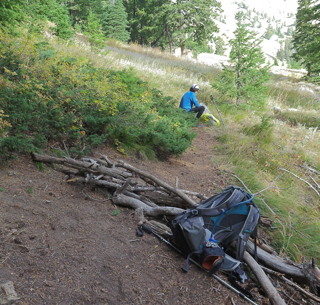 Intersection with Pioneer Cabin Trail (to the left). Keep going straight over branches to valley ahead 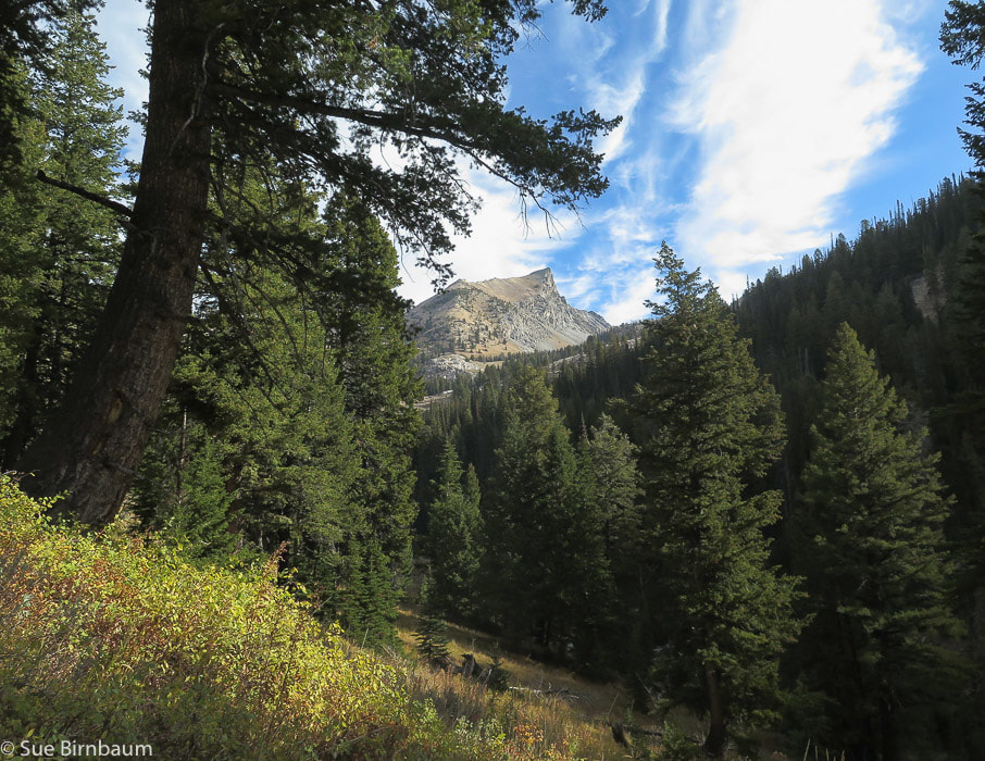 Handwerk Peak Named after Ted Handwerk, who served in Italy during WWII 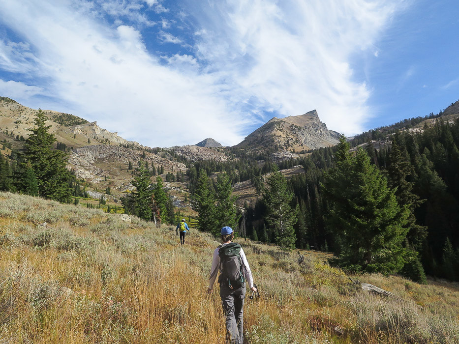 John in lead walking north toward the base of Handwerk Peak on its south side Route goes through the white cliffs just above John in the photo and turns northwest, staying to the west of drainage We crossed the narrow stream at the bottom of the basin and walked through tall bunch grasses at first, and then short grass as we neared the cirque wall at the end of the basin. Aim for Florian's Nudl, a fin-shaped dome on the ridge above the cirque. Goat Mountain is the prominence to the left on the ridgeline. The walk through this basin is a sensory experience of contrasts. Native, aromatic grasses are soft and quiet underfoot, like a huge gold carpet while the cold, ragged mess of walls and boulders looms ahead, sweeping down both sides in a U-shaped curve, typical morphology of glaciation. At the end, you run out of grass, except for a few patches distributed among the boulders. We went straight up the steep boulder wall in front of us, and came down the more circuitous route that contains more grassy areas to the right side (east) in the cirque. A huge boulder with a white "X" across its face lies at the entrance to the boulder field. Next time I do this climb, I will find this boulder and go up to the right; this route descending seemed longer but less steep. It's hands-on boulder climbing either way. 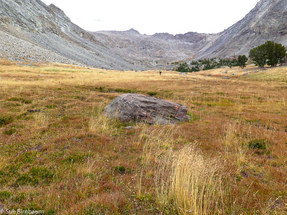 Basin between Handwerk Peak and Duncan Ridge Head toward Florian's Nudl, the fin-shaped dome toward the center of the ridge 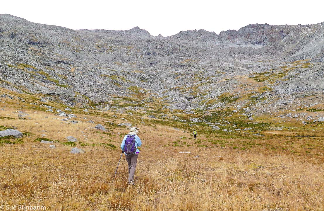 Heading towards Florian's Nudl Goat Mountain on far left of horizon 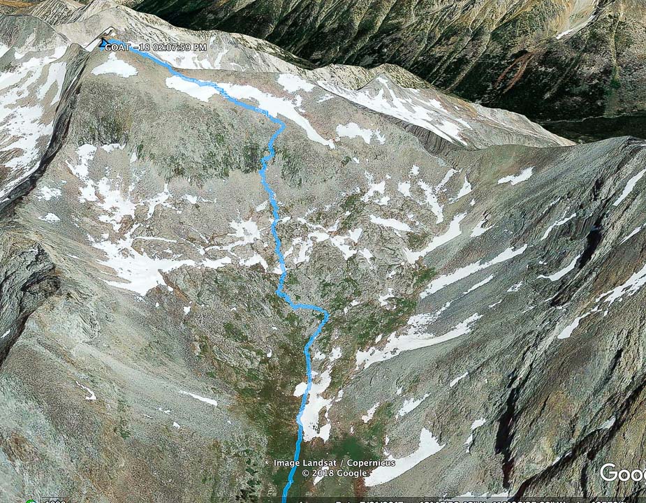 Our route up boulder field at end of basin to Goat Mountain On the hike down, we made a wide curve to the right in this photo: more distance but less steep The boulder-hopping was stable; rarely did I step onto a "tippy" rock. John practically ran up the rocks, while the three of us followed, grasping onto the granite and grass to hoist up. During the long climb, the skies became darker, and when we finally reached the top, we were assaulted by stinging ice crystals and a brisk, frigid wind. What timing! Snap a few photos, look at the squalls of rain around us, try to maintain our balance on the top of a narrow Pioneer Range ridge with 1,000-foot drops on both sides. Celebrate the breathtaking (literally!) 360-degree scene; commit to memory. And then get down. Goat Mountain has a double peak - we didn't get to the second (north) prominence which is slightly higher. 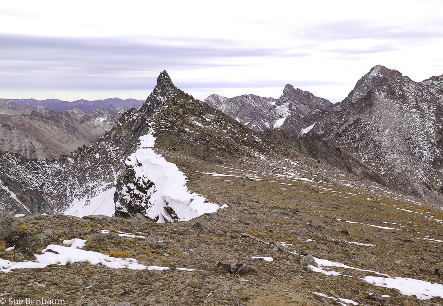 Florian's Nudl - Use this landmark for direction when climbing from basin below Named after Florian Haemmerle, an original instructor of the Alpine Touring School and the original curator of the Pioneer Cabin 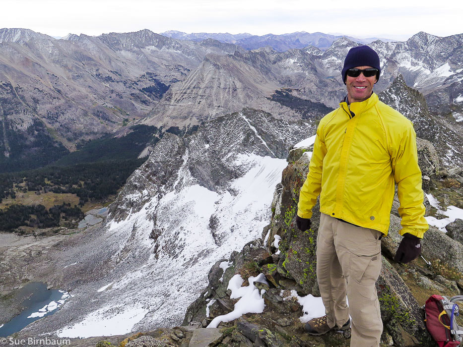 Fred near top of Goat Mountain 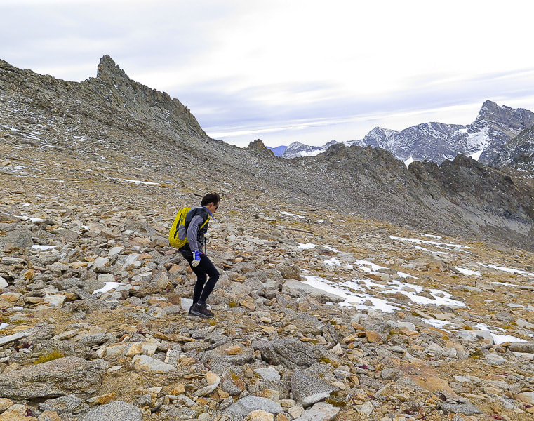 John heading down shelf above boulder field Florian's Nudl above him. 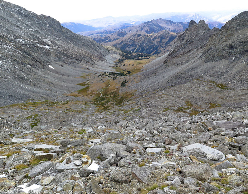 Looking down upon the basin we ascended, between Handwerk Peak and Duncan Ridge toward the southwest. John went down the direct steep face. Fred, Val, and I hiked toward the east side of the cirque. Descending down a gully near a sheer wall, we heard water rushing under rocks and I suddenly saw something white. A mountain goat stood calmly watching us at the bottom. We stopped and stared at each other. It posed for us a few minutes, then slowly ambled toward the rock wall. It looked like it was growing its winter coat. We joked that the goat was taking note of humans' relative incoordination while traversing rocks. We had seen mountain goat hair in the tundra grasses on the way up the mountain. 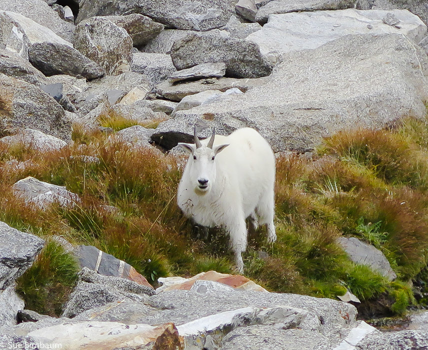 Oreamnos americanus We met up with John at the bottom of the boulder field. A refreshing, cool rain onto the bunch grasses made a clean, earthy scented air, which I breathed in deeply. Tall grey walls rose on either side. Occasional large boulders sat solitary and we took a short break on the lee side of a large one. Probably dropped out of the receding glacier. We resumed descending the basin and when I turned back to see the cirque and the ridge, curtains of rain covered most of the view. In our chatting, we didn't pay attention to staying close to the stream drainage and got too far to the west, so we took some extra time route-finding, thrashing through brush, navigating more boulders, and crossing streams to get back to the trail. A gentle rain cooled us the last two miles of the hike. In the cloud-covered dusk, we saw two bow hunters emerge from the woods in camouflage. The sky on the horizon was clearing. We raised a toast to our awesome 11-hour day with the excellent beer at the Power House in Hailey. We celebrated getting to the summit together in a spectacular mountain range where we saw no one else on the trail. We celebrated the fact that we are lucky to be able to see things that most people don't, and that our bodies are able to take us there. 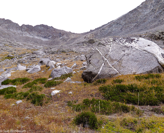 Boulder with white "X" at beginning of climb out of basin 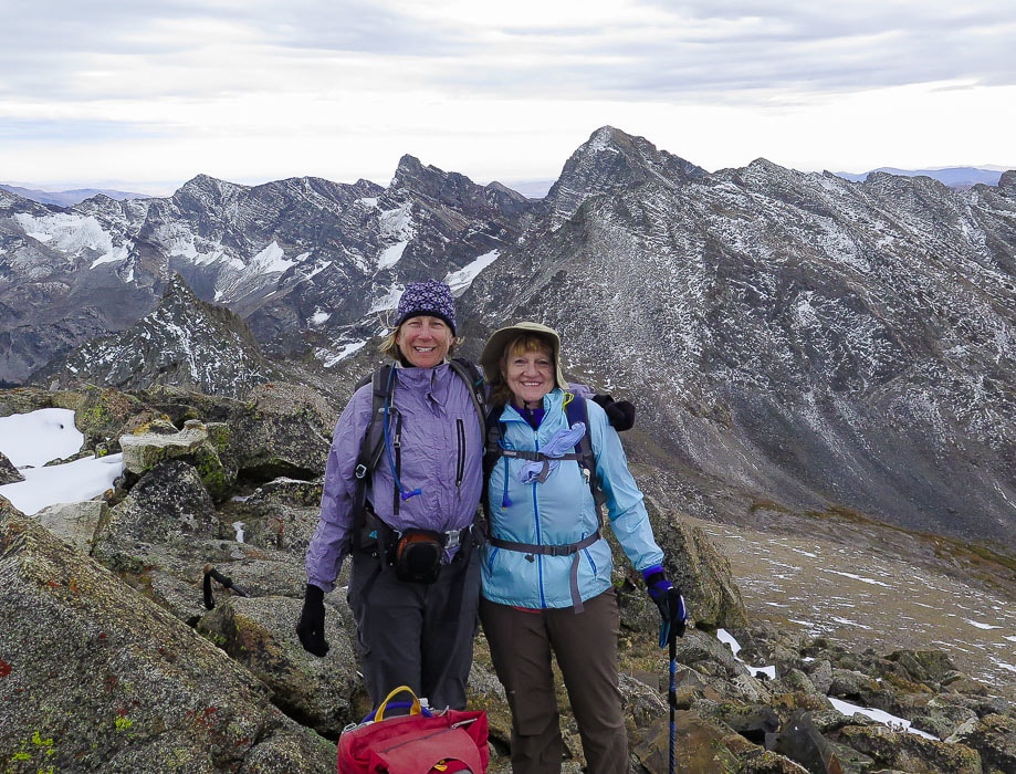 Sue and Val at the top! 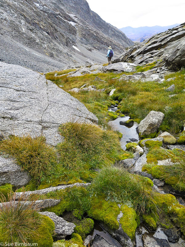 Walking down toward basin towards east side of cirque References:
Appearance of the Mountain Goat. Website by the British Columbia Mountain Goat Society, copyright Smithers BC Canada. A Brief History - Pioneer Cabin. Digital Geology of Idaho - Idaho Basement Rocks - Idaho State University. Lopez, Tom. 2000. Idaho - A Climbing Guide: Climbs, Scrambles and Hikes. The Mountaineers Books, Seattle, WA. Metamorphic Core Complexes - Idaho Museum of Mining and Geology.
6 Comments
Valerie
9/23/2018 08:59:05 pm
Sue, this is a wonderful description of our hike! Really enjoyed seeing the route map and reading a little history about the area. Your photos are terrific as usual! Had a great time on this one and it's always a treat to spend the day hiking with you and Fred! Looking forward to future adventures with you! Thanks for adding this to Explorumentary!
Lynn
9/23/2018 11:06:01 pm
What a wonderful expedition! Thanks for sharing your photos and stories!
Hi Linda! Leave a Reply. |
Categories
All

Sue and Fred

About this blogExploration documentaries – "explorumentaries" list trip stats and highlights of each hike or bike ride, often with some interesting history or geology. Years ago, I wrote these for friends and family to let them know what my husband, Fred and I were up to on weekends, and also to showcase the incredible land of the west.
To Subscribe to Explorumentary adventure blog and receive new posts by email:
Happy Summer!

About the Author
|