|
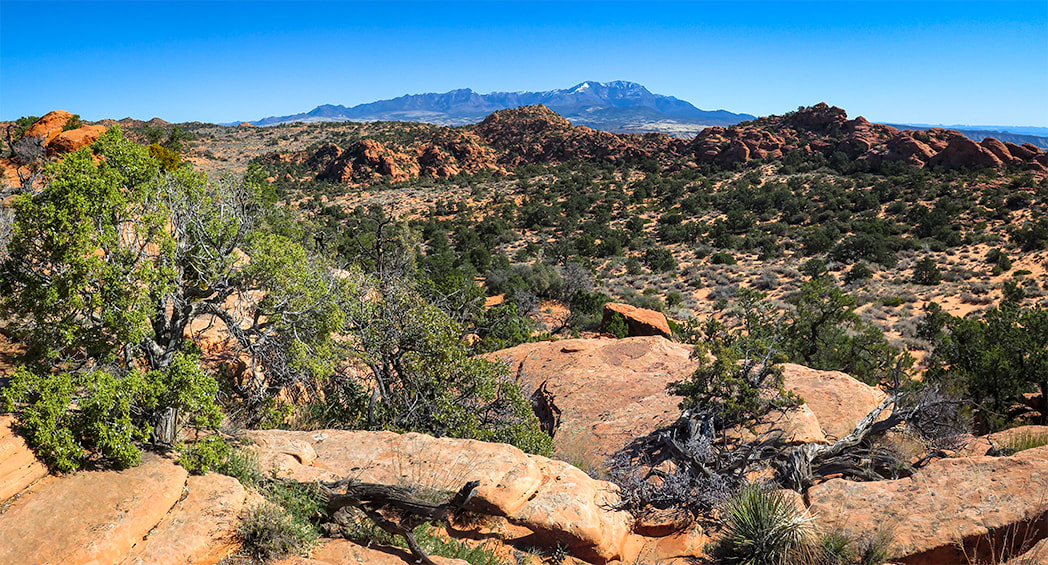
A New Year's Day 2024 journey through pinyon-juniper woodland on top of Red Mountain near St. George, Utah to a spectacular Snow Canyon overlook. 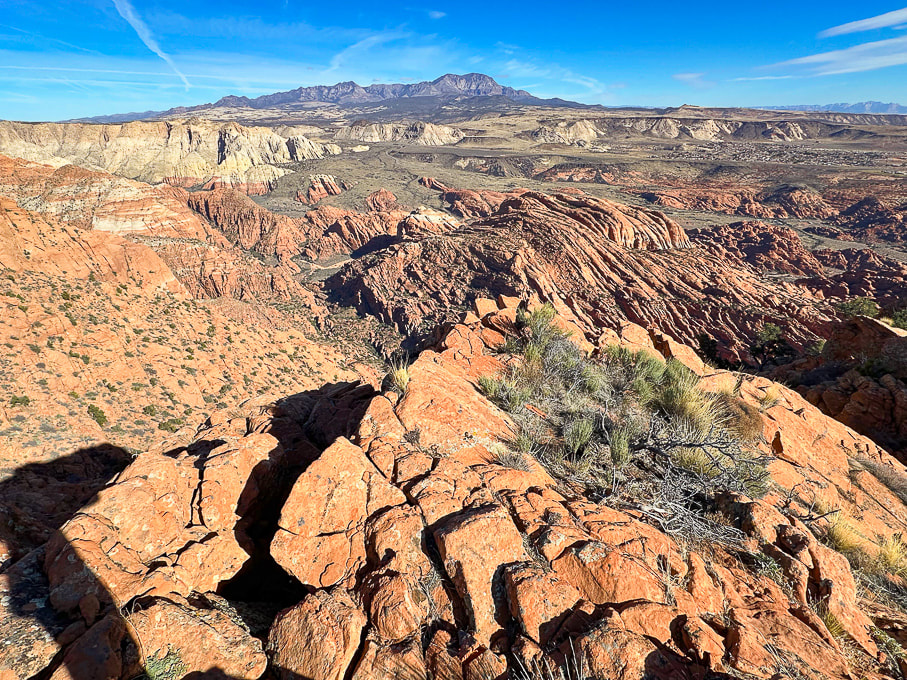 Looking north over Snow Canyon State Park from "On Top of the World" on Red Mountain. Pine Valley Mountains on the horizon. 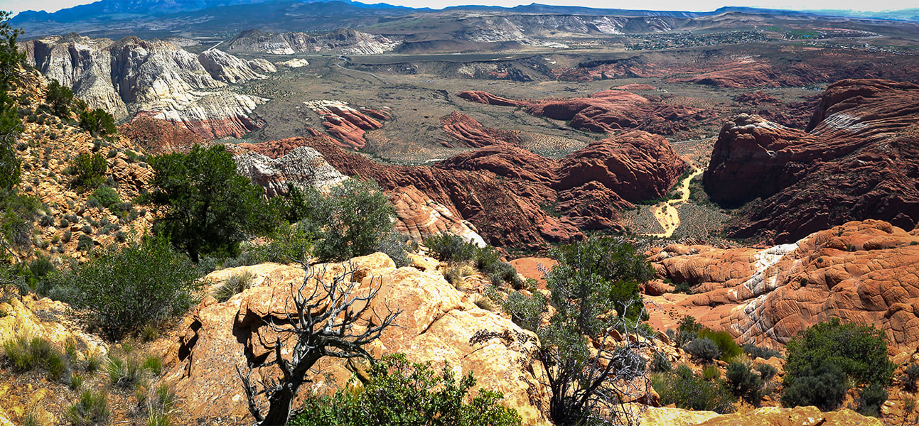 View of Red Sands Trail (right) in Snow Canyon SP from a previous hike - Red Mountain Primitive Trail. Trip Stats - Ivins Trailhead
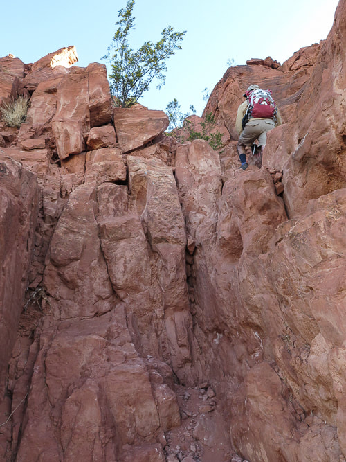
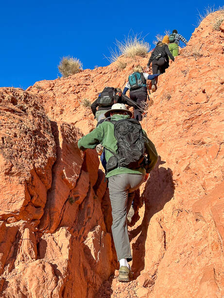
Overview/Location: This quiet, cross-country excursion through the gorgeous Red Mountain juniper woodland biome brings you to an expansive view of southern Utah's Snow Canyon State Park. A remote island of solitude in the Red Mountain Wilderness elevated above the cities of Ivins and St. George. Distance/Elevation gain: 5 miles out and back/1,575'. Coordinates/Elevation: Red Mountain Trailhead = 37.17519, -113.67755 (3,190'). Southern Red Mountain Primitive Trail out of Ivins. Top-off at 0.8 miles = 37.18375, -113.67849 (4,556'). Snow Canyon Overlook (On Top of the World) = 37.20116, -113.66671 (4,765'). Maps/Apps: Topo Maps U.S. app, Garmin GPS, BLM Utah Red Mountain Wilderness (Avenza app). Maps at end of this post. Difficulty/Trail: strenuous Class 1-3 climb up Red Mountain (mild exposure) for the first 0.8 mile, moderate cross-country Class 2 over slick rock and deep sand. Date Hiked: 1/1/2024. Geology: Red Mountain's lower slopes are the Kayenta Formation, the oldest rock in Snow Canyon State Park (190 million years). The horizontal sediment layers are made from rivers depositing mudstone, siltstone and sandstone. The upper slopes, cliffs and top of Red Mountain are a great block of Navajo Sandstone that is younger (180 million years), also seen as a major rock unit of Zion National Park. This Navajo Sandstone exhibits large, sweeping cross-bed features - horizontal and dipping layers of ancient sand dunes deposited in a vast eolian (wind carried) dune field. Red Mountain is bounded by the Gunlock Fault on its west side. It merges with an extensive field of 2.4 million - 2,000 year old basalt flows to the northeast. The Gunlock Fault is a normal fault with the down-drop on its west side (See references below). Considerations: The first mile from the Ivins trailhead is Class 1-2 with two short Class 3 maneuvers. Once the trail tops out, there is no marked trail. Experience with navigation and route-finding using a compass/GPS and topo maps is advised after top of Red Mountain is reached to avoid getting lost. A sign at this trailhead reads, "Hazardous, unmaintained route with steep exposed slopes: your safety is your responsibility." Recommend taking a GPS waypoint at critical points on the trail such as point where you enter the plateau from the cliffs. Search and rescue operations for lost hikers have occurred. Be prepared if you have to spend the night! Research this route thoroughly! 2/5/23: Three rescues in Washington County on the same Day (St. George News). Related Posts Our New Year's Day Hike Fred and I have a tradition of hiking on New Years Day. For 2024, we took friends to the top of Red Mountain and across its beautiful plateau to a high point dubbed "On Top of the World" by our friend Dan. From here, you stand 1,400 feet over an outstanding view of Snow Canyon's petrified yellow sand dunes and orange ridges, black basalt flows from northern volcanoes near Veyo. It's worth the orange sand trudge on the top to get there. This short, five-mile hike packs in a good variety of terrain. The first mile climbs steeply through a cliff band requiring some fun Class 3 (un-roped using hands to climb) maneuvers, gaining 1,300 feet. The next 1.5 miles initially descends through a beautiful juniper woodland bowl where Gunsight Pass can be reached to the southeast. You will trek through sand, washes, over slick rock then climb to a sandy saddle where our "On Top of the World" high point can finally be seen. Then it's a matter of making a ~0.5-mile beeline to it across relatively level terrain, traversing minor washes, dodging cacti and prickly shrubs. When you top-off onto Red Mountain's plateau, you initially follow the north/south Red Mountain Primitive Trail for ~1.2 miles, then a short jaunt off of it to the northeast to reach On Top of the World, elevation 4,765'. Red Mountain Primitive Trail's northern trailhead is located just north of Diamond Cinder Cone on Utah Highway 18. It's a fun little scramble to the cairned top, using your hands a few times to climb easy rocks, overlooking Padre Canyon and Tuacahn Center for the Arts to the southeast. Once you summit, the rugged terrain drops steeply below with a breathtaking view of Snow Canyon, with a few smooth slick rock benches above it that look interesting to explore or camp in. Can't think of a better way to celebrate the New Year: friends and the reward of finding our own way to a seldom-visited summit in one of the most beautiful places in the southwest. Great "medicine" for the soul, body and mind. Explore More in 2024!! 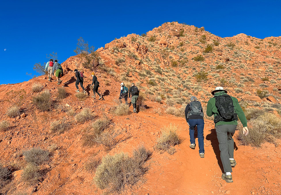 Southern Red Mountain trailhead in Ivins. The trail starts out steep! 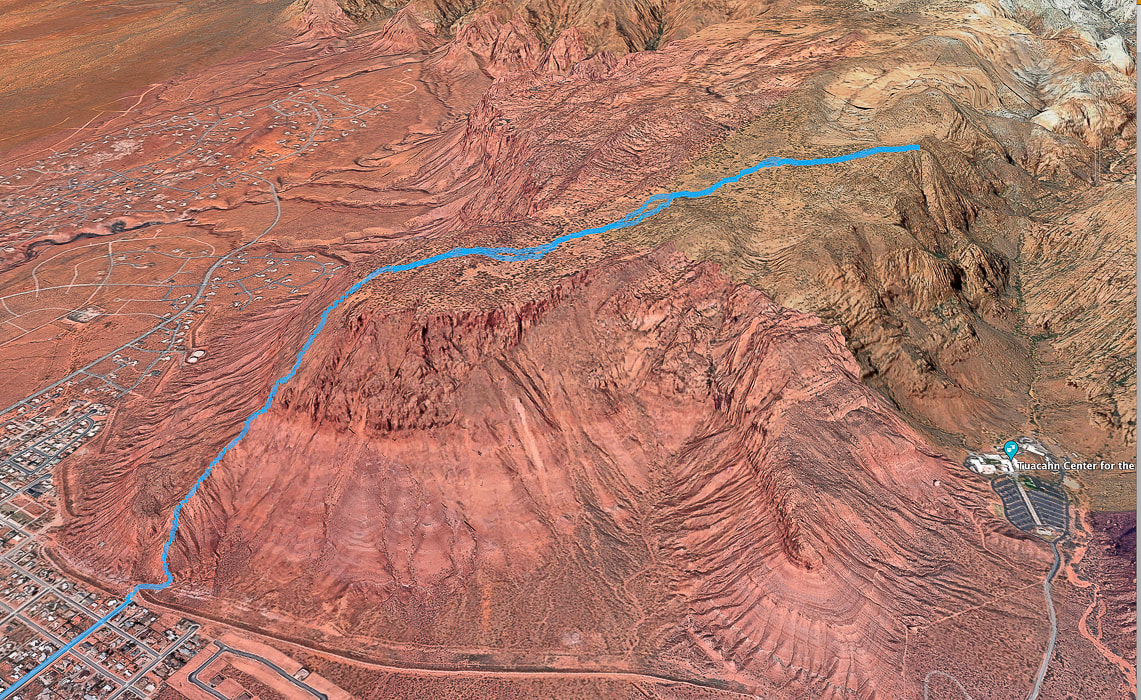 Google Earth view of our GPS tracks beginning at the Red Mountain Primitive Trail's southern trailhead in Ivins (lower left), going through the cliff-band about halfway up, getting onto Red Mountain, and traversing across plateau to "On Top of the World" overlooking Snow Canyon, Padre Canyon, and Tuacahn Center for the Arts. See more maps at the end of this post.
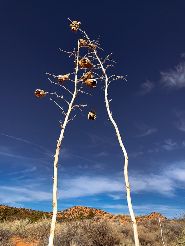
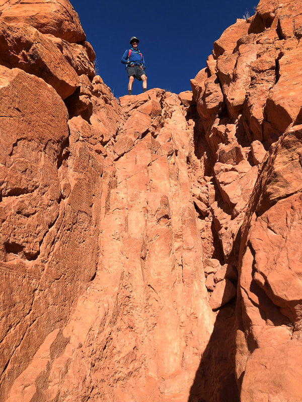
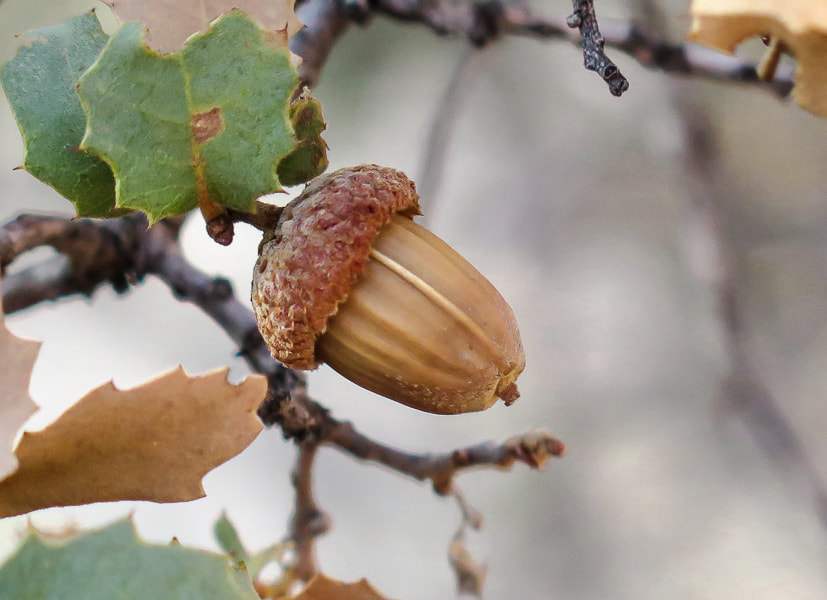
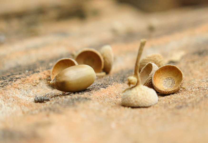
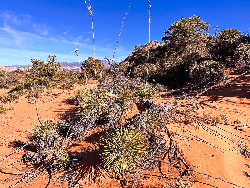 Utah yucca and pinyon pines, shrub live oak (Quercus turbinella) on Red Mountain's plateau. The name turbinella, meaning "like a little top", refers to the acorn, this plant's fruit which appears in summer. The reference to "turbinella" in the photo above prompted me to add these photos of the shrub live oak acorns. They're so cute! 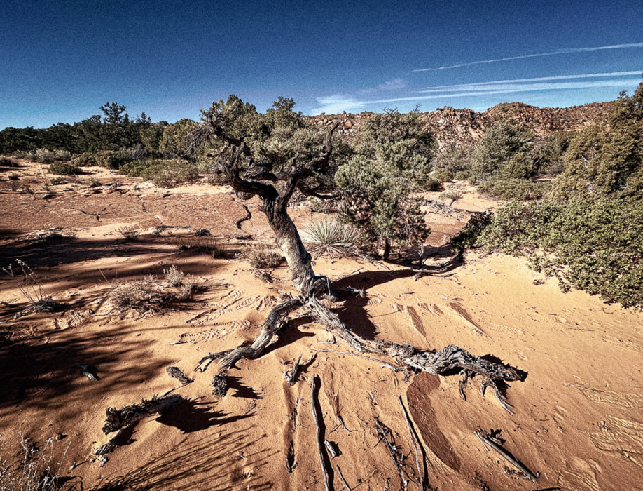 Life and death on the Colorado Plateau: beauty and grace in a dead juniper. 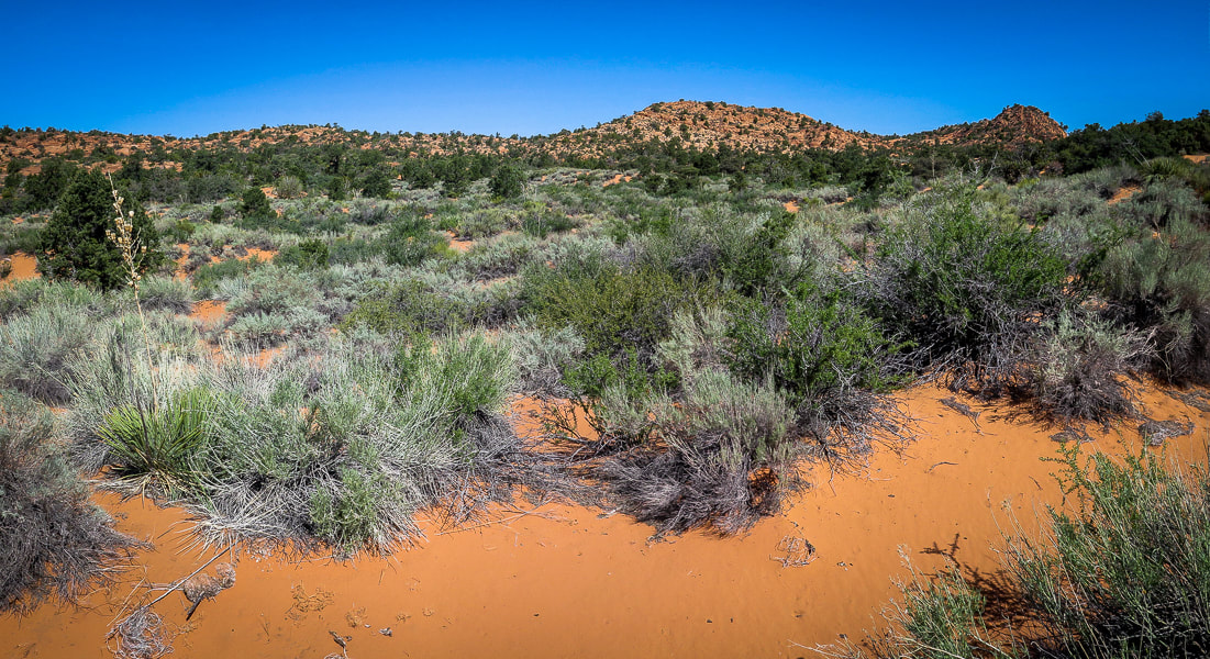 On top of Red Mountain: lots of sand and shrubs to negotiate. 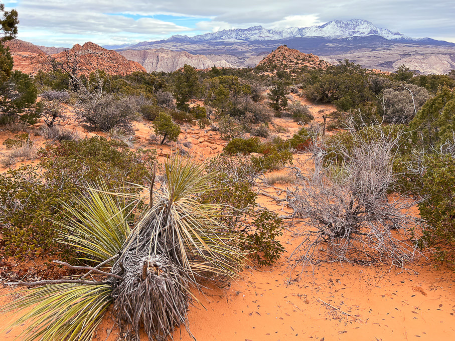 The first view of "On Top of the World" highpoint (red cone to the right). Snow-covered Pine Valley Mountains on the horizon. This photo was taken last winter when we had record snowfalls in southwestern Utah. 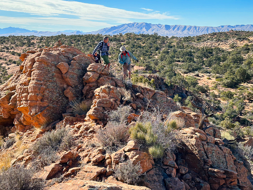 We have just walked across the pinyon/juniper scrub land behind Fred and Jeff and are starting up the ridge to our summit. Beaver Dam Mountains on the horizon to the west. 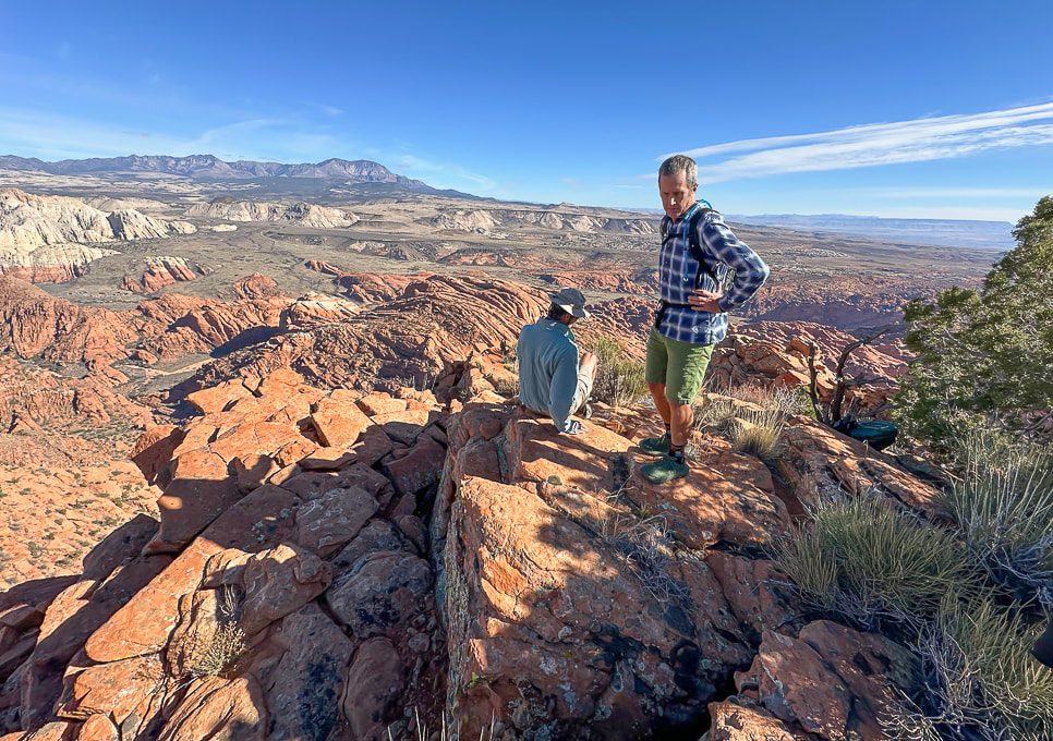 "On Top of the World!" 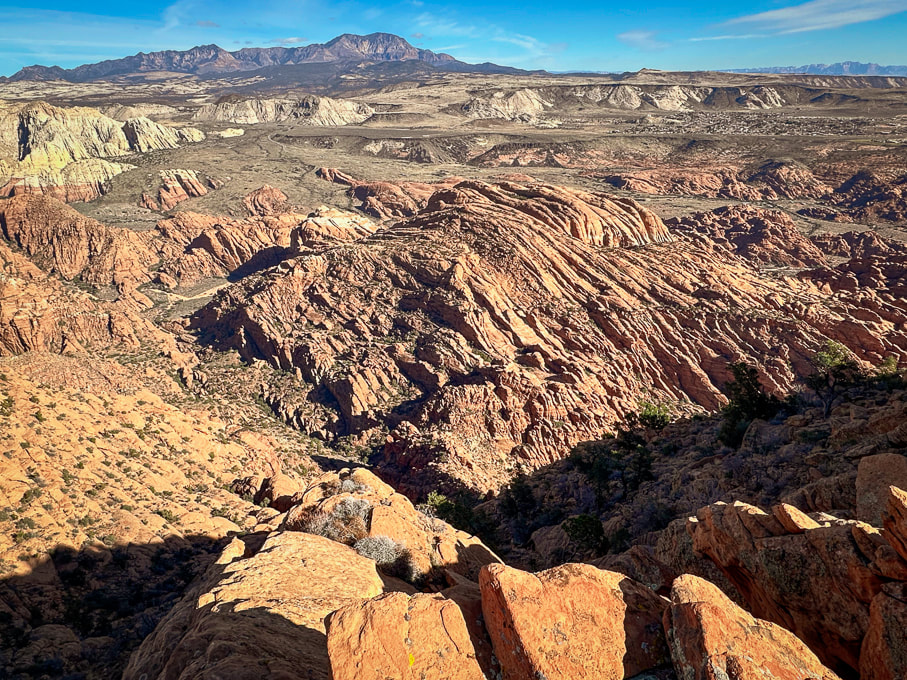 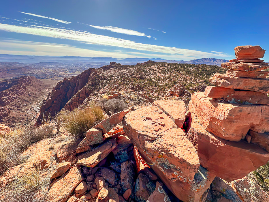 A cairn marking our summit and a view of Tuacahn Center for the Arts lower left. View is looking south at Ivins and St. George, Utah and toward Arizona on the horizon. 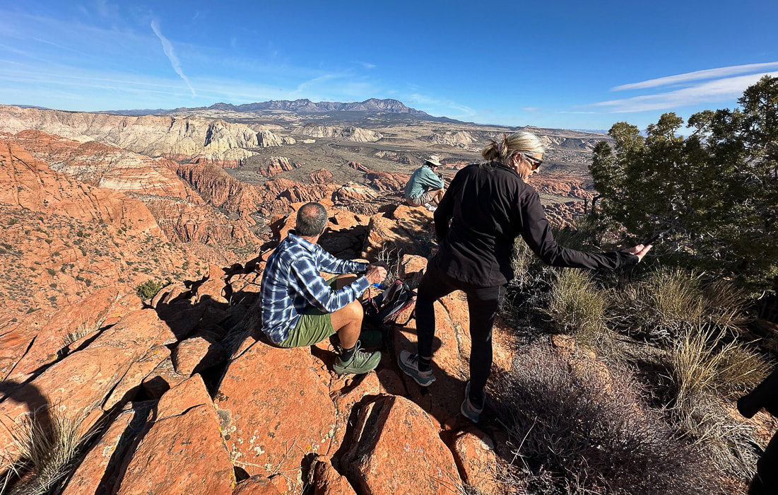 Jeff and Lindy - Happy New Years! 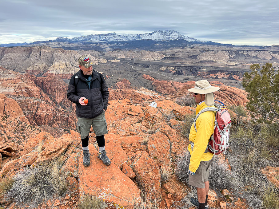 Dan (who named this summit "On Top of the World") in a photo from last winter. 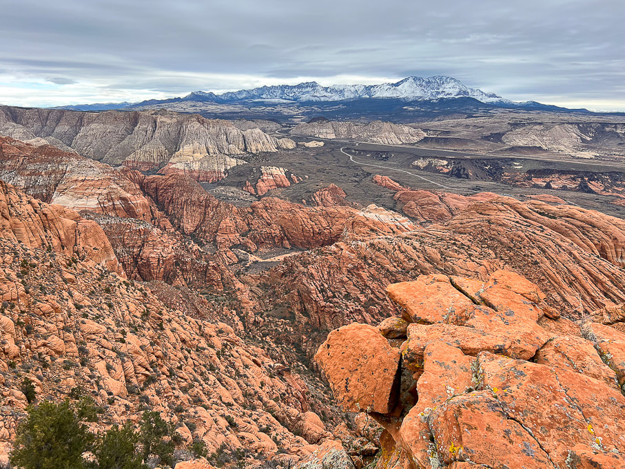 The road in the valley is the drive through Snow Canyon State Park. Note the black shrub-covered basalt flows mid/upper in photo, covering the Navajo Sandstone. 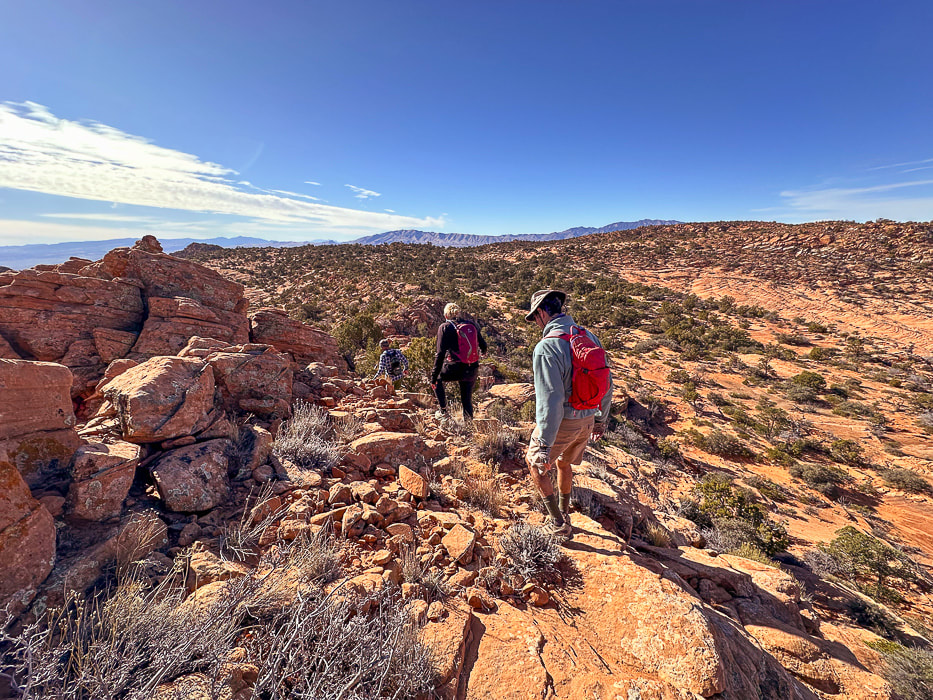 Heading back. As soon as you get over the saddle in the foreground, you drop into sand dunes and washes, then a brief climb up a sandstone ridge to find your entry point onto the plateau. Navigation experience on unmarked terrain is essential so you don't get lost. I recommend taking a GPS point when you finish the 0.8 mile climb from the trailhead to the plateau entry. 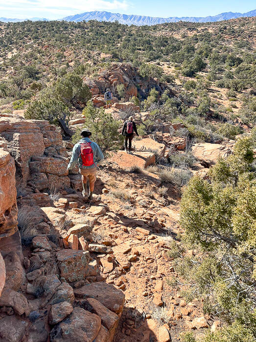 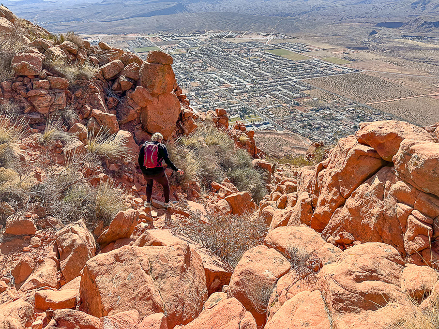 Heading down off the plateau of Red Mountain on Red Mountain Trail. Overlooking the city of Ivins. 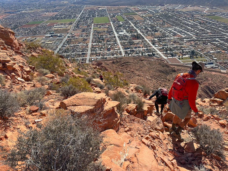 City of Ivins below. 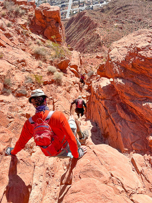 Descending through Class 2+/3 cliff band. Below us is the trail on top of the ridge. 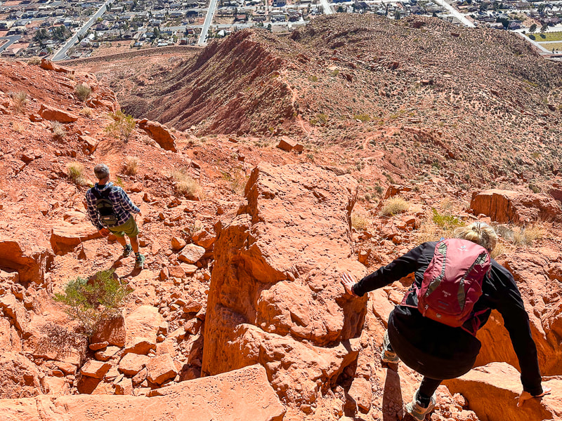 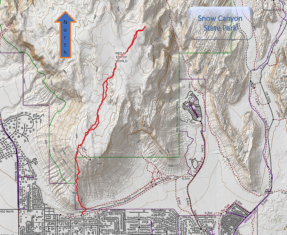 Caltopo Map of our GPS tracks. 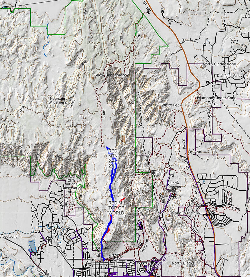 Caltopo map illustrating our hikes on the Red Mountain Primitive Trail. Red tracks = "On Top of the World" hike. Blue tracks = our hike on 2/4/23. Dashed line = continuation of Red Mountain Primitive Trail past Snow Benchmark, to intersection with Snow Canyon Overlook, then ending at its upper trailhead. References
Bugden, M. Geology of Snow Canyon State Park Cryptobiotic Soils: Jayne Belnap. Holding the Place in Place - USGS: Impacts of Climate Change on Life and Ecosystems. Red Mountain Wilderness Maps - Wilderness Connect Ecoregions of Utah - usgs.gov Geologic Map of the St. George and East Part of the Clover Mountains 30' x 60' quadrangles, Washington and Iron Counties, Utah. Biek, R.F., and others. USGS publications. Miller, R. Our Geological Wonderland: Snow Canyon State Park
2 Comments
2/1/2024 02:54:24 pm
Happy New Year! Thanks for sharing the beauty (beauty enhanced by your brilliant photography) with us. Yes, it's combining the things I love: husband, hiking, nature, writing about it and photographing the beauty. Thanks so much for reading Linda and I'm looking forward to your accounts of your 2024 adventures and insights on your website Rangewriter. I hope you can get some skiing in at Bogus the next 2 months! Leave a Reply. |
Categories
All

Sue and Fred

About this blogExploration documentaries – "explorumentaries" list trip stats and highlights of each hike or bike ride, often with some interesting history or geology. Years ago, I wrote these for friends and family to let them know what my husband, Fred and I were up to on weekends, and also to showcase the incredible land of the west.
To Subscribe to Explorumentary adventure blog and receive new posts by email:
Happy Summer!

About the Author
|