|
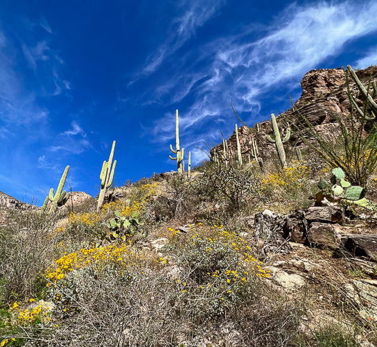
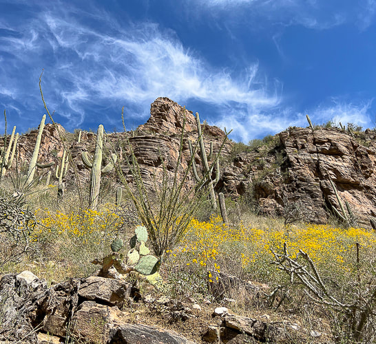
From saguaros to pines, walk through five Sonoran biomes to get to this "sky island" that stands almost one vertical mile over Tucson. 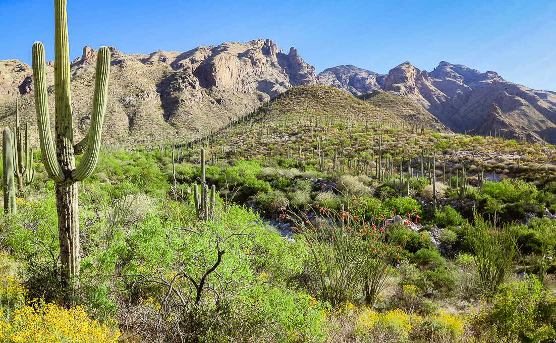 Beginning of hike with view of Mt. Kimball (rounded green peak in the distance). The brittlebush and ocotillos are in peak bloom. We were a bit too early for the saguaro blooms. Trip Stats Overview: Walk up Finger Rock Canyon, keeping its namesake spire in view, among many saguaros and ocotillos followed by a steep, rocky climb along the canyon's east wall. At a grassy plateau, arrive at the path to Finger Rock. Keep climbing, passing Linda Vista, finally entering into a forest of alligator juniper and ponderosa pines. Stand far above Tucson and mountain ranges to the south and even with the high points of the northwest Santa Catalinas. Location: Coronado National Forest - Santa Catalina Mountains - Pusch Ridge Wilderness - Tucson Distance/Elevation gain: 9.7 miles out and back/4,200'. Trailhead = 3,051', Summit = 7,258'. Difficulty: Challenging Class 1 Coordinates: Trailhead (Finger Rock/Pontatoc parking lot) = 32.33658, -110.91. Summit = 32.37728, -110.87904 Maps and Apps: Green Trails Maps: Santa Catalina Mountains Prominence: 1,098' Considerations: No dogs allowed in Pusch Ridge Wilderness Bighorn Sheep closure area, a portion of the Pusch Ridge Wilderness. Native peoples: Desert Archaic (2500 BC - 200 AD). Followed by Hohokam, who were "masters of the desert" until AD 1450, and O'odham peoples who still inhabit southern Arizona. O'odham means "the people". History: Named after Frederick E. Kimball, a land developer who influenced the building of road up to the Santa Catalina's highest summit, Mt. Lemmon. The Finger Rock Canyon trail to Mt. Kimball, one of the highest in the Santa Catalina Mountains, treks through gorgeous Sonoran landscape, meandering through wash and canyon lowlands, close to saguaros, gaining 400' in the first mile. That easy grade ends abruptly at mile two, when you encounter the first of many rock steps on a steep trail that climbs an average of 950' per mile to the summit. The south summit slope bestows a birds-eye view of Tucson, the north side a perched outcrop view of canyons below your feet and the rugged peaks of the western Santa Catalinas. Fred and I have been hiking this mountain ever since we started visiting Tucson to get out of Idaho high country's somber and snowy springs. This established Class 1 trail was a welcome change from the past few months of non-trail, route-finding, scrambling ascents in Utah and Nevada. Great to not have to navigate or continuously hunt for a route or the trail, but instead let the trail take us to the top. On this trip, we first stopped near Kingman, Arizona to attempt Mt. Tipton, but the unmarked 3,500' gain entailed miles and of shrubby terrain clogged with scrub oak and junipers, so we turned around. Islands in the Sky The ability to see the changing scenery of multiple life zones is one of the great features of southern Arizona hiking. The rewards are saguaros and yuccas at the beginning and end, and pine and juniper at the top of your hike, if you are willing to make the thousands-of-feet elevation journey. The Santa Catalina Mountains are but one of the many "sky islands" that rise above the desert. From the Chiricahua mountains in southeastern Arizona to the Sierra San Luis Mountains in Mexico's Chihuahua mountains, these unique, rugged environments support some of the highest levels of biodiversity in the world. Below is a summary of what I learned about biomes and sky islands. I also wrote about this in my Tanque Verde Peak - Saguaro Wilderness post. Southern Arizona mountains are a hiker's paradise. With waterfalls, rugged gneiss and granite rock outcrops to climb over, and wildflowers in spring that represent all of the color spectrum, this desert is surprisingly lush. It is a spectacular land where all elements work together in harmony through monsoons, rains, and killer heat waves, and cool winters. On Mt. Kimball's descent, the other side of the canyon is strewn with hundreds of saguaros clinging to rocky ledges, illuminated by the setting sun. This sight makes you forget about your tired legs. Hike Summary (GPS tracks at end of this post)
 Frost gelato has become a Tucson post-hike tradition! Biomes of the Sonoran Desert
The Santa Catalina Mountains are in the Arizona Uplands, the highest and coldest portion of the Sonoran Desert.
Biome - "Coarse ecological units based on the phenology, lifeform, and physiognomy of the dominant vegetation. - Sonoran Desert Inventory and Monitoring Network - National Park Service. Biomes are determined primarily by temperature and rainfall, and are based on vegetation because plants are easily recognizable components of a biological community. (Dimmitt, 2015). 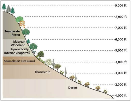
Biomes of Sonoran Desert Network Parks
-from Sonoran Desert Inventory and Monitoring Network - National Park Service Desert
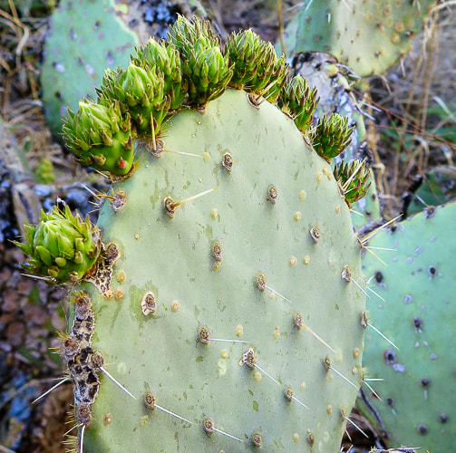
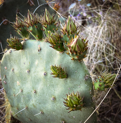
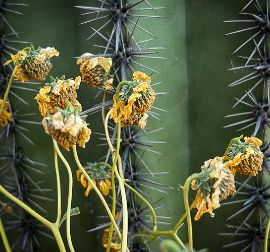
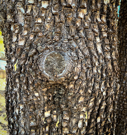
At around 3,000' elevation, the first mile or so of this hike begins where the desert biome is transitioning into the thornscrub biome. It wanders through a gorgeous landscape of saguaros, cholla, barrel cactus, and yucca succulents as well as mesquite, creosote bush and paloverdes shrubs. A great biome because plants are tough yet beautiful at the same time. Tough because plants have devised strategies to help them survive, such as thorns as a physical defense against predators, and hair on leaves to shield the relentless sun. Thorns and bristles act to shade and insulate certain crucial parts of cacti. Creosote bush adapts to the hot sun with wax-coated leaves to avoid loss of water. Thornscrub Before ascending the canyon wall at ~ 3,500', the landscape is transitioning to this biome, continuing with mesquite trees and catclaw (acacia) shrubs. Thornscrub has short trees with cacti, and is denser than desert biome. Vegetation grows lush with a lot of wildflowers. The climate is nearly frost-free (tropical). Plants shed leaves during dry season (drought-deciduous). Semi-desert grassland As the trail climbs just past 4,000 feet, a noticeable change in vegetation occurs: saguaros become scarce as the ridge is dominated by ever-increasing fields of bunchgrasses, oak and juniper. Calming, muted and soft neutral grey/greens replace bright primary colors of the lively, unrestrained desertscrub. Sotol, creosote and agave mix with a diverse array of grasses. As the trail gradually climbs, junipers become more prevalent. This land supports more succulents and shrubs. Hot pink Parry's penstemon add color to this landscape. Madrean Evergreen/Pine/Oak Woodland At the intersection with the trail to Finger Rock, ~ 5,200', larger trees such as alligator juniper appear. Evergreen oaks like Emory oak and Arizona white oak along with Mexican pinyon pine dominate this biome, named after its origin in the Sierra Madre mountain range that runs through Mexico and along the Gulf of California. These are subtropical woodlands. Temperate Forest A unique characteristic of the Sonoran temperate forest biome, officially beginning at around 6,000 feet elevation, is the cohabitation of lower-elevation desert plants, such as the yucca with spruces, pines, firs and maples. Species diversity reigns, although seemingly not to the degree of the desertscrub biome. Temperate forests are very cold-hardy and confined to cooler sites above the Madrean evergreen woodland. One of my favorite parts of this trail is where it crosses the creek to climb up to the intersection. The forest has some Ponderosa pines (reminds me of Idaho). At the top of Pima Trail, just below Kimball's summit, there are large alligator junipers to admire. 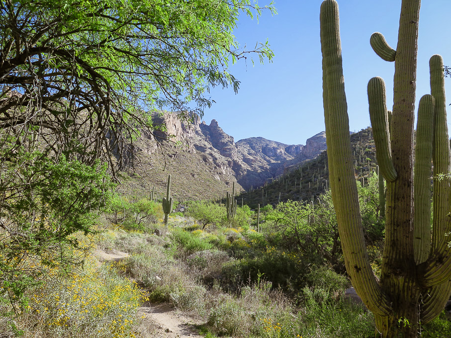
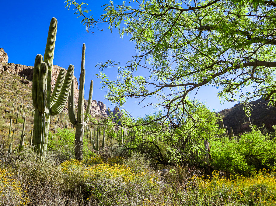 Beginning the canyon climb with Finger Rock on the opposite canyon rim (small rock tower just left of tree on horizon). 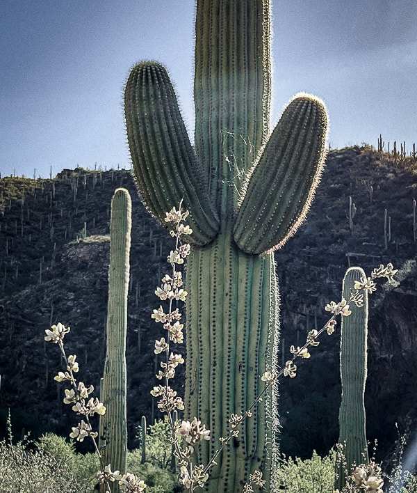 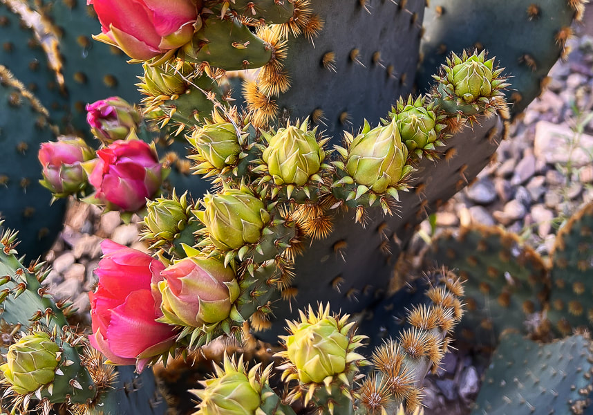 The promise of a super-bloom after an unusually wet winter. This photo was taken at our rental property in Tucson. 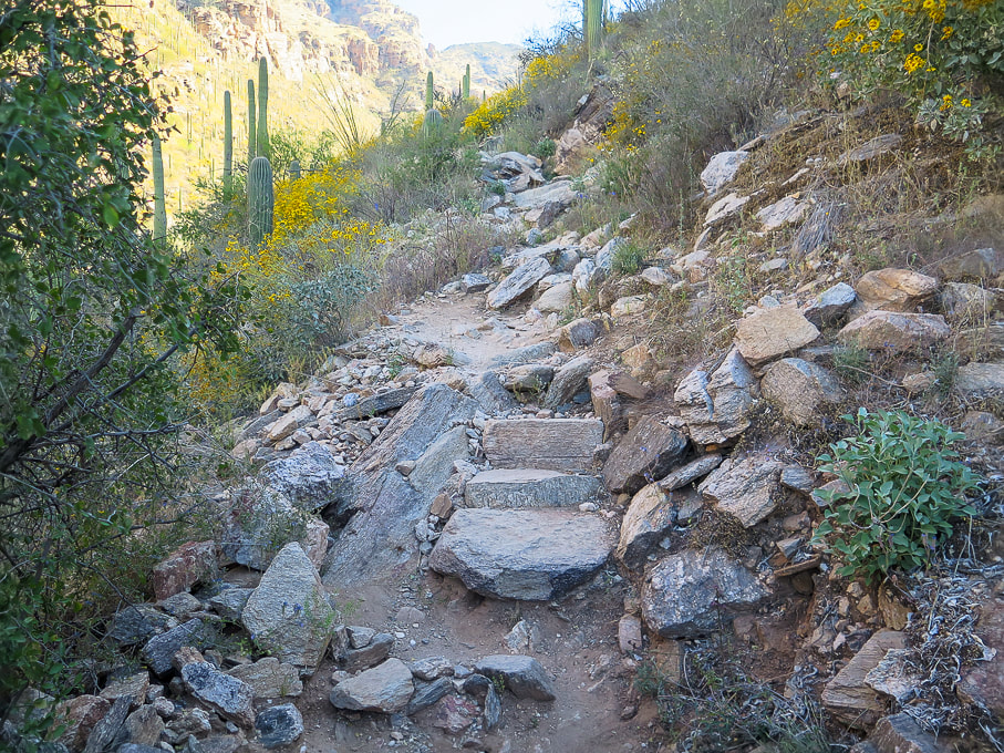 Near beginning of east canyon wall climb. 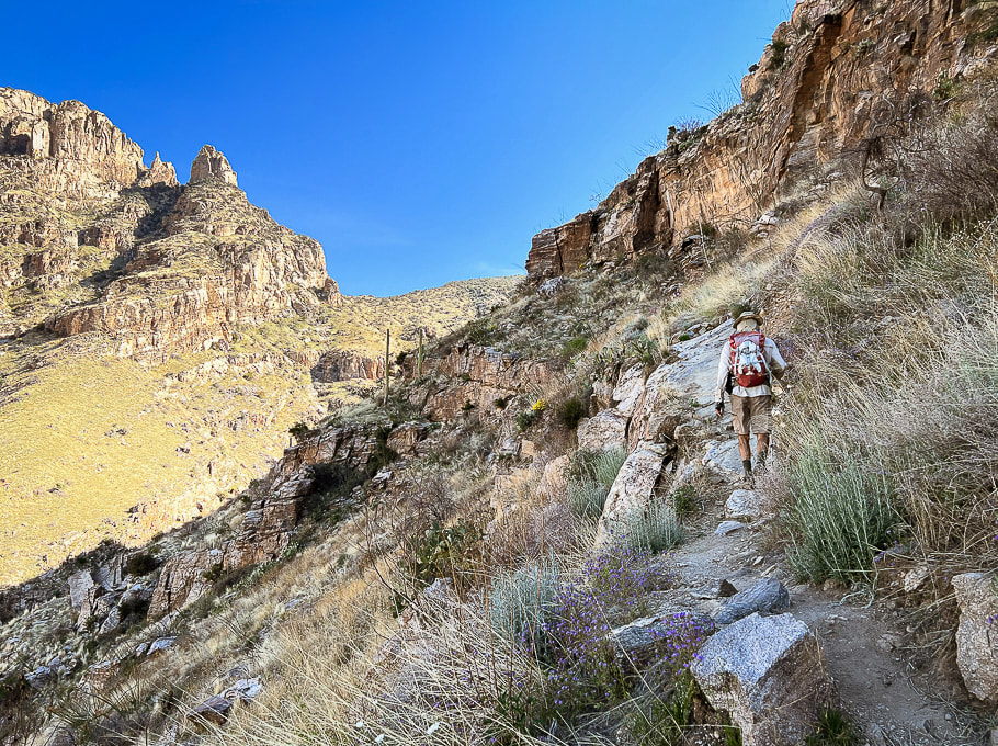 On east canyon wall entering semi-desert grassland biome. Getting closer to Finger Rock on the horizon. 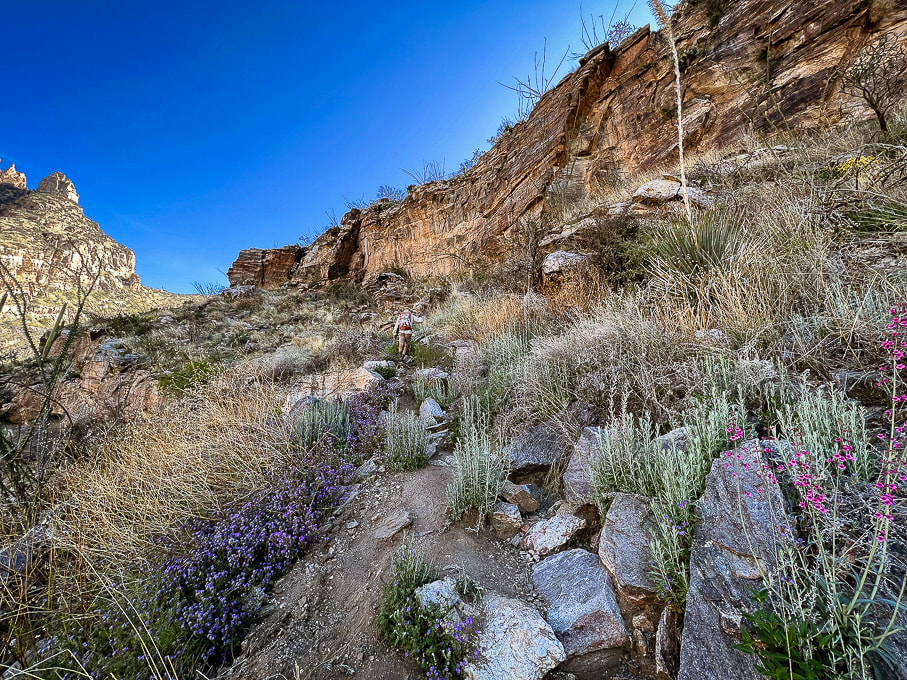 Finger Rock at far left. 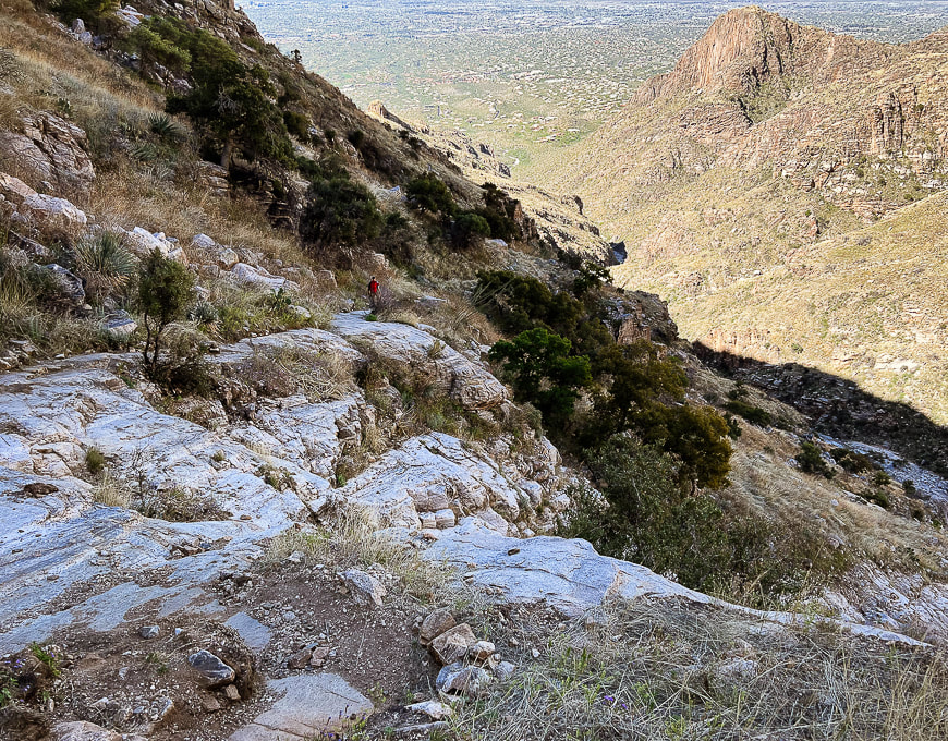 Looking down-canyon at city of Tucson. 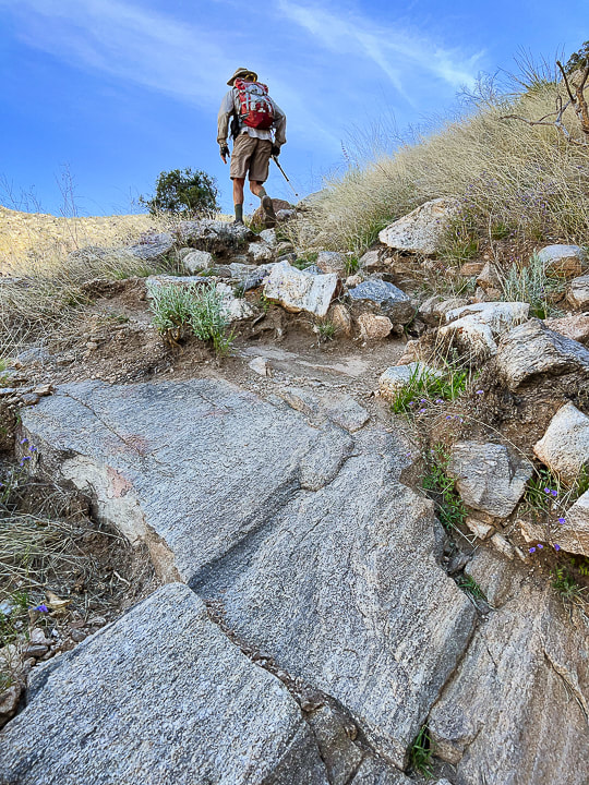 Climbing up toward intersection with side trail that goes to Finger Rock. Walk on bedrock this portion of the hike. 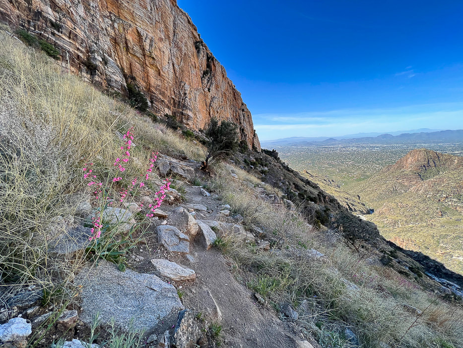 Looking back down canyon with Parrys penstemon in grassland biome. 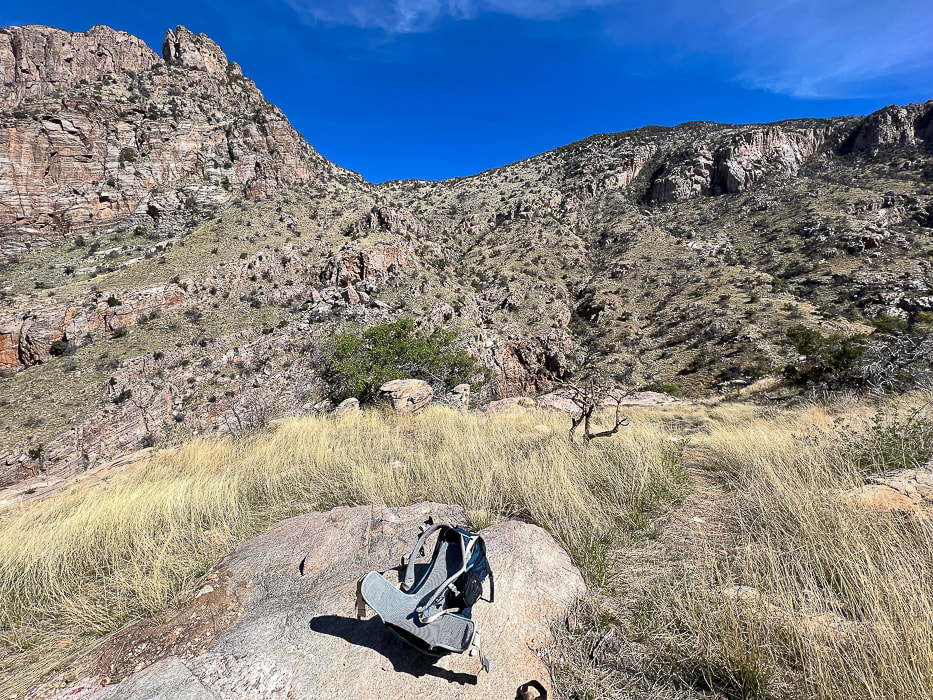 Intersection of our trail (Finger Rock Trail) and a trail that leads to Finger Rock on left side of canyon. 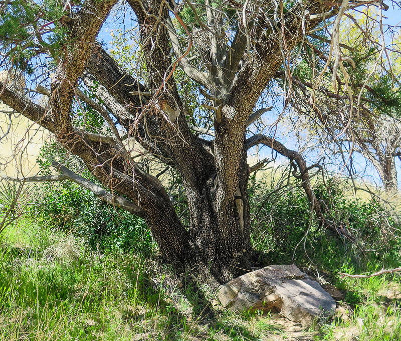 If this old alligator juniper could talk.... 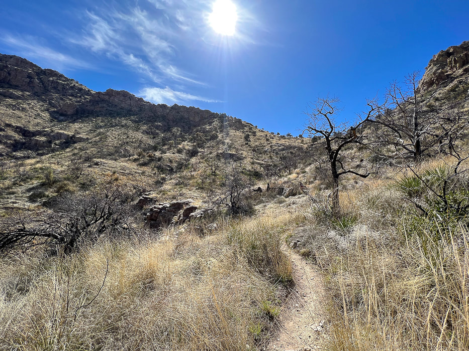 Continuing up to saddle and some awesome rock formations. 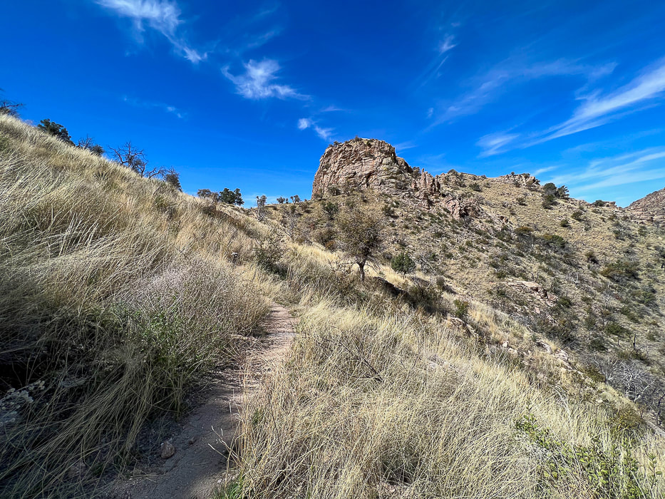 Looking back at Linda Vista; there's a short trail that goes to the saddle at mid-horizon for a great view of Tucson. 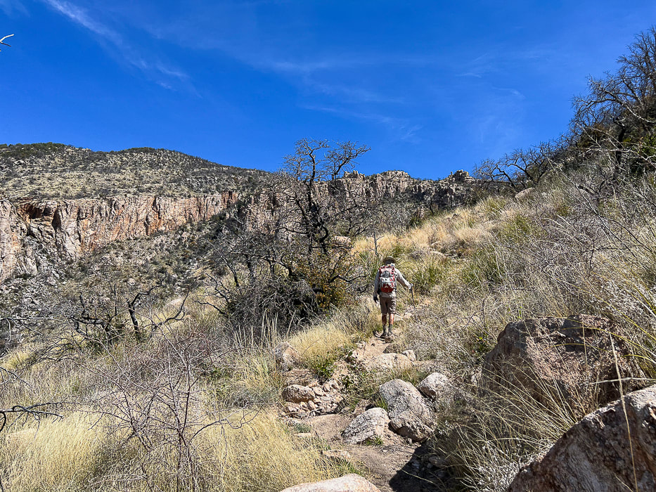 Getting closer to the intersection with the Pima Canyon Trail. Looking at Mt. Kimball's thick pine/oak/chaparral vegetation at left horizon. 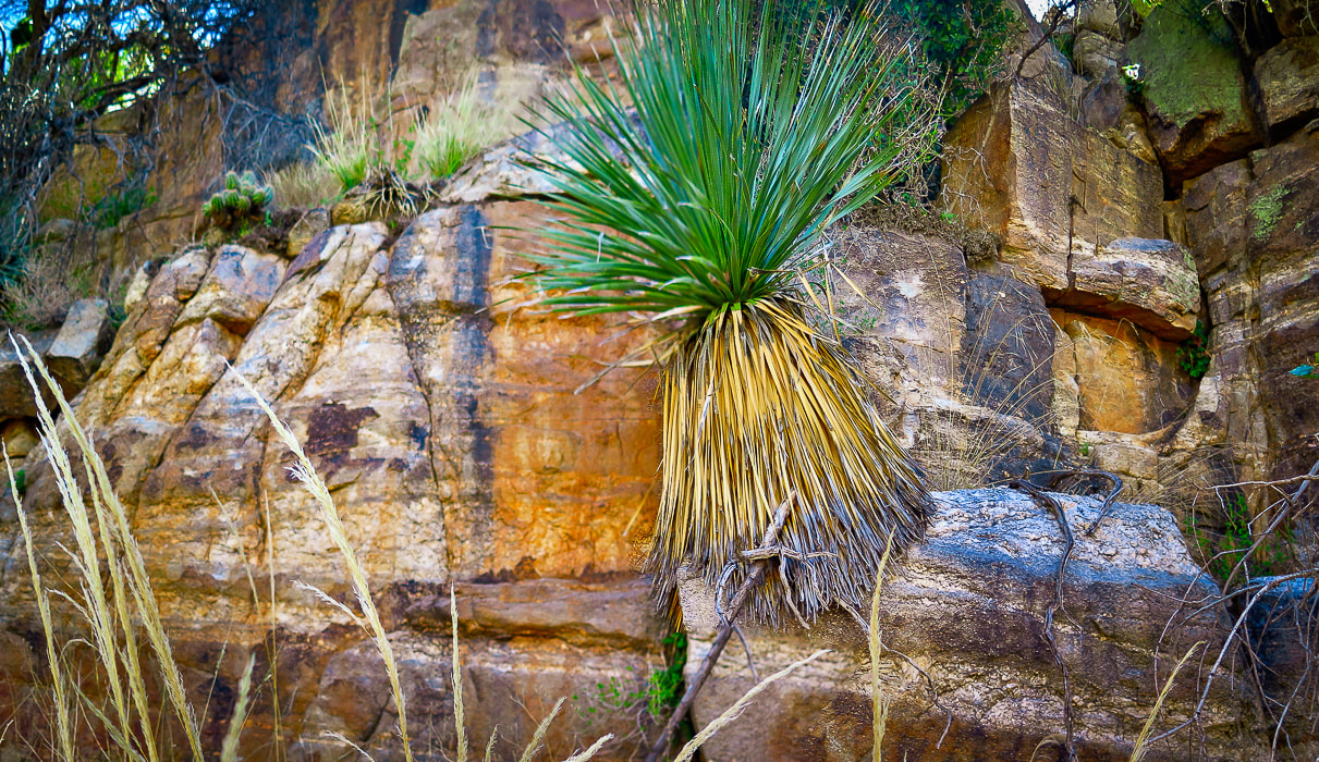 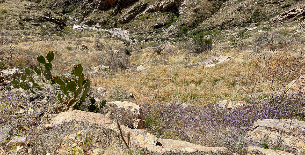 Looking back down Finger Rock Canyon; the prickly pear are studded with lots of flowers. 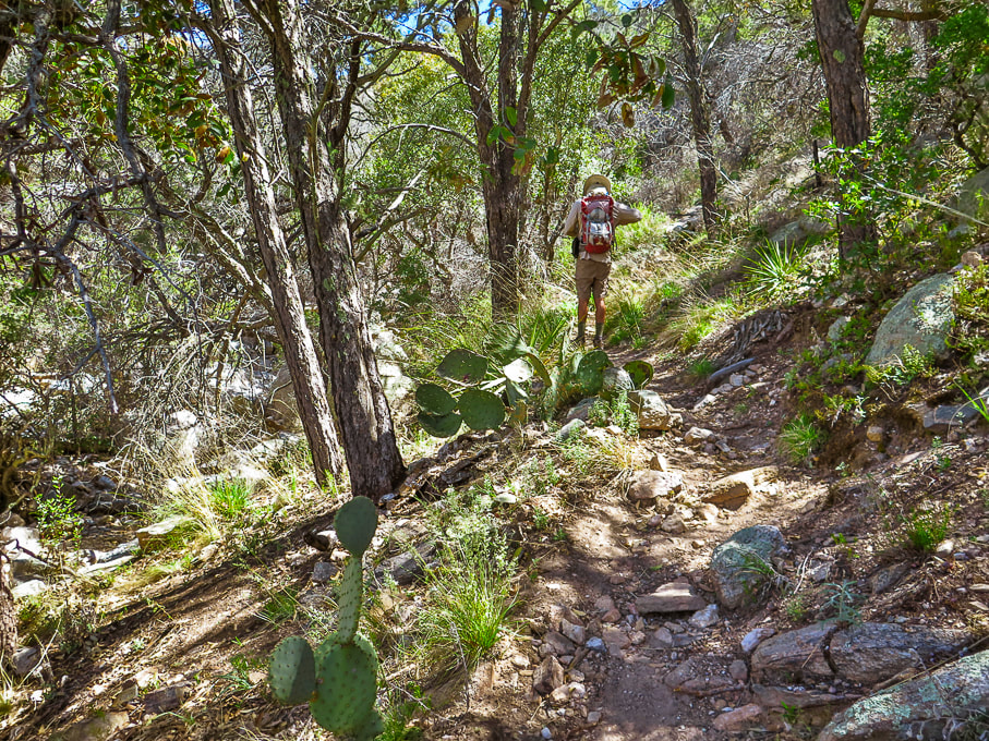 Madrean Evergreen/Pine/Oak Woodland Madrean refers to the Sierra Madre mountain range that runs through Mexico and along the Gulf of California. 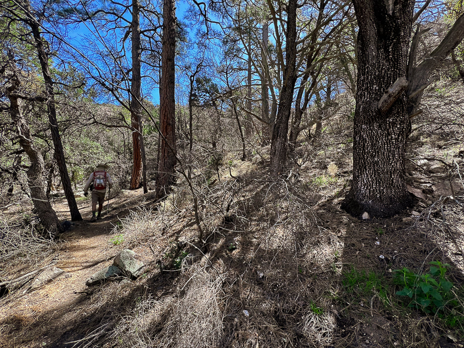 Temperate forest - one of my favorite portions of this hike, however sadly affected by recent wildfire. 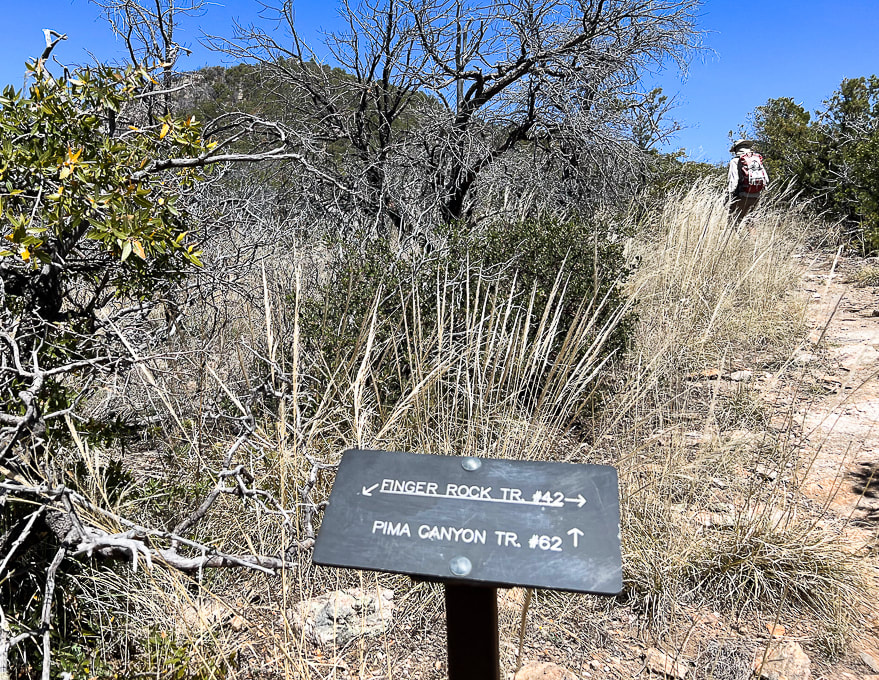 Intersection of Finger Rock Trail and Pima Canyon Trail. Finger Rock Trail continues to Window Peak and intersection with Ventana Canyon to the east. Follow Pima Canyon trail. Mt. Kimball seen above! 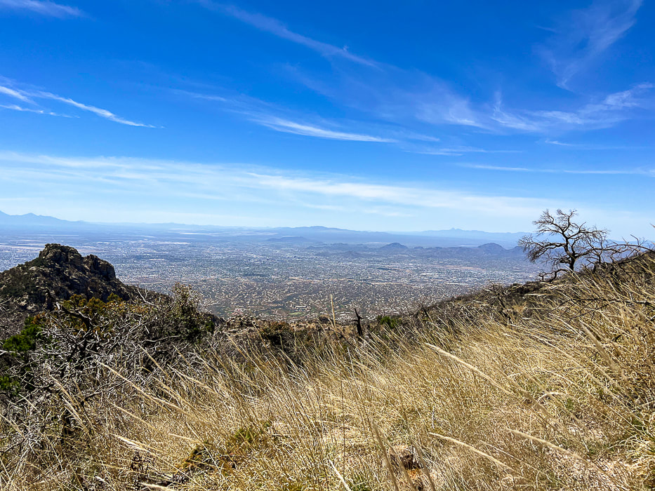 Nearing the summit - killer views of Tucson and mountain ranges to the south and southwest. 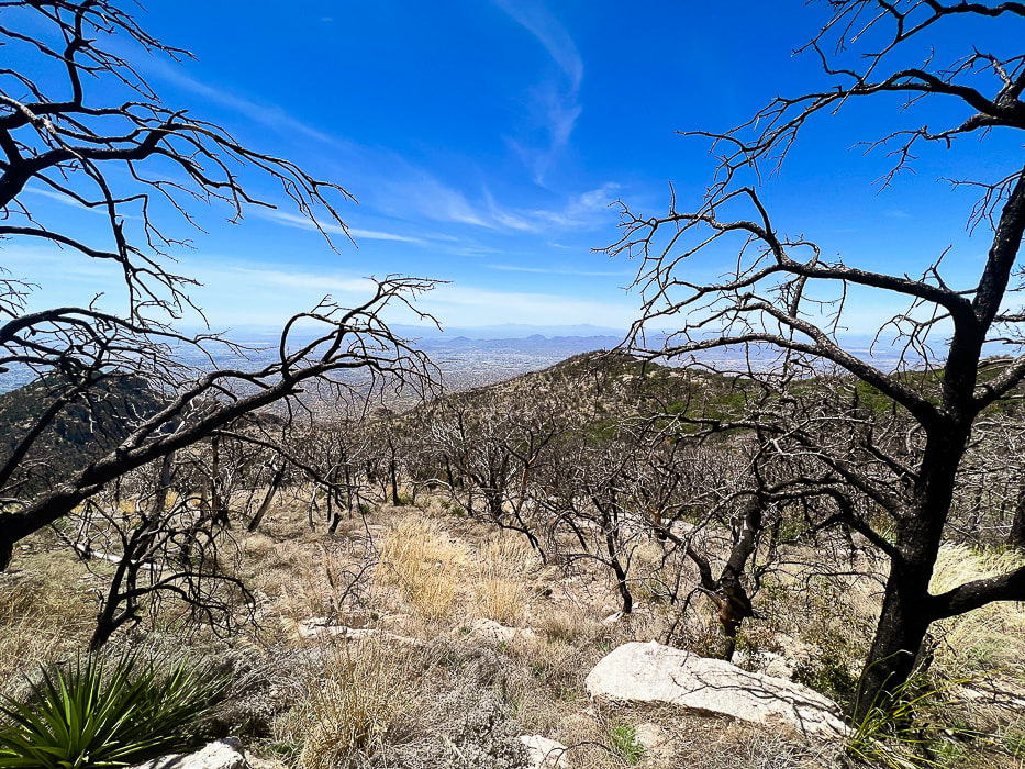 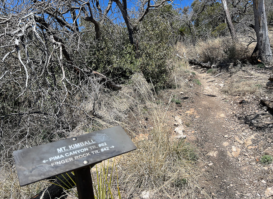 The point at which you turn off the Pima Canyon Trail and hike on this spur trail to Mt. Kimball's summit. 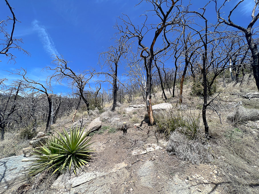 We left Pima Canyon Trail early, before the sign that indicates Mt. Kimball on the way up and went through this badly burned area. On the way down, we hiked the more-traveled spur trail to the sign. 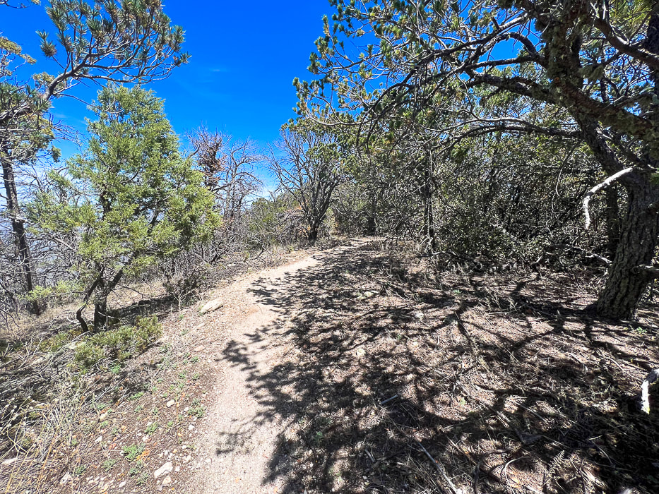 Spur trail to summit 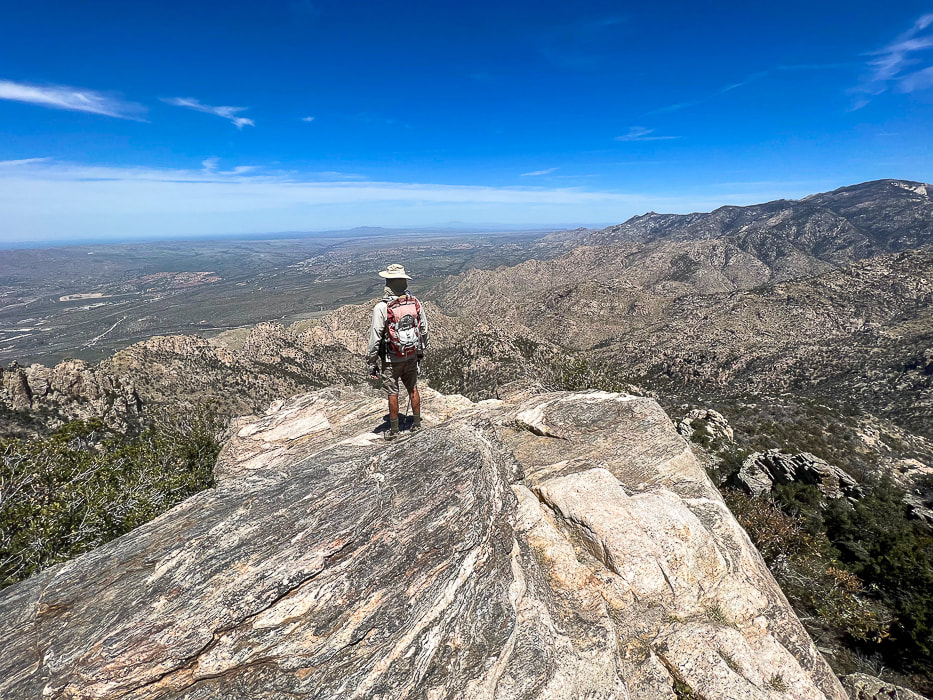 The summit of Mt. Kimball once again! View to the north toward Catalina State Park and the western Santa Catalinas. 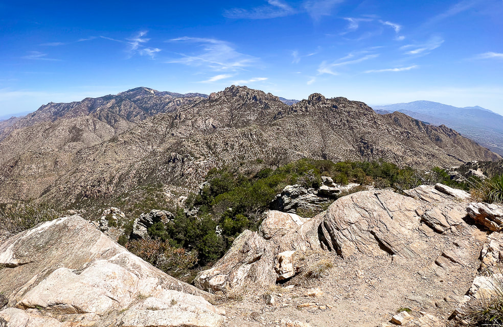 View of the southwestern Santa Catalinas and Tanque Verde ridge east of Tuscon on far horizon. 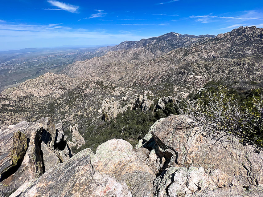 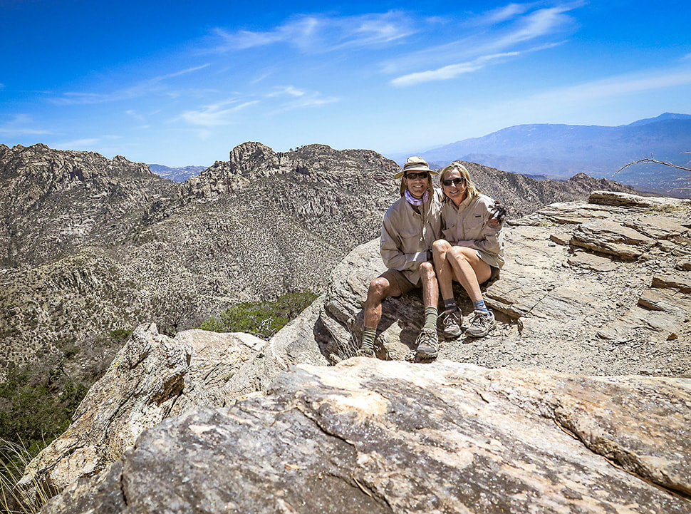 Fred and Sue: happy that we can still hike this summit! 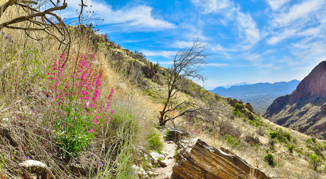 On the way back down; my favorite forb - pink Parry's penstemon. 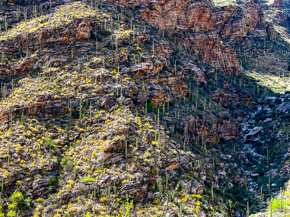 Finger Canyon's southeast-facing wall on the way down. Thinking about the Frost Gelato in our near future at this point. 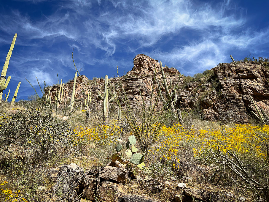 The beauty of the desert/thornscrub biome: saguaros, brittlebush, ocotillo, cholla and prickly pear. Cool stuff on the trail. 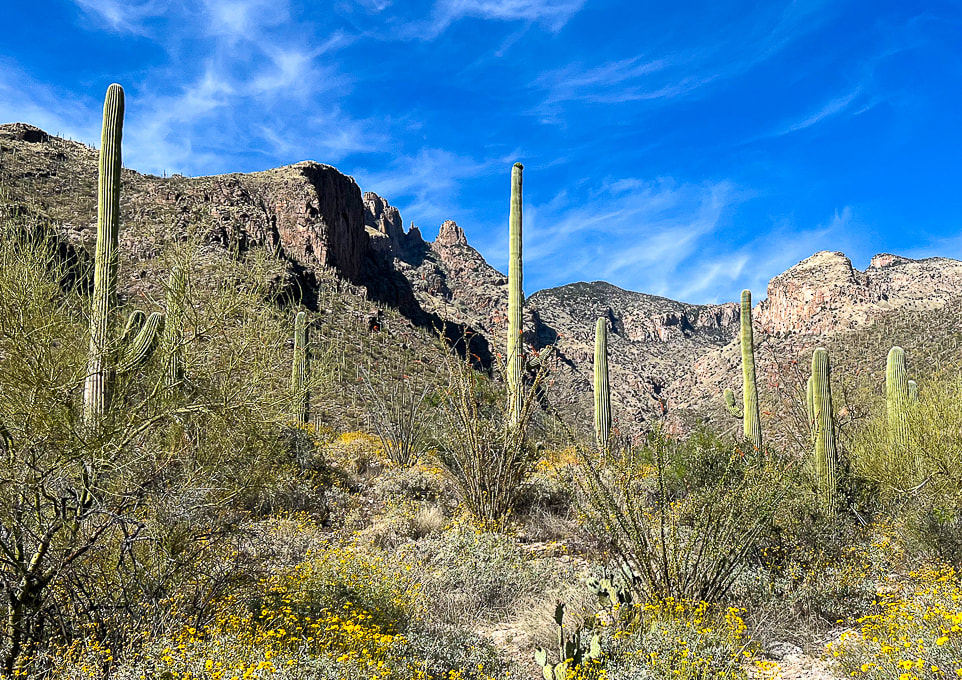 Parting shot: sun shining on The Finger left side of canyon and Mt. Kimball. Getting really close to that Frost Gelato! Great day on this sky island with beautiful weather. 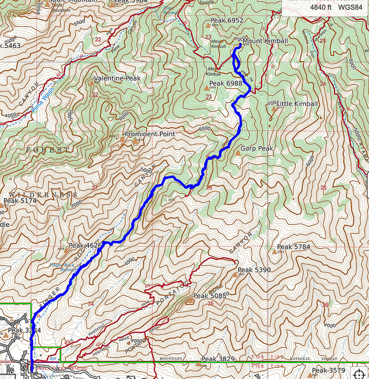 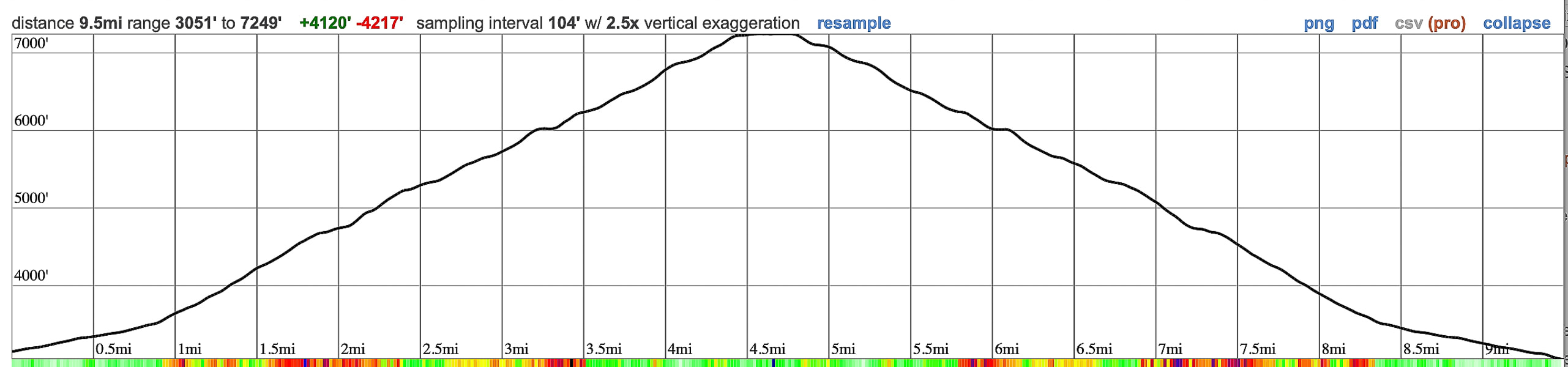 GPS tracks and elevation profile for Mt. Kimball, Pusch Ridge Wilderness, from CalTopo. 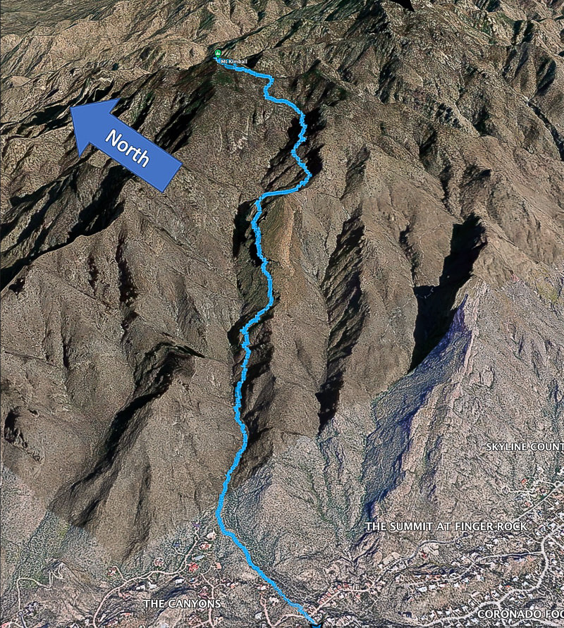 Google Earth image of our GPS tracks. References
Bezy, J. V. 2016. A Guide to the Geology of the Santa Catalina Mountains, Arizona: The Geology and Life Zones of a Madrean Sky Island. Arizona Geological Survey. Mt. Kimball. Summit Post website. Dimmitt, et al. 2015. A Natural History of the Sonoran Desert. Arizona-Sonora Desert Museum Press and University of California Press. The Sky Islands. From website: Sky Island Alliance.
2 Comments
James Ponder
5/17/2023 08:18:13 pm
Find any petroglyphs or signs of early inhabitants on this hike, Sue?
Hi James, Leave a Reply. |
Categories
All

Sue and Fred

About this blogExploration documentaries – "explorumentaries" list trip stats and highlights of each hike or bike ride, often with some interesting history or geology. Years ago, I wrote these for friends and family to let them know what my husband, Fred and I were up to on weekends, and also to showcase the incredible land of the west.
To Subscribe to Explorumentary adventure blog and receive new posts by email:
Happy Summer!

About the Author
|