EXPLORUMENTARY
  • Home
    • Cactus to Clouds Hike
    • More Quotes
    • Ann Zwinger Quotes
    • Mary Oliver Poems
  • Hikes by State
    • Southern Utah
    • Idaho
    • Arizona
    • California Desert
    • Nevada
    • Wyoming and New Hampshire
  • Petroglyphs and Pictographs
  • BLOG
    • Adventure Blog
  • GALLERY
    • DESERT PLANTS >
      • Beavertail cactus
      • Brittlebush
      • Christmas Cactus
      • Arizona Barrel Cactus
      • Parry's penstemon
      • Agave
      • Arizona Rainbow Hedgehog
      • Claret Cup Hedgehog
      • Desert Agave
      • Palmer's Penstemon
      • Silver Cholla
      • Cristate Saguaro
      • Indian Paintbrush
      • Ocotillo
      • Santa Rita Prickly Pear
      • Spiny Cliffbrake
      • California Barrel Cactus
      • Engelmann Prickly Pear
      • Velvet Mesquite
      • Joshua Tree
      • Buckhorn Cholla
      • Hedgehog Cactus
      • Fishhook cactus
      • Thompson's Woolly Locoweed
    • NATURE
    • BOISE
    • EARTH + SKY
    • URBAN
    • WATER
    • PATRIOT
    • ORCHIDS
  • Fit After 50
    • Brian Holgate
    • Fred Birnbaum
    • Dave Brasuell
    • Bus' Little Black Book
    • Mike Carlson
    • Ray Wilson
    • Bryan Krouse
    • Vickie Kearney
    • Maria Keezer
    • DOUG TRAUBEL
    • Boise Cross Fit Masters Ladies
    • Tim Clemens
    • Marcia Bondy
    • Becky Borczon Blake >
      • Becky B Downtown
    • Jennifer Cera and Sue Birnbaum
    • Dave Brasuell
    • Vance Powell
  • Contact

Shelly Baldy Peak: 11,321' - Tushar Mountains, Utah

10/3/2023

2 Comments

 
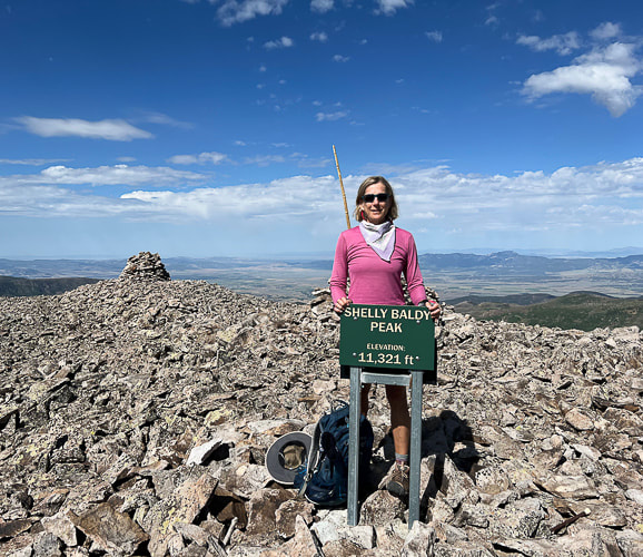
Hike a gorgeous and high Utah mountain range that relatively few know about.
Picture
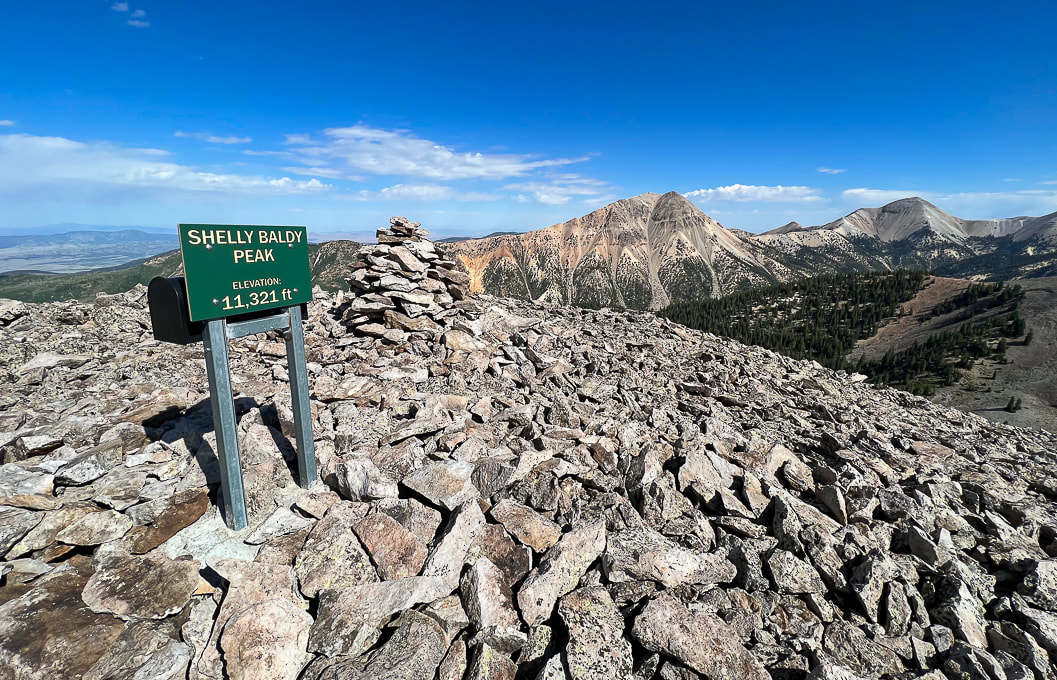
On Shelly Baldy's summit looking at Mount Baldy (left) and Mount Belknap (right), the Tushar Mountain's second highest peak after Delano Peak.
Trip Stats
Location:
  Southern Utah - Fishlake National Forest out of Beaver.
Quick Summary (from Skyline/ Big John Flat trailhead on Forest Road #123, head northwest, ascend northeast ridge).
  • At 0.45 mile cross over Griffith Creek
  • At 0.8 miles cross over Poison Creek
  • At 2.10 miles intersection with Blue Lake Trail.  Head north on Blue Lake
  • At 2.70 miles, exit Blue Lake Trail and head west toward Shelly Baldy's northeast ridge.
  • At 3.5 miles reach summit.
Distance/Elevation gain:  7.0 miles out and back/1,300'.    Trailhead = 10,086',  Summit = 11,321'.
Difficulty:  Easy - moderate Class 1, then moderate Class 2 scramble on stable talus ridge.
Coordinates:  Trailhead = 38.35910   -112.39317.    Summit = 38.36911    -112.42528
Trailhead location:  
The Skyline-Big John Flat Trailhead is located 21 miles east of Beaver, Utah. From Beaver travel east on UT-153 road for approximately 16.2 miles. Turn left onto the FR123 (Sunset Drive) for 0.3 miles. Keep left on FR123 and travel another 4.5 miles to the Trailhead.  Forest Service Interactive Map
Maps/Apps:  Fishlake National Forest - Beaver and Fillmore Ranger Districts map.
Date hiked:  July 26, 2023
Geology:  Shelly Baldy summit is Mount Baldy Rhyolite, an extrusive igneous fine-grained silica-rich rock.
Links:  Mountain Forecast (weather)    Fishlake National Forest
Related Posts:
Mt. Holly/Delano Peak Loop - Tushars
Delano Peak, 12,169' - Tushar's highest
Fremont Indian State Park, Utah
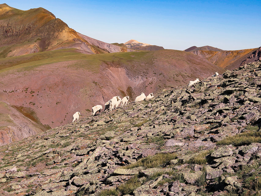
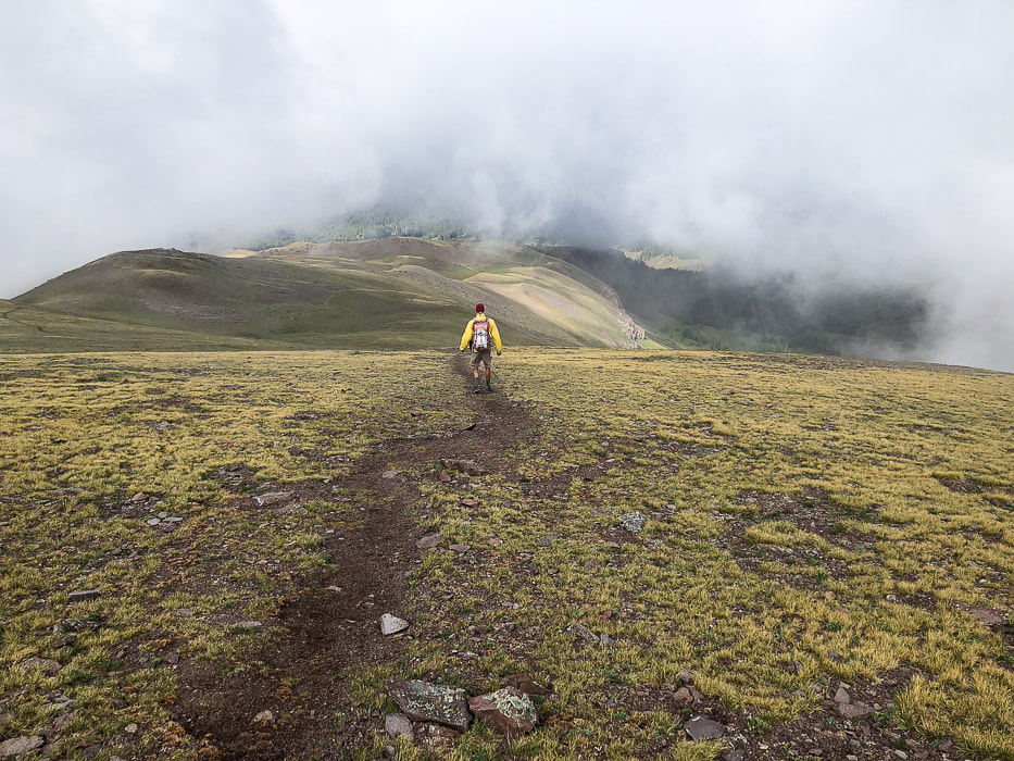
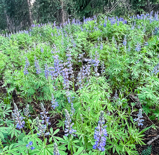
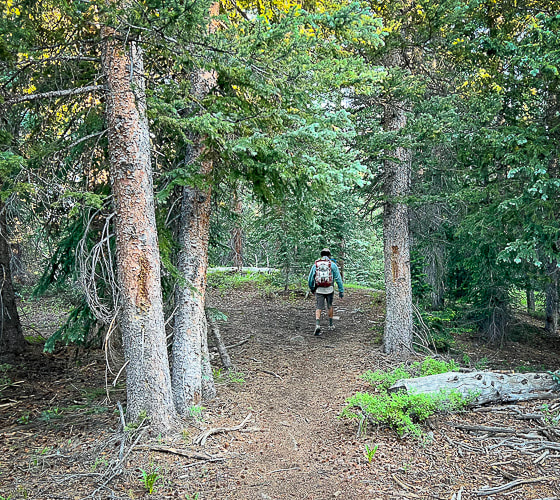
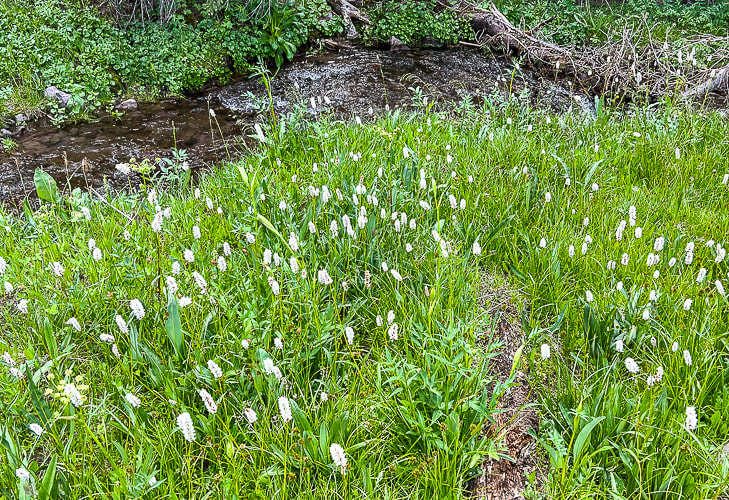
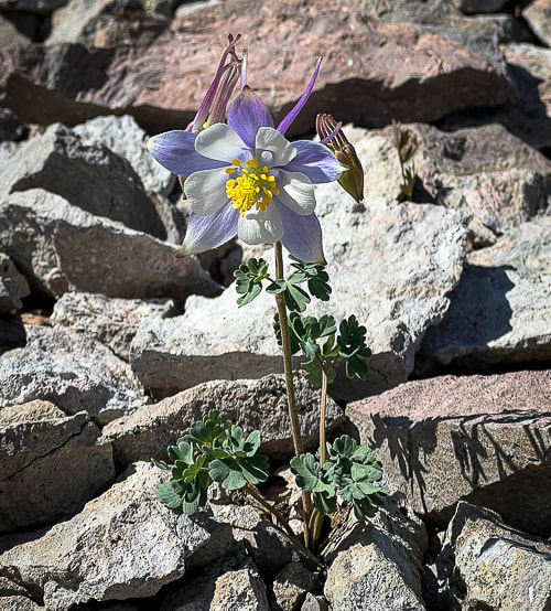
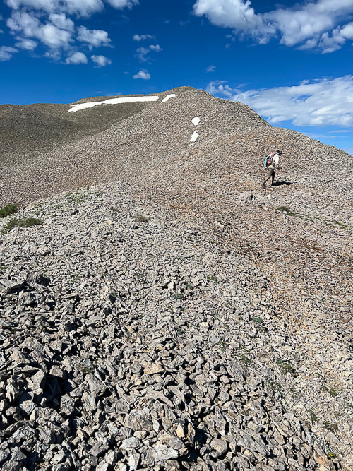
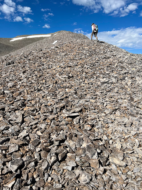
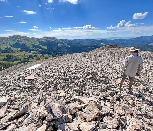
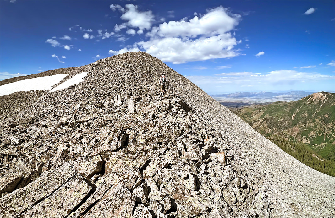
Descending Shelly Baldy's talus ridge looking toward the east and Delano Peak.
Picture
Picture
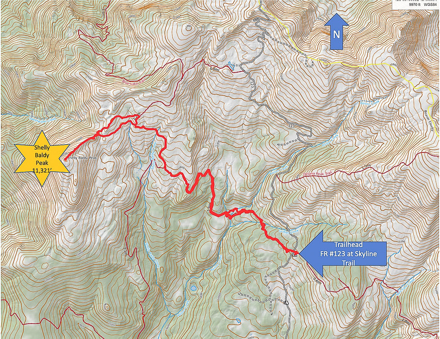
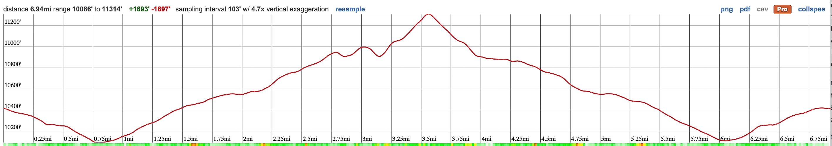
Topo Map and profile for Shelly Baldy Peak accessed from Big John Flat/Skyline Trail trailhead. (Thank-you Caltopo).


The Tushars:  Ouiet, High, and Beautiful
We keep returning to the less-traveled Tushars because of the forest, wildflowers, the variety of peaks to hike and the spectacular ridge scenery.  And it's so green!  We previously hiked Delano Peak, and a loop including Delano and Mt. Holly where we shared the mountain with the mountain goats.

Copper Belt Peak was our original plan this trip, accessed along a beautiful ridgeline in the central Tushars, but we were blocked by a gate on the access road.  We found out from a guy doing trail maintenance after finishing Shelly Baldy that there was still a snow slide blocking the road.  Last winter (2022-23) saw record-breaking snowfalls in southern Utah.

It's believed that Tushar came from the Southern Paiute word "T-shar", meaning "white".  Mt. Belknap and Mt. Baldy, two of its highest volcanic-rock summits gleam white from a distance.

Shelly Baldy is a fun peak and a not-too-difficult way to get stunning views of Belknap, Baldy and Delano.  The hike is a combination of high-country creeks and waterfalls, meadows and forest, tundra and talus, and many wildflowers this July.  The route is straightforward:  you hike the Blue Lake Trail to its closest point near Shelly Baldy's northeast ridge and jump off to head cross-country towards it, having to negotiate a large talus field before embarking on a straight-up route on its ridge.  It's a short climb on stable talus - not exposed - to the summit cairn, sign and mailbox that acts as a summit register.
That night we stayed in the Mahogany Cove Campground, camping out of the back of our truck.  We had driven up Forest Road 123 toward the trailhead the day before, but found all of the camping areas filled with RV's.  The 275-mile Paiute ATV Trail, a network of trails and dirt roads runs through the Tushars.  It ties together historic mining and native American sites, Mormon heritage sites, state parks and National Forests.

Copper Belt Peak is still on our list.  If we can't access it from Beaver, we can hopefully get to it from Marysvale, to the east.
Comfort Kills
In my Crossfit "box" (term affectionately used by Crossfitters to describe their gym which contains barbells, racks, rowers, jump ropes, kettlebells, etc.), a photo shows two athletes wearing shirts with the words "Comfort Kills."   Intrigued, I read up on this "attitude."  Forceful words, but they are true.  We must go beyond our limits, our comfort zone.  Going beyond what we think we can withstand, taking on risks in order to grow. 
"Our goal should not be to constantly remain in a sheltered place. Rather, in all circumstances have the ability to find solace." --Savage Gentleman website.
I will keep on reminding myself.
Growth and change happens in the extremes  -  Never Stop Climbing Mountains!
Picture
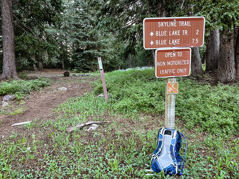
Skyline/Big John Flat Trailhead just on FR 123.
Lots of lupines
Shortly after trailhead - trees marked with blazes
Lots of bistorts
Utah columbine
Some cool stuff on the trail.
Picture
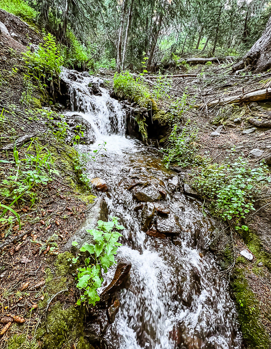
Griffith Creek near trailhead.
Picture
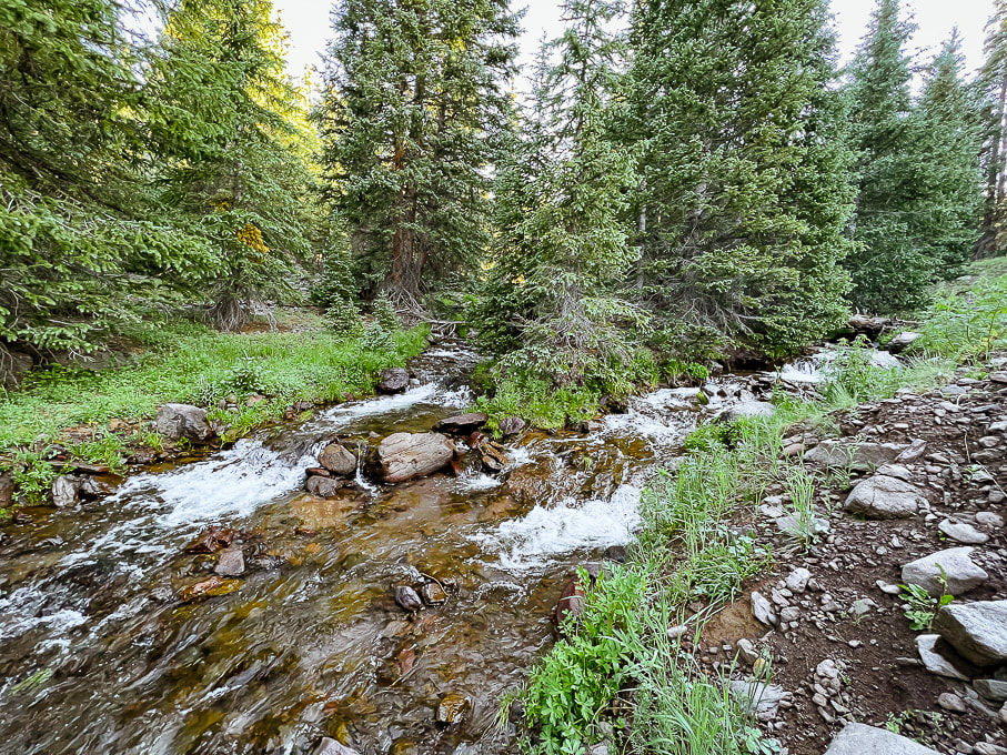
Poison Creek - cold water and a bit tricky to cross!
Picture
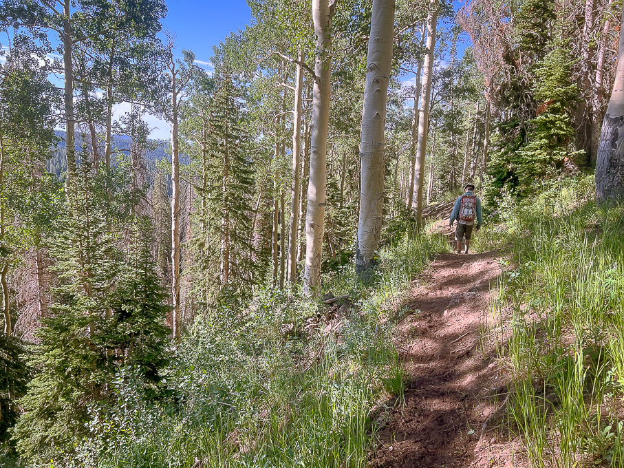
On the Skyline Trail walking out of the forest into higher meadows.
Picture
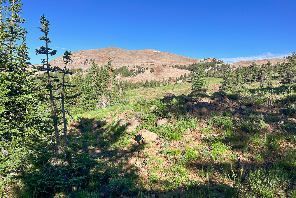
Still on Skyline:  first view of Shelly Baldy Peak with the two small snow patches near its summit.
Picture
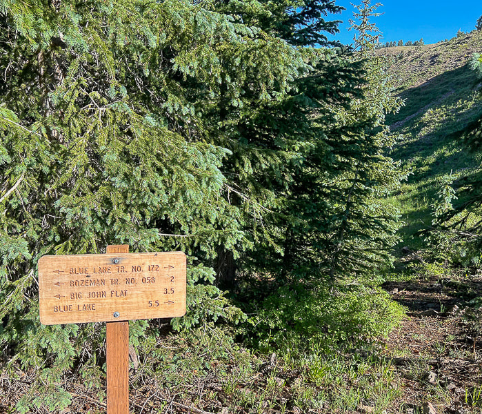
Intersection of Skyline Trail with Blue Lake Trail.  From here we headed north (right) onto Blue Lake Trail.
Picture
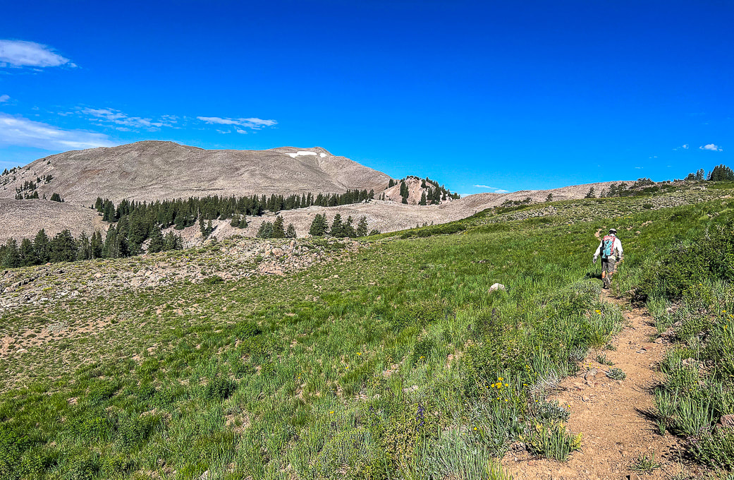
Blue Lake Trail:  finding a point closest to Shelly Baldy's (peak with snow on it) ridge on the right.
Picture
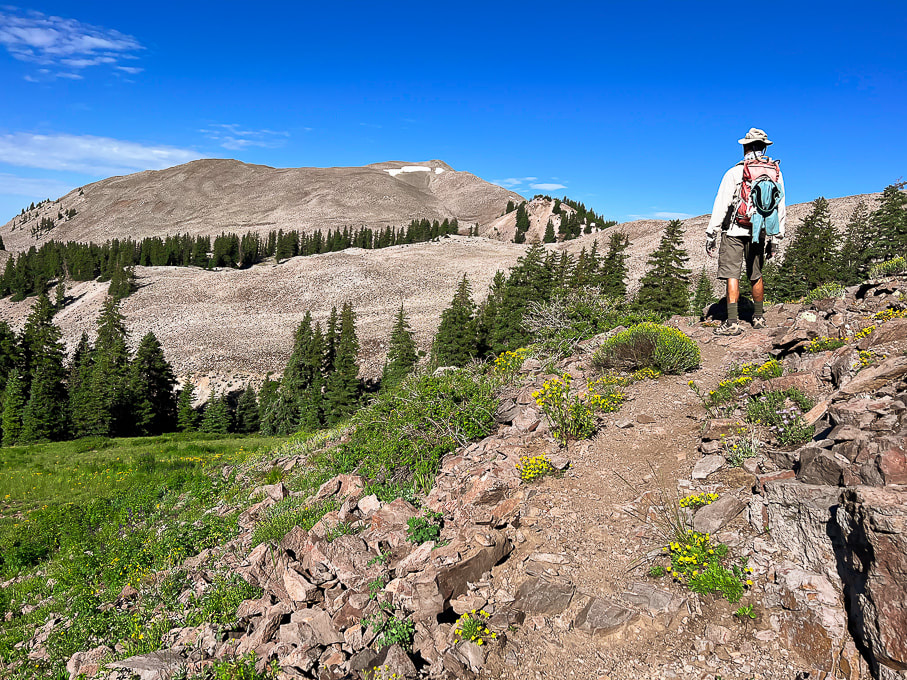
Looking for the best cut-off point from Blue Lake Trail.
Picture
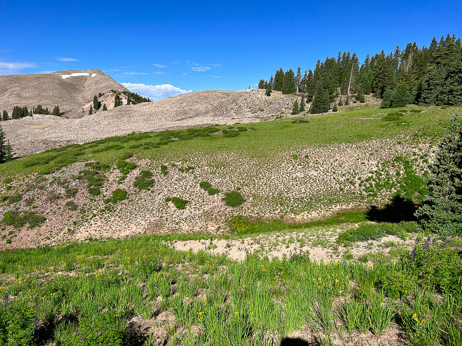
Looks like we found it.  There's that big mound of talus to get over before heading up Shelly Baldy's northeast ridge.  I think you could continue ascending Blue Lake Trail a little further and get off the trail to walk through the forest on the right and avoid so much of the talus.
Picture
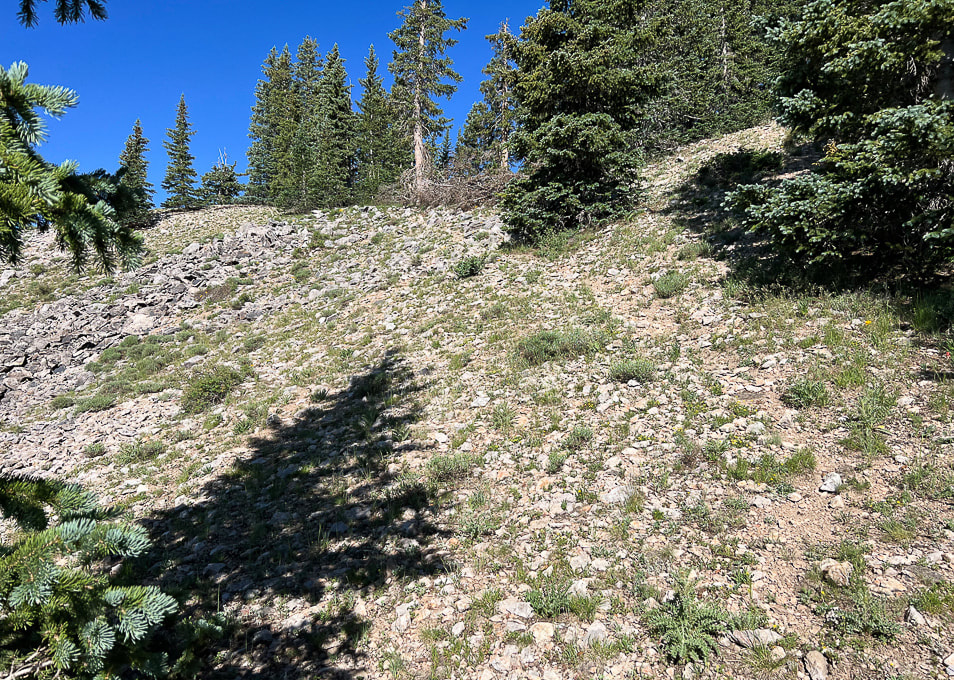
Faint trail through edge of forest.
Picture
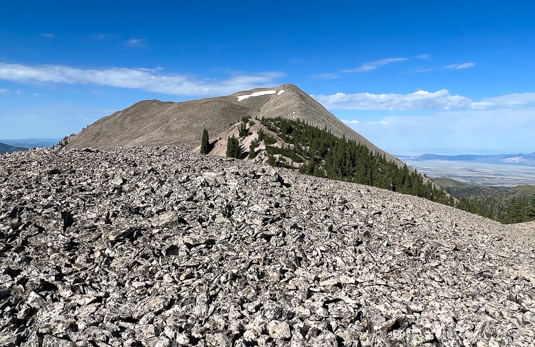
Hill of talus before reaching ridge.
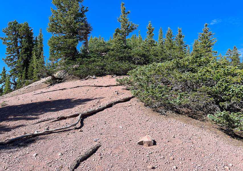
Picture
Wow!  Pink!!
Picture
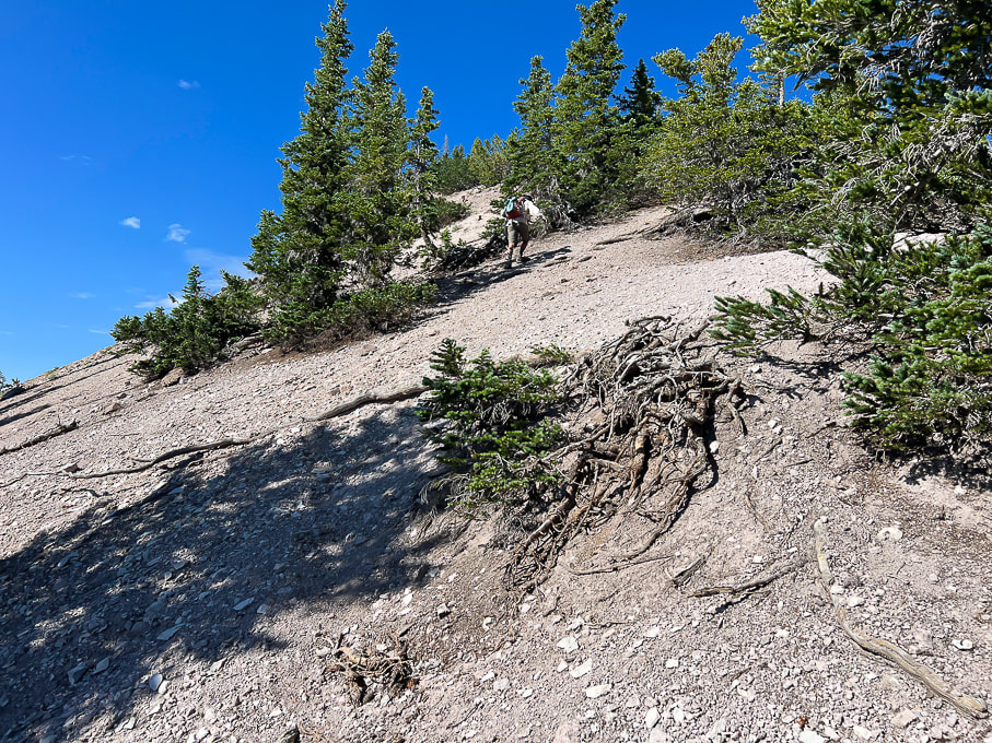
Finally on steep, slippery ridge.  Fred upper center.
Picture
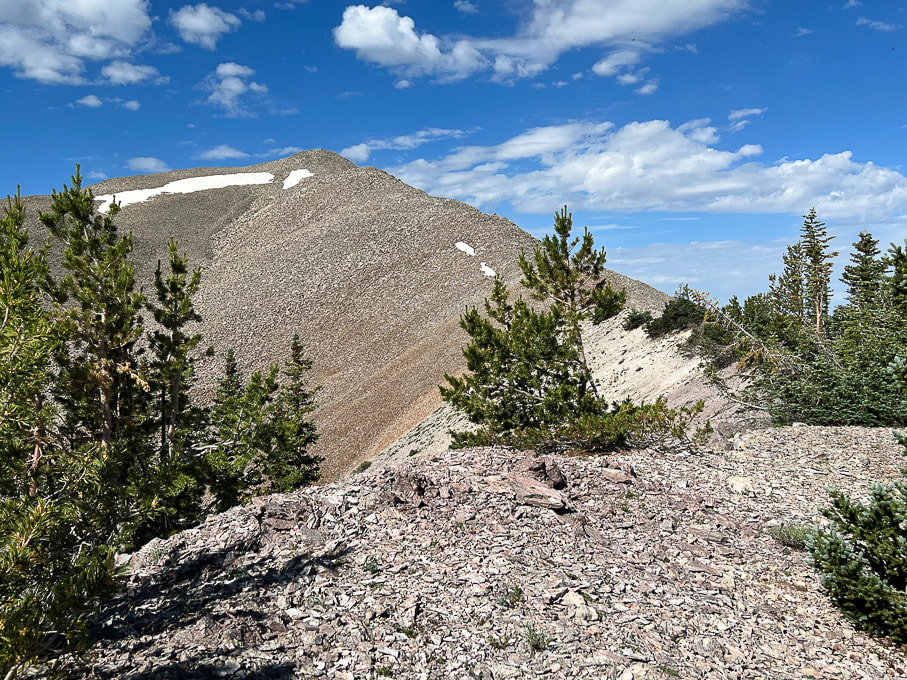
Pretty straightforward!!
Picture
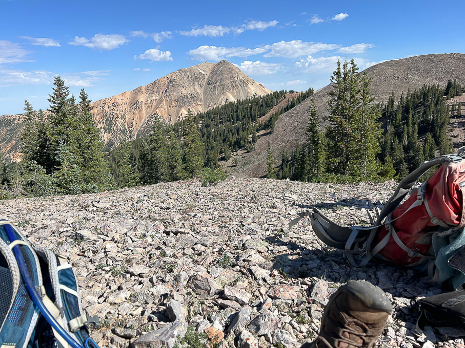
Mid-way up ridge looking at Mount Baldy, Tushar's third highest peak at 12,122'.
Picture
Picture
Picture
At Shelly Baldy summit.  Piece of cake!
Picture
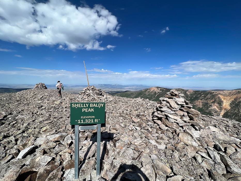
Looking west toward Mineral Mountains north of Beaver, Utah.
Picture
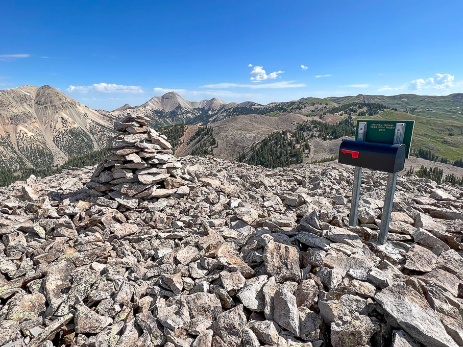
On summit:  Mount Baldy (left) and Mount Belknap (right).  You can see why "Tushar" may have come from "T-shar," the Southern Paiutes' word for "white."
Picture
Picture
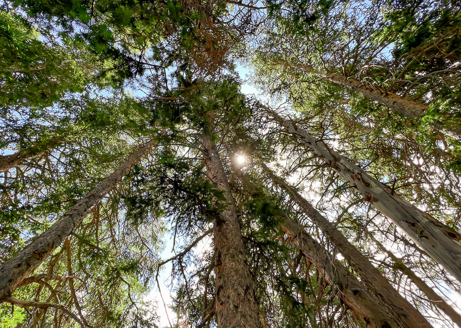
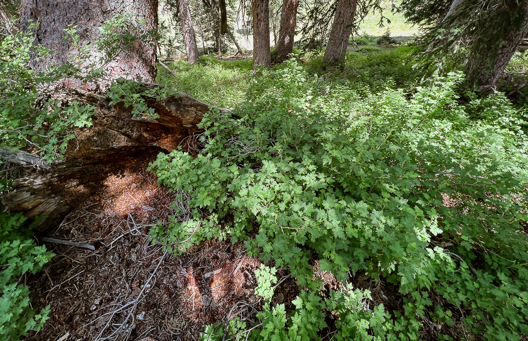
Never tire of this beautiful forest.
Reference
Cunningham, C.G, et. al.  1983.  Geologic map of the Tushar Mountains and adjoining areas, Marysvale volcanic field, Utah.
2 Comments
Linda Paul link
10/3/2023 05:06:57 pm

Another fabulous peak bagged and beautifully documented. Your images are stunning. Thanks for taking us along.

Reply
Sue link
10/3/2023 05:18:11 pm

Thanks Linda!
As you can tell, I am becoming very fond of the Tushars and Utah. Headed to Idaho to hike a mountain this weekend, and I'm sure it will bring back many great memories - ahhh, sentimental! I just saw your awesome Wyoming post on your Rangewriter - very nice!

Reply


Leave a Reply.

    Categories

    All
    Arizona Hikes
    California-desert-hiking
    California-desert-hiking
    Idaho Summits
    Nevada Hikes
    Petroglyphspictographs
    Snowshoe Hikes
    Southern Utah Hikesbikes

    To Subscribe to Explorumentary adventure blog and receive new posts by email:

    submit
    Picture
    Sue and Fred
    Picture

    About this blog

    Exploration documentaries          –  "explorumentaries"  list trip stats and highlights of each hike or bike ride, often with some interesting history or geology.  Years ago, I wrote these for friends and family to let them know what my husband, Fred and I were up to on weekends, and also to showcase the incredible land of the west.  
    Picture
    Happy Spring!
    Picture

    About the Author
    Sue Birnbaum

    A  trip to Jumbo Rocks Campground in Joshua Tree National Monument 40 years ago sparked my passion for hiking, exploring, and learning about desert ecosystems.  I met my husband Fred on Mt. San Jacinto.  We've explored the American West together; we love this land and I hope to inspire you to get out and explore through my photographs and trip descriptions.
    In 1992, Ray Wilson and I conceived the first Cactus to Clouds hike which climbs over 10,000 feet in one day to the summit of Mt. San Jacinto near Palm Springs, California.
    CACTUS TO CLOUDS HIKE 
    READ MORE
    ABOUT SUE
    Some of my favorite websites:
    ​

    ​Awkward Botany
    ​amateur botany for the phytocurious

    Bird and Hike

    ​"Intended to encourage people to visit, learn about, and fall in love with the desert."
    ​

    Draw and Shoot
    Beautiful Photography

    Daring Dayhikes
    "Interesting places you can visit with a daypack."  Terrific Tucson and other desert hikes and East Coast, too.


    Earthline: The American West
    Debra "writes to extol our beloved Earth." Detailed hike info, excellently written.
    ​

    Geologypics.com
    Geology and Geologic Time through Photographs

    Glenn Suokko
    Vermont artist's paintings "inspired by a place based on the land .... drawn to painting the representation and abstraction of nature."

    In the Company of Plants and Rocks
    ​A natural history blog about botany, plant ecology, and geology.


    MishMoments:  Joy of Photography
    this website is "
    about capturing that special moment in life’s journey and making the most of the time we have."

    Nature's Depths
    Walking through nature with John Palka, a neuroscientist who loves plants and ponders big questions.


    Rangewriter - What Comes Next?
    ​Linda's excellent writing brings to life her interesting adventures, "curiosities and thoughts", post-retirement.

    SeekingLost - Hiking and Backpacking Adventures.

    Stav Is Lost- Unconventional, out-of-the way hikes in the American West.


    Uprooted Magnolia
    ​Leah Yetter's beautiful "photo journal on life, love, and the spirit of Wyoming."

    Archives

    April 2025
    March 2025
    January 2025
    December 2024
    November 2024
    October 2024
    September 2024
    August 2024
    July 2024
    June 2024
    May 2024
    April 2024
    March 2024
    January 2024
    December 2023
    November 2023
    October 2023
    September 2023
    August 2023
    July 2023
    June 2023
    May 2023
    April 2023
    February 2023
    January 2023
    December 2022
    November 2022
    October 2022
    September 2022
    August 2022
    July 2022
    June 2022
    May 2022
    April 2022
    February 2022
    January 2022
    December 2021
    November 2021
    October 2021
    August 2021
    July 2021
    May 2021
    March 2021
    February 2021
    January 2021
    November 2020
    October 2020
    August 2020
    July 2020
    June 2020
    April 2020
    March 2020
    February 2020
    January 2020
    November 2019
    October 2019
    September 2019
    August 2019
    July 2019
    June 2019
    May 2019
    April 2019
    February 2019
    December 2018
    November 2018
    October 2018
    September 2018
    July 2018
    June 2018
    May 2018
    April 2018
    March 2018
    February 2018
    January 2018
    December 2017
    November 2017
    October 2017
    September 2017
    August 2017
    July 2017
    June 2017
    April 2017
    February 2017
    November 2013
    August 2013
    July 2013

HOME

Cactus to Clouds Hike
More Quotes
​
Mary Oliver Poems
Ann Zwinger Quotes
HIKES BY STATE

Idaho Hikes
Utah Hikes/Bikes
​Arizona Hikes
​California Desert Hikes
​Wyoming Hikes
​Nevada Hikes

BLOGS

Adventure Blog
Women and the Land
GEAR REVIEWS
FIT AFTER 50
Fred Birnbaum
Dave Brasuell
Bus' Little Black Book
​Mike Carlson
​Ray Wilson
​Marcia Bondy
Bryan Krouse
​Maria Keezer
​Tim Clemens
​Doug Traubel
​Brian Holgate
​
Becky Borczon Blake
​Jennifer Cera and
​Sue Birnbaum

​Vance Powell
​Boise Cross Fit Masters Ladies
​Vickie Kearney

GALLERY

Desert Plants
Nature
Earth + Sky
Urban
Water
Patriot 
​Orchids
Boise
​
  ABOUT
    Contact

​
© 2017 - 2025 by Sue Birnbaum.  Photos on this website are the sole property of Sue Birnbaum unless otherwise indicated.  Please receive permission before publishing my trip reports and photos.
I try my best to be accurate with my hike descriptions; please research your adventures, always bring a map and compass and know how to read them, be prepared!  All of these hikes can be dangerous; hike at your own risk.  ALWAYS carry the Ten Essentials with you on hikes. 
​Please feel free to contact me with comments or questions, or if you see any errors that need attention.
Thank-you for stopping by!


EXPLORUMENTARY.com
  • Home
    • Cactus to Clouds Hike
    • More Quotes
    • Ann Zwinger Quotes
    • Mary Oliver Poems
  • Hikes by State
    • Southern Utah
    • Idaho
    • Arizona
    • California Desert
    • Nevada
    • Wyoming and New Hampshire
  • Petroglyphs and Pictographs
  • BLOG
    • Adventure Blog
  • GALLERY
    • DESERT PLANTS >
      • Beavertail cactus
      • Brittlebush
      • Christmas Cactus
      • Arizona Barrel Cactus
      • Parry's penstemon
      • Agave
      • Arizona Rainbow Hedgehog
      • Claret Cup Hedgehog
      • Desert Agave
      • Palmer's Penstemon
      • Silver Cholla
      • Cristate Saguaro
      • Indian Paintbrush
      • Ocotillo
      • Santa Rita Prickly Pear
      • Spiny Cliffbrake
      • California Barrel Cactus
      • Engelmann Prickly Pear
      • Velvet Mesquite
      • Joshua Tree
      • Buckhorn Cholla
      • Hedgehog Cactus
      • Fishhook cactus
      • Thompson's Woolly Locoweed
    • NATURE
    • BOISE
    • EARTH + SKY
    • URBAN
    • WATER
    • PATRIOT
    • ORCHIDS
  • Fit After 50
    • Brian Holgate
    • Fred Birnbaum
    • Dave Brasuell
    • Bus' Little Black Book
    • Mike Carlson
    • Ray Wilson
    • Bryan Krouse
    • Vickie Kearney
    • Maria Keezer
    • DOUG TRAUBEL
    • Boise Cross Fit Masters Ladies
    • Tim Clemens
    • Marcia Bondy
    • Becky Borczon Blake >
      • Becky B Downtown
    • Jennifer Cera and Sue Birnbaum
    • Dave Brasuell
    • Vance Powell
  • Contact