|
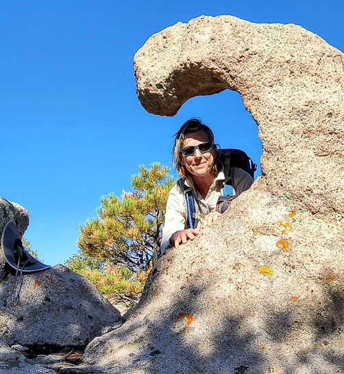
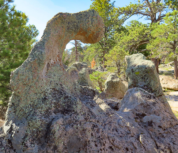
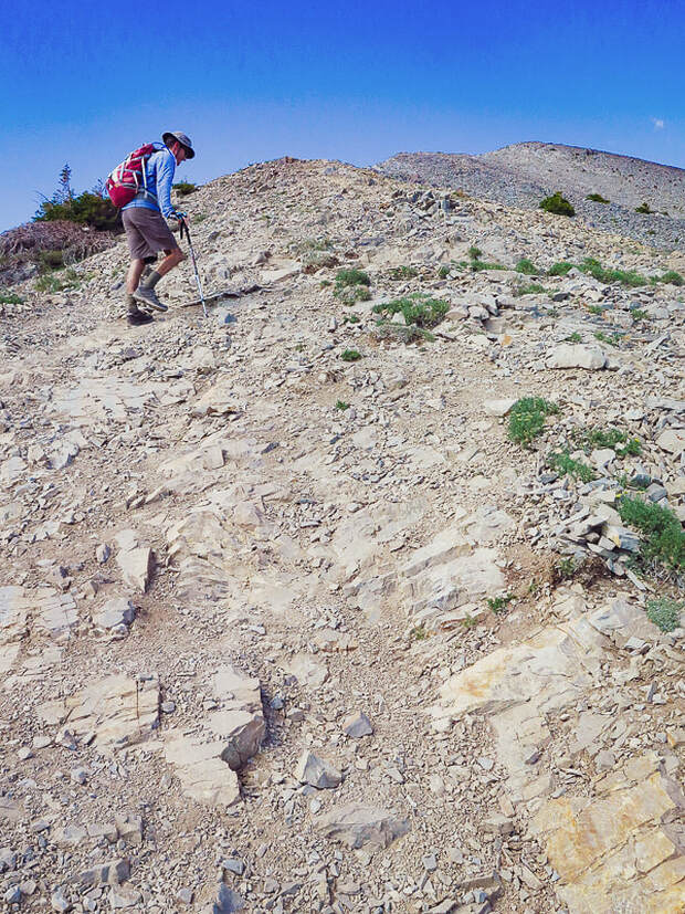
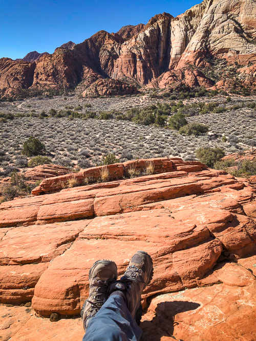
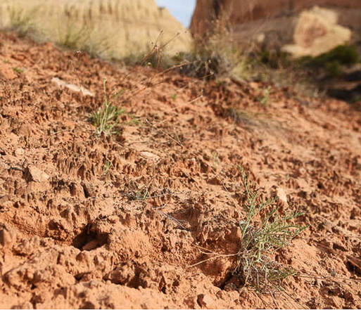
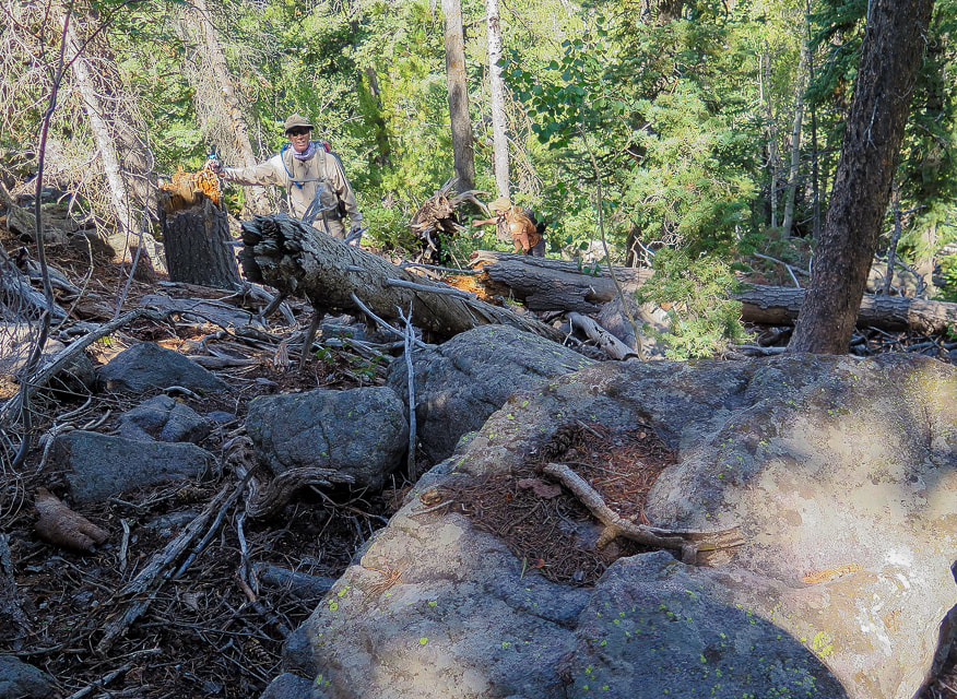
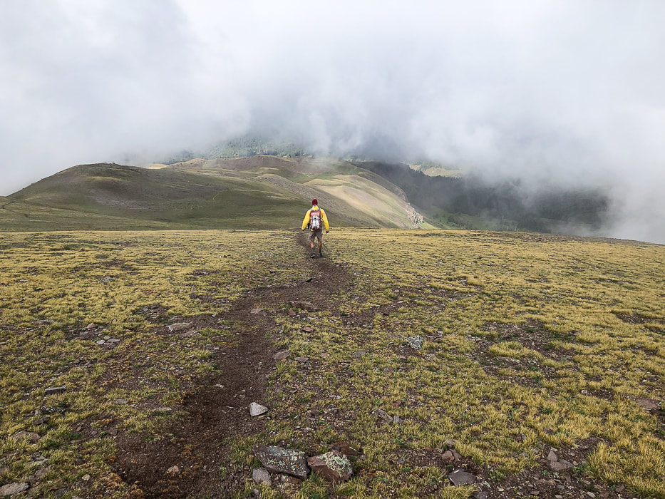
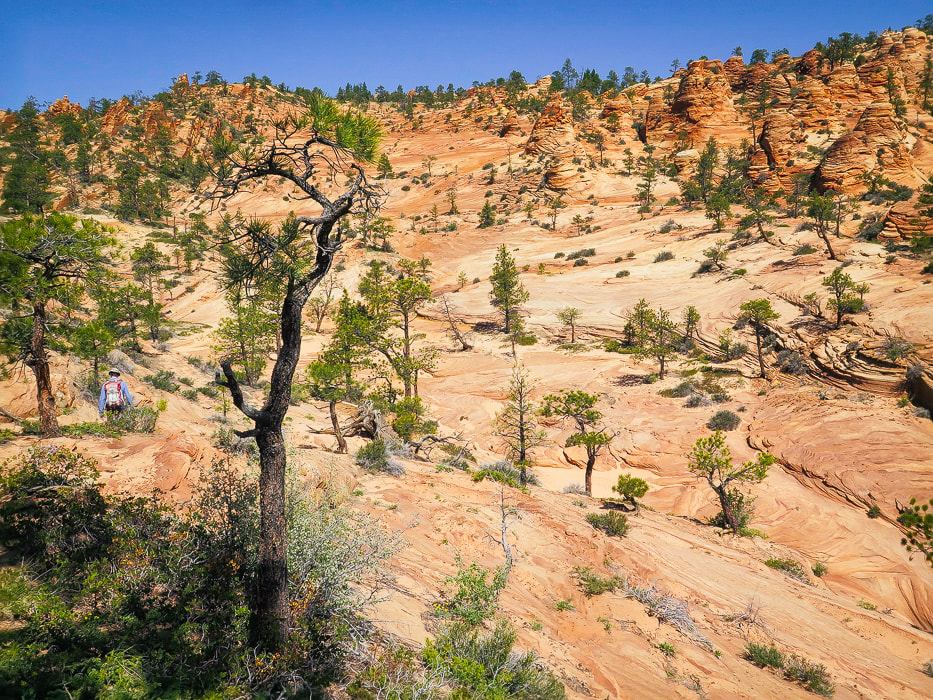
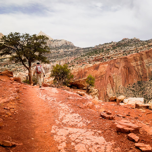
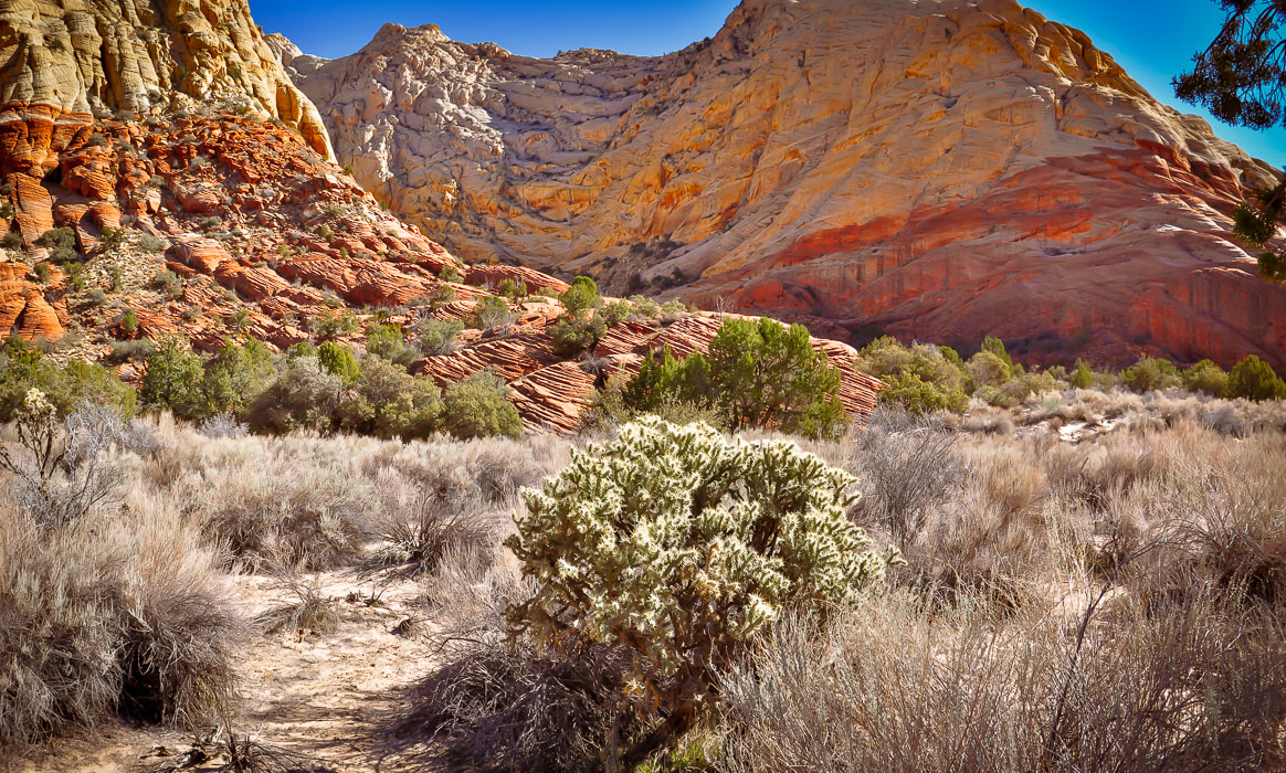
The steep, final ascent up Gardner's forested summit requires climbing over a lot of deadfall and rocks, but the approach treks through a variety of terrain including eroded rock formations on a lightly-used trail. Hiking with two fellow yogis made it double the fun.
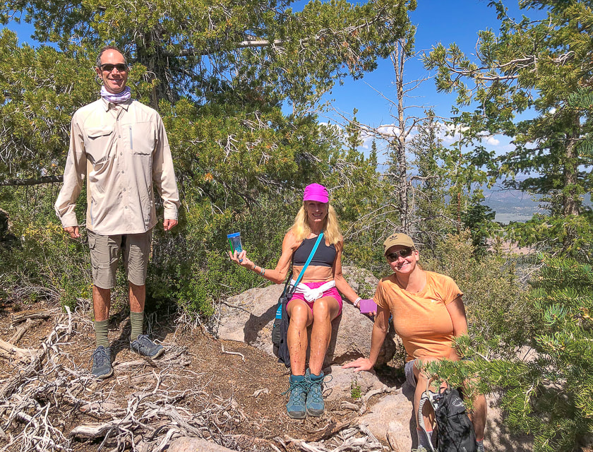
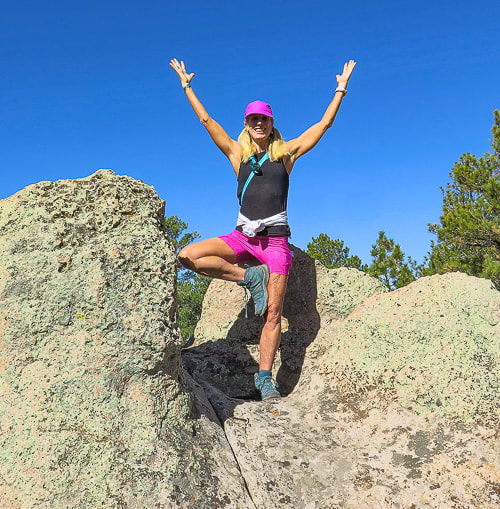
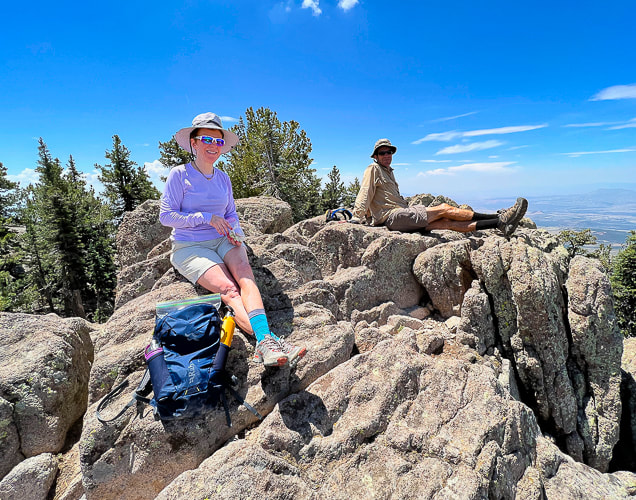
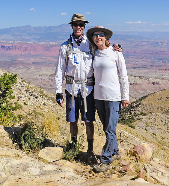
Fred, Lydia and Robin on Gardner Peak's summit.
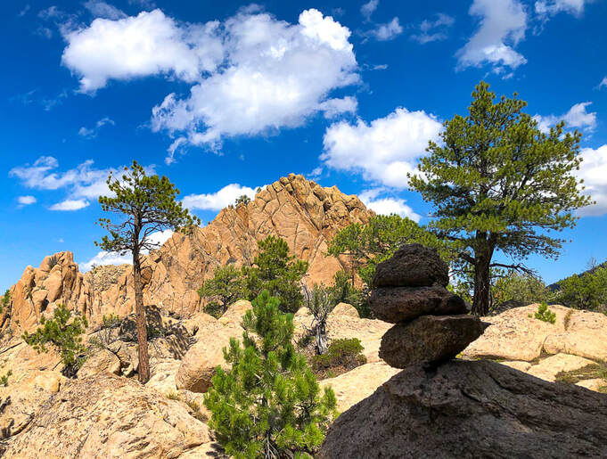
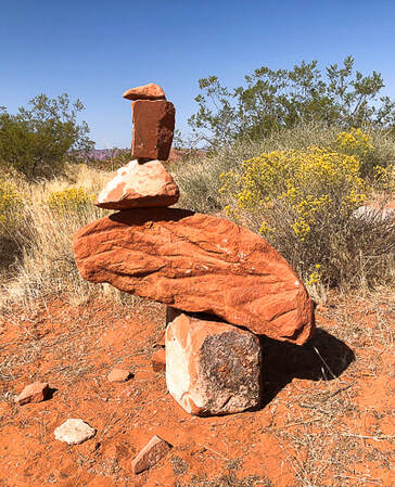
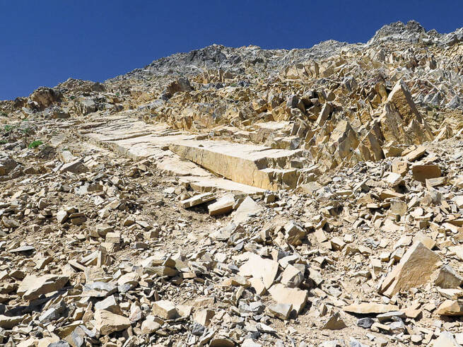
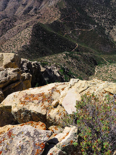
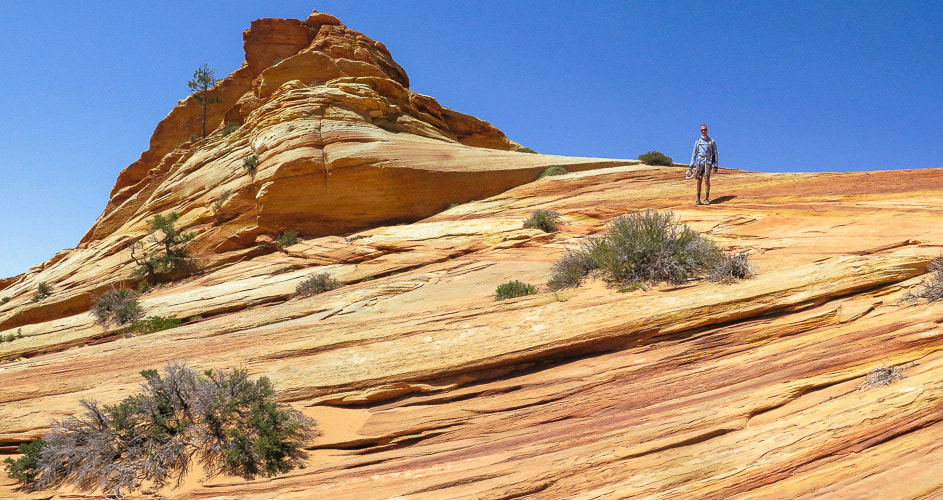
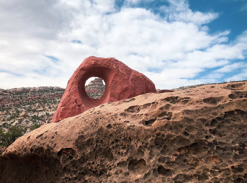
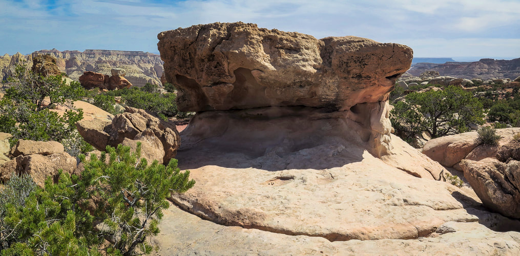
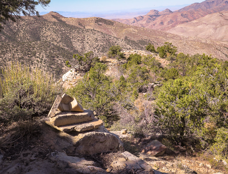
Pass by this pointed outcrop on the way up; this is a good landmark to navigate toward on descent from summit.
Trip Stats
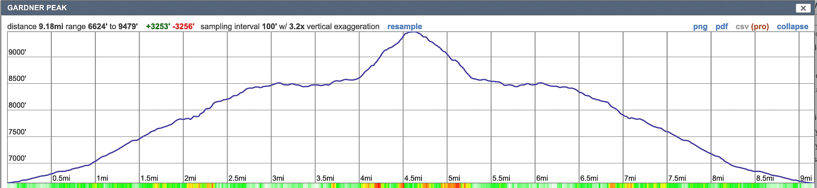
Location: Dixie National Forest, Pine Valley Ranger District. Trailhead in Pine Valley Recreation Area near town of Pine Valley, north of St. George, Utah. Distance and Elevation Gain: 9.2 miles round-trip; gain of 2,900' in 4.6 miles to summit. Trailhead elevation = 6,627'. Summit = 9,488'. Difficulty: Moderate Class 1 on cairned trail, Class 2 off-trail from base of mountain and Class 3 climbing near summit with minimal exposure. Coordinates: Summit = 37.39125, -113.45160. Trailhead = 37.38428, -113.48358. Permit: Day hikers parking at trailhead inside Pine Valley Recreation Area do not have to pay a fee at entrance station. Maps and Apps: Trails Illustrated Topo Map - St. George/Pine Valley Mountains #715, AllTrails app, Garmin GPS, USGS 7.5 minute topo - Grass Valley quad. Dates Hiked: 9/3/2021, 8/28/2022. Considerations: Experience in navigating through forest necessary (no official trail). I suggest long pants to avoid shin scraping when crawling over deadfall and through rock walls. Geology: Pine Valley Mountains are remnants of the Pine Valley Laccolith, one of the largest laccoliths in the U.S. (See "For the Geo-curious" below). Radiometric dates show the monzonite porphyry rock was formed 22 million years ago. History: Robert Gardner, Jr. was one of the original settlers of Pine Valley who helped establish a lumber mill. Driving Directions: Directions from St. George: Take Highway 18 north for about 24 miles, turn right at the Pine Valley junction (E. Pine Valley Road) and drive 8 miles until you reach a "T" in the road. Turn left and continue for about 1.5 miles. The trailhead is located on the left just after the Pine Valley Recreation Area entrance gate.
Overview
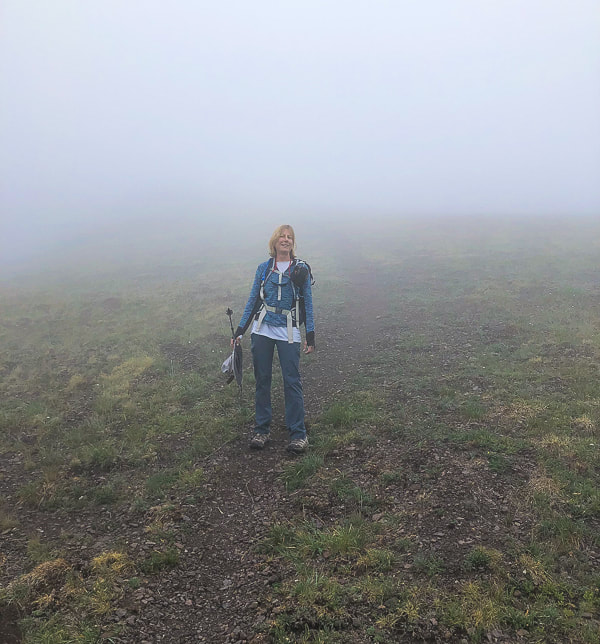
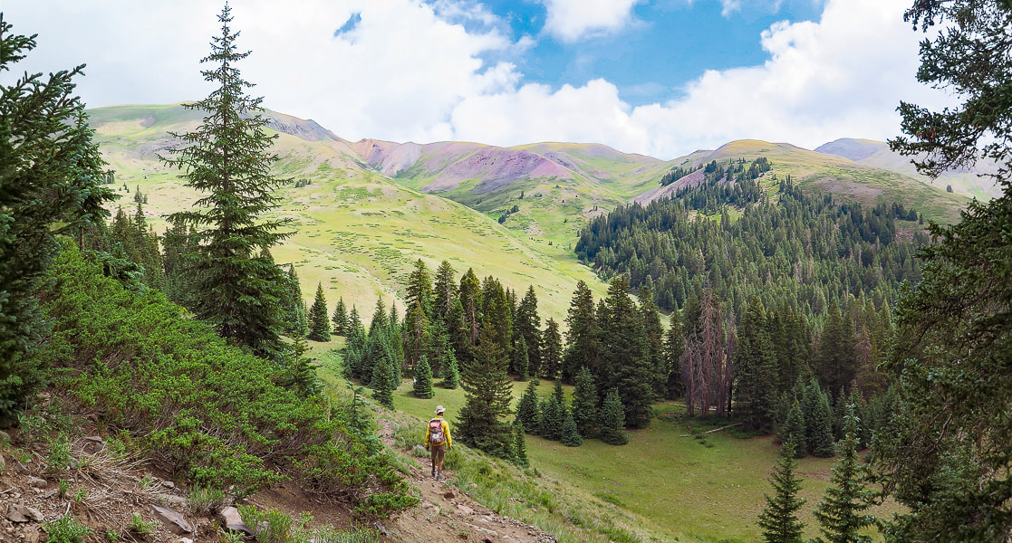
This time, on our second Gardner Peak hike, Fred and I got to share the trail with Lydia and Robin. Lydia, our lithe, exuberant and fit yoga teacher showed her love and refreshing awareness of nature and a beautiful tree pose atop a sculpted boulder. Robin, our fit fellow yogi, with a huge supply of bright optimism, has been training for her upcoming Grand Canyon rim to rim hike. Since we knew the way, Fred and I were able to get us up the steep and rocky deadfall-littered summit block. After a cairned trail to Gardner's base, there's few signs of a trail, except for a few "ducks" here and there. We followed my previous Gardner Peak GPS tracks, had a summit celebration, and found our entry from last year in the summit register. We discovered another register a few steps down on a slightly lower summit. Check out Lydia's excellent and fun adventure website - On the Loose Live for an account of this hike plus lots more interesting explorations and beautiful photography.
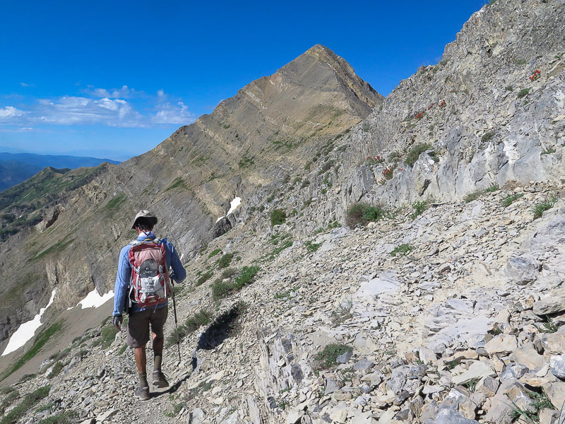
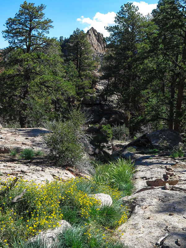
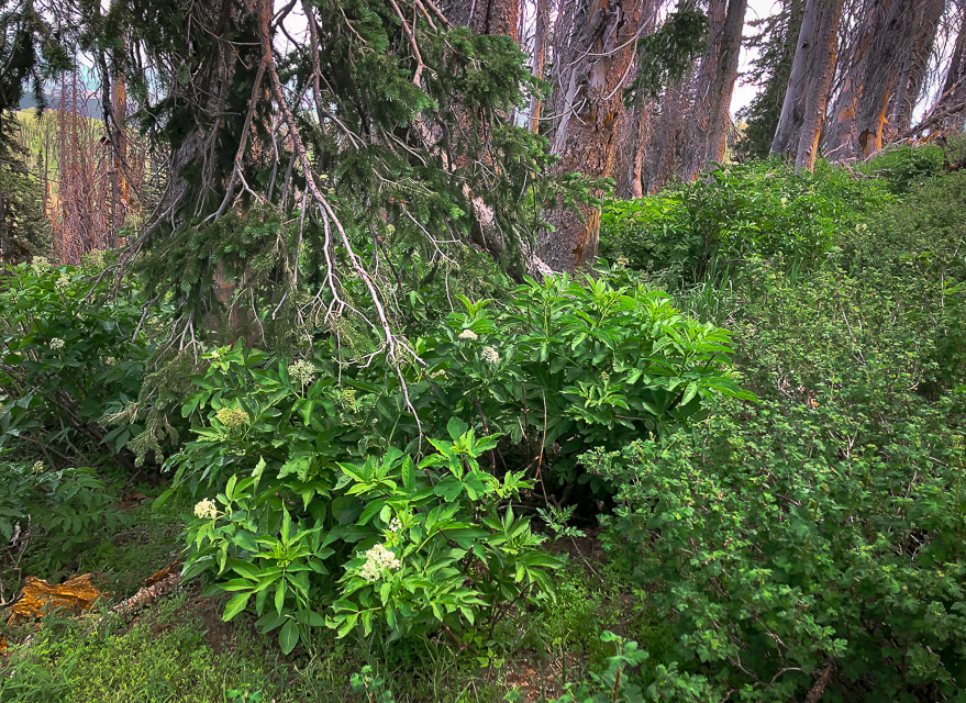
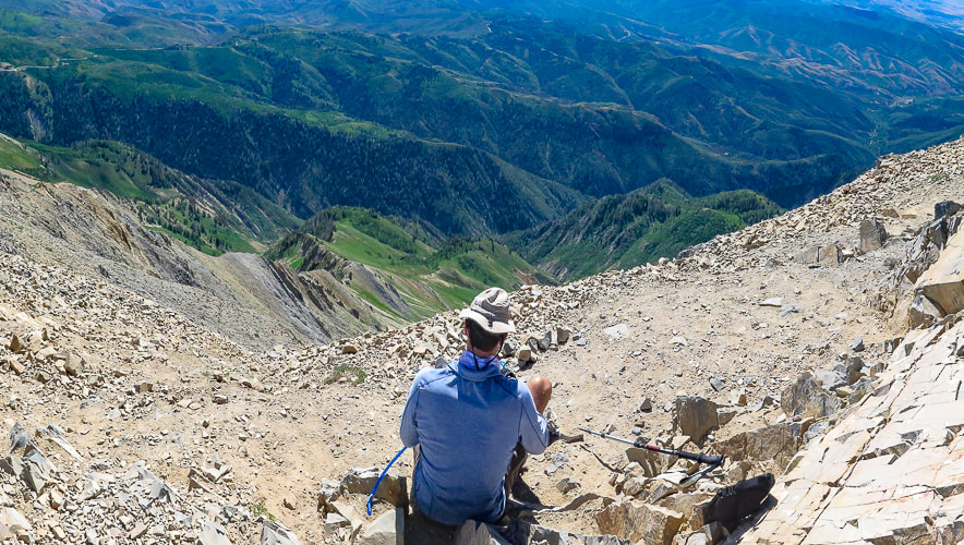
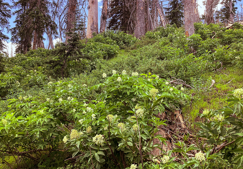
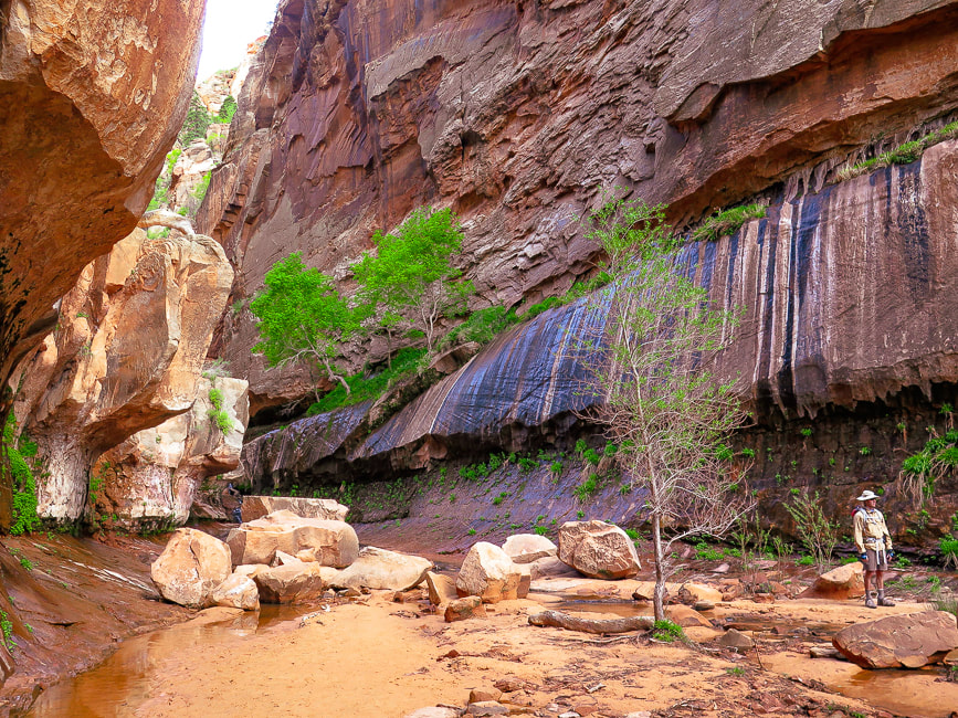
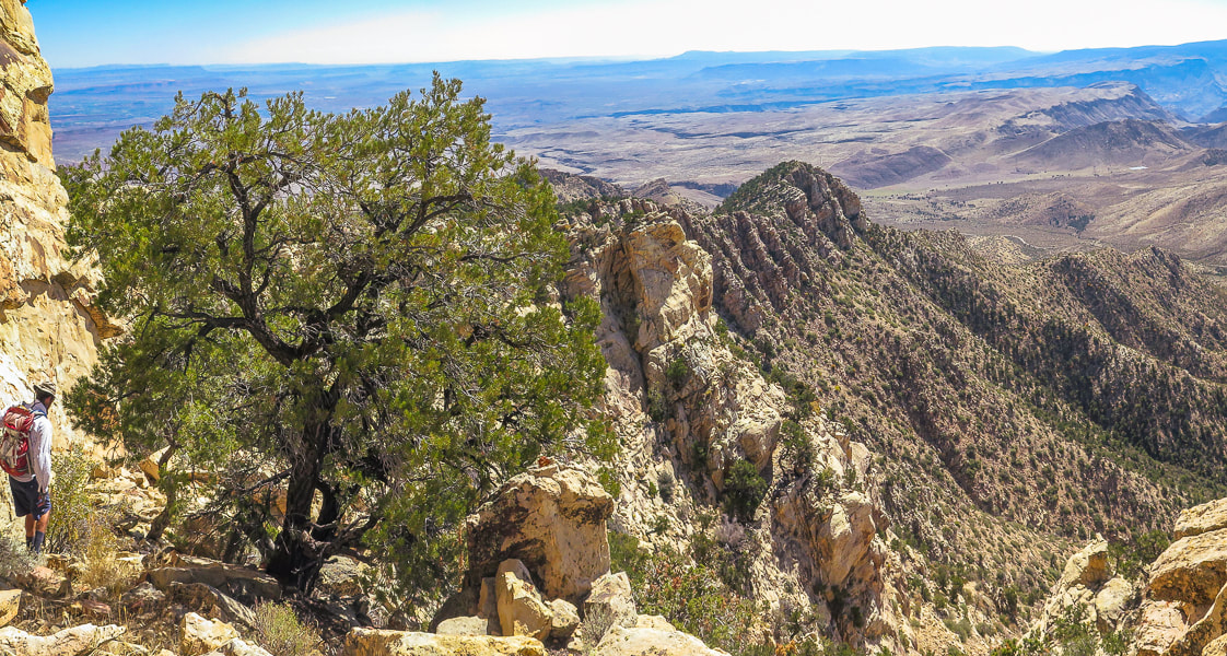
Gardner Peak sits right on the Pine Valley Mountain Wilderness boundary and although its trail may not be officially in the wilderness, it feels like it is because the trail is narrow and lightly used, less so than the higher and busier Burger Peak hike. The trail treks through a small area burned from the 2020 Gardner fire. You will reach two false peaks before you get to the summit - a narrow rock perch with a view only to the east.
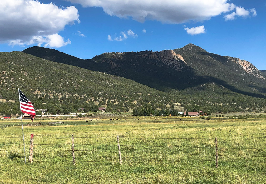
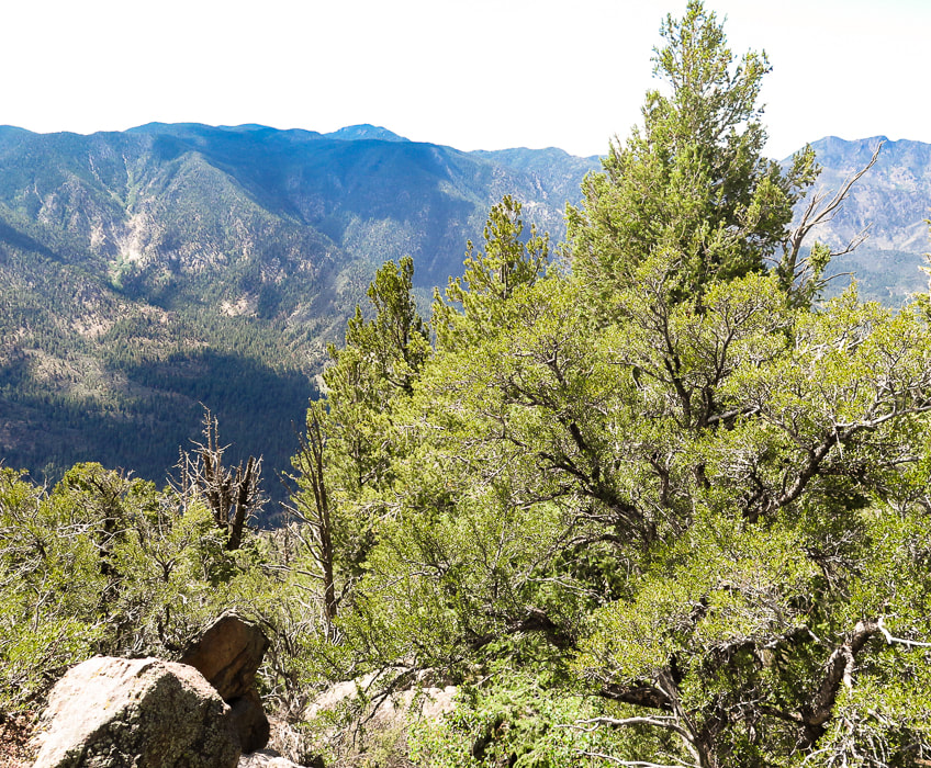
Gardner Peak overlooking Pine Valley, Utah
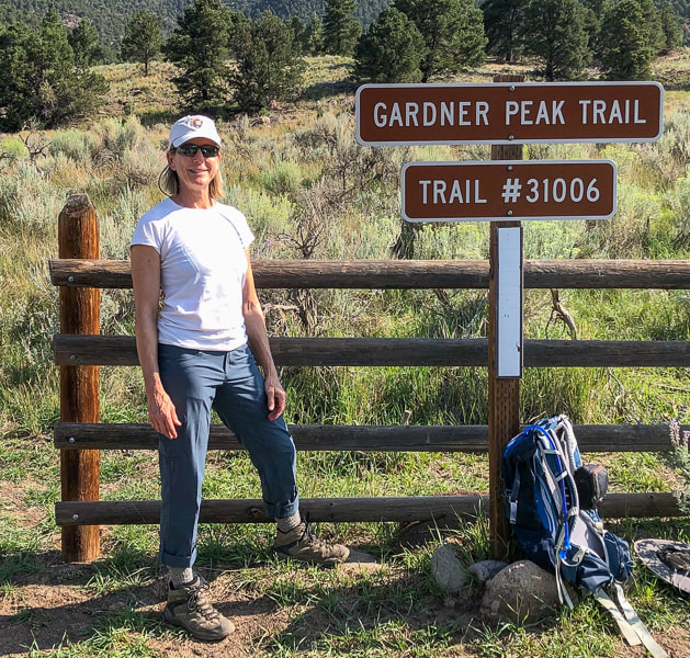
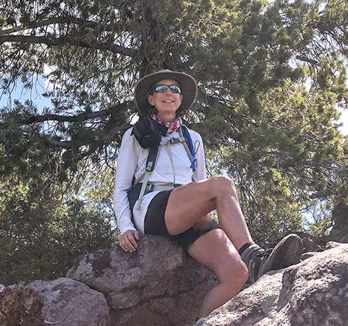
Sue at trailhead in new Kuhl hiking pants.
Gardner Peak Trail to base of Gardner Peak
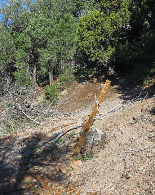
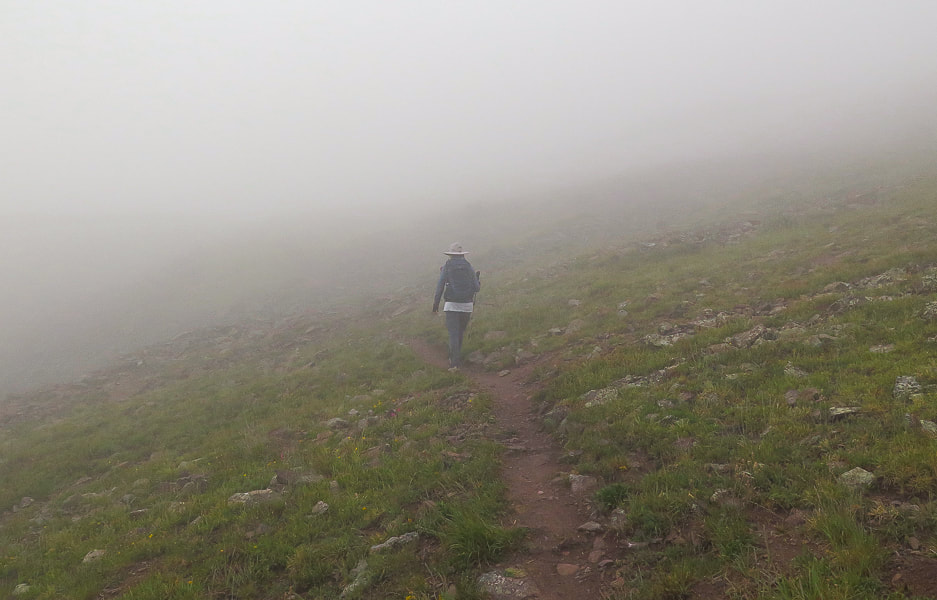
Driving past the Pine Valley Recreation Area entrance station, Gardner Peak trailhead is a short distance on the left. You may share the sagebrush-lined trail with cows for the first 1/2 mile. The trail quickly ascends into the forest, then at 0.9 miles intersects with the Canal Trail which traverses the base of the mountain. By walking a few yards to the left on the Canal Trail, painted rocks and an old signless post propped by a cut tree trunk mark the Gardner Peak trailhead. Continue north on a steep and rocky trail.
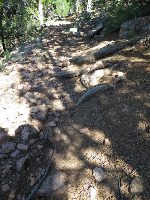
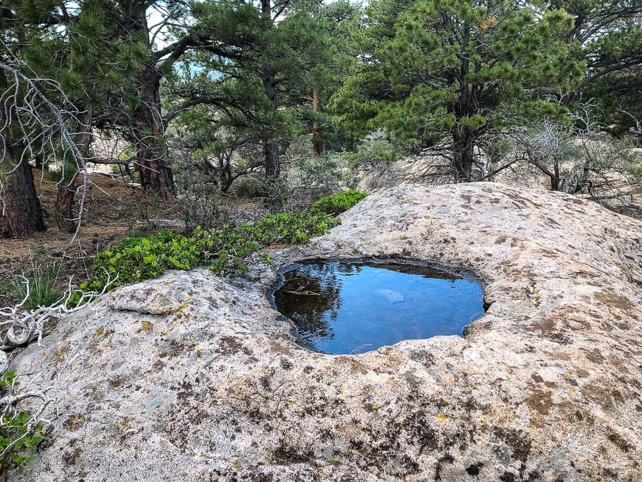
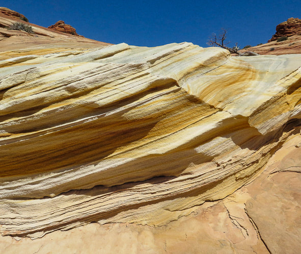
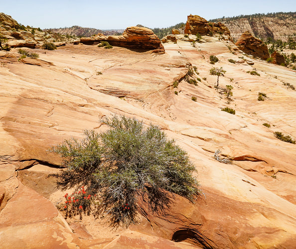
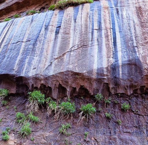
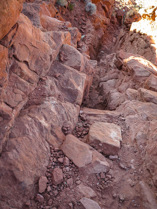
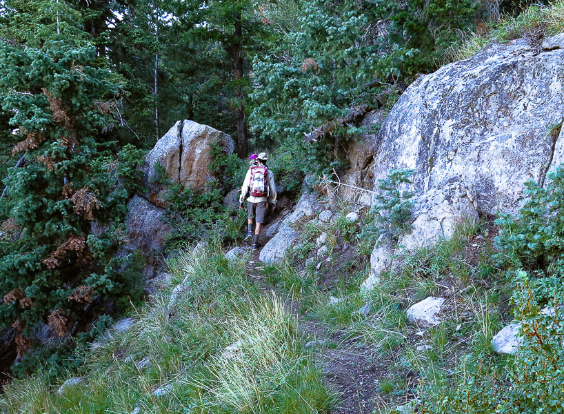
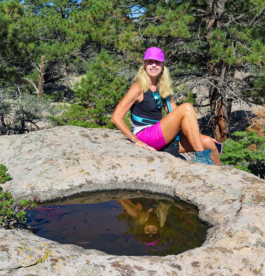
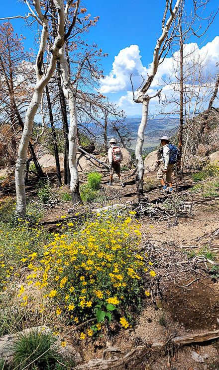
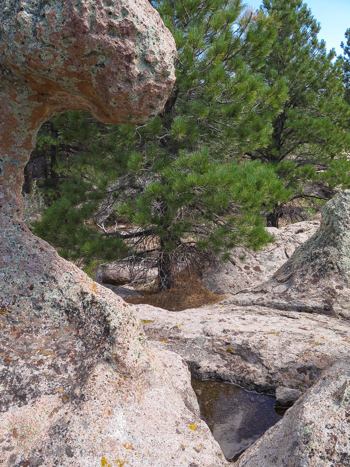
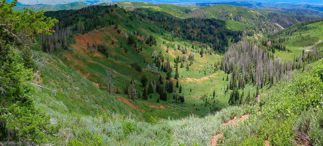
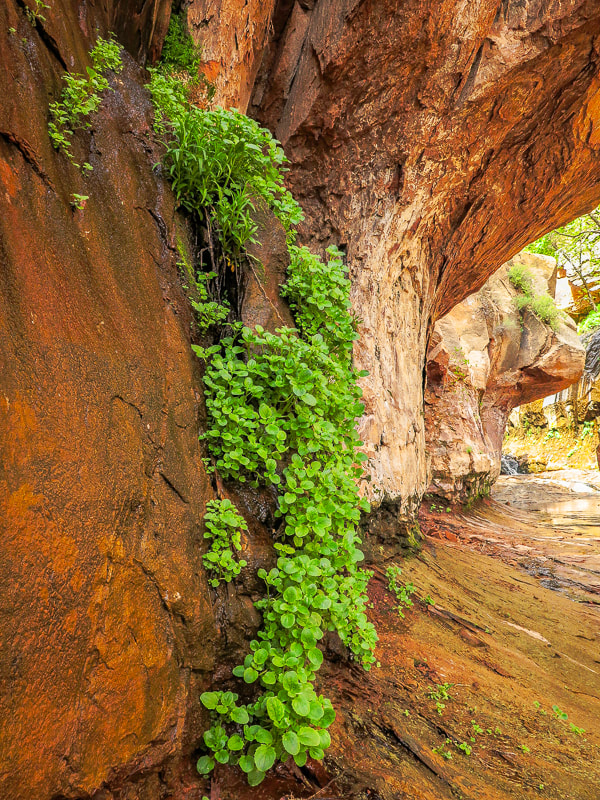
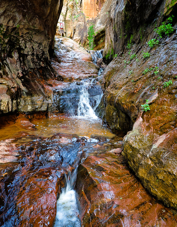
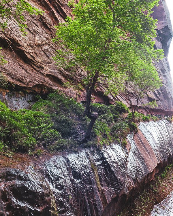
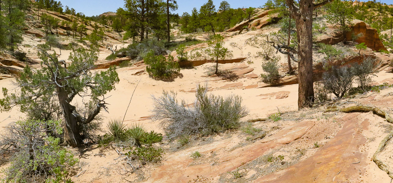
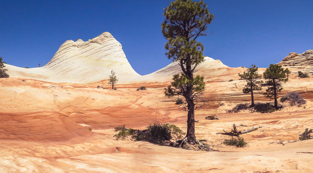
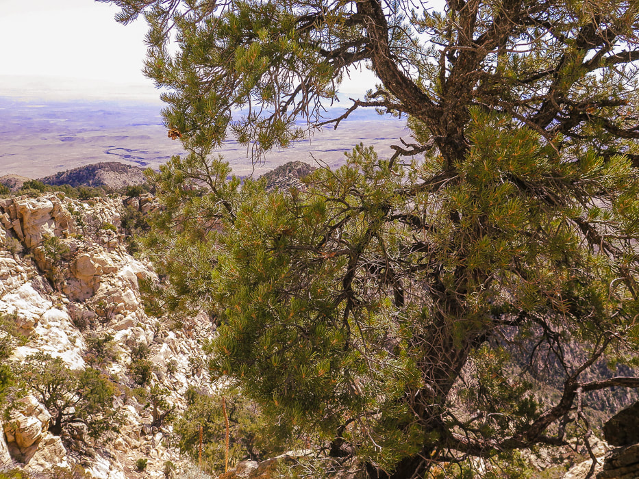
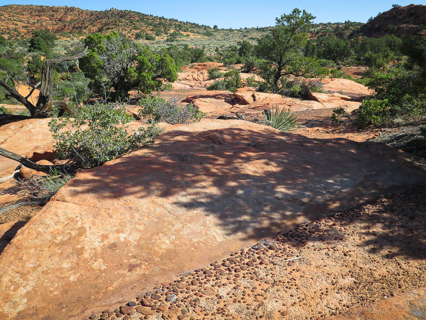
The forest becomes thicker; the trail is faint in some areas. It turns east and at two miles crosses over a saddle with a great view of Grass Valley below. The forest shade becomes more abundant, with a beautiful combination of ponderosa pines and aspen. The trail stays narrow, weaving around large boulders, and over bare rock with rain water pools etched into its surface. An adequate amount of cairns marks the trail, except when it crosses the burned area from the 2020 Gardner fire, where we used the AllTrails app to find our course. Go straight ahead when you reach this section; we went too high onto the bare rock to the right. The trail then descends steeply to cross a dry run-off stream section and continues to Jodes Flat, the small meadow at the base of Gardner Peak.
Base of Gardner Peak to the summit
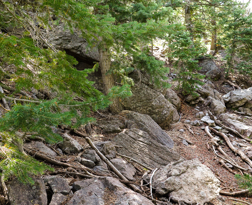
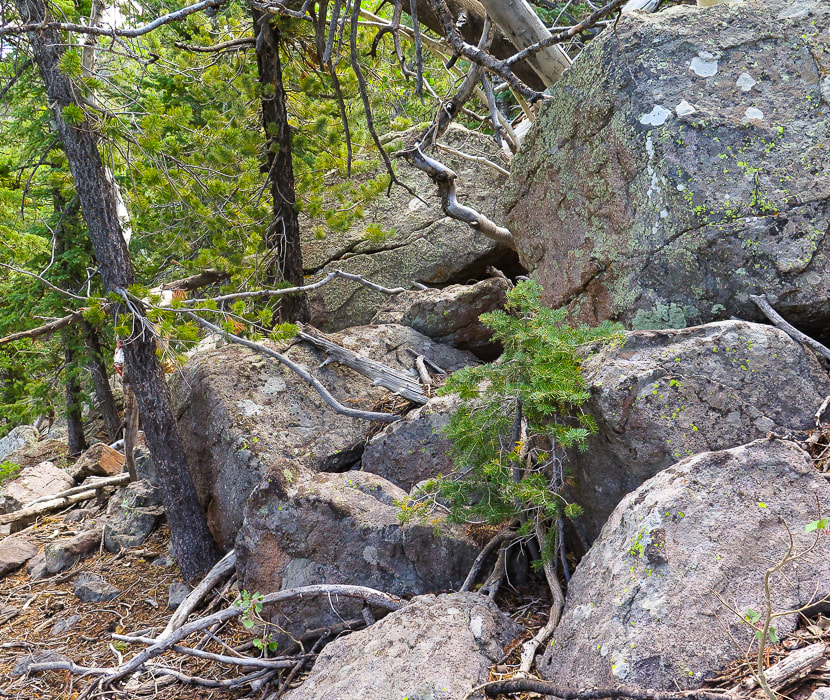
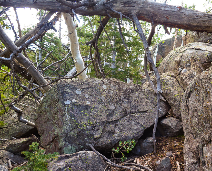
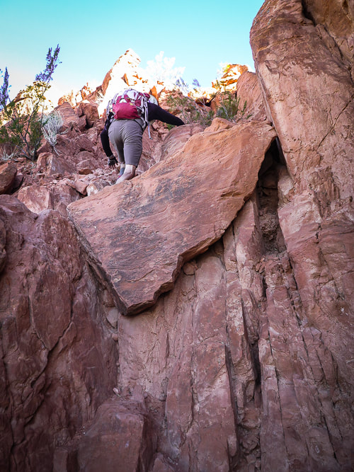
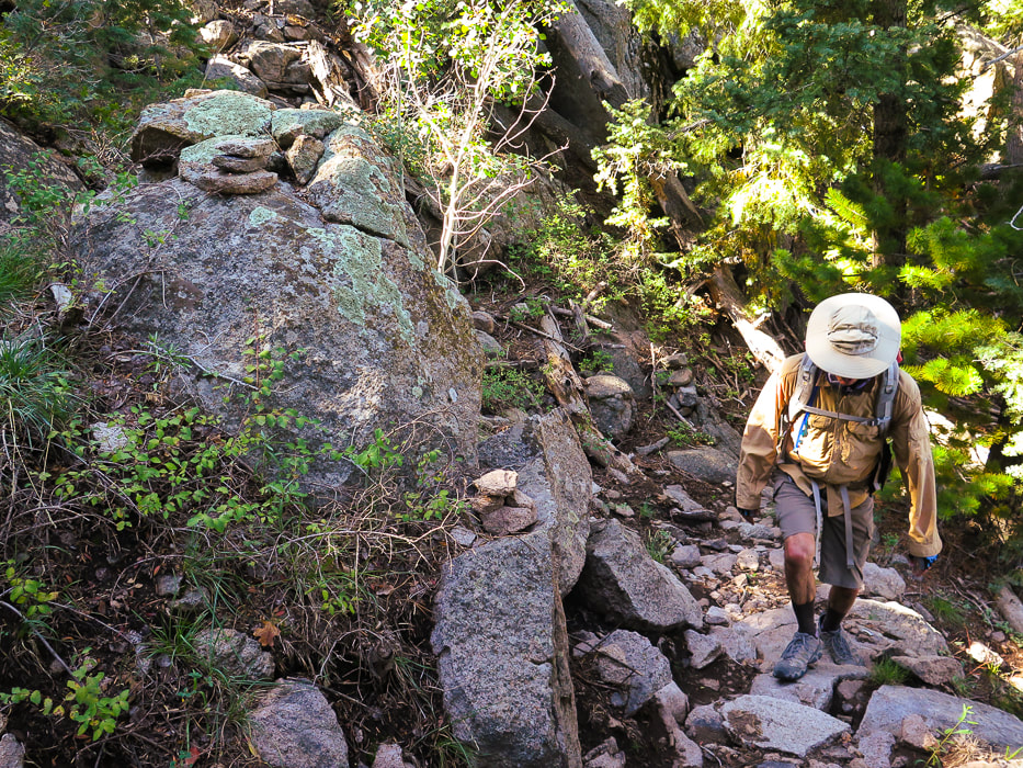
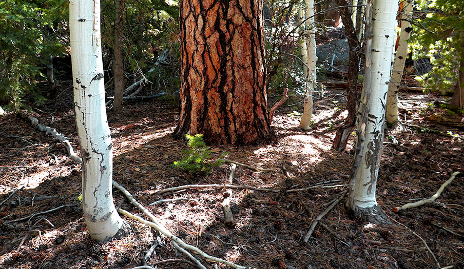
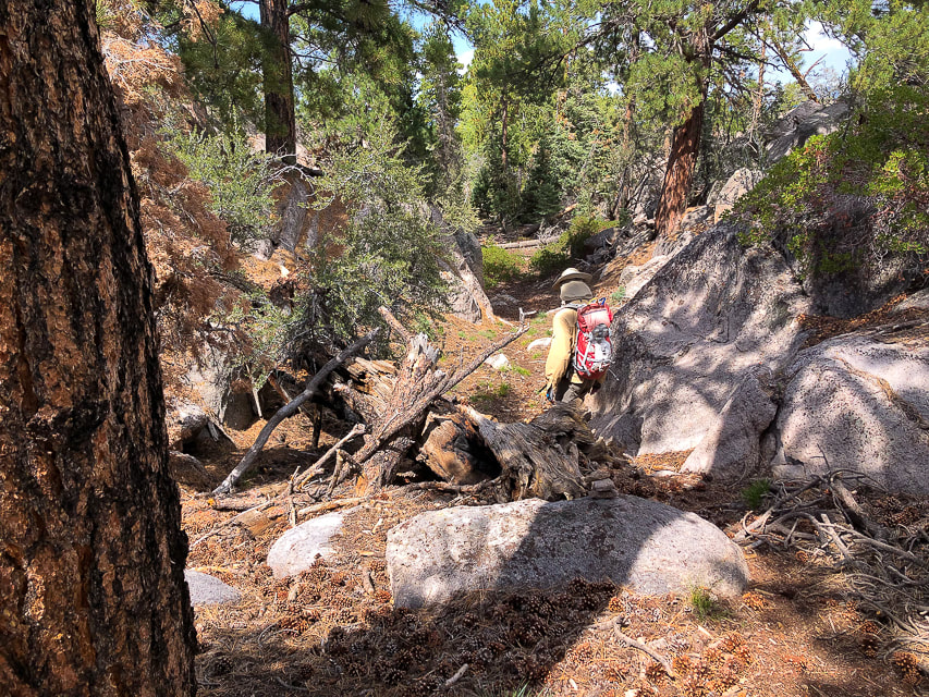
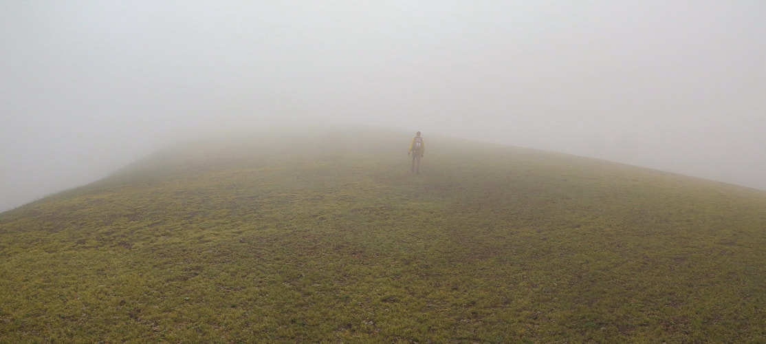
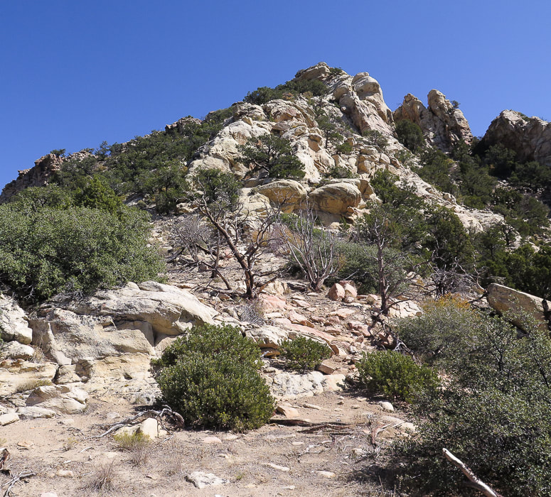
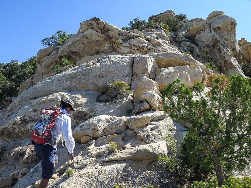
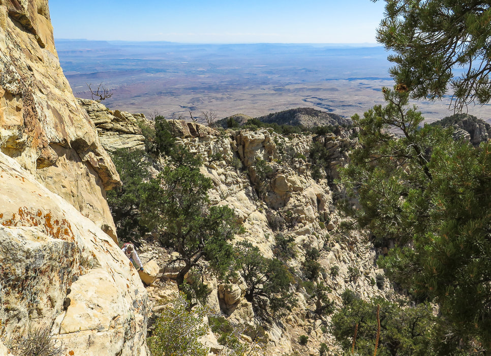
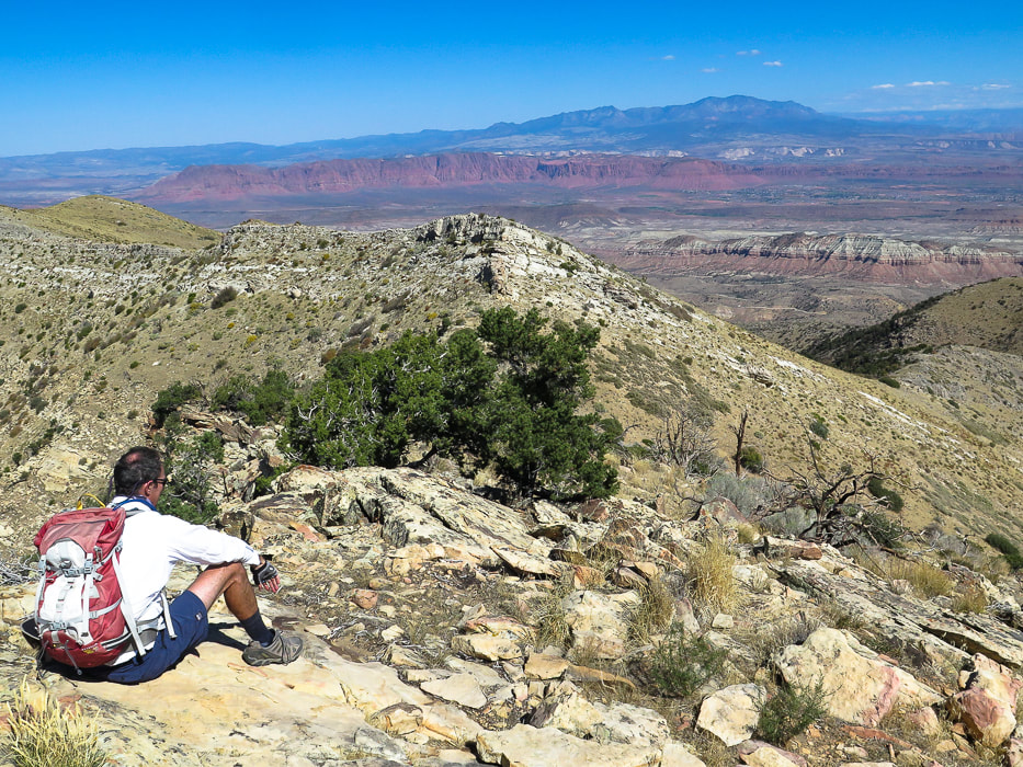
At 3.8 miles from the trailhead, after the short fire area, reach the small meadow, Jodes Flat, to see the thick forest on the west side of Gardner Peak. This is where the trail ends. We walked straight up this flank for a 900' gain, aiming toward the peak coordinates. There is a lot of deadfall to crawl over and Class 3 climbing through huge rock outcrops toward the top, as well as 2 false summits. The summit is small - basically a few huge boulders with a register with a few entries hidden under rocks. The summit is mostly forested, but a view to the east looks over a deep canyon. A forested summit is not as spectacular as a bare, above-treeline perch overlooking huge expanses of terrain, like Leatherman Peak, which we summited last July. But they are still great and each has its own characteristics that stand out in my memory of them. The reward of finding an unseen summit as you keep on seeing more sky as you climb is extraordinary. Keeping the bare rock outcrop we had passed on the way up in view, and using my GPS trackback, we found our way back to Jodes Flat. It's easy to get disoriented; you basically want to head northwest. Hiking with Robin and Lydia was a joyful excursion, reminding me that moving in nature is important for optimal health. And if you can do yoga balance poses on a steep boulder, all the better!
"Between every two pines is a doorway to a new world."
- John Muir Keep On Exploring! Stay close to Nature! 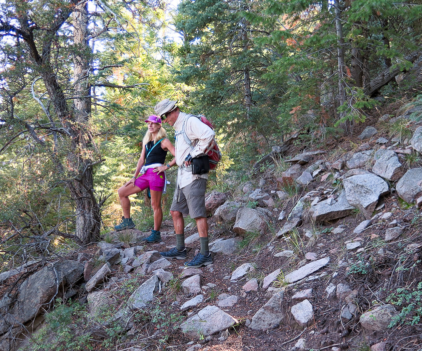
Lydia and Fred on the way up.
Walking into forest after valley view to the north.
Ducks mark the trail.
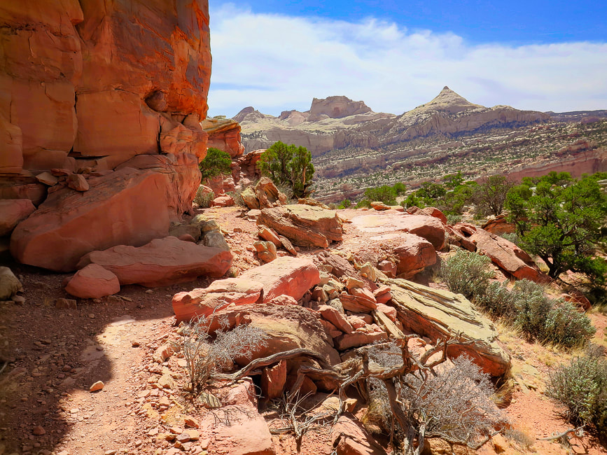
View ahead of crags - we used these as a landmark to descend peak; rock cairns (right) mark the trail.
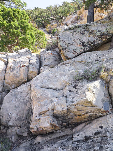
Lydia at sculpted rocks section of trail.
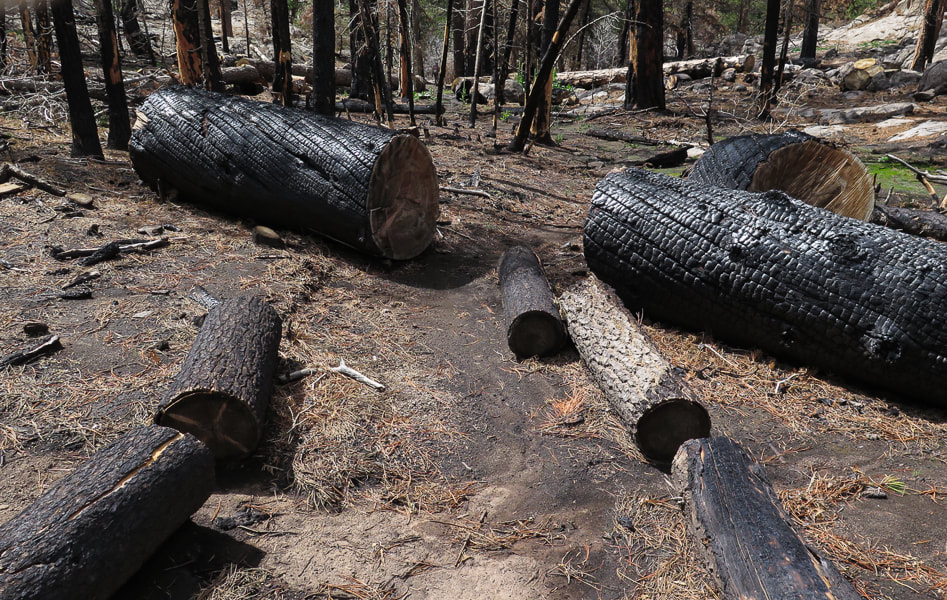
Short section burned from the 2020 Gardner fire.
Some cool stuff on the trail.
Fred and Sue hiking through burned section - thanks for the photo, Lydia!
Fred winding through Ponderosa pines on section before you reach sculpted rocks.
One of the many meadows in Pine Valley Mountains
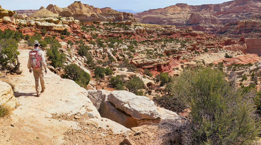
A look at the peak ahead.
Fred and Robin maneuvering through deadfall and boulders near the summit.
Yep, there's lots of rocks and trees to navigate when climbing the off-trail portion to the summit!
(900' elevation gain).
Scenes from the top of Gardner Peak

View from Gardner Peak of Pine Valley Mountain Wilderness to the south
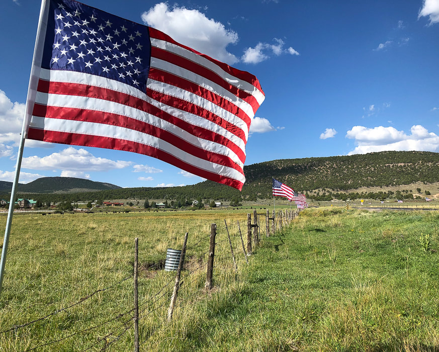
Pine Valley celebrating Labor Day
For the Geo-curious - Pine Valley Laccolith
A laccolith is a large amount of magma that is injected between layers of rock, causing a dome-shaped mass. In this case, the Pine Valley Laccolith was a final surge of magma that occurred after the initial volcanic vents were shut off, causing the magma to be squeezed and move sideways between the layers of the Claron formation below it and the overlying magma layer. This injection, 22 million years ago, amounted to a 3,000-foot layer of monzonite porphyry, composed mainly of plagioclase and alkali feldspar. This is similar to granite, and when you look at a fresh surface of the rock, you can see the crystals, indicating the rock cooled slowly enough to form large crystals - allowing us to easily see them. The laccolith was uncovered when the volcanic layer above it eroded. The Claron Formation is made of limestone and mudstone; it is the rock that makes the spectacular hoodoos seen in Bryce Canyon National Park.
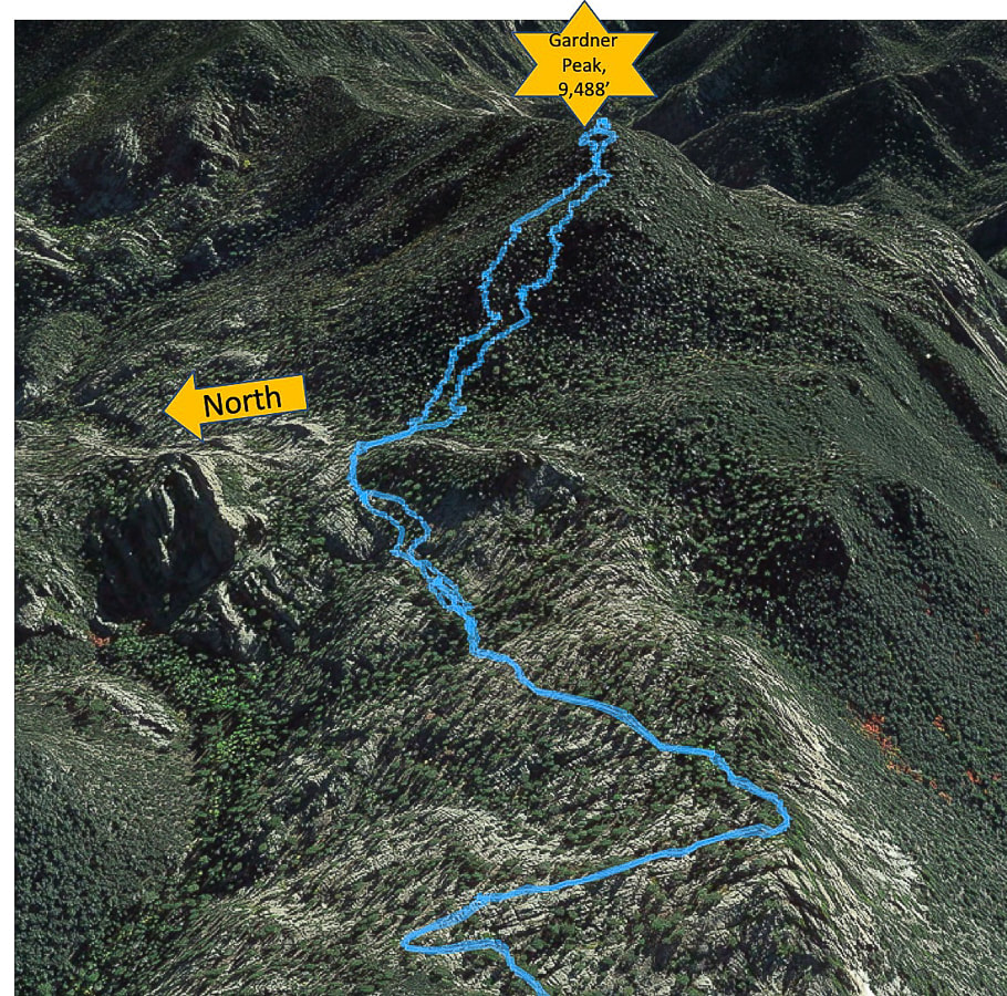
Interactive map of our GPS tracks to Gardner Peak
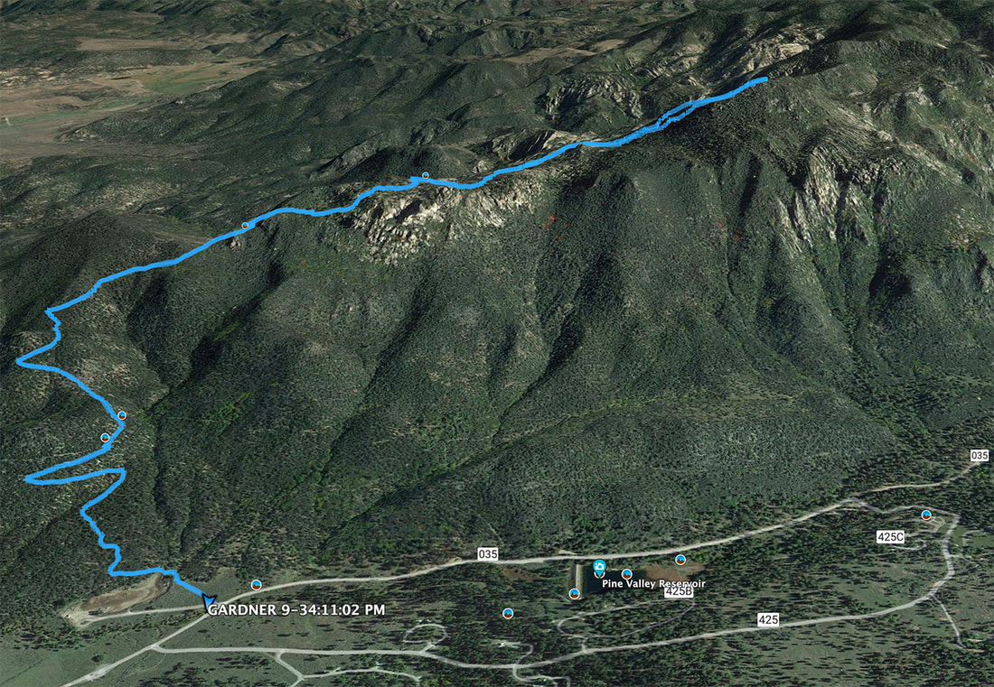
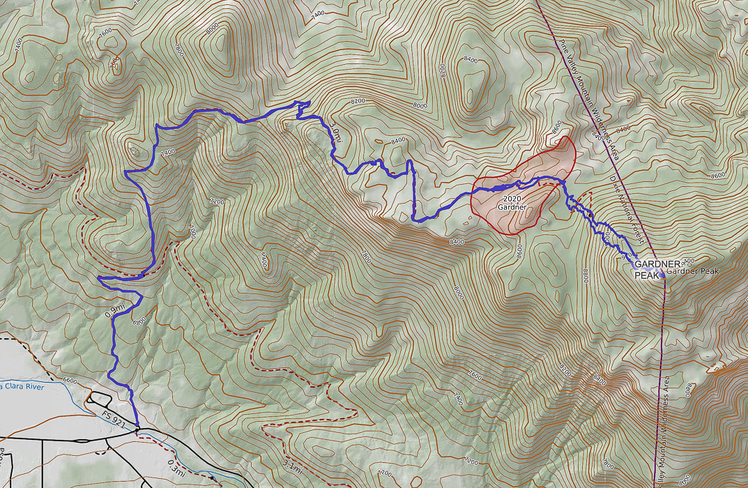
Our GPS track; note extent of 2020 Gardner fire on map. Gardner Peak is on the boundary of Pine Valley Mountain Wilderness Area.
The last section of hike through rock outcrops to the summit.
References:
Miller, R. Our Geological Wonderland: The Pine Valley Mountain Laccolith. The Independent - A Voice for Southern Utah. Feb. 2018. Pine Valley Day: The story of how 'the most beautiful sight' went from lumber supplier to summer retreat. By Reuben Wadsworth reporting in the St, George News. Pine Valley Chapel 1868. Informational flyer about the history of Pine Valley and its chapel, available at the Pine Valley Chapel.
3 Comments
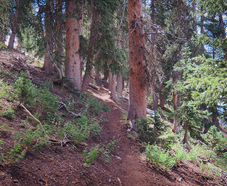
If you like short, Class 1 hikes to the highest summit of a spectacular mountain range, this hike in the unfrequented Tushar Mountains is for you. While you're there, sample the meadows and forests of the Skyline National Recreation Trail for a good dose of solitude.
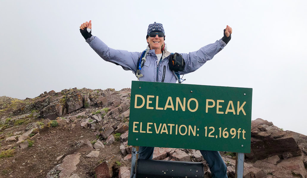
Looking like I'm going to fly away in Delano Peak's high winds.
Related in Explorumentary:
List with Links for Utah Hikes/Bikes Hike Mount Nebo - On Top of the Wasatch
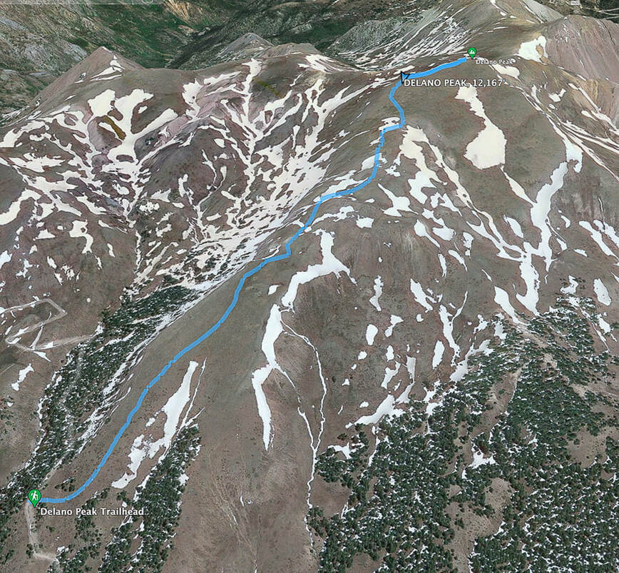
Trip Stats for Delano Peak
Location: Fishlake NF, Tushar Mountains, Trail #224, near Beaver, Utah. Fishlake National Forest - Beaver Ranger District. Prominence: 4,689'. Distance/Elevation gain: West ridge approach = 3 miles round trip - 1,625' gain. Trailhead = 10,500', summit = 12,169'. Difficulty: Moderate Class 1 on cairned trail to Delano Peak. Coordinates: Trail head = 38.36753, -112.39561 Delano Peak = 38.36917, -112.37137 Date Hiked: 8/1/22 Maps and Apps: AllTrails Delano Peak, Fishlake National Forest Beaver and Fillmore Ranger Districts Travel Map - USDA. Considerations: most passenger cars can drive the graded dirt/gravel road to trailhead (FR 123). This road is also part of the Paiute ATV trail, so there is some ATV use on roads nearby. No motorized vehicles allowed on hiking trails. History: named after Columbus Delano (1809–1896), Secretary of the Interior during the Grant administration. He was instrumental in establishing Yellowstone National Park after supervising the first federally-funded scientific expedition into Yellowstone in 1871, and the first Secretary of the Interior to request congress to protect preservation of a nationally important site (from Wikipedia). Geology: The Tushar Mountains are remnants of volcanos whose first eruption period was 22-35 million years ago (Bullion Canyon Volcanics) and second eruption 21 million years ago (Mt. Belknap Volcanics). Delano Peak resides in the Bullion Canyon Volcanics. It is the highest point on the edge of Big John's Caldera, a concealed structure on Delano's west side that subsided ~ 23 million years ago during ash flow eruptions. This caldera filled and eroded over time. The second eruption created the source rock for the mined uranium of the Marysvale mining district north and east of Delano Peak. (See "For the Geocurious" below).
The Skyline National Recreation Trail Links
Ramblers - Beaver County, Utah How to Day Hike Three Different Sections of the Scenic 23-Mile Skyline Trail - Utah - Life Elevated 
On the morning drive up FR 123 to the trailhead.
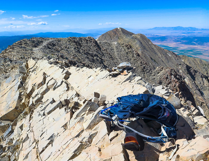
Delano Peak
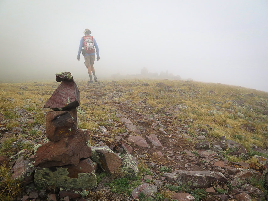
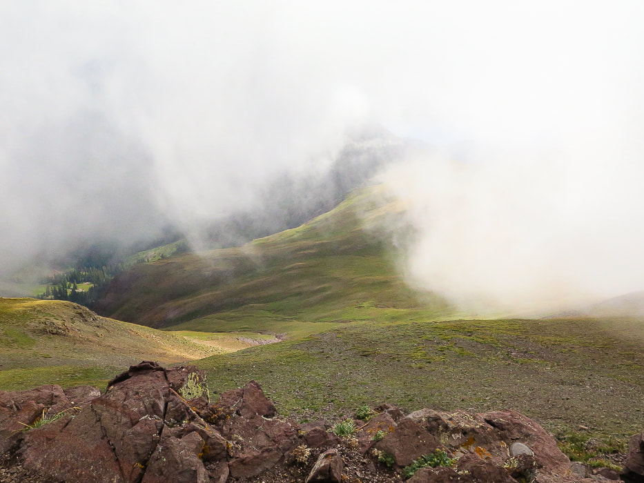
We had planned to hike a loop on on the Tushar range's highest ridge to Delano Peak and Mount Holly further down the ridge, but when we got to Delano's summit, we could barely see each other, let alone the ridge. A few times, Fred got ahead of me and vanished into the huge clouds that engulfed the summit. The terrain below was occasionally revealed as sunny and bright green, but not for long. Getting cold with the wind blowing us around, we descended the short trail to our truck and drove to the Skyline National Recreation Trail trailhead. Mount Holly can be accessed from this trail. Delano Peak is the highest summit in the Tushar Mountains - the third-highest range in Utah, after the Uinta and the La Sal Mountain ranges. The Geologic Map of the Tushar Mountains looks like a chaotic Jackson Pollock painting and one that would bring a sparkle to any geologist's eyes. It's a symphony of color blotches and random hatched lines that represent almost all major forms of volcanic rocks and structural features. Red Hills Tuff, Grey Hills Rhyolite and Blue Lake Rhyolite are just a few of the members of volcanic assemblages. Thrust faults, caldera walls and breakaway scarps scatter about this complicated terrain. Delano Peak's summit sits at the top of Big John Caldera. Four more calderas exist, as well as eight major mining centers. We were surprised that such a large, gorgeous wilderness area with more than a few peaks over 11,000 feet had so few visitors. While hikers flock to the Wasatch and Uinta ranges, the Tushars are not as well-known. There are ATV trails that course through parts of this range, but there are plenty of hiking trails where they are not allowed. This is a quick hike on a trail through grass and small rocks - only 1.5 miles to the summit. It is a bit challenging because you start at 10,000 feet. Delano Peak can also be summited from the northeast; in fact, this trail continues from the summit down to the base of Mt. Brigham. We plan on giving our loop another try.
Skyline National Recreation Trail
The SNRT is an 8.3-mile trail that is part of the panoramic Tushar Skyline Trail stretching 23 miles and passes under Delano Peak, the highest mountain in southwestern Utah. It takes you through streams, meadows, and forests. In 1986 and 1988, 25 mountain goats were introduced into the Tushars from the Wasatch range in northern Utah and Olympic National Park. They have prospered to number 120 goats, and some have been transplanted to other areas. They can be seen on the Delano-Holly ridge line. We entered the SNRT where it intersects with FR 123, ~ 1 mile south of Delano Peak trailhead and hiked toward Mt. Holly's base. The high Tushar's grassy slopes don't appear intimidating; no major cliffs or talus slopes. By this time, the clouds had retreated from the high ridge, but we decided to enjoy a rambling hike rather than a climb up Mount Holly. Ah, maybe we are getting soft in our "old age"!! Any time out in the wilderness, whether we get to our planned destination or not, is cherished.
"Why do they say we’re over the hill? I don’t even know what that means and why it’s a bad thing. When I go hiking and I get over the hill, that means I’m past the hard part and there’s a snack in my future."
- Ellen DeGeneres
Keep On Exploring! Keep Moving! Your Body and Mind will Love you for it!
For the Geocurious: Volcanos and the creation of Uranium
Just east of the Tushar Mountains, the Mount Belknap Volcanics erupted radioactive lava flows and ash-flow tuffs (rocks of consolidated ash) ~ 21 million years ago. Unique geologic processes then created the uranium deposits that formed in a shallow water vein system in the Central Mining Area near Marysvale, a short distance from the Tushars. The veins formed 19 million years ago above a magma chamber, filling in open spaces and fractures with fluids rich in fluorine, molybdenum, and uranium. Hydrothermal fluids and rock reacted to precipitate uranium. Nine mines in the Central Mining area produced uranium. Because of decreased demand for uranium, Utah's mines were closed before 2000. 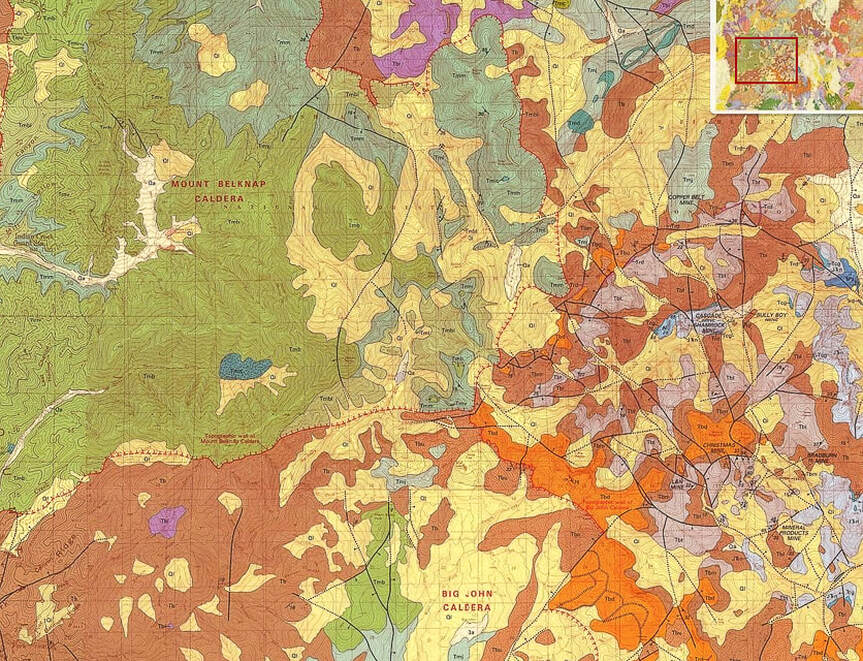
A small part of the geologic map of the Tushar Mountains that shows rock units and structural features of the highest part of the range.
click on photo for complete geologic map of the Tushar Mountains
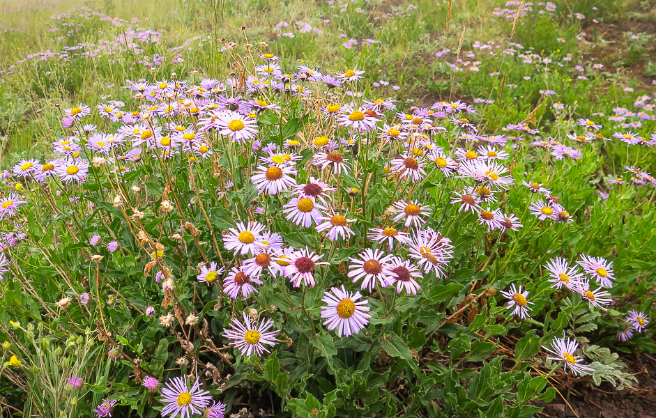
Fleabane
Liking the cool moist air!
Are you sure this isn't Scotland?
Nearing Delano Peak's summit.
Looking down from near the summit.
Clouds beginning to clear on the lower hike down.
Some cool stuff on the trail.
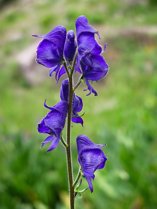
Columbian monkshood found near small streams.
These wildflowers like to grow in rich, moist soils - water use is high. They are poisonous to humans if ingested. 
Skyline National Recreation Trail heading southeast toward Mt. Holly on right horizon.
Google Earth image of our GPS tracks to Delano Peak. North points to the top left of the photo.
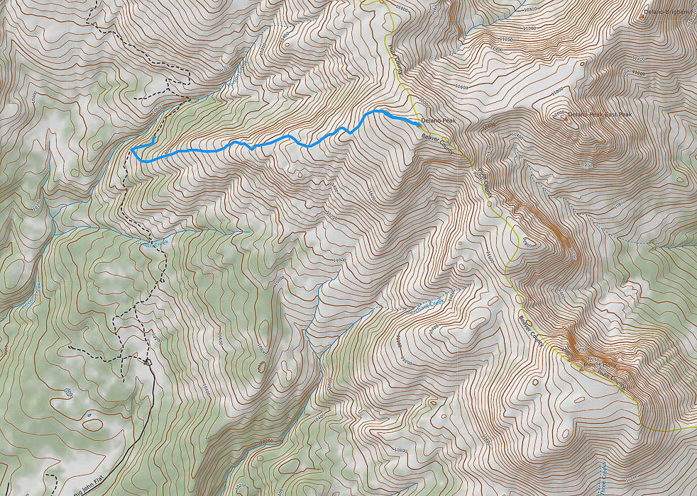
Caltopo image of our GPS tracks: North points to top of photo. Mount Holly located on ridge lower right.
AllTrails map with GPS tracks on the Skyline National Recreation Trail: Big Flat Trailhead (south) to Mud Lake (north).
click on map for link to AllTrails website.
References:
Cunningham, C.G., Rasmussen, J. D., Steven, T.A., Rye, R.O., Rowley. P.D., Romberger , S.B., Selverstone. J. 1998. Mineralium Deposita, 33:477. Delano Peak - Wikipedia Geologic map of the Tushar Mountains and adjoining areas, Marysvale volcanic field, Utah. USGS National Geologic Map Database. Mindat.org. Marysvale Mining District. Plant Database: Aconitum columbianum. The University of Texas at Austin website. Ringholz, R. C. Uranium Mining in Utah. Utah History Encyclopedia. Steven, T. 2013. Igneous Activity and Related Ore Deposits in the Western and Southern Tushar Mountains, Marysvale Volcanic Field, West-Central Utah: USGS Professional Paperback.
One of the "ultra-prominent peaks" in the lower 48 states, this excellent hike treks through blankets of wildflowers, up a steep slope and across a long, thin ridge to the summit of the Wasatch Range's highest peak.
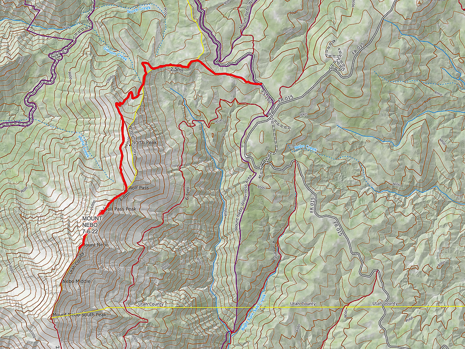
Fred walking over Wolf Pass Peak, with Mount Nebo behind him. Actual summit is just behind the high point in the photo.
Related in Explorumentary
Utah Hikes: List and Links Utah's Red Rock Country Moving Makes You Feel Better: The Latest Research Experiencing "Flow" - The Secret to Happiness
Maps and Apps: Trails Illustrated Wasatch Front South #701, AllTrails track.
Weather forecast: mountain-forecast.com Date Hiked: July 6, 2022. Directions to trailhead from Nephi, Utah: From the town of Nephi, take UT 132 (I-15 exit 225) east. Drive 4.8 miles from I-15 to Mount Nebo Scenic Loop Road (FR 015), take a left. Drive 13.4 miles to junction of Mona Pole Road (FR 160), at Monument Trailhead. Take Mona Pole road - drive 0.4 miles on good dirt road to parking area on left. Geology: Mount Nebo is comprised of the Oquirrh Formation: interbedded limestone and sandstone.
Overview
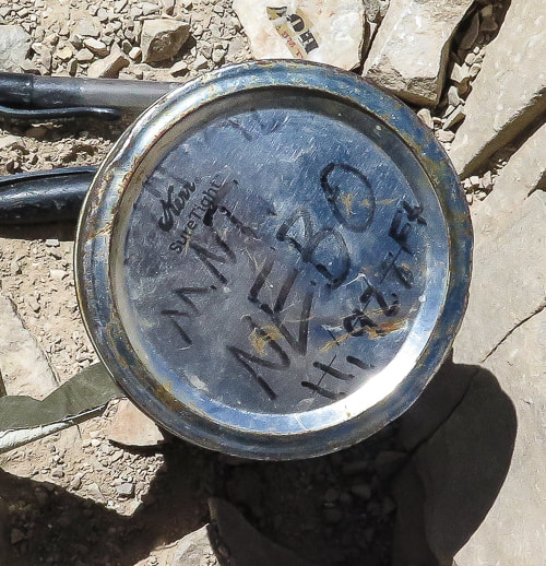
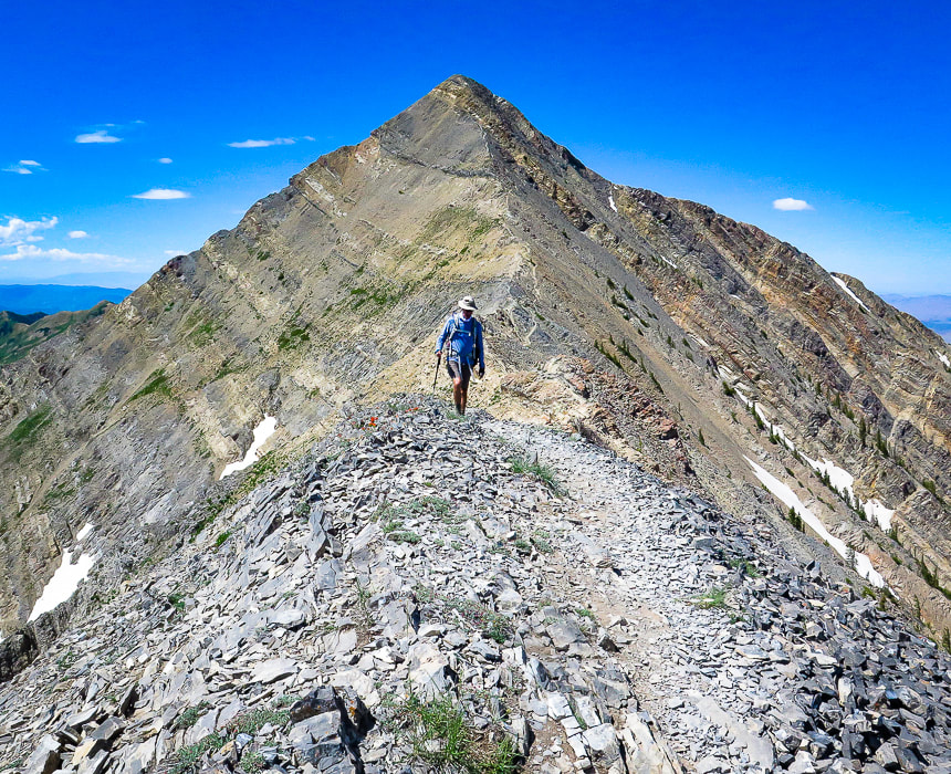
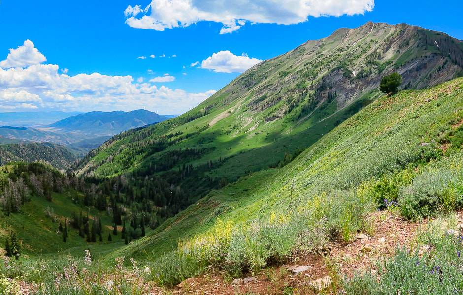
Mount Nebo, a towering bare hunk of tilted limestone, is aptly named to mean "Sentinel of God" by early Mormon pioneers. You can't miss this impressive-looking mountain that dominates the Nephi (pronounced NEE-fy) skyline, close to Utah's I-15. Some people think Mt. Timpanogos, another impressive peak near Provo, is the highest in the Wasatch range; however it is 179 feet lower than Mount Nebo. I was advised by a sales associate at The Desert Rat, St. George's outdoor specialty store to NOT summit Nebo via the southern route, Nebo Peak Trail. After telling me to hike the North Peak Trail, its trailhead north of Mount Nebo, he said, "You should probably see some great wildflowers." He was right on both accounts: the trail was great and profuse wildflowers of every color covered the forest understory. The trailhead is at 9,254 feet and the summit is 11,928 feet. However, you lose elevation on the way to the summit and gain elevation on the way back, making the cumulative gain 3,700 feet. The trail passes over Wolf Pass Peak (Point 11,440') first before it tackles the great pyramid-shaped Mount Nebo. There's a really steep pitch on Wolf Pass Peak's northeast slope. It's short switchbacks make for a heart-pounding climb of over 800 feet in just 0.4 miles. Glad I had my hiking pole for the way down! We hiked Nebo on a weekday and ran into four other parties. I imagine this is a busy trail on weekends. But that would not deter me - this hike is fantastic! Mount Nebo is #39 out of 57 ultra-prominence peaks in the lower 48 states. To qualify as"ultra-prominence", the summit of a peak has to rise at least 1,500 meters (4,921 feet) above its key saddle, which is the lowest contour that encircles it, and no other peak.
Our Hike
North Peak Trailhead to Wolf Pass: Miles 0 - 3.5 with a 1,350' gain We began our hike at 7:20 a.m. to ensure we would be off the most exposed part of the peak around noon. The North Peak Trail ascends through a lush forest with lots of wildflowers and vegetation spilling over to arrive at a bare avalanche area where we crossed a small snow field and continued steeply up to a saddle on North Peak's north ridge for the first incredible view of Mount Nebo. You also get a great view of Juab Valley and Mona Reservoir to the west. From here, the trail splits in 0.2 miles to the left to summit North Mountain. Keep right on the main trail to traverse North Mountain's shady west flank to arrive at Wolf Pass, just south of North Mountain. Here's a place with great views to both the west and the east, and an opportunity to rest a bit before tackling Wolf Pass Peak.
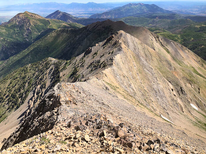
Wolf Pass to Mount Nebo summit: Miles 3.5 - 4.5 with a 1,300' gain
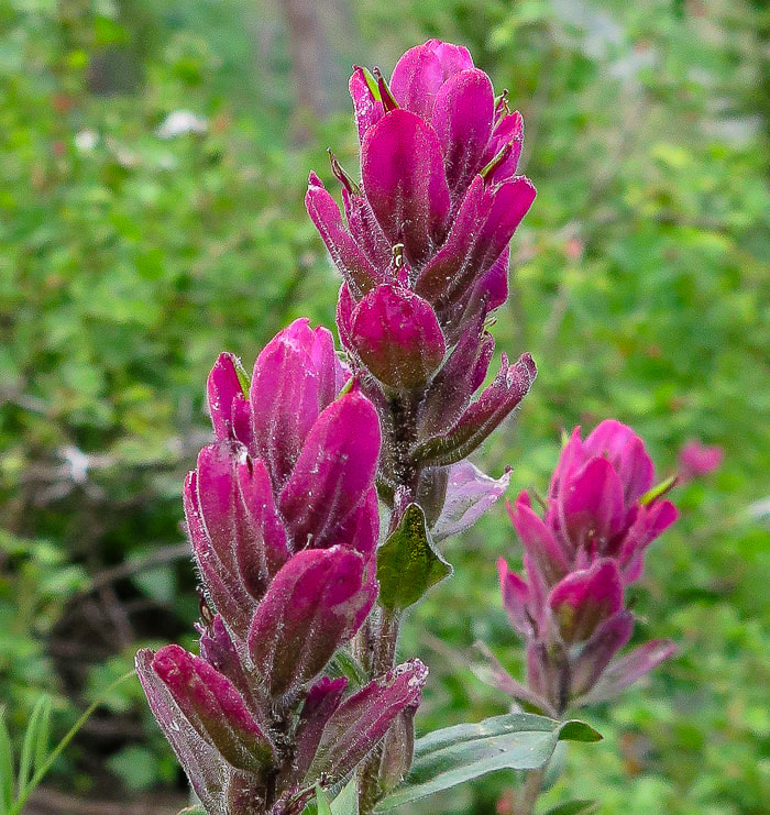
I felt quite small standing on Wolf Pass, an immediate 800 feet of climbing staring me in the face. We put our heads down and used a modified rest-step to get up this steep and rocky pitch efficiently. We use this technique for long, steep pitches, especially at elevation to save energy: use momentum to kick your foot forward while keeping back knee straight - rest a second and repeat with other leg, going in a measured, rhythmical gait, not over-using your quads or glutes. Before topping off on Wolf Pass Peak, we followed a trail going left, traversing just under the summit for a short distance. We had to scramble back up to the ridge just after the summit. We avoided that on the way back and just stayed on the ridge over Wolf Pass Peak. The walk on the ridge to Mount Nebo's summit was divine. A feeling of being on the top of everything else in the region with steep basins and canyons with names like Hell Hole, Middle, North and South Basin dropping for a long way on both sides. Occasional scant stands of scraggly trees line a few steep couloirs. The ridge trail is wide and stable enough so it doesn't feel precarious or scary. As soon as we reached what we thought was the summit, suddenly there was the "true" summit just behind it, only about 40 feet higher. The summit is narrow and long, a trail leads to the next high point to the south, Nebo Middle and then after that, Mount Nebo South Peak. The summit register consisted of a glass mason jar stuffed with sticky notes with lots of names, dates, and comments. A couple of things were remarkable about the descent. The first was Wolf Pass Peak's steep, rocky pitch - it reminded me of a short version of Mt. Borah's (the highest peak in Idaho) descent - steep and slippery. The second was the abundant wildflowers, reminding me of Colorado hikes. We didn't know that Utah's high country could be so beautiful. Our adventure possibilities have just expanded - again. Wouldn't it be great if the years of our lives expanded accordingly? I guess the key is in living in the moment and fully appreciating that we have the ability to get to the "top of the world" and see Indian paintbrush splash the forest with magenta.
"So, if you cannot understand that there is something in man which responds to the challenge of this mountain and goes out to meet it, that the struggle is the struggle of life itself upward and forever upward, then you won’t see why we go. What we get from this adventure is just sheer joy. And joy is, after all, the end of life. To struggle and to understand. Never the last without the first. That is the law."
- George Mallory, mountaineer who climbed with the first three British expeditions to Mt. Everest in the 1920's.
Keep on Moving! Keep on Exploring!
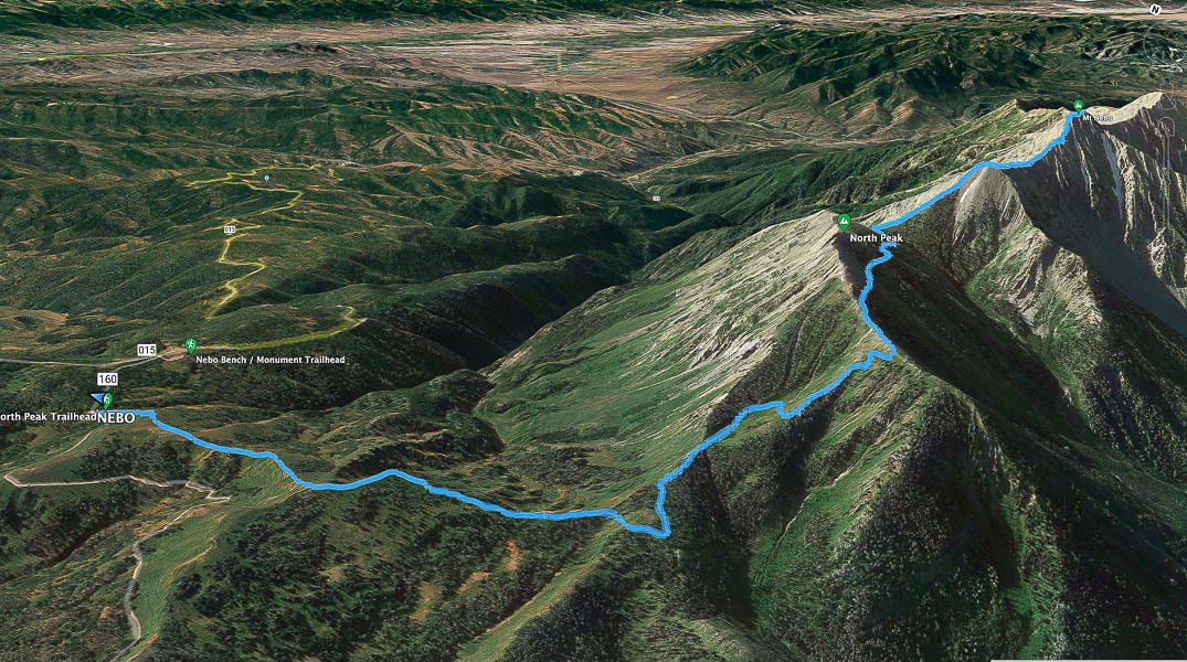
Google Earth image of our tracks heading from North Peak Trailhead west to ridge, then south to Mount Nebo summit on the right. Mount Nebo Scenic Loop road (015) approaches trailhead upper left. South points to the upper right.
View of Mount Nebo from Mount Nebo Scenic Loop Road.
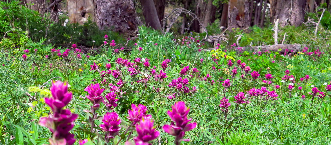
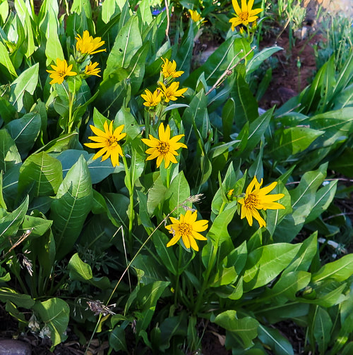
Indian paintbrush
Gorgeous summit!
On Mount Nebo's summit looking east.
Heading back - trail goes over the top of Wolf Pass Peak (Point 11,440').
Some cool stuff on the trail.
On the way down
North Mountain from near the trailhead.
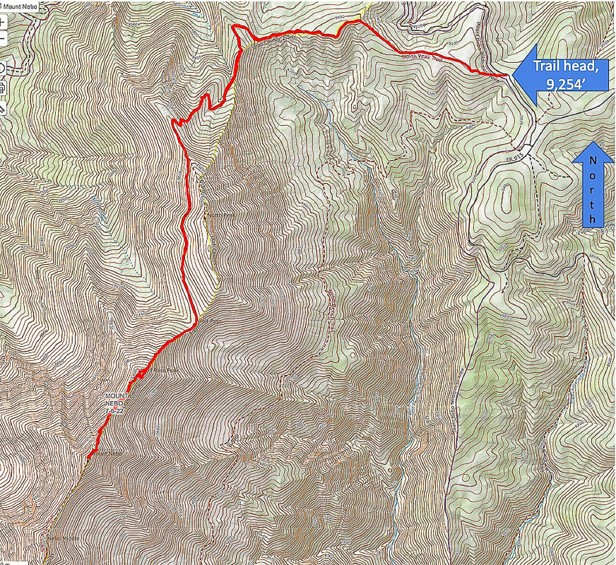
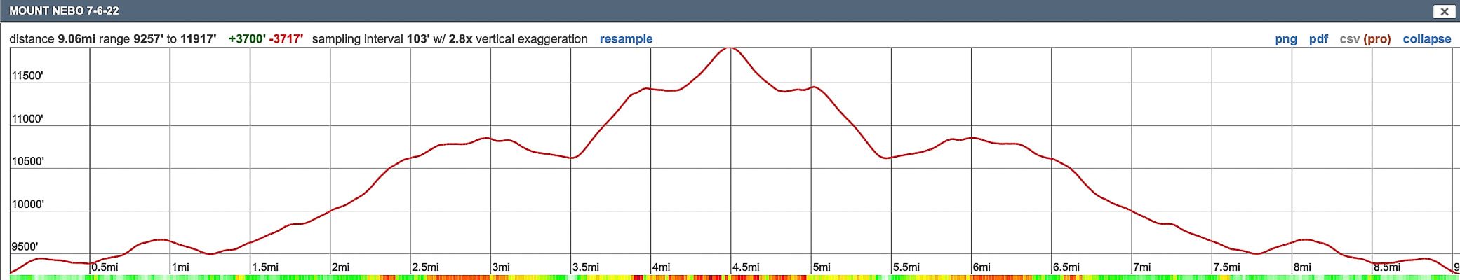
Our GPS tracks and elevation profile for Mount Nebo.
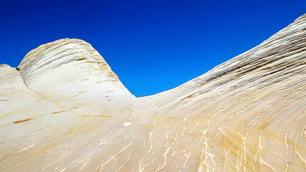
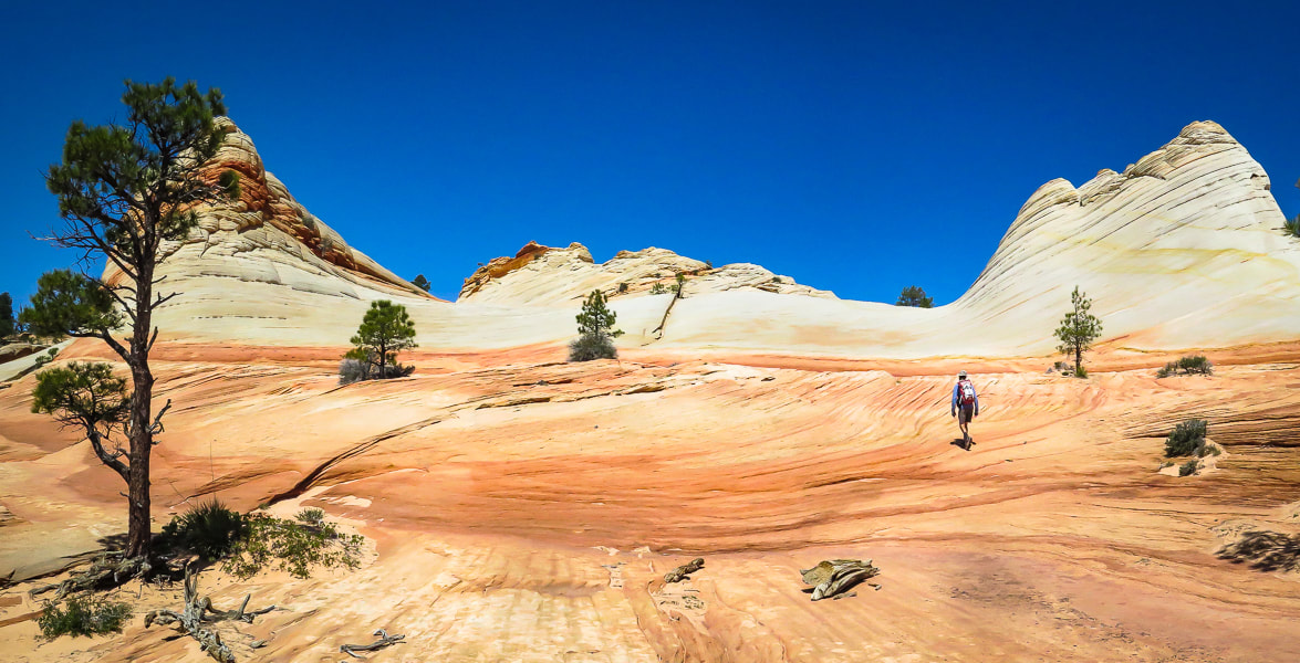
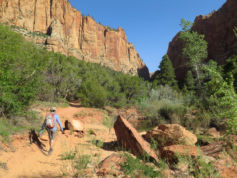
Walk on the surreal slick rock of White Domes, near the top of Canaan Mountain as you climb out of Water Canyon. This is a an extraordinary hike in a gorgeous, remote and rugged wilderness.

White Domes - Canaan Mountain, Utah
Related in Explorumentary:
Canaan Mountain via Squirrel Canyon Utah's Red Rock Country Southern Utah Hiking and Biking in a Pandemic: Wire Mesa, Snow Canyon, Zion National Park Mt. Kinesava Hike - Zion NP Angels Landing in Zion - Not for the Faint of Heart Utah Hikes
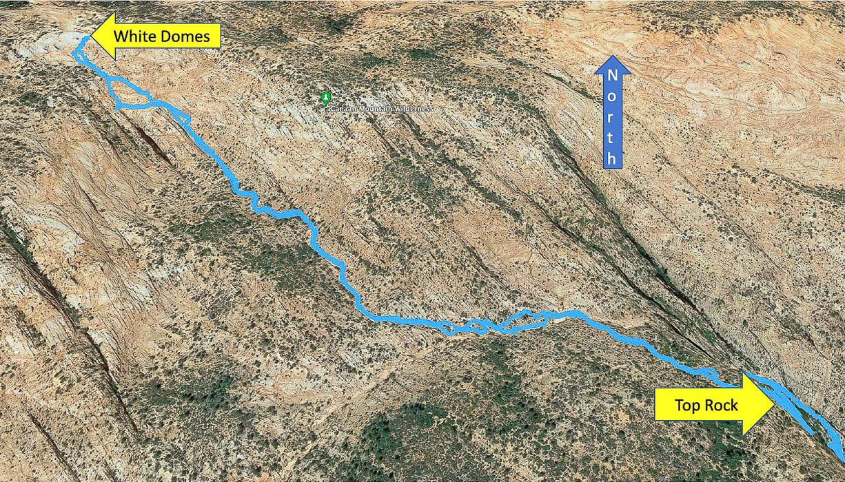
Coordinates: Trailhead = 37.03681, -112.95364. White Domes = 37.06259, -112.98348.
Maps and Apps: (See topo maps of our trail at end of post). USGS 7.5 min topo, Hildale, Utah-Arizona, AllTrails White Domes via Water Canyon Trail, Avenza and physical map of St. George, Springdale, Hurricane & Zion NP, Utah by Adventure Maps, Inc. Link to Zion topo Map of Canaan Mountain Considerations: Take GPS coordinates when you top off out of Water Canyon so you can return to the same point to descend. Once on the plateau, experience with navigation using physical topo maps as well as smart phone apps is advised; trails are not marked and "social trails" go in various directions. There are limited openings through the Water Canyon cliffs, so you must return to the same point at which you entered the wilderness above the cliffs. Allow enough time to get off the mountain. Date Hiked: May 8, 2022. Directions to Water Canyon Trailhead: From Hwy 59 in the border town of Hildale, Utah, turn left on Utah Ave., which heads 2 miles east before turning north (left) onto Canyon St. In less than a mile, turn right at the intersection of Maxwell Canyon Rd. and Water Canyon Rd. Follow this dirt road for another 2 miles to park at one of two parking lots at the trailhead. Can be treacherous driving on this road if it is wet. Geology: Block of Navajo sandstone originally deposited on the continent of Pangea, which included today's North America, Africa, Europe, and South America, existing as a single continent. Sand was wind-blown and deposited in a huge sand sea - creating the petrified sand dunes seen in many Utah state and national parks. The parallel sand layers are cross-beds: the inclination of the layering was caused by aeolian (wind-blown) sand, migrating down-wind. Related:
Overview - Canaan Mountain Wilderness
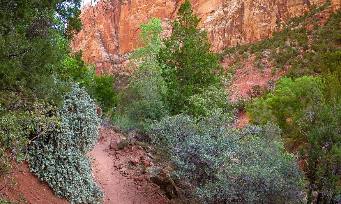
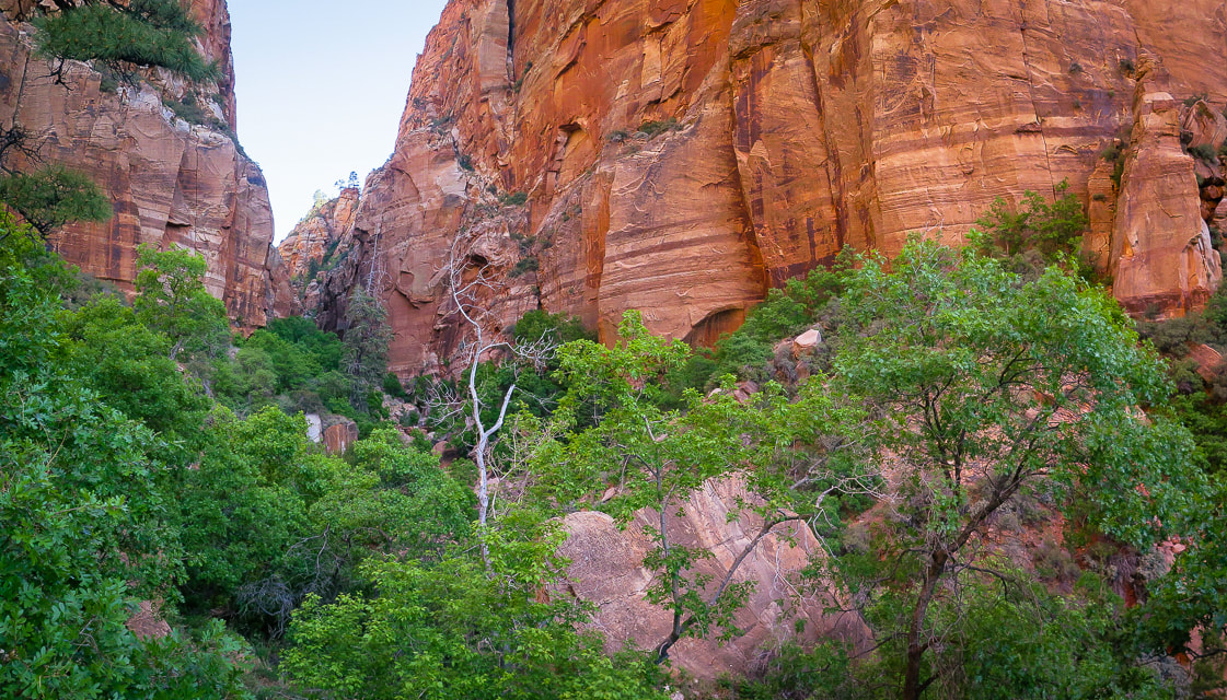
Navajo Sandstone cliffs, 2,000 feet high, surround Canaan Mountain on three sides, making this an exceptional wilderness with limited access. The landscape is always interesting and gorgeous; around every corner, atop every plateau and rising up out of sandy washes are the various landforms sculpted by wind, water and ice erosion. The red and orange Vermillion Cliffs form its base. The cream, yellow, red, orange and white colors compliment greens of scattered ponderosa and pinyon pines, scrub oak and gambel oak, creating a striking color palette. Cross-bedded cliff walls, pinnacles, domes, slot canyons, hoodoos, natural arches, ledges, open slickrock, waterfalls, seeps with hanging gardens, and carved pools are some of the things you see in this extraordinary land. It has only a few primitive routes, with one rocky and sandy 4WD road, the Sawmill Trail/Canaan Mountain Trail, a historic logging route that enters from the east. To us it is comparable in beauty to Zion NP, and we get to practice our navigation skills.
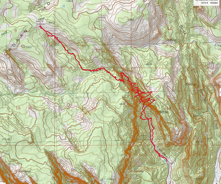
Hike Summary
Miles 0 - 2.2: Water Canyon trailhead to top of cliffs/entry onto mesa at "Top Rock". Miles 2.2 - 3.9: "Top Rock" through mesa to White Domes/Canaan Mountain Ridge. Fred and I got "temporarily bewildered", not exactly lost, when we attempted this hike a few years ago. We neglected to take a waypoint at our Water Canyon exit onto Canaan Mountain plateau's unmarked wilderness. We followed the wrong path and found ourselves further from the White Domes. When we decided to head back to the canyon rim, we took a waypoint just in case because there were a few paths there, but nothing marked - no cairns or signs. We came close to our entry at the canyon rim but missed it by a short distance. So, we returned back (one mile!) to our waypoint, carefully retraced our footsteps, and finally got back to our entry, the only way we knew to get back down. The lesson: when hiking in Southern Utah's canyon country, there may be only one entrance/exit point and it is crucial to know how to navigate back to that point when there is no marked trail. This wild and spectacular country is filled with numerous washes, pedestal rocks, slick rock, and boulders; it can turn into a maze where landmarks can look similar. This time we were ready, armed with AllTrails and Avenza maps, as well as our physical map. My Garmin GPS insured we were backtracking successfully. We took the crucial waypoint at Top Rock (see below). We followed Joe's Guide to Zion NP - Water Canyon and Canaan Mountain hike directions. Occasional rock cairns helped, too.
Interactive map. The large-amplitude swings in GPS tracks are the GPS trying to find satellites while deep in Water Canyon.
See more topo maps at end of post 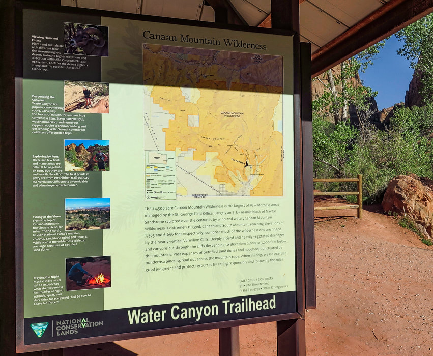
Starting out - Water Canyon to the right.
Climbing out of Water Canyon
Fred and I began trudging (at times) through sand, passing under canopies of pine and juniper to the picturesque waterfall section of Water Canyon. Here, the canyon is dark and narrow; walls drip water onto bright green leaves, and a series of small waterfalls tumble over sandstone. Long striped walls on both sides converge at a slot where you walk through the shallow stream. Just past this, at about one mile into the hike, you start to climb steeply up the west (left) cliffs of Water Canyon, passing more waterfalls, walking over a series of rock ledges, hoisting over boulders now and then, and even walking over a log propped against a ledge to gain access to the top of it. This trail to the plateau above is a masterfully-planned route through available ledges and passages with the canyon at times dropping steeply below to the right, but you won't feel overly exposed. There are some rock cairns to follow. At about 1.9 miles into the hike, the trail makes a U-turn and heads south to ascend the final wall to the opening into the plateau, and to Canaan Mountain Wilderness boundary. Impressive towering walls of cross-bedded sandstone seem close as the canyon widens. Shortly, "Top Rock" is reached - a large, weathered sandstone rock on a flat area (see Fred and I sitting on it, below). A few websites and topographical maps refer to this landmark as Top Rock. RECORD YOUR COORDINATES NEAR PLATEAU ENTRY - We recorded "Top Rock" coordinates for a waypoint.
Canaan Mountain plateau to White Domes
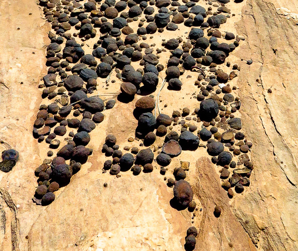
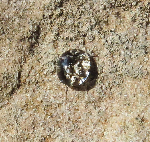
As you stand at Top Rock, the White Domes on Canaan Mountain's ridge to the northwest are 400 feet higher. We walked straight towards them, initially descending, finding a discernible path marked often by small rock cairns, hiking in a northwest direction. Our route took us through the forest, down through small drainages and short stretches of slick rock into a larger sandy wash (upper Water Canyon), where I placed some tree branches to mark our entry into the wash. We followed this creek west upstream for ~ 0.25 miles, going around a few dry waterfalls to their north (right) side. Reach a wide intersection between two washes; take the side wash to the right (NW) and follow it for ~1.0 mile to the domes. Walking over sand and slick rock is exquisite as you pass by sandstone walls and moqui marble collections - round sandstone balls coated with dark red or black iron oxide. As you near the top of this side wash, White Domes come into view - you exit the canyon and start hiking steeply up pure white sandstone. Top out on Canaan Mountain's ridge between these layered domes to see the temples and mountains of Zion National Park to the north. Walking on the bright white, bare sandstone with cream-colored veins flowing through it and bright blue sky above is an almost surreal experience. The curves between the domes have been masterfully formed by wind and water, and make it easy to walk around them. A website describes this area as "wondrous" - I would have to agree. We returned, using my GPS to backtrack, as there are a few shallow canyons coming down from White Domes, and no rock cairns. I'm glad I marked the exit out of the upper Water Canyon wash with branches because the distance back in the wash seemed shorter than the morning's distance. From White Domes, the Sawmill Trail, an old jeep road continues west toward a few more landmarks that represent Canaan Mountain's lumber history. The trail leads to the southwestern edge of Canaan Mountain to the windlass ruins, the remains of a cable system that lowered timber to the valley floor. It continues to the highest point on Canaan Mountain at 7,363' (~400' higher than White Domes) and Sawmill Spring, the remains of the sawmill. Again, we feel lucky to be able to hike to these awesome places. So many adventures to be had, so many beautiful things to see, so much appreciation for the American west. Ah, but so little time.....
Keep Moving and Keep Exploring!

CrossFit athlete at CrossFit Dixie in St. George, Utah.
Getting deeper into the canyon.
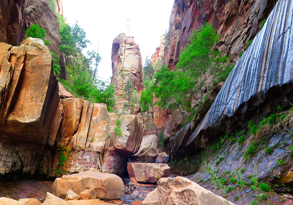
Reaching waterfall section where walls converge to make slot to walk through.
Dripping walls at waterfalls section of Water Canyon.
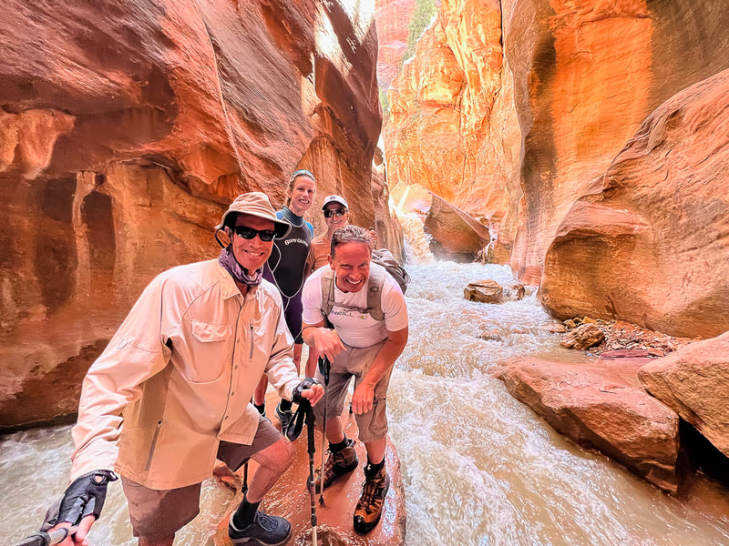
Walk through shallow stream at slot.
Walking above the waterfall section, about ready to start climbing west canyon wall.
Long, narrow waterfalls as you ascend Water Canyon.
Starting to climb canyon wall.
Very helpful way to get up this tall ledge!
Rock cairn marking ledge up west cliff climb; nearing the canyon opening at the top.
Fred and Sue on "Top Rock", at entrance to plateau from Water Canyon. 
Looking down Water Canyon from near top of its west wall.
Looking across to Water Canyon's east wall.
View from "Top Rock" above exit from Water Canyon of White Domes on Canaan Mountain.
Descending down into upper Water Canyon wash, then we walked 1/4 mile west to intersection with wash that leads NW to White Domes.
Waterfall #1
Waterfall #2
Intersection of washes - we took the wash on the right, out of the main wash; it leads up to White Domes ~ 1.1 mile.
Slick rock scenes on ascent to White Domes.
On the way to White Domes
Looking at Zion NP to the north.
Some cool stuff on the trail.
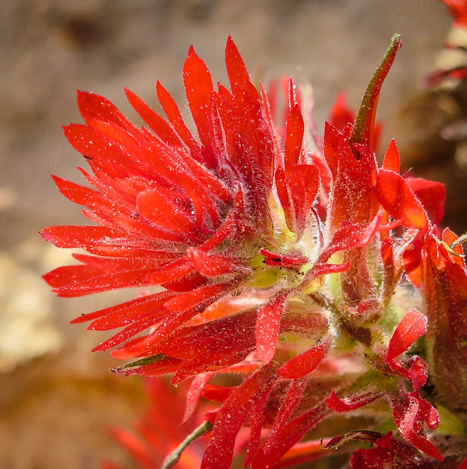
Indian paintbrush (Castilleja)
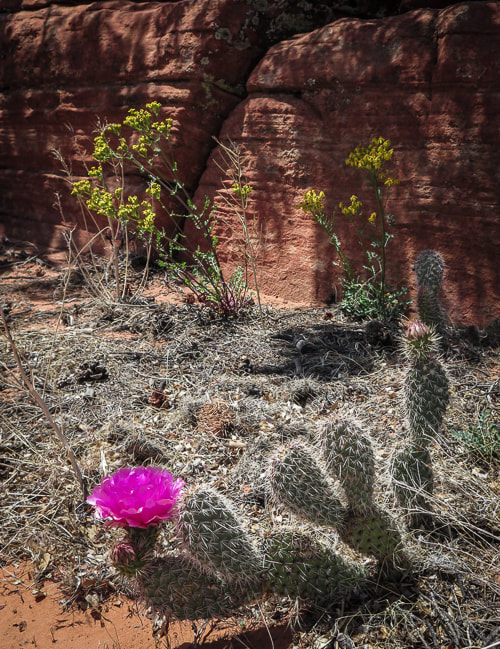
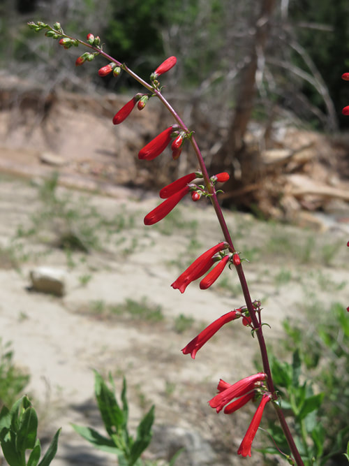
DESERT PLANTS 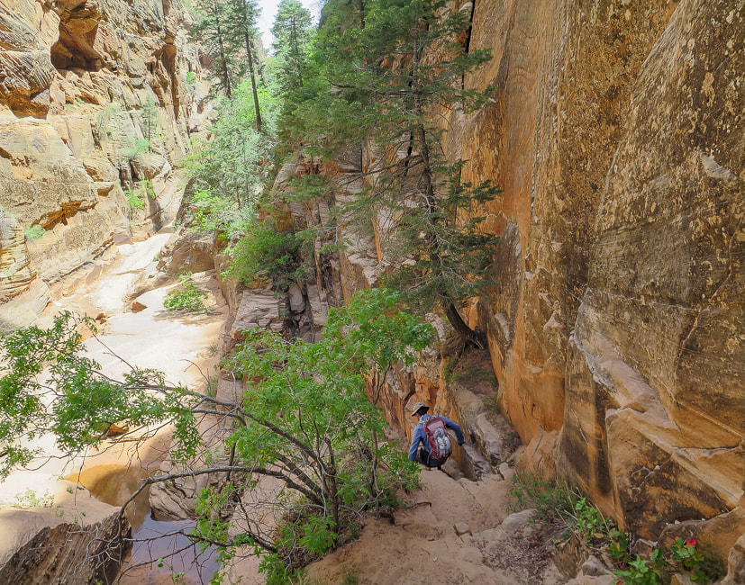
Heading back down.
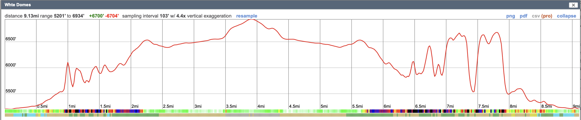
Our GPS tracks reflect an inaccuracy due to inadequate number of satellites signals while hiking in the canyon. According to CalTopo, it takes a minimum of 4 satellites communicating with your GPS to get accurate elevation and location measurements. It's not uncommon for satellites to be close to the horizon, so they may be blocked depending on the terrain you're hiking on.
Google Earth image of our route from Top Rock just out of Water Canyon to White Domes, going cross-country to drop down into upper Water Canyon wash, then following side wash straight to White Domes in NW direction. Distance from Top Rock to White Domes = ~ 1.7 miles.
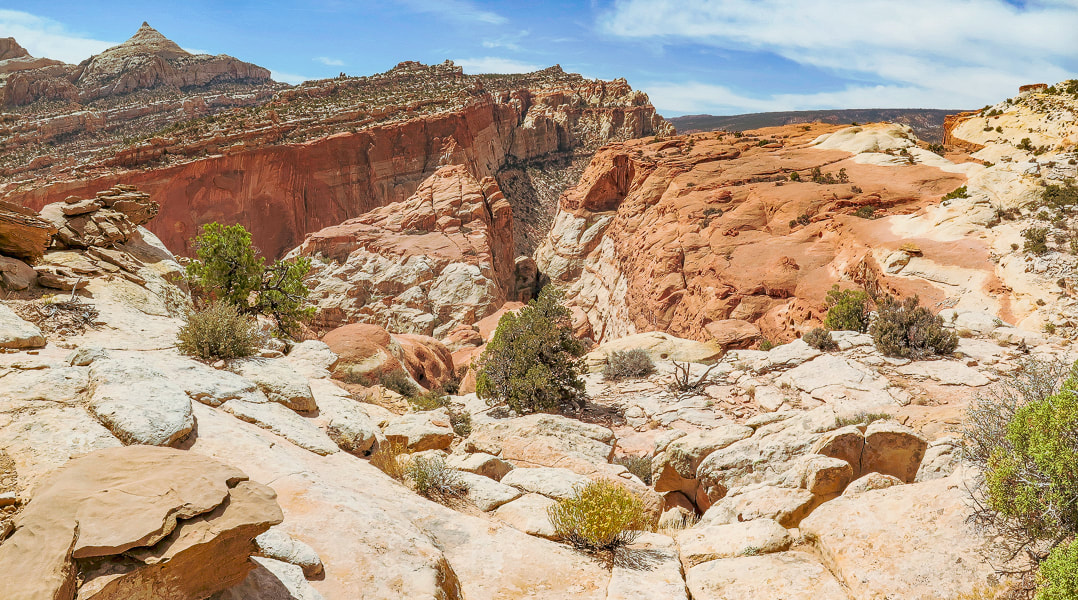
Cassidy Arch is only one feature of many on this spectacular hike on the Waterpocket Fold that will capture your imagination and make you feel minuscule as you hike over open slickrock and between towering walls.
Related:
Utah's Red Rock Country Hiking Mt. Kinesava, Zion NP Southern Utah Hiking/Biking in a Pandemic: Snow Canyon State Park, Wire Mesa, and Zion NP Red Mountain Primitive Trail, St. George, Utah In Search of the Rattlesnake Petroglyph Desert Plant Photos 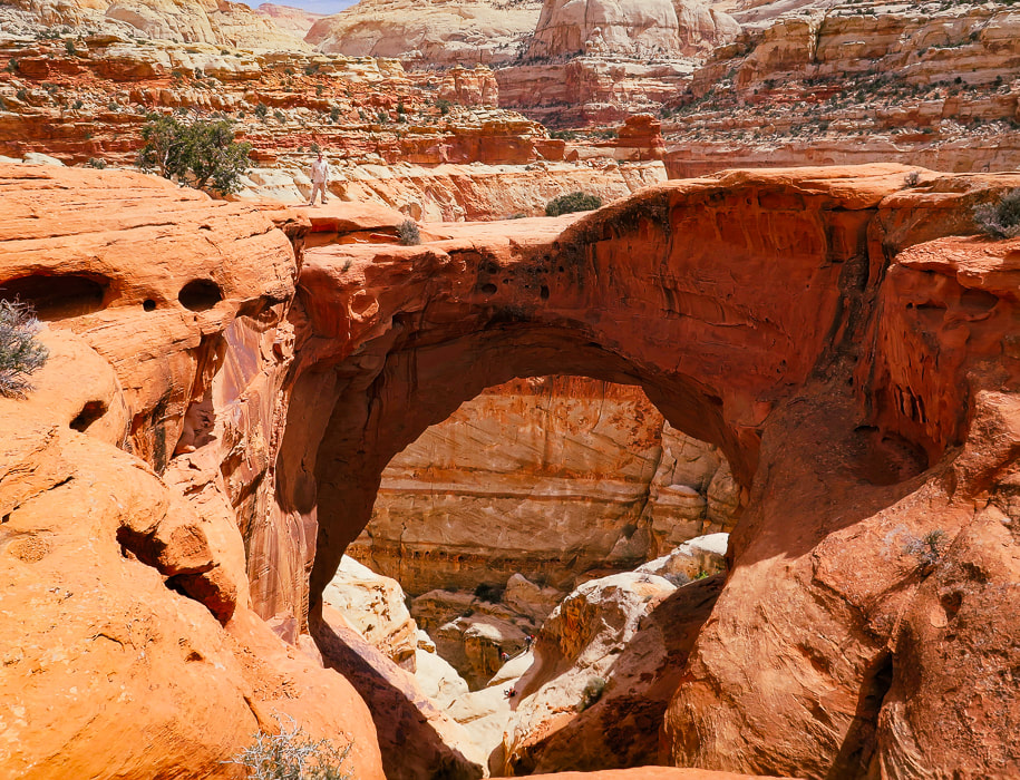
Fred (upper left) standing on top of Cassidy Arch, Capitol Reef NP.
Trip Stats
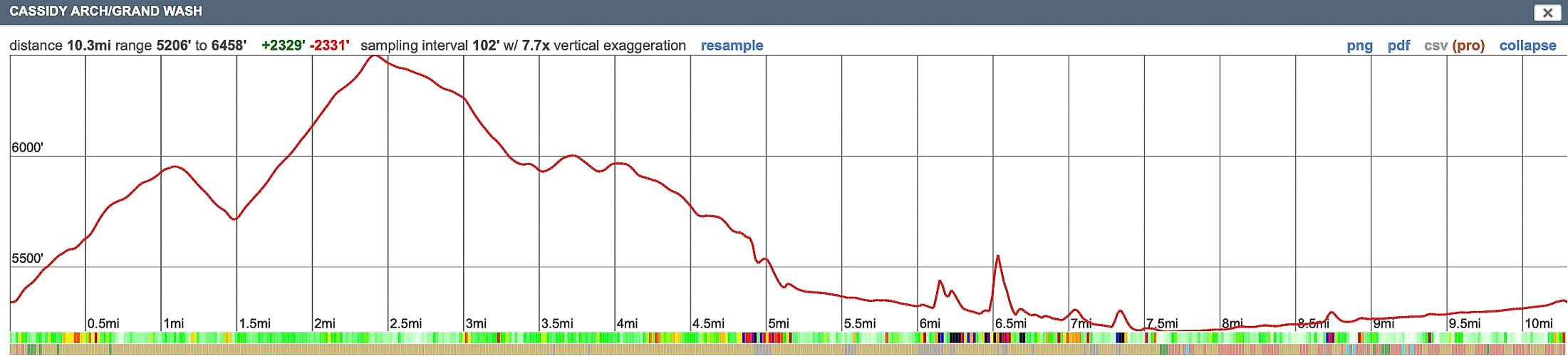
Overview: Maximize your already overloaded visual experience in Capitol Reef by hiking a trail less-traveled to Cassidy Arch, then descending through the soaring heights of Grand Wash. The only drawback on this spectacular loop is the 2.6-mile walk on the park's road (Hwy 24) back to the trailhead. Location: Hickman Bridge Trailhead, 2 miles from Capitol Reef NP visitor center on main park road. Coordinates: Trailhead: 38.287936, -111.226906.
Difficulty: Moderate Class 1 with signs and rock cairn markers.
Permit/Fee: $20 for private vehicle pass good for 7 days. Navigational aids: Hiking Map and Guide - Capitol Reef National Park (topo map), Stav Is Lost's route description. Date Hiked: April 28, 2022. Geology: Capitol Reef NP encompasses its main geologic feature - the Waterpocket Fold, a nearly 100-mile crimp in the Earth (see "For the Geocurious" below.)
Our Hike
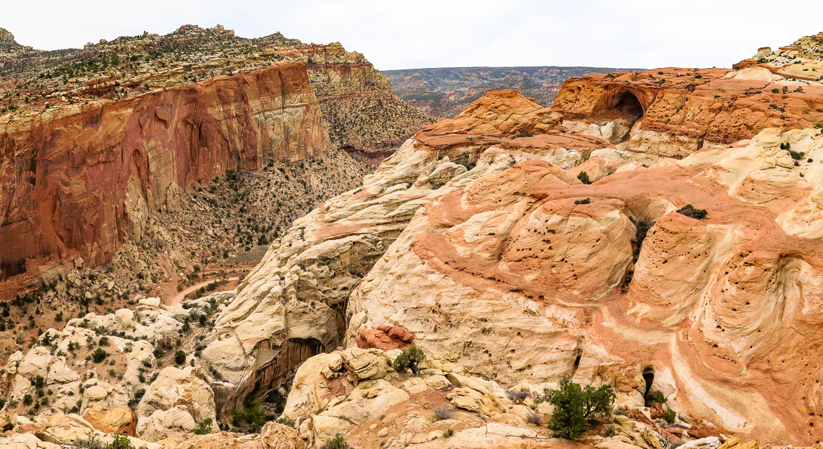
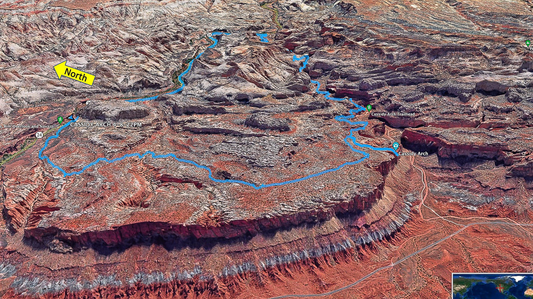
Seems like the last few hikes we've done have histories of late 1880's wild west rustlers and outlaws. Two of them - Mount Minerva Hoyt and Lost Horse Mountain in Joshua Tree NP look over valleys where cattle rustlers hid their "stock". Cassidy Arch, the premier feature of this hike is named after Butch Cassidy, leader of the "Wild Bunch" - bank robbers who hid in the remote canyons of Capitol Reef. Wild west characters - one of the many things I like about living in America's magnificent west. One of the best attributes of this hike is variety; Frying Pan Trail elevates you to a spectacular high point and a rock wonderland with eroding sandstone towers scattered about, then drops you down to the intersecting trail that leads you to Cassidy Arch's cavernous opening. The grand finale is a walk through a long deep canyon aptly named Grand Wash. To get back to our car, we had to walk on the main park road which snaps you out of a dream world of hoo-doos, warm-colored rock layers, scented junipers and ancient petroglyphs to bring you back to the real world of traffic and tourists. It would be optimal to have two vehicles - one at Hickman Bridge trailhead and one at Lower Grand Wash trailhead on Highway 24. Cohab Canyon/Frying Pan Trail Start at the sign for Frying Pan Trail/Cohab Canyon across and slightly down the main park road from Hickman Bridge parking. According to local lore, Cohab Canyon got its name because it was a polygamist hideout if lawmen came around. But, lack of diaries and documents from Fruita, the Mormon settlement at Cohab Canyon, indicate it's probably more lore than truth. Intersect with Frying Pan Trail in 0.55 miles, taking a left to head south under Frying Pan Peak. Cohab Canyon Trail continues to the right (west) to Fruita site.
Cassidy Arch Trail - out and back
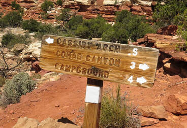
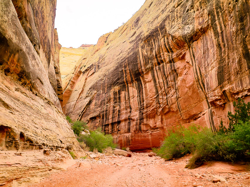
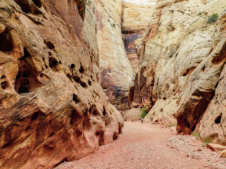
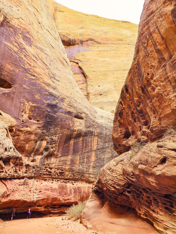
Hike over cairned and open slick rock 0.5 miles to Cassidy Arch where without warning the sandstone drops below to a spacious opening. It seems appropriate to be named after Butch Cassidy because it's hidden until you are practically on top of it. This a great place to take a break and watch people walk over its top. Stav is Lost describes a canyoneering trip report that begins next to the arch and does several rappels into narrows, a grotto and more arches, and ends up at Grand Wash Road and trailhead. Head back to intersection from which you came and take a right to descend on Frying Pan Trail for 1.0 mile to the intersection with Grand Wash Trail. Cassidy Arch looks like a big tunnel high up on the mesa overlooking Grand Wash. 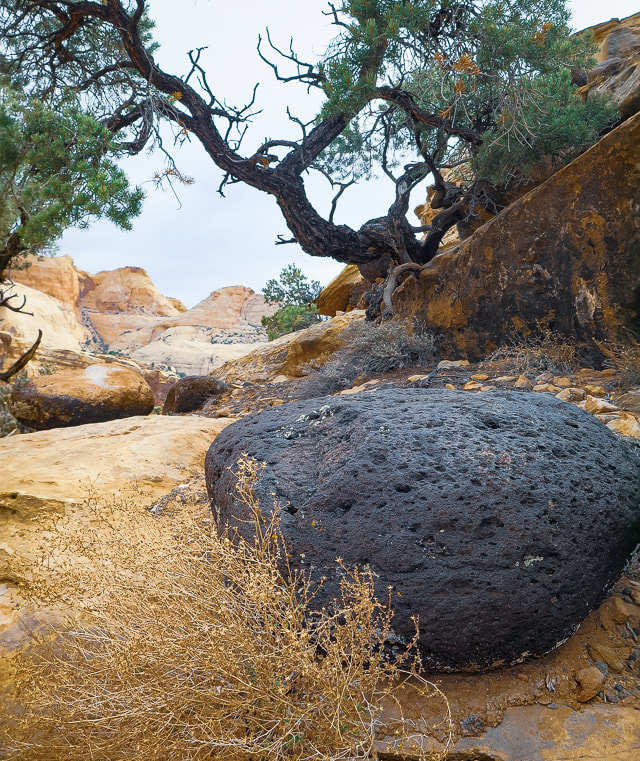
Large basalt flows erupted and accumulated in the Boulder Mountains, west of Capitol Reef 20 million years ago. These rounded and vesicular boulders are scattered about everywhere in Capitol Reef, brought there by melt-waters from glaciers that had spread out over the lava flows. Many miles of rolling and tumbling sculpted them into these beautiful shapes.
Frying Pan Trail is well-marked.
View from Frying Pan Trail to the southwest.
Those are some thick sandstone layers!
Topping off on Frying Pan Trail.
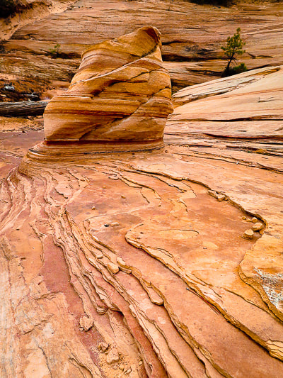
On the way down toward intersection with Cassidy Arch Trail. Fern's Nipple on the horizon. Great view of titled layers of the Waterpocket Fold.
Heading down toward intersection with Cassidy Arch Trail.
Cassidy Arch Trail swings down to the right: Cassidy Arch is under the sandstone on the right mesa - its opening on the left edge of that mesa. Fern's Nipple on left horizon.

Suddenly it's there: first view of Cassidy Arch.
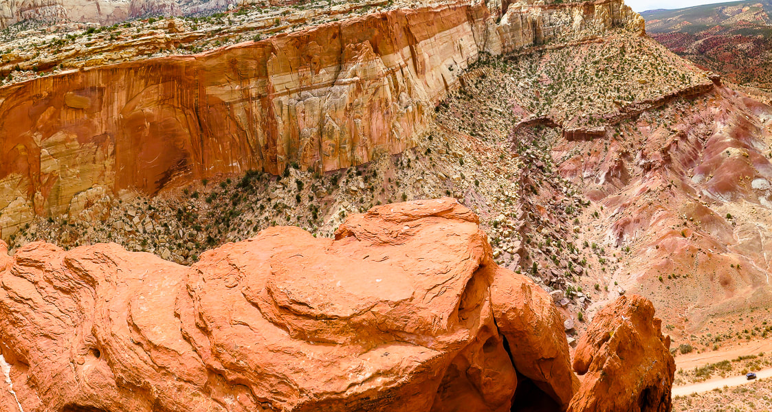
From Cassidy Arch looking down onto Grand Wash Road.
Grand Wash Trail
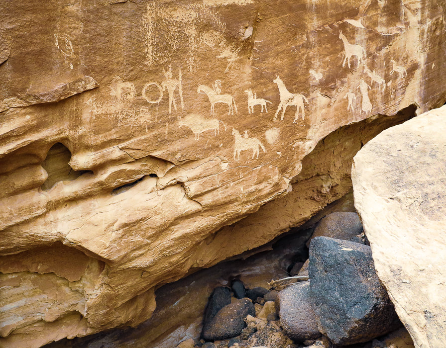
After you get back onto Frying Pan from Cassidy Arch, you'll probably run into hikers coming from the Grand Wash Trailhead to the southeast. Frying Pan Trail is longer but so beautiful and less populated. Grand Wash is a peaceful walk between high walls with dark stripes of manganese and iron minerals contrasting with orange and light yellow sandstone. There's many interesting erosion features such as honeycomb weathering, or tafoni - holes produced in the sandstone from water, wind and ice on surfaces facing the sun. Every turn, every bend brings another great sight to see. Petroglyphs, pecked into sandstone panels, appear near the end of the wash. I'm always intrigued by the people who made these - what did they look like? What tools did they use? What did they eat? I had a great time learning about them when I was writing my petroglyph post - In Search of the Rattlesnake Petroglyph. The road walk back to the trailhead was worth it - It's hard to top Frying Pan Trail - thanks to Stav is Lost for giving us the idea! There is so much more to explore in Capitol Reef, we plan on getting back to this incredible land. I recommend hiking Upper Muley Twist Trail off Burr Road in the southern part of Capitol Reef - it elevates you to an amazing view of the Waterpocket Fold.
Keep on Exploring!
View of Cassidy Arch (top right) from Cassidy Arch Trail descending into wash with intersection to Grand Wash Trail.
Grand Wash
Some cool stuff on the trail: click on the milkvetch and petroglyph photos for more information.
For the Geocurious - The Waterpocket Fold
As national parks go, the map of Capitol Reef is unusual. It's long and vertical area encompasses the Waterpocket Fold, a part of the Earth created during the Rocky Mountain building phase ~ 70 - 50 million years ago. Horizontal rock layers were pushed up by compressional stresses on one side by an underlying fault, creating a classic monocline (mono = one, cline = incline), a steep "ramp" of rocks 4,000 feet higher on the west side than the east. It was further uplifted 15 million years ago, exposing more of the strata to erosion to create "waterpockets" - holes in the rock of varying sizes. Increased tilt of the layers created increased gradient of streams, which accelerated erosion. This unique geological phenomenon revealed strata laid down hundreds of millions years ago in red rock country that has weathered into domes, canyons, arches and cliffs. There are a few scenic loop drives in Capitol Reef NP - a popular drive is Notom-Bullfrog Road/Burr Trail/Scenic Highways 12 and 24 loop. Burr Road crosses the Waterpocket Fold and is incredibly scenic, giving ample geologic "feast for the eyes", especially for the "geocurious". 
Image of Waterpocket Fold from NASA Earth Observatory
A good You Tube video features Capitol Reef park rangers describing in simple terms the creation of Waterpocket Fold:
Monocline Explained: Capitol Reef National Park 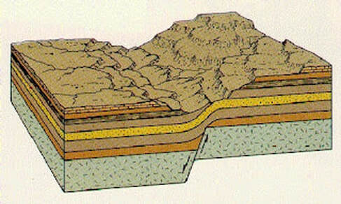
Illustration from Written In Stone - Seen Through My Lens of a classic monocline like the Waterpocket Fold. Compression in the brittle underlying bed rock causes faulting and folding with east-directed forces during mountain-building and the whole Colorado plateau was uplifted. The western block was pushed onto and over the east block causing the fold. This was initiated by the Farallon Plate sliding under the North American Plate.
Our GPS tracks for entire loop - on top of the Waterpocket Fold.
Fred in Grand Wash.
Grand Wash
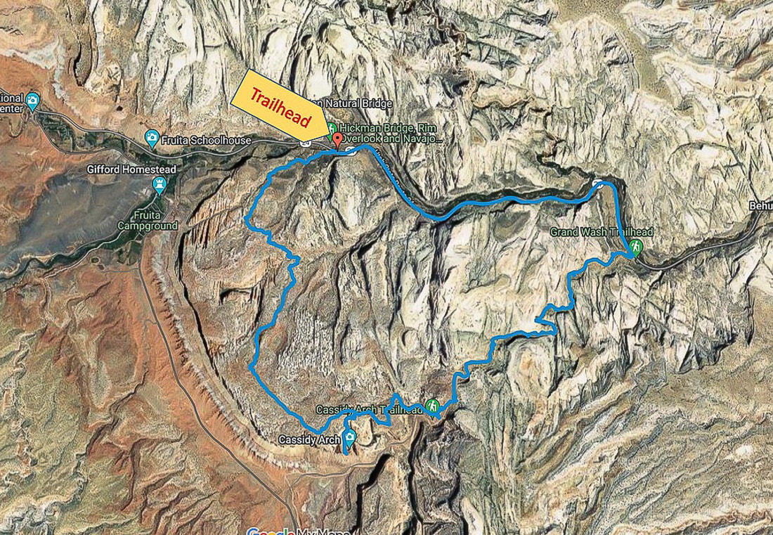
Our GPS tracks and profile. We hiked counterclockwise from Hickman Trailhead on Hwy 24 to Grand Wash Trailhead.
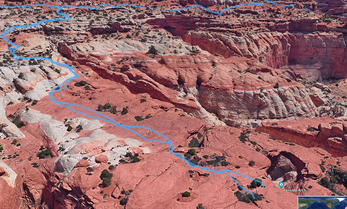
Google Earth image of our tracks from intersection of Cassidy Arch Trail/Frying Pan Trail (top left) to Cassidy Arch (bottom right).
References
Butch Cassidy- Outlaw - His Early Years. Capitol Reef Country (website). Wayne County Tourism. Capitol Reef Administrative History. Chapter 4: Mormon Settlement. U.S. National Park Service. Capitol Reef: The Waterpocket Fold. Capitol Reef Country. Flight Plan: Part II – Geology of the Circle Cliffs Uplift and the Waterpocket Fold at Capitol Reef National Park. From website: Written In Stone - Seen Through My Lens. NASA Earth Observatory. Traces of an Ancient Watery World In Capitol Reef. Website entry on 5/2/22. Olson, V, Olson, H. 1990. Capitol Reef: The Story Behind the Scenery. KC Publications, Inc. More evidence on how exercise helps our brain and immune system, increase our resiliency and decrease anxiety and depression, and how "nature experiences" decrease rumination, a negative emotion. Plus, scenes from a few walks in Snow Canyon State Park.
More resources on Exercise and Mental Health and the Neurofit Lab's Mental Health Tool Kit at end of this post. 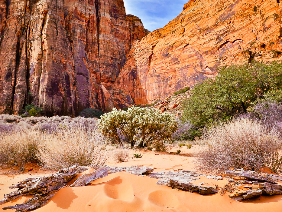 Red Sands trail in Snow Canyon State Park Next month I will be back with another adventure post - in this and the last post, I wanted to pass along the positive news of the mind/body connection and how we can find strength, resiliency, optimism and better health. Many of us know the connection between a walk in nature and feelings of optimism, relaxation and happiness. Hiking elevates your mood, decreases anxiety, and helps open your mind for creativity. For the lucky ones, including me, nature is virtually outside my front door. I'm close to Snow Canyon State Park near St. George, where I can walk in the famous picturesque world of Utah's red rock country. However, you don't need this dramatic scenery in order to improve your mood. A study by Stanford University on nature experience and the brain has found that participants who walked in a grassland/oak/shrub environment "greenspace" reported greater feelings of well-being and less stress than those who walked in an urban setting. The question is, "what effect does living in an urban environment have on our mental health?" What surprised me is that humanity is removed from nature more than ever: more than 50% of people live in urban areas. The forecast for the proportion of urban dwellers in 2050 is 70%. Yikes! 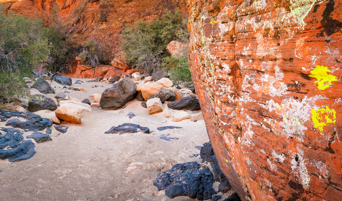 "Running is Medicine for my Mind": All the Good Brain Neurochemicals In her Nike Trained: Mental Health Miniseries podcast, neuroscientist and expert in brain health, Jennifer Heisz, PhD. discusses her recent research that shows a definite connection between exercise and movement and the release of brain neurochemicals that decrease anxiety and depression. Her new book, Move the Body, Heal the Mind: Overcome Anxiety, Depression, and Dementia and Improve Focus, Creativity, and Sleep, highlights her latest research in her Canadian lab. Her biggest revelation is that exercise has been found to be equally as beneficial as medication for anxiety and depression, and in some cases, even better than meds. Those that need to stay on their medications, by additionally doing exercise, can lessen potential side-effects from the medications. Heisz also weaves into her book her personal journey of the mental benefits she obtained while training for an Ironman Triathlon - resiliency is one. She made the huge transition from a sedentary academic to a triathlete to experience first-hand exercise's effects on the brain. Because the Ironman Triathlon was cancelled due to the pandemic in 2020, she laid out and completed her own course! Dr. Heisz's website for her book and back story. Exercise, because it acts as an anti-inflammatory, has been found to strengthen the immune system to fight infections. Chronic stress that can cause stress-induced depression compromises the immune system. A health paradox that Heisz discovered from her research, especially apparent during the COVID pandemic, was that many of us wanted to exercise more to improve our mental health, but symptoms of depression and anxiety were getting in the way of doing so. A recent study found that active participants reported less stress during shelter-in-place than did non-active participants.
Endocannabinoids, our body's natural production of cannabis are produced during exercise, helping us to feel mellow, balanced, and content. Endorphins, the body's natural pain killer are also released. I like to say that hiking produces the vital nutrients to thrive - my medicine! In my last post, Experiencing "Flow": The Secret to Happiness, I wrote about what I've known for years: hiking and exercise is crucial for my mental health. Going to a Tai Chi class for eight years really helped me handle and the stress I felt from work. A boy in my class was learning how to utilize Tai Chi for his ADHD disorder, rather than use medications. High-Intensity Interval Training - HIIT During HIIT, you push your body through intervals of near maximal effort with rest in between. In almost all cases, high intensity interval training is beneficial for people with mental illnesses. By maintaining a certain level of stress, your body learns to adapt and then becomes stronger. There is one caveat: people who have anxiety sensitivity, or fear of the normal symptoms that accompany exercise may react negatively to HIIT. Some people are afraid of their hearts beating too fast, or of the feeling of trying to catch their breath, and they over-exaggerate their symptoms. These people benefit from lower intensity exercise, potentially increasing fitness by adapting to increments of challenging exercise.
Neurochemicals immediately released in your brain after exercise.  Basalt flowed into what is now Snow Canyon State Park, covering red and yellow sandstone.    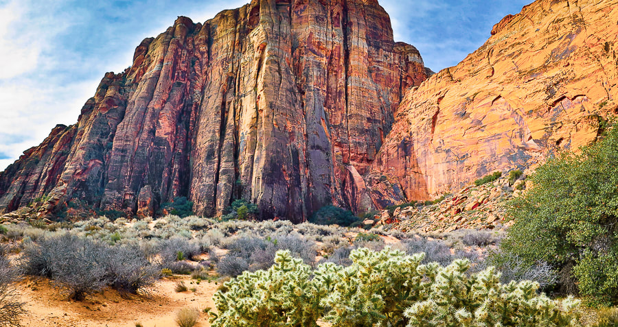 Reduce Rumination - Feel Better! The Stanford study set out to answer the question: "by what mechanism(s) might nature experience buffer against the development of mental illness?" (quoted from the study). It found that nature walks decreased rumination, a dysfunctional pattern of negative self-thought that's associated with depression and other mental illnesses. The subgenual prefrontal cortex becomes activated during rumination. Participants had a brain scan which showed blood flow to this part of the brain. The researchers' hypothesis was correct: blood flow in the subgenual prefrontal cortex decreased after the nature experience used in the study, thereby reducing rumination. This state of decreased rumination also occurs with experiencing "flow" where you are so wrapped up in an activity that you focus on the joy it brings, rather than yourself. Flow occurs in all sorts of people, in all sorts of endeavors where levels of challenge and skill are more or less are equal and at relatively high levels. Thousands of people have been interviewed to share their flow experiences: monks, writers, artists, mountain climbers, surgeons, etc. A common theme is reported - a feeling of optimal happiness and satisfaction. Mix in friends on your hike and nature walks and you have the perfect ingredients for contentment, hope, and happiness. We need to take care of our mental health just as much as we do our physical health, and the research linking movement and mental health is long overdue. Our bodies are a gift! These studies also illustrate the importance of "green spaces" in our urban areas to help reduce mental illnesses. For help with motivation, you can download the Mental Health Tool Kit from Dr. Heisz's Neurofit Lab that identifies problems encountered since the onset of COVID and solutions to get you going. Keep moving, keep hiking, keep exploring! "The wonderful things in life are the things you do, not the things you have." - Reinhold Messner, mountaineer
     Sunrise near Snow Canyon State Park's entrance. Books on Mind/Body Connection and Movement
On-Line Article The chronic stress of coronavirus is affecting your mental health. Here's how exercise can help. The Conversation. Dr. Heisz's Trained Podcast Dr. Heisz's book and back story website
References
Bratman, G., Hamilton, J.P., Hahn, K., Daily, G., Gross, J. 2015. Nature experience reduces rumination and subgenual prefrontal cortex activation. PNAS. Cirino, E. 2019. Ten Tips to Help You Stop Ruminating. Healthline website. Dusenbery, M. How Exercise Affects 2 Important 'Happy' Chemicals in your Brain. Livestrong.com NIH - National Library of Medicine. Physical activity and stress management during COVID-19: a longitudinal survey study. January 2022. Nike Trained: Body and Mind Mental Health Miniseries - Jennifer Heisz, PhD. Podcast: Season 9 Episode 9. Rogers, Marilyn. Doctors Tell Us How Hiking can Change our Brains. From website Lifehack. https://www.lifehack.org/363786/doctors-agree-hiking-good-for-your-mental-health
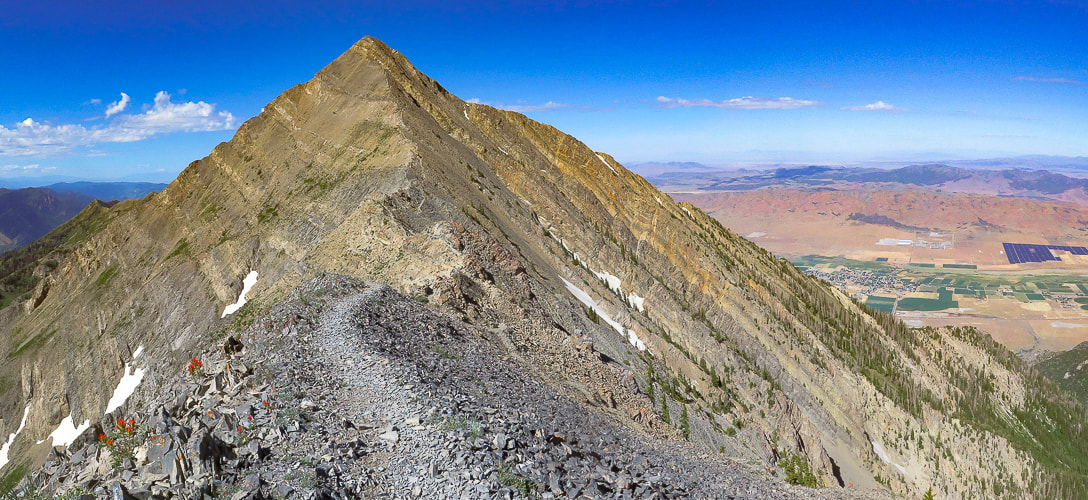
Break out of the "typical" southwestern Utah hike to discover more remote and interesting backcountry adventures. A short hike up Jarvis' northwest ridge rewards with expansive views of two distinct physiographic regions: the Colorado plateau to the east and the Mojave Desert to the southwest.
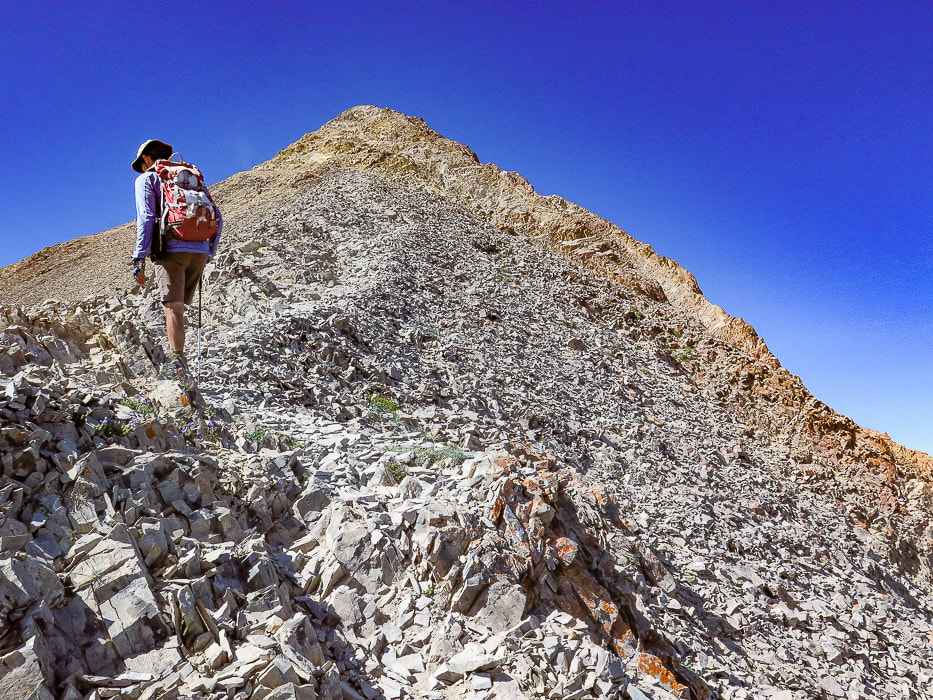
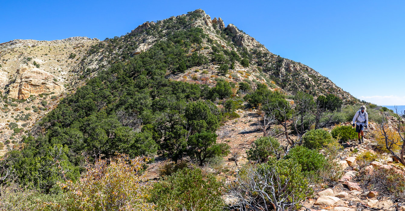
Approaching the final ascent on Jarvis Peak's northwest ridge.
Easier route switchbacks just left of summit through pinyons and junipers. Want a more "exciting" ascent? - go around to the right beneath the crags. 
View of Jarvis Peak (highest point on the left side of range) from near summit of West Mountain - Beaver Dam Mountains.
Trip Stats
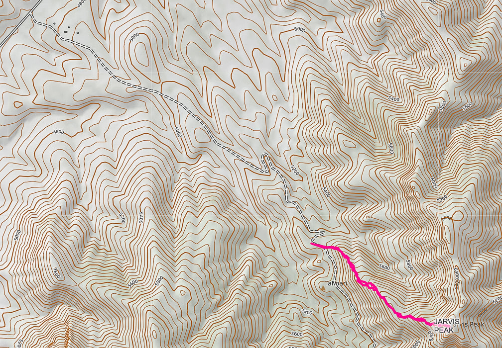
Location: Beaver Dam Mountains, west of St. George, Utah. This mountain range extends into northern Arizona. Distance/Elevation Gain: 2 miles out and back: 1,100' gain. Start of ridge = 5,453', summit = 6,533'. Coordinates: Trailhead: UTM 12S 0250585E 4108377 N (WGS84). Jarvis Peak: 0251503E 4107770 N. Difficulty: Moderate Class 1 and Class 2 with minimal exposure if use north route around summit block; Class 3 moderate exposure south route. Maps: USGS 7.5 min topo map - Jarvis Peak, Arizona Strip Visitor Map from BLM, All Trails app. for Jarvis Peak. Date Hiked: October 2, 2021 Considerations: High-clearance 4WD needed on access road to base of Jarvis' west ridge, due to rocks and ruts. Walking the road adds 1.7 miles one way. Driving Directions: From St. George, drive northwest on Old Highway 91. Soon after you pass Ivins and cross over the Santa Clara River, reach a junction with Hwy 91 and Gunlock Reservoir. Take a left to stay on Hwy 91. Travel 7.1 miles to the Utah Summit. At the pull-off parking area to the left (east), follow gravel road (not marked and steep and rocky in parts) east for 1.7 miles to a pull-off to the right at a sharp left switchback in the road and park. Jarvis' western ridge to the left is gained in a few hundred feet of walking further on this road. Hike Directions: shortly after parking, walk up road a few hundred feet to see a path on left side of gravel road to gain Jarvis' ridge. Trail is seen most of the hike, with occasional rock cairns - basically stay more or less on top of the ridge. On the way up, the trail treks slightly left of the ridge to avoid cliffs to the right. At the final saddle below the last steep ascent, go up through the trees to the left of the summit for an easier route. We went around the summit's right (south) side but found it difficult to reach summit due to Class 3-4 climb up final summit block.
Related:
Overview
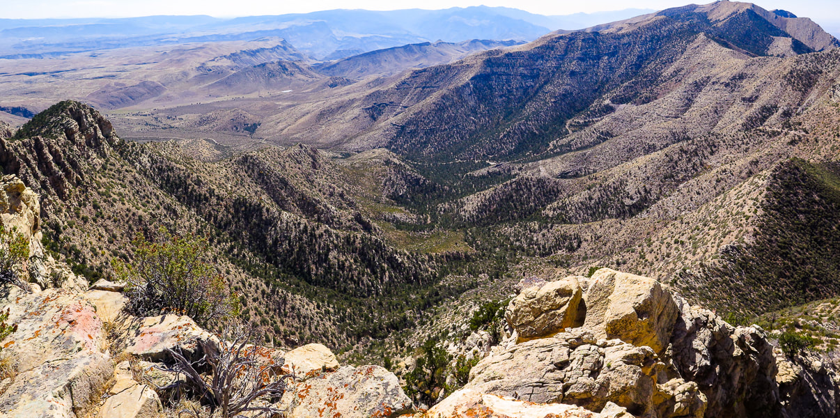
You would think that a spectacular 360-degree multi-state and multi-region view from a summit is earned only after a long and arduous hike, but not true with Jarvis Peak. After a short drive from St. George in southwestern Utah and a short one-mile hike, we were looking at Arizona on one side, and Utah on the other. To the northeast, a fantastic view of Red Mountain's cliffs stands out in a long crimson row beneath the snow-dusted peaks of the Pine Valley Mountain Wilderness. The rock towers of Zion Canyon capture the horizon to the east. The huge, dry and rugged Arizona Strip, north of the Grand Canyon with its mountain ranges and alluvial fans spreads to the south. West Mountain Peak with its communication towers, the highest point in the Beaver Dam Mountains (7,680'), is seen not far away to the northwest. The Beaver Dam mountain range is a "sky island" that rises high above a sea of thinly vegetated, dusty, stark, and monotone desert, with the exception of the bright red sandstone in the St. George area. It's great that we can choose either mountains or low desert, according to seasons. It feels like wilderness until you see the cities of Ivins and St. George to the east. The Beaver Dam Mountain range straddles three distinct physiographic regions (provinces) of the southwest -a "geologic triple junction": the Mojave Desert, the Colorado Plateau and Nevada's Great Basin. If you live in St. George, you have access to all of these regions. I know the grandeur of Zion National Park can't be beat (except by the Grand Canyon), but the solitude, beauty, and geologic features of the remote backcountry and wilderness surrounding it is just as noteworthy. Fred and I are discovering that this huge region of southwestern Utah is an adventurer's paradise. And since I am a self-described "geology nerd", there is a lot of area to study and learn about in this region (see "For the Geo-curious" below). 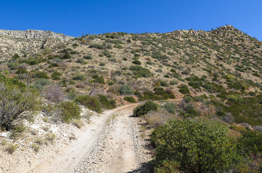
Beginning of hike, just a few hundred yards from parking on this road; trail leading up to top of ridge - Jarvis Peak behind ridge in this photo.
Quite possibly Mojave prickly pear, AKA Old Man prickly pear.
Our Hike
The huge view of southern Utah and northern Arizona from Jarvis Peak is just a one-mile hike from start to summit. It's not everywhere you can get a grand view in such a short distance. The gradual climb up the northwest ridge is not hugely exciting, but if you go around the right (south) side of the mountain it gets a lot more interesting with Class 3 climbing up final cliff to summit. We summited using the left (northwest) side of the peak. The 1.7-mile 4-wheel drive road from Utah Hill on Highway 91 to the base of Jarvis Peak's northwest ridge gradually becomes steeper, more narrow with ruts and rocks. If you choose to walk the road, the total hike distance out and back would be ~ 5.5 miles. The trail to Jarvis Peak begins just a few hundred yards after parking up the gravel road. It gains the ridge pretty quickly and then stays on it, going through thickets of manzanita and ducking under junipers and pinyon pines. It is marked occasionally by rock cairns as it meanders in sand around and on top of sandstone rocks. The greens of prickly pear, pines, juniper and lichens mix perfectly with the reds of manzanita branches, stained sandstone and pinyon pine cones to create a pleasing southwest desert landscape. 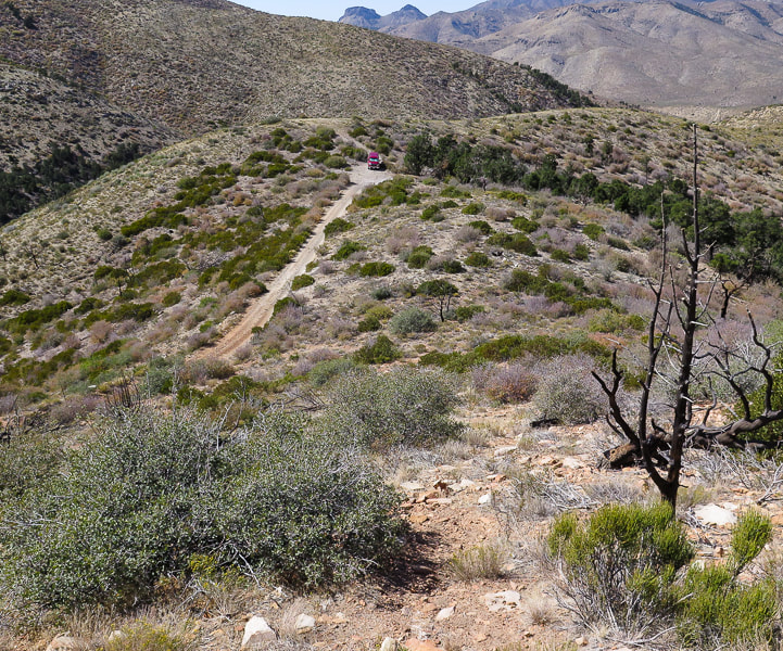
Trail (bottom) not far from where we parked (top of image).
One of the largest junipers I have ever seen!
We stayed as close to the crest of the ridge as possible. This hike rambles up a series of short climbs and short saddles. Upon reaching the last saddle at the base of the final summit ascent, there is a large rock cairn placed toward the left side of the base. We ignored its subtle direction, telling us to go left. Instead, we first went to the right around the south side of Jarvis Peak, stepping quickly across a loose-rocked steep gully to the back of the peak. I found the short and final Class 3 climb up a vertical crack in cream-colored Queantoweap sandstone was too exposed, because the platform is narrow, slippery and drops steeply. So, we retraced our steps and went by some cool-looking sandstone caves, back to the rock cairn and then found our way up through a gentler, but still steep slope to easily gain the summit.
A rock cairn marks the base of the final peak ascent, directing you to the left side of the summit, up through trees.
We originally went around to the right - up the canyon in shadow with two pinnacles, but I found that final summit cliff too daunting; we came back down and climbed to left of summit through the trees.
Heading toward south side of Jarvis Peak
Maneuvering around the steep back side of summit - Fred behind sandstone ourcrop lower left.
The backside (east-facing) of Jarvis Peak with the sandstone cliffs on east side of its summit.
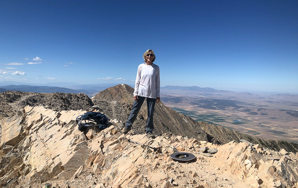
Jarvis Peak summit looking to the east: Red Mountain near St. George and Pine Valley Mountains on horizon.
Huge pine tree on southeast side of summit.
For the Geo-curious
Jarvis Peak is located in the eastern Beaver Dam Mountains where a "magnificent set of sedimentary rocks" is described by authors of Geologic Map of the Shivwits Quadrangle, Washington County, Utah. This area of southwestern Utah/Northern Arizona is geologically significant not only because it includes all the major rock types - igneous, sedimentary, and metamorphic, it also sits between the Colorado Plateau to the west which includes the red and orange rocks of Zion National Park, the Great Basin and Range Province to the west, most easily described as parallel mountain ranges caused by spreading, and the Mojave desert to the south. The geology in the Beaver Dam Mountains is certainly not lacking in variety; it includes major folds as well as structures caused by the earth spreading, alluvial fans and just about every kind of fault. The Redwall Limestone forms impressive cliffs and has abundant coral fossils. It was easy to find geologic maps. You will be hiking on Queantoweap Sandstone (Permian period) on the way up to and including Jarvis Peak, and on its west side look over siltstone and limestone containing fossils. This sandstone is massive (homogenous, lacking internal structure), cliff- and ledge-forming, gray to pink in color, best seen on the right (south) side of peak.
Apex Mine - just one mile south of Jarvis Peak. More recently, ore was mined for its gallium and germanium content. Gallium is used in semi conductors and electronics. Germanium's uses range from infrared optics to cloth and food containers. Copper and silver were originally taken from this mine 1884 - 1962. These are samples of azurite found in this mine. Photos from mindat.org.
Queantoweap Sandstone on Jarvis Peak
Note the honeycomb weathering in upper cavernous recess.
View from the top - road possibly to Apex Mine.
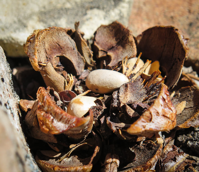
Pinyon pine cone and its seeds - AKA pine nuts
Interactive Google map for Jarvis Peak hike.
Our GPS tracks from access road leading from Utah summit on Hwy 91 to Jarvis Peak.
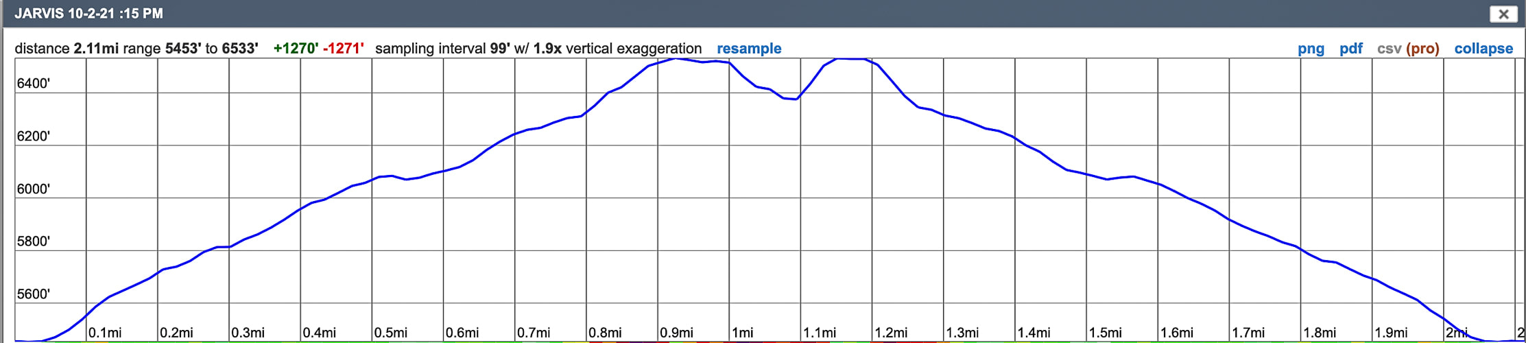
Profile for Jarvis Peak: only one mile to the summit.
The dip in the profile at the summit shows that we reversed our course and went around to the other side to reach summit.
References
BackroadsWestTrip blogs - Unique Landscapes of the Southwest - backroadswest.com. Hammond, B.J. Geologic Map of the Jarvis Peak Quadrangle, Washington County, Utah. Hintze, L.F., Hammond, B.J. 1994. Geologic Map of the Shivwits Quadrangle, Washington County, Utah. Utah Geologic Survey. McNair, A.H. 1951. Paleozoic stratigraphy of part of Northwestern Arizona: American Association of Petroleum Geologists Bulletin, v. 35, no. 3. Mindat.org. Apex Mine. Washington County Historical Society. The Apex Mine (from internet). Explore this "hidden gem" in the Red Mountain Wilderness; a primitive trail that quickly elevates the hiker from city to a spectacular and peaceful plateau in the southern Utah red rock wilderness. 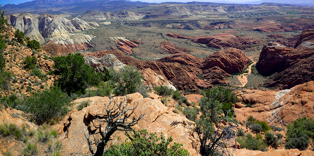 On top of Red Mountain overlooking Red Sands Trail (wash), part of the Padre' Canyon Loop in Snow Canyon State Park. Considerations: The first mile from the Ivins trailhead is Class 1 with two short Class 3 maneuvers. Once the trail tops out, there is no marked trail. Experience with navigation and route-finding using a compass/GPS and topo maps is required after top of Red Mountain is reached to avoid getting lost. A sign at this trailhead reads, "Hazardous, unmaintained route with steep exposed slopes: your safety is your responsibility." Recommend taking a GPS waypoint at critical points on the trail such as point where you enter the plateau from the cliffs. Search and rescue operations for lost hikers have occurred. Be prepared if you have to spend the night! Research this route thoroughly!
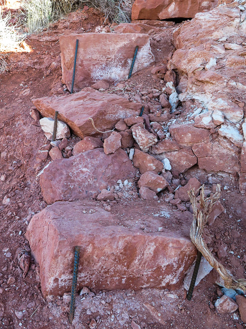
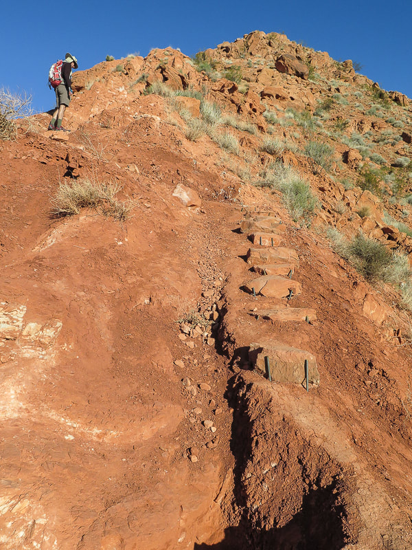
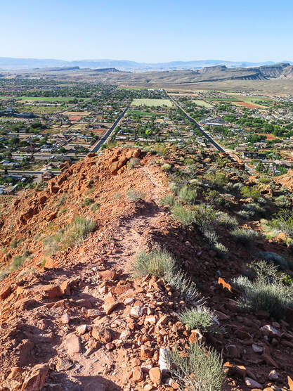
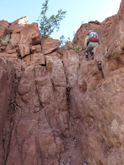
2/5/23: Three rescues in Washington County on the same Day (St. George News). Trip Stats - Ivins Trailhead Overview: Within a few steps of Red Mountain's steep cliffs overlooking the bustling desert cities of Ivins and St. George, Utah, enter a quiet and sublime wilderness of pinyons, junipers and mule deer that is unmarked except for an occasional cairn. The Red Mountain Primitive Trail extends for 11 miles in the Red Mountain Wilderness through saddles crossed by washes and slickrock basins between rocky sandstone spires and crags, with spectacular views of Snow Canyon State Park We hiked this trail's southern 3.5 miles. Location: Red Cliffs National Conservation Area (BLM) in the Red Mountain Wilderness north of Ivins, Utah. Southern trailhead starts at intersection with Toe Trail, at the north end of North 200 E Street in Ivins. North trailhead is just off Highway 18, 15 miles north of Bluff Road in St. George, north of Snow Canyon State Park. Distance: We hiked 3.6 miles of the 11-mile trail, out and back for a total of 7.2 miles. Elevation: Southern trailhead = 3,189': our top point = 4,930'. Difficulty: Mostly strenuous Class 1 on first 0.8 miles; a short section is Class 3 using hand- and foot-holds to maneuver up rocks with mild-moderate exposure. Once on top, navigation and route-finding on unmarked terrain Class 2. Lat/Long: Ivins Trailhead (south): 37.1754 -113.6772. Top point of our hike overlooking Snow Canyon: 37.2129 -113.6707. Trail at Ivins descent (top out onto plateau): 37.1842 -113.6783. Water: Plan on packing in your water. Permit: None Date Hiked: May 9, 2021. Maps: Google Maps Interactive map below Trail Map and Guide for: St. George, Hurricane and Zion NP, Utah - Adventure Maps.net Santa Clara 7.5 minute topo map (PDF). BLM Red Mountain Wilderness Map. See maps of our tracks below. Geology: Red Mountain's lower slopes are from the Kayenta Formation, the oldest rock in Snow Canyon State Park (190 million years). The horizontal sediment layers are made from rivers depositing mudstone, siltstone and sandstone. The upper slopes, cliffs and top of Red Mountain are a great block of Navajo Sandstone that is younger (180 million years), also seen as a major rock unit of Zion National Park. This Navajo Sandstone exhibits large, sweeping cross-bed features - horizontal and dipping layers of ancient sand dunes deposited in a vast eolian (wind carried) dune field. Red Mountain is bounded by the Gunlock Fault on its west side. It merges with an extensive field of 2.4 million - 2,000 year old basalt flows to the northeast. The Gunlock Fault is a normal fault with the down-drop on its west side (See references below). Desert Tortoise Habitat Conservation and Large Solar Plants
Mojave Desert Tortoise near Toe Trail at base of Red Mountain Don't get to see these very often - as tortoises can spend as much as 95% of their lives underground in burrows. The U.S. Fish and Wildlife Service has listed this species as "threatened". Recent News: The Sierra Club is one of several environmental groups opposing the massive solar plant project, "Gemini", which would cover 14 square miles (the equivalent of 7,000 football fields) with solar panels, northeast of Las Vegas, Nevada, prime desert tortoise habitat. The Interior Department approved the project, stipulating Arevia Power would have to relocate tortoises to a new habitat. "U.S. Fish and Wildlife Service estimates 15,390 tortoises stand to lose nearly 70,000 acres of habitat in solar projects planned for the Southwestern Deserts." - From The Wall Street Journal, 6/5/2021. 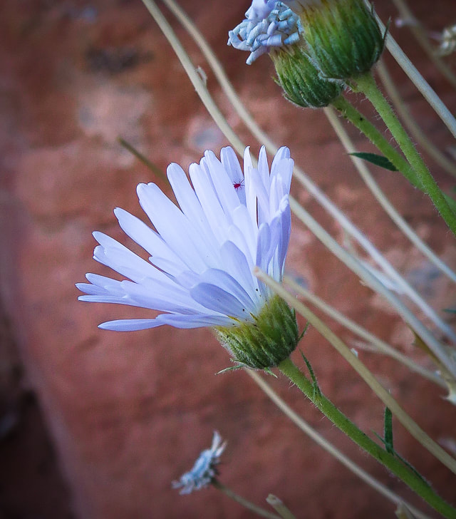
Our Hike (from Ivins trailhead) It looks impossible to climb, but If you can get up the steep side of Red Mountain and maneuver through its short sandstone cliffs to the dune-like pink-orange sand at the top, you will enter into a beautiful and seldom-visited shrub and woodland ecoregion. Most are satisfied to end their hike in this soft sand to see the cities of Ivins and St. George sprawling 1,400 feet below. Very few venture beyond this onto Red Mountain's long plateau made of washes, spires, wildflowers, pinyon pines, junipers, scrub oak and slick rock basins. This is designated as a "primitive" trail; it is not officially marked. If you want to get some mileage in, you must hike pretty much due north, avoiding deep canyons to the west and east. We found saddles and washes to get us to a large sandstone ridge with a faint trail on top and killer views of Snow Canyon State park to the east, where we stopped for lunch. Occasional boot print paths in the sand go a short distance and then disappear; rock cairn trail markers are few and far between. What makes this hike exquisite is that it combines vegetation from both the Central Basin and Range to its north and Mojave Basin and Range to its south, creating a great diversity of flora and fauna. This, along with dramatic views witnessed in solitude makes this hike special. 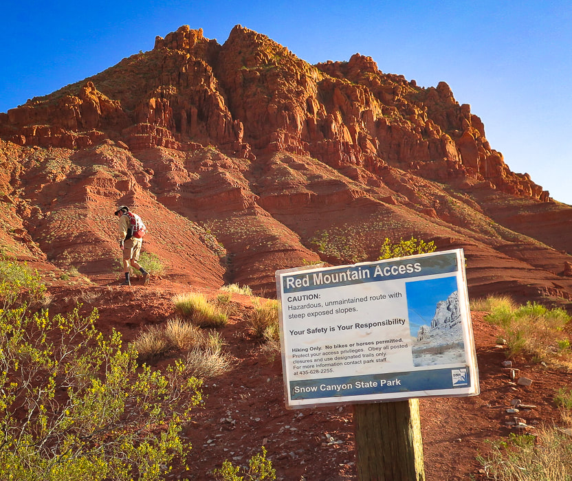 The southern end of Red Mountain A good example of two different rock units: the older Kayenta Formation deposited in large streams at the bottom, and the Navajo Sandstone vertical cliffs and ancient sand dunes deposited mid-slope and on top by wind-carried sand. Initial Climb - 1,400 feet in 0.8 miles The initial climb to the top of Red Mountain from the city of Ivins is nearly 1,400 feet in 0.8 miles. Someone during the past year has expertly placed rebar and other metal posts to hold the fast-eroding slopes in place. Rock cairns mark the initial trail. Fun Class 3 climbing (I say "fun" because there are enough hand-and foot-holds so it's not too scary) is required in two spots mid-mountain to get through its cliff band. The path has a few switchbacks, but mainly climbs straight up. At the top, progress is slowed as you trudge through deep pink sand; then there is suddenly no trail. Junipers, prickly pears, yuccas and manzanita are scattered about in the sand and on sandstone bluffs and ledges. After climbing through the cliff band, a few small spray-painted white dots on rocks direct you to ascend to the right. I think too many people were going up to the left or straight up at this point, so following the route decreases erosion on this very erosion-prone hike. Before you get to the cliff band, look for the rebar-stabilized rocks - that's the trail.
Rebar holding rocks in place on the steep initial ascent
The trail tops out on ridge overlooking Ivins and Santa Clara, Utah (left), and Class 3 climbing (right).
Class 3 climbing through cliff band 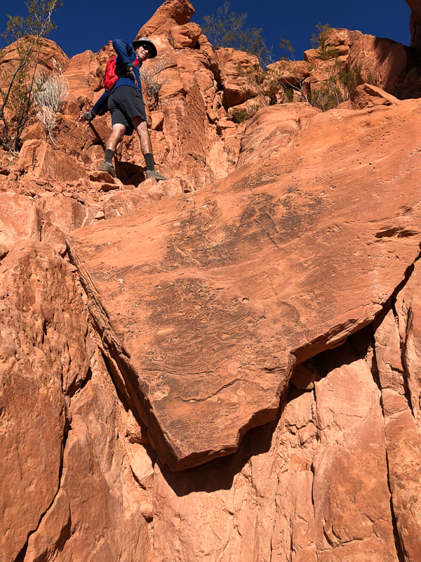 Climb up the left side of this "triangle rock" in the cliff band, about 1/2 way up face of Red Mountain.  Climb through cliff band: Trail on ridge below Lots of foot and hand holds 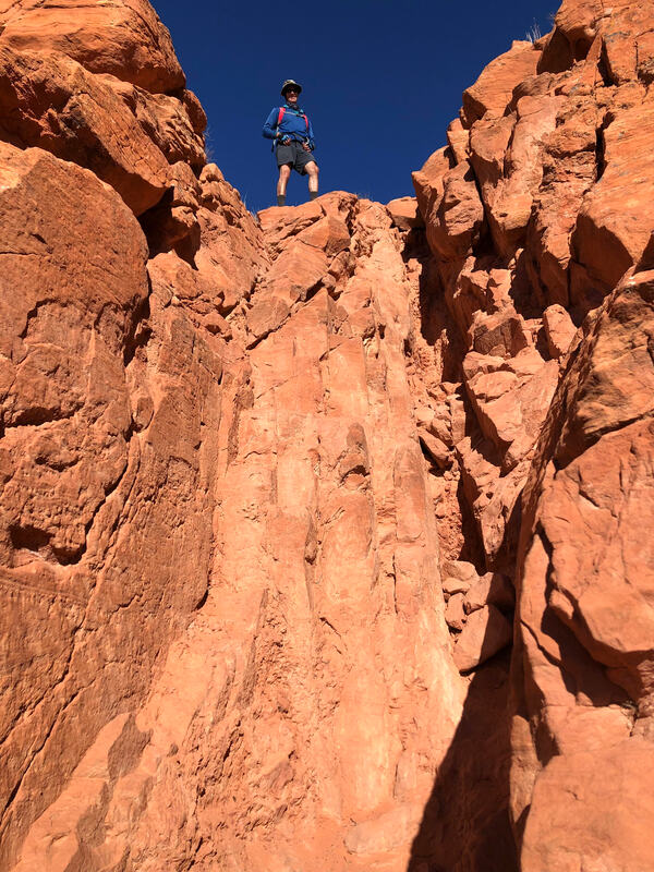 Top of cliff band section 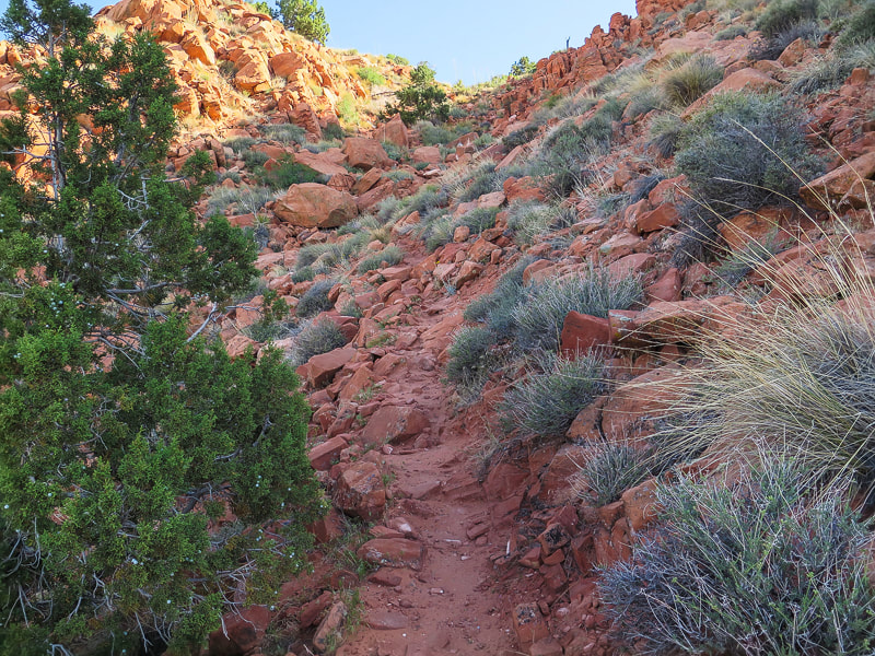 Final climb to top of Red Mountain entry onto its plateau Journey on top of Red Mountain At the entry point onto the plateau, it's a good idea to take note of landmarks around you such as mountains - stay oriented. I also take a waypoint on my GPS. Leaving civilization and steep slopes behind, we entered a colorful and sublime woodland - shrub "ecoregion" filled with manzanita and junipers and started heading north. A high point of sandstone is reached 1/4 mile after entering the plateau, and then a beautiful sandy basin opens up 100 feet below, surrounded with rock piles and small domes. Descend down into the basin through short sandstone steps and shelves, turning from an easterly direction to a northerly direction. This little basin lulls you into it and makes you want to stay and enjoy the complementary colors of sky and sand, of juniper and bright red firecracker penstemon. Once in the basin, we aimed due north for a low, shrub-filled saddle on the horizon; we startled a mule deer that trotted away. We began heading north to this green saddle stretched between red and orange ridges and rock piles. Trudging up soft sand washes, we tried to stay close to the ridge on the right which had amazing views of Snow Canyon State Park's basalt flows and orange sandstone formations. We could see that by venturing too far to the left, we would run into Red Mountain's west cliffs. A slight movement in a shrub alerted us, and then a snake's head poked out. We stood and let it cross the wash in front of us as it gave a cursory rattle; it didn't appear too threatened. Navigating through unmarked wilderness takes more time than following an established trail, as we check topo map and compass a few times. It was not too difficult in this case because the "trail" heads north. The trick is to avoid getting sucked into cliff walls and canyons on the west and find the best way around high points on the east. It's satisfying to be able to figure out a way through unmarked territory, to become more wary of the terrain and to know chances are that where your boot falls, no other has fallen before. 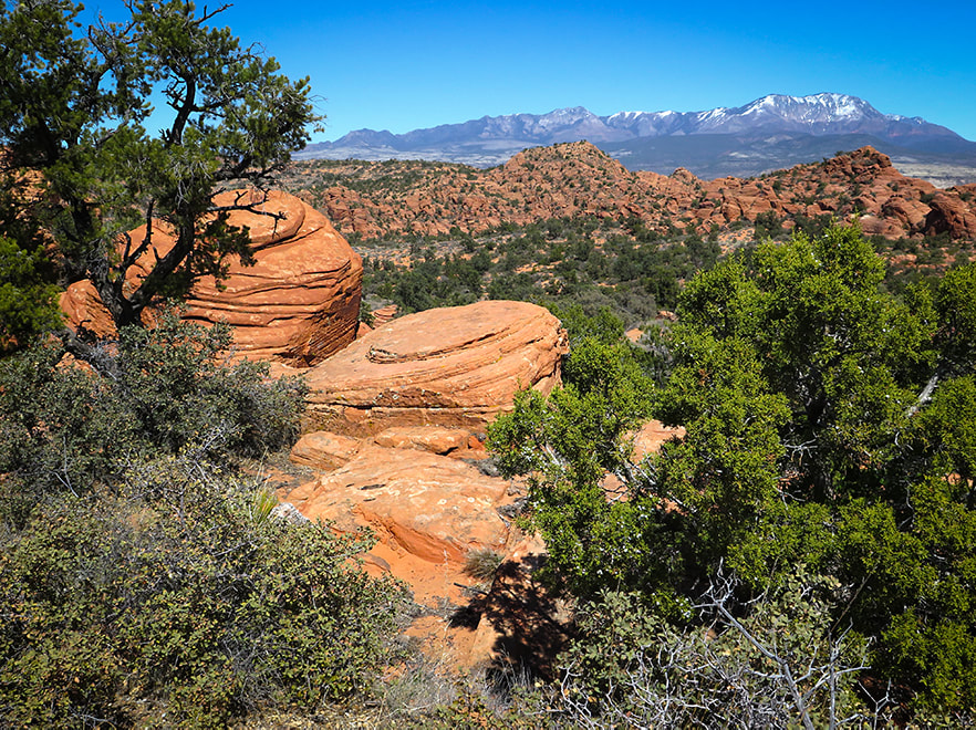 Within 0.25 miles of arriving at top of Red Mountain, reach a rim of weathered sandstone encircling a small sandy basin - head left through basin up saddle to the north. Pine Valley Mountain Wilderness on horizon to the northeast (Burger Peak, 10,320'). 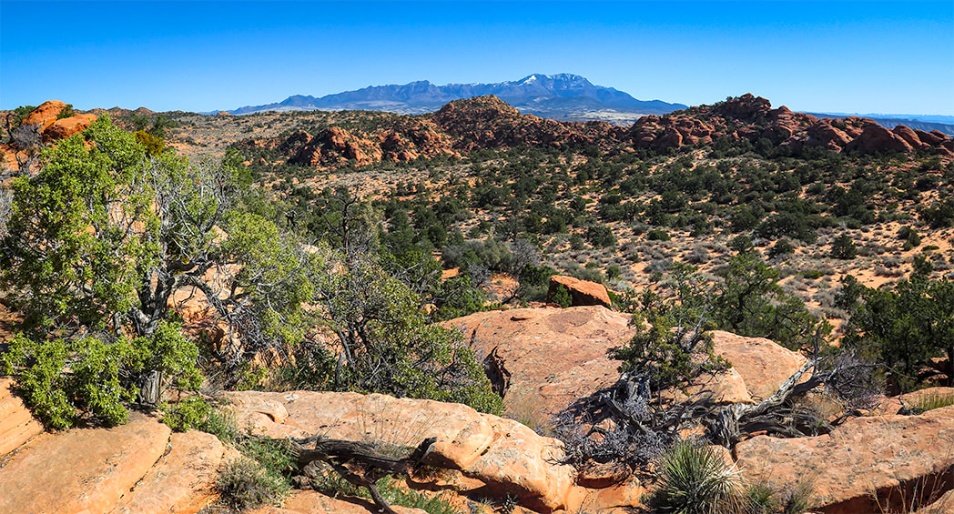 After topping off on plateau, reach this sandy basin surrounded by sandstone 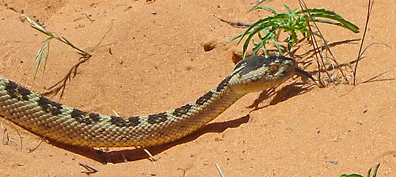 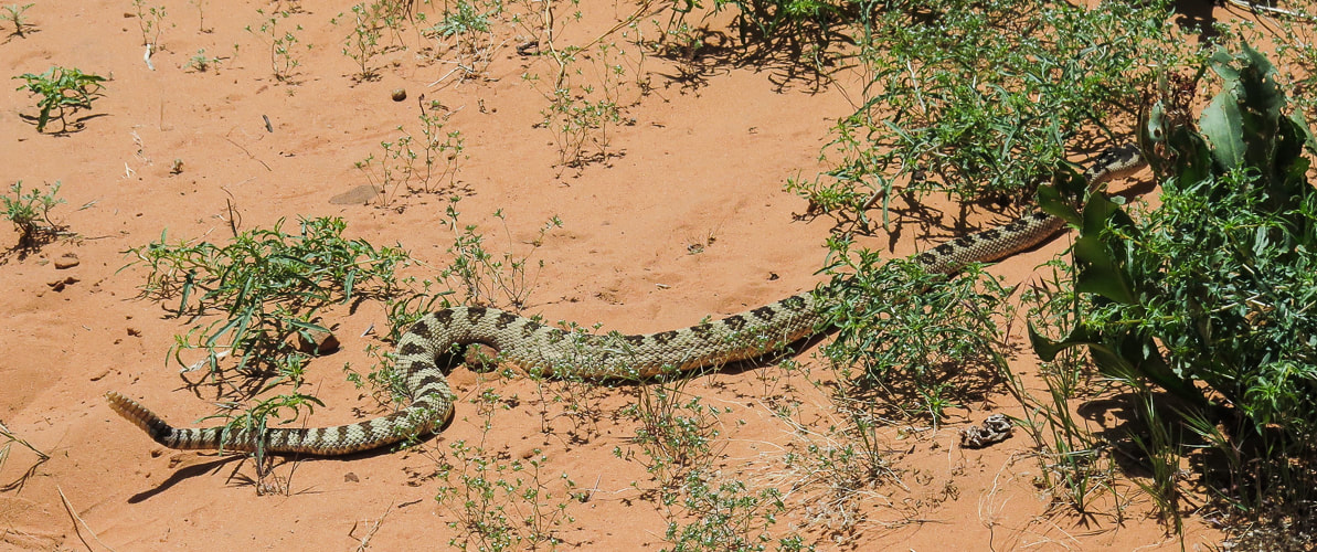
 On the east side of the sandy basin reached shortly after topping off onto Red Mountain. Aim toward the light-green shrub covered saddle on the horizon.
Cryptobiotic (biological) soil crusts, made of cyanobacteria, lichens and mosses. These form on easily eroded soils and increase stability and help provide more water infiltration and are the dominant source of nitrogen in pinyon-juniper ecosystems. These crusts hold the soil in place. Recovery of crusts that have been destroyed takes at least 45 years.  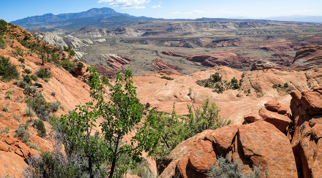 One of the first views of Snow Canyon State Park from ridge of Red Mountain primitive trail. Once we ascended the "green" saddle, we stayed to the right, avoiding slickrock basins to the left. We saw a faint trail that ascended through a beautiful steep-sided arroyo and followed it out onto a rocky hillside. This wash had funneled hikers and created a more defined trail at its head, where we negotiated a few rolling rock hills and topped off on the ridge overlooking Snow Canyon State Park where a few faint trails were present. Pinyon pines became more prevalent at we approached 5,000 feet elevation. A thorough look at Red Mountain Trail's 11-mile north/south traverse on Google Earth shows that there is no defined trail to follow on its southern end. However, a defined 2-track trail coming from Red Mountain's north trailhead can be seen. We ended our 3.6-mile hike on the ridge overlooking Snow Canyon, with a view of Red Sands Trail, a sandy wash that is part of the Padre' Canyon loop hike. Looking at Google Earth, I can see that the 2-track coming from the north can be reached through slickrock basins further to the left/west of our route, avoiding some of the high points along the ridge. Future goal: hike the entire 11-mile Red Mountain Trail. 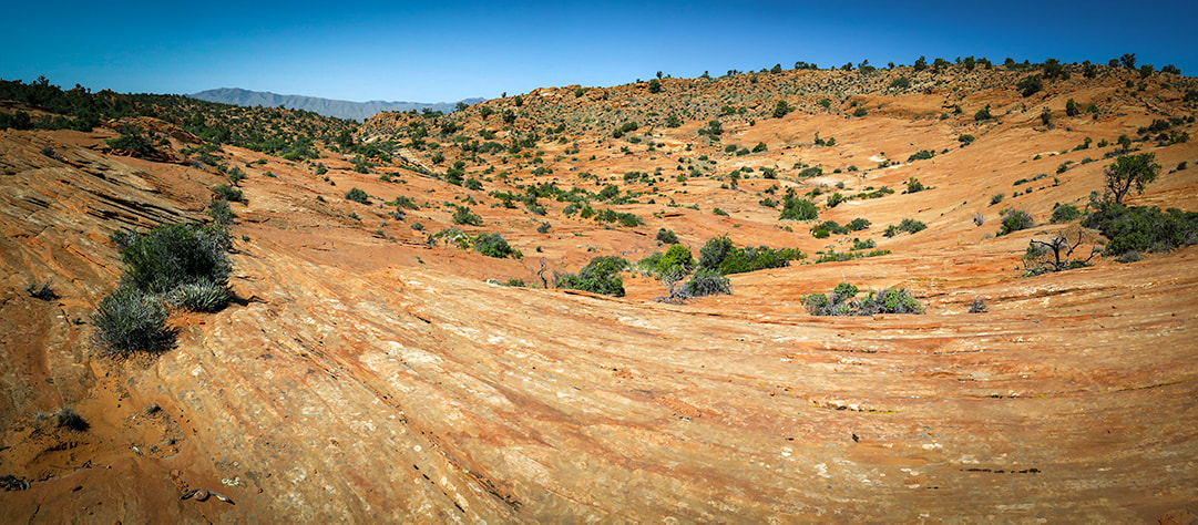 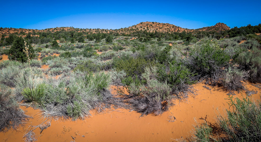 Once over the initial saddle, more washes and shrubs to traverse. Head north through a network of washes and shrubs to rock saddle between two high points on the horizon. 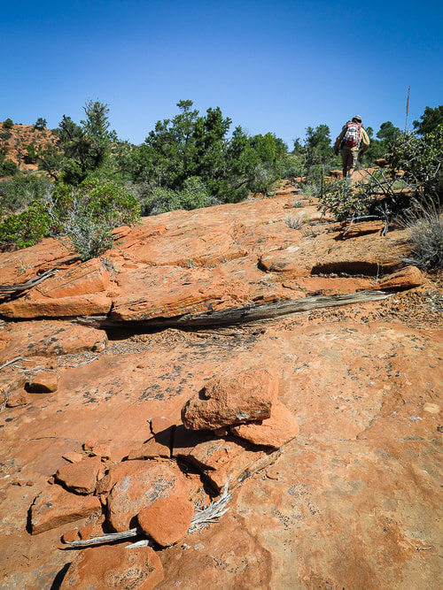 One of the few rock cairns along the way 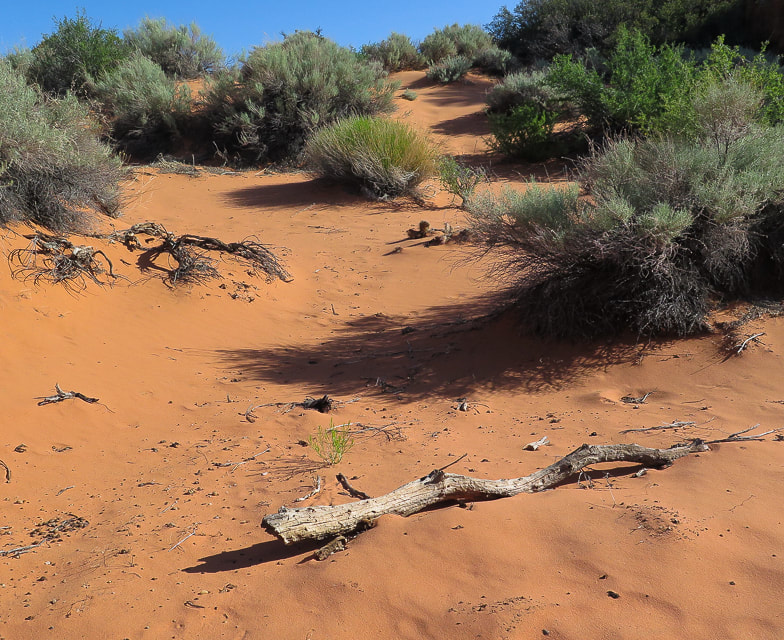 Finding a route through soft sand 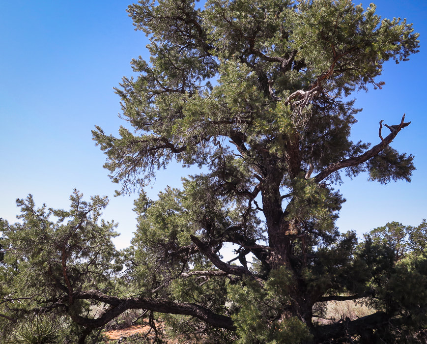 A beautiful example of a Pinyon pine  Small canyon to hike through between open areas. 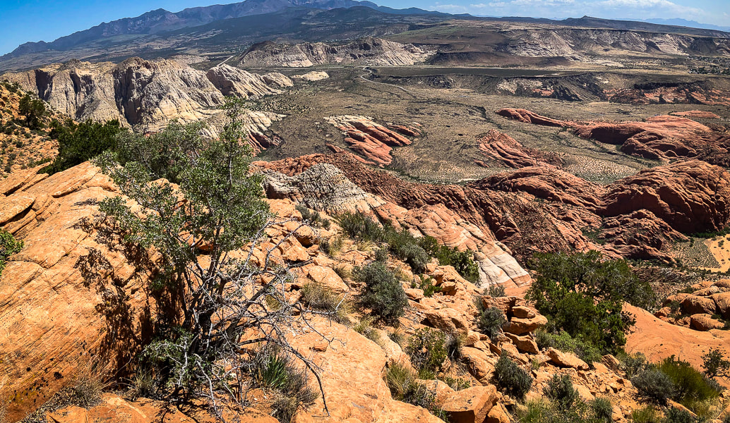 Lunch break view of Snow Canyon State Park and Pine Valley Mountain Wilderness on horizon Basalt flows fill sandstone valleys 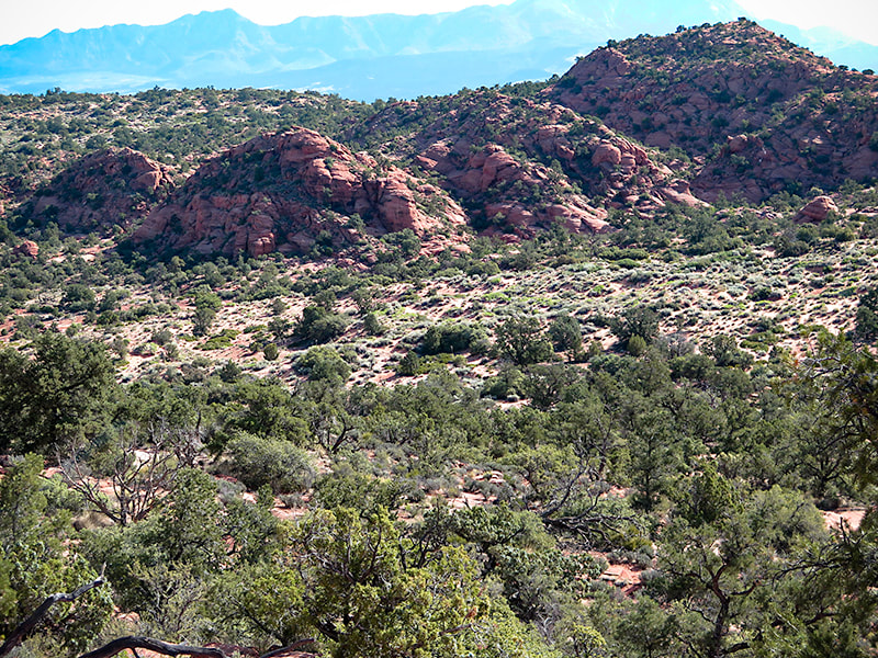 Jurassic sand dunes on top of Red Mountain Turnaround - return to Red Mountain Trail trailhead in Ivins Our lunch rock was elevated 1,550+ feet above the dramatic terrain of Snow Canyon State Park. The red and white Navajo Sandstone is cross-bedded and vertically jointed - remnants of ancient sand dunes. Water has cut valleys that were filled in much later with black basalt flows from the northeast. Looking to the northeast horizon, we could see Burger Peak in the Pine Valley Mountain Wilderness, elevation over 10,000 feet - a peak we climbed last year. Elevated above the surrounding desert, we had an airy 360-degree view. The sandstone we were sitting on was warm from the day's unobstructed sun. We used GPS to track back and use a waypoint to reach the sand dunes at the opening of the steep trail onto the plateau, overlapping our ingoing tracks a few times. The sun had warmed the orange-pink fine sand. I watched a fly, or was it a bee, or maybe a "bee-fly" with a long black proboscis collecting nectar from a yellow flower. It kept a connection with the flower as they both swayed back and forth together in the breeze. In full sun on the west side of Red Mountain, we made it through the Class 3 section, climbing down through the rocks backward and finding enough foot- and hand-holds on grippy sandstone layers. The square houses and street grid of the flat valley below are such a contrast to the irregular and varied shapes on Red Mountain. Back to busy civilization from the serene and beautiful world atop Red Mountain. An added bonus to this hike: buy a thirst-quenching drink from a turquoise-painted refrigerator with the red words, "Cold Drinks" at the side of the house next to the trailhead. That is among the many things to look forward to on this adventure. 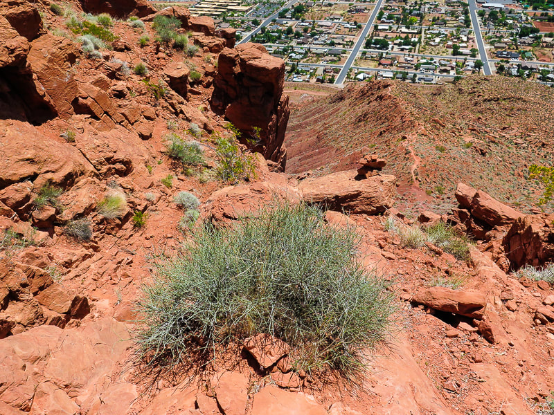 Back to civilization: Descending cliff band of steep side of Red Mountain overlooking Ivins 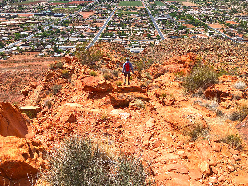 Descending to trailhead at Ivins.  Cold Drinks at southern trailhead - just deposit 25 cents for water and $1.00 for energy drinks!! 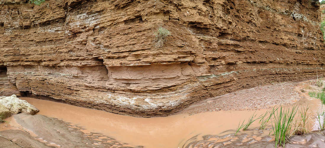 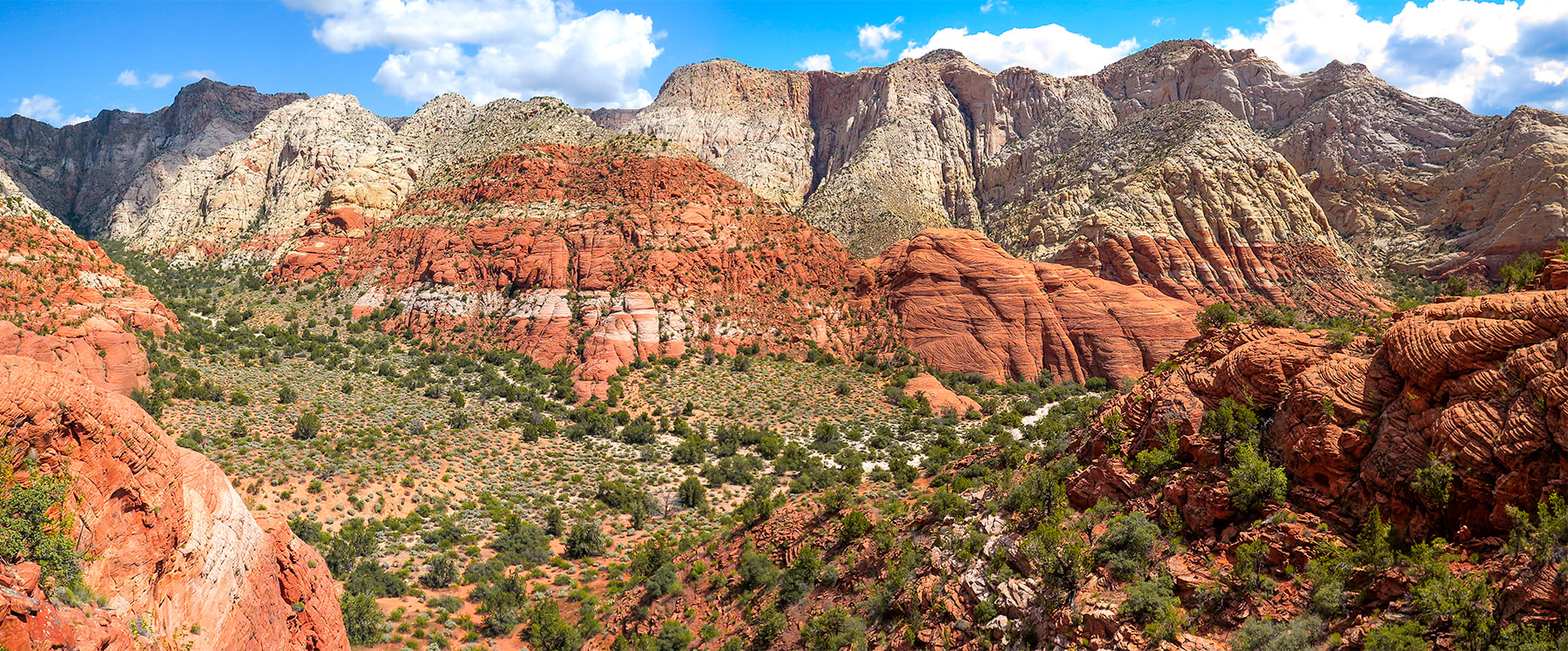 Snow Canyon State Park, Utah 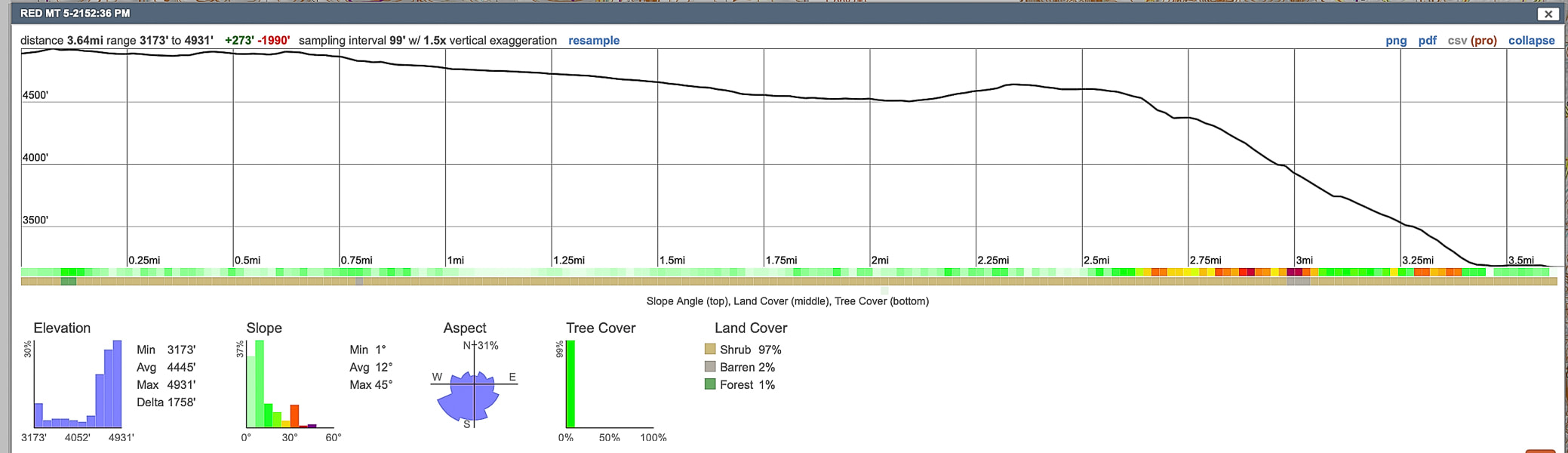 Elevation and distance profile of our hike from top point back to trailhead. We gained almost 2,000 feet total in 3.65 miles. 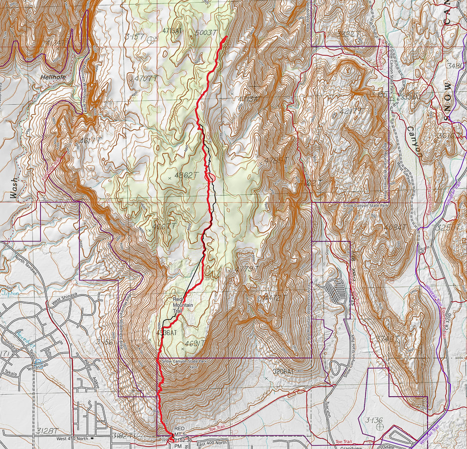 Our hike (red line) on southern portion of the Red Mountain Trail from Ivins, Utah. 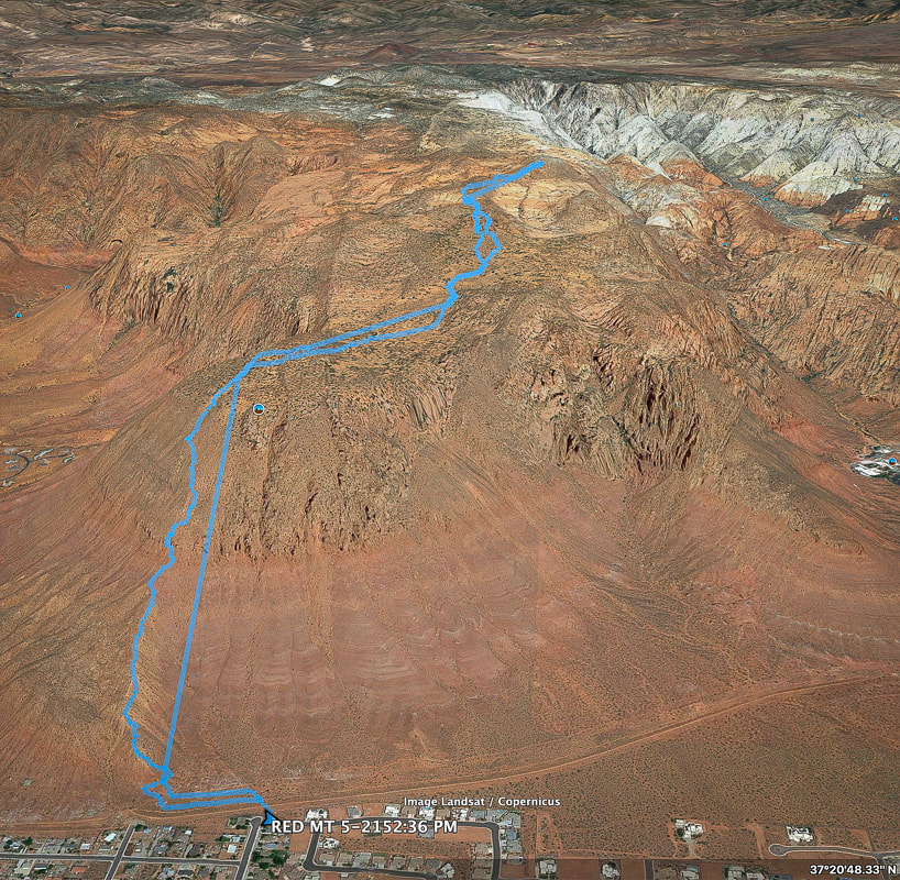 Google Earth image of our GPS tracks from southern Red Mountain trailhead in Ivins, Utah . Resources:
Bugden, M. Geology of Snow Canyon State Park Cryptobiotic Soils: Jayne Belnap. Holding the Place in Place - USGS: Impacts of Climate Change on Life and Ecosystems. Red Mountain Wilderness Maps - Wilderness Connect Ecoregions of Utah - usgs.gov Geologic Map of the St. George and East Part of the Clover Mountains 30' x 60' quadrangles, Washington and Iron Counties, Utah. Biek, R.F., and others. USGS publications. Miller, R. Our Geological Wonderland: Snow Canyon State Park Mojave Desert Tortoise - Nevada Fish and Wildlife Service Reflections on Southern Utah's warm colors and a remedy for the Boise winter blues. Related Posts:  Buckskin Gulch, the longest slot canyon in the southwest Paria Canyon - Vermilion Cliffs National Monument  Buckskin Gulch Hiking West Rim Trail after a March snowstorm - looking into Zion Canyon at the Virgin River. In color meaning and symbolism, red is a physical stimulant. It triggers our adrenal gland, causing us to have energy and take action. It makes us more sensitive to our environment and invigorates us. Orange is the color of warmth, vitality, creativity, and it too increases our activity levels and gives us a sharper awareness of our surroundings. It's no wonder Fred and I escape the low-energy and dispassionate grays and browns of wintertime Boise to reinvigorate in Utah's red rock country. Somewhere between Paragonah and Parowan, on our drive southward to St. George and the Zion area, the landscape transforms from hints of pink to to the blazing oranges and reds of Red Mountain Wilderness. Or we travel to Vermilion Cliffs and Grand Staircase-Escalante areas for adventures in chocolate-brown, pink and maroon sandstone canyons. Like bees to flowers, we have found our way to Southern Utah many times over the past 20 years and there's so much yet to see. If you had to identify one element responsible for the warm colors of Southern Utah, an element that jolts us out of our winter blues and spurs us onto adventure, it would be .....iron. The Navajo Sandstone exposed in Zion National Park shows off the many colors that iron creates. When iron is exposed to oxygen, it produces varying colors; and these colors depend on what form of iron oxide is present. The accumulated sand grains get coated with iron oxide. Hematite is the iron oxide responsible for the saturated reds. Limonite is responsible for the yellows. It's believed that white sandstone formerly had color but then was "bleached" by ground waters that dissolved iron oxides from the upper heights of the Navajo Sandstone. There's a reason Zion gets over 4 million visitors a year: it has the thickest exposure of the colorful and cross-bedded ancient sand dunes that make up the Navajo Sandstone (2,200 feet).  Zion Wilderness 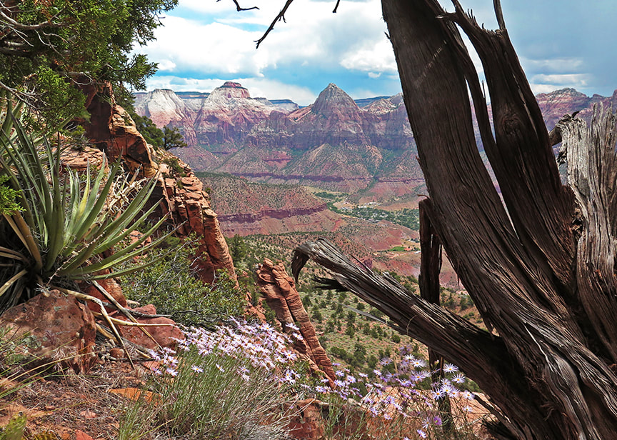 Zion Canyon from cliffs of Mt. Kinesava Bridge Mountain mid-horizon, East Temple to the left of it. Red Sands Trail - Snow Canyon State Park
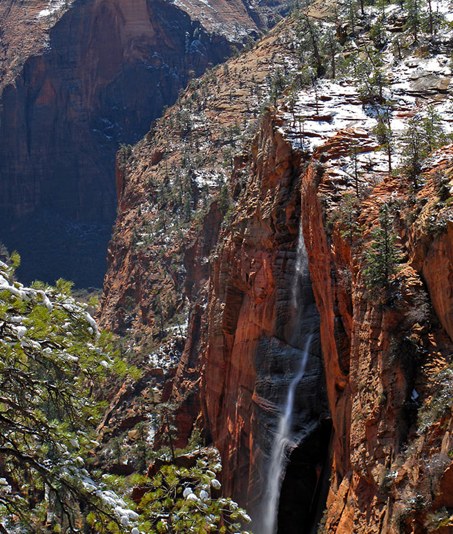 Zion's West Rim Trail after a March snowstorm 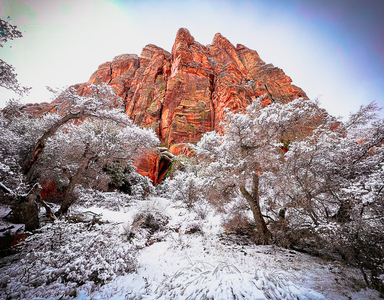 Snow Canyon State Park 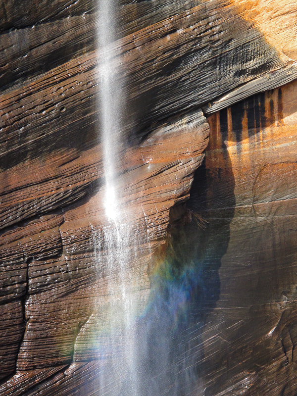 Cross bedding of ancient sand dune - Zion National Park 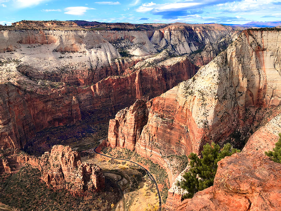 Overlooking Zion Canyon and Virgin River from Cable Mountain. 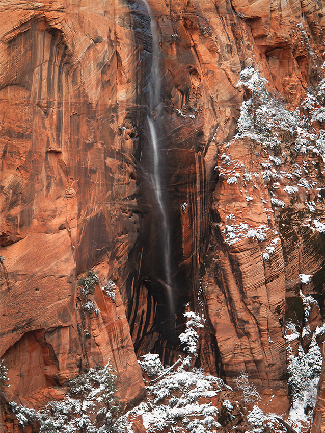 West Rim Trail - Zion National Park 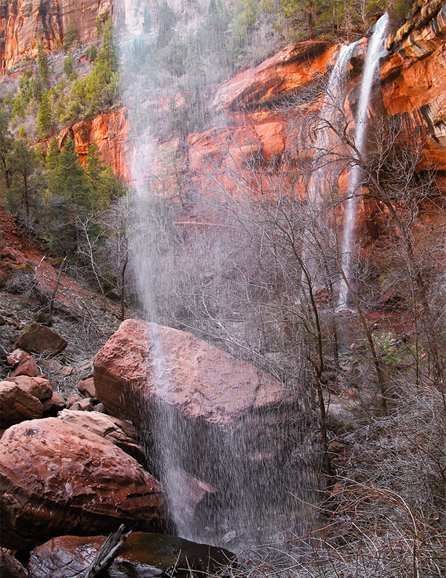 Emerald Pools - Zion National Park  Hidden Pinyon Trail - Snow Canyon State Park 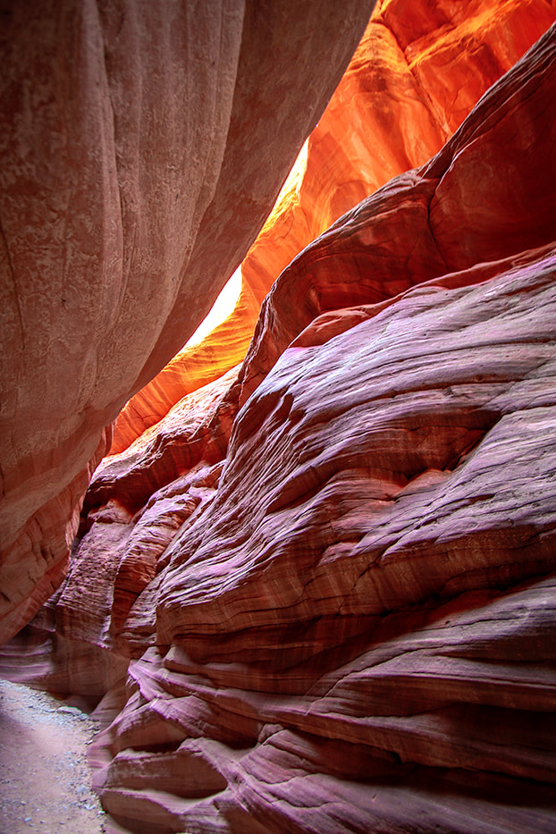 Peekaboo Canyon near Kanab. 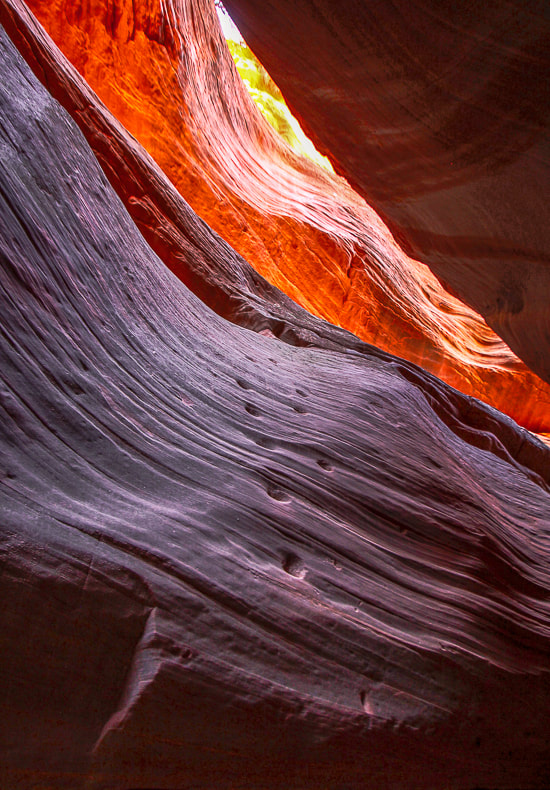 Chiseled steps from ancient ones in Peekaboo Canyon near Kanab.  "The Wave" Coyote Buttes in Paria Canyon-Vermilion Cliffs Wilderness Only 20 people per day are allowed; we were able to get permits twice by getting to the Kanab office early in the morning during Christmas Holidays before it became so popular! 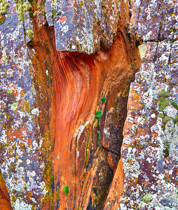 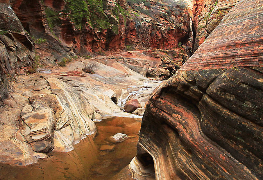 Zion's East Rim Trail Portions of this trail now closed due to large rockfall. The Great Gallery and Archaic Culture Sometime around 2,000 B.C. until 500 A.D., scientists say, nomadic hunter-gatherers from the Desert Archaic culture used red ochre paint to make pictographs of human-like figures onto the sandstone walls of what is now Horseshoe Canyon. It's a long drive for a short hike, but distances don't matter when standing in front of this incredible wall. As we stared at these red, almost eerie-looking figures, a park ranger quietly came up the path to sit on a nearby fallen cottonwood trunk, as he had almost every day to prevent vandalism. More recently, geologists date the rock art panel between 0 A.D. to 1,100 A.D. It has been interpreted as a sacred place for Archaic hunters. The significant discovery of an old leather bag eroding from sand by visitors in 2005 helped archaeologists piece together a scenario of the Archaic hunter who placed it near the Great Gallery wall. The bag contained three small leather pouches, a water-rounded stone, and marsh-elder seeds. Two of the pouches were stained red by hematite, one of which held chert to make arrowheads; the other probably held pieces of this ore. The seeds were an emergency food cache. The flintknapper/hunter had collected more chert flakes than he needed and was heading southwest to his home. This was an excellent place for him to stash extra hunting tools and food in case of emergency, and an easy landmark to remember and describe to kin. He was walking through a natural travel corridor.  The "Holy Ghost" and the Great Gallery in Horseshoe Canyon Canyonlands National Park in southeastern Utah 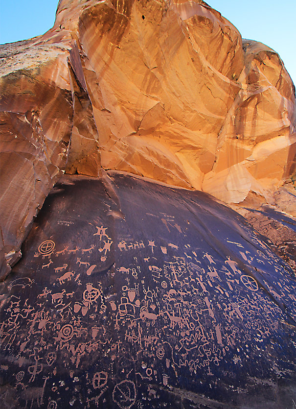 Newspaper Rock - San Juan County, Utah One of the largest collections of petroglyphs in the country. Fremont, Ute, and Anasazi Native Americans contributed to this panel. Designs were created by pecking through the desert varnish to the lighter rock beneath.  Santa Clara River Reserve near St. George.  Mesa Arch at Sunrise - Canyonlands National Park The best spot to photograph this arch was already taken by a photographer and his tripod at 5:30 a.m. Still more than enough places for photographs!  Death Hollow in Grand Staircase/Escalante' National Monument (these are the actual colors - not saturated with Photoshop). One of the most colorful canyons I have been in. 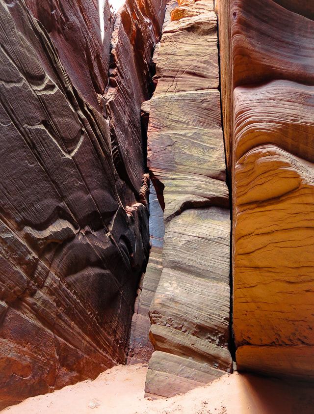 Buckskin Gulch 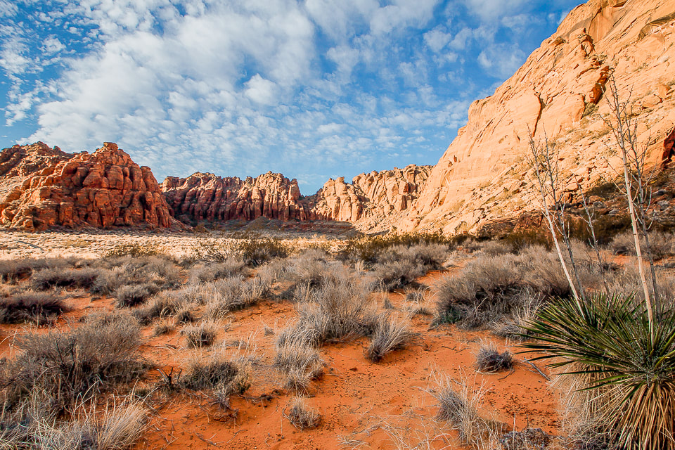 Snow Canyon State Park at sunrise 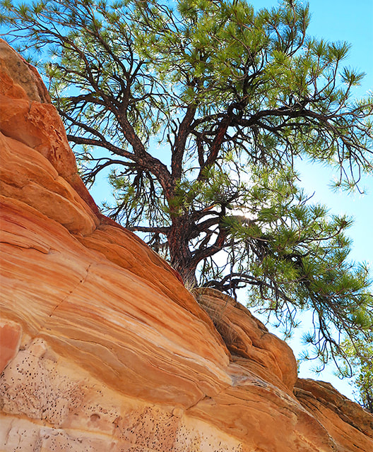 Writing About Red Rock Country In her book "Red: Passion and Patience in the Desert," Terry Tempest Williams effectively conveys how it feels to be in the red rock country. To read her words is to feel the warm sun, the rough sandstone, and the enormous space in the red rock canyons and mesas. She reflects on its physical and spiritual aspects. She grew up in Utah and is also an educator and environmental activist. The more I visit this beautiful place, the more I can relate to her writings. She reminds us to slow down and really "see" and contemplate the land. If we do that, then we can "hear the voice of our conscience. If we listen to that voice, it asks us to be conscious. And if we become conscious, we choose to live lives of consequence." Another quote from her book: "Time and space. In the desert there is space. Space is the twin sister of time. If we have open space then we have open time to breathe, to dream, to dare, to play, to pray to move freely, so freely, in a world our minds have forgotten but our bodies remember. Time and space. This partnership is holy. In these redrock canyons, time creates space--an arch, an eye, this blue eye of sky. We remember why we love the desert; it is our tactile response to light, to silence, and to stillness."
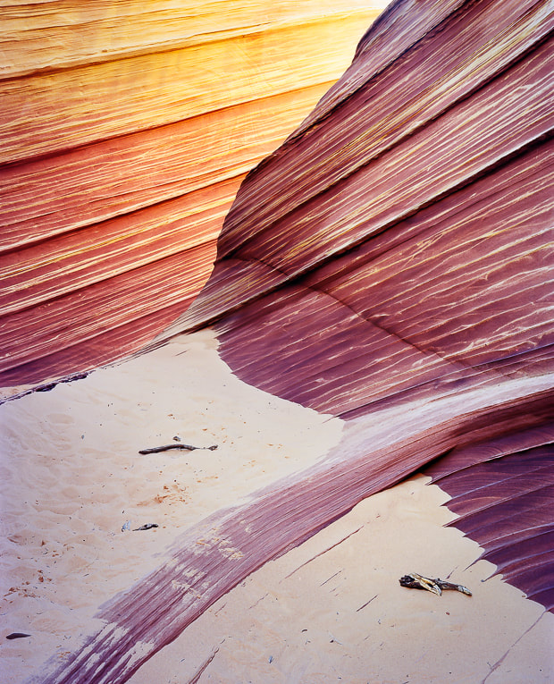 Paria Canyon-Vermilion Cliffs Wilderness Area, Northern Arizona - "The Wave" in Coyote Buttes 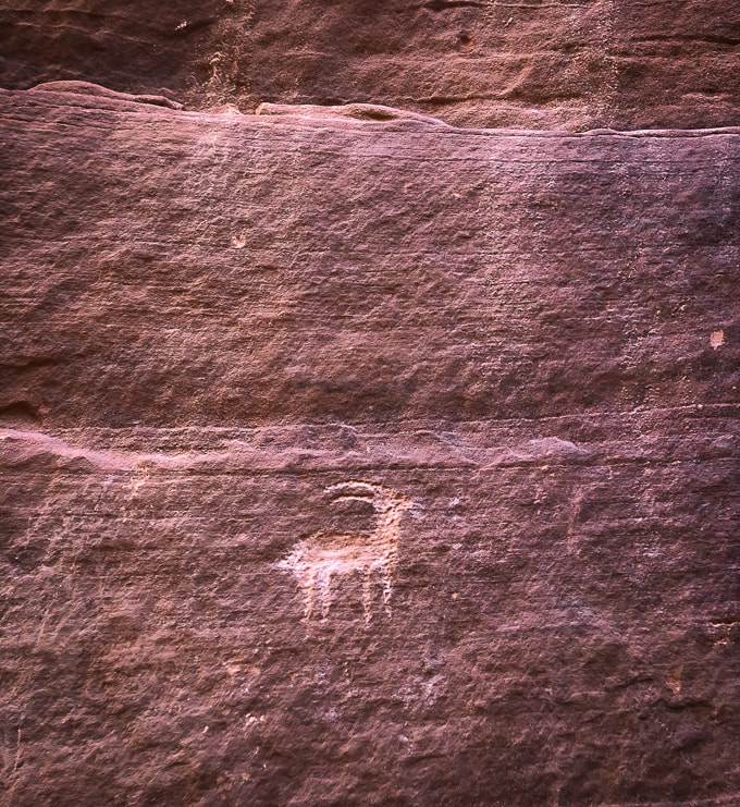 Petroglyph at confluence of Wire Pass and Buckskin Gulch Paria Canyon-Vermilion Cliffs Wilderness - Arizona 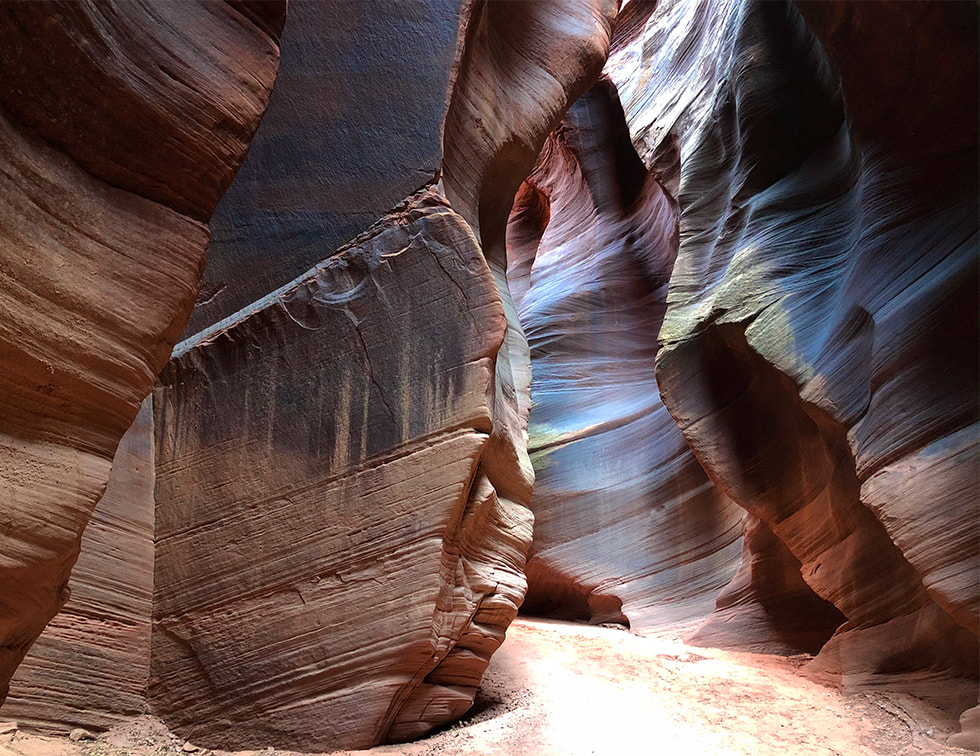 Buckskin Gulch Paria Canyon-Vermilion Cliffs National Monument 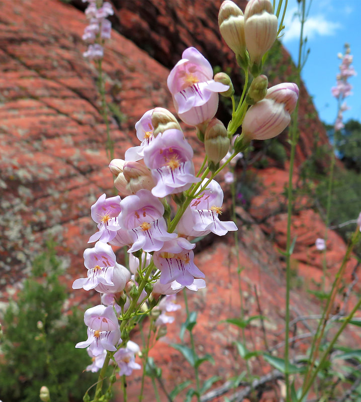 Palmer's Penstemon in Snow Canyon State Park, Utah. 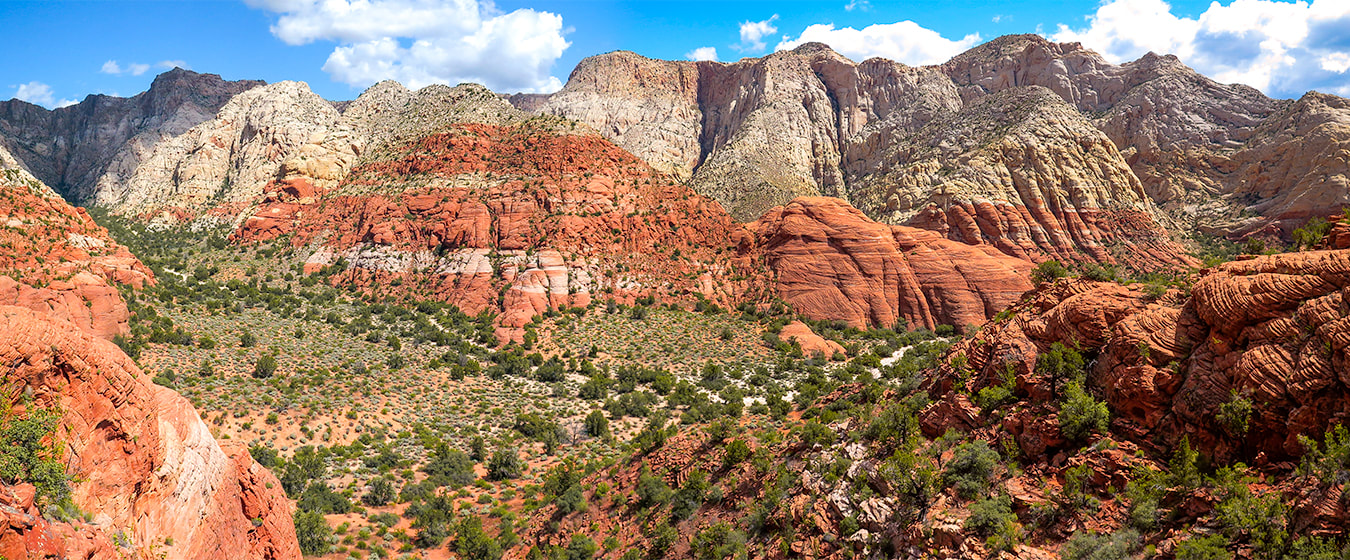 Snow Canyon State Park - St. George, Utah 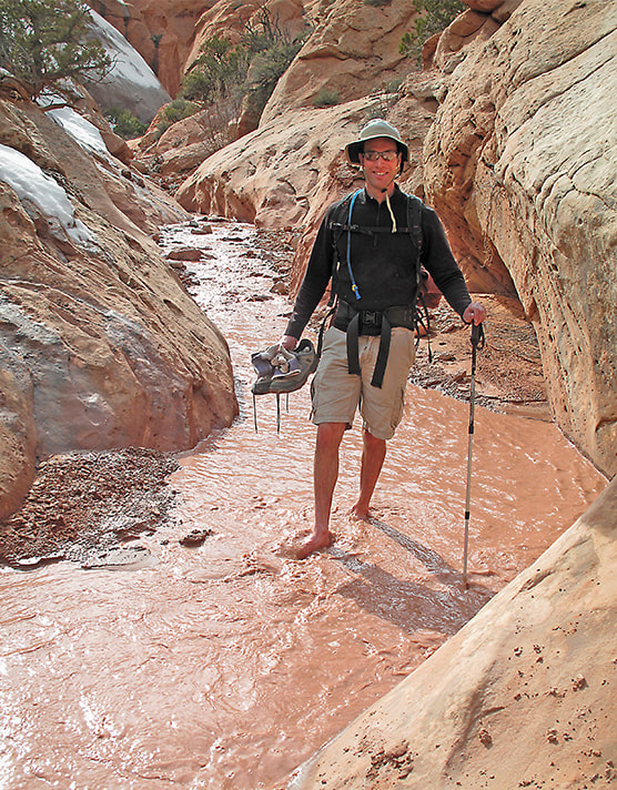 Fred on Upper Muley Twist Trail - Capitol Reef National Park Off of Burr Road, south of Boulder, Utah Great views of the Waterpocket Fold, hike through canyons and on top of mesa Walking through snowmelt from higher up on plateau, but the water wasn't too cold!  Along Taylor Creek on the Double Arch Alcove Hike Zion National Park Kolob Canyons section Leaves were all rotating counter-clockwise in this small pond. References National Park Service. Analysis and Dating of the Great Gallery tool and Food Bag. Natural History Museum of Utah. Bold Figures, Blurred History: The Great Gallery in Horseshoe Canyon. Weaver, Lance. 2020. What Gives Utah's "Red Rock Country" its Color? Utah Geological Survey. Colors of the Navajo Sandstone. nps.gov. sensationalcolor.com. Color Symbolism and the Meaning of Red. Navajo Sandstone. Utah Geology.com. Our attempt at a relentless 3,500-foot gain, sections of Class 3-4 climbing, and route-finding journey under cliffs and over ridges make this fabled summit complete with petroglyphs elusive for now. I recommend this tough, extraordinary hike even if you don't intend on summiting. But do your research first. Related: Utah Mountain Biking: The Cowbell and the Cryptobionic Highway (cryptobiotic crusts) Angels Landing in Zion: Not for the Faint of Heart Southern Utah Hiking and Biking in a Pandemic: Zion, Wire Mesa, and Snow Canyon Canaan Mountain via Squirrel Canyon Red Mountain Primitive Trail - St. George Desert Plant photos 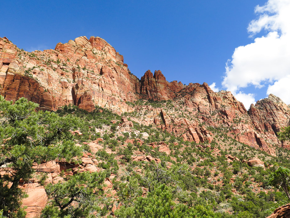 East cliff face below Mt. Kinesava. Summit cannot be seen from this vantage point. Route goes through trees at base of cliffs in shadow, then up to the right following trees to notch. After this, still hundreds of feet climb to summit.
Our Hike Fred and I decided to hike Mt. Kinesava when we saw it towering over the southern entrance to Zion National Park while riding on the Wire Pass Trail near Springdale, Utah. When we finally had a cool day during a more recent hike/bike vacation, we gave it a try. Even though we didn't make it, this mountain is one of the most memorable I have ever hiked. Majestic Mt. Kinesava remains elusive, invincible, its petroglyphs unreachable, at least to us. A grudge peak. Kinesava is more than a hike, it's an experience. The view of red and orange cliffs and pinnacles that tower the more you climb, the increasingly spectacular views of Zion Canyon behind you and the ever-shrinking town of Springdale below create a unique "surround-view" experience of being "perched" for hours. Kinesava's refusal to let just anyone walk on her summit may be the reason why Native Americans chose this place to carve petroglyphs on the mesa just above these challenging rock walls. Landmarks in Zion, like Mt. Kinesava and Sinawava are named after Paiute deities. You have to do your homework for this cross-country hike, but there are few summit reports available. There is a break in the cliff band that surrounds Kinesava's base created by an apparent old landslide where you can enter the terrain that will take you up to the cliffs. You must catch this same entry point on your exit, so a good idea to look back to note where this is by looking at landmarks. Rock cairns mark faint trails, but it seems like you usually find these more often on the way down. Cairns left by previous hikers were helpful in the Class 3-4 sections. For a more detailed hike description, click on "Trip Stats" above. You have to navigate over three ridges before you get to the base of the sheer walls, where you scramble and climb across narrow sections of the cliff in a horizontal/diagonal direction following the line of trees. Here, the climb is Class 3 (climbing with use of hands) up more or less vertical rocks, making your way to the right along cliff base. Where we reached too much exposure (Class 4), we backtracked to find a safer route. It took us longer than we wanted to navigate through the horizontal band of trees under the pinnacled vertical cliffs. We reached a comfortable platform with a good view of the "catwalk", a very narrow section that must be traversed to gain access to the final climb up the diagonal band of trees to the notch that lands you on the plateau above. This is where we stopped; it looked pretty difficult and we didn't have enough time to summit AND get down (see image below). Once on the plateau, Mt. Kinesava's summit is another 300-400 foot climb. (See our GPS tracks below). 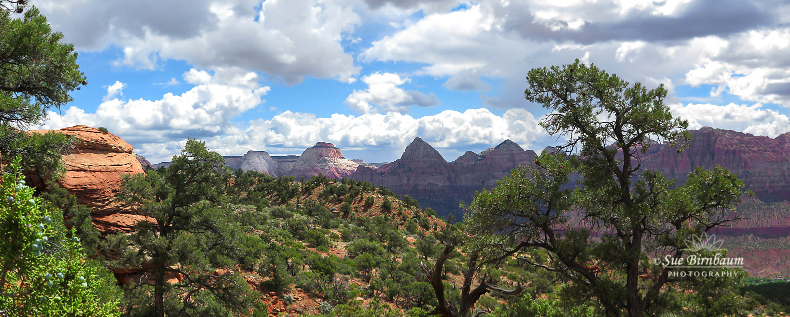 Zion Canyon from east face of Mt. Kinesava 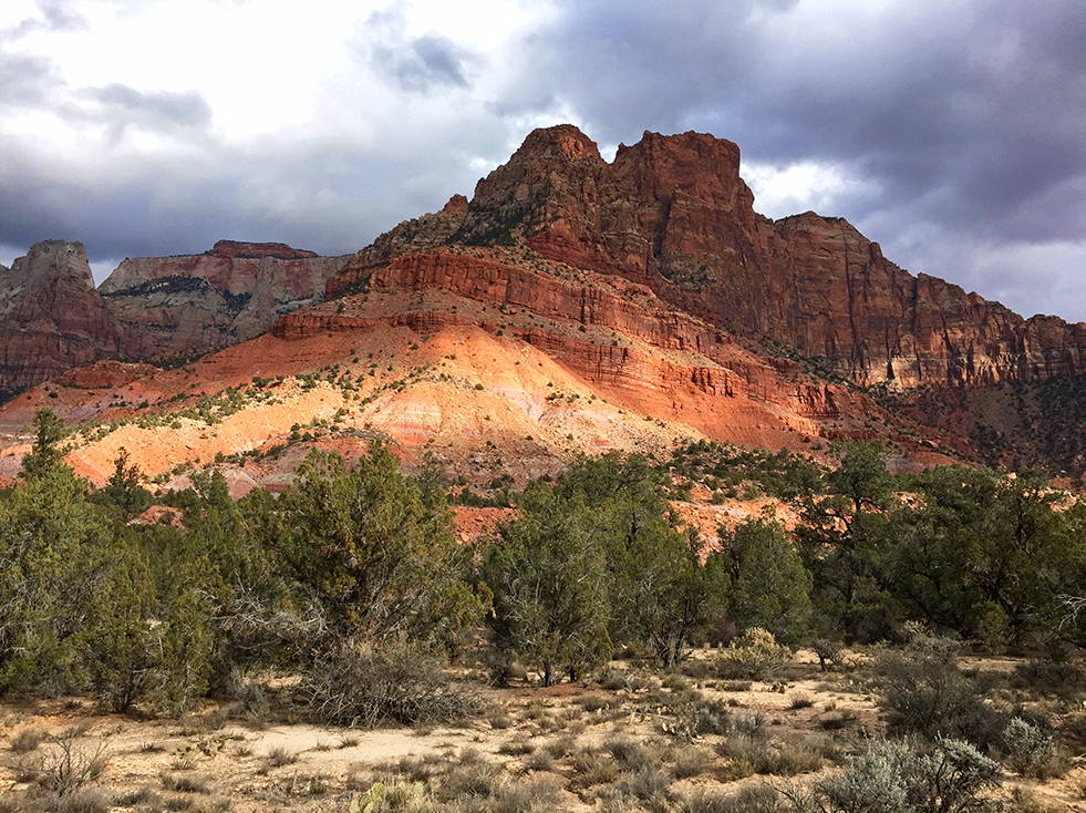 Mt. Kinesava from Chinle Trail (on a different hike) 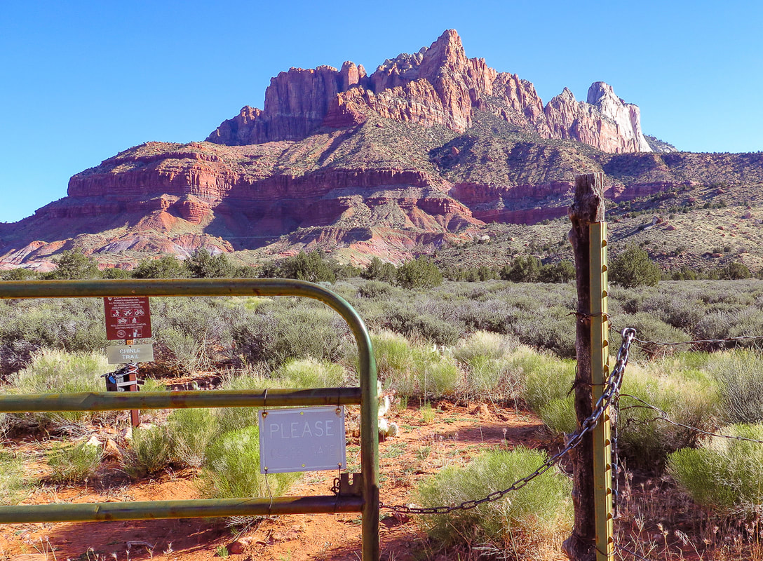 Looking at east face of Mt. Kinesava in the morning. The summit is just behind the largest prominence, mostly hidden from this view. Gate, 1.1 miles from Chinle Trailhead marks Zion National Park boundary. Chinle trail continues to the left. The route goes up the fan-shaped debris slide through the trees, continuing through trees to right of prominence up to notch. 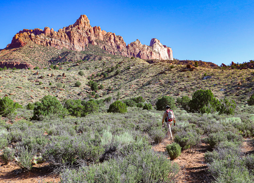 First set of Ridges just after Zion NP Boundary Heading cross-country towards 3 main lower ridges. We went up the ridge to the right in the photo. 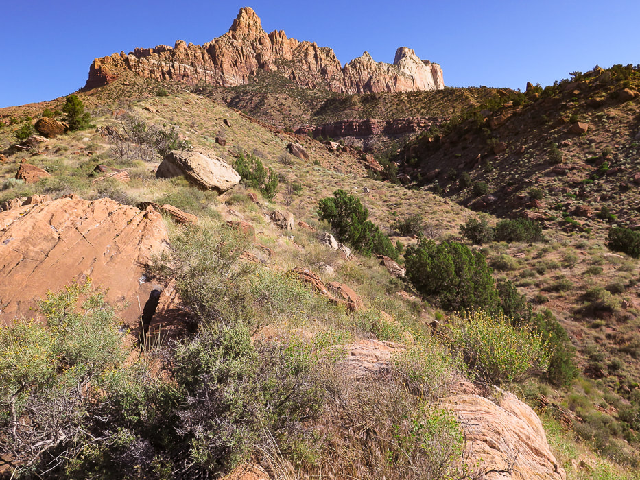 We ascended the left (west) ridge, and descended the right (middle) ridge on the way back. At the top of the ridge to the right is a trail and the 3 telephone poles at entry through break in cliff band to arrive at plateau above cliff. I would ascend via the right ridge next time. 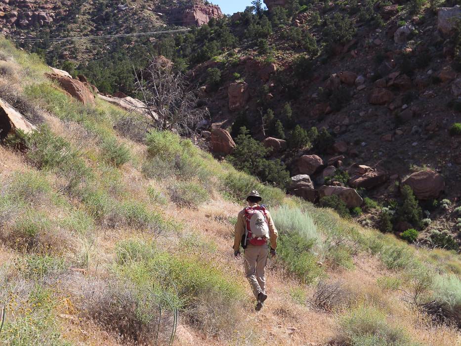 We had to lose some elevation and side-hill the left ridge into the small canyon. Aim for the telephone wires and 3 large poles on middle ridge saddle just under passage through cliff band. 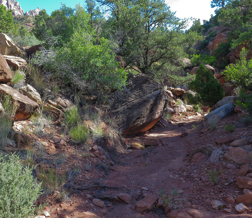 Small canyon between left and middle ridges. After descending from west, or left ridge into this canyon, it took us right up to saddle with 3 telephone poles. 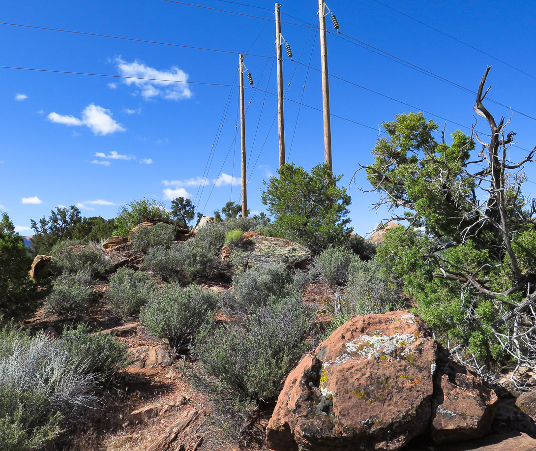 Aim for three telephone poles at base of trail that goes through cliff break landslide. On our way back down, we stayed on the ridge that these poles are on, to the right of this image (the "middle" ridge). 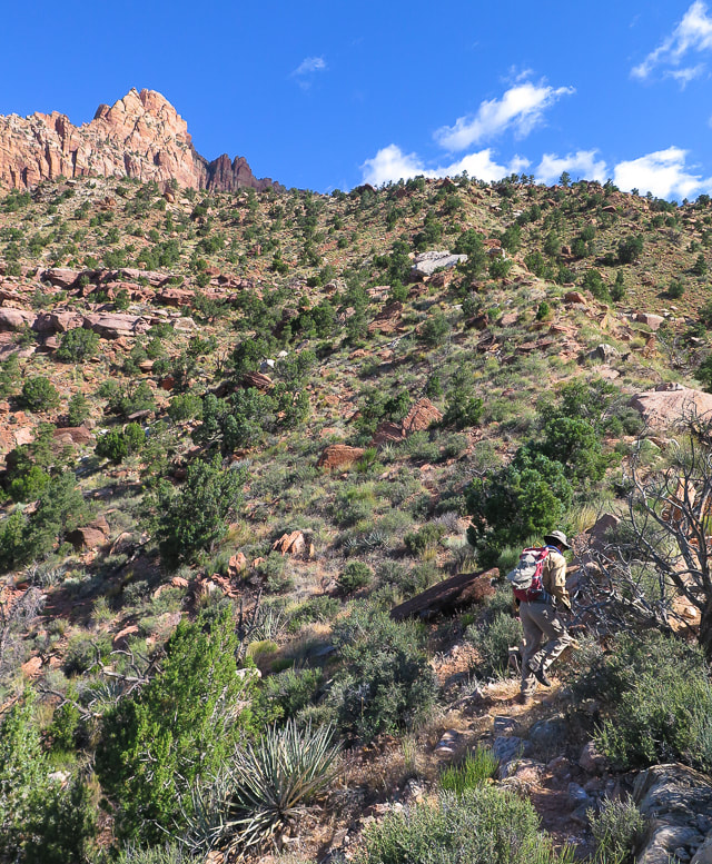 Second Ridge Rock slide over bottom cliff base is entry/exit onto plateau above. Defined trail here. 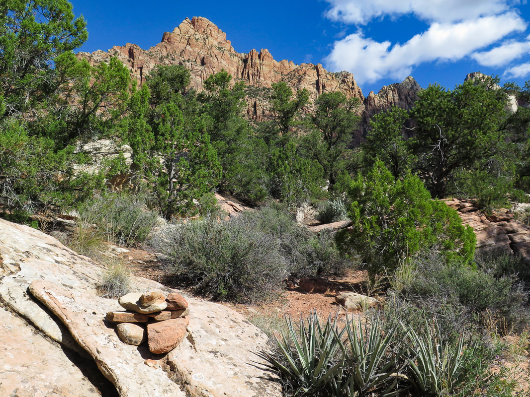 Cairn that marks entry from steep second ridge through lower cliffs to plateau above. These white rocks can be seen above to aim for on the way down off the plateau.
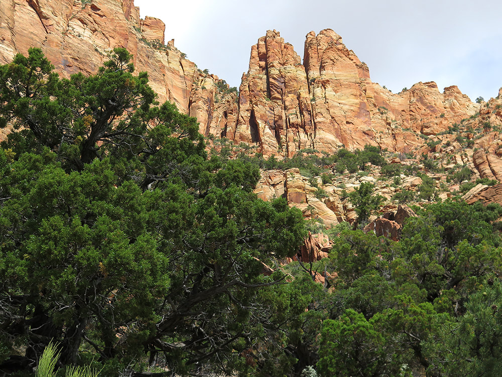 Third Ridge Approaching horizontal band of trees under sheer cliffs 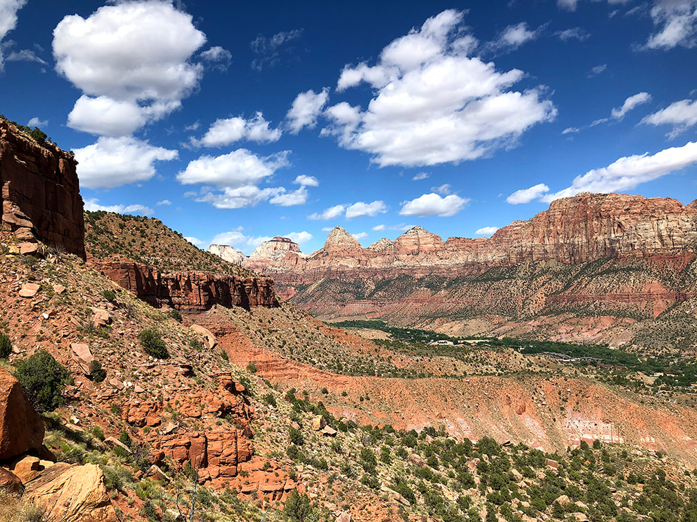 Everywhere you look, it's spectacular! Zion Canyon 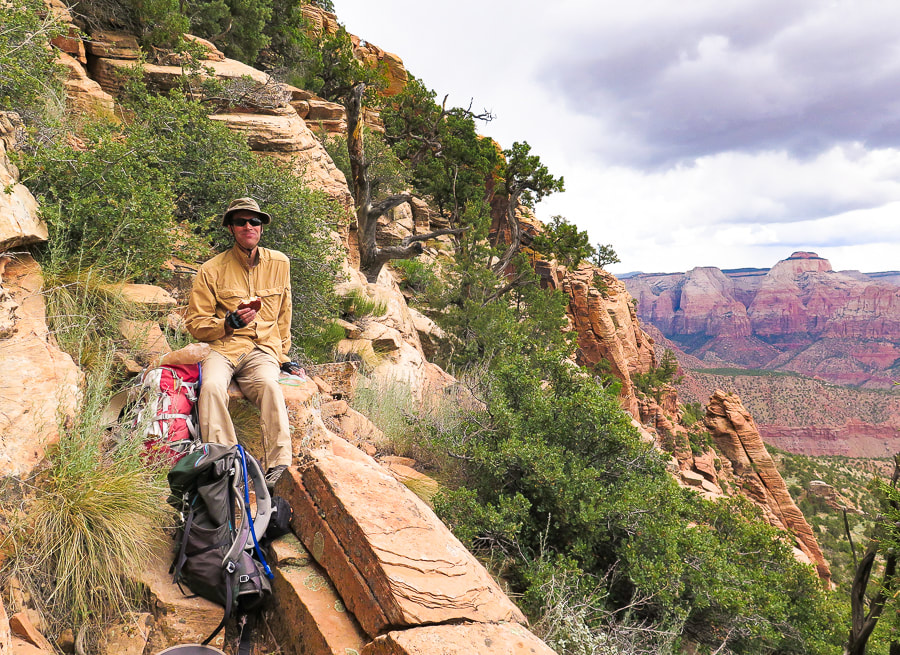 Reached horizontal band of trees for a cliffside lunch - Zion Canyon view. 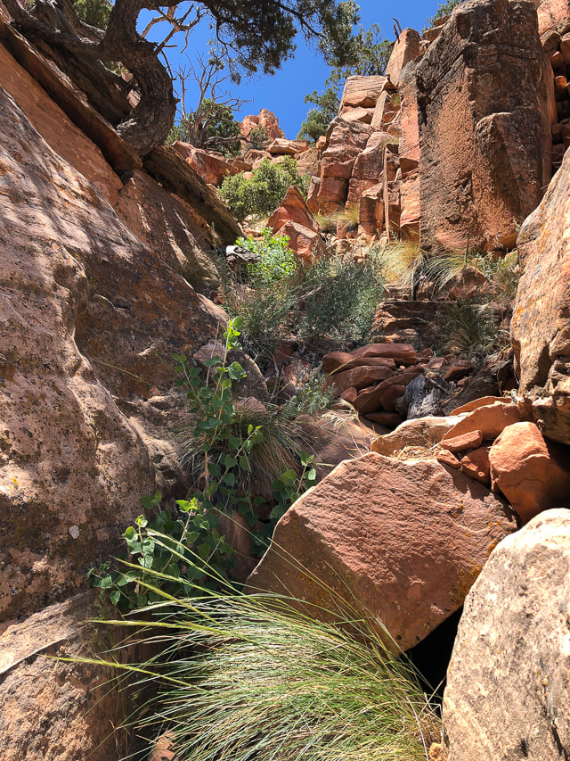 Fun "passageway" to to get to vertical rocks 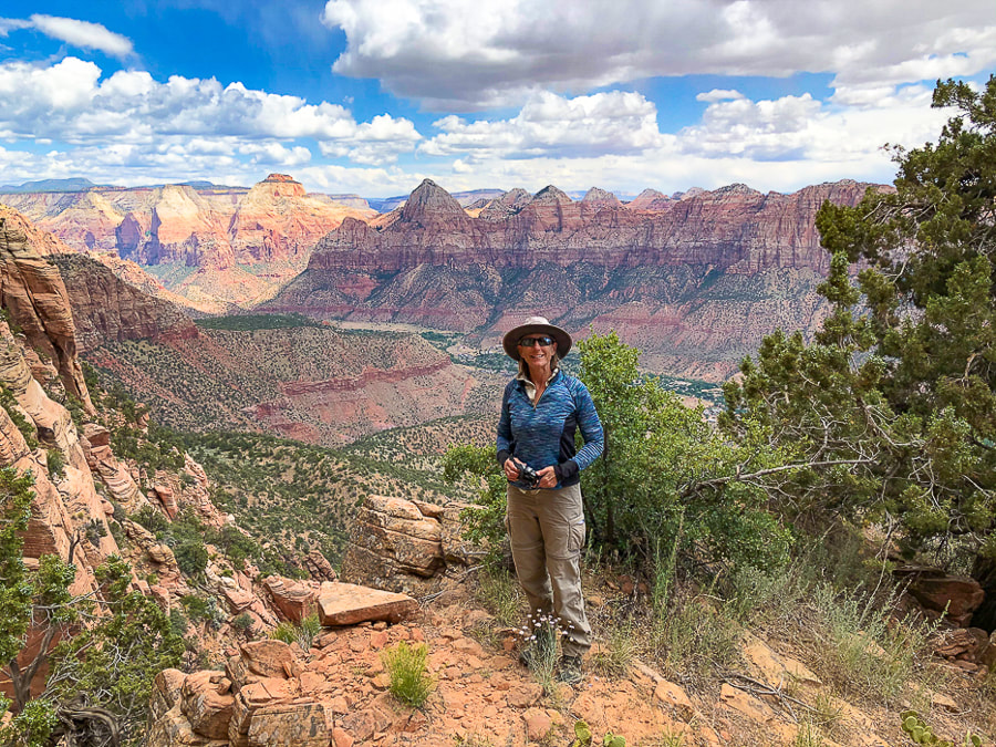 Zion Canyon from cliffs of Mt. Kinesava - 6,400 feet Keep on Exploring - Never Stop Climbing Mountains! 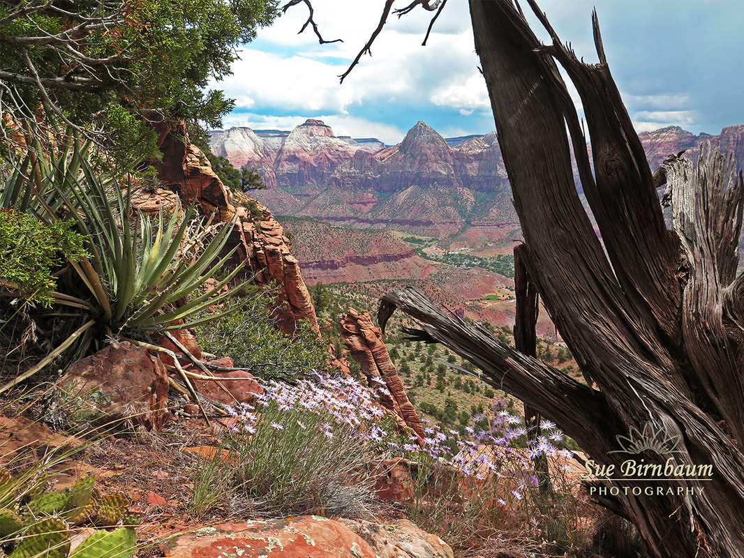 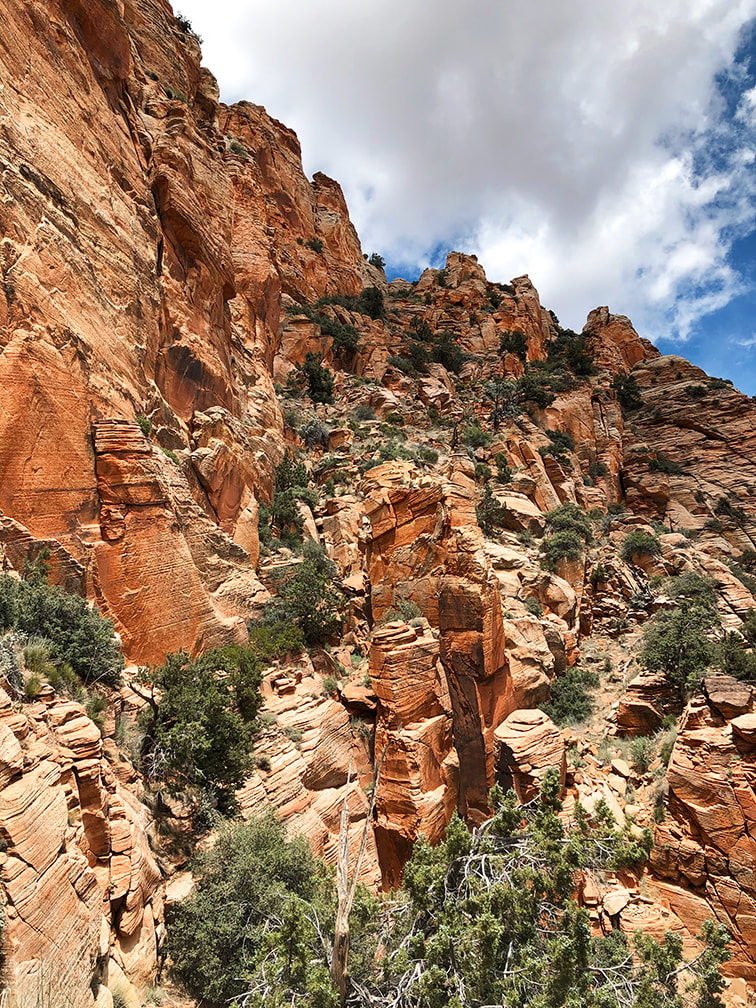 This is where we stopped. Trail continues through trees on far left, over the "catwalk" and up through trees to notch. The Way Down The view of the cliff-hugging narrow "catwalk" and vertical rock towers is intimidating. It's a different feeling entirely as I sit here at my desk writing this post, where I am not facing this astonishing scene of exposed walls and loose rocks to climb - it's easy to think now I can do it. Edward Abbey, in his book Desert Solitaire said that Southern Utah "is the most beautiful place on earth." My words don't do justice when describing what it's like to hike in this extraordinary place, where all natural elements seem to fit almost magically together. The orange and green, the soft sand and the hard cross-bedded rocks, the cliffs and the undulating lowlands and streams. The expansive desert with steep mesas standing like platforms under a wide sky. Places to rest and absorb the views among imposing and rugged terrain. Prickly cacti and slender, waving penstemon. We caught a defined trail on the way down that took us a bit too far to the west. The most important thing to remember is to aim for the large white boulders on the edge of plateau; it's your exit point to the ridges below. Hopefully next time I attempt this hike, we will be able to conquer this section, see the petroglyphs on the plateau above, and summit. I already feel lucky to be able to see these sights that not many others have seen before, and to be able to hike with my husband. We have fun! Life is really good. "Freedom begins between the ears." - Edward Abbey, environmental advocate and author of Desert Solitaire 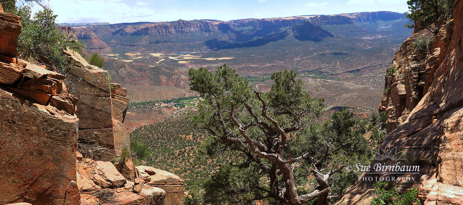 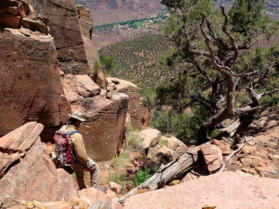 Heading down! 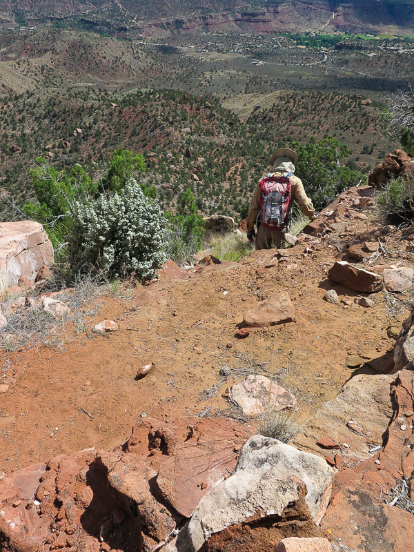 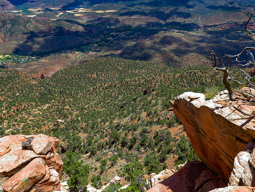 Heading off cliffs onto "third ridge". Springdale, Utah below in river bottom with Virgin River "Our updated trailhead will add 2 hours to the trip, which means that now fewer of you should ever attempt it. DO NOT GET STUCK ON THIS ROUTE IN THE DARK!!!!!"
- zionnational-park.com Trip Stats
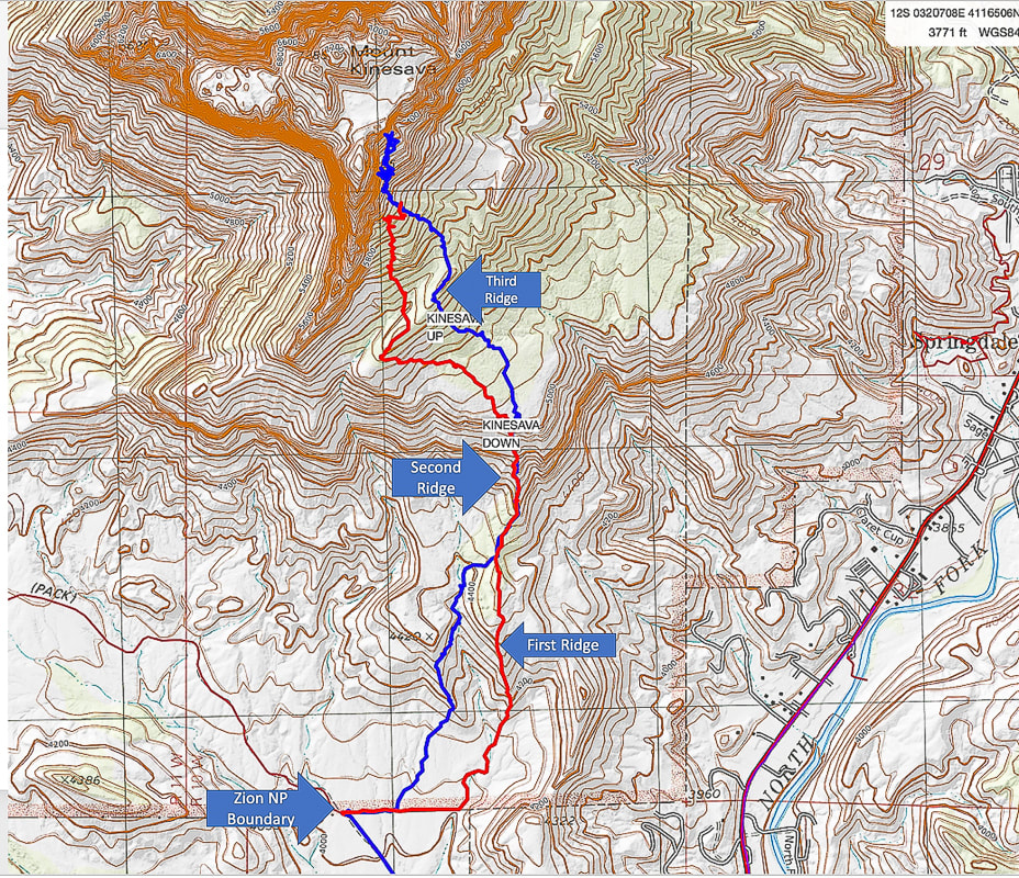 Our route up (blue) and route down (red) Bottom of map shows approach to Zion National Park boundary fence via Chinle Trail (Trailhead on Utah State 9 Highway just before Springdale). I recommend using the ridge that the red trail traverses just after fenceline. 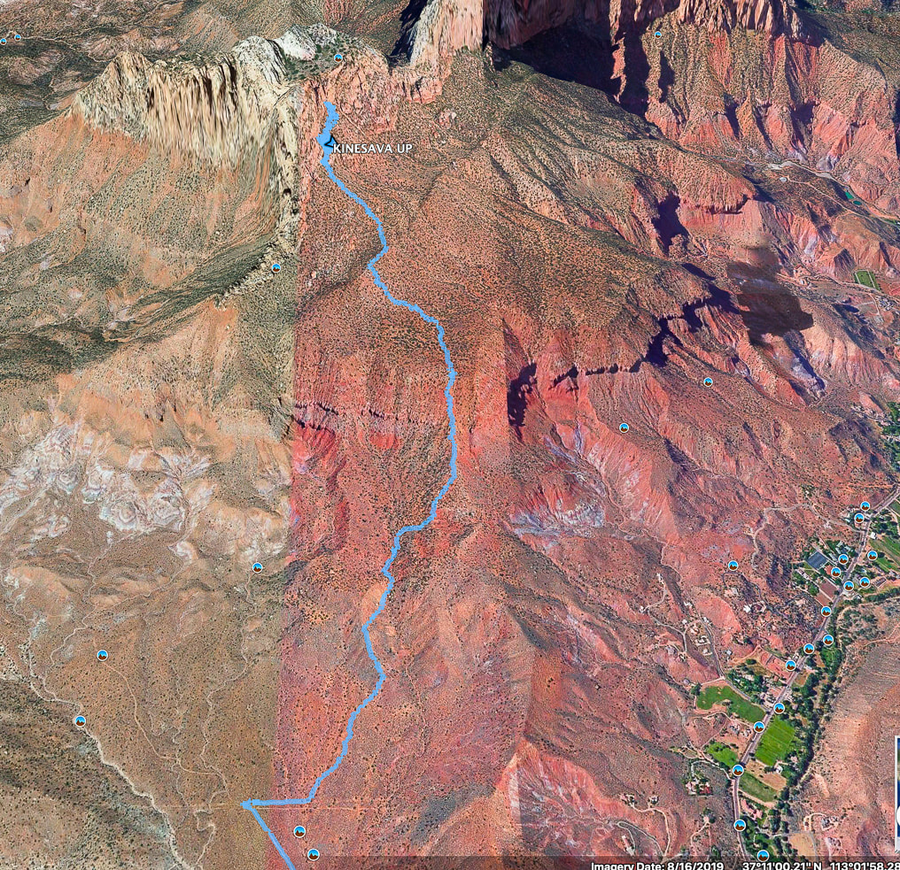 Google Earth image of our hike up after crossing Zion NP boundary fence To avoid losing elevation on the way up, better to take the ridge to the right (east) of the one we took up. This leads up to only break in the cliffs that surround the bottom. Town of Springdale at lower right. References
Chesher, Greer K. Zion Canyon: A Storied Land. 2007. The University of Arizona Press. Quarnstrom, Evan. Zion National Park: Tackling Mt. Kinesava. Website: Evan Quarnstrom: Stories of Travel and Adventure. The Hiker's Code: Brush Up on Trail Etiquette in Time for Hiking Season. Posted 11/5/19 on Utah.com Zion: Mt. Kinesava. Favorite Hikes In and Around Zion National Park. zionnational-park.com |
Categories
All

Sue and Fred

About this blogExploration documentaries – "explorumentaries" list trip stats and highlights of each hike or bike ride, often with some interesting history or geology. Years ago, I wrote these for friends and family to let them know what my husband, Fred and I were up to on weekends, and also to showcase the incredible land of the west.
To Subscribe to Explorumentary adventure blog and receive new posts by email:
Happy Spring!

About the Author
|