EXPLORUMENTARY
  • Home
    • Cactus to Clouds Hike
    • More Quotes
    • Ann Zwinger Quotes
    • Mary Oliver Poems
  • Hikes by State
    • Idaho
    • Southern Utah
    • Arizona
    • California Desert
    • Nevada
    • Wyoming
  • BLOGS
    • Adventure Blog
    • Women and the Land
  • GALLERY
    • DESERT PLANTS >
      • Beavertail cactus
      • Brittlebush
      • Christmas Cactus
      • Arizona Barrel Cactus
      • Parry's penstemon
      • Agave
      • Arizona Rainbow Hedgehog
      • Claret Cup Hedgehog
      • Desert Agave
      • Palmer's Penstemon
      • Silver Cholla
      • Cristate Saguaro
      • Indian Paintbrush
      • Ocotillo
      • Santa Rita Prickly Pear
      • Spiny Cliffbrake
      • California Barrel Cactus
      • Engelmann Prickly Pear
      • Velvet Mesquite
      • Joshua Tree
      • Buckhorn Cholla
      • Hedgehog Cactus
      • Fishhook cactus
      • Thompson's Woolly Locoweed
    • NATURE
    • BOISE
    • EARTH + SKY
    • URBAN
    • WATER
    • PATRIOT
    • ORCHIDS
  • Fit After 50
    • Brian Holgate
    • Fred Birnbaum
    • Dave Brasuell
    • Bus' Little Black Book
    • Mike Carlson
    • Ray Wilson
    • Bryan Krouse
    • Vickie Kearney
    • Maria Keezer
    • DOUG TRAUBEL
    • Boise Cross Fit Masters Ladies
    • Tim Clemens
    • Marcia Bondy
    • Becky Borczon Blake >
      • Becky B Downtown
    • Jennifer Cera and Sue Birnbaum
    • Dave Brasuell
    • Vance Powell
  • About
    • CONTACT

Boulder Mail Trail to Death Hollow in Grand Staircase-Escalante National Monument

9/3/2018

6 Comments

 
Hike the remote cross-country route of the last mule U.S. mail delivery in the Phipps Death Hollow Wilderness Study Area through slickrock sandstone and sagebrush flats
Related:
No Mans Mesa in Grand Staircase-Escalante NM
Picture
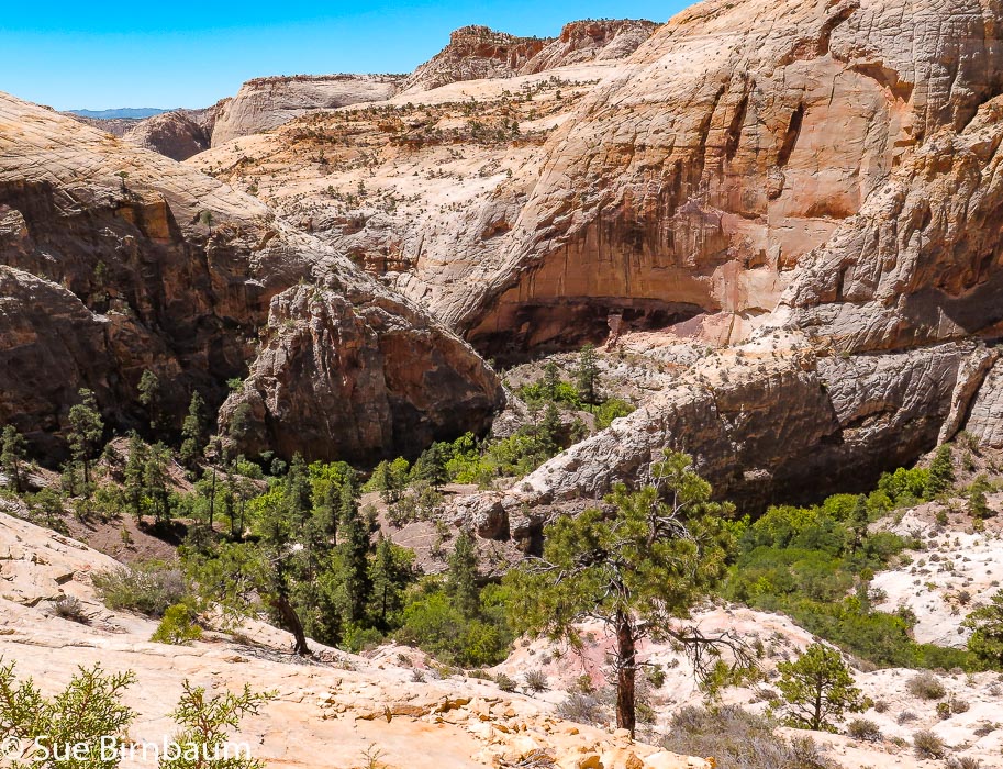
Descending into Death Hollow from northern route of Old Boulder Mail Trail Cross Country Route
Trip Stats:
  • Overview:   Retrace the steps of the horse and mule route that traveled over rough and dangerous terrain to deliver mail and supplies to settlers in remote Boulder and Escalante, Utah.  This is a unique cairned trail that ascends and descends  through enormous and sublime slickrock country with a rugged and unforgiving character, ending in the dramatic and famed Death Hollow.
  • Distance:  North Boulder Mail Trail to Death Hollow out and back = 12 miles.  Entire Boulder Mail Trail Cross Country Route from Escalante to Boulder = 16 miles.
  • Elevation gain:  Trailhead = 6,800 feet; Creek in Death Hollow = 5,797 feet.  Cumulative gain into Death Hollow = ~ 600 feet; cumulative gain back to trailhead = 1,450 feet.  Total gain round-trip = 2,100 feet. 
  • Difficulty:  Moderate effort.  Steep trail on slickrock descending into Death Hollow.
  • ​Navigation:  Rock cairns are frequent.  Recommend a good topo map due to most of trail is not readily apparent except due to cairns.  Make a note of last cairn passed in case next cairn is not immediately visible.
  • Maps:  Trails Illustrated - Canyons of the Escalante  1:75,000 (# 710), Boulder Town, Escalante, Calf Creek 7.5 min USGS topos.
  • Water availability:  Sand Creek and creek in Death Hollow flowing in mid-June - use water filters if taking from creeks.  We brought 3 liters of water each and filled up on water pre-hike.
  • Direction to trailhead:  Boulder Mail Trail trailhead is located between Boulder and Escalante on Utah State Highway 12.  Access is from Hells Backbone Road at milepost 84, which is 3.2 miles from Utah 12/Burr Trail Road junction and 22.7 miles from Escalante.  Travel 0.1 mile on Hells Backbone Road, then turn left (south) onto the gravel McGath Point Road.  Travel 0.5 miles to cross Boulder Landing Strip to see trailhead sign and parking.
  • Hike Directions:  The trail begins at the well-marked trailhead sign and register, descending southwest gently through pinyon pine,  juniper forest and open sagebrush.  At ~ 1.5 miles, an expansive view opens as you stand at the rim of Sand Creek tributaries.  It is here that you see the contrast of the Ponderosa pines and white Navajo Sandstone spread before you, dotted with boulders and rocks.   Frequent cairns lead you down to cross Sand Creek at 2.7 miles.  The trail leaves the creek and switchbacks up past rounded basalt boulders to make a few short and steep climbs up to a plateau where it follows along with the old telephone wire installed in 1910 and then on to Slickrock Saddle where Death Hollow eventually comes into view.  Pay close attention to cairns here as you enter several stretches of soft sand.  Gain ~ 500 feet from Sand Creek to the highest point on Slickrock Saddle; Death Hollow comes into view ~ 5 miles.  Cairns lead you 700 feet down slickrock, steep at times and at one point carved straight in the rounded stone.   A short cross through thick vegetation lands you in a beautiful sandy and shady campsite underneath towering walls on the opposite side of the creek of Death Hollow.  Return the same route.
  • Geology: Navajo Sandstone - Early Jurassic (~ 200 - 174 Ma): Gray and locally reddish - orange, thickly cross-bedded, medium to fine- grained eolian sandstone.  Erodes to massive cliffs and domes, 400 - 1800 feet thick.  Sediment deposited during migration of dunes.
  • ​History:  Originally a trail used by native Americans for centuries, became the "Death Hollow Trail" connecting the remote settlements of Boulder and Escalante.  Mail was delivered twice a week by the U.S. Postal Service starting in 1902 using two to ten mules.  Mail, medicine, and occasional travelers were carried across the 16-mile route.  Steps were cut into the sandstone in some places to create safer footing.  The descent into Death Hollow was notorious for being dangerous.  A telephone line, installed in 1910, ran along the trail, and today remnants of this are seen attached to trees and running adjacent to the trail.  In 1924, mules carried machine parts, boots, sewing machines, etc. when Parcel Post became available.  The mail trail became unnecessary when the Civilian Conservation Corps built better roads in the early 1930's.​
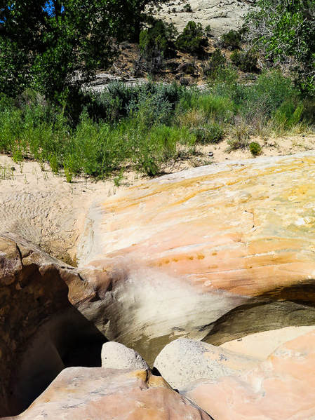
"If ever monuments are erected to unsung heroes, probably the tallest should be for those who brought the mail."
         -  Nethella Woolsey, Escalante historian 
Picture
Picture
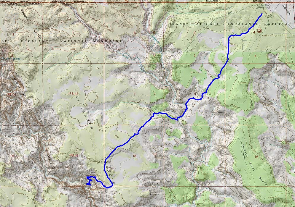
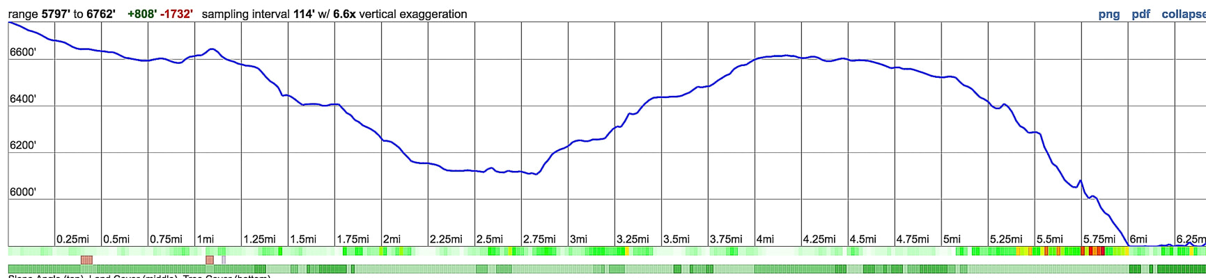
Northern section of Old Boulder Mail Trail Cross Country Route travels southwest from trailhead near Boulder Landing Strip to Death Hollow.  This trail descends to Sand Creek, climbs to Slickrock Saddle, then descends again to Death Hollow.
Our Adventure
It was the vivid colors in Death Hollow that I remember most when Fred and I hiked the Boulder Mail Trail 18 years ago.  Bright blue skies, red rounded rocks, orange and yellow cut walls, verdant willows:  the whole scene reminded me of the hues on the art class color wheel.  We saw only two other people on the trail that day - two guys swimming and splashing joyfully under steep walls.  So extraordinarily different this hollow was from other streams I had hiked before whose colors, albeit beautiful, are usually various shades of brown, grey and green.  Here, in the middle of an immense sandstone sea, we had color combinations only the desert can produce. 

On a very warm day in June this year, Fred and I hiked this trail again.  The sandstone wall of Death Hollow as the Boulder Mail Trail enters it from the north is bright yellow and grey.  I wondered if that rock surface could really be that colorful, and checked the colors of vegetation in the images I was taking.  Maybe it was a reflection of the sun?  Sandstones can be yellow due to dissolving of calcium carbonate, a common cementing material.  The grey vertical stripes looked like weathering stains to me.
Picture
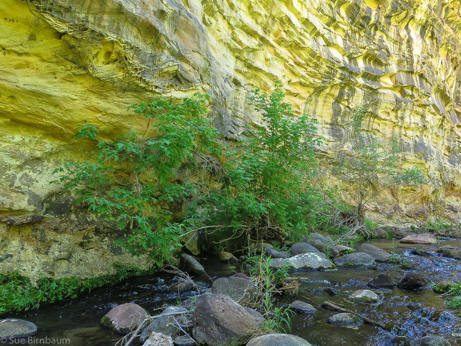
Death Hollow where Boulder Mail Trail enters from the north
These days, the Boulder Mail Trail trailhead is generously marked.   The first 1.5 miles trek steadily down a bench through a pinyon/juniper/sagebrush forest.  Views suddenly open up as the trail drops down into sandstone hills and gulches of the Sand Creek tributaries.  Rock cairns mark the trail for the remaining trek to Death Hollow (and then on to Escalante), except for a few sandy stretches where the trail is marked initially by a cairn.
Picture
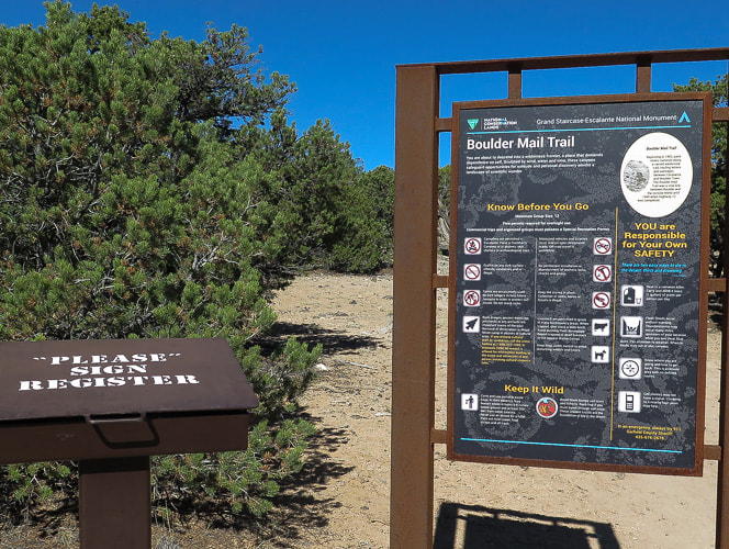
Boulder Mail Trail trailhead sign and register
Picture
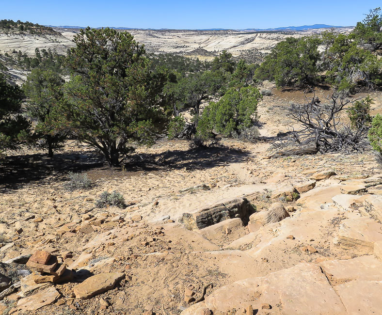
Nearing transition from plateau to shallow Navajo Sandstone canyon.  Look at that marvelous open country in the distance that we get to walk through!
Picture
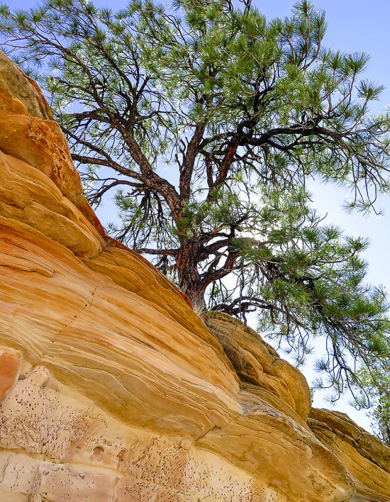
The trail zig-zags through a sandy opening of a shelf of eroded orange sandstone layers and deposits you onto the immense slickrock.  As you leave the plateau behind, two and even three cairns can be seen ahead, linking the trail to Sand Creek.  So much to see in such a stark landscape:  grey lichen, aged wood, sand pockets, and water-smoothed channels.
Picture
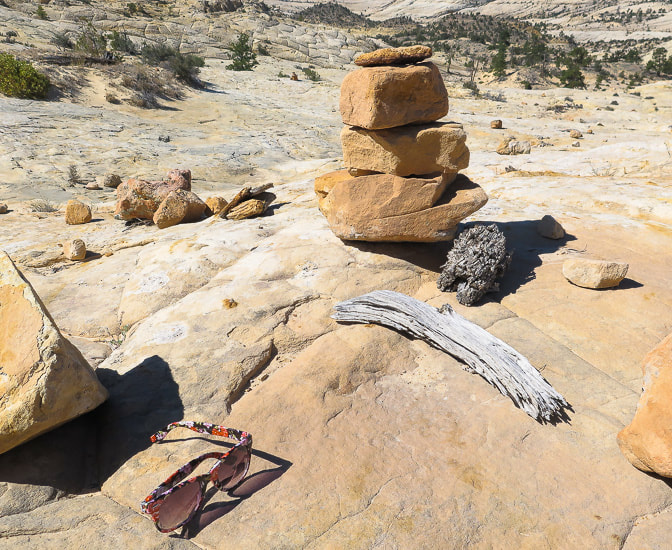
You never know what you may find on slickrock 
Picture
Eroded channel leading to Sand Creek
Picture
Asclepias speciosa
Showy Milkweed

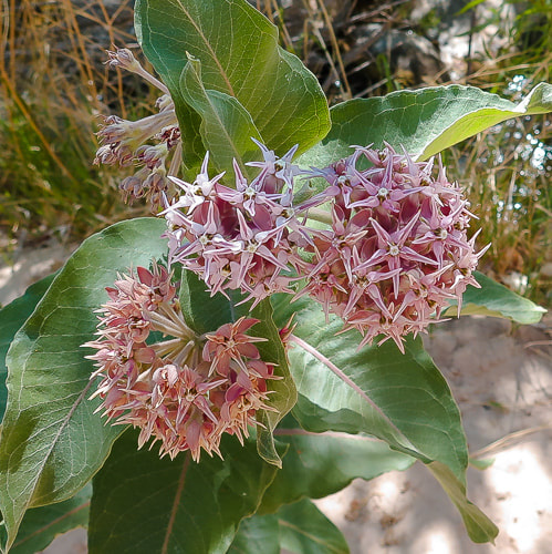
At 2.7 miles, cross Sand Creek, flowing in mid-June.  Walk on right (west) side of creek through willows for ~ 0.2 - 0.3 miles to cairns that climb out of creek bottom and briefly switchback over a knob.  We had to backtrack here because we followed the creek too closely to the shore.  The climb from Sand Creek to the highest point on Slickrock Saddle is ~ 500 feet.  The initial climb out of the creek is steep, then alternates between less steep and steep rises (see profile chart, above), trekking around the northwest side of a large dome with hoodoos on top.

Telephone wire installed 108 years ago runs along the trail as it treks through long stretches of deep sand in a pinyon/juniper forest.  This segment leads to the summit of Slickrock Saddle Bench at 6,600 feet and the first view of Death Hollow.
Picture
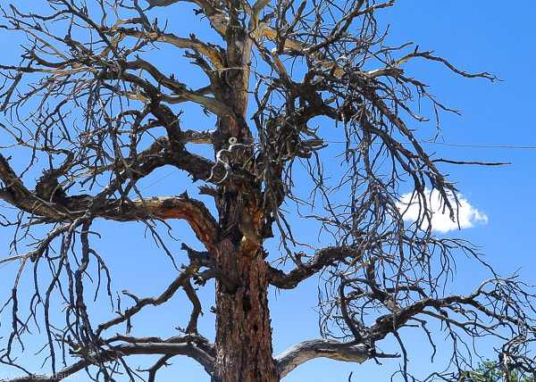
Telephone line installed in 1910 runs along trail - insulators attached to trees like this one above in a dead Ponderosa Pine
Picture
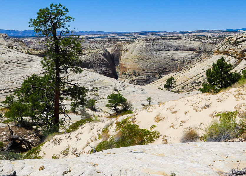
First view of Death Hollow from top of Slickrock Saddle Bench - last bit of sand hiking in foreground
As you make your way off  Slickrock Saddle Bench, the shadowy chasm of Death Hollow becomes deeper and deeper; you know it's there, but it just won't reveal itself right away.  It's tempting to stare in awe at this unique sight, but stay focused on the cairns, too, because the trail swings south and skirts around a knob at 6,617 feet, heading for the best way off the bench.  Next, the trail switchbacks and treks in a northwest direction.  The steepest part lies ahead, and you wonder how mules delivering mail in the early 1900's walked across this precarious descent.  A passage from the book "Advised them to Call the Place Escalante" reads:
​"To a reader sitting in a comfortable arm chair it is hard to describe the beauty of the Death Hollow Trail or the fear caused while sitting astride a horse trying to make its way safely over the rough terrain.  It is said that horses' legs literally quivered as they gingerly picked their way down the trail."
         -  Jerry C. Roundy, Escalante resident and author of "Advised them to Call the Place Escalante"

​This trail was known in the early 1900's as the Death Hollow Trail, and it was the shortest route between Boulder and Escalante.  It was the fastest route if one was in a hurry, for the wagon road between the towns was a longer distance.  Parts of this trail were "blasted out" in order for safe horse passage.  Tales of cream cans and eggs being delivered via the Death Hollow Trail among other trail experiences are described in Jerry Roundy's book.  The residents of Boulder and Escalante finally received the mail service they had been petitioning for in 1902 when the first government mail carrier's contract was given to an Escalante resident, who would deliver mail using the Death Hollow Trail twice per week.

I'm more aware of my balance on the steep slickrock; most of the texture of the rock enables my boots to grip well, but there are smoother patches to look out for.  I imagine what it was like to lead horses and mules over this section.  Did they slip?  During the winter was there ice?  What would this place look like with several inches of snow?  Or under a full moon?  I believe the Death Hollow Trail mail carriers were pretty tough, and they got to see some of the most beautiful scenery in the world.

Starting at ~ 5.25 miles, the well-marked trail switchbacks and descends 600 feet in 3/4 of a mile to the thick vegetation of the flowing creek in Death Hollow.  Some moss-covered rocks were slippery to step onto.  There's a sweet tent spot at the terminus, and from the paths seen on the treeless part of the shore on the descent, there are probably more tent spaces available.

This time we didn't hike down Death Hollow as we did 18 years ago, although the water would have cooled us off in the mid-80's temperature.  Vegetation along water seemed thicker this time, but the colors and textures no less beautiful.  The cool shade, chatter of water over rocks, sudden splash of colors and tall vertical walls in Death Hollow contrast with the bright and open, mostly shadeless trek across sandstone country.

After resting in the shade, we started the 6-mile hike back, looking forward to the largest elevation gain of the trip - 1,450 feet. On the way back, we took a break at Sand Creek, near huge rounded basalt boulders, probably from Boulder Mountain, whose basalt age is 6 - 16 Ma, and whose run-off streams  provide water for Sand Creek.

There's always numerous adventures awaiting me, and seeing Fred walk across the slickrock is even more fulfilling than the hike, which is hard to beat.  One of the best parts of life is the hope of future adventures in the beautiful American West.  Next time -  the entire Boulder Mail Trail!

Two days earlier, Fred and I hiked from Escalante to Mamie Creek along the Boulder Mail Trail (the southern portion).  Although we didn't get all the way to Death Hollow, I feel that portion of the trail is even more gorgeous.  We had the Phipps Death Hollow Wilderness all to ourselves that day, as we saw no one else.  It's days like these that I will remember reverently - forever. 

Below are some images of the portion of the Boulder Mail Trail Cross Country Route south of Death Hollow.
Picture
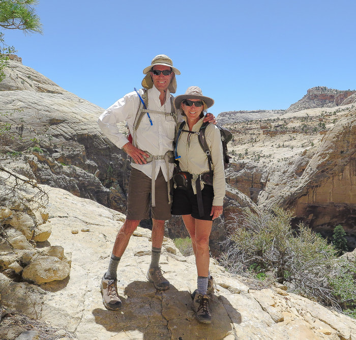
We ran into a retired biologist who took this photo of us after a detailed discussion of Fe+3, ferric iron in the rocks - very interesting to me, but Fred not so much!
Picture
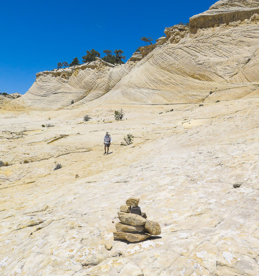
Thank goodness for cairns!
Slickrock Saddle Bench

Picture
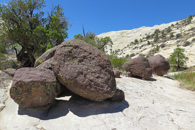
Basalt boulders near Sand Creek
Images from south portion of Boulder Mail Trail Cross Country Route - Escalante to Mamie Creek
Picture
Picture
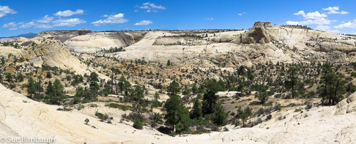
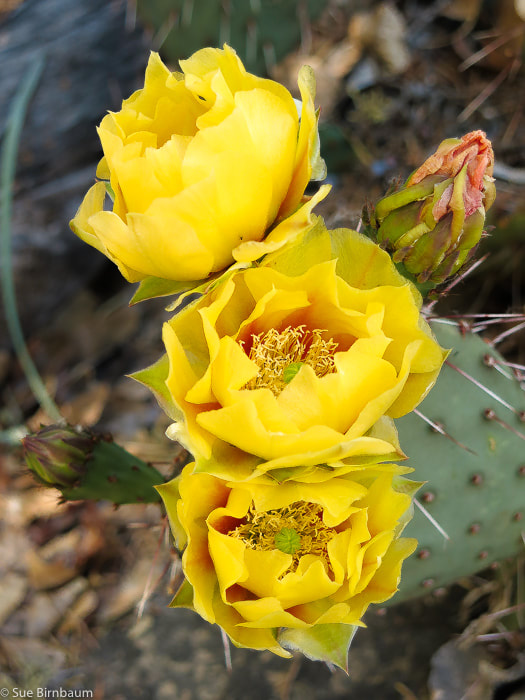
Prickly pear near junction of Pine Creek and Old Boulder Mail Trail 
Picture
Picture
Picture
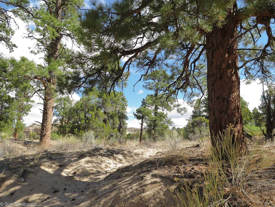
Heading up to Antone Flat
Picture
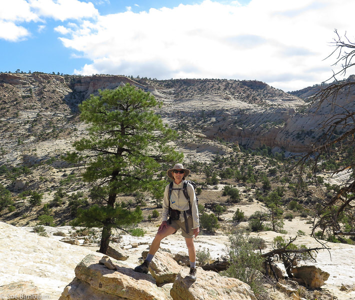
South end of Boulder Mail Trail from Escalante trailhead
Trail goes to the left of large drainage and then treks to the right in this photo on the smooth portion at the base of plateau

References:

Boggs, S. Jr.  2012.  Principles of Sedimentology and Stratigraphy, Fifth Ed.  Pearson Education, Inc.

​Hackman, R.J., and Wyant, D.G., 1973, Geology, structure, and uranium deposits of the Escalante quadrangle, Utah and Arizona: U.S. Geological Survey, Miscellaneous Geologic Investigations Map I-744, scale 1:250,000.

Parry, W. T. 2016.  Geology of Utah's Mountain, Peaks and Plateaus.  Friesen Press, Victoria, B.C., Canada.  

Roundy, J. C.  2000.  "Advised them to Call the Place Escalante".  Art City Publishing, Springville, Utah.  355 pp.


UtahGeology.com.  http://utahgeology.com/bin/formationdescs.php?fm=fm_navajo.  
6 Comments
Linda Paul link
9/4/2018 08:37:21 am

Sue, I love your descriptions of this rugged landscape. You are my virtual senses as this is not an area I would be likely to explore. You show me, in vivid detail, what I'm missing.

Yes, those mail carriers of old were a tough lot. But most people were, I think. They were never softened by running water, flush toilets, dishwashers, and sofas. We can barely conceive the enormity of picking a way through that slick rock with a string of mules, than they could conceive of the world we live in today.

Reply
Sue link
9/4/2018 05:52:28 pm

Linda!
Thank you so much - I wish everyone could see the things I see! I love the American West so much.

And I had a sentence in that post admitting that I wouldn't have been as tough as those mail carriers but I took it out (probably goes without saying). We get it a lot easier today like you said, with marked trails. How did they not get lost?
There's a new history museum in Escalante that has resources that describe the pioneers of that region and the book "Advised them to call the place Escalante" is full of stories of those hardy pioneers.

Reply
Valerie Estabrook
9/16/2018 03:49:08 pm

So very interesting, both the photos and your detailed descriptions! I felt like I was actually on the trail! Would love to do this one in the near future. Thanks for sharing this one Sue!

Reply
Sue link
9/16/2018 04:31:07 pm

Thanks Val!
Like we were talking about yesterday - hopefully you will get more time next year to explore southern Utah - you would love and appreciate the extraordinary beauty of that area - Grand Staircase/Escalante region is my favorite because it is so vast and remote. Since you did that really tough hike yesterday to Goat Mountain, you could definitely hike the entire Boulder Mail Trail!

Reply
purple cv reviews link
1/3/2019 01:08:43 am

I guess, this is one of the best adventures you had so far! Old Boulder Mail Trail Cross Country Route looks a bit creepy because it's too big. Once you get lost or trapped, it's quite impossible for you to be found. In my case, I just have to accept my fate because I wouldn't survive it. I watched a movie that features a hiker who got trapped while he was on his trail. it was based on a real story so I don't know actually how he overcome it after being trapped for almost a couple of days! But he managed to survive despite hundreds of circumstances that he wouldn't!

Reply
Sue link
1/5/2019 01:37:54 pm

Thanks for your comment!
It's true that if you are not used to this isolated, immense country, it feels intimidating and scary. Most of the hikes I have done across slick rock have been marked pretty well, but I am more cautious about these hikes because there is no continuous path, except through the sand and sage brush. So I always bring a map with me - a good topo map and research the hike before hand. I always wonder how the original Boulder Mail Trail mail carriers found their way through this incredible wilderness.....It's always good to have items in your pack that would sustain you through the night if you needed - a great idea for a blog post!

Reply


Leave a Reply.

    Categories

    All
    Arizona Hikes
    California Desert Hiking
    Idaho Summits
    Nevada Hikes
    Snowshoe Hikes
    Southern Utah Hikes/Bikes

    Complete list of Hikes/Bikes on HOME page
    Picture
    Sue and Fred
    Picture

    About this blog

    Exploration documentaries          –  "explorumentaries"  list trip stats and highlights of each hike or bike ride, often with some interesting history or geology.  Years ago, I wrote these for friends and family to let them know what my husband, Fred and I were up to on weekends, and also to showcase the incredible land of the west.  

    To Subscribe to Explorumentary adventure blog and receive new posts by email:

    submit
    Picture
    Happy Spring!
    Picture

    About the Author
    Sue Birnbaum

    A  trip to Jumbo Rocks Campground in Joshua Tree National Monument 38 years ago sparked my passion for hiking, exploring, and learning about desert ecosystems.  For the past 25 years, my husband Fred and I have explored the American West together; we love this land and I hope to inspire you to get out and explore through my photographs and trip descriptions.
    In 1992, Ray Wilson and I conceived the first Cactus to Clouds hike which climbs over 10,000 feet in one day to the summit of Mt. San Jacinto near Palm Springs, California.
    CACTUS TO CLOUDS HIKE 
    READ MORE
    ABOUT SUE

    Archives

    February 2023
    January 2023
    December 2022
    November 2022
    October 2022
    September 2022
    August 2022
    July 2022
    June 2022
    May 2022
    April 2022
    February 2022
    January 2022
    December 2021
    November 2021
    October 2021
    August 2021
    July 2021
    May 2021
    March 2021
    February 2021
    January 2021
    November 2020
    October 2020
    August 2020
    July 2020
    June 2020
    April 2020
    March 2020
    February 2020
    January 2020
    November 2019
    October 2019
    September 2019
    August 2019
    July 2019
    June 2019
    May 2019
    April 2019
    February 2019
    December 2018
    November 2018
    October 2018
    September 2018
    July 2018
    June 2018
    May 2018
    April 2018
    March 2018
    February 2018
    January 2018
    December 2017
    November 2017
    October 2017
    September 2017
    August 2017
    July 2017
    June 2017
    April 2017
    February 2017
    November 2013
    August 2013
    July 2013

    Some of my favorite websites:
    Awkward Botany
    ​citizen botany for the phytocurious

    Bird and Hike

    ​"Intended to encourage people to visit, learn about, and fall in love with the desert."
    ​

    Draw and Shoot
    Beautiful Photography

    Earthline: The American West
    Debra "writes to extol our beloved Earth." Detailed hike info, excellently written.
    ​

    Geologypics.com
    Geology and Geologic Time through Photographs

    Glenn Suokko
    Vermont artist's paintings "inspired by a place based on the land .... drawn to painting the representation and abstraction of nature."

    In the Company of Plants and Rocks
    ​A natural history blog about botany, plant ecology, and geology.

    Nature's Depths

    Walking through nature with John Palka, a neuroscientist who loves plants and ponders big questions

    Rangewriter - What Comes Next?
    ​With excellent writing, Linda tells the story of her unique mother's life including WWII era; with beautiful photographs.

    SeekingLost - Hiking and Backpacking Adventures.

    Stav Is Lost- Unconventional, out-of-the way hikes in the American West.


    Uprooted Magnolia
    ​Leah Yetter's beautiful "photo journal on life, love, and the spirit of Wyoming."
HOME

Cactus to Clouds Hike
More Quotes
HIKES BY STATE

Idaho Hikes
Utah Hikes/Bikes
​Arizona Hikes
​California Desert Hikes
​Wyoming Hikes
​Nevada Hikes

BLOGS

Adventure Blog
Women and the Land
GEAR REVIEWS
FIT AFTER 50
Fred Birnbaum
Dave Brasuell
Bus' Little Black Book
​Mike Carlson
​Ray Wilson
​Marcia Bondy
Bryan Krouse
​Maria Keezer
​Tim Clemens
​Doug Traubel
​Brian Holgate
​
Becky Borczon Blake
​Jennifer Cera and
​Sue Birnbaum

​Vance Powell
​Boise Cross Fit Masters Ladies
​Vickie Kearney

GALLERY

Desert Plants
Nature
Earth + Sky
Urban
Water
Patriot 
​Orchids
Boise
​
  ABOUT
    Contact

​
© 2017 - 2023 by Sue Birnbaum.  Photos on this website are the sole property of Sue Birnbaum unless otherwise indicated.  Please receive permission before publishing my trip reports and photos.
I try my best to be accurate with my hike descriptions; please research your adventures, always bring a map and compass and know how to read them, be prepared!  All of these hikes can be dangerous; hike at your own risk.  ALWAYS carry the Ten Essentials with you on hikes. 
​Please feel free to contact me with comments or questions, or if you see any errors that need attention.
Thank-you for stopping by!


EXPLORUMENTARY.com
  • Home
    • Cactus to Clouds Hike
    • More Quotes
    • Ann Zwinger Quotes
    • Mary Oliver Poems
  • Hikes by State
    • Idaho
    • Southern Utah
    • Arizona
    • California Desert
    • Nevada
    • Wyoming
  • BLOGS
    • Adventure Blog
    • Women and the Land
  • GALLERY
    • DESERT PLANTS >
      • Beavertail cactus
      • Brittlebush
      • Christmas Cactus
      • Arizona Barrel Cactus
      • Parry's penstemon
      • Agave
      • Arizona Rainbow Hedgehog
      • Claret Cup Hedgehog
      • Desert Agave
      • Palmer's Penstemon
      • Silver Cholla
      • Cristate Saguaro
      • Indian Paintbrush
      • Ocotillo
      • Santa Rita Prickly Pear
      • Spiny Cliffbrake
      • California Barrel Cactus
      • Engelmann Prickly Pear
      • Velvet Mesquite
      • Joshua Tree
      • Buckhorn Cholla
      • Hedgehog Cactus
      • Fishhook cactus
      • Thompson's Woolly Locoweed
    • NATURE
    • BOISE
    • EARTH + SKY
    • URBAN
    • WATER
    • PATRIOT
    • ORCHIDS
  • Fit After 50
    • Brian Holgate
    • Fred Birnbaum
    • Dave Brasuell
    • Bus' Little Black Book
    • Mike Carlson
    • Ray Wilson
    • Bryan Krouse
    • Vickie Kearney
    • Maria Keezer
    • DOUG TRAUBEL
    • Boise Cross Fit Masters Ladies
    • Tim Clemens
    • Marcia Bondy
    • Becky Borczon Blake >
      • Becky B Downtown
    • Jennifer Cera and Sue Birnbaum
    • Dave Brasuell
    • Vance Powell
  • About
    • CONTACT