|
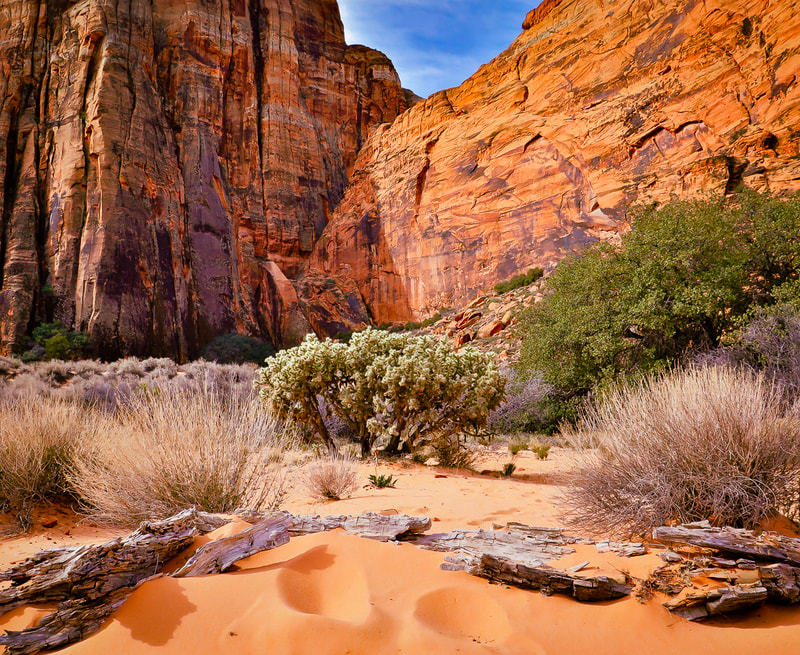
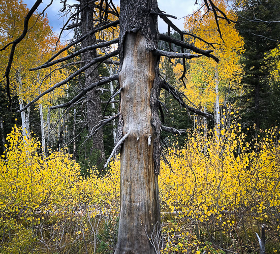
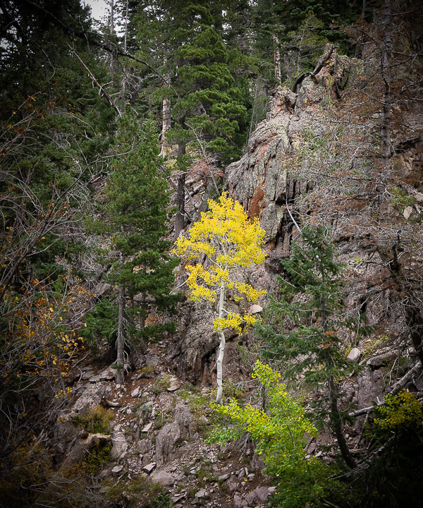
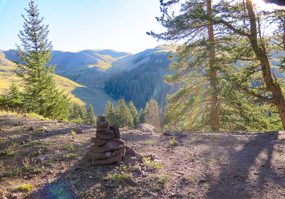
Crack Canyon, with its narrows and soaring sandstone walls is a non-technical, scenic joy to hike. It's one of the over 30 remote and hidden canyons transecting the San Rafael Reef. Bonus: you might have it all to yourself.
Related posts:
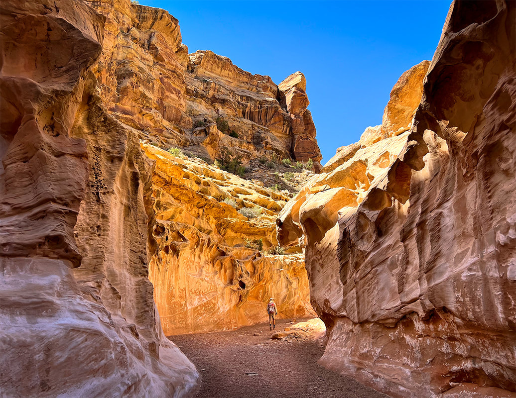
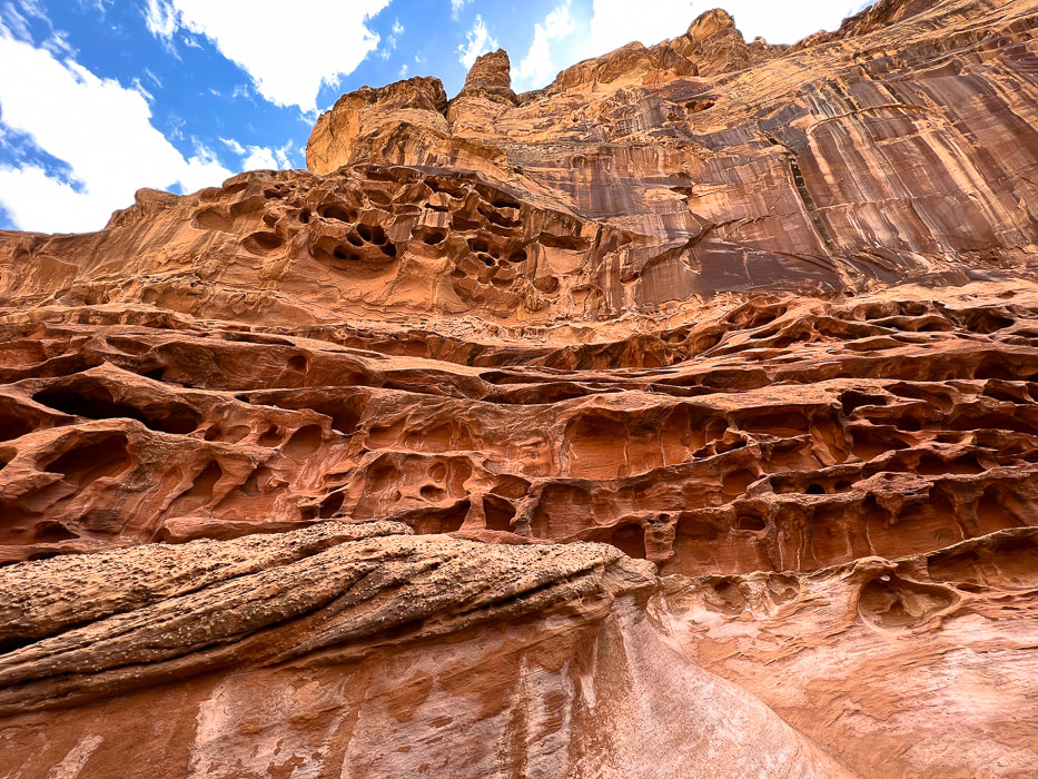
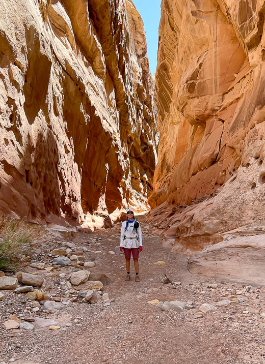
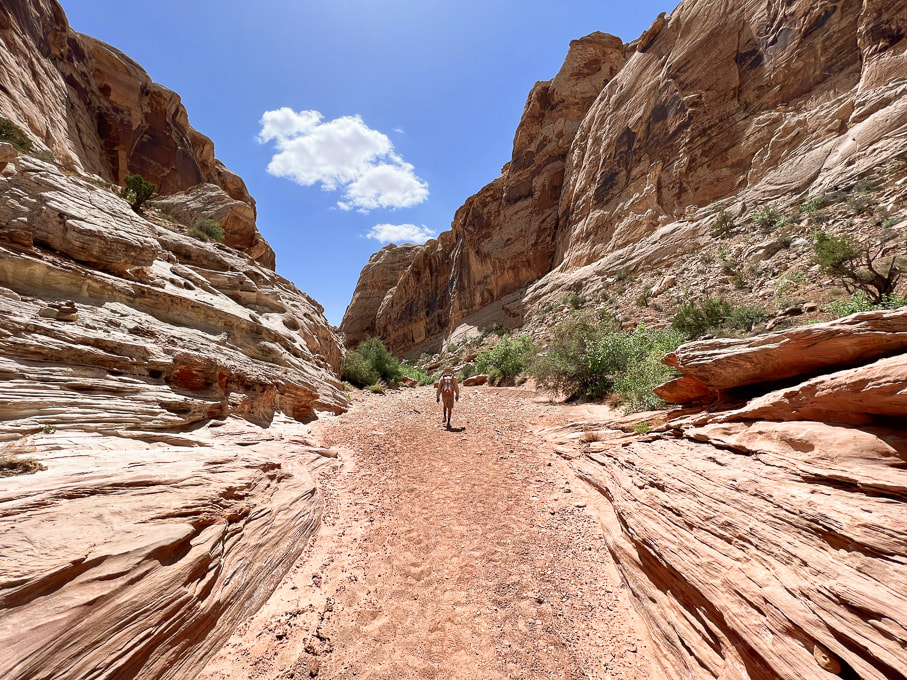
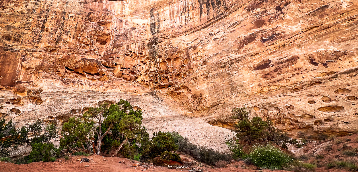
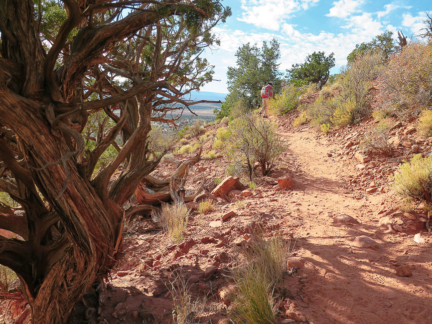
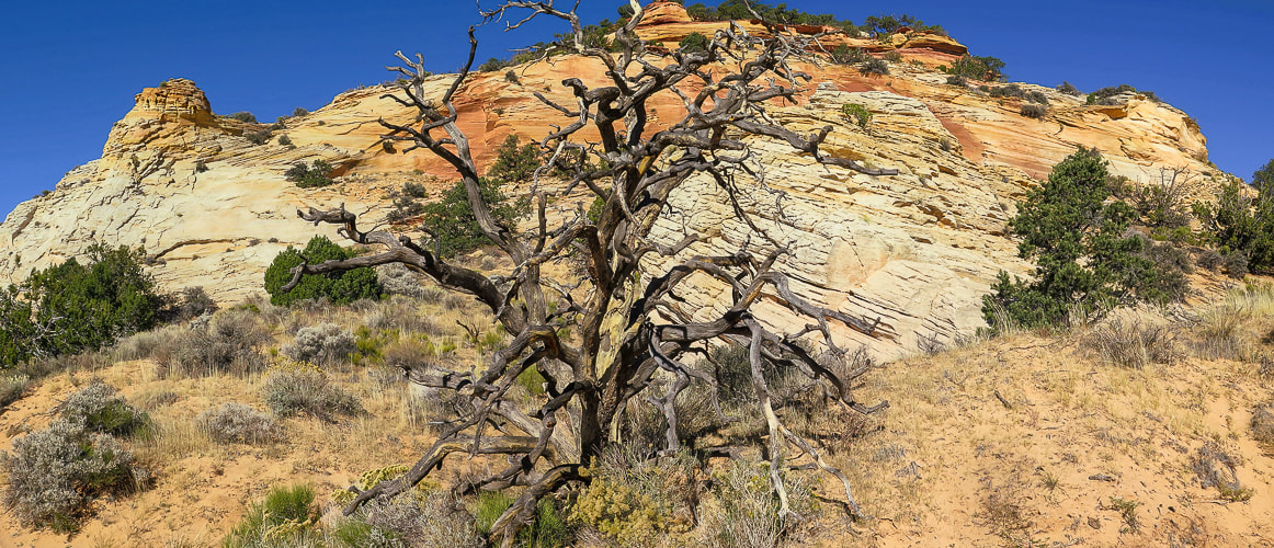
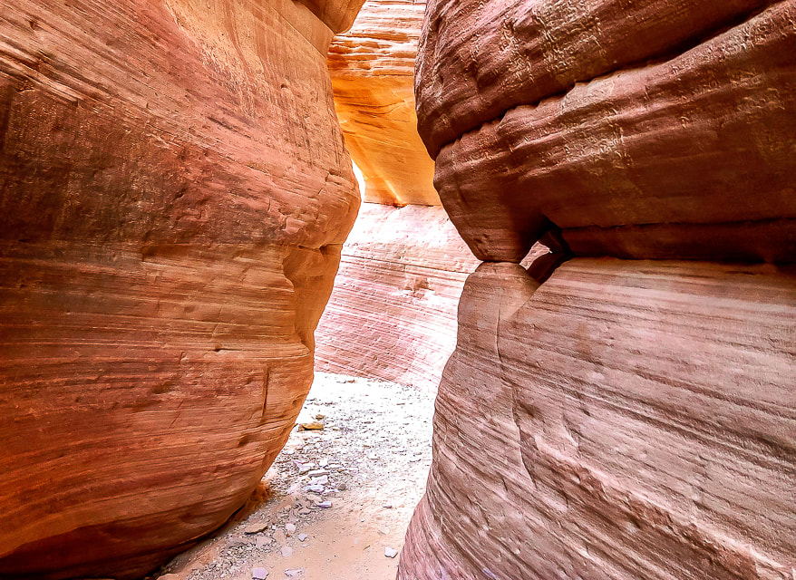
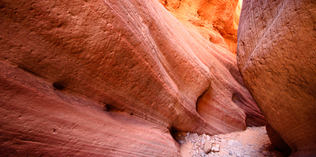
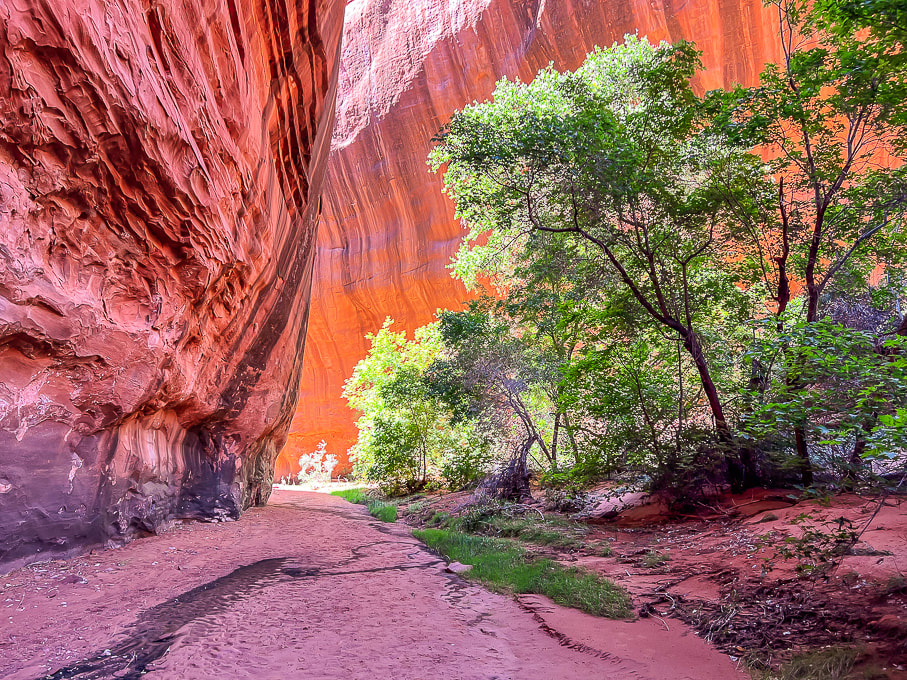
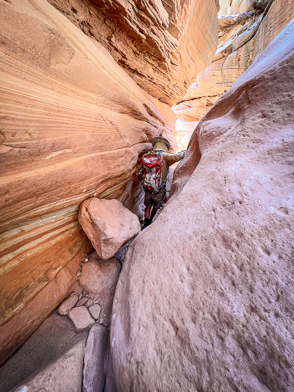
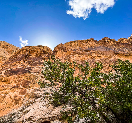
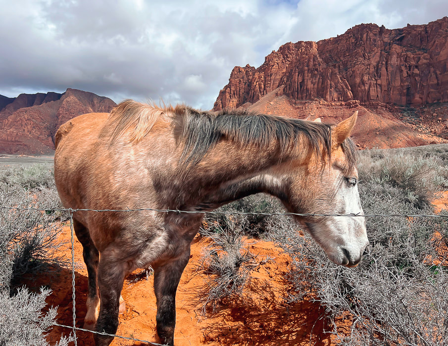
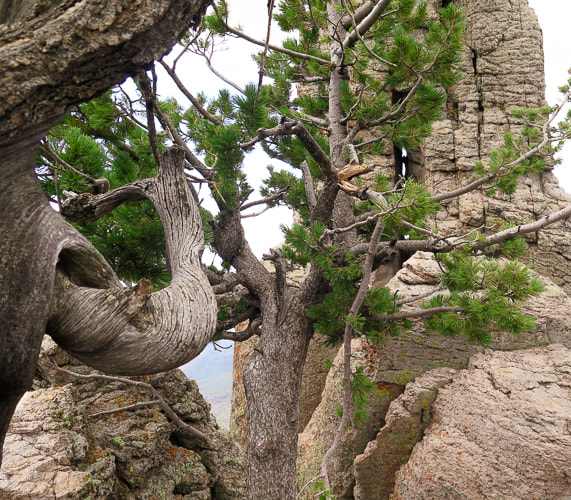
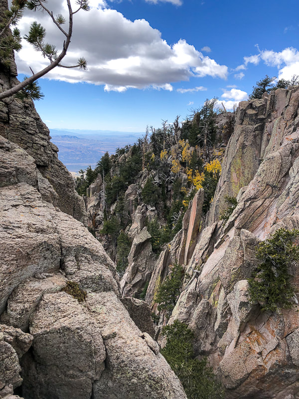
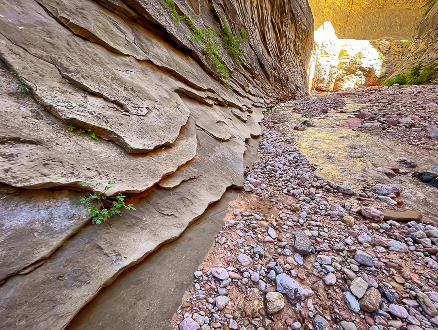
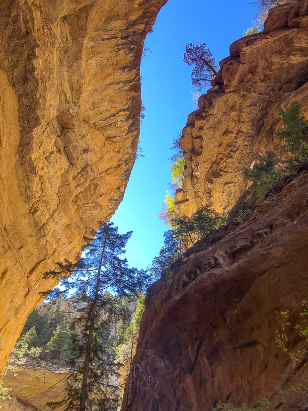
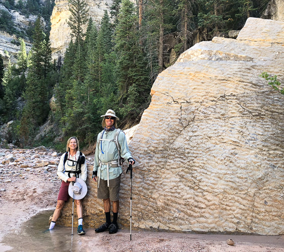
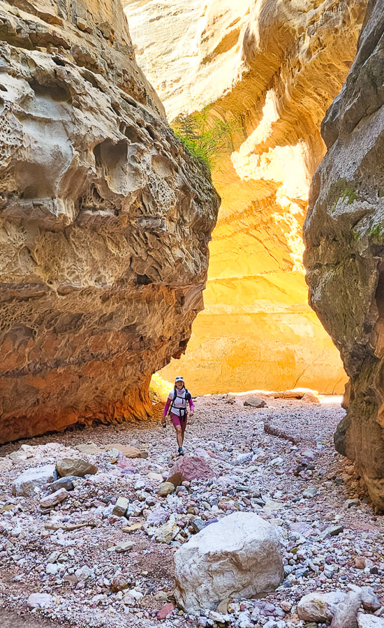
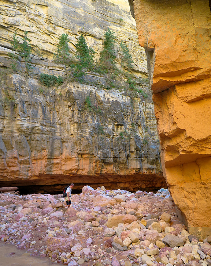
Entrance into Crack Canyon, San Rafael Reef.
Trip Stats
Location: Central Utah, Bureau of Land Management - Price Field Office - Southeast San Rafael Swell - Crack Canyon Wilderness Study Area. Overview: Penetrate the San Rafael Reef through one of its spectacular slot canyons as waters have for millions of years, with new discoveries around every corner, including a few narrows. This delightful "hands-on" hike navigates boulders, walls and slick rock. A cool cave awaits at the mouth of Crack Canyon, if you go far enough. Distance/Elevation gain: We began 0.4 miles from trailhead. Our hike = 8.0 miles round-trip. Elevation goes from 5,600' at top to ~ 5,000' at mouth. Difficulty: Easy/moderate with a few Class 3 moves and one Class 3-4 on short walls and boulders (one has a bypass). Coordinates: Trailhead on Behind the Reef Road: 38.64315 -110.74504 Maps/Books: Trails Illustrated #712 - San Rafael Swell - BLM - Price Field Office/Hiking and Exploring Utah's San Rafael Swell, 4th Ed., by Michael R. Kelsey. Caltopo map of our GPS tracks at end of post. Directions to Trailhead: From Green River, Utah on I-70 head west and take Hwy 24 exit toward Hanksville. At milepost 135 on Hwy 24, follow signed road toward Goblin Valley State Park (west). Follow this road to junction (5.1 miles); continue straight. At 7.2 miles from Hwy 24, turn left on a good graded road (Behind the Reef Road). Reset your odometer and travel 4.1 miles to Crack Canyon TH, passing the TH to Wild Horse Creek at 1.6 miles. We drove the old sandy road 0.4 miles down canyon in our 4x4 truck. High clearance 2WD ok on Behind the Reef Road. Date Hiked: May 11, 2023.
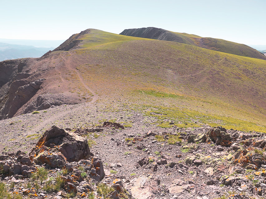
Our tracks down-canyon and back, beginning in the north just off of Behind the Reef Road.
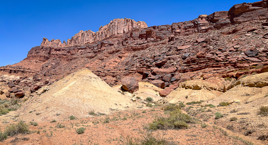
The northwest Colorado plateau's San Rafael Swell and its huge, tilted reef of sandstone has much to offer the intrepid explorer who will boldly go where not a lot of people go. It's an extraordinary place of sublime topography and deep, dark canyons, some that contain pools to swim through. I've heard of this area for years, especially with reference to Native American petroglyphs and pictographs. Fred and I stayed at Goblin Valley State Park years ago to hike Canyonland National Park's remote Horseshoe Canyon to witness the amazing Great Gallery/Holy Ghost pictograph panel and dinosaur print. Relatively unknown compared to Utah's well-visited parks like Capitol Reef, there's a lot to do and see as evidenced in Michael Kelsey's book Hiking and Exploring Utah's San Rafael Swell.
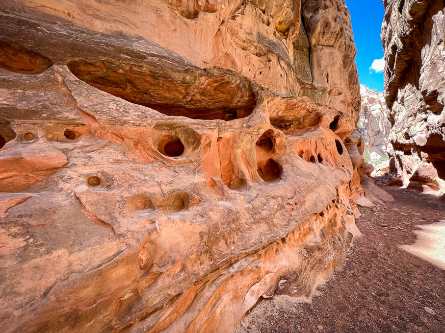
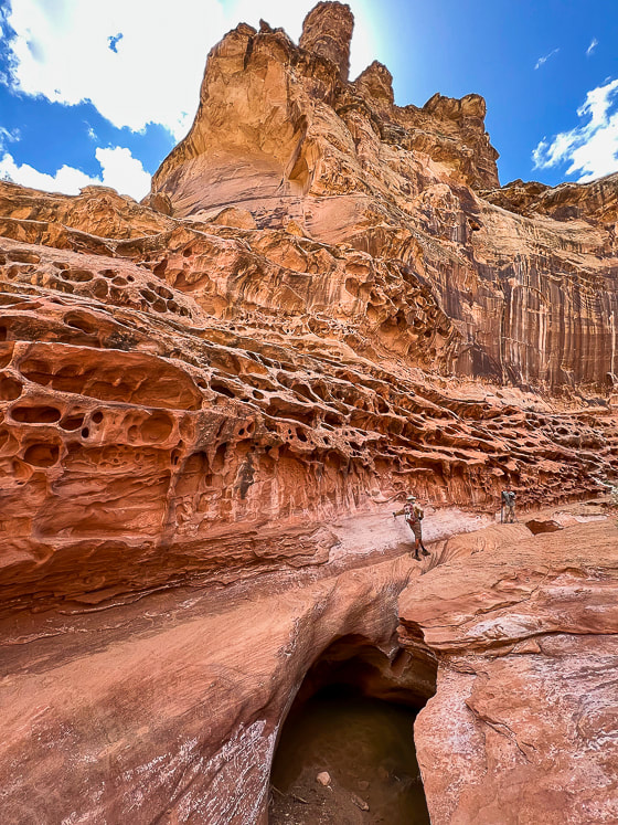
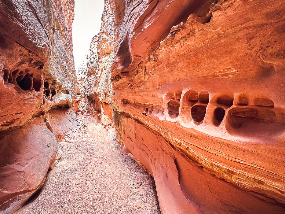
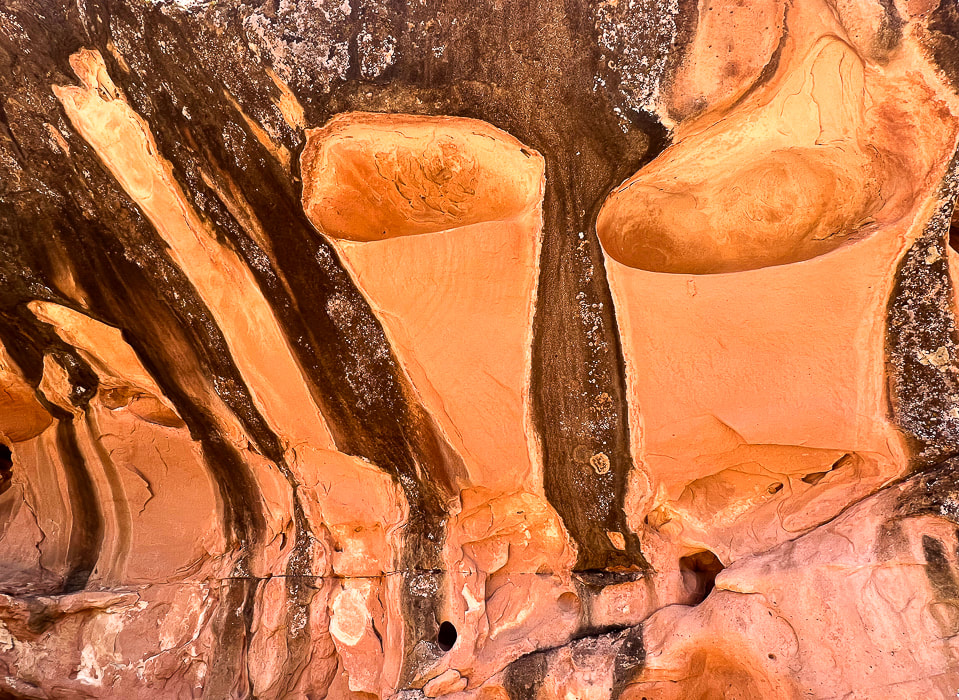
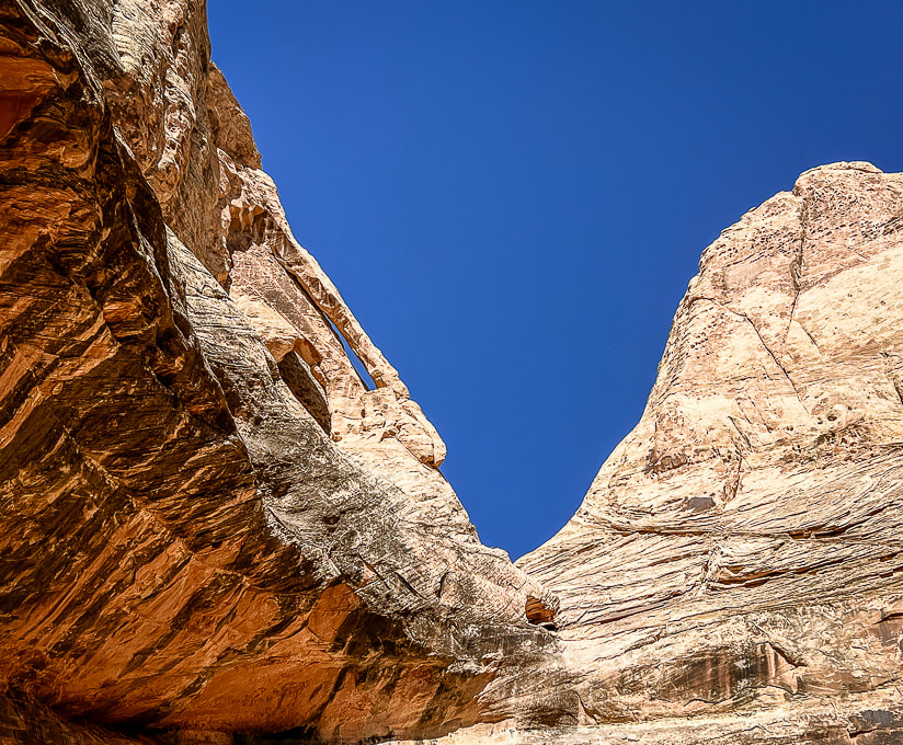
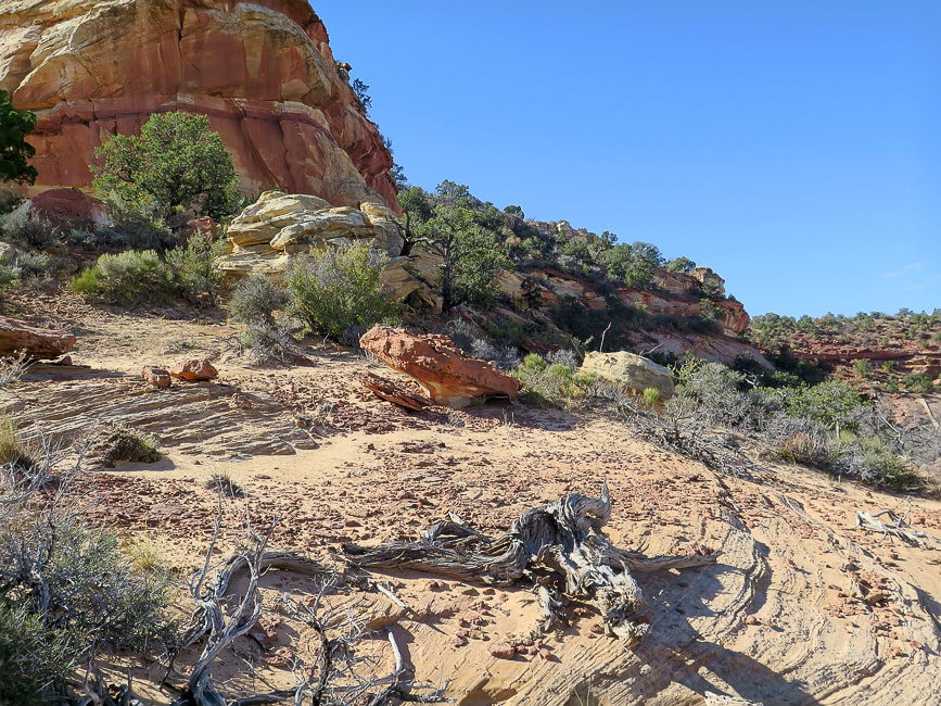
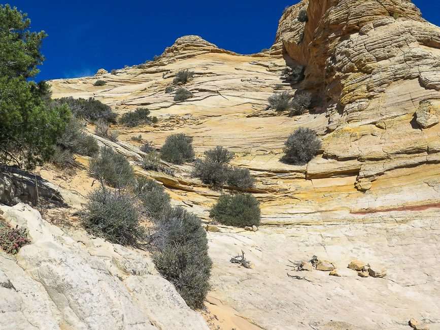
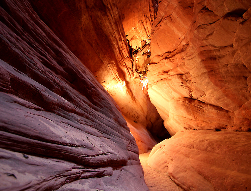
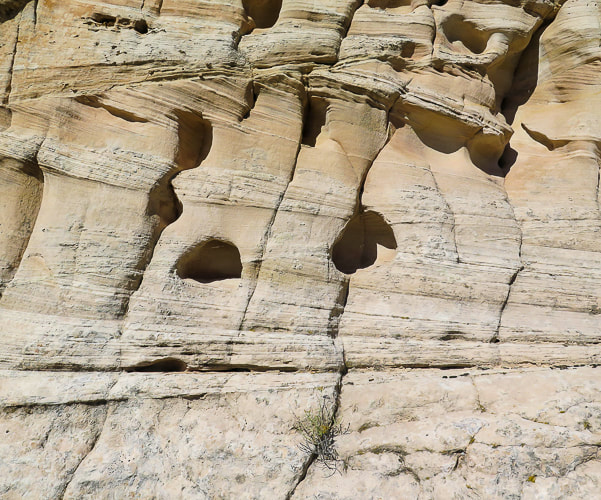
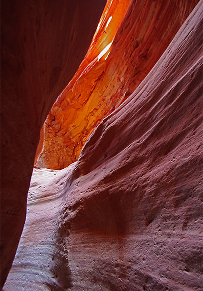
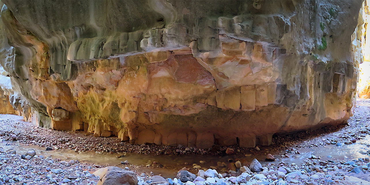
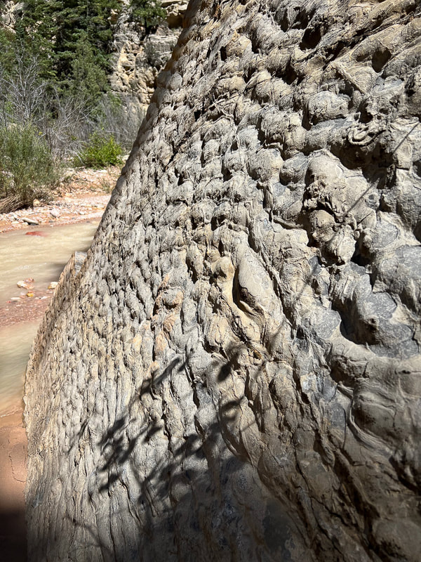
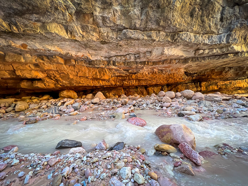
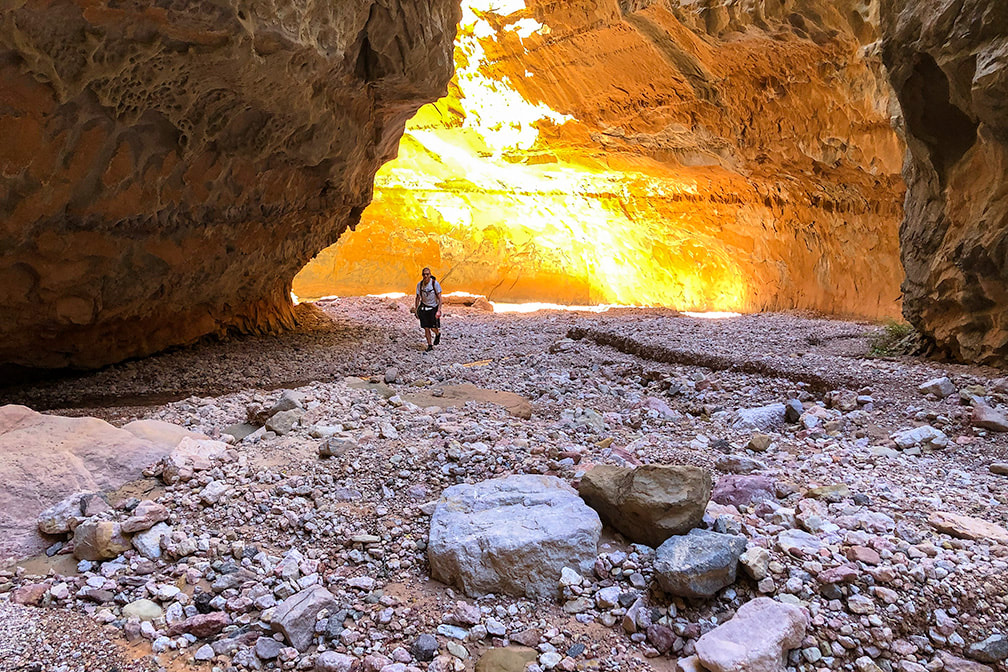
Mexican Mountain, Sids Mountain, Devils Canyon, and Muddy Creek are among the seven wilderness study areas in the San Rafael Swell. The reef on the eastern side of San Rafael is bisected by around 30 slot canyons, many of them requiring technical climbing and navigating skills. A few days before Crack, we went to see the amazing pictographs in Black Dragon Canyon and walked up-canyon from there past an old uranium mine. I'm not exactly sure how Crack Canyon got its name but I can guess two reasons. At the beginning, as the canyon begins to narrow, there is a "crack" in a tunnel ceiling, only a few feet wide. Further down, the honeycombed walls are so tall on each side at portions there is a "crack" of sky, especially in the narrows. What sets this canyon apart from other slots is the amount of extensive weathering in the form of honeycombs and caverns.
Features of Crack Canyon Hike
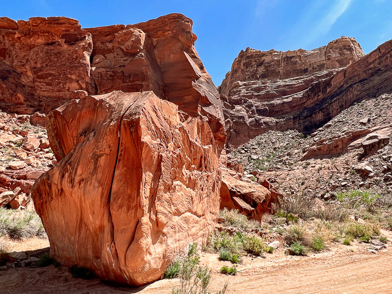
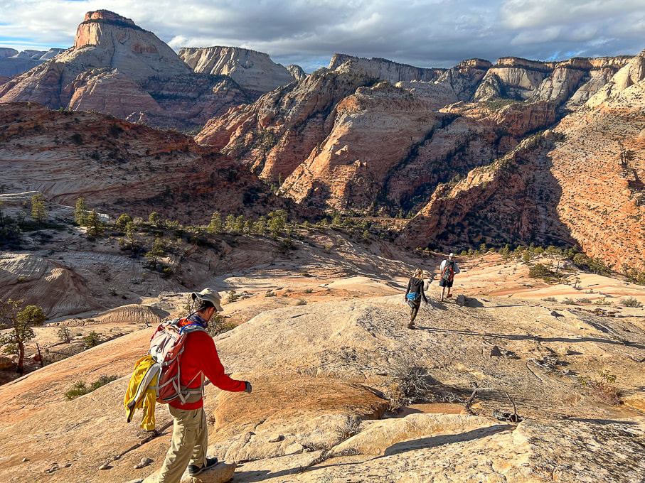
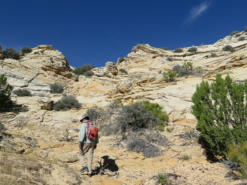
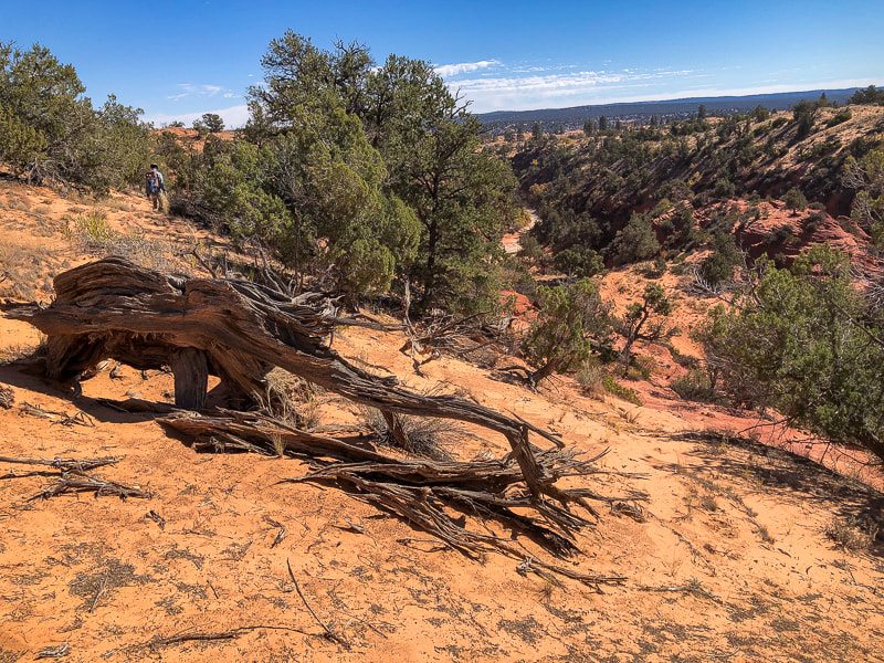
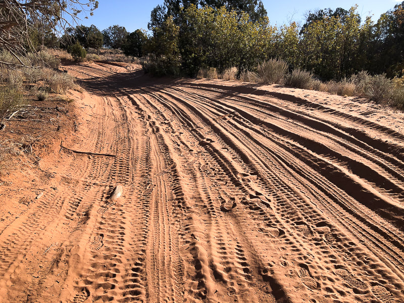
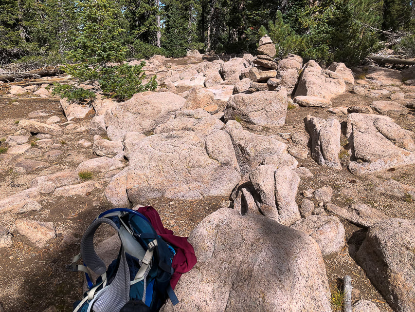
Although there's parking at the trailhead to Crack Canyon on Behind the Reef Road, we drove our 4x4 truck ~ 0.4 miles and parked when the canyon narrowed. It was a stellar day - azure skies with tall glowing, cavernous-weathered sandstone walls on both sides. We encountered only eight people on this Thursday. We ran into two older San Rafael-experienced gentlemen who recommended the Little Wildhorse Canyon/Bell Canyon loop, a bit further to the southwest. We've got lots of plans for when we return to this unique, contorted and high-cliffed desert less-traveled.
“Standing there, gaping at this monstrous and inhumane spectacle of rock and cloud and sky and space, I feel a ridiculous greed and possessiveness come over me. I want to know it all, posess it all, embrace the entire scene intimately, deeply, totally...”
- Edward Abbey, Desert Solitaire Never Stop Exploring! 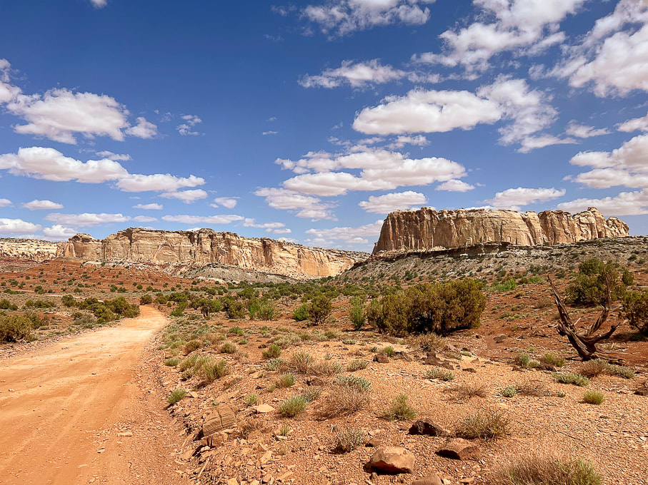
The graded Behind the Reef Road on the west side of the San Rafael Reef that takes you to Crack Canyon Trailhead. Looking northeast toward Temple Mountain.
Start of hike after we drove ~0.4 miles down canyon from trailhead on Behind the Reef Road.
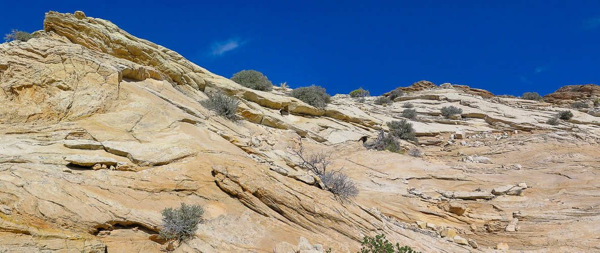
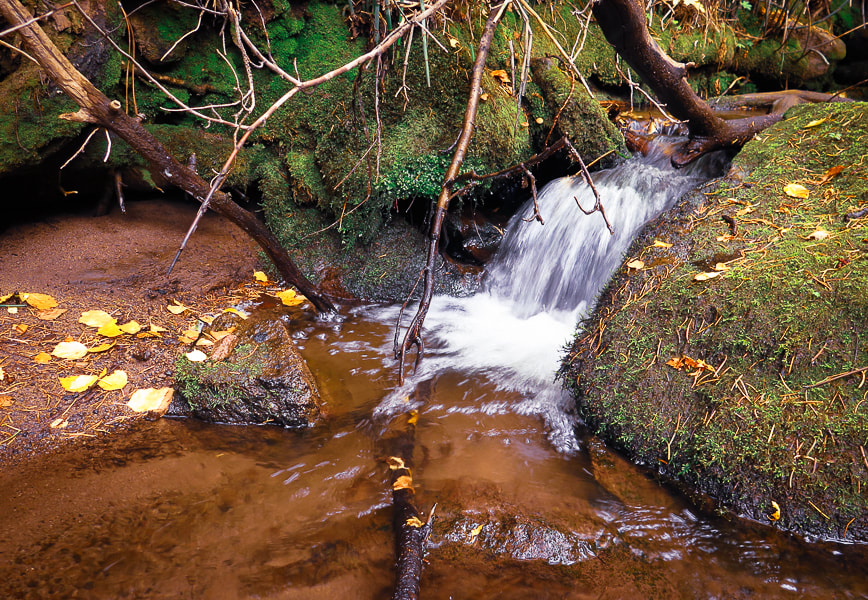
Crack Canyon's immense wall entrance.
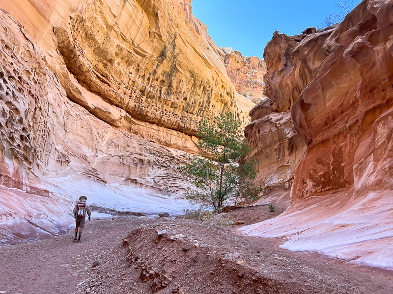
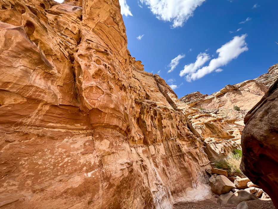
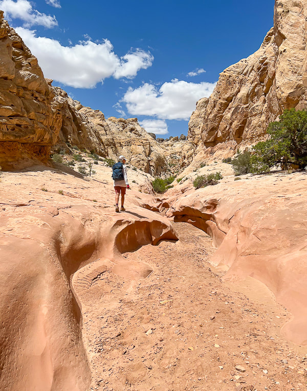
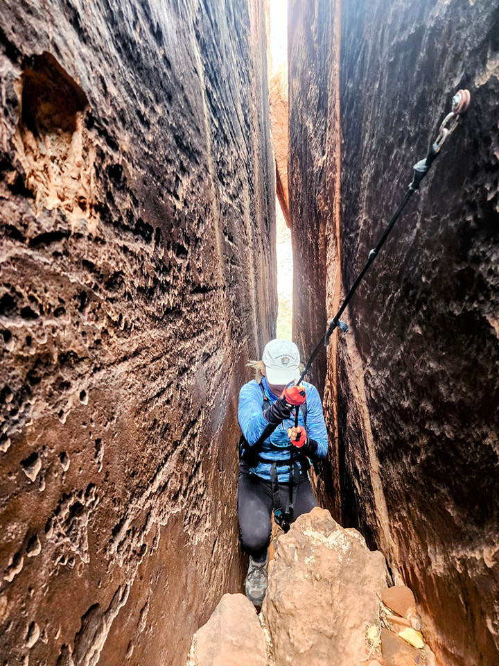
Crack Canyon starting to narrow.
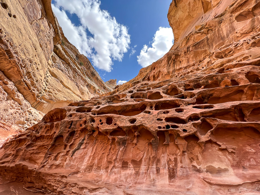
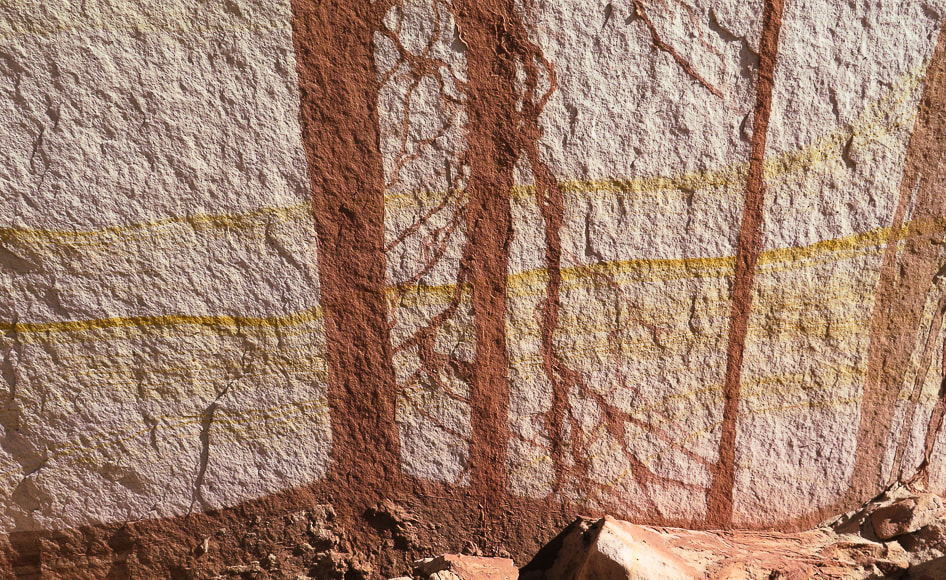
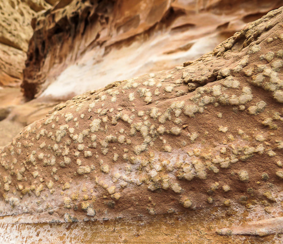
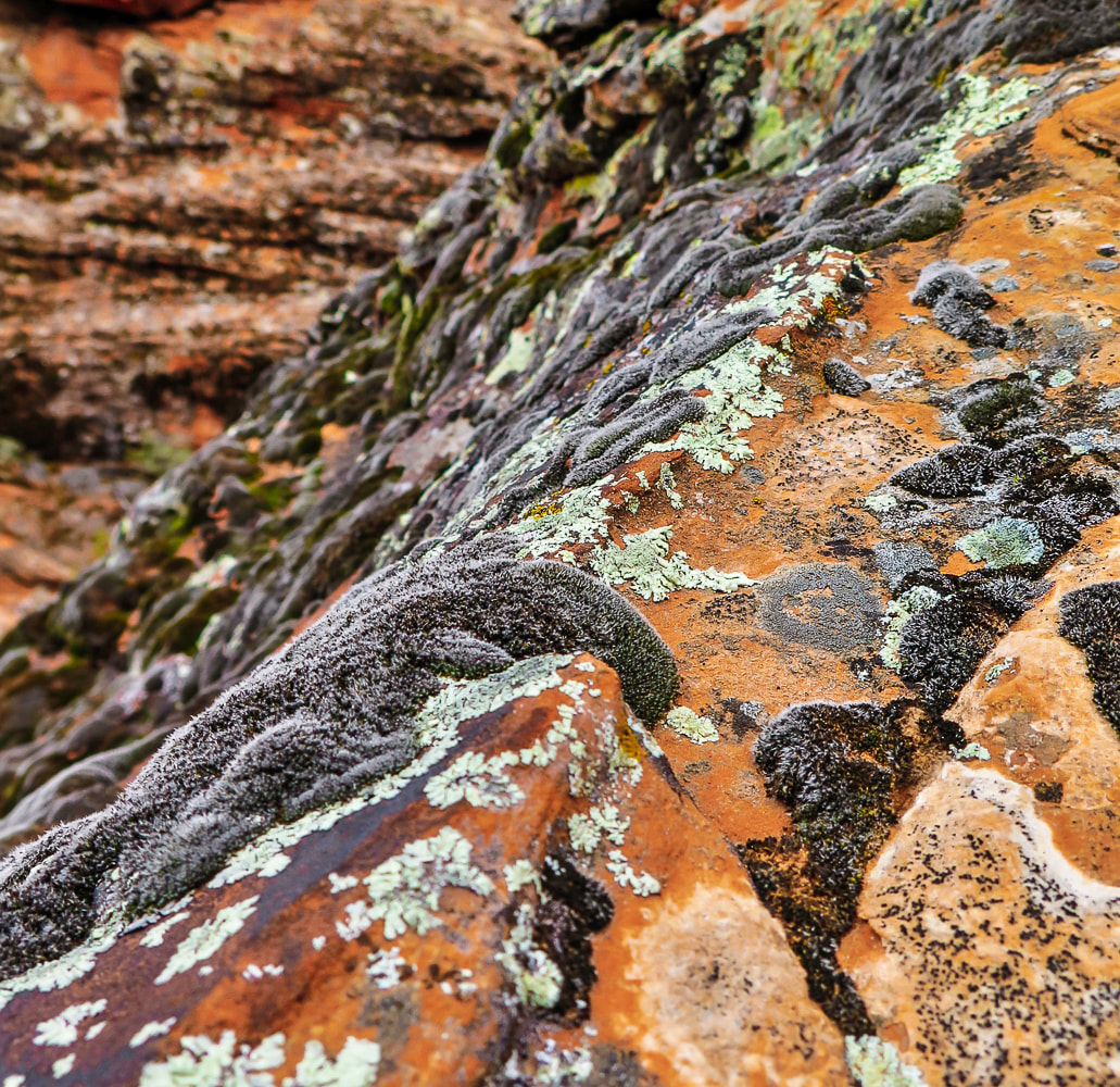
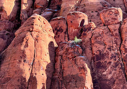
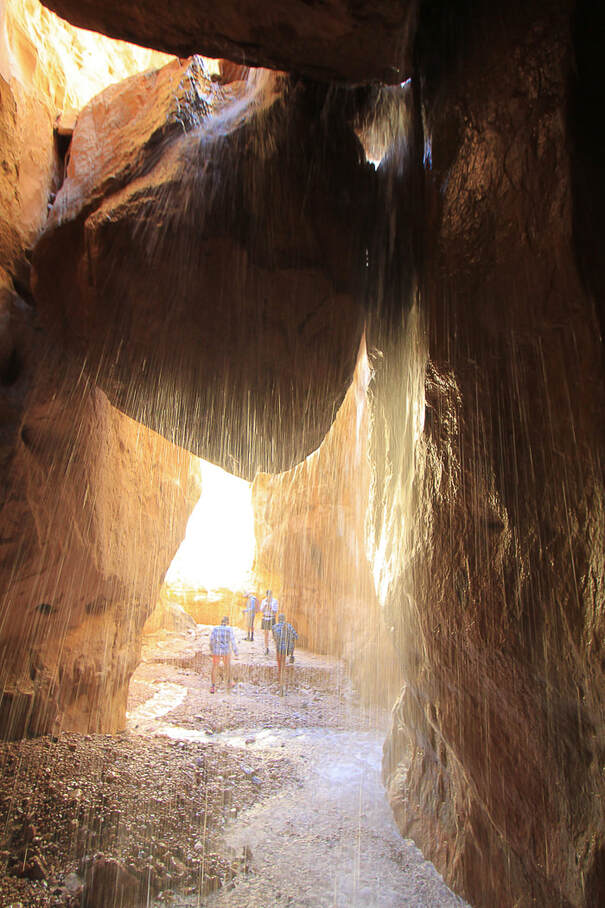
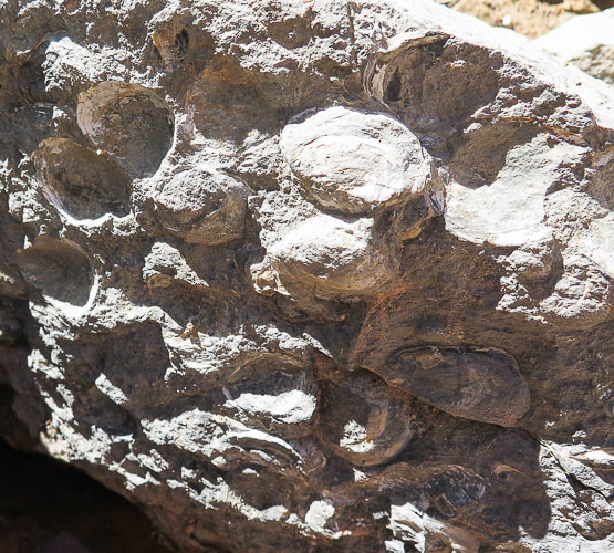
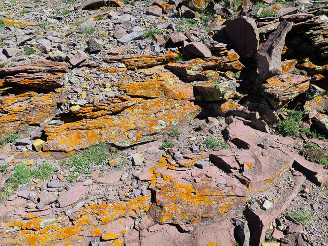
Cavernous weathering (tafoni) in sandstone caused by salt crystallization ("salt weathering") and physical processes such as wind and water weathering. Dissolution of the calcite cement between sand grains may take place, weakening the bonds between sand grains. The factors influencing cavernous weathering are seasonal wetting and drying, aeolian (wind-blown) salt, and water vapor.
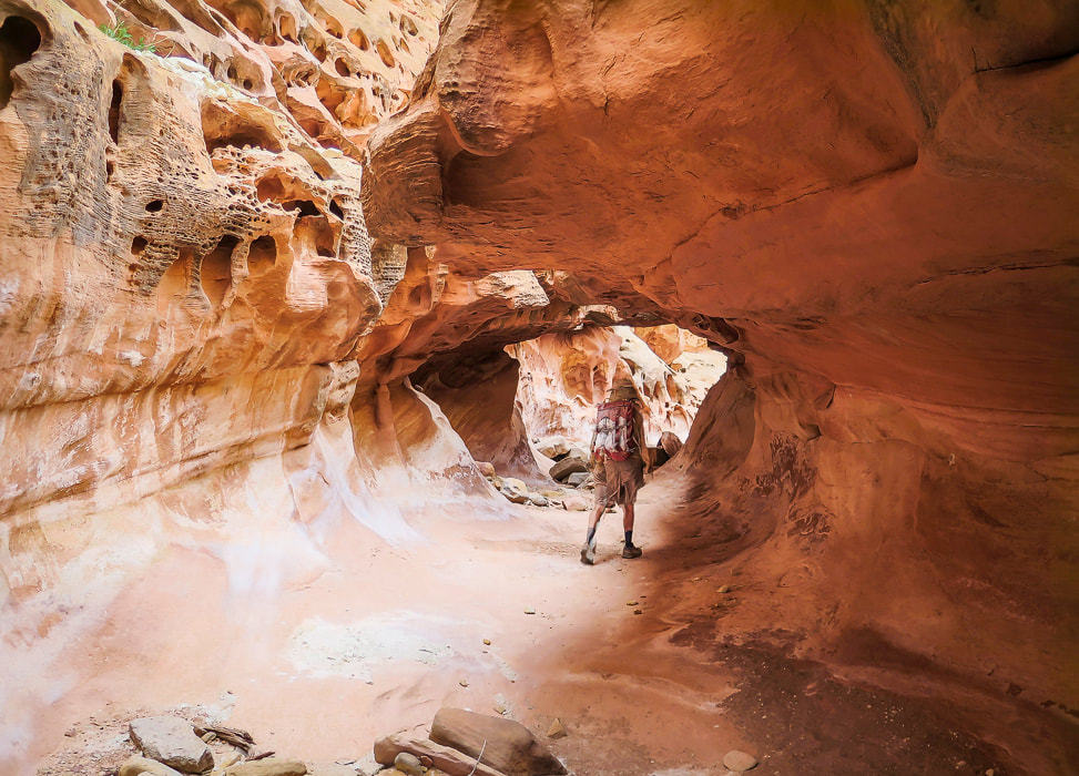
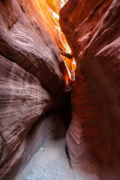
Entering "tunnel" with crack in its ceiling.
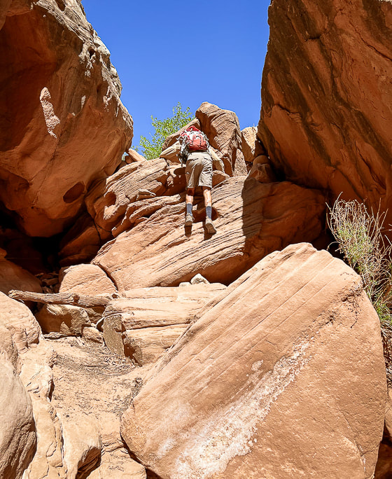
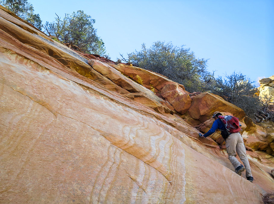
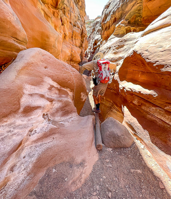
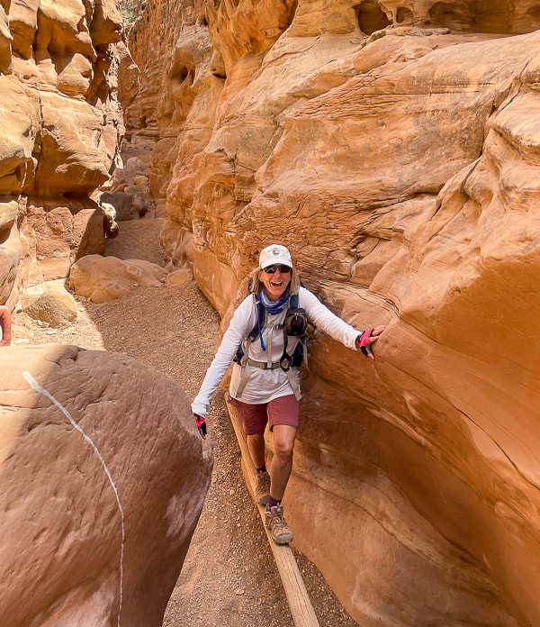
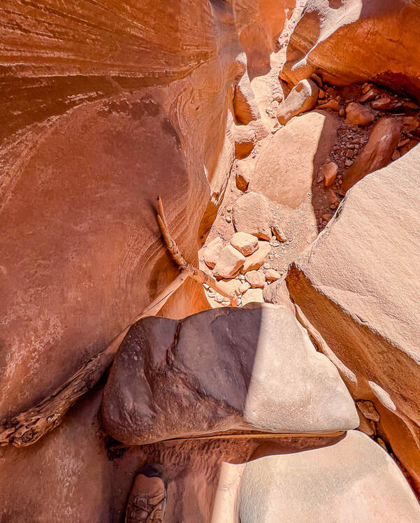
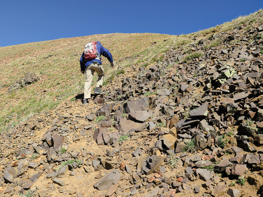
Log to ascend/descend sheer boulder wall (top of image in the sunlight).
Fun things in the canyon: a log helps to descend a sudden drop-off.
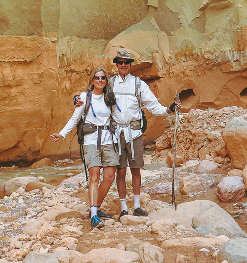
Fred going down, Sue going up. 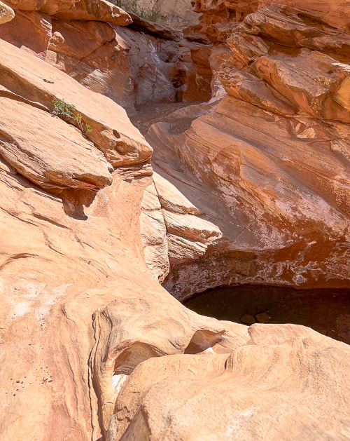
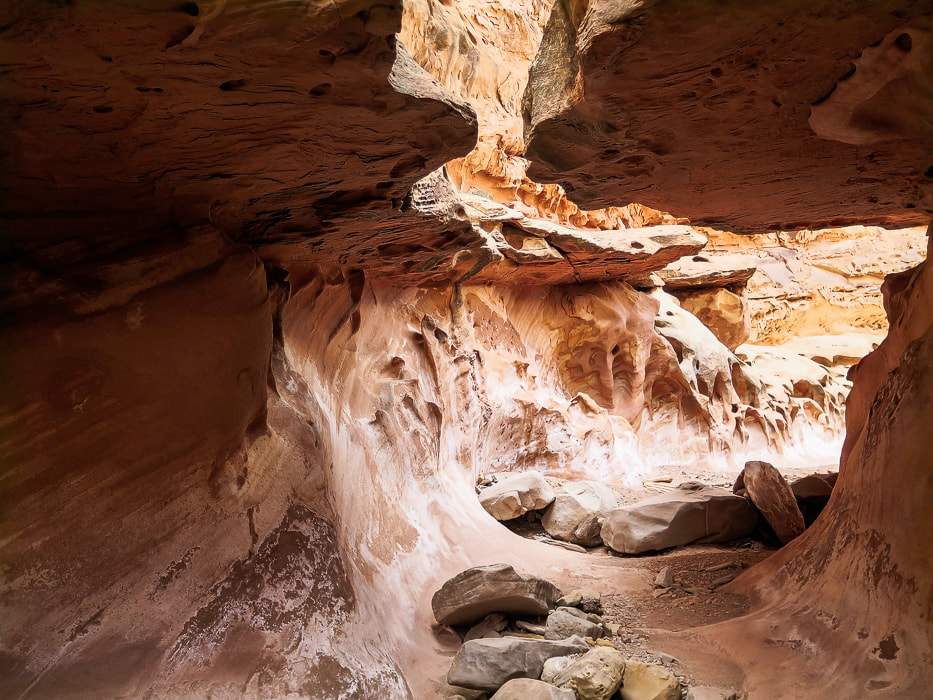
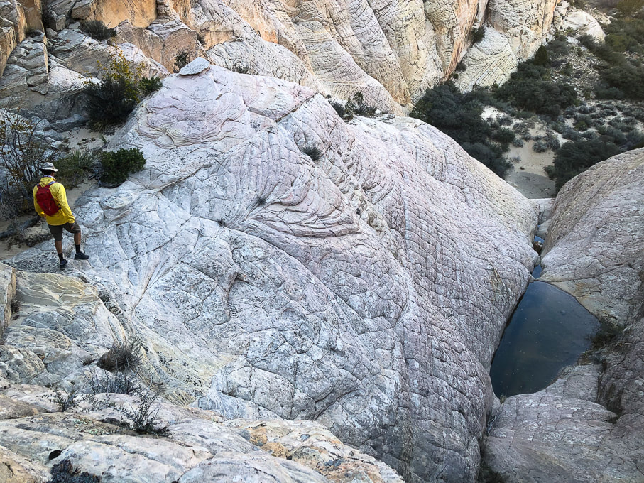
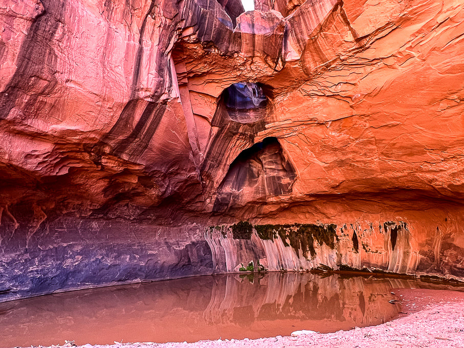
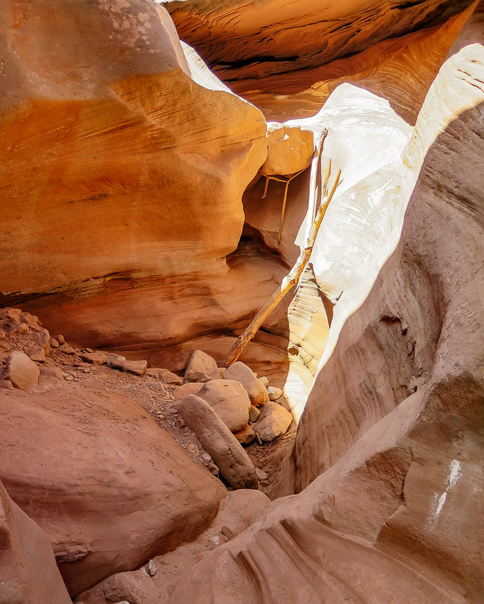
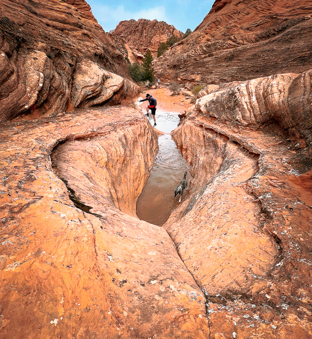
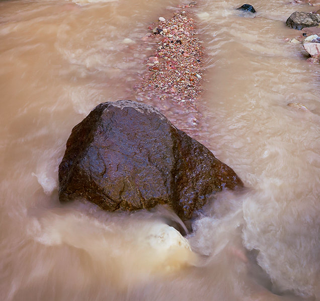
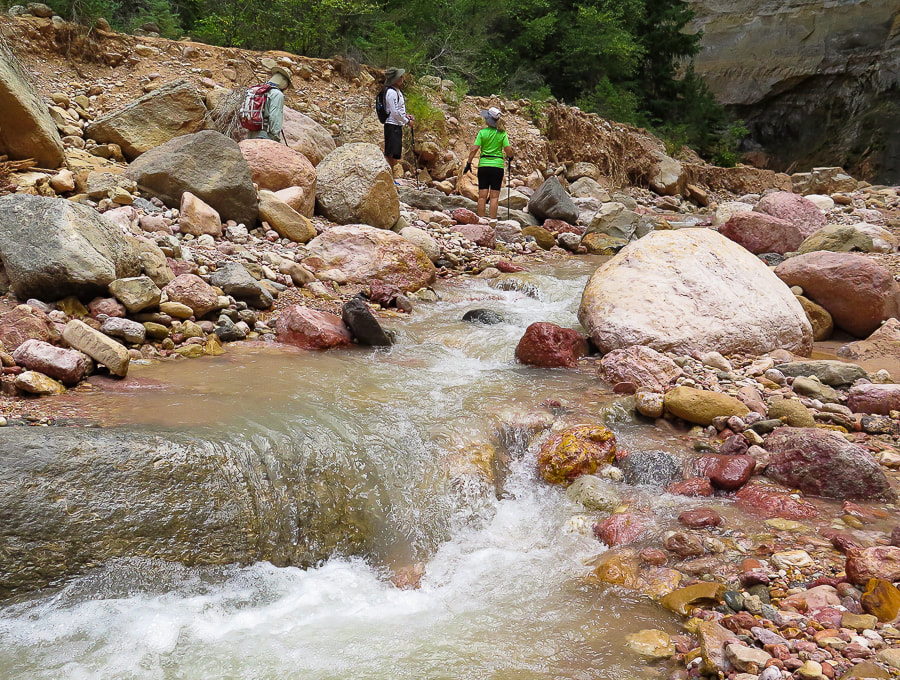
After descending a short wall above in this photo, you skirt around this pool of water walking on sandstone.
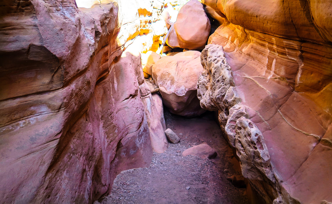
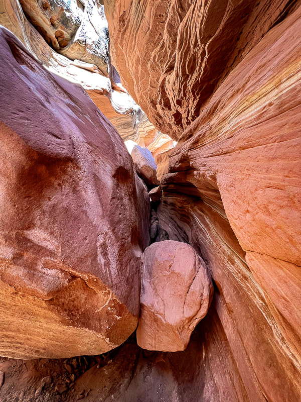
Looking at both ends of this boulder-navigating obstacle.
Climbing down short wall.
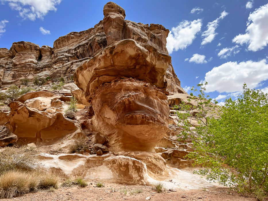
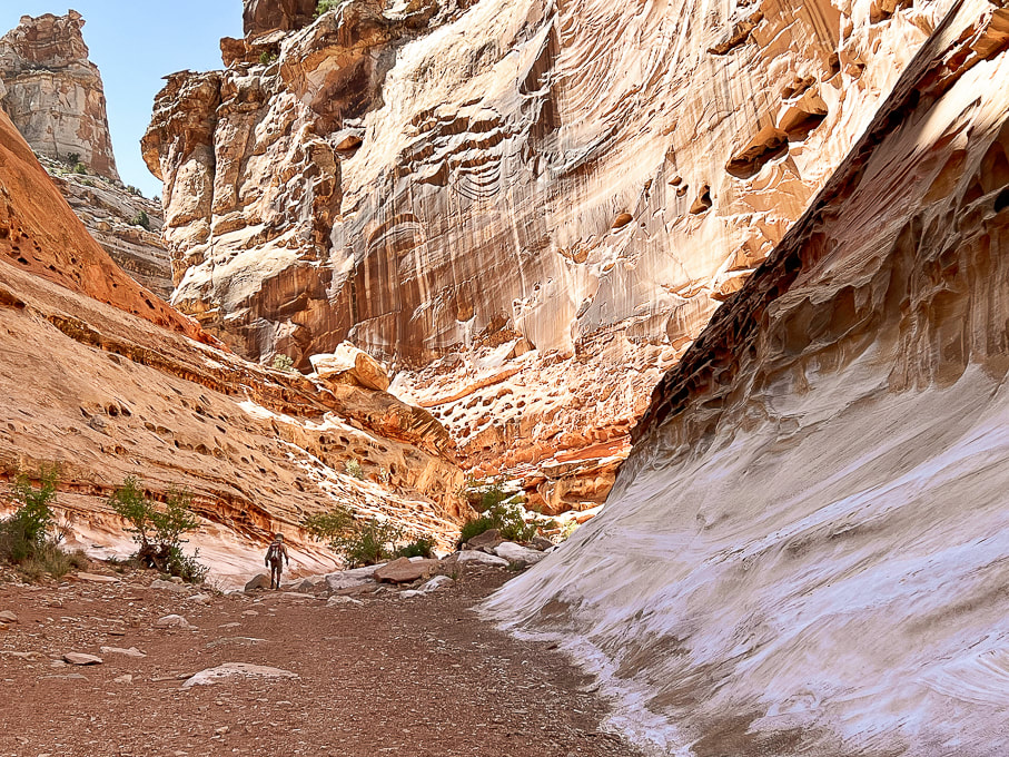
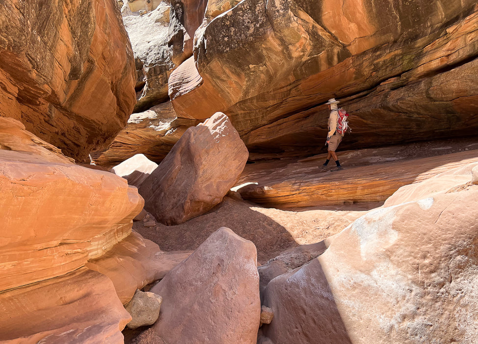
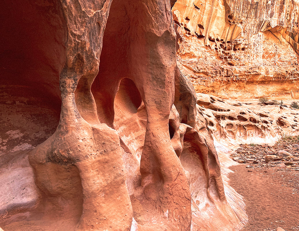
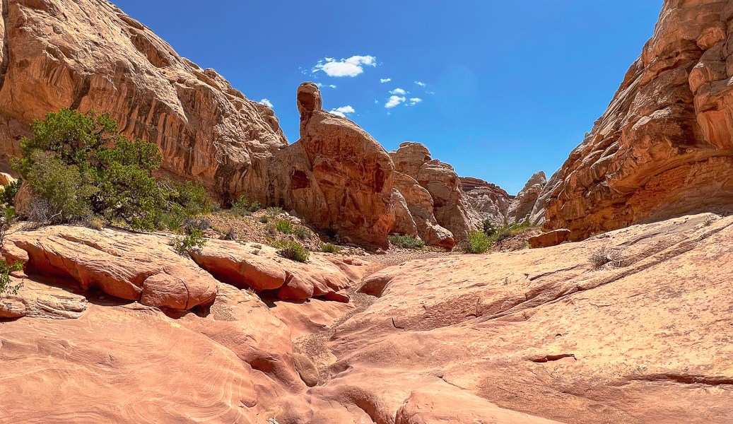
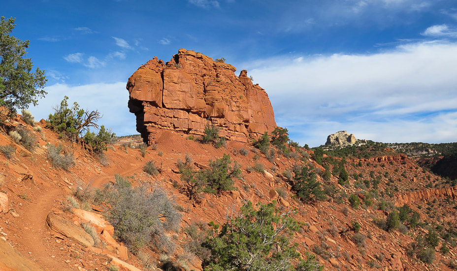
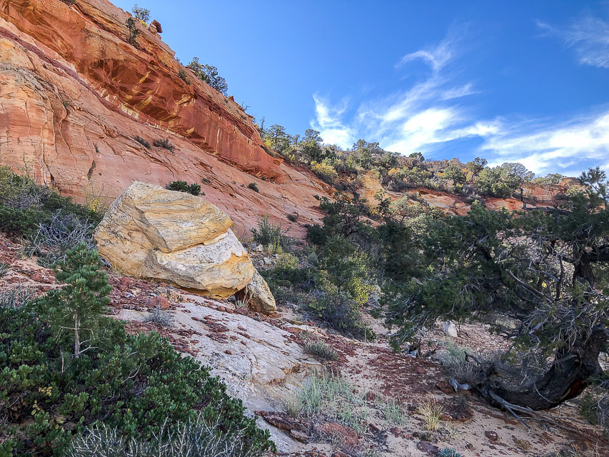
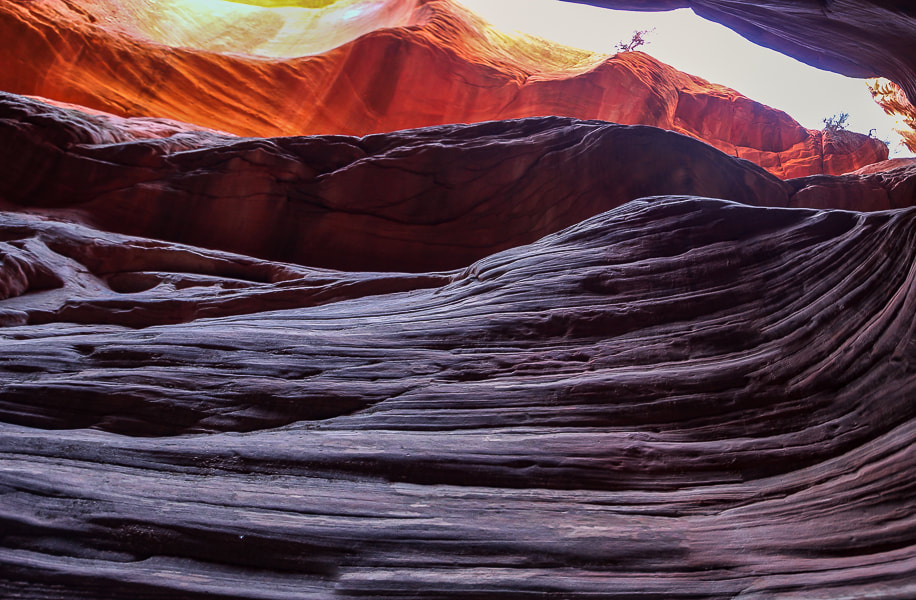
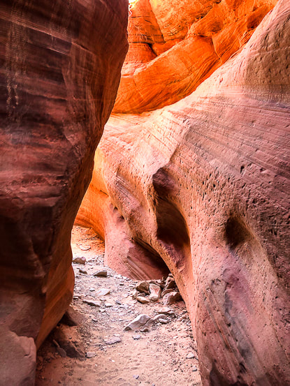
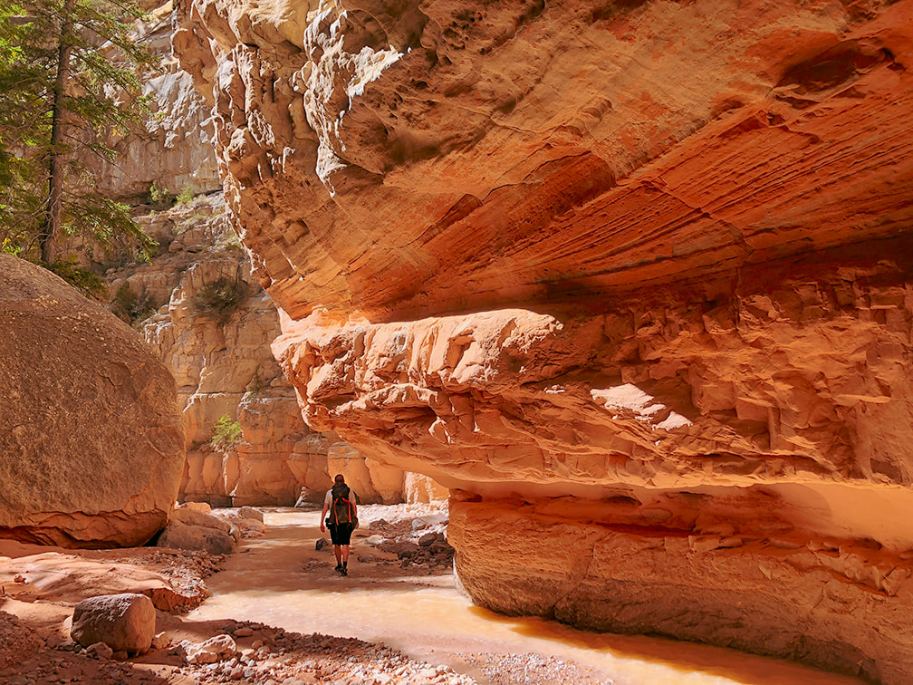
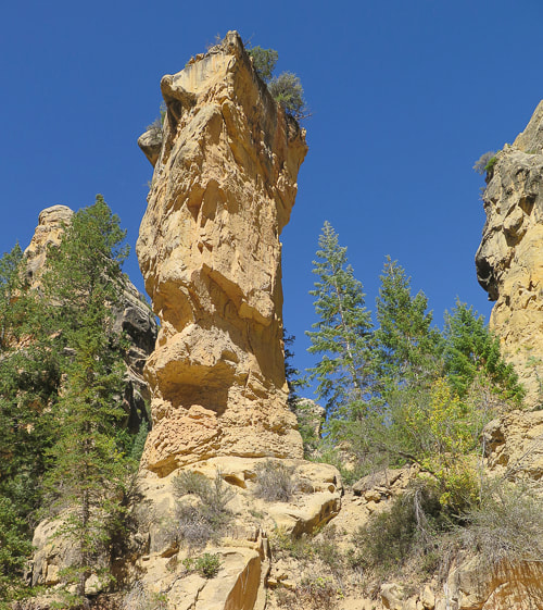
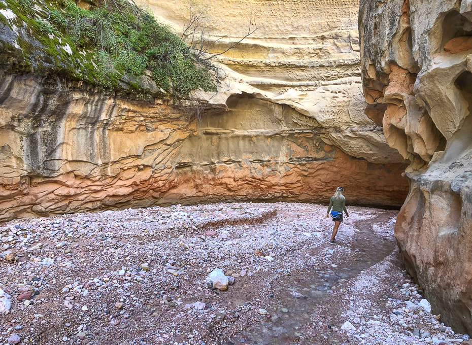
Really cool rock formations in a wide part of the canyon.
Walk by this huge alcove.
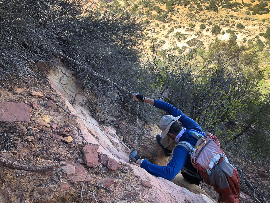
Cairned-marked up-canyon bypass around the most exposed Class 3-4 section. The bypass is short and well-marked.
Looking down at the most difficult obstacle with tree branch to help ascend/descend and webbing around boulder (left) and view looking up-canyon of same obstacle (right). There's a bypass around this obstacle a few hundred feet up-canyon on the east wall. Look for cairns that lead up through a crack to a ledge.
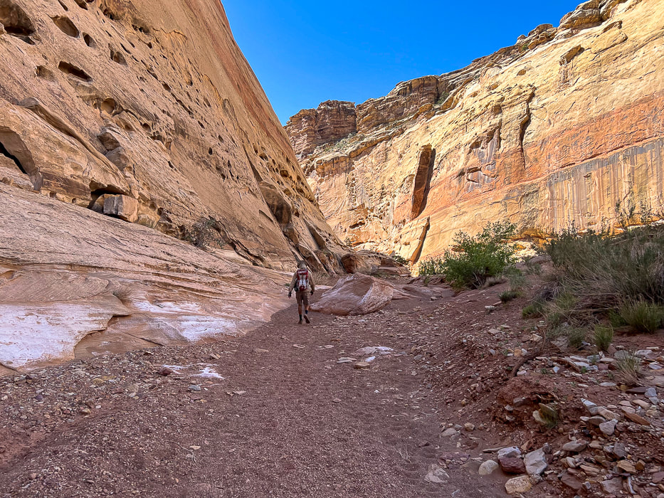
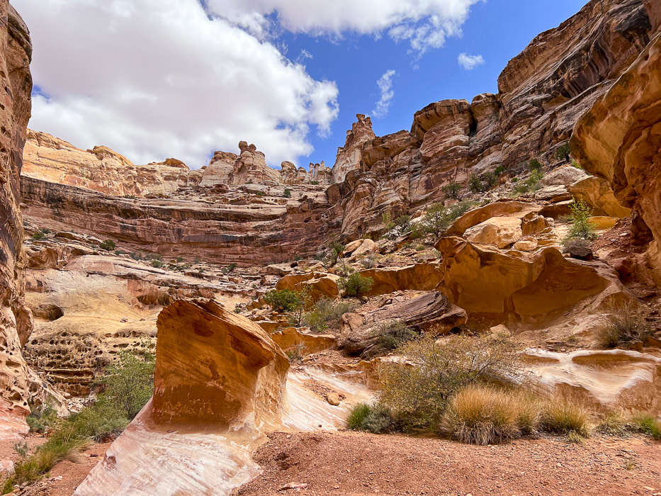
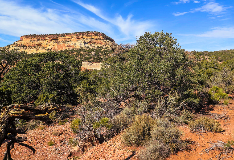
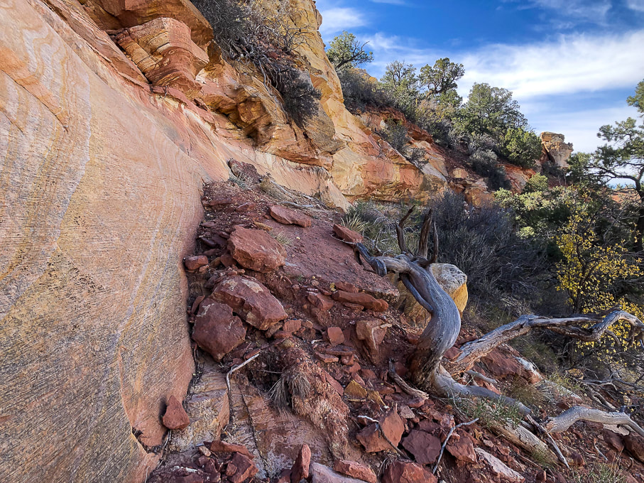
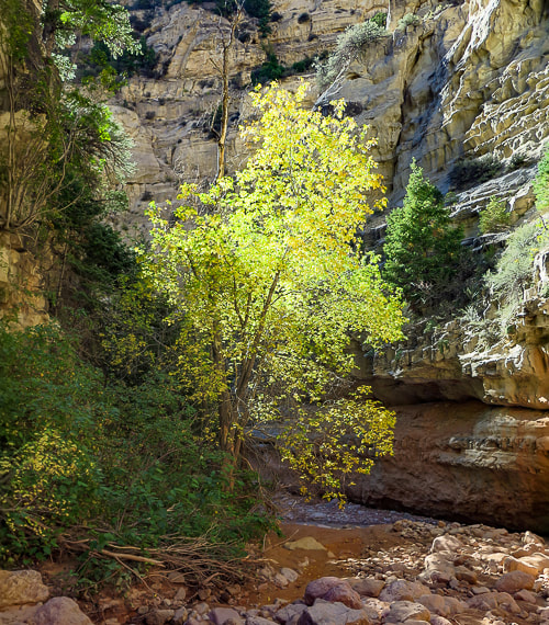
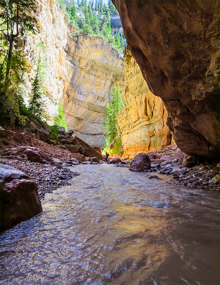
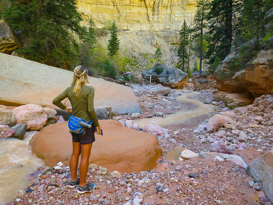
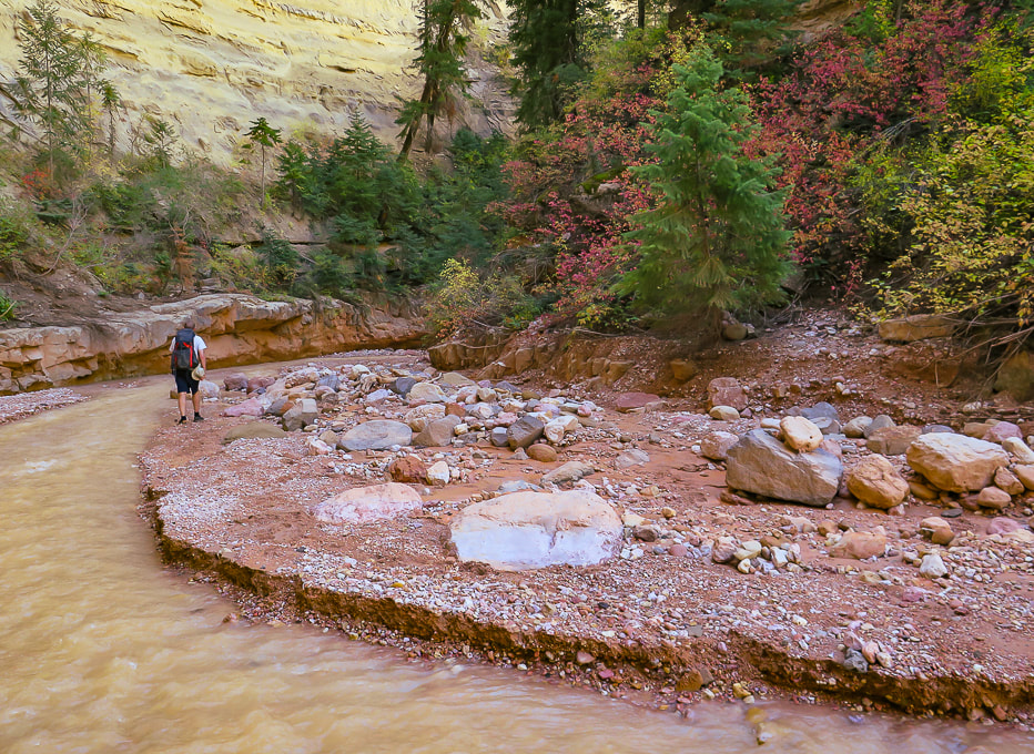
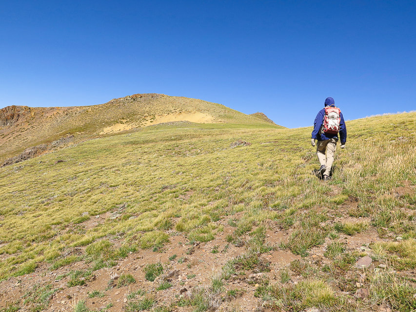
Canyon opens further down.
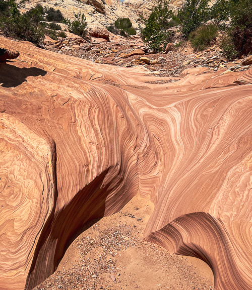
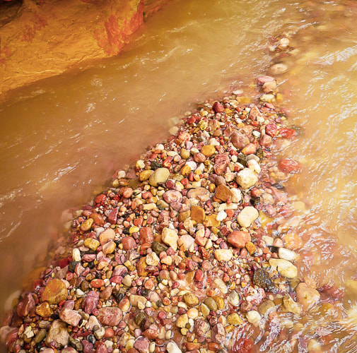
Carved slickrock at bottom of canyon.
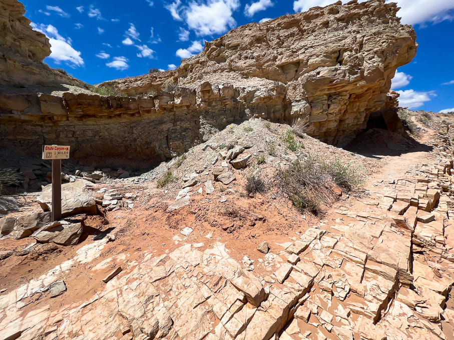
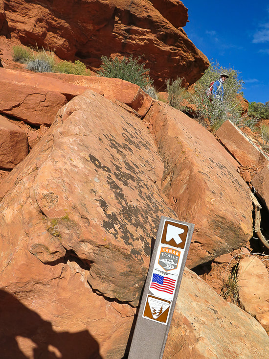
Sign at intersection of lower Crack Canyon with overland trail to lower Chute Canyon (2 miles from Crack to Chute).
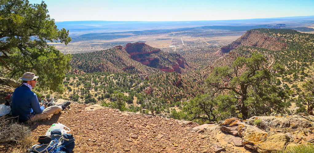
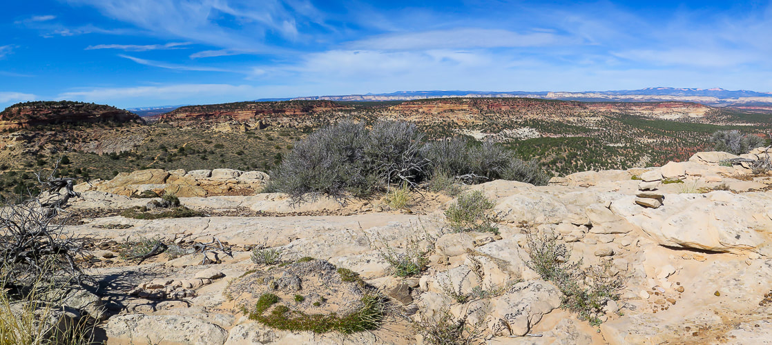
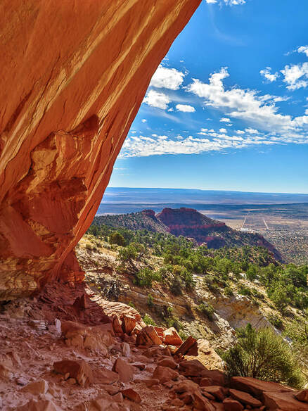
Rock arrow pointing toward steep trail (above) that leads to a great lookout.
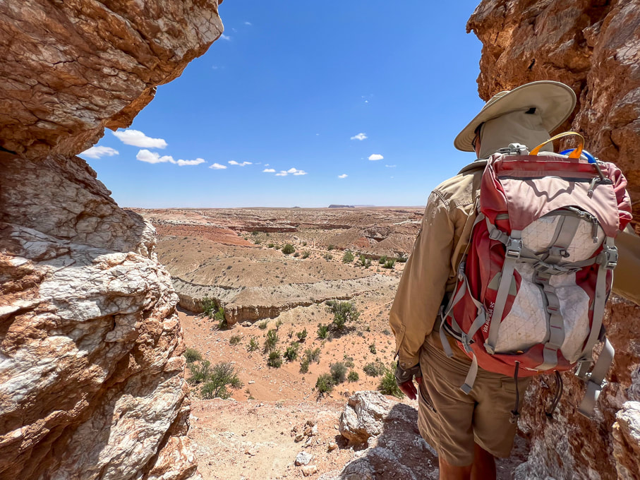
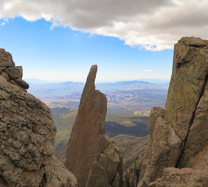
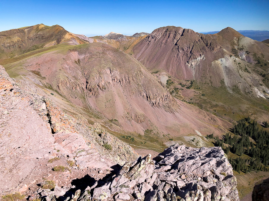
Lookout over the San Rafael Desert toward the southeast.
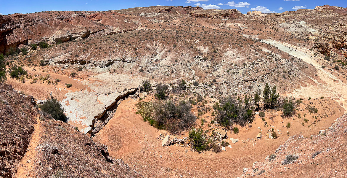
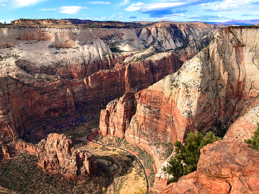
Looking down into Crack Canyon.
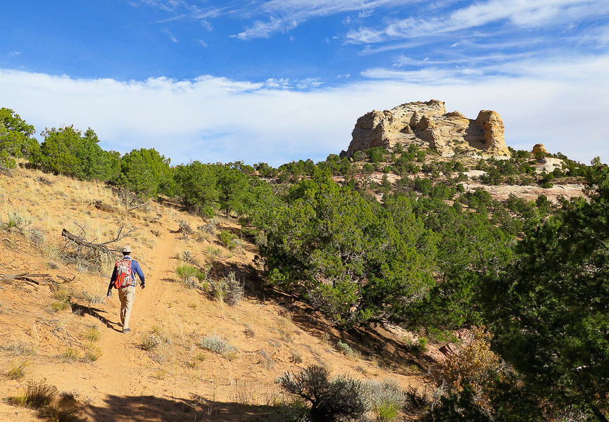
Heading back up-canyon.
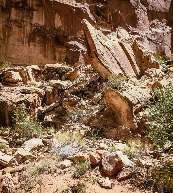
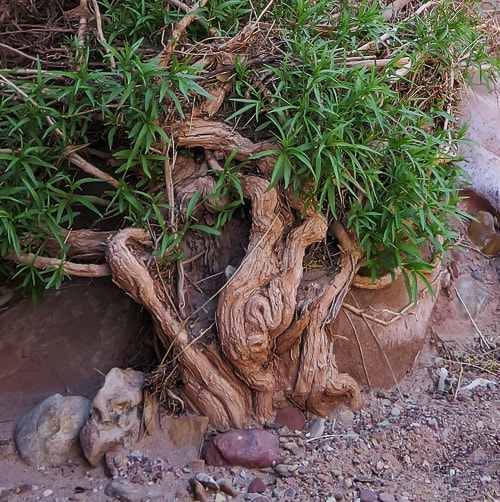
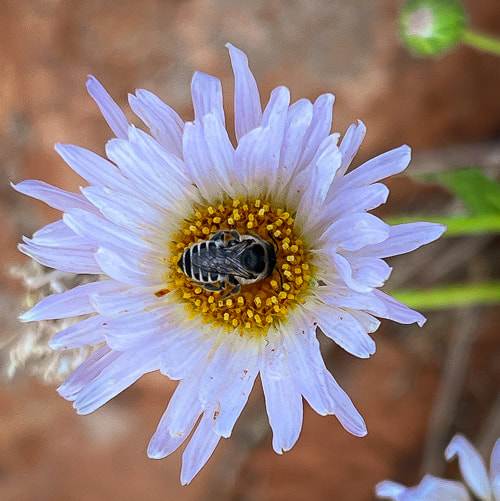
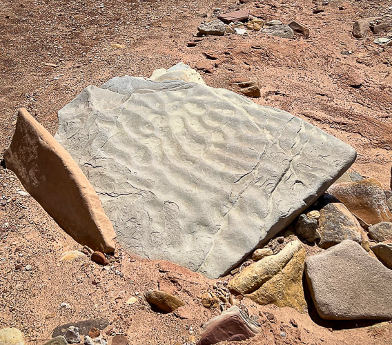
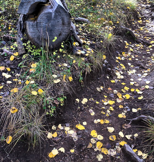
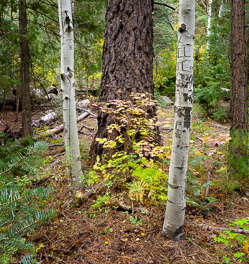
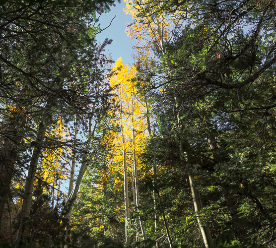
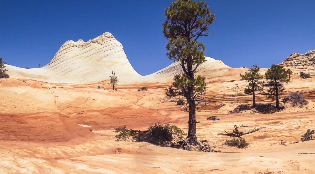
Some cool stuff on the trail.
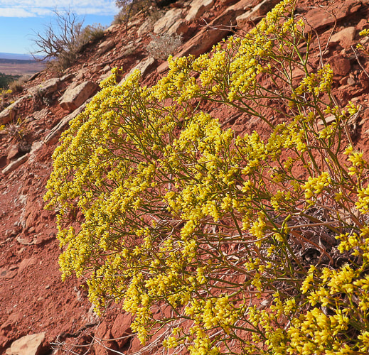
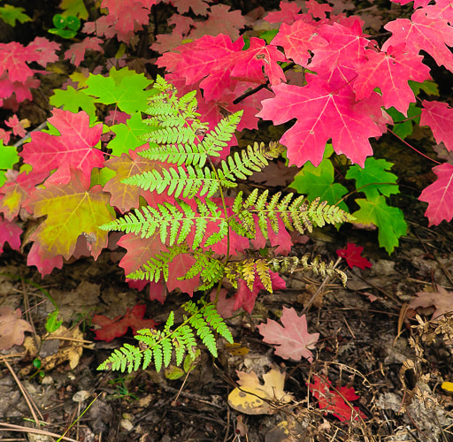
The purple flower is actually from the Red Mountain Primitive Trail near St. George, Utah. 
North points straight up - beginning of hike at top just south of Behind the Reef Road (CR 1016): hike down canyon SSE direction.
We hiked to the mouth of Crack, just beyond the intersection with trail leading to Chute Canyon (next canyon on the left), so a loop could be done.
6 Comments
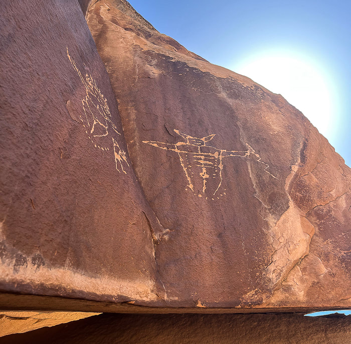
Utah's quiet San Rafael Swell has awe-inspiring Archaic Period pictographs and the alleged "winged monster" high on the walls of Black Dragon Canyon.
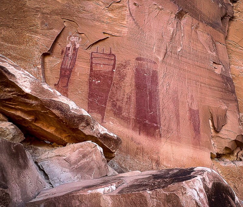
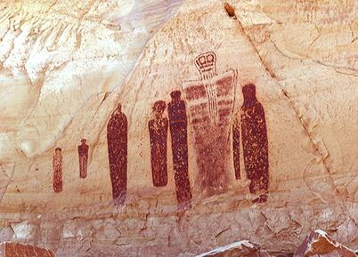
Temple Mountain Wash pictographs near Goblin Valley State Park
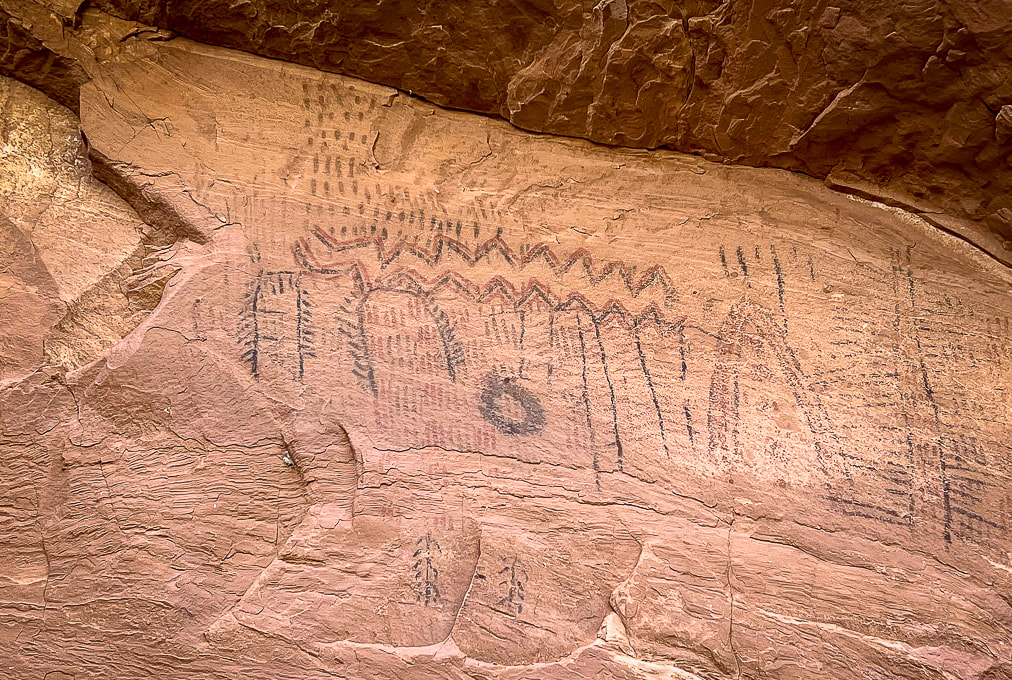
These figures are Barrier Canyon Style and date to the Archaic Period: several proposed dates include as far back as 8,000 BC or a younger time of 1,100 AD (see interpretive sign below).
Trip Stats
Black Dragon Canyon: (Northeastern San Rafael Reef) Driving west on I-70, 12.5 miles from Green River, Utah, turn off at mile marker 147 onto a dirt road with a closed gate. Close the gate after entering. The road quickly crosses over the wash on the left. We went a short distance along the right side of the wash until we found a better crossing and got back on the main, well-traveled road that heads north in the direction of the reef. The entrance to Black Dragon Wash is on the left at the Mexican Mountain Wilderness sign, 1.1 mile from the interstate. We drove 4x4 truck on good sand to the fenced at base of pictographs and parked. Temple Mountain Wash: (Southeastern San Rafael Reef) From Green River, Utah on I-70, travel west to the junction with highway 24 that goes to Hanksville. Go toward Hanksville (south) for about 25 miles to Mile Post 135. Turn left (west) at road to Goblin Valley State Park and drive 5.1 miles to junction. Drive straight for 1.0 mile - the panel is on your right with an interpretive sign. Maps/Books: Hiking and Exploring Utah's San Rafael Swell by Michael R. Kelsey/San Rafael Swell Map (Price Field Office)- National Geographic Trails Illustrated #712. Dates Hiked: May 9-11, 2023. 
Utah I-70 piercing the San Rafael Reef (tilted light sandstone).
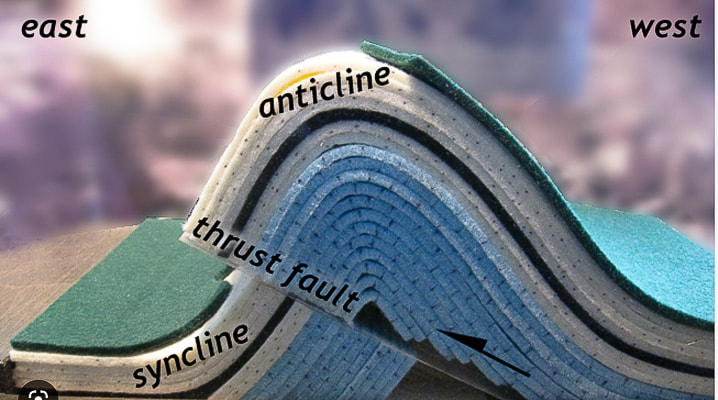
The Swell was caused by a vertical fault in ancient Precambrian basement rocks that lifted the western block higher than the eastern block of the fault, causing the younger layers of overlying rocks to drape over the fault zone creating an anticline, or "swell".
The San Rafael Swell and its near-vertical tilted sandstone beds named the San Rafael Reef is a Utah adventurer's paradise. Many steep and scenic canyons like Crack, Chute, and Zero Gravity cut through the reef. There's the Upper and Lower Black Boxes, old homesteads, mines, the San Rafael Knob, pictographs and petroglyphs from Archaic and Fremont cultures. The last time Fred and I visited this area, we stayed in Goblin Valley Campground and explored the Archaic Great Gallery/Holy Ghost pictograph panels in remote Horseshoe Canyon.
You're on your own in this remote part of Utah; there aren't many services, campgrounds or signs in the San Rafael Recreation Area (which has several official Wilderness Areas). And not many people ;). We barely scratched the surface with a few hikes and petroglyph/pictograph viewings. We trailer-camped in nearby Green Valley, Utah. One day, we stumbled upon the amazing Temple Mountain Wash pictographs when driving to hike Wild Horse Creek Trail. You can see where much of the pictograph panel has spalled off because of the elements of water and minerals. On another day, we drove the sandy roads to see the Spring Canyon petroglyphs and the Black Dragon Canyon pictographs and then walked up-canyon from there. It was here we saw the fabled "winged monster", a disconcerting pictograph that prompted scientists to unravel its mystery. 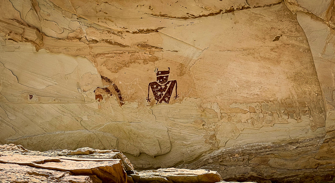
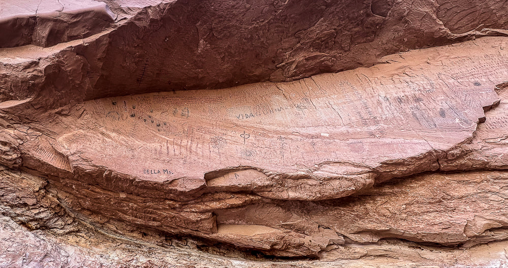
Temple Mountain Wash panel
These pictographs are Fremont style (AD 100 - AD 1300) and located to the left of the Barrier Canyon pictographs (above). Spalling, the breaking off of the surface of the rock, has removed previously-painted pictographs. 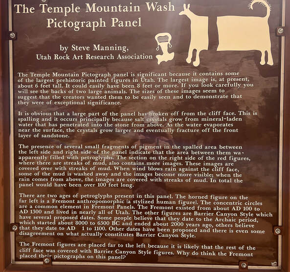
Interpretive sign at the site.
The "Dragon" Controversy In Black Dragon Canyon: a winged monster, a man, a grebe - what is it?
The sandy road leading to the pictographs in high-walled Black Dragon Canyon was in good shape, so we were able to park in the large space adjacent to these astounding pictographs. The left-most figures are in the characteristic Archaic Barrier Canyon style, with tall dark red mysterious-looking figures. To the right of these are Fremont Style pictographs featuring animals, abstract lines including concentric circles, lines, dots and zig-zags. It's always fun to imagine how the native peoples applied these red pigments. In this case, however, it wasn't fun to see the annoying white chalk lines drawn around some of the weathered pictographs. A large rockfall under the Archaic pictographs allowed the creators to paint their images high on the wall. There's a camera present with a sign. With apparent wings and a long tail, an unusual pictograph looks like a dragon/dinosaur creature, hence the name Black Dragon Canyon. In 1928, it got a reputation as a "winged monster", when amateurs discovered it. In the 1940's, John Simonson drew a chalk line defining his interpretation of a winged monster or dragon, and published a paper describing his methods. Decades later, a geologist said it resembled a pterodactyl, so the Young Earth Creationists started using this as evidence that Native Americans and pterodactyls lived at the same time. 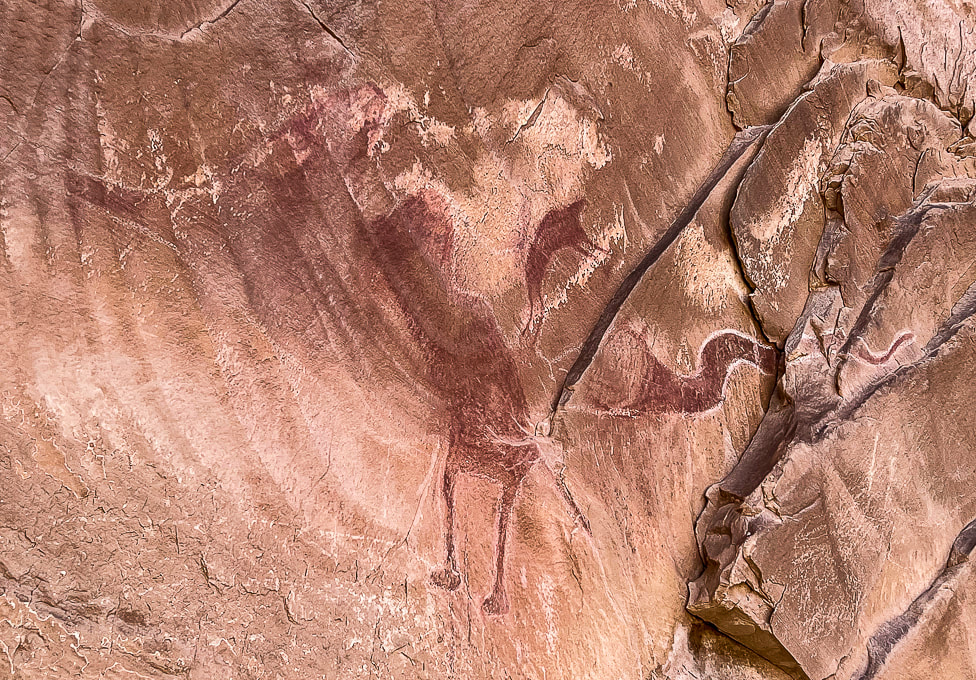
The "dragon" in Black Dragon Canyon - mistaken identity
Chalk lines drawn around separate Fremont style pictographs to define a dragon. Modern diagnostic techniques revealed five separate pictographs that were previously outlined together as one "winged monster" - possibly a pterodactyl. For instance, the "head" of this creature is actually a supplicating man. (I didn't include the furthest-left pictograph in this photo).
Enter modern technology: diagnostic tools to image the red pigment and iron that has faded over the years and not seen by the human eye. Dstretch enhances photographs of pictographs by revealing faded pigments, and x-ray fluorescence measures the iron concentration in the red pigment to see where Native Americans applied the pigment to the rock.
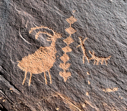
Conclusion: There are five separate pictographs encircled by the white chalk outline (see Dstretch illustration below), so the single "winged monster" pictograph has been debunked. From left to right: a bighorn sheep, a dog, a large, bug-eyed anthropomorph with a snake in his hand, a small man bent at the waist in supplication with his arms outstretched, and a large, sinuous horned snake. All five are the Barrier Canyon style. Simonson had converted the small man pictograph into the head and neck of a dragon.
I also found a paper (no date, but spoke of trips to the site in the 1990's) that stated this pictograph is a representation of an eared grebe, a type of waterfoul that breeds in the area and may have been hunted. The person who painted it may have been summoning the spirit of the grebe to bring more water. But now this interpretation has been debunked.
Photo of an eared grebe courtesy of the Cornell Lab of Ornithology - Macaulay Library.
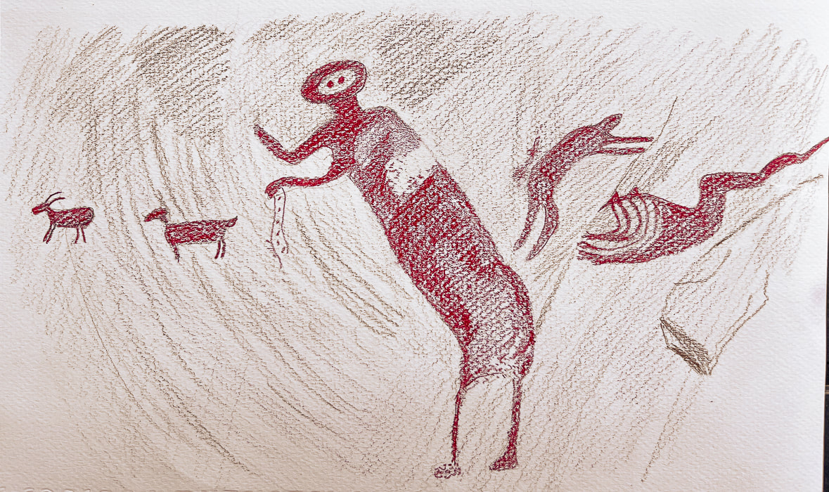
Dstretch technique illustration of all five of the images found in the "dragon" pictograph in Black Dragon Canyon
(from left to right): Bighorn sheep, dog, a tall figure, a smaller figure with arms outstretched in supplication, and a horned snake. Chalk lines currently include all of these pictographs into one image of a "dragon". Compare this to the now-discredited "dragon" above. (I drew this image from a photo in "The Death of a Pterodactyl," by Jean-Loïc Le Quellec, Paul Bahn and Marvin Rowe, from Antiquity, Volume 89, p 872-884, 2015). Here is the link to the real picture: https://www.livescience.com/51886-winged-monster-rock-art-deciphered.html 
The largest Archaic Barrier Canyon style pictographs seen in Black Dragon Canyon.
Black Dragon Canyon pictograph panels
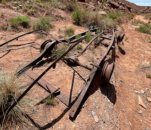
We walked up-canyon a few miles toward the Swell. Black Dragon Mine (uranium) is located on the south side of the canyon. We saw what looked to be the remains of an old truck and some mining tailings. We saw a few mountain bikers riding down-canyon; there's some great biking routes in the San Rafael Swell. So many reasons to love Utah and the American West: intriguing Native American rock art, infinite forms of warm-colored weathered sandstone, so much open area to move around in, and its beautiful peace.
As I write this post, I look forward to sharing our Crack Canyon adventure in this majestic and silent land. Silent, and I can feel every once in awhile the spirits of those who traveled these canyons and plateaus, who painted and pecked images on walls hundreds and thousands of years ago.
"Time and space. In the desert there is space. Space is the twin sister of time. If we have open space then we have open time to breathe, to dream, to dare, to play, to pray to move freely, so freely, in a world our minds have forgotten but our bodies remember. Time and space. This partnership is holy. In these redrock canyons, time creates space--an arch, an eye, this blue eye of sky. We remember why we love the desert; it is our tactile response to light, to silence, and to stillness."
- Terry Tempest Williams from Red: Passion and Patience in the Desert. 
Both images above near Black Dragon Canyon at dusk.
Fertility petroglyphs?
Driving up Black Dragon Canyon a little further to park and hike up-canyon, we spotted these petroglyphs high up on a huge boulder - supposedly a man and a woman and Kokopelli, the fertility deity and flute player. The only reference I could find was a hiking website that described these as a "fertility scene". Kokopelli has a backpack with what might be seeds and the same small peck marks are arranged in a crescent shape beneath each figure, and on the man. 
The hike up Black Dragon Road passes near the Black Dragon Mine, whose main commodity was uranium.
This road is a mountain-bike route to the plateau area of the San Rafael Swell. 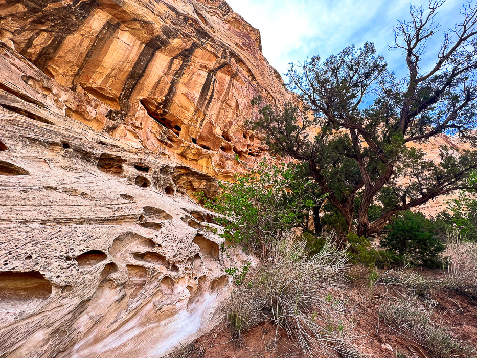
Wild Horse Creek in the reef south of Black Dragon Canyon.
A camping spot surrounded by tall walls of honeycomb weathering in Wild Horse Creek Trail, a creek south of Black Dragon Canyon that transects the reef.
Sandstone detail in Wild Horse Creek.
Along the mining exploration road leading out of Black Dragon Canyon. A great road for mountain biking.
Arches in Spring Canyon, on the way to Black Dragon Canyon.
Some cool stuff on the trail and in the Green River State Park Campground.
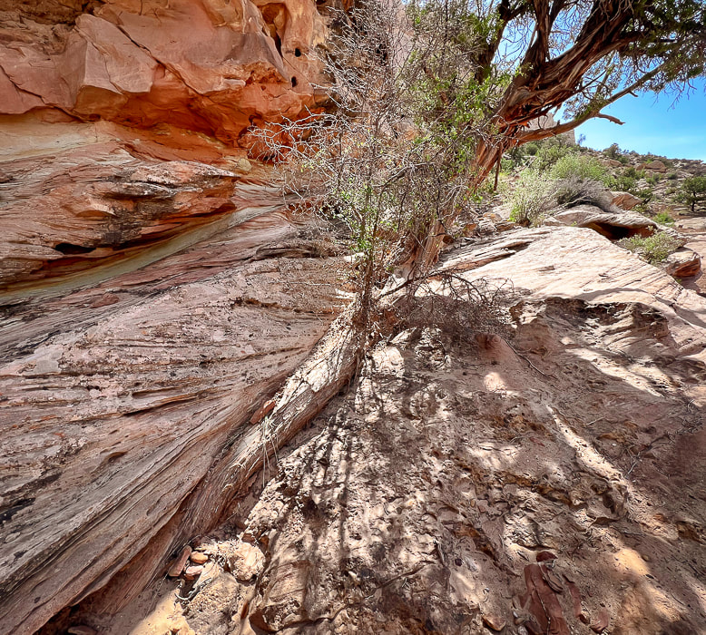
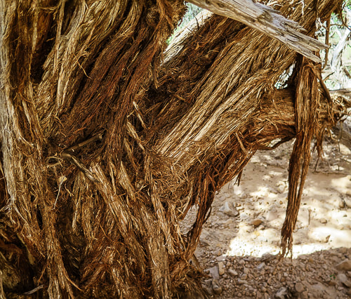
Juniper tree trunk blending with sandstone cross-beds.
References
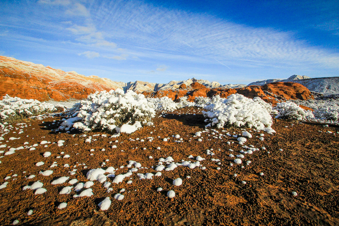
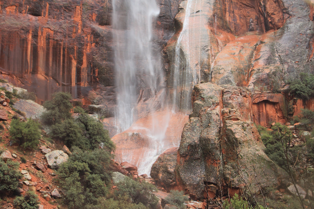
Allee, P.A. et al. The Black Dragon Solar Solstice Markers and Calendar. utahrockart2.org. Demarco, E. 'Winged Monster' on Ancient Rock Art Debunked by Scientists. Science website, August 25, 2015. Geggel, L. 2015. "Winged Monster" Rock Art Finally Deciphered. from LiveScience website. The Eared Grebe. From the Cornell Lab All About Birds website. Mitton, J. 2020. Controversial Interpretations of the Black Dragon Pictograph. Colorado Arts and Sciences Magazine. University of Colorado - Boulder. Sucec, David. The B.C.S. Project: Barrier Canyon Rock Art Style. www.bcsproject.org/barrierstyle.html The unusually cold, snowy 2022-23 winter in southwestern Utah provided opportunities for interesting photographs. 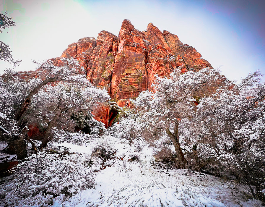 Snow Canyon State Park along the Red Sands Trail. Recently, on March 24, 2023, Utah broke its snowfall record. The Great Salt Lake's water level rose 2 feet and as a result Utah's "severe drought" status has greatly decreased. My favorite ski resort, Alta, recorded its most snowfall ever, with 749 inches of the fluffy stuff. Outside my windows, snow blankets the mountain ranges to the north and west of St George. For a few seconds the other day, I thought I was in Boise, Idaho, my former domicile with its surrounding winter mountains. Red and orange sandstone cliffs quickly confirmed that I was in southern Utah. The southwestern Utah snowpack basin received the largest increase above normal snowpack - 300% - the highest percentage of all 16 Utah snowpack basins. St. George long-time residents tell me that this is a "really unusual winter" (with an emphasis on "unusual"). Every week brings days of rain. Our local reservoir is filled! Temperatures are 10-15 degrees below normal. We are now at the end of March, but living in January temperatures. This has created a unique opportunity for photography. I've been fortunate to see snow against the warm hues of sandstone, mosses rehydrated to bright green pillows dotting north rock faces and hidden canyon grottos, and, by sticking around places long enough, the beginning of waterfalls during a rainstorm or sun snow melt. The "Triple Junction" at St. George, Utah St. George is a unique place because it's situated right at the intersection of three distinct geographical provinces, or regions that have indicative geology, physiography, botany, and climatic attributes. This triple junction is a transition zone between the Great Basin desert to the northwest, the Mojave desert to the southwest, and the Colorado Plateau to the east. St. George's downtown is located in the Mojave desert. A short drive from downtown St George northwest brings you to Snow Canyon State Park, whose geology is that of the Colorado Plateau province, and one of my favorite places to go wandering with my cameras. The 6 Keys to Longevity and Mental Health Hiking and meandering solo with my cameras is a great form of meditation, a time that combines creativity with connection to nature. I get to achieve 3 of the 6 keys to longevity and mental health: exercise, meditation and purpose. If you're interested in finding a good discussion of mental health and longevity, click on the link above to an article on Roxiva's website. Walking in nature is a great form of meditation and research has shown that people who live near green spaces tend to live longer, have lower rates of illness, and better mental health. Getting away from stress is fundamental to health, but we need to have ways to find stillness and silence ourselves, because it won't find us! One of my best days this winter included a hike to see the rare waterfalls in Hell Hole, a deep canyon on the boundary of Red Cliffs National Conservation Area (BLM) near Kayenta, a development northwest of St. George, on a very rainy day. I got to witness the spectacular sight of towering waterfalls spilling down sandstone cliffs, and the downstream wash, churning with salmon-colored water. It was a sight I will never forget, and as I stood there alone, it started pouring. Deep in the canyon, close to the orange walls and cascading water, I watched as more waterfalls developed and spilled in ever increasing amounts, elevating the roar of the falls and the creek. It was a gift to see nature change so quickly and beautifully in solitude. It's time to move on to warmer and sunnier days. At least one bonus besides replenishing our reservoirs: the wildflower show should be spectacular! When I'm out making images, I remember a few of my favorite quotes: "As long as you are making images, you are living the dream." - Michael Kadillak, photographer and friend who taught me black and white "Zone System" film processing. "Nature, time, and patience are the three best physicians." - Ann Zwinger - The Art of Wandering in The Nearsighted Naturalist Keep on Exploring! 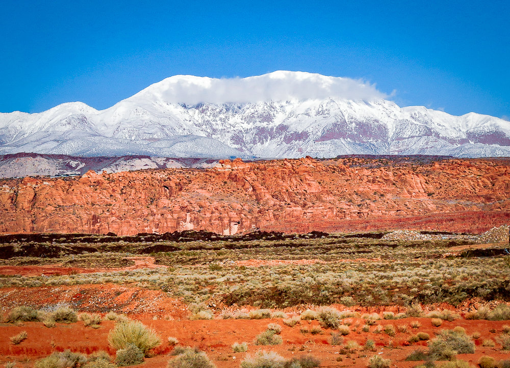 Pine Valley Mountains - the largest laccolith in the U.S. - rising above Snow Canyon State Park near St. George, Utah. A laccolith can be thought of a volcano that never erupted because molten magma was injected between layers of sedimentary rock. The pressure of the magma pushed the layers into a dome. The layers overlying the magma have since eroded away, exposing the laccolith. (this photo was taken last winter). 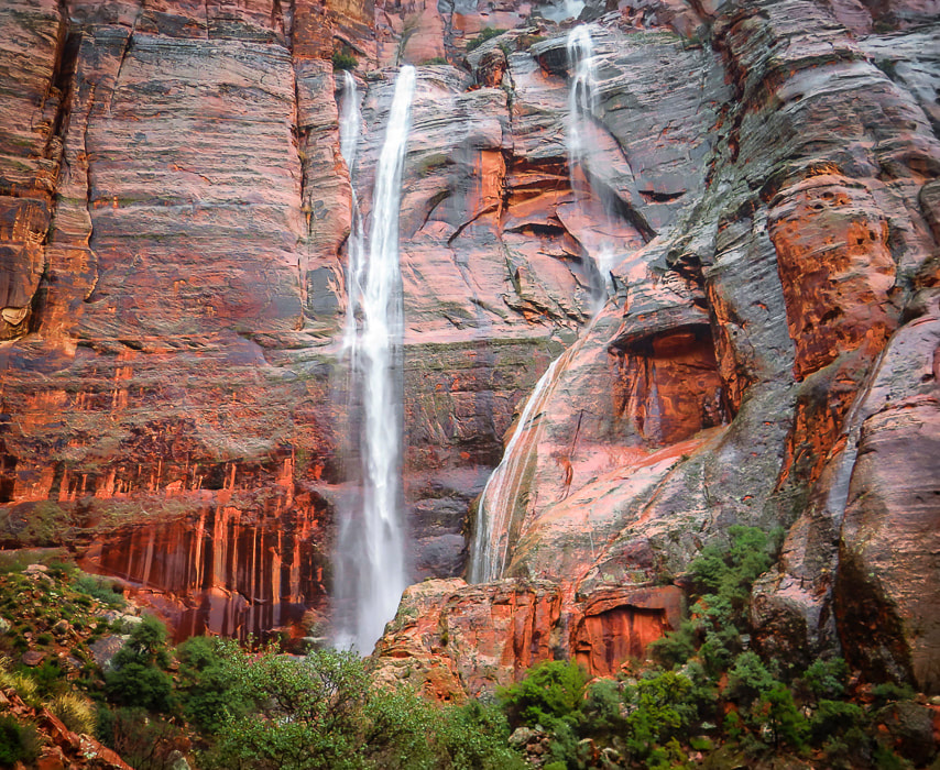 Hell Hole at the head of Kayenta Wash. The waterfall on the right began while I was there in a rain storm. 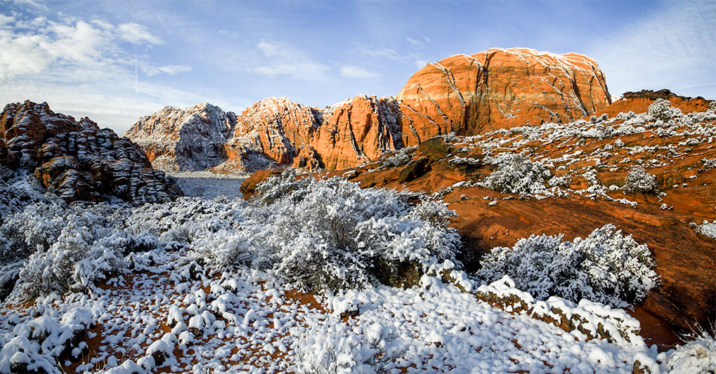 Snow Canyon State Park 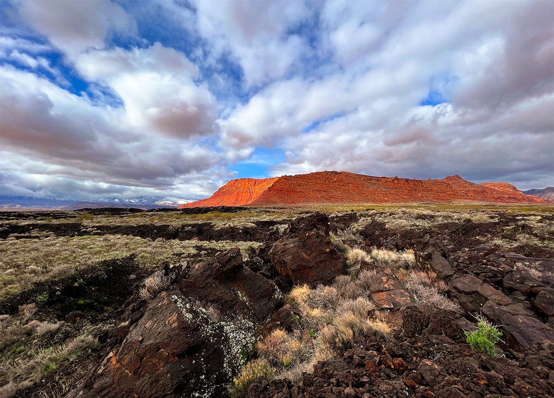 Red Cliffs National Conservation Area Looking over basalt flows south of Snow Canyon State Park. 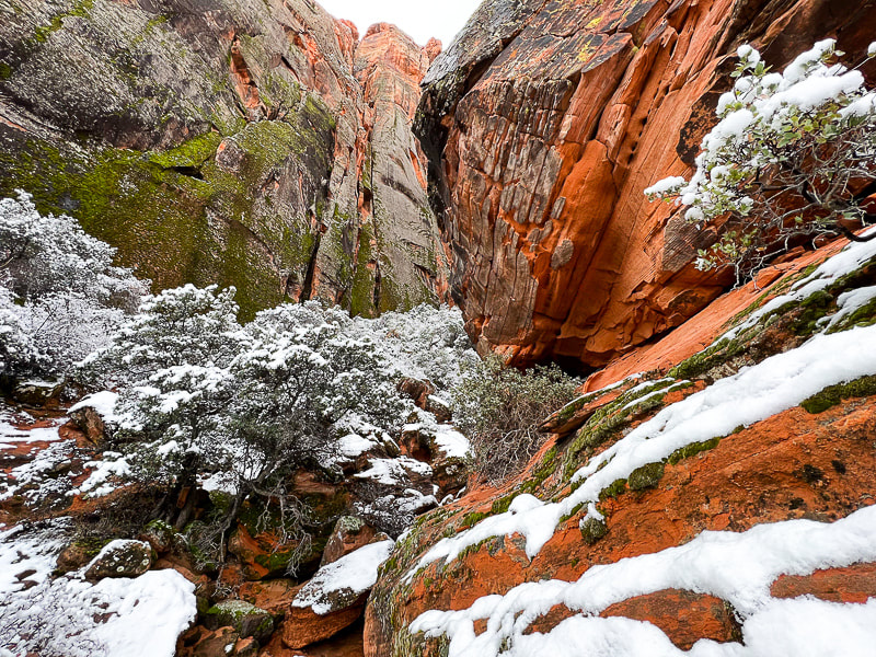 One of the smaller, scrub oak-filled side canyons in Snow Canyon State Park. 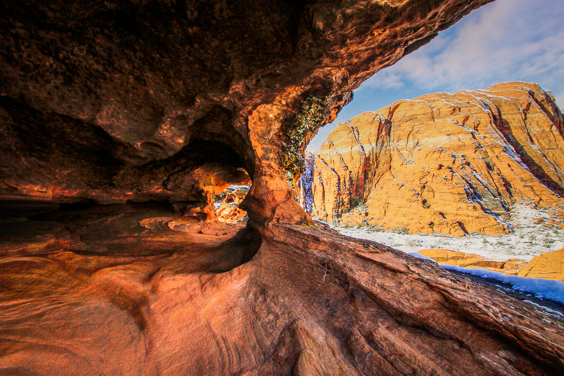 Along the Hidden Pinyon Trail in Snow Canyon State Park. 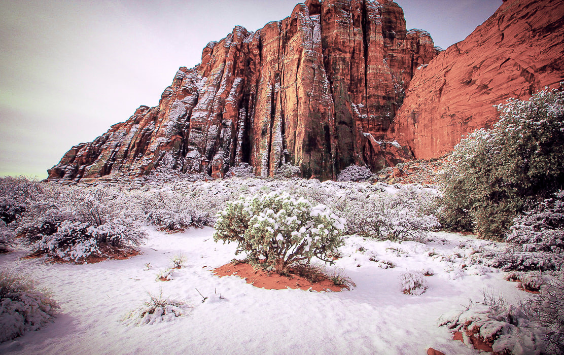 One of my favorite chollas on the Red Sands Trail in Snow Canyon State Park. 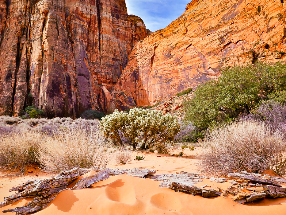 The same cholla as above in late spring. 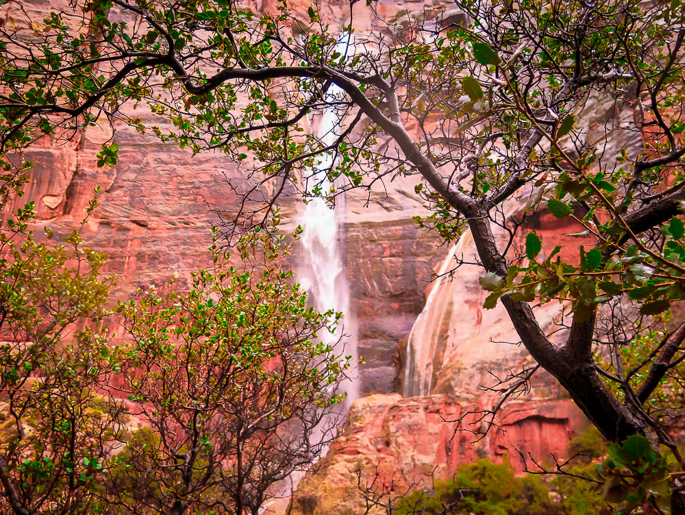 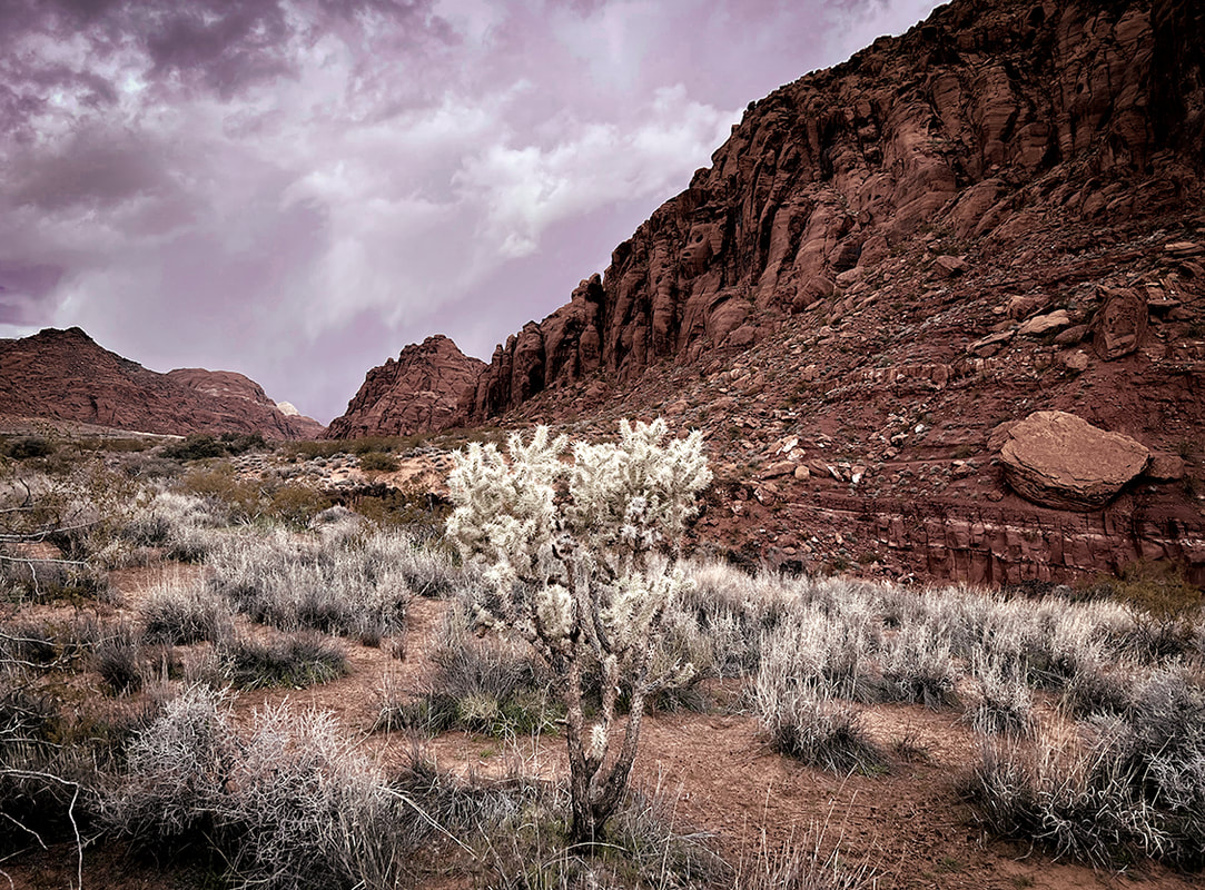 Approaching storm near Johnson Canyon in Snow Canyon State Park. 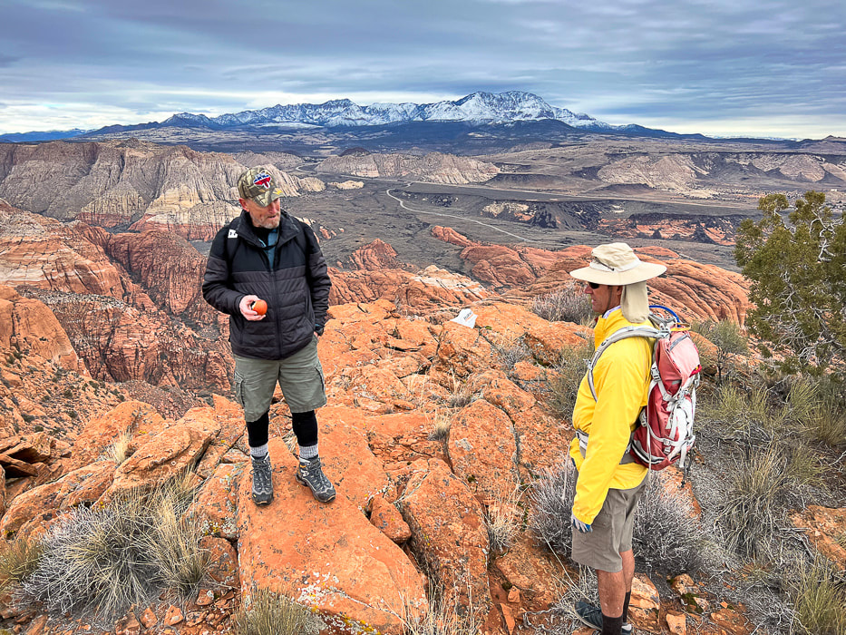 Early season hike up Red Mountain with Dan and Fred to an overlook of Snow Canyon SP and Pine Valley Mountains on the horizon. 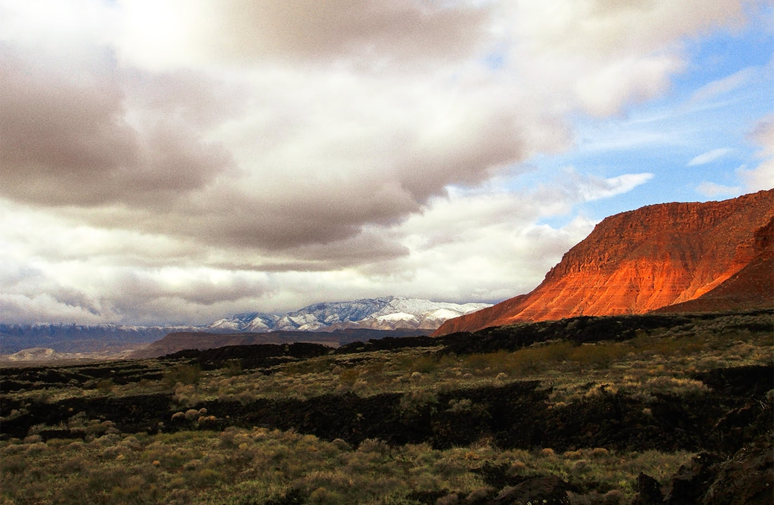 Three types of rock: basalt flow, Kayenta sandstone, and the sandstone and limestone of the snow-covered Beaver Dam Mountains.  Hell Hole - these waterfalls appear only with a lot of rain or snow on top of the walls that melts. Much more rain this season afforded more opportunities than usual to see this beautiful sight.  Scouts Cave overlooking St. George, Utah and the Beaver Dam Mountains. 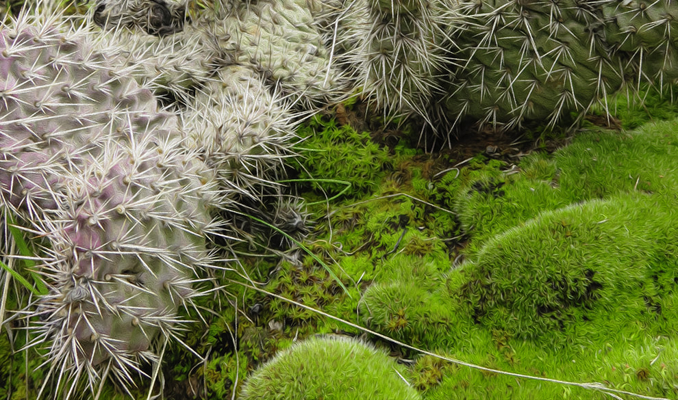 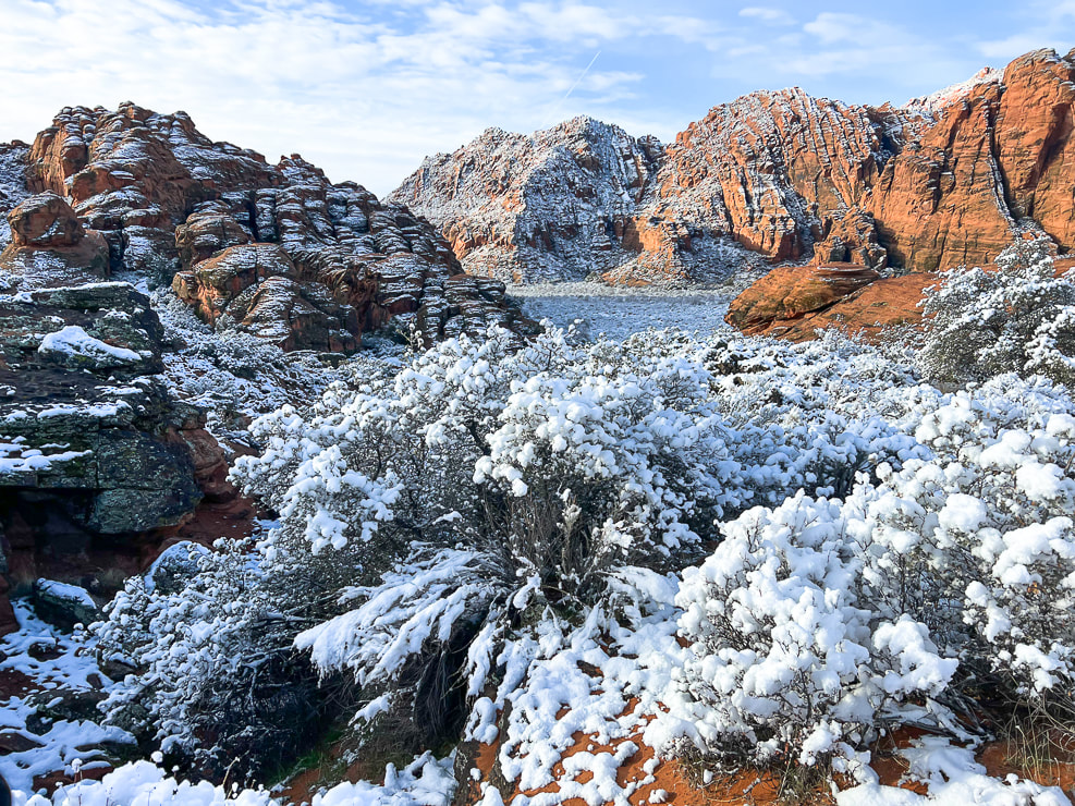 Snow Canyon State Park The oldest sedimentary rocks of Snow Canyon SP are the stream deposits of the Kayenta Formation (190 million years ago). The famous Navajo Sandstone layer was deposited over the Kayenta (183 million years ago) and are the most impressive orange, red and white cliffs as you ascend in the park. The Navajo sandstone is also the prominent layer seen in Zion National Park. 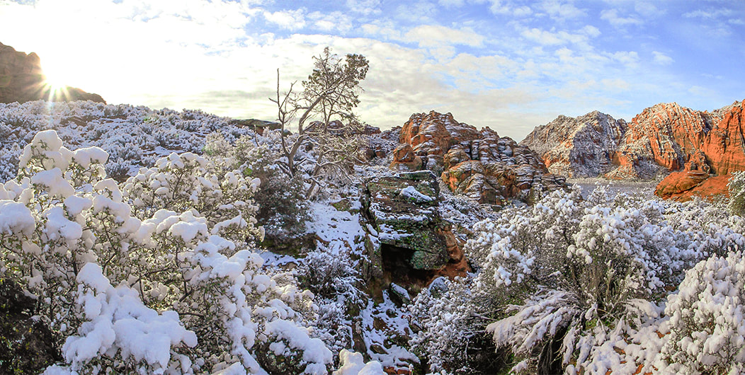 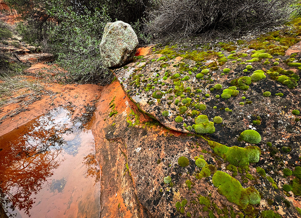 Rains left pools and bright green hydrated moss mats. 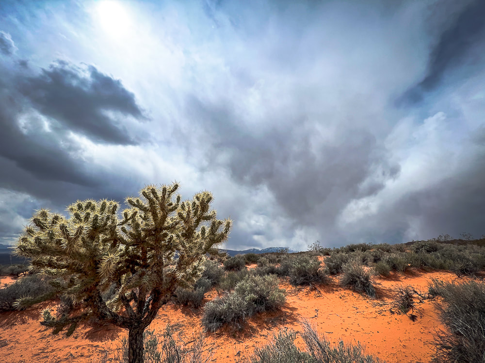 Another storm coming! Gila Trail, Snow Canyon. 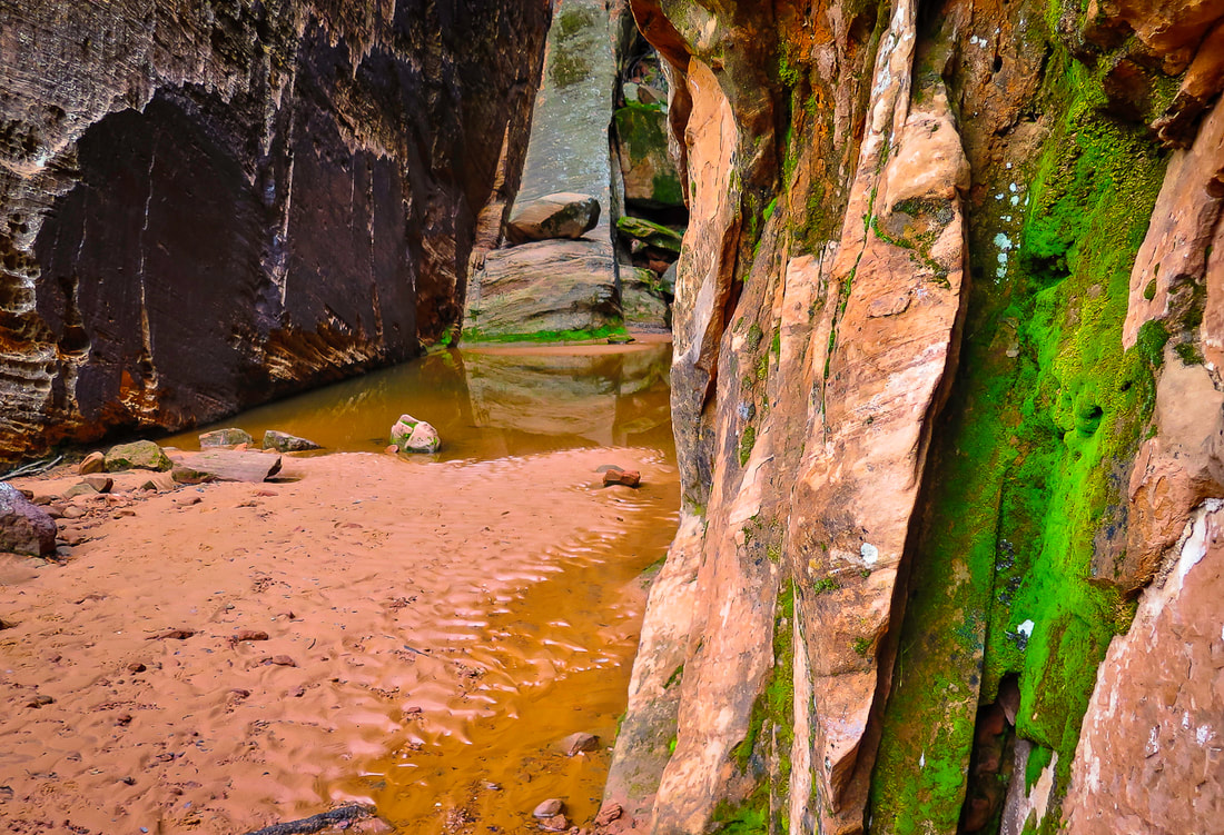 A large pool of water and bright green moss at this grotto hidden behind immense sandstone walls. 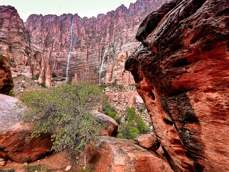 Walking into Hell Hole. 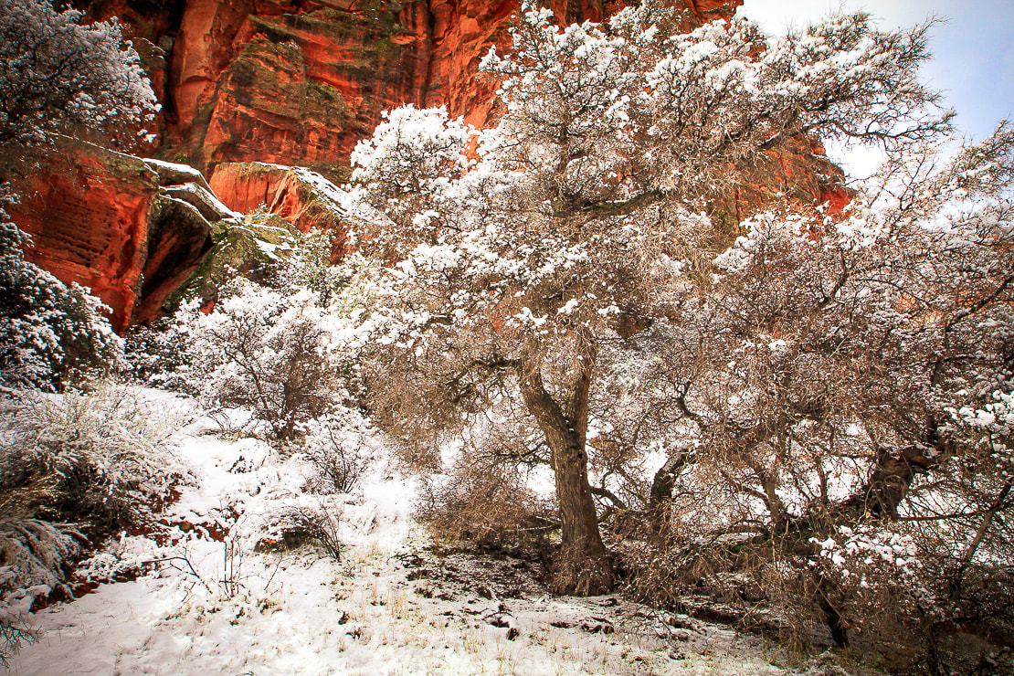 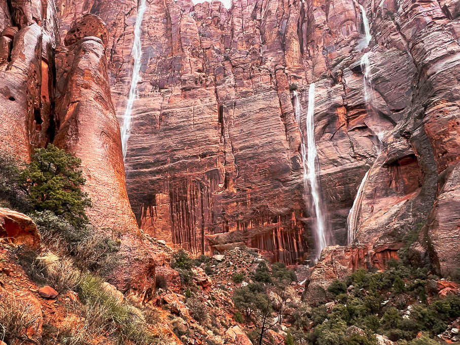 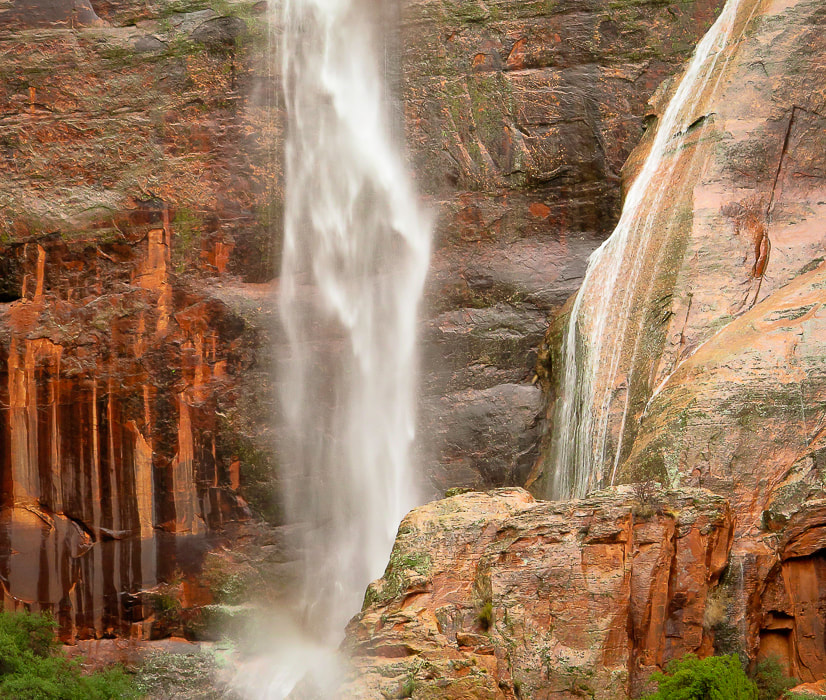 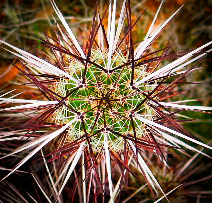 Engelmann's hedgehog cactus 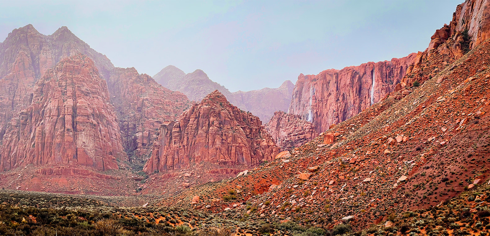 Walking out of Hell Hole: three waterfalls. 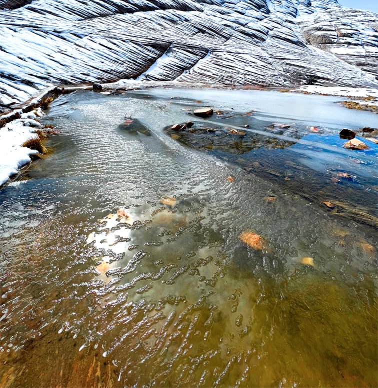 Whiterocks amphitheater, Snow Canyon SP 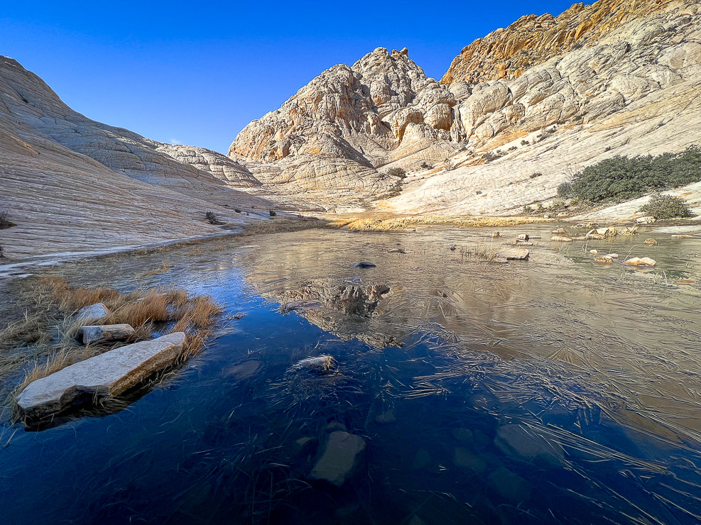 Whiterocks amphitheater  Snow Canyon State Park This hidden pool extended between two towering walls with dripping water It sounded so peaceful! 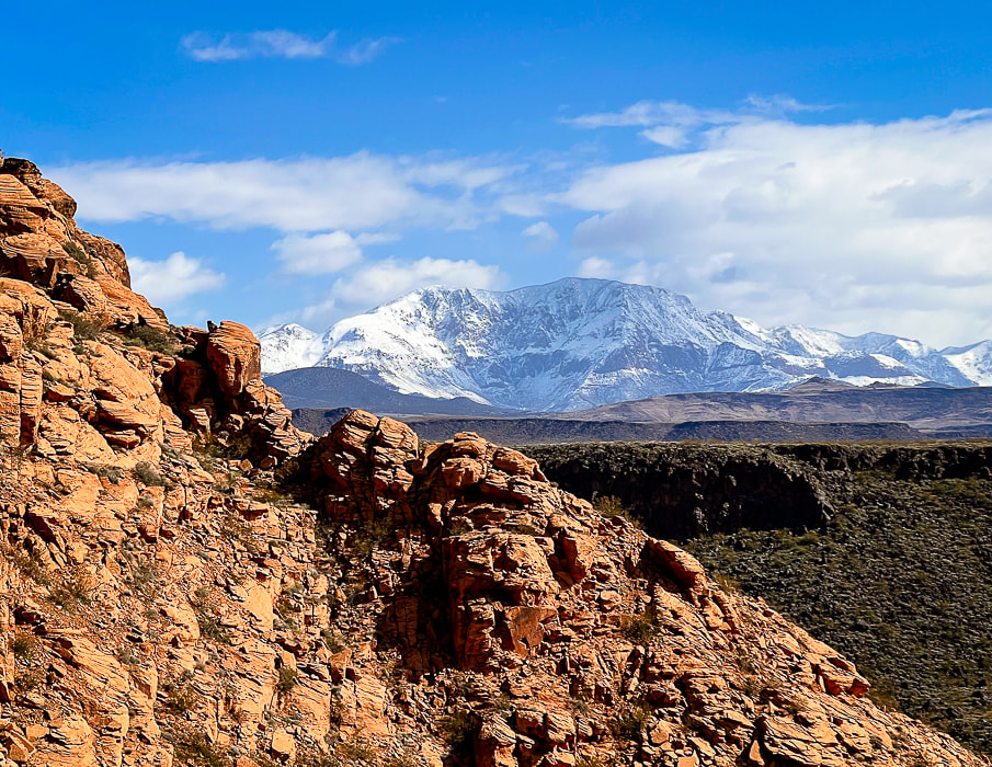 Three rock types: Navajo Sandstone, basalt flow, and snow-covered Pine Valley Mountain's monzonite porphyry (granite with large crystals) that formed as a result of slow cooling underground.  Red Mountain from our front yard.  Sunrise on Beaver Dam Mountains - from our back yard. References
The Triple Junction of Southern Utah. a You Tube video from BackRoadsWest1. Images of sensational slickrock journeys in southwestern Utah.  We've made a refreshing change in our mode of hiking and exploring. After years of using established trails, we are doing more hikes "cross-country" over slickrock or remote desert, where markers are few or none. We've been fortunate to hike with a fellow southern Utah explorer who has discovered the routes illustrated in the slickrock slideshows below. I still appreciate rock cairn markers over miles-long treks in slickrock seas, like Boulder Mail Trail to Death Hollow in Grand Staircase-Escalante. And, as the southwestern deserts heat up, we will find ourselves in higher elevations on signed forest trails. Navigation through slickrock country is a fun way to explore, but extra precautions are needed. You can use dead-reckoning and a compass to travel, but using a topo map helps you discover the canyons and plateaus between you and your destination. I've started using Topo Maps US, an iphone and ipad compatible navigation application (version 12.0 or later). With this app, you can download maps for areas in which you will be hiking, record and save your tracks. I also always use my Garmin GPS to record our tracks, and occasionally Avenza Maps. Don't Walk on the Crypto! (more info at end of this post).
As in Slickrock Nirvana - Part One, the following slideshows contain images from our unique excursions. More images follow the slideshows. “Instructions for living a life. Pay attention. Be astonished. Tell about it.” ― Mary Oliver Yant Flat and areas around St. George, Utah Red Mountain Wilderness  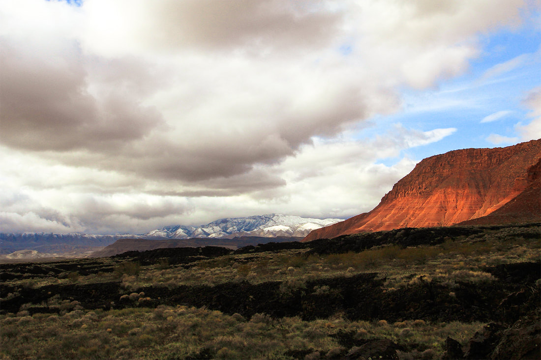 Snow Canyon State Park - basalt flows, Navajo Sandstone, and snow-covered Beaver Dam Mountains (limestone). 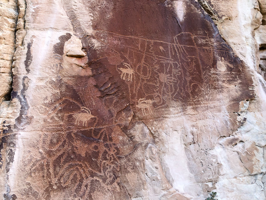 For more on petroglyphs: In Search of the Rattlesnake Petroglyph 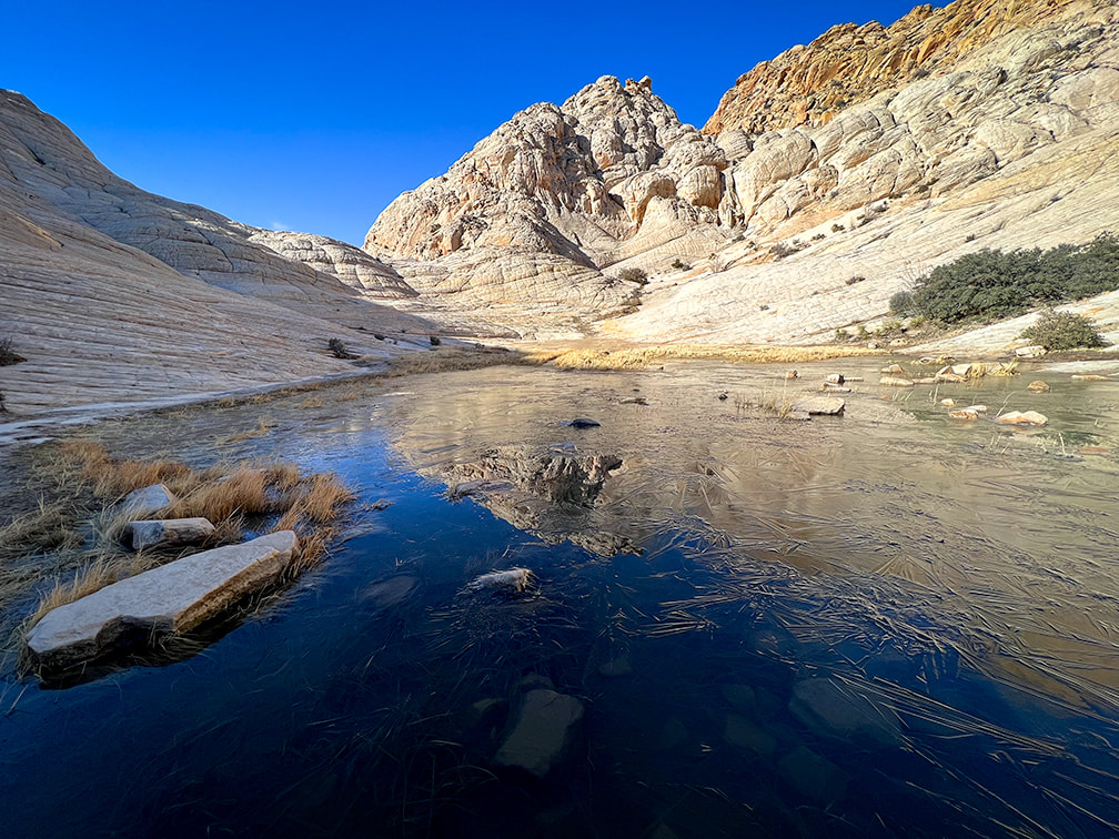 Don't Walk on the Crypto! A subscriber to my posts asked a great question: "I wonder if you worry about the cryptobiotic crusts?" We had to dodge and maneuver around these amazing stabilizing soil crusts to avoid stepping on them. They're an important part of the ecology in desert ecosystems, and take many years to rebuild if destroyed. Cryptobiotic (biological) Soil Crusts
Cryptobiotic (biological) soil crusts, made of cyanobacteria, lichens and mosses. These form on easily eroded soils and increase stability and help provide more water infiltration and are the dominant source of nitrogen in pinyon-juniper ecosystems. These crusts hold the soil in place. Recovery of crusts that have been destroyed takes at least 45 years. 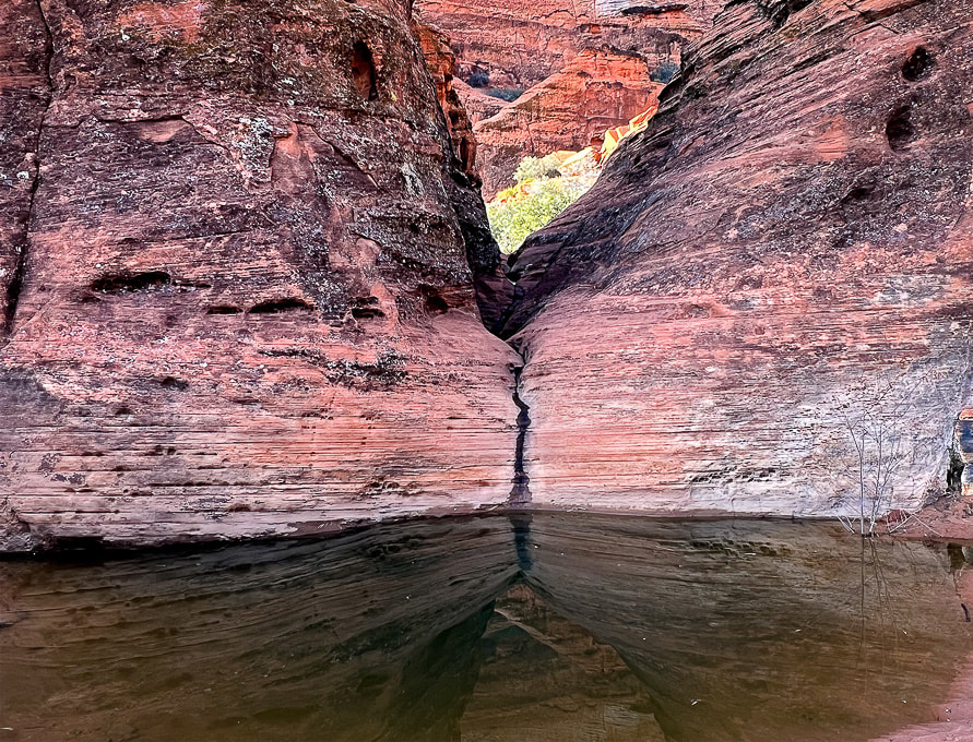 References
Loope, D. et al. 2016. Sandstones and Utah’s canyon country: Deposition, diagenesis, exhumation, and landscape evolution. University of Nebraska - Lincoln. One day's journey into southern Utah's wild slickrock paradise.
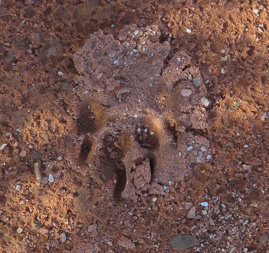
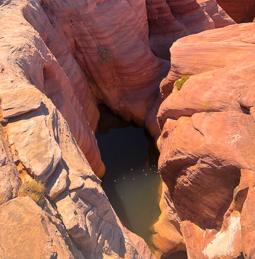
  I have often wondered why the term "slickrock" is used to describe smooth-surfaced sandstone. My boots didn't slip on it; in fact I found it rather grippy while hiking across it, up it, or down it. Unless it is covered by a thin coat of ice or damp moss, it wasn't slippery. My mountain bike tires held firmly on Moab's Slickrock Trail. "Slick" was the term that early pioneers of the southwest region gave this multi-colored, cross-bedded rock because metal horseshoes and wheel rims had poor traction on this terrain. We have been fortunate to meet two friends who are showing us some routes in the magical and ever-changing southern Utah slickrock country. These routes are not marked; no cairns, no signs. They are wild and untrammeled and untrampled, a welcome change from southern Utah's over-traveled national parks. The landscape is remarkable because there are so many things to see - from small-scale ferns, moqui marbles, and mountain lion tracks, to large-scale towers, blazing orange temples, hoo-doos and spires. Colors vary from black desert-varnished and stained sandstone to blue pool refections in white slickrock. This land is unpredictable. When you reach the top of a smooth sandstone bowl or cross-bedded steps, you may find a cliffed-out canyon, or more slickrock flats, or a rocky pass with gnarled ponderosa pines and junipers to negotiate to reach the sand washes below. "Nirvana" is the final goal of enlightenment in Buddhism, a state of transcendence where there is no suffering, desire or sense of self. It's also a term used to describe paradise, a place of perfect peace and happiness - an "idyllic" place. After a few nights backpacking in the Sawtooth Mountains, I would call that range in central Idaho "paradise". Low, green valleys and sawtooth peaks all formed by glaciers, and plentiful lakes, so many that you could walk to a few of them in a day or spend each night at a different one. Southern Utah's Red Rock Country might be described as paradise, or nirvana, at least by me. It's a place where you can immerse yourself in the extraordinary beauty that's the artwork of millions of years of shaping and carving an ancient sand sea. I'm grateful to be able to experience these places - to have the companionship of my husband and friends, to have strong legs to get there and be able to share our adventures with others. We have available limitless adventures, but limited time. The slickrock slideshow and other images that follow highlight scenes from one day's journey into slickrock paradise. Slickrock Slideshow 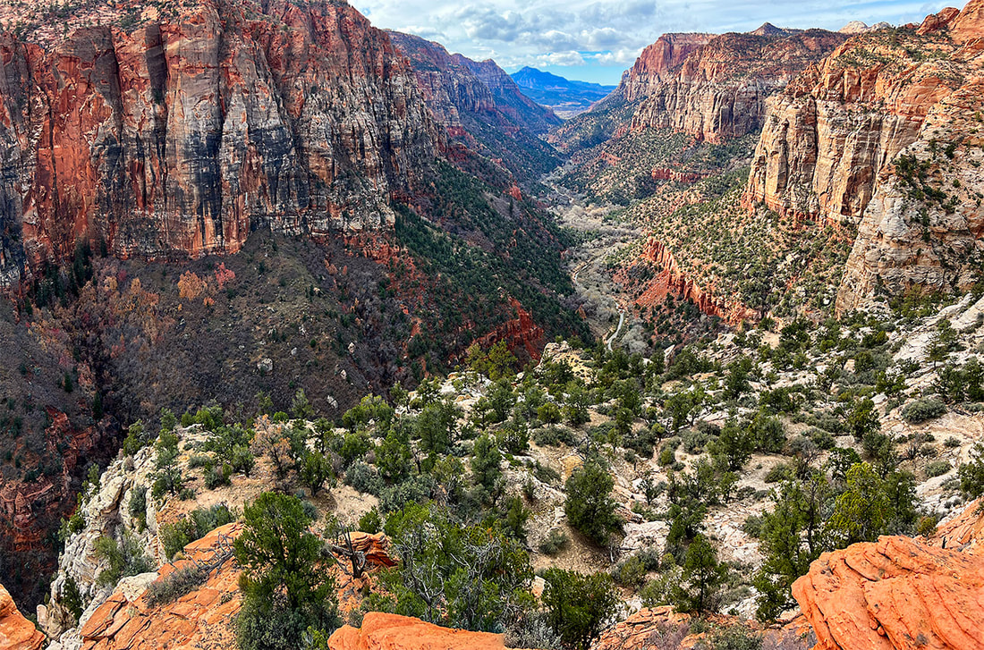 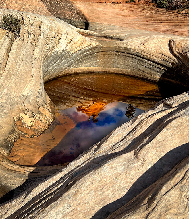 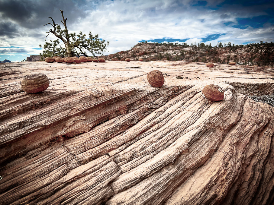 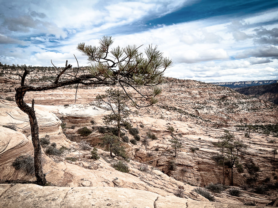  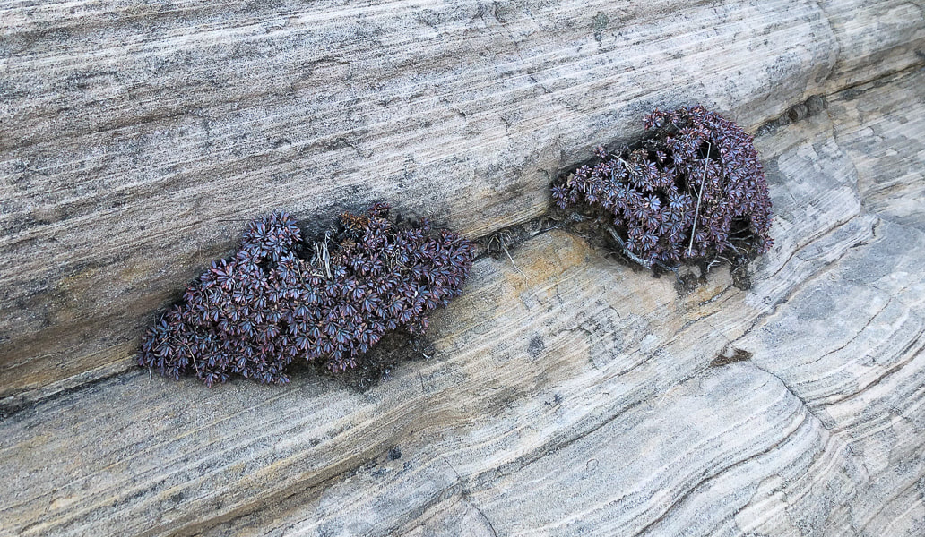 Create your own exploration of this quiet, transcendent wonderland surrounded by ancient limestone mountains. Walk for an hour or all day and you will understand why it is called "bowl of fire". 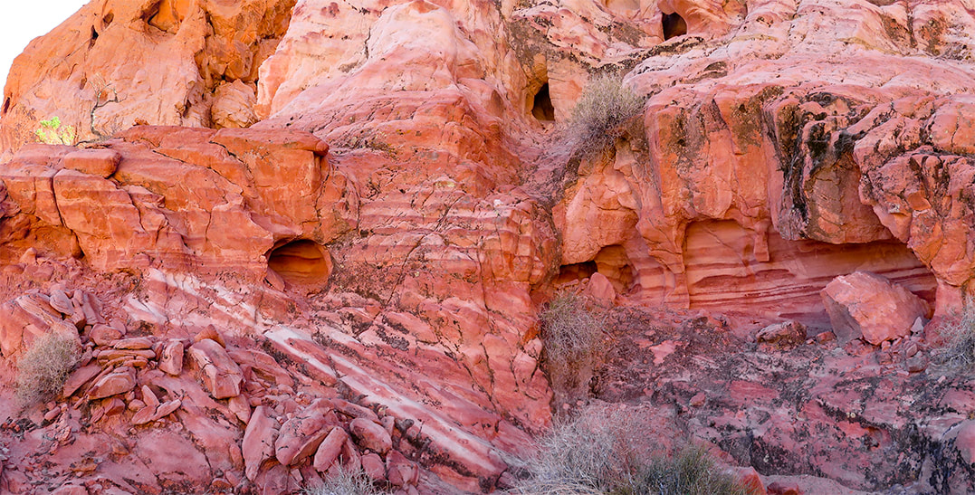 Trip Stats - Bowl of Fire Overview: Hike a long loop through rugged north and south sections of Bowl of Fire, or a shorter out-and-back journey to sample this unique Jurassic-age sandstone terrain. Either way, you will find yourself in a wonderland of washes and small canyons, exploring a land of grey, orange and red scattered boulders, water-filled potholes and honeycombed-eroded slickrock. Muddy Mountain's looming limestone backdrop adds to the drama. Location: Muddy Mountain Wilderness (NRA), Northern portion of Lake Mead NRA, southern Nevada. Access from two trailheads on Northshore Road: Northshore Summit Traihead and pull-out 2.4 miles west of this trailhead. Nearby Peaks on our wishlist: Muddy Mountain, Bearing Peak, South Gate and North Gate Peaks. Maps and Apps: AllTrails tracks, Lake Mead map from National Geographic Trails Illustrated no. 204. Date hiked: 11/12/22. We have discovered, in exploring southern Utah, Nevada, and northern Arizona that our list of "to-do's" grows exponentially. The Bowl of Fire is just one small place in the geologically complex Lake Mead National Recreation Area, where rock ages span 1.8 billion years. Recognizable from trailheads on Northshore Road, the Bowl of Fire is a bright orange pocket of sandstone beneath the formidable-looking Muddy Mountains, made of 500-300 million year old gray limestone. The summit of Muddy Peak, a ~ 3,000-foot gain is one of the "classic" desert peaks to hike. It's on our list. From its summit, we will be able to see our recent ascents up Virgin Peak and Signal Peak. We stayed in Echo Bay campground in the northern portion of Lake Mead National Recreation Area. We walked to the shores of Lake Mead and found the area pretty much abandoned. Lake Mead is at its lowest level since 1937, filled only to 27% capacity. An old boarded-up restaurant still stood. I bet in its heyday it was a thriving place, but now signs say "Launch Ramp Closed." It's eerie to see the "bathtub ring" of light-colored rock at the base of mountains, where there once was water. Besides the Bowl of Fire, we ventured up a high point in the rugged volcanic Jimbilnan Wilderness to get a view of Lake Mead. Stark and dry, this is the Mojave Desert, dominated by creosote bush, mojave yucca and beavertail cactus. "Jimbilnan" is a combination of names of three National Park Service employees who surveyed this area - Jim, Bill and Nancy. This wilderness is made up largely of the rocks from the Cleopatra stratovolcano that erupted 13 million years ago. This is an area of many small brown to grey "bumps", gnarly ridges and peaks, and we found ourselves climbing on unforgiving, crumbly, sharp rocks. Two Parts to the Bowl of Fire Upon entering "the bowl", you are free to create your own path and wander wherever your impulse takes you - maybe explore a rocky canyon, walk to a high point through sandstone blocks, climb into a "cave" of eroded sandstone, or pass by slickrock tinajas (pools). We hiked just the southern part of Bowl of Fire (see Google Earth image below), our trailhead 2.4 miles west of Northshore Summit trailhead on Northshore Road. We parked in a small pull-out and soon found a trail heading north, crossing Callville Wash. Birdandhike.com describes an 8-mile hike that includes both north and south sections. Just when I thought I had seen every kind of sandstone feature, we ran into some highly eroded blocks on the ridge of a high point that looked like Rice Krispies treats! (see below). Here, the rocks have character and the land in this Lake Mead area just north of Las Vegas is sublime and transcendent. Muddy Peak's summit is in the works - we will see some killer views of Nevada, Arizona and Utah. Our to-do list grows.... Never Stop Exploring ! For the Geo-curious: The Bowl of Fire "window" after older rocks are pushed onto younger rocks
Bowl of Fire is early Jurassic-age Aztec Sandstone (~180 mya), the equivalent to Utah's Navajo Sandstone. Muddy Mountains are made of sedimentary rocks (limestone) of Cambrian, Mississippian and Devonian age (500-400 million years ago). The Muddy Mountain Thrust layered older limestone over younger aeolian-deposited (wind) Aztec sandstone. Erosion of this overlying layer has revealed "windows" of the bright orange Aztec sandstone.
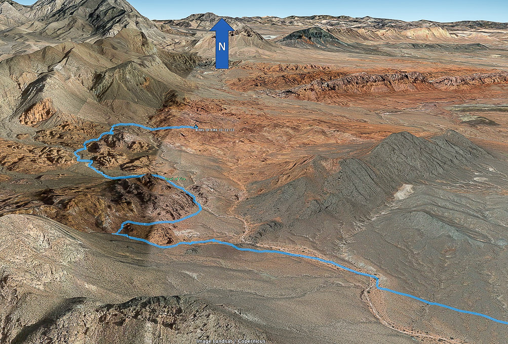 Our GPS tracks to southern Bowl of Fire. Complete tracks not recorded: we made a loop passing tinajas (pools under dry waterfalls) and ultimately walked down the wash seen above. Northern section of Bowl of Fire seen upper right, Muddy Mountains upper left.  But first: A stop at the Virgin River Casino in Mesquite, Nevada for a free lunch on our way to Lake Mead (Fred is an Army vet). 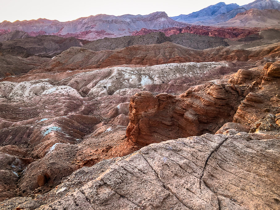 Sunsets create magical landscapes at Lake Mead National Recreation Area. 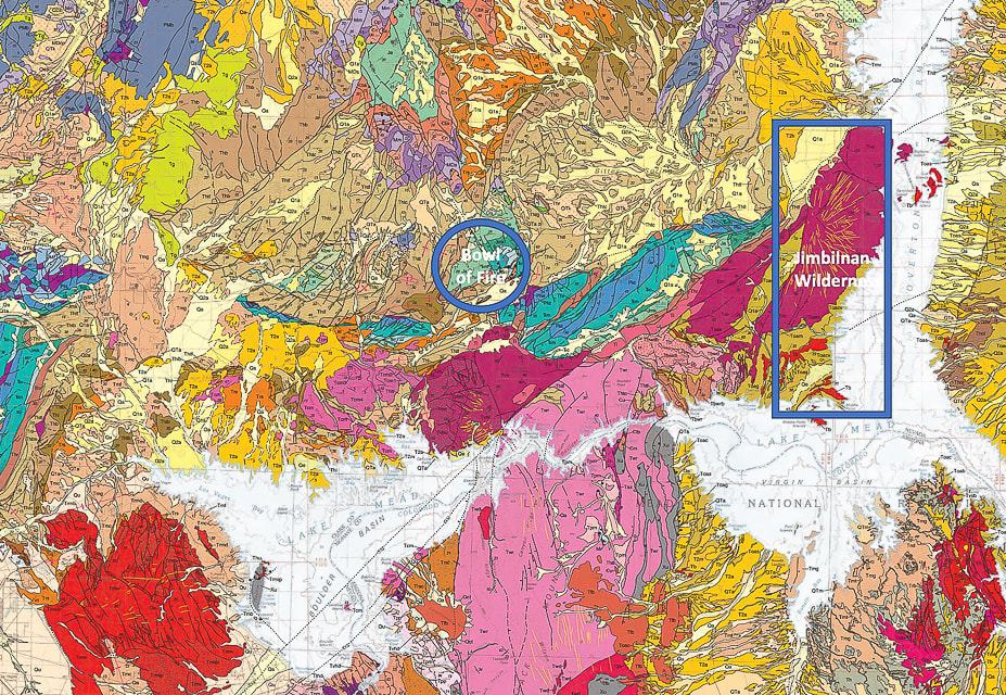 USGS geological map of Lake Mead quadrangle. Each color represents a different rock unit. Oldest rocks are 1.8 billion year-old early Proterozoic gneiss. The magenta-colored units in the Jimbilnan Wilderness are from the Cleopatra Volcano and are much younger than the green-colored Jurassic units in of Bowl of Fire. The thin yellow lines in the Cleopatra rocks represent dikes where magma rose to fill fractures in existing rocks to produce an eruption of igneous rocks. Notice three distinct magenta sections including Jimbilnan: they used to be one huge stratovolcano more than 3,000 feet high now named Hamblin-Cleopatra. Two faults have since split the volcano into three parts and fault blocks have moved. 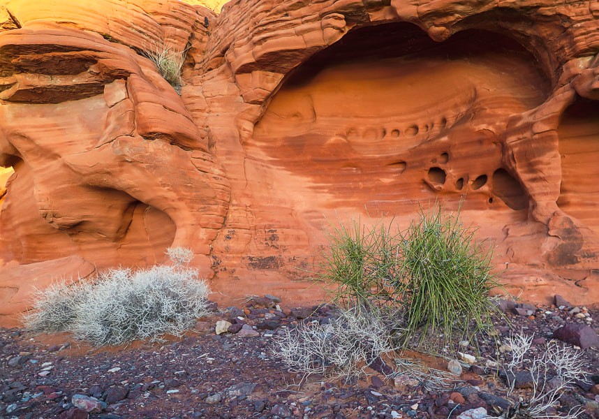 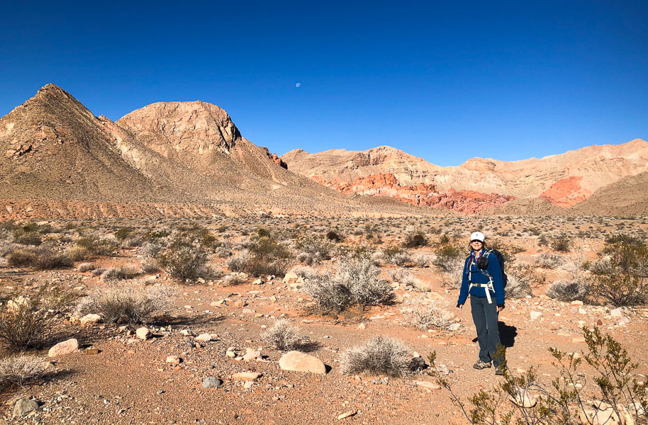 Following a trail toward Bowl of Fire. 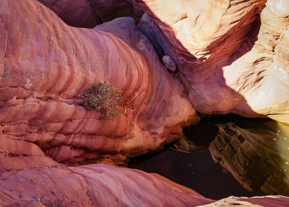 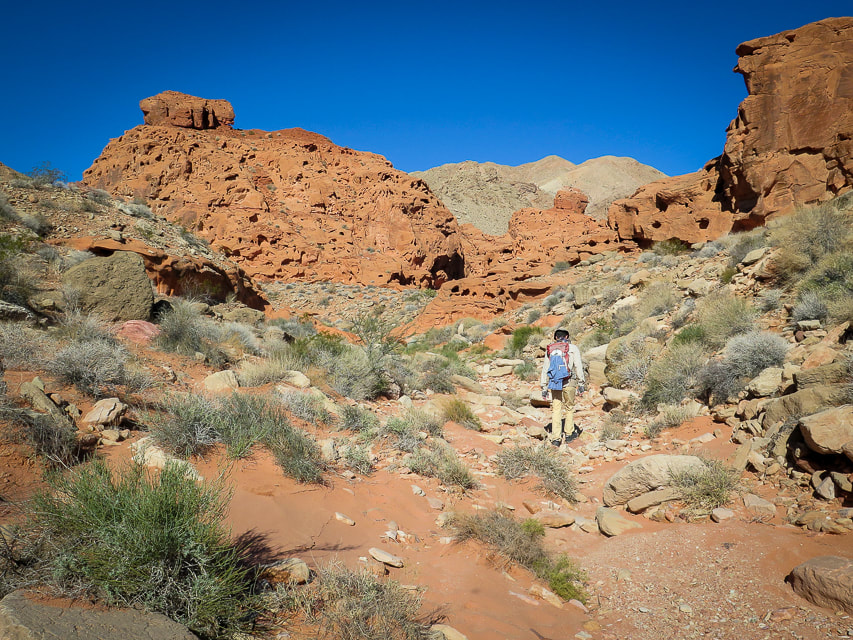 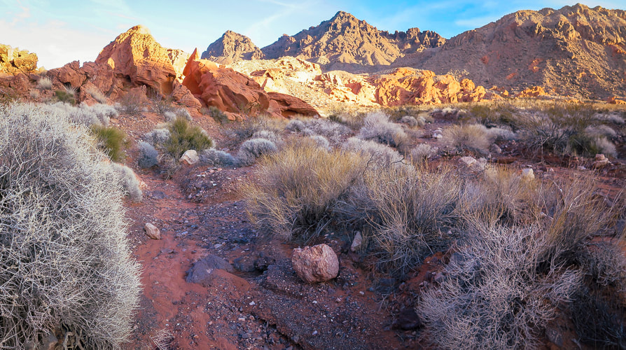 Muddy Mountains on horizon. 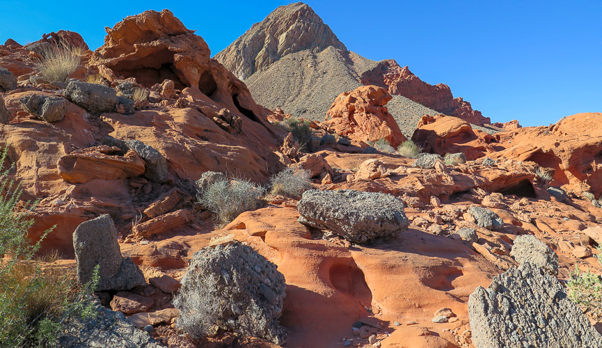 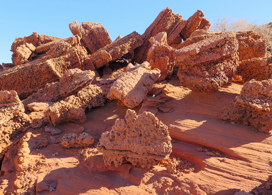 Porous, weathered sandstone reminding me of giant Rice Krispies treats! 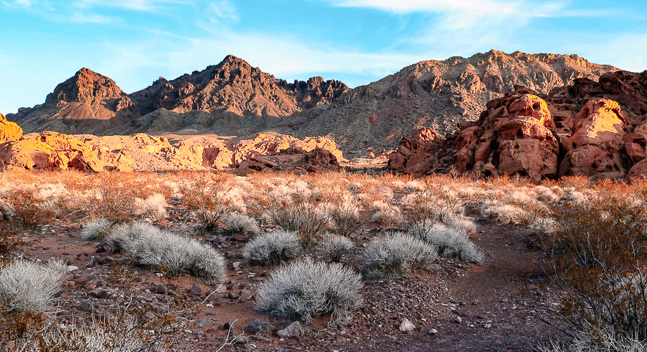 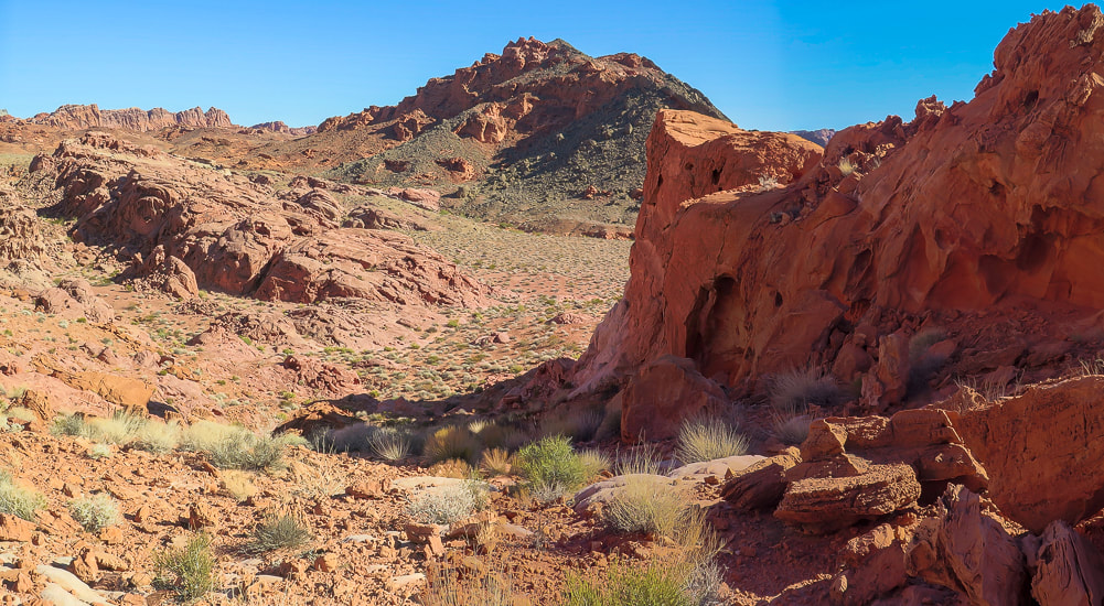 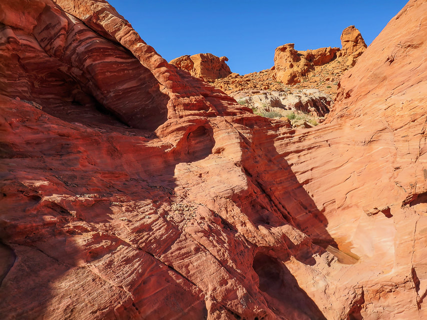 This section had a few dry waterfalls and pools of water. 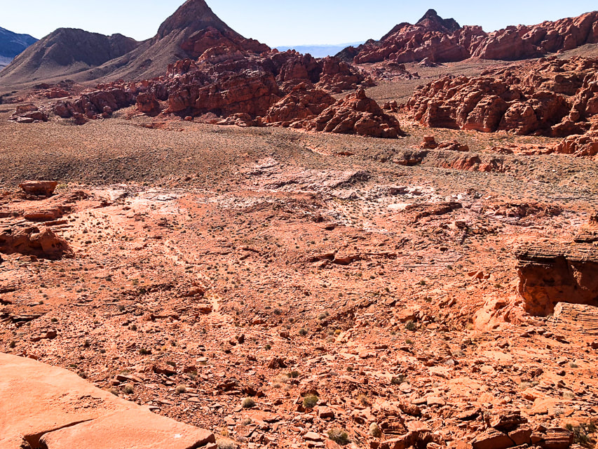 The view from a high point in the Bowl of Fire. 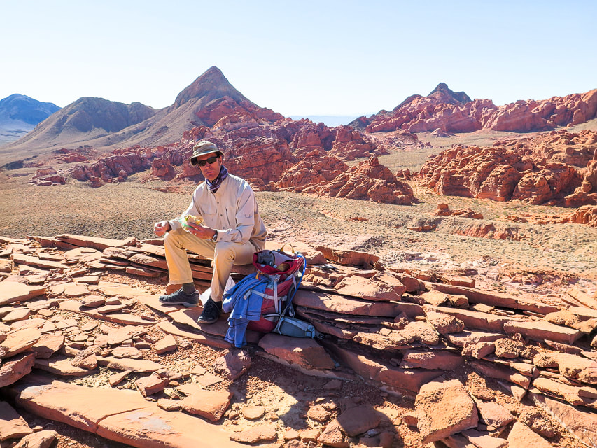 Lunch on high point. Some cool stuff on the trail. 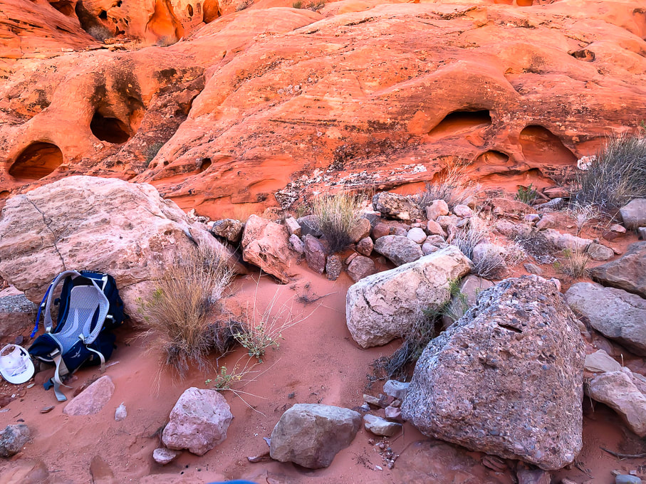 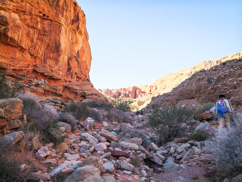 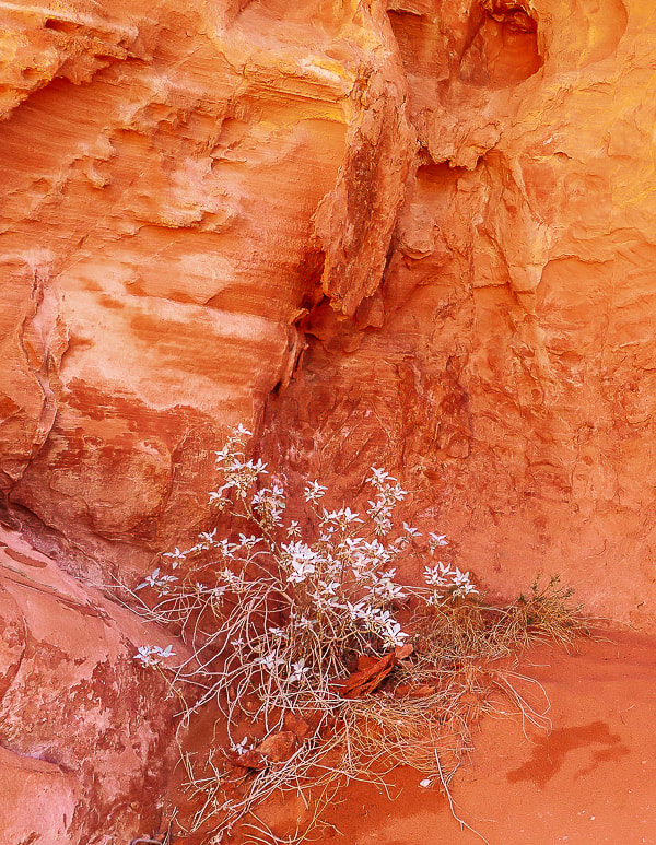  A small glimpse of Lake Mead on left side of photo in the Jimbilnan Wilderness. 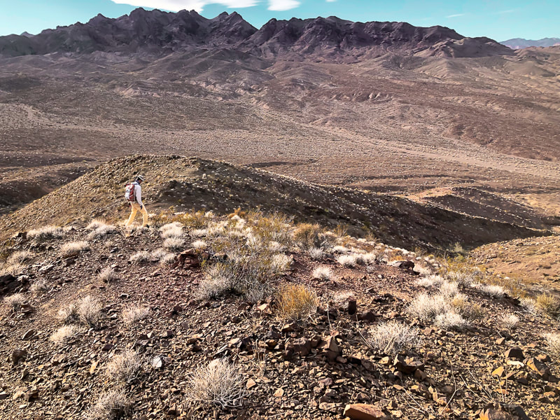 Hiking down from high point in Jimbilnan Wilderness along the shores of the Overton arm of Lake Mead. Rocks are from 15-million year-old Hamblin-Cleopatra stratovolcano. The Black Mountains across the valley. 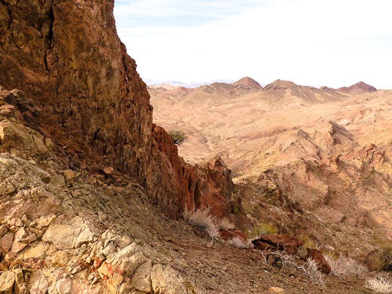 We got to this pretty sketchy ridge in the volcanic Jimbilnan Wilderness, enjoyed the far-reaching views and then descended. 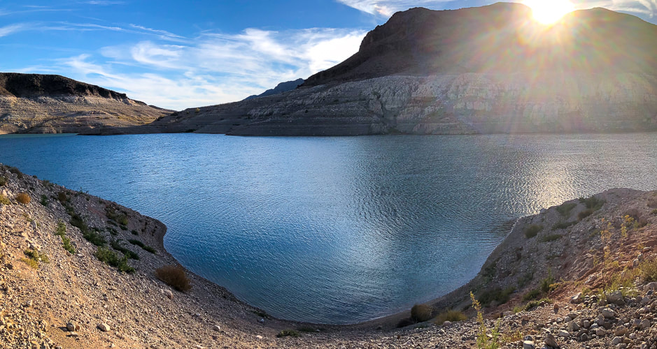 Echo Bay, Overton arm of Lake Mead. 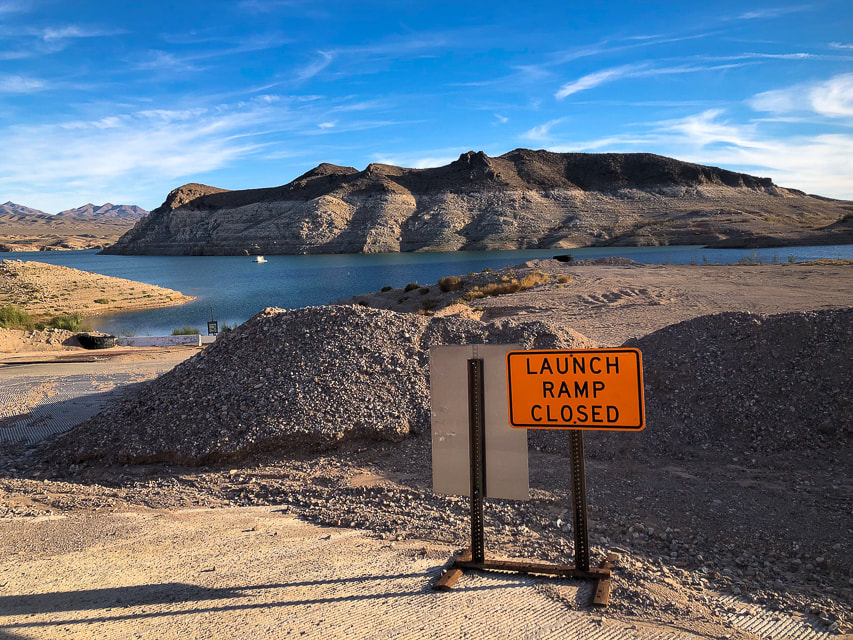 Echo Bay - Overton arm of Lake Mead. 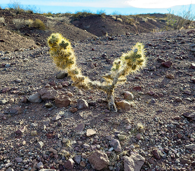 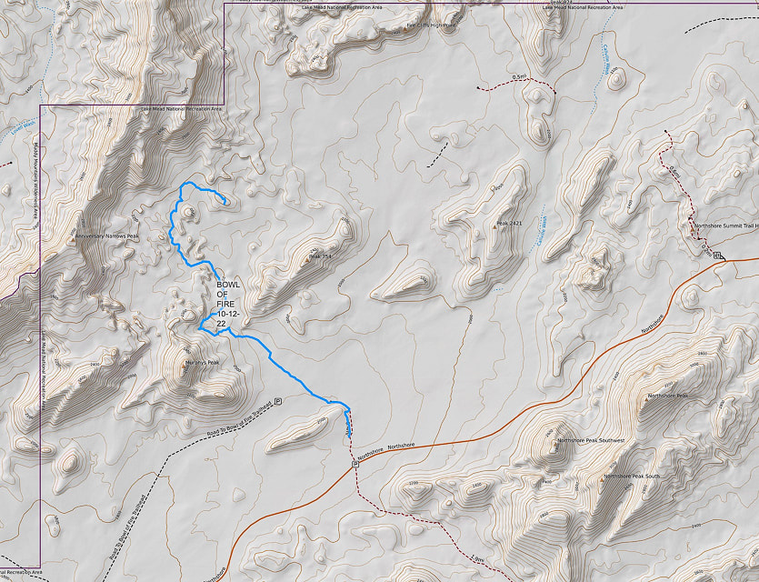 Our GPS tracks into the southern Bowl of Fire. References
Beard, L.S, et al. 2007 Preliminary Geologic Map of the Lake Mead 30' X 60' Quadrangle, Clark County, Nevada, and Mohave County, Arizona. USGS website. Hamblin-Cleopatra Volcano. NPS - Lake Mead. Lake Mead National Recreation Area - Geology, USGS slideshow. Lake Mead Keeps Dropping. NASA Earth Observatory Zuluaga, L.F., et al. 2017. Structural and petrophysical effects of overthrusting on highly porous sandstones: the Aztec Sandstone in the Buffington window, SE Nevada, USA
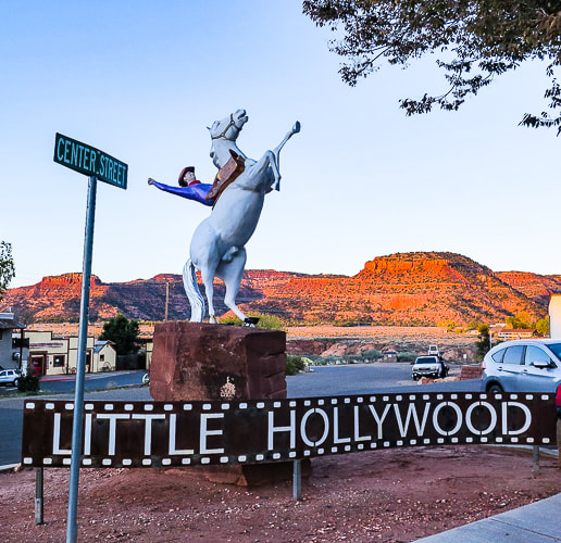
Expansive views of southern Utah and northern Arizona, cool canyon narrows, Pueblo II petroglyphs, a deep sand slog and delicious quiche in Kanab, "Utah's Little Hollywood."
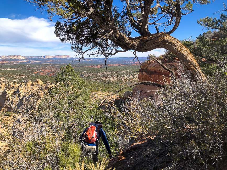
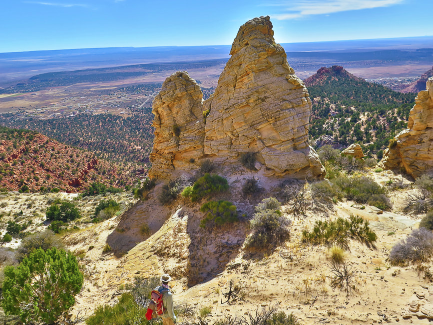
On the trail to Mansard Benchmark (mesa on the left).
Ancient Moqui steps carved into Red Canyon (AKA Peekaboo)
Also called "moki" steps, these were carved into sandstone to access alcove above. The lowest step is about 5 feet from the canyon floor. Handmade ropes and ladders were possibly used to access the steps, or sediment has washed away, making the access higher. There may have been a granary in the alcove. more Peekaboo photos below Trip Stats - Mansard Benchmark and East Mansard Peak
Overview: Hike to petroglyphs tucked in a alcove overlooking northern Arizona, scramble up a weakness in Mansard Benchmark's cliffs to top out for a huge view. Summit #2 is a fun slickrock climb up East Mansard to look over multi-hued mesas to snow-covered mountains to the northwest.
Location: Vermilion Cliffs, Bureau of Land Management Distance/Elevation gain: 6.2 miles/1,450' cumulative gain. Coordinates: Trailhead = 37.03414 -112.42366. Mansard Benchmark = 37.04925 -112.43087 Difficulty: Moderate Class 1 to bases of the two summits, Class 2, 2+, and one Class 3 move onto Mansard Benchmark. Maps and Apps: Stav is Lost's trip report, AllTrails GPX tracks, Kanab map from BLM. Directions to trailhead: BLM website. Date Hiked: 10/29/22 Trip Stats - Peekaboo Slot Canyon
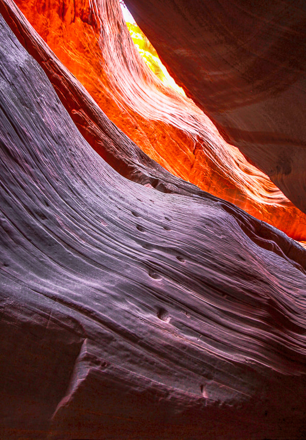
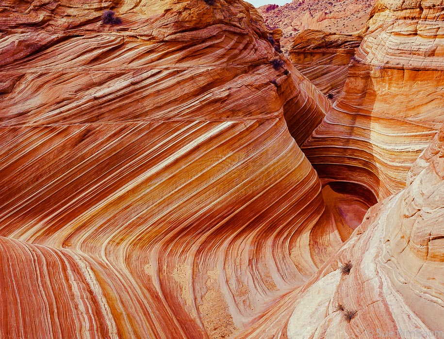
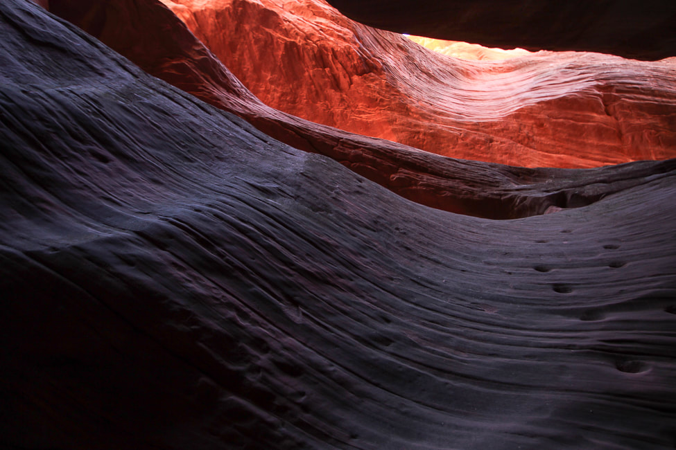
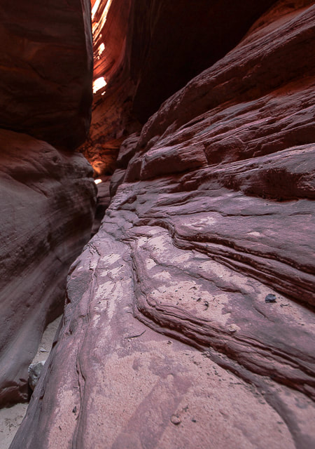
Overview: Experience gorgeous shapes, textures and ever-changing colors as you wind through sandstone narrows. It's also fun to walk along the canyon rim for views of the White Tower to the north and the "White Wave".
Location: Trailhead is 9 miles north of Kanab on Highway 89 - Bureau of Land Management. Entrance to canyon: 37.17928616, -112.5597135. Distance: 6.3 miles out and back if starting from trailhead on Highway 89, north of Kanab; 0.7 miles if you drive to canyon entrance. Maps and Apps: AllTrails tracks. Considerations: Sandy road (2.8 miles) to Peekaboo Canyon entrance requires 4WD and tires with good traction in sand. Directions to trailhead: BLM website. Date Hiked: 10/30/22
Kanab, "The Greatest Earth on Show" is adventure-central for southern Utah and a nice little city with good restaurants, a museum, and a great bakery. We stayed in an RV park with our small trailer for two nights, walked into town for dinner one night, and did two hikes. Mansard Benchmark and East Mansard Peak were just out of city limits, and a great way to get the lay of the land for miles around. The Peekaboo Canyon hike was a slog through deep sand to get to the slot canyon (we didn't have the right tires on our pick-up). Kanab has adventure companies galore that will take you to Antelope Canyon, Horseshoe Bend, Peakaboo Canyon and the Grand Canyon. It's not far from the now world-famous "The Wave" in Vermillion Cliffs, as well as Buckskin Gulch and Wire Pass. It used to be easier to get into "The Wave"; Fred and I have gone twice about 20 years ago, when all we had to do was to be the first in line at the Kanab Ranger Station by 8:00 a.m. to get two of the limited number of permits. Now you have to go through a lottery system.
There's a reason you may feel invigorated after visiting Kanab. There's a lot of orange. Orange is the color of warmth, vitality, and creativity. According to Color Theory, orange increases our activity levels and gives us a sharper awareness of our surroundings.
Mansard Benchmark and East Mansard Peak
This short hike combines most of the great attributes of southern Utah: slickrock scrambling, spectacular views, petroglyphs, striking landforms and geology, junipers and pinyon pines, and some route-finding. A couple of weaknesses in the north cliffs proved a bit daunting for me to climb, but then we found a rope that assisted me up and down the cliff band. Hike Summary
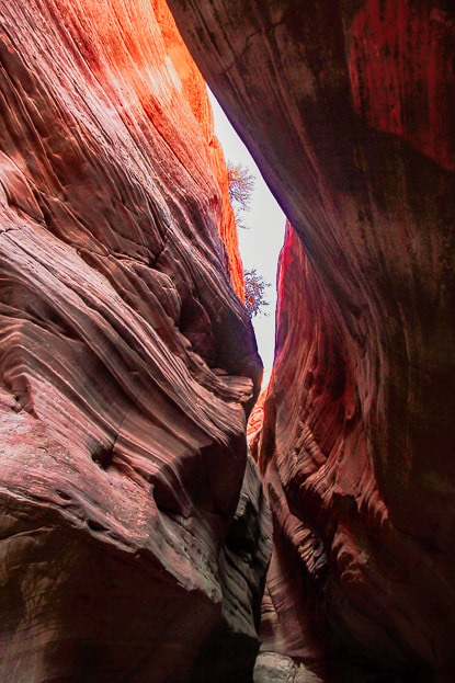
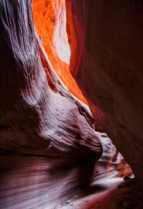
Peekaboo Slot Canyon (Red Canyon)
We didn't trust our truck's tires on the jeep/ATV road's deep sand (Road 102 from the highway trailhead), so we walked that 2.8-mile distance to the entrance of Peekaboo, which admittedly got a bit frustrating on the last mile back. But it was worth it. Within the confines of towering 80-foot high walls, you enter a silent, almost mysterious world. It's mind-boggling to consider how many millions of years it took for water to carve this Navajo Sandstone. We walked through at optimal light that shifted orange, red and purple hues during our time in the slot. So many compositions of curves, textures, lines can be captured with a camera. It becomes darker as you progress to the end, requiring a tripod if using a digital camera to capture sharp images. The moqui steps carved into a vertical wall by Native Americans were the most amazing feature. They clearly lead to a ledge, at this time illuminated with a fiery orange. Stripped and bleached tree trunks wedged between narrow sandstone spaces above attest to past waters moving fast enough to deposit them there. Oh, yes. I mentioned we had the best quiche at Kanab Creek Bakery, which prepares food using "traditional European" methods. Their croissants looked so good. We got there when it opened at 8:00 a.m., and soon after there was already a line for breakfast. The best modes of transportation to explore the desert around Kanab and Grand Staircase are jeeps and UTV side-by-sides. White Pocket in northern Arizona's Vermilion Cliffs is our next goal - just outside of Kanab near the famous "Wave" in Coyote Buttes. We just need to talk our neighbor, who has a jeep, into going with us.
Keep On Exploring!!
"The Wave" in Coyote Buttes North - Paria Canyon-Vermilion Cliffs Wilderness, Bureau of Land Management.
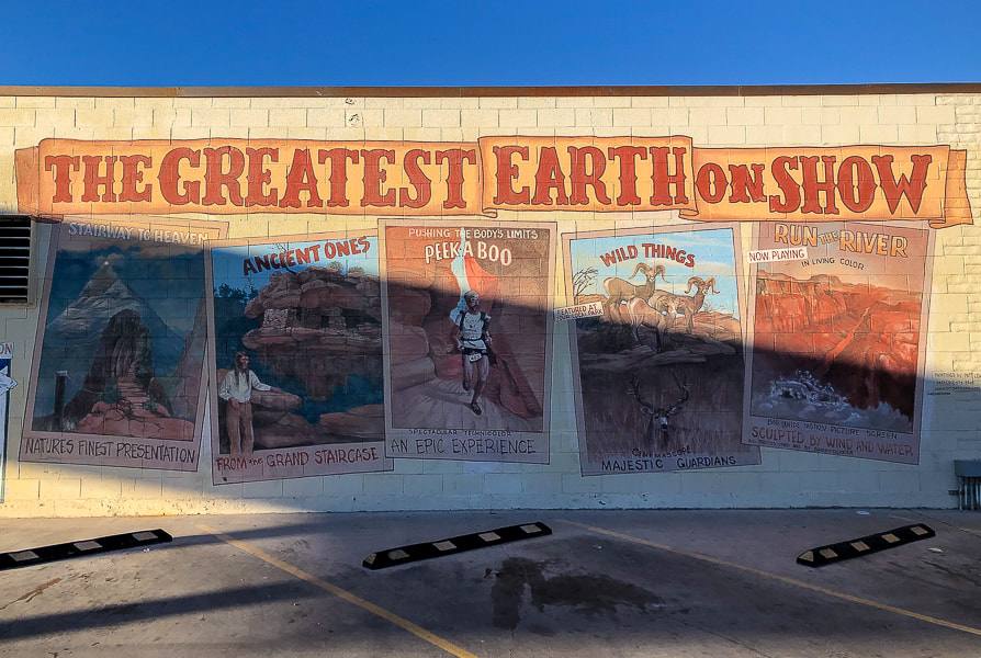
Mural in Kanab.
(more city of Kanab images at end of post) Mansard Benchmark and East Mansard Peak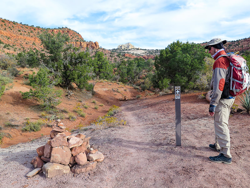
Cairn a short distance from parking lot. East Mansard Peak is center horizon.
Vermilion Cliffs: first mile of trail switch-backs up to the top where it heads north toward saddle between Mansard Benchmark and East Mansard Peak.
Mansard Trail switchbacks.
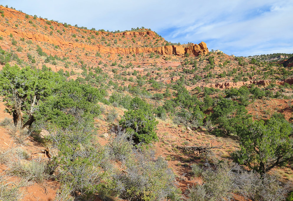
Off the switchbacks, onto the plateau. East Mansard Peak on the right.
Mansard Benchmark seen once on top of the plateau. The route to summit this is from the other (north) side of this mesa.
Pleasant stroll - East Mansard Peak seen here.
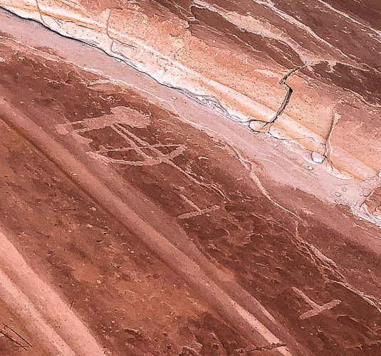
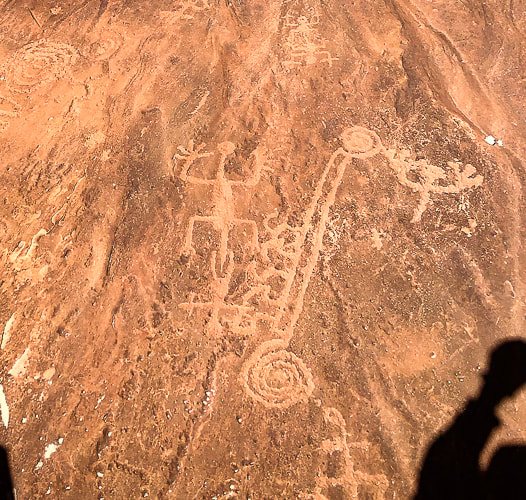
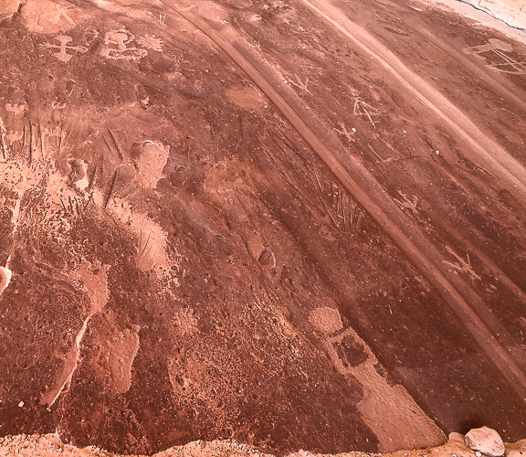
On the way to petroglyph site on south side of Mansard Benchmark.
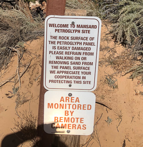
Mansard Trail petroglyphs are ~ 870 - 1,070 years old according to Bureau of Land Management Mansard Trail page.
Detail in sandstone wall near petroglyph site.
Some cool stuff on the trail.
Just had to photograph (in high dynamic range) this beautiful, huge juniper!
Point at which we left the sandy road and headed toward Mansard Benchmark's north cliffs.
Approaching north cliffs.
Looking for a route to the top.
Get to climb beautiful slick rock!
Walking along cliff base to find a Class 3 weakness.
Found this rope: Fred used it only to climb down. He climbed up a weakness in the cliff just before this.
At the top of Mansard Benchmark looking over Kanab and Kanab Plateau into northern Arizona.
Heading down: large juniper marks where we ascended the cliff band.
Looking up at East Mansard Peak.
Social trail takes you from main Mansard Trail to base of East Mansard; begin climbing through sand/on sandstone to the left.
Maneuvering over sandstone to ridge and then following it to the right.
Summit at the right.
Cairn on summit. View includes Mansard Benchmark (left). Grand Staircase/Escalante National Monument on right in photo.
Base of East Mansard Peak.

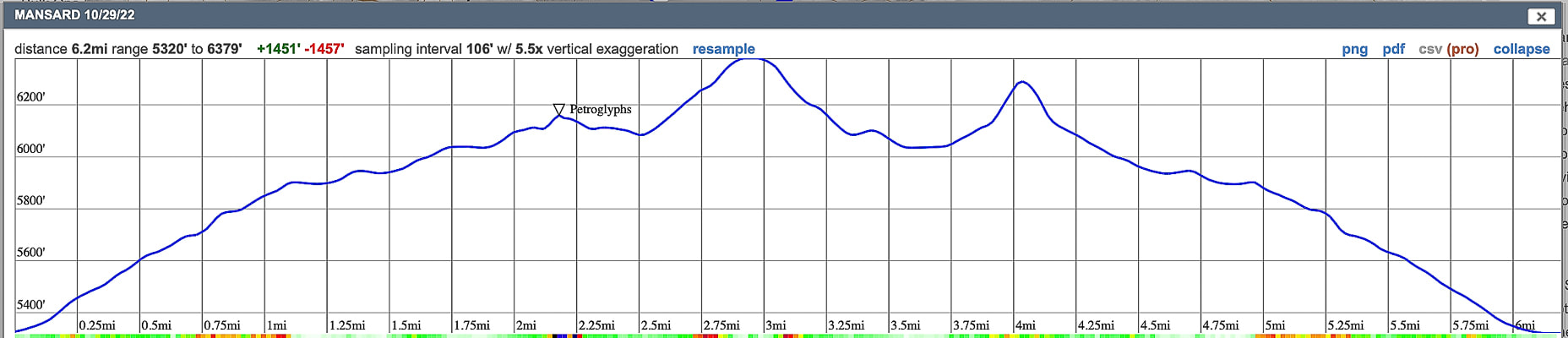
Our GPS tracks and elevation profile
click on map for larger view Peekaboo Slot Canyon, Kanab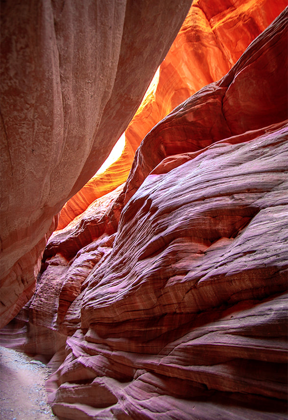
Walking on Peekaboo's rim.
The road leading to Peekaboo from the trailhead off Highway 89. Sand gets deeper than this in some parts of this road.
Some cool stuff in Kanab.
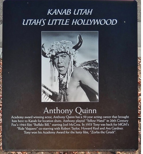
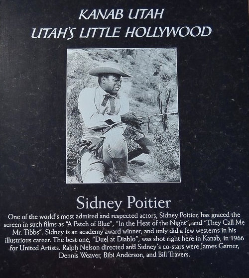
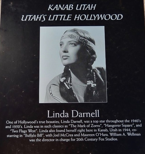
More than 100 movies and television shows, like Gunsmoke were filmed in Kanab and vicinity. It was the setting for The Lone Ranger, Billy the Kid, The Outlaw Josey Wales and even Planet of the Apes. A walking tour of "downtown" Kanab presents many nice-quality plaques that feature actors like John Wayne, Frank Sinatra, Dale Evans, Jack Nicholson, Clint Eastwood, Ronald Reagan, and many other stars who came to Kanab to film movies.
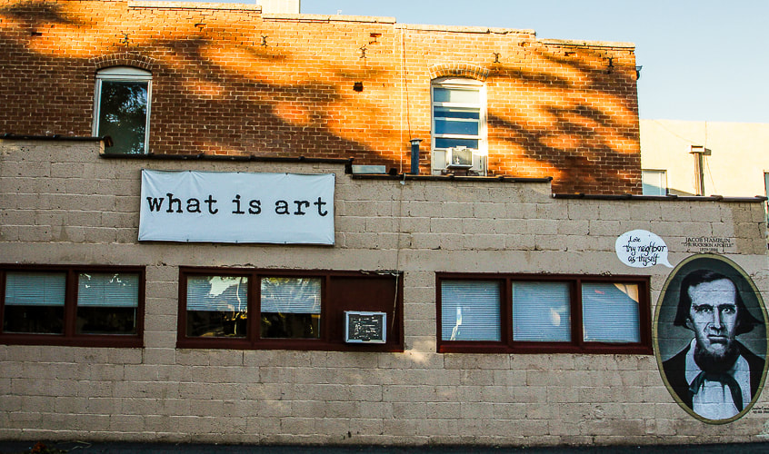
"Love Thy Neighbor as Thyself"......Jacob Hamblin, Buckskin Apostle.
References
|


| Related: Burger Peak, 10,320' - Pine Valley Mountains Gardner Peak, The Summit Less Traveled List of Utah Hikes | |
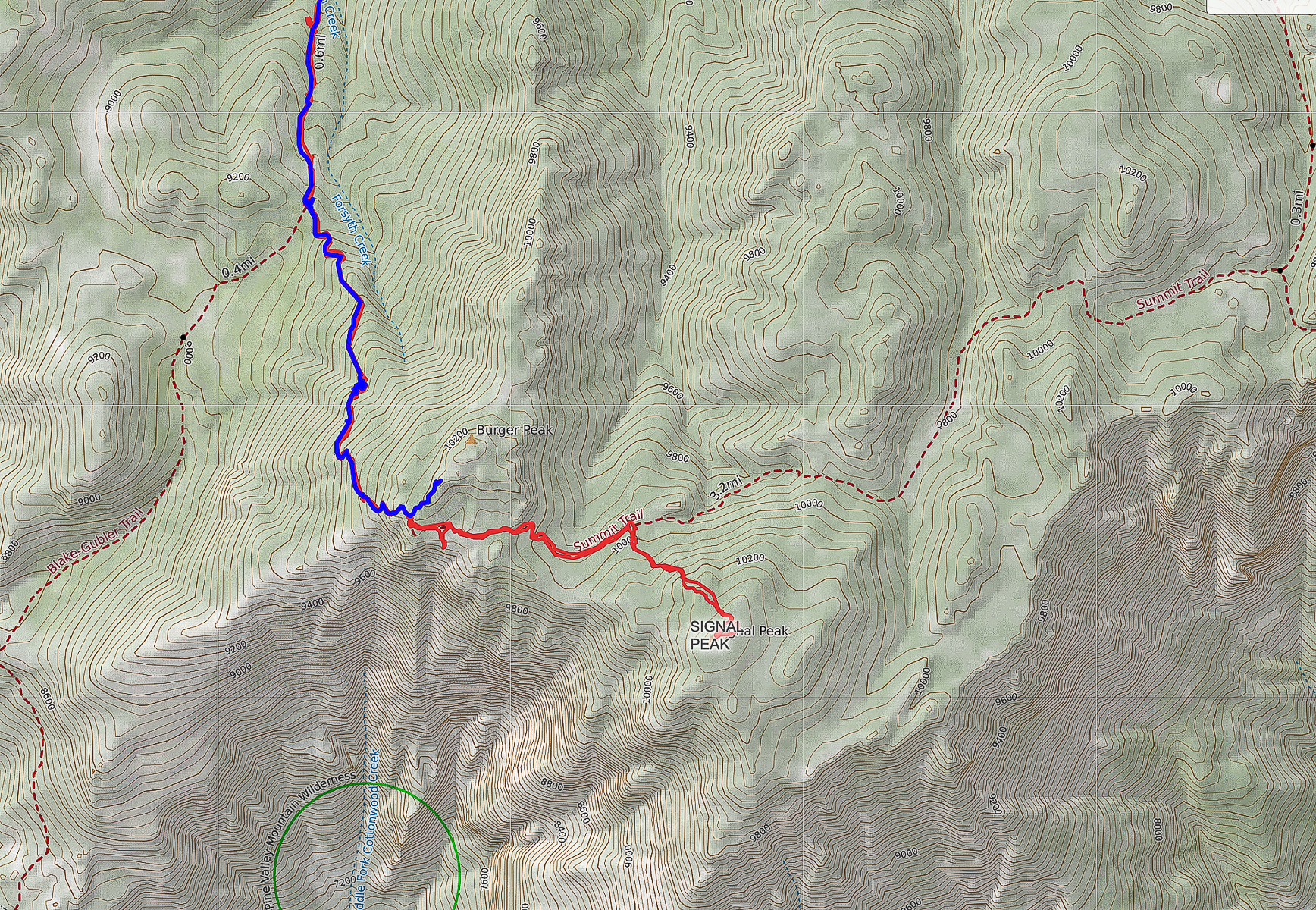
Overview: Hike to the high point of Utah's fourth largest wilderness that has the most diverse flora of any other Utah range (1,000 species). You can summit Burger Peak on the way to forested Signal Peak. Start in mountain mahogany, walk along Forsyth Creek through aspens and ponderosa pines to summit of firs and pines. A spectacular view of the Red Cliffs National Conservation Area and mountains in Arizona is seen as you climb out of the forest near the base of Burger Peak.
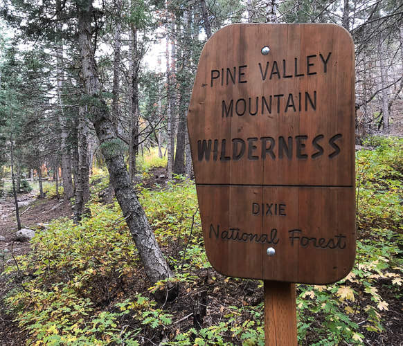
Location: Dixie National Forest, Pine Valley Mountain Wilderness, out of Pine Valley, north of St. George, Utah.
Distance/Elevation gain: 14 miles out and back/3,900' cumulative gain. Trailhead = 6,650', Summit = 10,369'.
Difficulty: Moderate - Strenuous on Class 1 to base of Signal Peak; Class 2 to summit (no trail).
Prominence: 4,485'.
Coordinates: Forsyth Trailhead = 37.38331 -113.50682. Signal Peak: 37.3197, -113.49162.
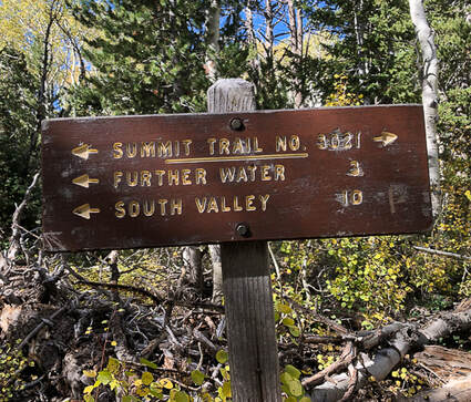
Trails: Forsyth Trail (#31012) to Summit Trail (#31021).
Maps and Apps: Trails Illustrated #715 - St. George-Pine Valley Mountains, Garmin GPS, Avenza (St. George/Springdale/Hurricane map).
Date Hiked: 10/7/22
History: Pine Valley was discovered by Mormon pioneers Gunlock Bill Hamblin, Jacob Hamblin, and Isaac Riddle when they were moving cattle north of Santa Clara for summer grazing. A sawmill to process lumber was erected in 1856. The tall white Pine Valley Chapel stands out as you drive through town. Built in 1868 according to Ebenezer Bryce's plan, it is the oldest meetinghouse in continuous use of the Church of Jesus Christ of Latter Day Saints. Bryce reportedly followed a lost cow later into a beautiful canyon - the now famous Bryce Canyon National Park. Bryce's experience in Scotland as a shipbuilder was the impetus for the well-constructed chapel.
Geology: The Pine Valley Mountain range is the largest laccolith in the U.S., and perhaps the world. Molten rock was injected into existing strata 20 million years ago; top layers eroded to reveal this large body of monzonite rock (similar to granite). This monzonite porphyry (coarse-grained) rock was deposited over the famous Claron formation, the rock that is seen in the form of hoodoos in Bryce Canyon.
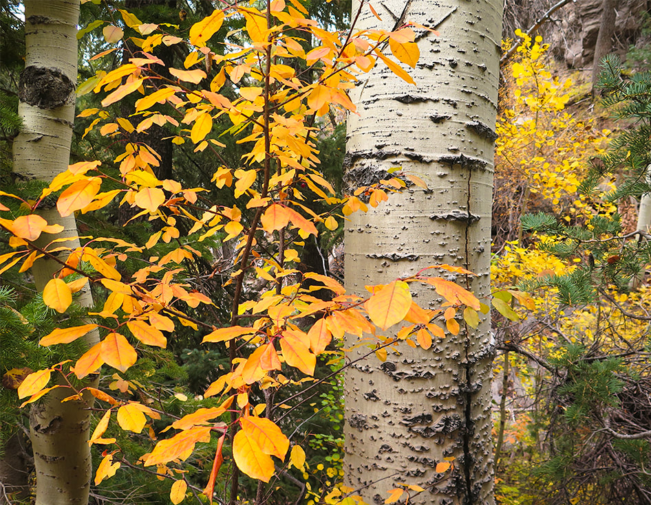
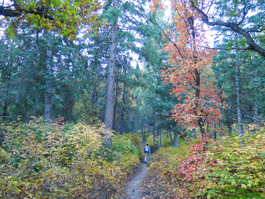
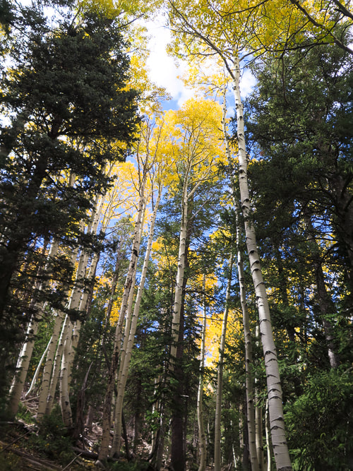
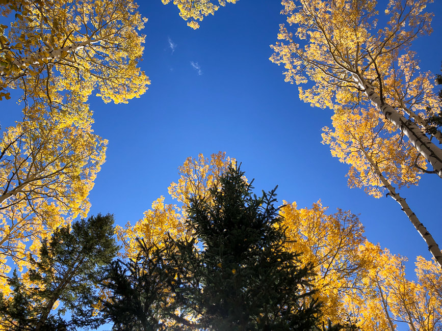
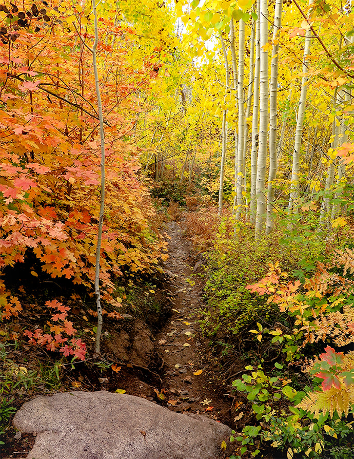
If you ever happen to be in southwestern Utah the first week of October, I highly recommend this hike. The onset of autumn makes an enchanting forest in the Pine Valley Mountains; it reminds me of the spectacular autumn foliage we saw when we lived in New Hampshire.
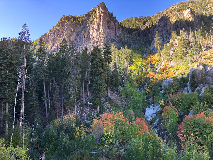
In my last post, I indicated that most people aren't aware of the hidden, magical world of southern Utah's Ashdown Gorge beneath the highway out of Cedar City. It's the same with the steep and rugged Pine Valley Mountain Wilderness just north of St. George. In this case, you can see this "sky island" rising like a hulk over red sandstone and black cinder cones, but it's not until you actually get into the heart of this wilderness that you realize its extraordinary beauty and find solitude.
We timed our hike to the highest point in the Pine Valley Mountains - Signal Peak - perfectly. The autumn colors were at their optimum, adding variety and depth to this dense forest. We had already summited Burger Peak, the second-highest in this beautiful, lightly-traveled mountain range, navigating deep snow banks in the spring. Lucky for me, afternoon clouds provided the best light that made these colors glow, so I spent a lot of time yelling ahead to Fred that I had stopped to photograph. We saw only three other hikers who were also enjoying the "zen" of this enchanting forest.
We are frequent visitors to this range that is remarkable for having the most botanical species than any other Utah mountain range - including three new species to Utah recently identified. We hiked Gardner Peak, a summit not often traveled a few months ago with friends.
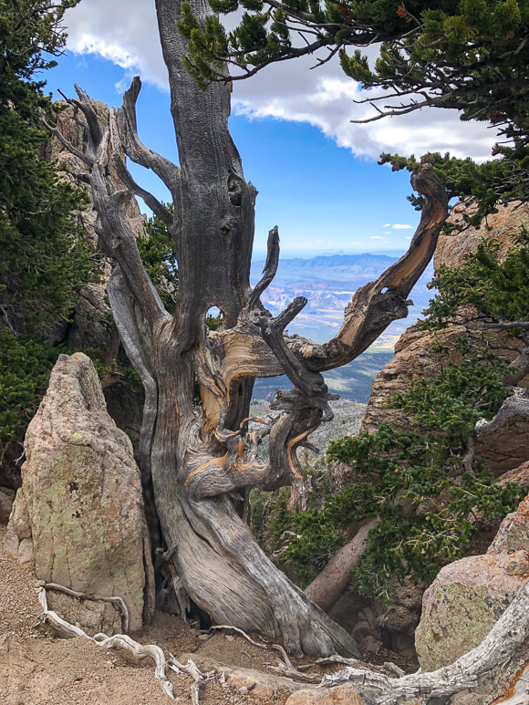
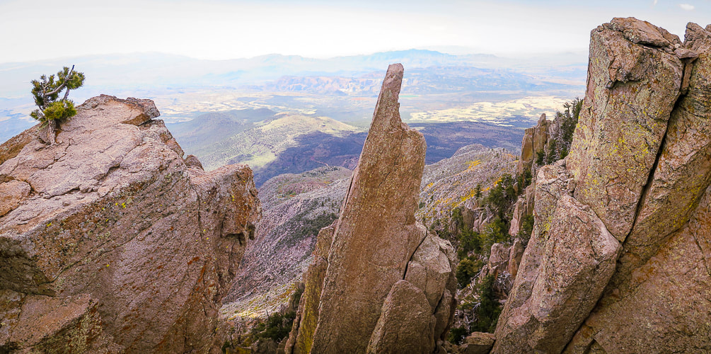
Striking rock formations growing gnarly old trees form steep cliffs with almost vertical valleys that drop toward the south when you finally emerge from the forest for a huge view of Southern Arizona and the red and yellow rocks near St. George at about 10,000 feet elevation. It's a brief view near the base of Burger Peak, and then it's back into the forest for the one-mile walk to Signal Peak summit. The spur trail to Burger Peak, ~ one mile before Signal Peak, is marked by an easy-to-miss two-rocked duck.
| Hike Summary
|  |
We found Summit Trail to be well-marked with cairns and tree blazes. I took a waypoint on my Garmin as we left the Summit Trail to make sure we would catch it again on the descent. There is no marked trail to the summit. If you pay attention on your descent from Signal, you will see Summit Trail, but it may not be obvious. I used Avenza app to find the summit. The peak is forested, so there's no great view.
| It had been awhile since Fred and I had hiked 14 miles with such a gain. Doubts about whether I could do this hike with the same pace I have in the past crossed my mind. Even though we are 61, we hiked as we had 20 years ago. Well, maybe I was a bit more tired than I would have been 20 years ago. Guess our legs are so used to it. I believe our bodies, in many instances, can be pushed more than we think. And there are usually rewards that come with challenges: a stronger and happier body and mind! Don't wait - just go! - Next post: Adventures in Kanab “There’s a constant tension in climbing, and really all exploration, between pushing yourself into the unknown but trying not to push too far. The best any of us can do is to tread that line carefully.” – Alex Honnold, the first person to free solo El Capitan in Yosemite National Park |  |

Peakaboo slot canyon
Click for larger image
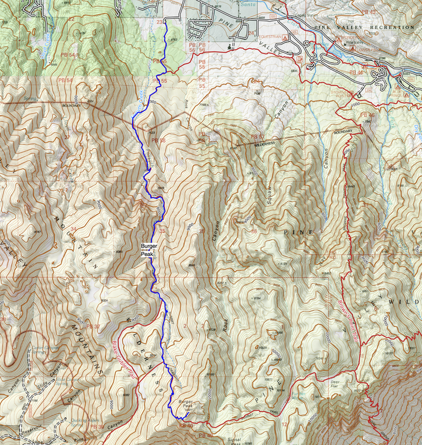
For Google Earth view of our tracks, click Burger Peak post.
Miller, Rick. Our Geological Wonderland: The Pine Valley Mountain Laccolith. The Independent.
Highlights: Walk through a stream under spectacular sandstone walls to narrows and Lake Creek and Rattlesnake Creek waterfalls.
Location: Utah's Dixie National Forest - Cedar City Ranger District, Ashdown Gorge Wilderness.
Distance: Up to 8.8 miles round trip if you hike up to the end of both streams at confluence/fork, ~ 6.5 miles if just hiking left fork to the waterfalls.
Difficulty: Easy effort walking on combination of rocks in stream and on stream banks. Walking more difficult with higher stream run-off.
Maps and Apps: AllTrails tracks, Trails Illustrated Cedar City Markagunt Plateau #702.
Coordinates: Trailhead on Utah Highway 14: 37.63463 -112.94357
Elevation: Trailhead = 7,000'. Rattlesnake Creek Falls and Lake Creek Falls = 7,672'
Trailhead location google maps
Considerations: Check weather forecast for nearby Cedar City and mountains above Ashdown to avoid possibility of being caught in flash floods in this canyon. I recommend old trail running shoes/closed-toed workout shoes with good tread and support.
Dates hiked: 9/2/22, 9/24/22, 9/6/23.
History: Named after George Ashdown who set up a sawmill there in 1898.
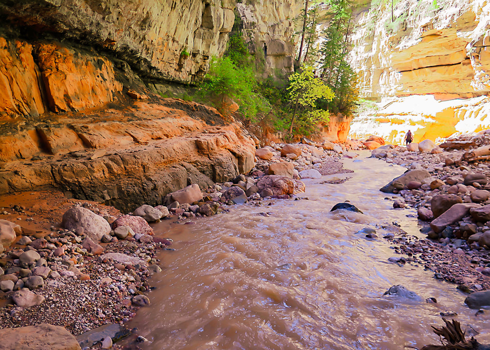
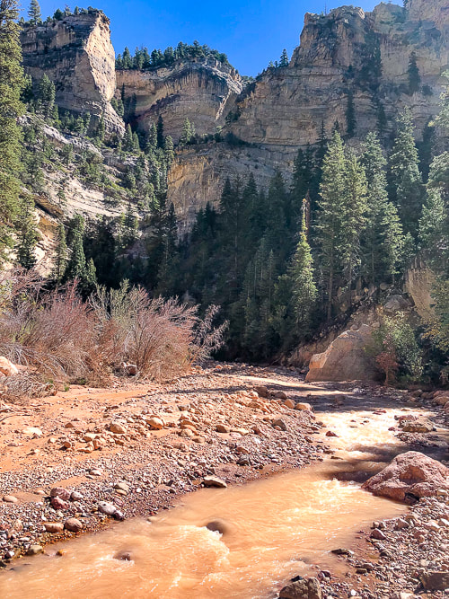
Most of those traveling Utah’s Highway 14 from Cedar City to the heights of the Markagunt plateau are unaware that a spectacular hidden world is tucked away in a canyon beneath their feet and that life millions of years ago is recorded in the rocks that the canyon’s waters, over the millennia, have worn through the plateau, pushing sand grains, scouring strata and revealing infinite colors to create beautiful Ashdown Gorge.
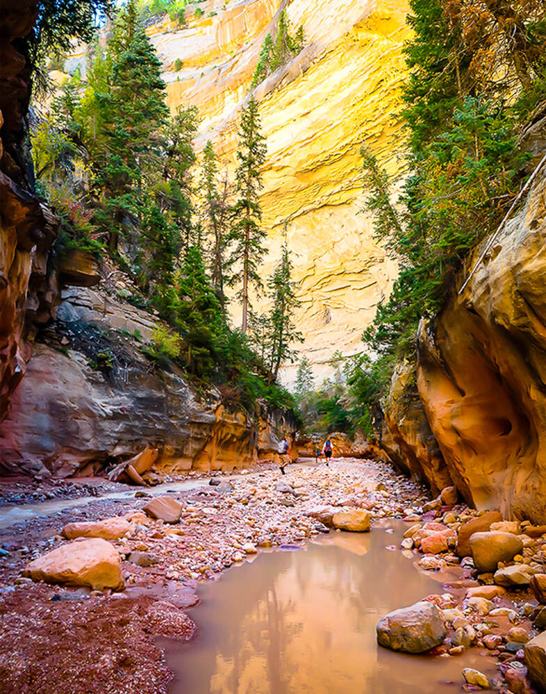
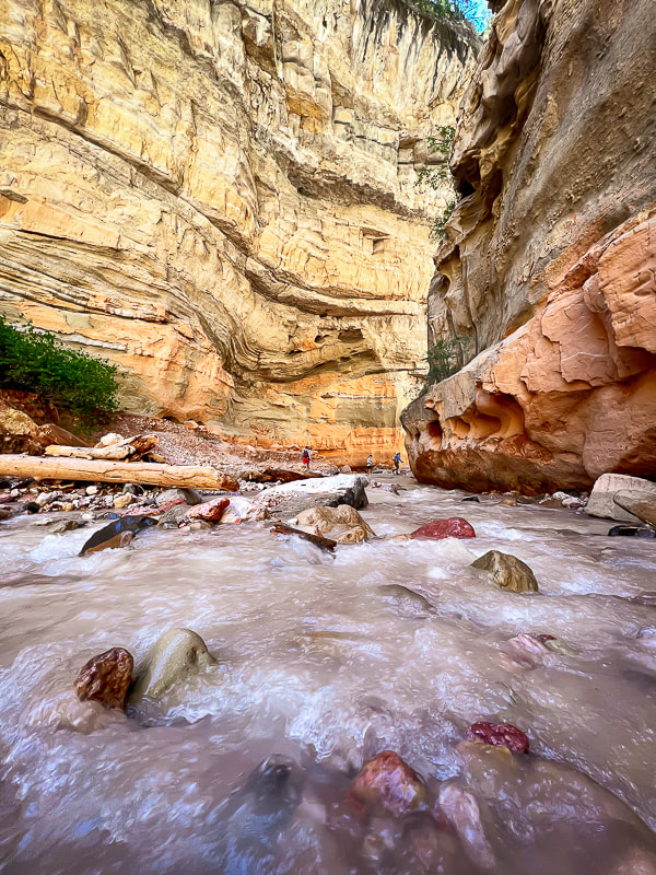
To venture through Ashdown Gorge is to experience so many exquisite elements that make up the quintessential Utah non-technical canyon hike. Soaring, overhanging walls change shape, color and texture around every stream bend. Walk by small car-sized boulders and stream-carved rocks of nearly all hues of the color spectrum. As the canyon narrows, bright green ferns grow on moist walls; hidden grottos and alcoves are cool, dark places in which to retreat and watch the water flow melodically. Conifers cling to near-vertical walls. Walk by the occasional ancient panels of preserved ripples and oyster bed fossils. Lots to take in - you could go on this hike many times and see something new.
The waters of Ashdown Gorge originate from an elevation of 10,000 feet in Cedar Breaks National Monument, coursing through the Ashdown Gorge Wilderness via Ashdown, Rattlesnake, and Lake Creeks, creating beautiful waterfalls at the end of the hike, after a walk through short narrows. Alternately, you can experience Ashdown after descending from Rattlesnake Trail, whose trailhead is just outside Cedar Breaks.
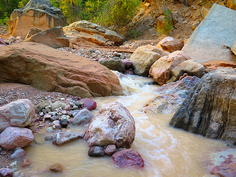
Each time I've hiked this gorge, water conditions have varied. This time, the stream was higher and clouded by salmon-colored silt; there must have been a storm that carried sand from Cedar Breaks higher up creating increased run-off.
A large parking area on the left of Highway 14 is the access to the lower Ashdown Gorge (see Google Maps link above in Trip Stats).
A spectacular chunk of preserved ancient shoreline ripples, tilted almost vertically, has been plunked down on the right side of the creek as you ascend. You weave in and out of the water, walking through gravel bars and around boulders, over fallen flood-deposited trees. It is a unique experience to feel so tiny with tall overhanging walls close by on each side, blocking out most of the sky.
"Tom's Head", a noticeable 100-foot monolith greets you at the intersection between Ashdown Creek and Rattlesnake Creek. To see Rattlesnake Creek Falls, turn left at this confluence to follow Rattlesnake Creek. Shortly, another small confluence is seen; turn left and you hike a short distance to Lake Creek Falls. Turn right, hike through an ever-narrowing canyon, you hear Rattlesnake Falls before you see it - a long sheet of white water spilling into a multi-colored gravel pool.
If, instead you turn right at Tom's Head, you will be continuing walking up Ashdown Creek ultimately to Ashdown Gorge Trailhead and onto High Mountain Trail and ultimately an intersection with Rattlesnake Creek Trail, which originates just north of Cedar Breaks National Park.
Since moving to Utah, I have been amazed at how gorgeous and diverse the landscape is. This hike is just one example of how nature's elements fit together in harmony and draw us into a beautiful world. There's a lot to take in on this hike: textures, waterfalls, colors, something new around every bend. Interesting how a place can have so much to look at that it's almost overwhelming, but yet it is also so relaxing, and I can get to a state of "flow". I'll spend more time photographing and checking out the fossils and geology next time. For now, I will let the following images speak for themselves.


 |  Rattlesnake Creek waterfall |
|
For the Geocurious: Rocks created in an interior sea
The walk through Ashdown Gorge is a journey through what was the Cretaceous Western Interior Seaway that transgressed (filled) and regressed (emptied), leaving behind evidence such as oyster and other mollusk fossils. Mountain building during this time created a basin that collected thousands of feet of sediment where this inland sea existed. According to the geologic map for this area, this hike begins in the Dakota Formation, a ledge-forming, yellowish-brown, fine- to medium-grained sandstone and siltstone and gray smectitic (clay) mudstone. As you walk further upstream, inside the narrower Ashdown Gorge, you enter into the Straight Cliffs Formation in which marine deposition stopped as the inland sea slowly withdrew in a beach and lagoon environment next to a coastal plain. You can't miss the bold, cliff-forming walls of this formation. At the top of these walls, the Smoky Hollow and John Henry members of the Straight Cliff Formation were deposited in a river and floodplain environment. |
The cliffs of the Straight Cliffs Formation
|
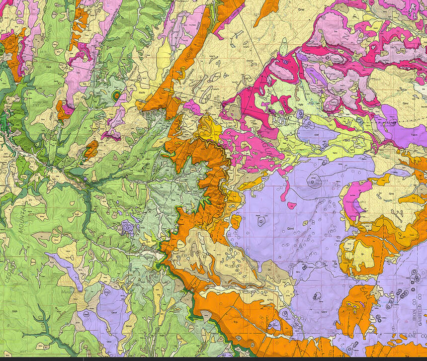
From Biek, R., et. al. 2015. Geologic Map of the Panguitch 30' x 60' Quadrangle, Garfield, Iron, and Kane Counties, Utah. Map 270DM, Utah Geological Society.
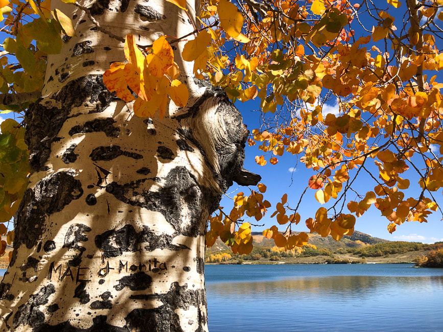
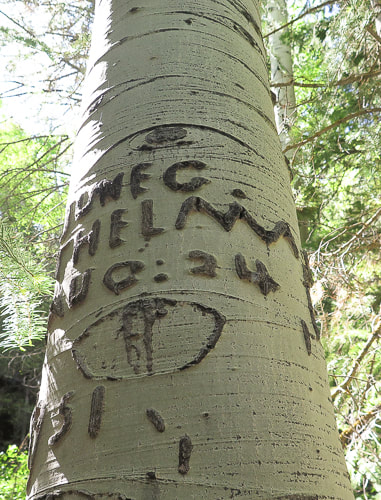
Notice the engraving in tree trunk, lower left.
Ashdown Gorge Wilderness - Wikipedia
Biek, R., et. al. 2015. Geologic Map of the Panguitch 30' x 60' Quadrangle, Garfield, Iron, and Kane Counties, Utah. Map 270DM, Utah Geological Society.
Cretaceous Atlas of Ancient Life: Geology of the Western Interior Seaway. National Science Foundation.
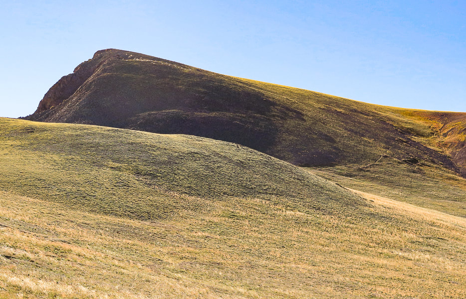
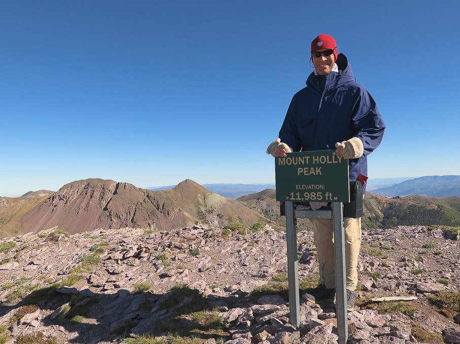
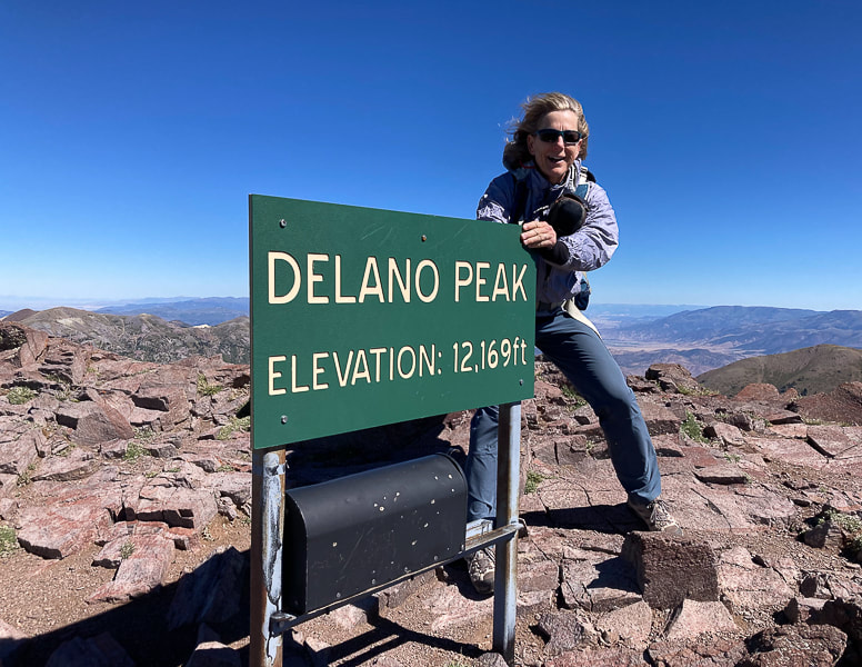
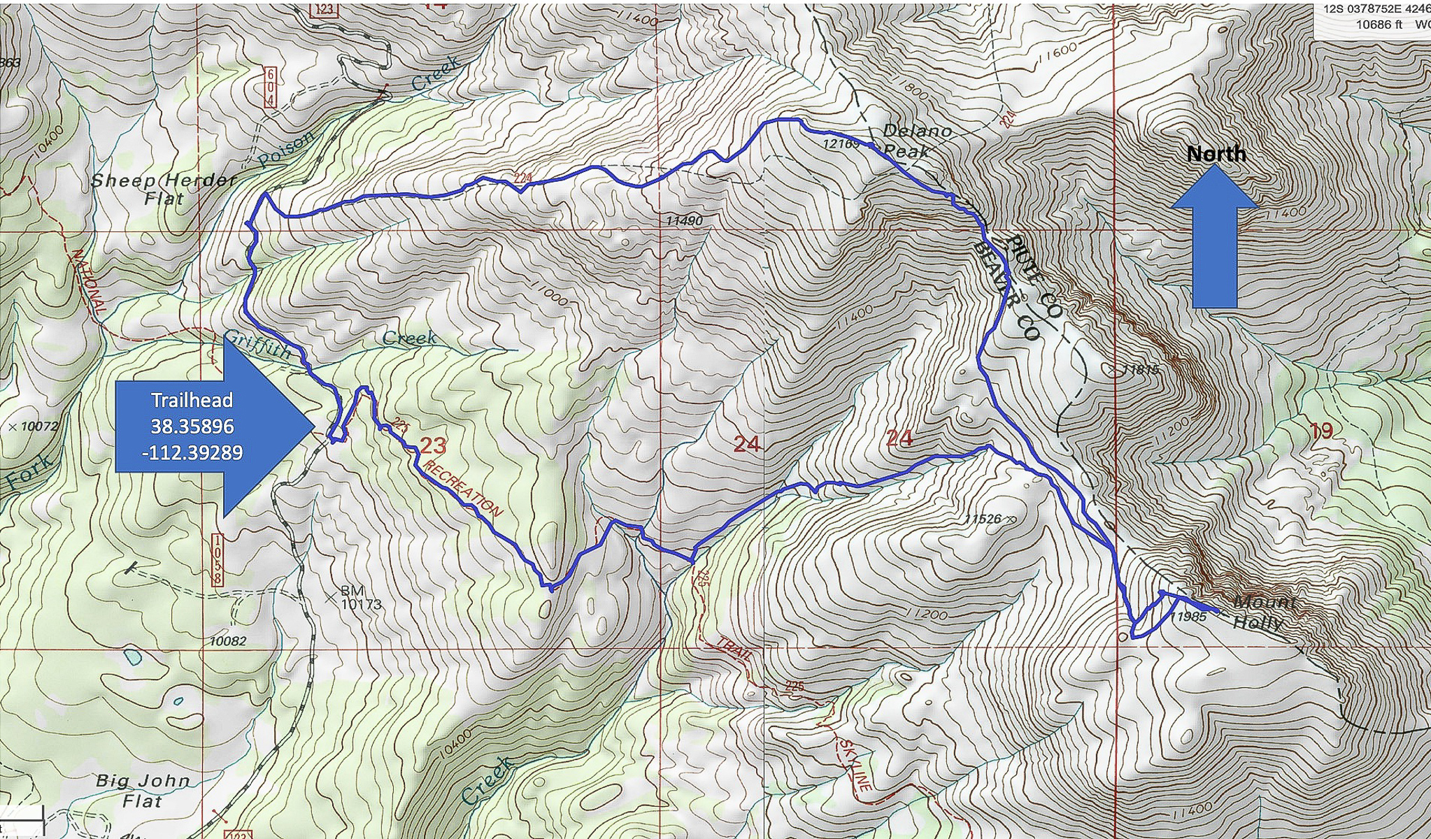
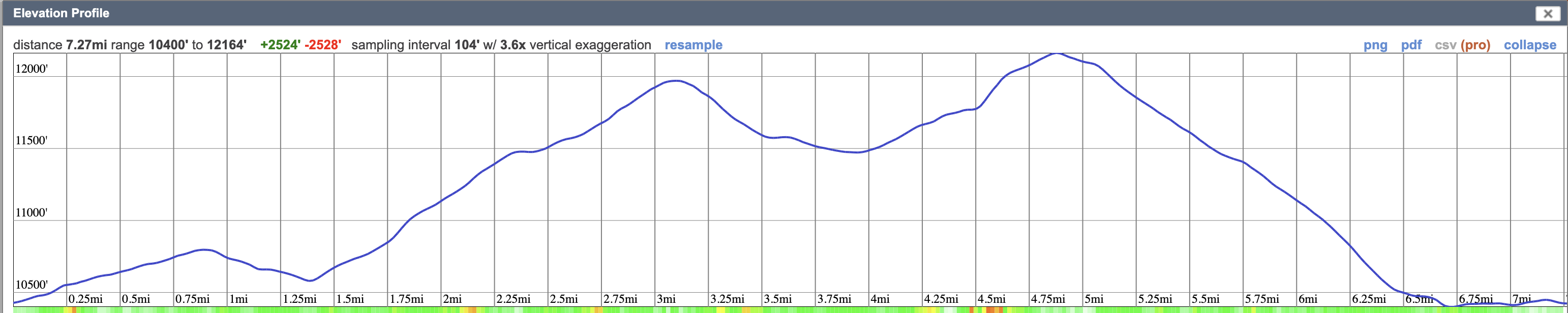
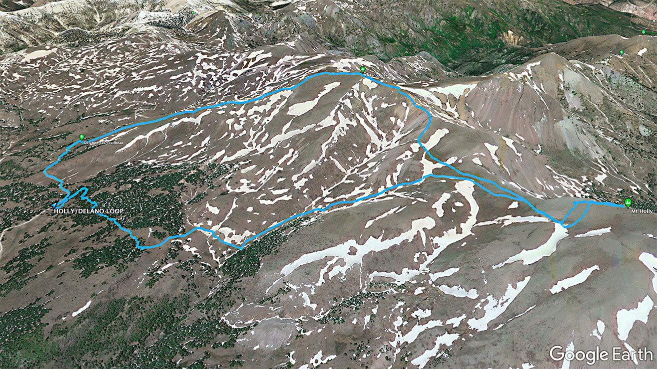
Location: Fishlake NF, Tushar Mountains, near Beaver, Utah. Fishlake National Forest - Beaver Ranger District.
Distance/Elevation gain: 7.3 miles/2,500'. Trailhead = 10,400'. Delano Peak = 12,169'. Mt. Holly = 11,985'.
Coordinates: Trailhead = 38.35896 -112.39289.
Prominence: Delano Peak = 4,689'. Mt. Holly = 425'.
Difficulty: Mostly moderate effort, Class 1.
Trails: #225 (Skyline National Recreation Trail) for Holly approach, and #224 from Delano summit to road.
Maps and Apps: Fishlake National Forest-Beaver and Fillmore Ranger Districts Travel Map -USDA, AllTrails tracks for Mt. Holly, route map from Stavislost.com.
Date hiked: 9/19/22.
Geology: The Tushar Mountains are remnants of volcanos whose first eruption period was 22-35 million years ago (Bullion Canyon Volcanics) and second eruption 21 million years ago (Mt. Belknap Volcanics). Delano Peak resides in the Bullion Canyon Volcanics. It is the highest point on the edge of Big John's Caldera, a concealed structure on Delano's west side that subsided ~ 23 million years ago during ash flow eruptions. This caldera filled and eroded over time. The second eruption created the source rock for the mined uranium of the Marysvale mining district north and east of Delano Peak.
Native Peoples: Five native Paiute bands were present in Beaver County ~ 700 years ago: Tu-roon-quints band in the northeast corner of the county; the Qui-ump-uts band around Beaver and Adamsville; the Pa-moki-abs band in the vicinity of Minersville; the Toy-ehe-its band in the Milford area; and the Indian Peak band in the western part of the county and into Nevada. Evidence such as pottery, tools, weapons, and petroglyphs left by Paleo native Americans as far back as 12,000 years ago, at the end of the last ice age is present in Beaver County in which the Tushars are located.
(from A History of Beaver County, by Martha Sonntag Bradley).
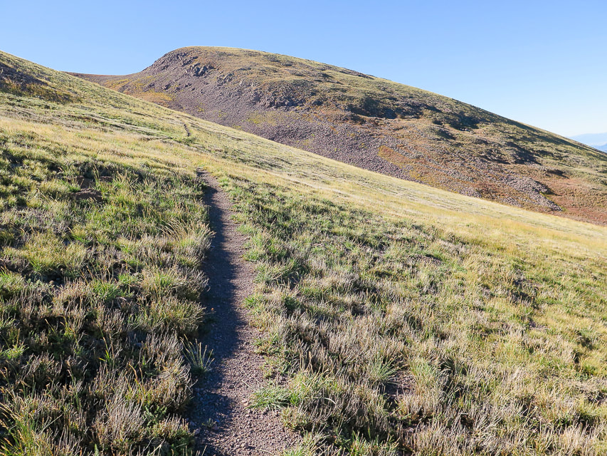
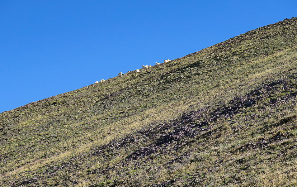
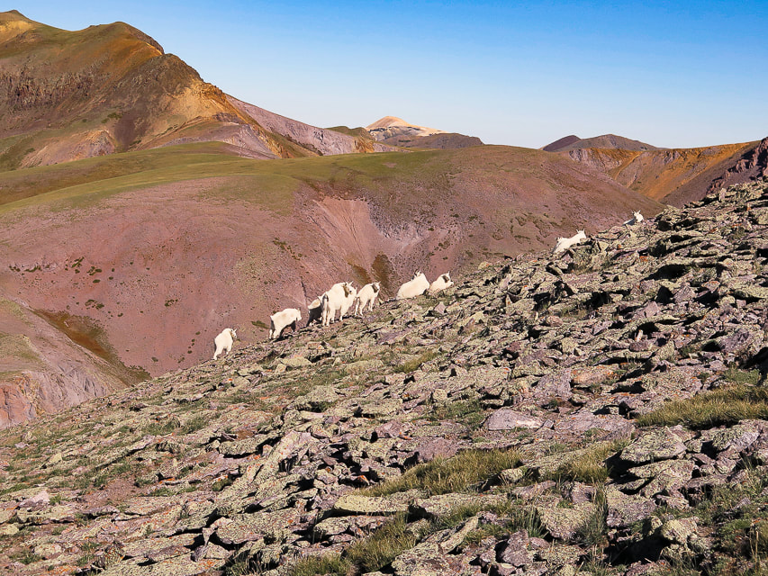
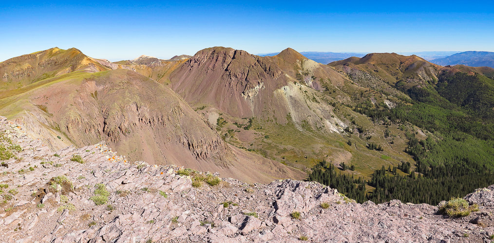
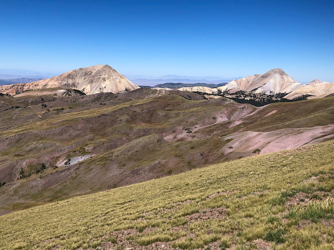
"The area possesses a very high degree of naturalness, palpable solitude, and nearly unlimited opportunities for primitive and unconfined recreation," says Wikipedia. A variety of great things are packed into this 7-mile hike: forest, sustained spectacular ridge views, goats, aspens and meadows below, and a fun steep climb between peaks.
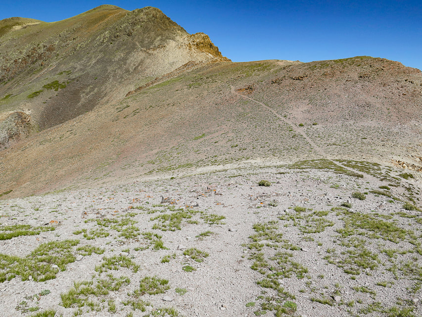
After a nice forest hike from the Skyline Trail trailhead off of graded gravel road and #123, we came to a saddle where we descended into a beautiful valley with Mt. Holly on the horizon. Our route left the Skyline Trail at Merchant Creek, walking toward Holly on the left side of a prominence covered with pines to the right. Shortly, a defined trail appears in the grasses. It becomes less-defined as you arrive on wide expanse of the tundra, just below Mt. Holly and then becomes more defined as it traverses Mt. Holly's southwest flank.
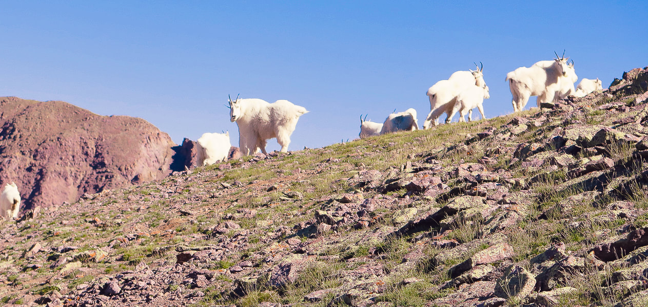
The mountain goats on Mt. Holly were hunkered down enduring the wind. They reluctantly got up as I got closer to them, and when we were on the ridge hiking toward Delano Peak, we saw that some of them had sought safer places on Holly's northwestern cliffs. We stayed on Mt. Holly long enough to sign the register, then descended back down out of the summit gusts to find a way to Delano Peak. We didn't see an obvious trail linking Mount Holly to the northwest ridge leading to Delano Peak; we probably could have gotten to the top of the ridge sooner than we did (see our route).
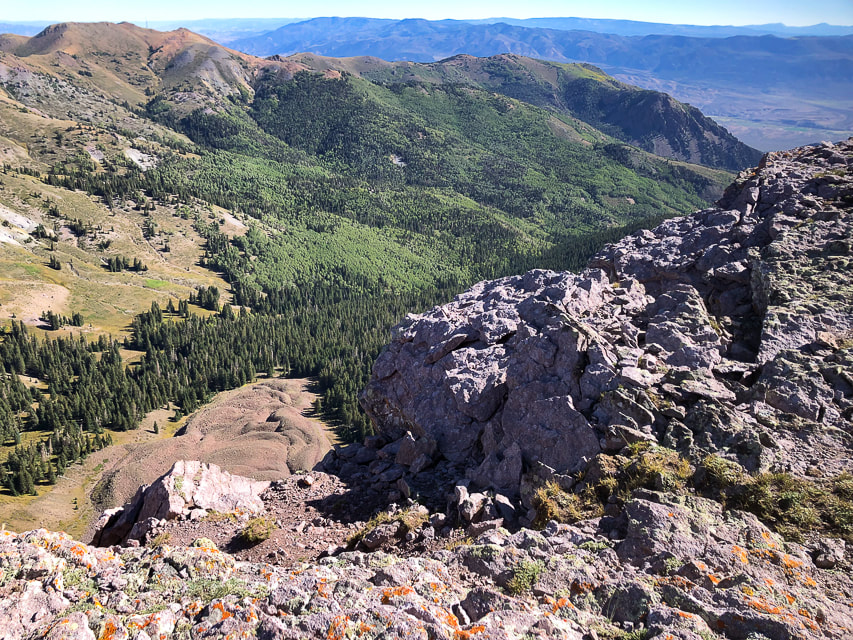
We gained the ridge at a saddle between Delano and Holly where we found the ridge trail. We took a windy break observing a spectacular view of steep Cottonwood Creek to the east. We battled the winds up a short and somewhat loose ascent to a gentler tundra ridge walk. The trail was easy to follow to Delano Peak. We didn't want to stand too long on this highest point in the Tushars for fear of being blown over the edge.
The walk down Trail # 224 is a quad burner, losing 1,700' of elevation in 1.8 miles. We then walked south on road #123, where the wind was less brisk, to our car at the trailhead, a short 0.6-mile distance.
The definition of "grit" is achieving goals through passion, perseverance and commitment. An important attribute for many aspects of life. An important trait to teach our kids. With some "grit" we reached the summits during the windstorm, although I have to admit, the thought of going back down after Mount Holly briefly crossed my mind. I plan on getting back to this hike with some friends. If I go in the next few weeks, the forest will be splashed with stands of yellow aspens in a sea of dark green.
|
As the crickets' soft autumn hum
Is to us So are we to the trees As are they To the rocks and the hills. -Gary Snyder |
click on map for larger image
Sontag Bradley, M. A History of Beaver County. 1999. Utah State Historical Society Beaver County Commission.
Categories
All
Arizona Hikes
California Desert Hiking
Idaho Summits
Nevada Hikes
Petroglyphs/Pictographs
Snowshoe Hikes
Southern Utah Hikes/Bikes


About this blog
To Subscribe to Explorumentary adventure blog and receive new posts by email:

About the Author
Sue Birnbaum
In 1992, Ray Wilson and I conceived the first Cactus to Clouds hike which climbs over 10,000 feet in one day to the summit of Mt. San Jacinto near Palm Springs, California.
Awkward Botany
amateur botany for the phytocurious
Bird and Hike
"Intended to encourage people to visit, learn about, and fall in love with the desert."
Draw and Shoot
Beautiful Photography
Daring Dayhikes
"Interesting places you can visit with a daypack." Terrific Tucson and other desert hikes and East Coast, too.
Earthline: The American West
Debra "writes to extol our beloved Earth." Detailed hike info, excellently written.
Geologypics.com
Geology and Geologic Time through Photographs
Glenn Suokko
Vermont artist's paintings "inspired by a place based on the land .... drawn to painting the representation and abstraction of nature."
In the Company of Plants and Rocks
A natural history blog about botany, plant ecology, and geology.
MishMoments: Joy of Photography
this website is "about capturing that special moment in life’s journey and making the most of the time we have."
Nature's Depths
Walking through nature with John Palka, a neuroscientist who loves plants and ponders big questions.
Rangewriter - What Comes Next?
Linda's excellent writing brings to life her interesting adventures, "curiosities and thoughts", post-retirement.
SeekingLost - Hiking and Backpacking Adventures.
Stav Is Lost- Unconventional, out-of-the way hikes in the American West.
Uprooted Magnolia
Leah Yetter's beautiful "photo journal on life, love, and the spirit of Wyoming."
Archives
April 2024
March 2024
January 2024
December 2023
November 2023
October 2023
September 2023
August 2023
July 2023
June 2023
May 2023
April 2023
February 2023
January 2023
December 2022
November 2022
October 2022
September 2022
August 2022
July 2022
June 2022
May 2022
April 2022
February 2022
January 2022
December 2021
November 2021
October 2021
August 2021
July 2021
May 2021
March 2021
February 2021
January 2021
November 2020
October 2020
August 2020
July 2020
June 2020
April 2020
March 2020
February 2020
January 2020
November 2019
October 2019
September 2019
August 2019
July 2019
June 2019
May 2019
April 2019
February 2019
December 2018
November 2018
October 2018
September 2018
July 2018
June 2018
May 2018
April 2018
March 2018
February 2018
January 2018
December 2017
November 2017
October 2017
September 2017
August 2017
July 2017
June 2017
April 2017
February 2017
November 2013
August 2013
July 2013