EXPLORUMENTARY
  • Home
    • Cactus to Clouds Hike
    • More Quotes
    • Ann Zwinger Quotes
    • Mary Oliver Poems
  • Hikes by State
    • Idaho
    • Southern Utah
    • Arizona
    • California Desert
    • Nevada
    • Wyoming
  • BLOGS
    • Adventure Blog
    • Women and the Land
  • GALLERY
    • DESERT PLANTS >
      • Beavertail cactus
      • Brittlebush
      • Christmas Cactus
      • Arizona Barrel Cactus
      • Parry's penstemon
      • Agave
      • Arizona Rainbow Hedgehog
      • Claret Cup Hedgehog
      • Desert Agave
      • Palmer's Penstemon
      • Silver Cholla
      • Cristate Saguaro
      • Indian Paintbrush
      • Ocotillo
      • Santa Rita Prickly Pear
      • Spiny Cliffbrake
      • California Barrel Cactus
      • Engelmann Prickly Pear
      • Velvet Mesquite
      • Joshua Tree
      • Hedgehog Cactus
    • NATURE
    • BOISE
    • EARTH + SKY
    • URBAN
    • WATER
    • PATRIOT
    • ORCHIDS
  • Fit After 50
    • Brian Holgate
    • Fred Birnbaum
    • Dave Brasuell
    • Bus' Little Black Book
    • Mike Carlson
    • Ray Wilson
    • Bryan Krouse
    • Vickie Kearney
    • Maria Keezer
    • DOUG TRAUBEL
    • Boise Cross Fit Masters Ladies
    • Tim Clemens
    • Marcia Bondy
    • Becky Borczon Blake >
      • Becky B Downtown
    • Jennifer Cera and Sue Birnbaum
    • Dave Brasuell
    • Vance Powell
  • About
    • CONTACT

Adventures in Kanab:  Peekaboo Slot Canyon, Mansard Benchmark and East Mansard Peak

11/26/2022

2 Comments

 
Expansive views of southern Utah and northern Arizona, cool canyon narrows, Pueblo II petroglyphs, a deep sand slog and delicious quiche in Kanab, "Utah's Little Hollywood."
Related:
Utah's Red Rock Country
Southern Utah Hikes 
Picture
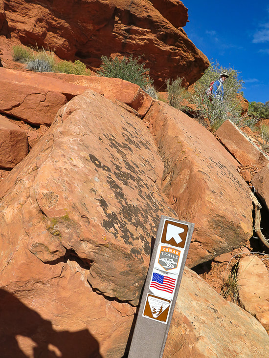
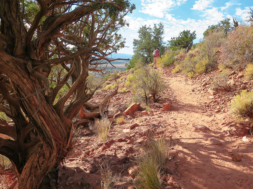
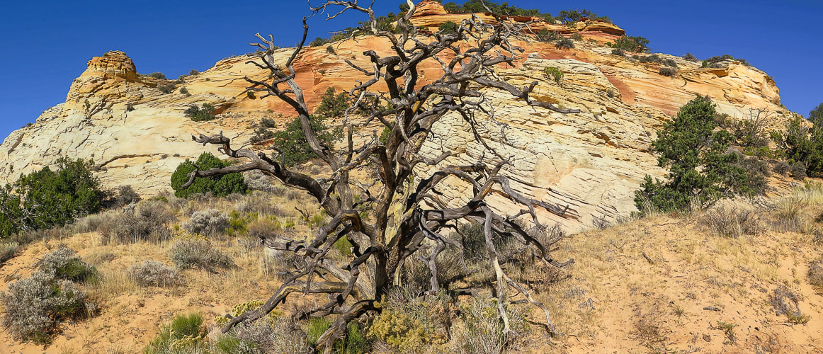
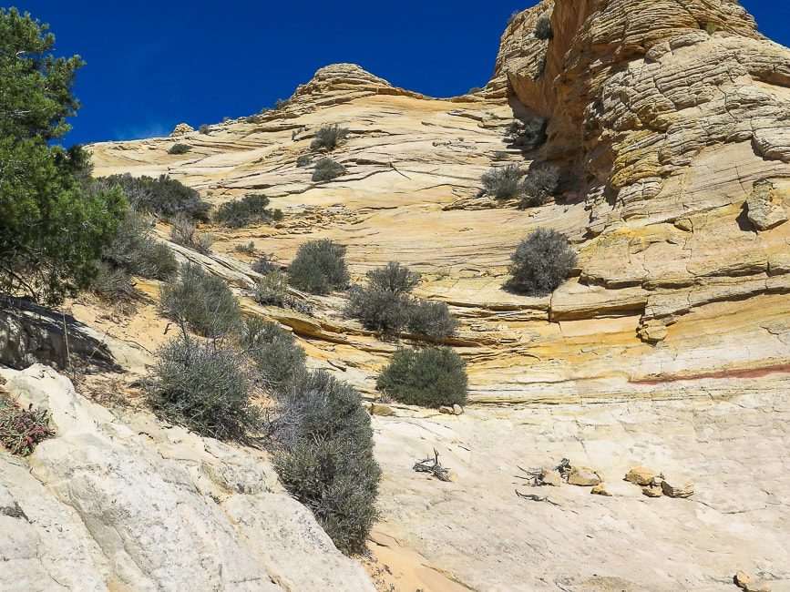
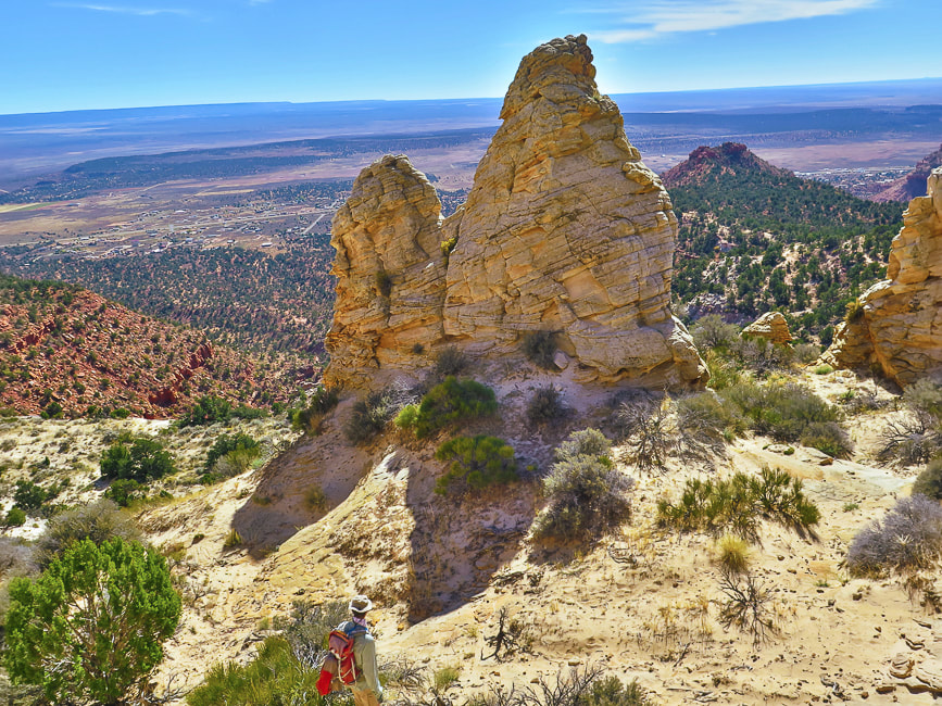
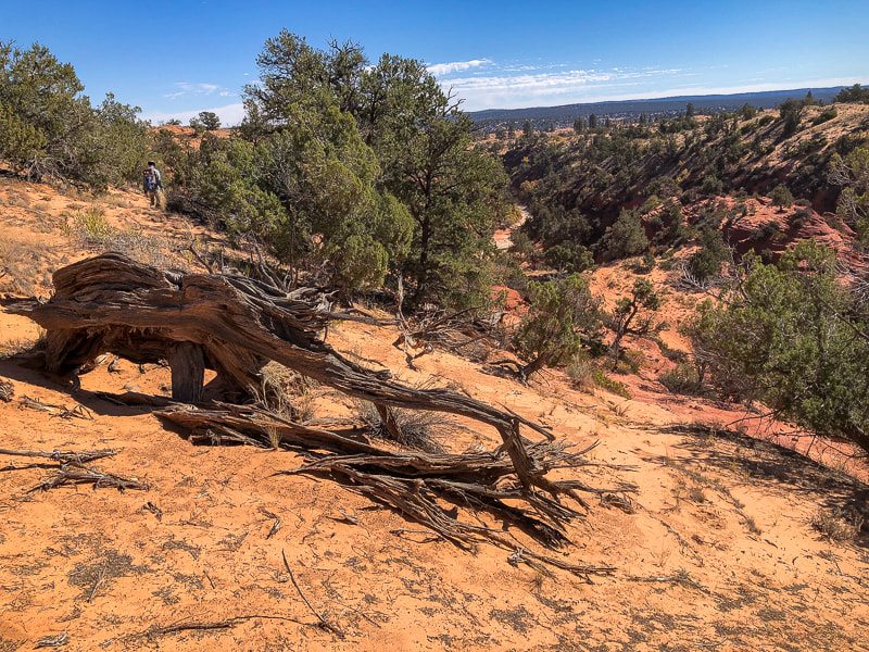
On the trail to Mansard Benchmark (mesa on the left).
Picture
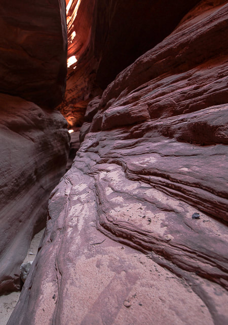
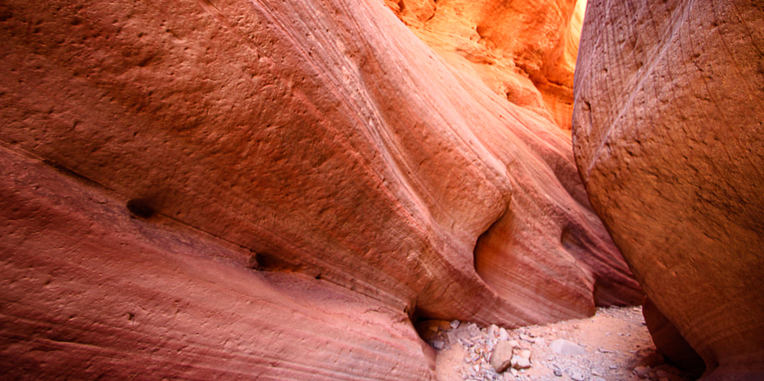
Ancient Moqui steps carved into Red Canyon (AKA Peekaboo)
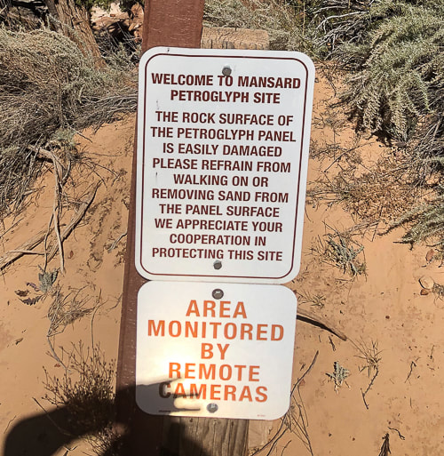
Also called "moki" steps, these were carved into sandstone to access alcove above.  The lowest step is about 5 feet from the canyon floor.  Handmade ropes and ladders were possibly used to access the steps, or sediment has washed away, making the access higher.  There may have been a granary in the alcove.
more Peekaboo photos below

Trip Stats - Mansard Benchmark and East Mansard Peak

Overview:  Hike to petroglyphs tucked in a alcove overlooking northern Arizona, scramble up a weakness in Mansard Benchmark's cliffs to top out for a huge view.  Summit #2 is a fun slickrock climb up East Mansard to look over multi-hued mesas to snow-covered mountains to the northwest.
Location:  Vermilion Cliffs, Bureau of Land Management
Distance/Elevation gain:  6.2 miles/1,450' cumulative gain.
​Coordinates:  Trailhead = 37.03414  -112.42366.  Mansard Benchmark = 37.04925  -112.43087
Difficulty: Moderate Class 1 to bases of the two summits, Class 2, 2+, and one Class 3 move onto Mansard Benchmark.
Maps and Apps:  Stav is Lost's trip report, AllTrails GPX tracks, Kanab map from BLM.
Directions to trailhead:  BLM website.
Date Hiked:  10/29/22

Trip Stats - Peekaboo Slot Canyon

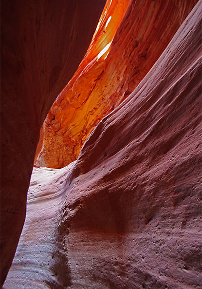
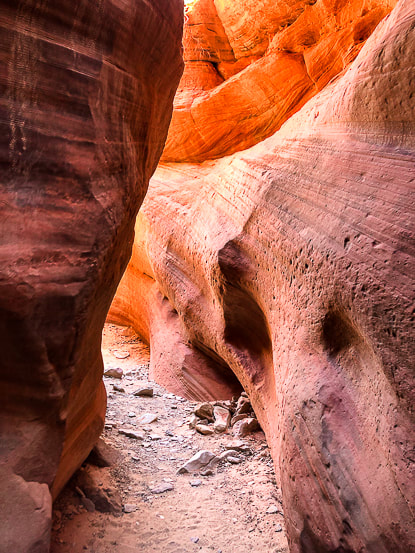
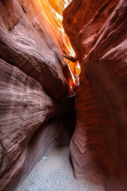
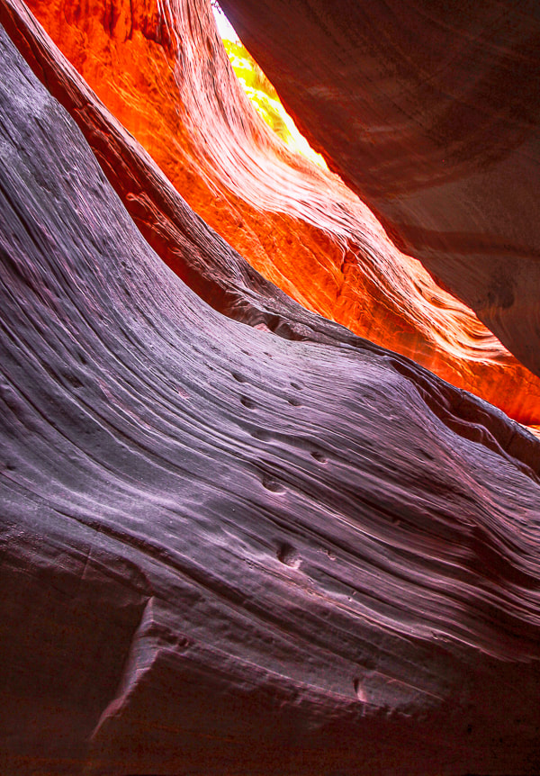
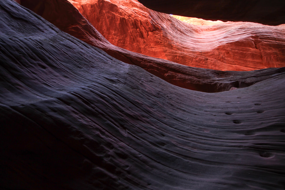
Overview:  Experience gorgeous shapes, textures and ever-changing colors as you wind through sandstone narrows.  It's also fun to walk along the canyon rim for views of the White Tower to the north and the "White Wave".
Location:  Trailhead is 9 miles north of Kanab on Highway 89 - Bureau of Land Management.  Entrance to canyon:  37.17928616, -112.5597135.  
Distance:  6.3 miles out and back if starting from trailhead on Highway 89, north of Kanab; 0.7 miles if you drive to canyon entrance.
Maps and Apps:  AllTrails tracks.
Considerations:  Sandy road (2.8 miles) to Peekaboo Canyon entrance requires 4WD and tires with good traction in sand.
Directions to trailhead:  BLM website.
Date Hiked:  10/30/22
peekaboo slot canyon photos
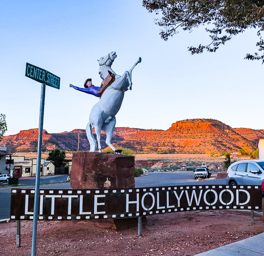
Kanab, "The Greatest Earth on Show" is adventure-central for southern Utah and a nice little city with good restaurants, a museum, and a great bakery.  We stayed in an RV park with our small trailer for two nights, walked into town for dinner one night, and did two hikes.  Mansard Benchmark and East Mansard Peak were just out of city limits, and a great way to get the lay of the land for miles around.  The Peekaboo Canyon hike was a slog through deep sand to get to the slot canyon (we didn't have the right tires on our pick-up).  Kanab has adventure companies galore that will take you to Antelope Canyon, Horseshoe Bend, Peakaboo Canyon and the Grand Canyon.  It's not far from the now world-famous "The Wave" in Vermillion Cliffs, as well as Buckskin Gulch and Wire Pass.  It used to be easier to get into "The Wave";  Fred and I have gone twice about 20 years ago, when all we had to do was to be the first in line at the Kanab Ranger Station by 8:00 a.m. to get two of the limited number of permits.  Now you have to go through a lottery system.

​There's a reason you may feel invigorated after visiting Kanab.  There's a lot of orange.  Orange is the color of warmth, vitality, and creativity.  According to Color Theory, orange increases our activity levels and gives us a sharper awareness of our surroundings.
Mansard Benchmark and East Mansard Peak
This short hike combines most of the great attributes of southern Utah:  slickrock scrambling, spectacular views, petroglyphs, striking landforms and geology, junipers and pinyon pines, and some route-finding.  A couple of weaknesses in the north cliffs proved a bit daunting for me to climb, but then we found a rope that assisted me up and down the cliff band.

Hike Summary
  • One mile of switchbacks from trailhead to arrive at top of Vermilion Cliffs, to see both summits.   
  • Mansard Trail takes a left at the saddle between these two high points to end at a junction with a sandy road.
  • Hike left up this road to find the signs for the petroglyph site.  Most hikers/runners stop here and return.
  • Hike to Mansard Benchmark summit:  access is on the north side of the mesa, reached by hiking on the sandy road in the opposite direction, leading northeast.
  • Hike on this road ~ 0.4 miles, then leave road and head up the slope toward the north side of Mansard Benchmark's cliffs.
  • Walk along base of cliff until you find a spot you can do a Class 3 move to get over the cliff.  I eventually found a rope tied to a sturdy tree and used it to ascend onto ground above cliff band.
  • We found cairns to mark the way through the brush on top to a nice lookout over petroglyph site to the south, making sure to take a visual of the descent point.  In this case, there is a distinct-looking juniper that is right over our entry point.
  • Climb East Mansard Peak: Descend back down to sandy road; we bush-whacked from road to Mansard Trail to find a 0.2-mile social trail that went toward the base of East Mansard.  Class 2-2+ scramble on white slickrock to summit.
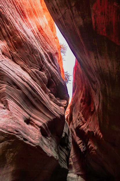
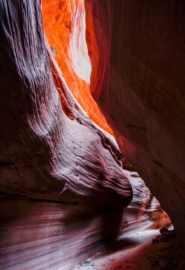
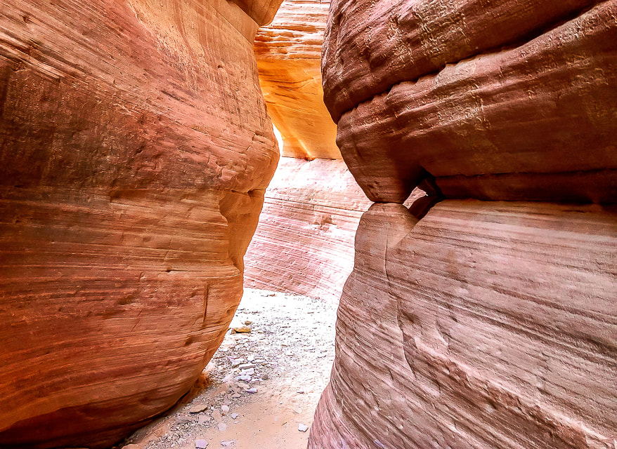
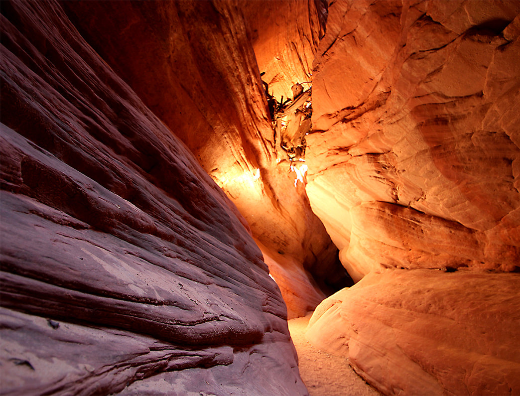
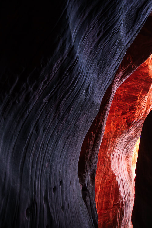
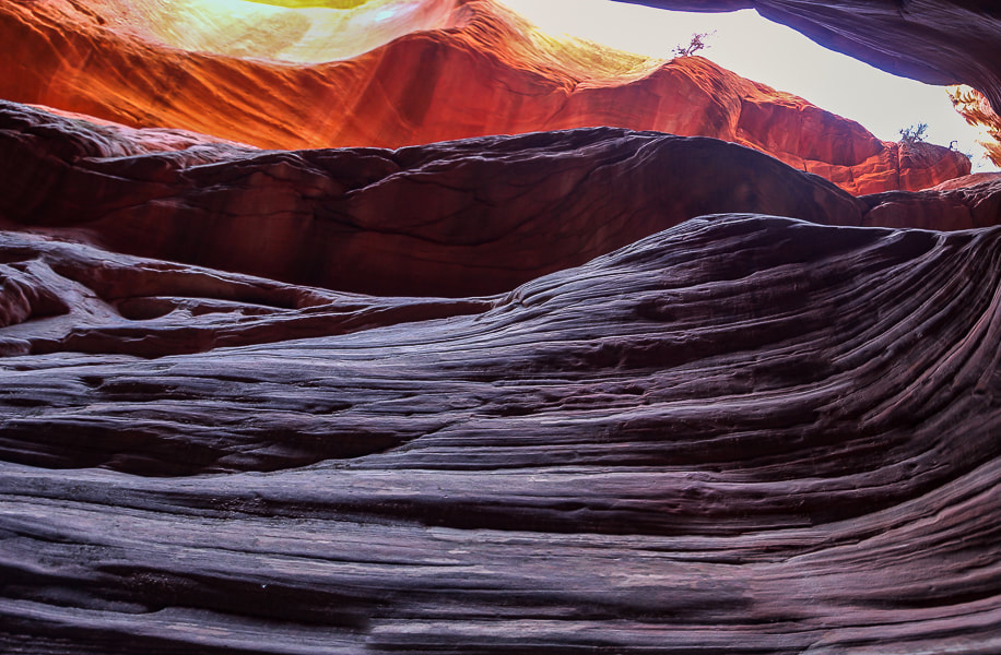
Peekaboo Slot Canyon (Red Canyon) 
​We didn't trust our truck's tires on the jeep/ATV road's  deep sand (Road 102 from the highway trailhead), so we walked that 2.8-mile distance to the entrance of Peekaboo, which admittedly got a bit frustrating on the last mile back.  But it was worth it.  Within the confines of towering 80-foot high walls, you enter a silent, almost mysterious world.  It's mind-boggling to consider how many millions of years it took for water to carve this Navajo Sandstone.  We walked through at optimal light that shifted orange, red and purple hues during our time in the slot.  So many compositions of curves, textures, lines can be captured with a camera.  It becomes darker as you progress to the end, requiring a tripod if using a digital camera to capture sharp images.  The moqui steps carved into a vertical wall by Native Americans were the most amazing feature.  They clearly lead to a ledge, at this time illuminated with a fiery orange.  Stripped and bleached tree trunks wedged between narrow sandstone spaces above attest to past waters moving fast enough to deposit them there.

Oh, yes.  I mentioned we had the best quiche at Kanab Creek Bakery, which prepares food using "traditional European" methods.  Their croissants looked so good.  We got there when it opened at 8:00 a.m., and soon after there was already a line for breakfast.  

The best modes of transportation to explore the desert around Kanab and Grand Staircase are jeeps and UTV side-by-sides.  White Pocket in northern Arizona's Vermilion Cliffs is our next goal - just outside of Kanab near the famous "Wave" in Coyote Buttes.  We just need to talk our neighbor, who has a jeep, into going with us.
Keep On Exploring!!
Picture
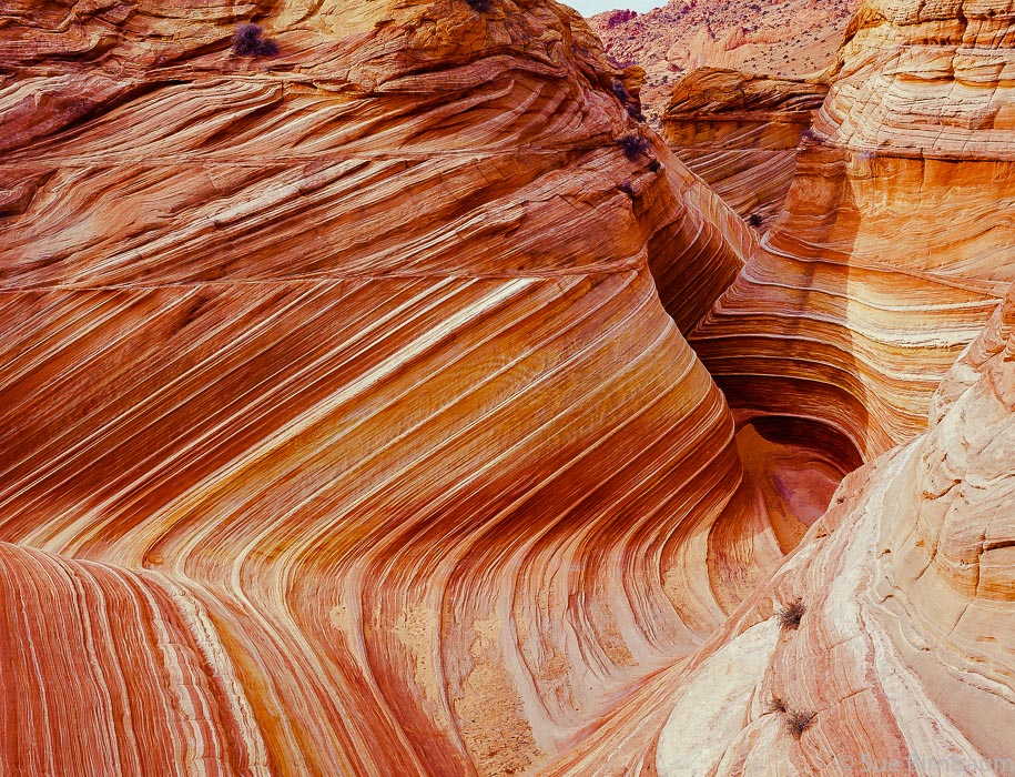
"The Wave" in Coyote Buttes North - Paria Canyon-Vermilion Cliffs Wilderness, Bureau of Land Management.
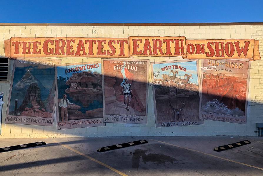
Picture
Mural in Kanab.
(more city of Kanab images at end of post)


Mansard Benchmark and East Mansard Peak

Picture
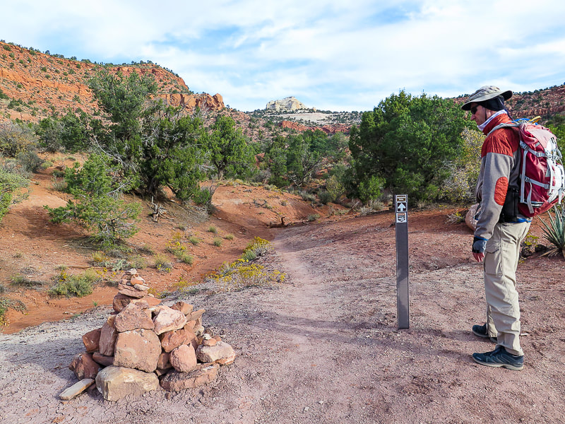
Cairn a short distance from parking lot.  East Mansard Peak is center horizon.
Picture
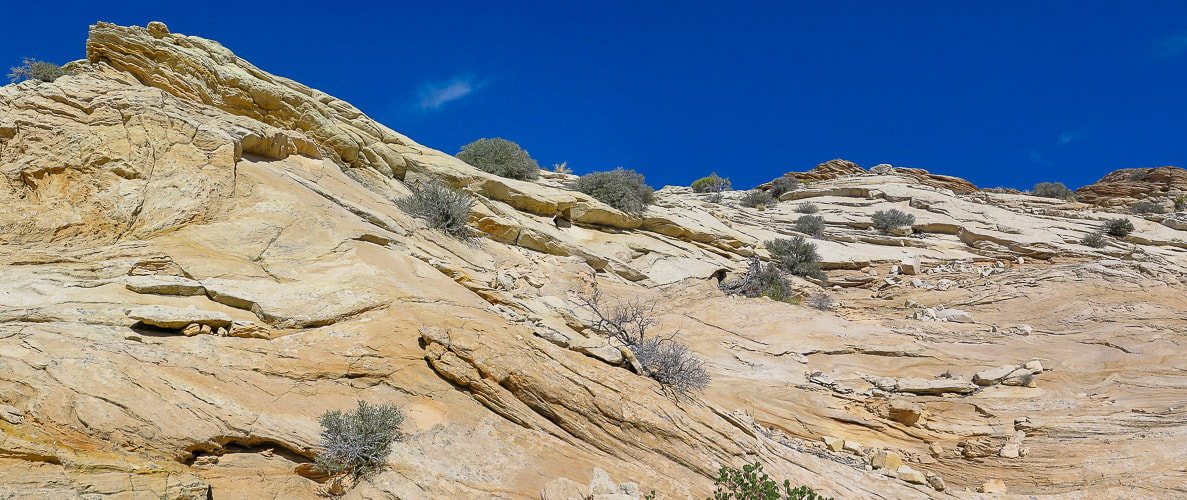
Vermilion Cliffs:  first mile of trail switch-backs up to the top where it heads north toward saddle between Mansard Benchmark and East Mansard Peak.
Picture
Mansard Trail switchbacks.
Picture
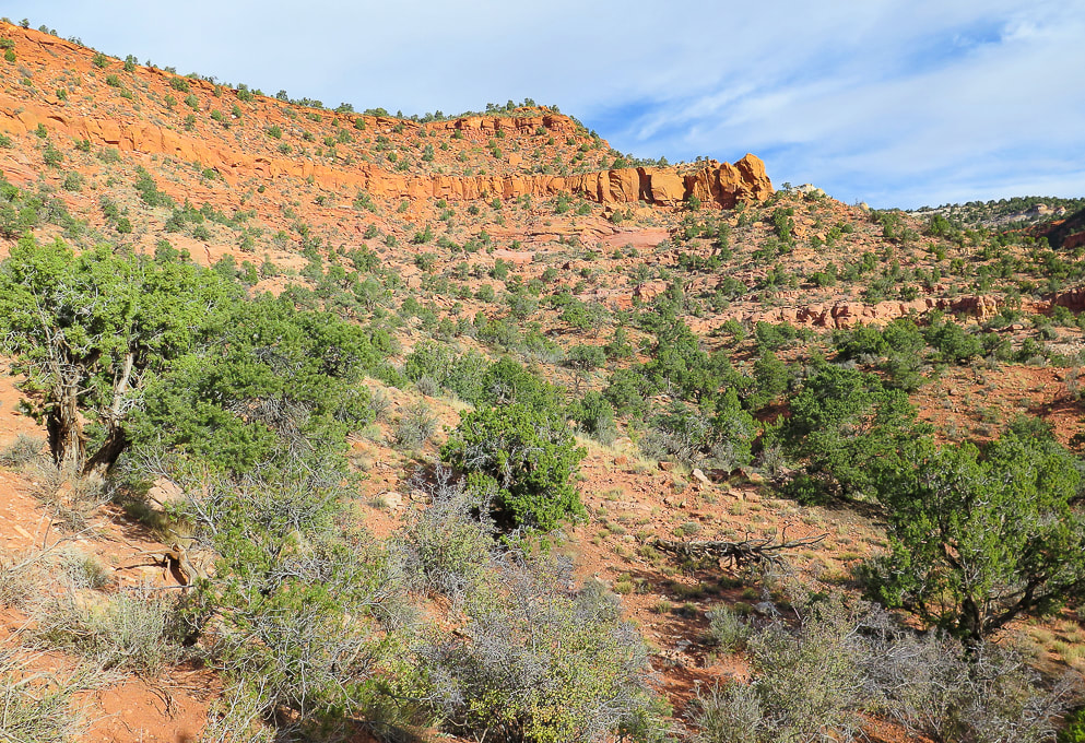
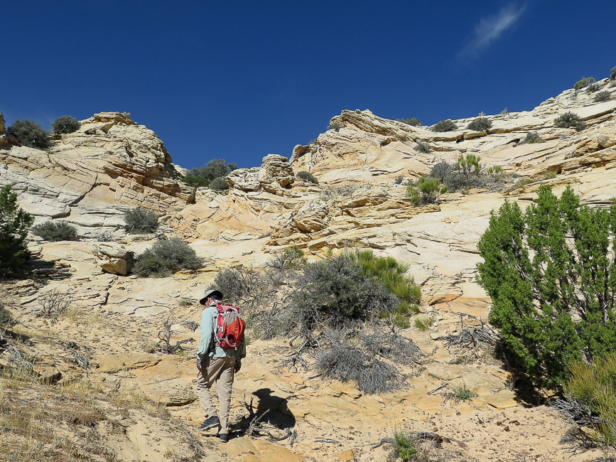
Off the switchbacks, onto the plateau.   East Mansard Peak on the right.
Picture
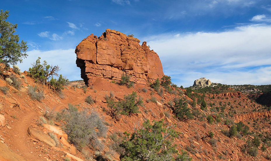
 Mansard Benchmark seen once on top of the plateau.  The route to summit this is from the other (north) side of this mesa.
Picture
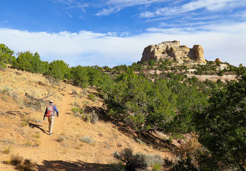
Pleasant stroll  - East Mansard Peak seen here.
Picture
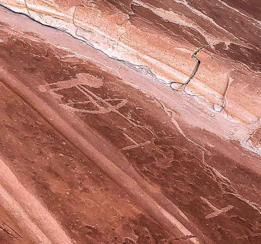
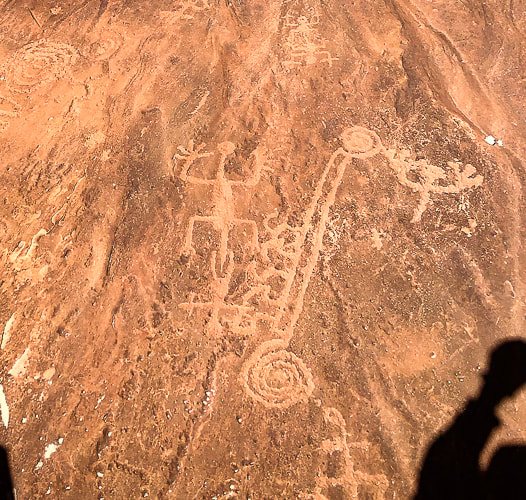
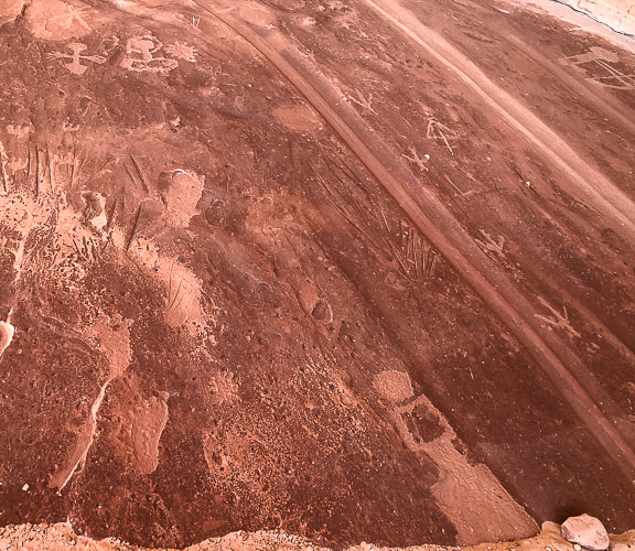
On the way to petroglyph site on south side of Mansard Benchmark.
Mansard Trail petroglyphs are ~ 870 - 1,070 years old according to Bureau of Land Management Mansard Trail page.
Picture
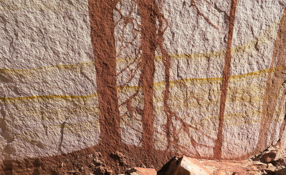
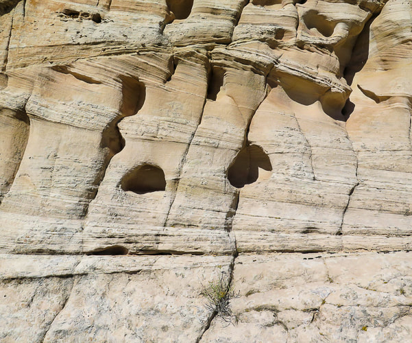
Detail in sandstone wall near petroglyph site.
What blooms like this in November?
chert flakes
Unintended perfect timing
Cross beds and honeycomb weathering!
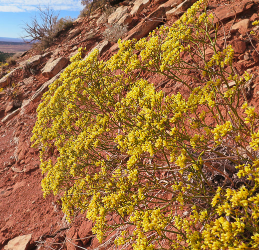
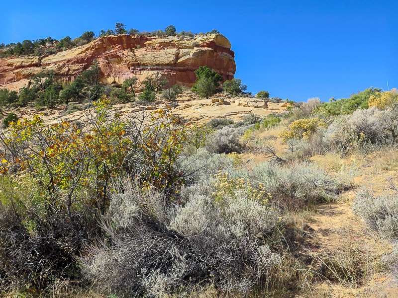
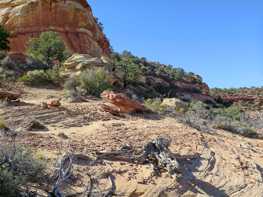
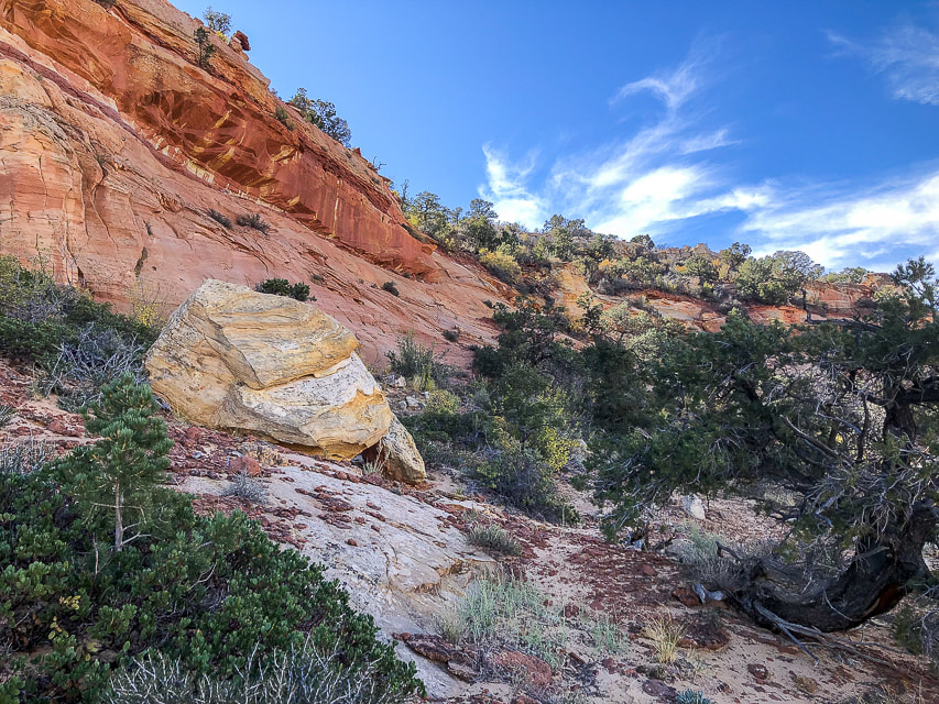
Some cool stuff on the trail.
Picture
Looking south toward Northern Arizona.
Picture
Class 3 - have to use hands to assist - on switchbacks.
Picture
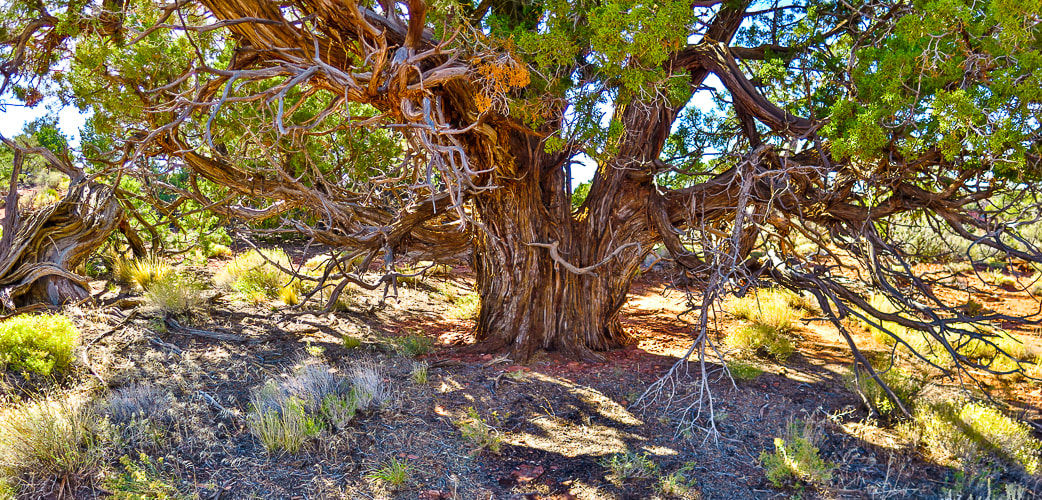
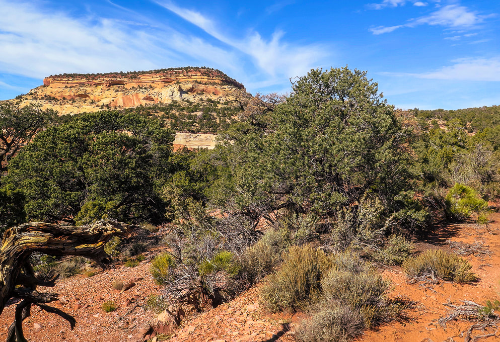
Just had to photograph (in high dynamic range) this beautiful, huge juniper!
Picture
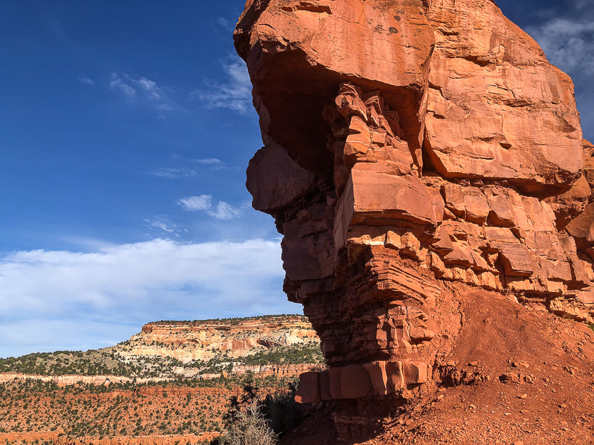
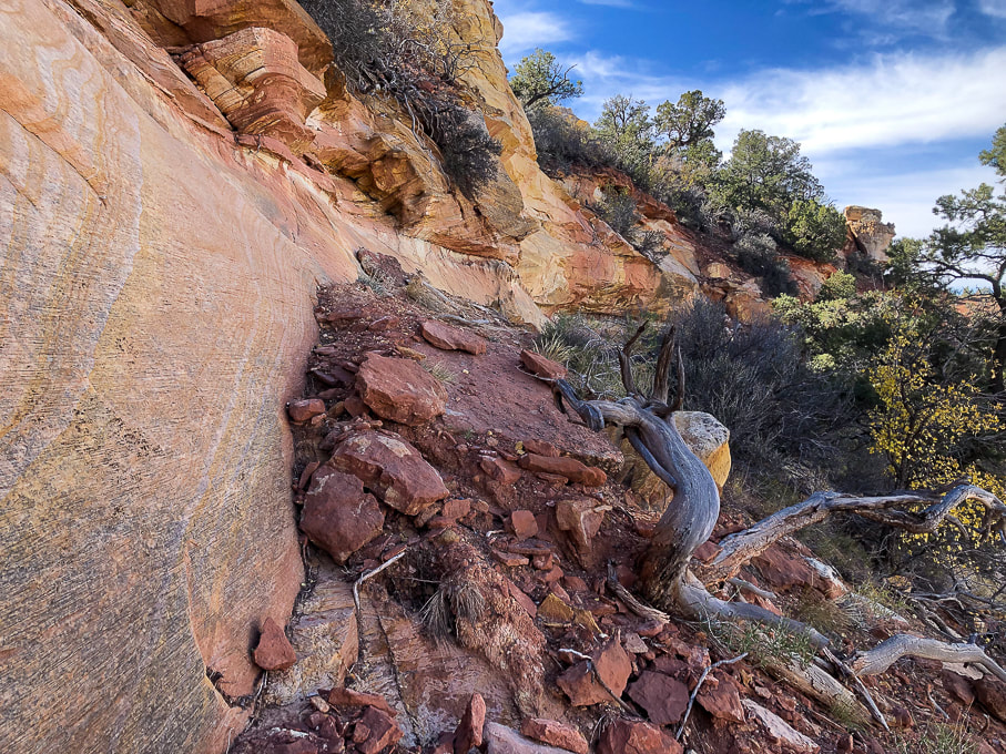
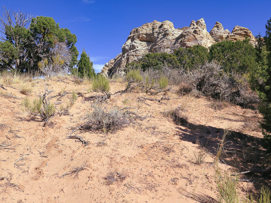
Point at which we left the sandy road and headed toward Mansard Benchmark's north cliffs.
Picture
Approaching north cliffs.
Picture
Looking for a route to the top.
Picture
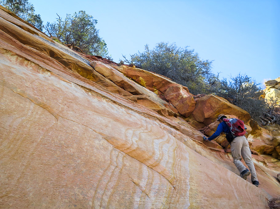
Get to climb beautiful slick rock!
Picture
Walking along cliff base to find a Class 3 weakness.
Picture
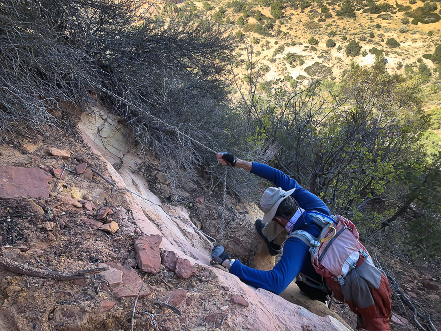
Found this rope:  Fred used it only to climb down.  He climbed up a weakness in the cliff just before this.
Picture
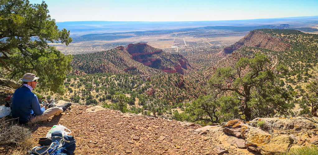
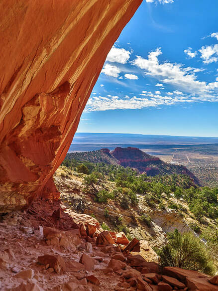
At the top of Mansard Benchmark looking over Kanab and Kanab Plateau into northern Arizona.
Picture
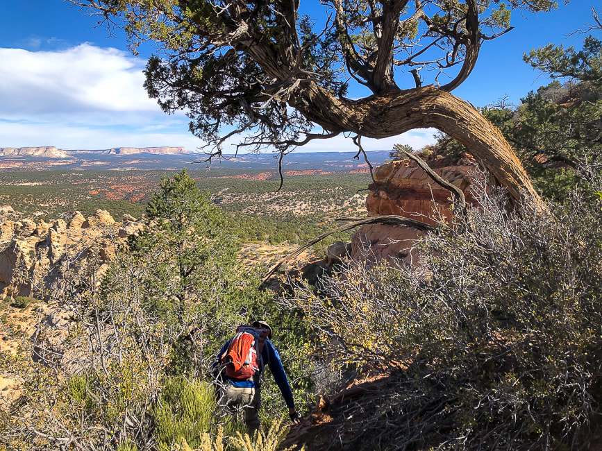
Heading down:  large juniper marks where we ascended the cliff band.
Picture
Looking up at East Mansard Peak.
Picture
Social trail takes you from main Mansard Trail to base of East Mansard; begin climbing through sand/on sandstone to the left.
Picture
Maneuvering over sandstone to ridge and then following it to the right.
Picture
Summit at the right.
Picture
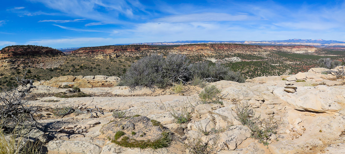
Cairn on summit.  View includes Mansard Benchmark (left).  Grand Staircase/Escalante National Monument on right in photo.
Picture
Base of East Mansard Peak.
Picture


Picture
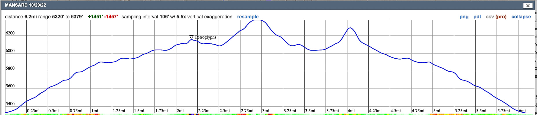
Our GPS tracks and elevation profile 
click on map for larger view
 

Peekaboo Slot Canyon, Kanab

Picture
Picture
Picture
Picture
Picture
Picture
Picture
Picture
Picture
Picture
Picture
Picture
Picture
Picture
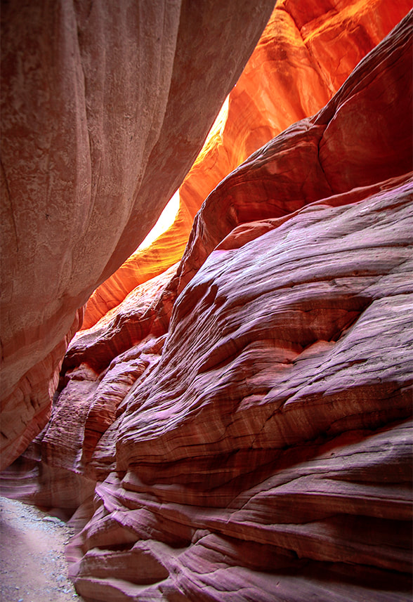
Walking on Peekaboo's rim.


Picture
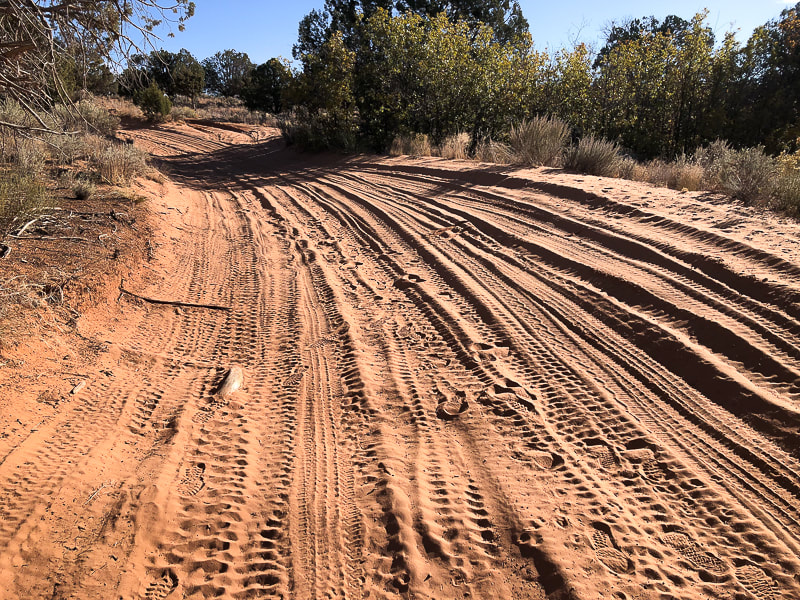
The road leading to Peekaboo from the trailhead off Highway 89.  Sand gets deeper than this in some parts of this road.
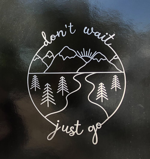
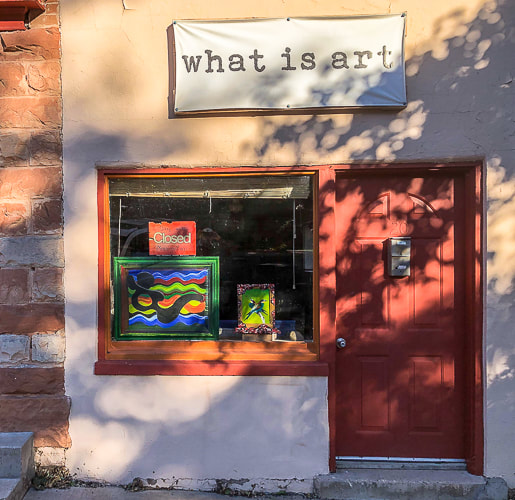
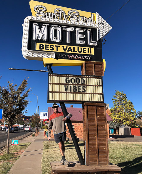
Some cool stuff in Kanab.
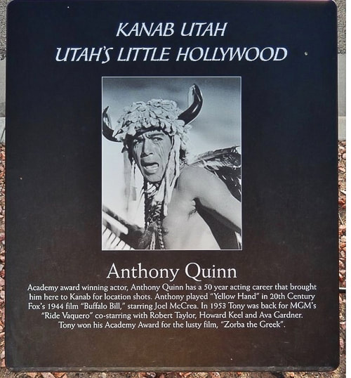
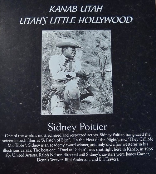
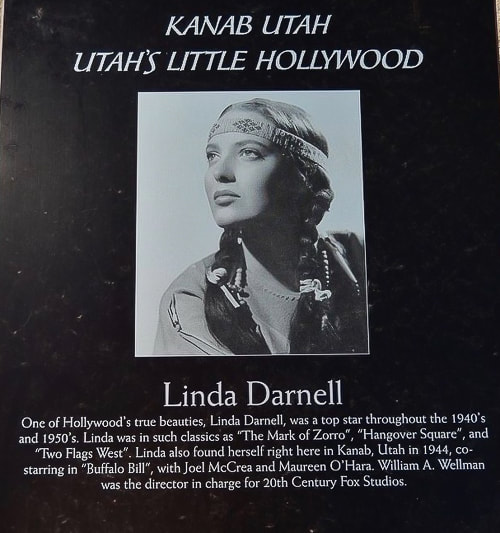
More than 100 movies and television shows, like Gunsmoke were filmed in Kanab and vicinity.  It was the setting for The Lone Ranger, Billy the Kid, The Outlaw Josey Wales and even Planet of the Apes.  A walking tour of "downtown" Kanab presents many nice-quality plaques that feature actors like John Wayne, Frank Sinatra, Dale Evans, Jack Nicholson, Clint Eastwood, Ronald Reagan, and many other stars who came to Kanab to film movies.
Picture
Picture
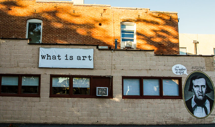
"Love Thy Neighbor as Thyself"......Jacob Hamblin, Buckskin Apostle.

References
City of Kanab website.
​
Peek-A-Boo slot canyon - Bureau of Land Management.
​
Moki Steps - Wikipedia
Reel Rundown website.

2 Comments
Linda Paul link
11/26/2022 03:07:02 pm

Another fabulous post, Sue. Have you entertained the thought of gathering your beautiful posts into a hiker's book? The depth of information that you provide just calls out for sharing and helping others to appreciate what they might walk right past, if they didn't have your extensive background knowledge. Actually, your images would also make an amazing coffee table book. But I know how dreadfully expensive that would be to produce. Maybe the hiking book, marketed in outdoor oriented retail stores and online, could subsidize the coffee table book.

Of course, then you'd probably have to deal with the reality of bazillions of neophytes clogging up your trails and trailheads. That might be too high a price to pay.

Reply
Sue link
11/26/2022 07:46:27 pm

Hi LInda,
Thanks so much for your compliments. It is great hearing it from you - a writer that I admire. I have a friend Lydia, who has the blog On The Loose Live and she takes me on awesome hikes. We both agree to not being so specific about where our hikes are for the very reason you stated. I have been migrating to communicating to others a more general awareness and appreciation of nature and importance of geology, history, as a story of the land. I want to help bring our appreciation back to nature - a connection to the land.

I am glad that you are noticing - gives me motivation to keep on doing what I think is important! I sure appreciate you looking at my posts.

Reply


Leave a Reply.

    Categories

    All
    Arizona Hikes
    California Desert Hiking
    Idaho Summits
    Nevada Hikes
    Snowshoe Hikes
    Southern Utah Hikes/Bikes

    Complete list of Hikes/Bikes on HOME page
    Picture
    Sue and Fred
    Picture

    About this blog

    Exploration documentaries          –  "explorumentaries"  list trip stats and highlights of each hike or bike ride, often with some interesting history or geology.  Years ago, I wrote these for friends and family to let them know what my husband, Fred and I were up to on weekends, and also to showcase the incredible land of the west.  

    To Subscribe to Explorumentary adventure blog and receive new posts by email:

    submit
    Picture
    Happy Winter!
    Picture

    About the Author
    Sue Birnbaum

    A  trip to Jumbo Rocks Campground in Joshua Tree National Monument 38 years ago sparked my passion for hiking, exploring, and learning about desert ecosystems.  For the past 25 years, my husband Fred and I have explored the American West together; we love this land and I hope to inspire you to get out and explore through my photographs and trip descriptions.
    In 1992, Ray Wilson and I conceived the first Cactus to Clouds hike which climbs over 10,000 feet in one day to the summit of Mt. San Jacinto near Palm Springs, California.
    CACTUS TO CLOUDS HIKE 
    READ MORE
    ABOUT SUE

    Archives

    January 2023
    December 2022
    November 2022
    October 2022
    September 2022
    August 2022
    July 2022
    June 2022
    May 2022
    April 2022
    February 2022
    January 2022
    December 2021
    November 2021
    October 2021
    August 2021
    July 2021
    May 2021
    March 2021
    February 2021
    January 2021
    November 2020
    October 2020
    August 2020
    July 2020
    June 2020
    April 2020
    March 2020
    February 2020
    January 2020
    November 2019
    October 2019
    September 2019
    August 2019
    July 2019
    June 2019
    May 2019
    April 2019
    February 2019
    December 2018
    November 2018
    October 2018
    September 2018
    July 2018
    June 2018
    May 2018
    April 2018
    March 2018
    February 2018
    January 2018
    December 2017
    November 2017
    October 2017
    September 2017
    August 2017
    July 2017
    June 2017
    April 2017
    February 2017
    November 2013
    August 2013
    July 2013

    Some of my favorite websites:
    Awkward Botany
    ​citizen botany for the phytocurious

    Bird and Hike

    ​"Intended to encourage people to visit, learn about, and fall in love with the desert."
    ​

    Draw and Shoot
    Beautiful Photography

    Earthline: The American West
    Debra "writes to extol our beloved Earth." Detailed hike info, excellently written.
    ​

    Geologypics.com
    Geology and Geologic Time through Photographs

    Glenn Suokko
    Vermont artist's paintings "inspired by a place based on the land .... drawn to painting the representation and abstraction of nature."

    In the Company of Plants and Rocks
    ​A natural history blog about botany, plant ecology, and geology.

    Nature's Depths

    Walking through nature with John Palka, a neuroscientist who loves plants and ponders big questions

    Rangewriter - What Comes Next?
    ​With excellent writing, Linda tells the story of her unique mother's life including WWII era; with beautiful photographs.

    SeekingLost - Hiking and Backpacking Adventures.

    Stav Is Lost- Unconventional, out-of-the way hikes in the American West.


    Uprooted Magnolia
    ​Leah Yetter's beautiful "photo journal on life, love, and the spirit of Wyoming."
HOME

Cactus to Clouds Hike
More Quotes
HIKES BY STATE

Idaho Hikes
Utah Hikes/Bikes
​Arizona Hikes
​California Desert Hikes
​Wyoming Hikes
​Nevada Hikes

BLOGS

Adventure Blog
Women and the Land
GEAR REVIEWS
FIT AFTER 50
Fred Birnbaum
Dave Brasuell
Bus' Little Black Book
​Mike Carlson
​Ray Wilson
​Marcia Bondy
Bryan Krouse
​Maria Keezer
​Tim Clemens
​Doug Traubel
​Brian Holgate
​
Becky Borczon Blake
​Jennifer Cera and
​Sue Birnbaum

​Vance Powell
​Boise Cross Fit Masters Ladies
​Vickie Kearney

GALLERY

Desert Plants
Nature
Earth + Sky
Urban
Water
Patriot 
​Orchids
Boise
​
  ABOUT
    Contact

​
© 2017 - 2023 by Sue Birnbaum.  Photos on this website are the sole property of Sue Birnbaum unless otherwise indicated.  Please receive permission before publishing my trip reports and photos.
I try my best to be accurate with my hike descriptions; please research your adventures, always bring a map and compass and know how to read them, be prepared!  All of these hikes can be dangerous; hike at your own risk.  ALWAYS carry the Ten Essentials with you on hikes. 
​Please feel free to contact me with comments or questions, or if you see any errors that need attention.
Thank-you for stopping by!


EXPLORUMENTARY.com
  • Home
    • Cactus to Clouds Hike
    • More Quotes
    • Ann Zwinger Quotes
    • Mary Oliver Poems
  • Hikes by State
    • Idaho
    • Southern Utah
    • Arizona
    • California Desert
    • Nevada
    • Wyoming
  • BLOGS
    • Adventure Blog
    • Women and the Land
  • GALLERY
    • DESERT PLANTS >
      • Beavertail cactus
      • Brittlebush
      • Christmas Cactus
      • Arizona Barrel Cactus
      • Parry's penstemon
      • Agave
      • Arizona Rainbow Hedgehog
      • Claret Cup Hedgehog
      • Desert Agave
      • Palmer's Penstemon
      • Silver Cholla
      • Cristate Saguaro
      • Indian Paintbrush
      • Ocotillo
      • Santa Rita Prickly Pear
      • Spiny Cliffbrake
      • California Barrel Cactus
      • Engelmann Prickly Pear
      • Velvet Mesquite
      • Joshua Tree
      • Hedgehog Cactus
    • NATURE
    • BOISE
    • EARTH + SKY
    • URBAN
    • WATER
    • PATRIOT
    • ORCHIDS
  • Fit After 50
    • Brian Holgate
    • Fred Birnbaum
    • Dave Brasuell
    • Bus' Little Black Book
    • Mike Carlson
    • Ray Wilson
    • Bryan Krouse
    • Vickie Kearney
    • Maria Keezer
    • DOUG TRAUBEL
    • Boise Cross Fit Masters Ladies
    • Tim Clemens
    • Marcia Bondy
    • Becky Borczon Blake >
      • Becky B Downtown
    • Jennifer Cera and Sue Birnbaum
    • Dave Brasuell
    • Vance Powell
  • About
    • CONTACT