EXPLORUMENTARY
  • Home
    • Cactus to Clouds Hike
    • Grand Canyon Rim to Rim - Hikes and Training
    • More Quotes
    • Ann Zwinger Quotes
    • Mary Oliver Poems
  • Hikes by State
    • Southern Utah
    • Idaho
    • Arizona
    • California Desert
    • Nevada
    • Wyoming and New Hampshire
  • Petroglyphs and Pictographs
  • BLOG
    • Adventure Blog
  • GALLERY
    • DESERT PLANTS >
      • Beavertail cactus
      • Brittlebush
      • Christmas Cactus
      • Arizona Barrel Cactus
      • Parry's penstemon
      • Agave
      • Arizona Rainbow Hedgehog
      • Claret Cup Hedgehog
      • Desert Agave
      • Palmer's Penstemon
      • Silver Cholla
      • Cristate Saguaro
      • Indian Paintbrush
      • Ocotillo
      • Santa Rita Prickly Pear
      • Spiny Cliffbrake
      • California Barrel Cactus
      • Engelmann Prickly Pear
      • Velvet Mesquite
      • Joshua Tree
      • Buckhorn Cholla
      • Hedgehog Cactus
      • Fishhook cactus
      • Thompson's Woolly Locoweed
    • NATURE
    • BOISE
    • EARTH + SKY
    • URBAN
    • WATER
    • PATRIOT
    • ORCHIDS
  • Fit After 50
    • Brian Holgate
    • Fred Birnbaum
    • Dave Brasuell
    • Bus' Little Black Book
    • Mike Carlson
    • Ray Wilson
    • Bryan Krouse
    • Vickie Kearney
    • Maria Keezer
    • DOUG TRAUBEL
    • Boise Cross Fit Masters Ladies
    • Tim Clemens
    • Marcia Bondy
    • Becky Borczon Blake >
      • Becky B Downtown
    • Jennifer Cera and Sue Birnbaum
    • Dave Brasuell
    • Vance Powell
  • Contact

Grand Canyon Rim To Rim in One Day:  Training near St. George, Utah

4/13/2024

8 Comments

 
Getting creative with hikes in Southwestern Utah to prepare for the Grand Canyon.
Grand Canyon North Rim to South Rim Hike Facts:
Standard route north to south (North Kaibab Trail and Bright Angel Trail).
Distances/Elevation gain/loss:
North Kaibab Trail = 14 miles/5,700 feet loss.    Bright Angel Trail = 9.4 miles/4,350 feet gain.  Note: I've seen various estimates of "net elevation gain" that are higher.  Since there is not any major regaining of lost elevation, I am estimating gain by difference between Colorado River and south rim.  

Elevations:  north rim = 8,200 feet, south rim = 6,850', Colorado river = 2,500'.
Geology:  Oldest rocks are Vishnu Schist, an early Paleoproterozoic basement rock (2 billion years ago) at bottom of Grand Canyon.  Youngest rock is the Kaibab Limestone on the top of the rim, a cream and white sandy limestone.  
"By far the most sublime
of all earthly spectacles . . .
the sublimest thing on Earth."      -   Clarence Dutton referring to the Grand Canyon.

Related Posts
Cactus to Clouds
Tucson Mountains Tour
Crack Canyon

​On May 23, we will be walking Grand Canyon from its north rim to its south rim in one day - again.  Fred and I first hiked this 23 years ago, to celebrate birthday #40 for both of us.  We hiked it on our 50th.  We talked about doing it for our 60th, but it wasn't until our friend Robin asked us to go that we got our motivation to train for rim to rim #3.  Jeff will do it too, and Lindy will train with us but when it comes to the big day, she has generously offered to drop us off at the north rim and drive all the way around to the south rim to pick us up.

Since January, Fred, Jeff, Lindy, Robin and I have been hiking the most challenging trails near St. George, Utah and in Zion National park.  Creative planning like linking trails together ensures optimal distance and elevation training.  We need to be able to cover 23 miles and a 4,500' gain for rim to rim.  Just when your legs are tired from descending 14 miles on North Kaibab Trail, you face the biggest challenge:  climbing up Bright Angel Trail for another 9.4 miles.  And temperatures on the climb out can be hot, which was the case when we did this hike 23 years ago.  We ended up soaking our hats in streams on the way up to cool off.  Fred drank 9 liters of water!  The next day, we hiked back to the north rim.
Some of Our Training Hikes
  • Snow Canyon south to north
  • Wittwer Canyon/Land Hill - Santa Clara River Reserve
  • Zion NP - West Rim Trail
  • Red Mountain Traverse in Red Mountain Wilderness
  • Zion NP Kolob Canyons section - LaVerkin Creek Trail to Kolob Arch
  • Suicidal Tendencies Trail, Barrel Roll Trail and Ivins "badlands"
Planned training:  Skyline Trail in Palm Springs, a portion of Cactus to Clouds hike, a 10,300-foot gain challenge that Ray Wilson and I created in 1993.
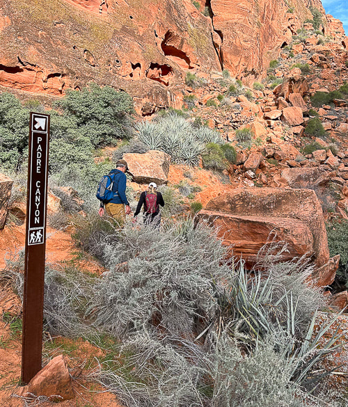
Strengthening for Hill Climbing - Walking Lunge with Overhead Weight
Climbing out of the Grand Canyon requires strong glutes!  The most important function of your gluteus medius during hiking is to stabilize your pelvis to keep it level while standing on one leg (stance phase of walking).  The stronger they are, the better protection for your knees, and the more efficiently they work, the less energy you waste.  Walking lunges challenge your glute and core strength.  Holding a weight over your head adds more challenge to your core musculature including abdominals and back extensors, as well as your shoulder girdle stabilizers (rhomboids, trapezius, serratus).  Good training for scrambling hikes where you have to use hands to propel up rocks.
Action:
Hold dumbell or kettlebell overhead with elbow straight, next to your ear. Or, you could hold the weight in a "goblet" position next to your chest.  Take a large step forward, that knee should not go ahead of your foot.  Opposite knee taps the ground.  Squeeze glute on stance leg to raise to lunge with opposite leg.
​Here's some scenes from three of our training hikes:
Snow Canyon from Bottom to Top and Then Some:  Berm Trail to Joan's Bones (12 miles RT,  ~1600' net gain)
Berm Trail → Padre' Canyon Trail → Red Sands Trail → West Rim Trail → Lava Flow Trail → Whiterocks Trail →Joan's Bones → car at Whiterocks Trailhead.   
Living near Utah's Snow Canyon State Park sure has its advantages.  Each time I hike in this Navajo Sandstone paradise, I love it more.  We started near where we live, caught the berm trail and walked to the Whiterocks Trail on the north side of the park, then walked east to almost the top of Joan's Bones.  This route features gorgeous pools in cross bedded sandstone, soaring orange and red towers, petrified sand dunes, and pristine white sandstone slickrock strewn with black basalt boulders. 
Joan's Bones hike is on AllTrails (misspelled as "Jones Bones").
Picture
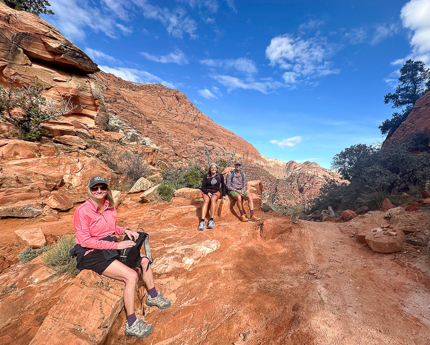
Snow Canyon training!  Robin, Lindy and Jeff at top of Padre' Canyon.
Scenes from Snow Canyon State Park, except upper right photo is from Joan's Bones Trail to the east.
Picture
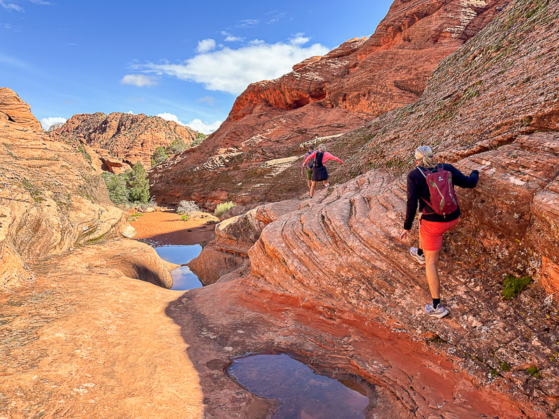
Jeff, Robin and Lindy on the Padre' Canyon Trail.
Picture
Picture
Picture
Padre' Canyon:  Jeff and Lindy in the grotto (left), hiking up to the saddle (right).
Picture
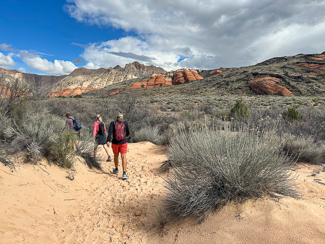
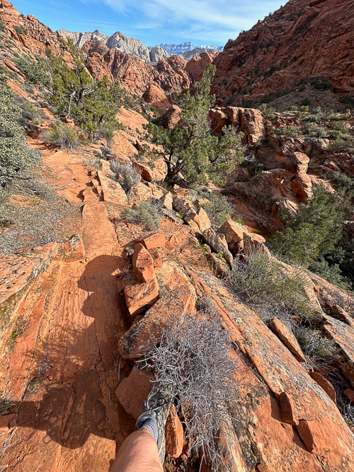
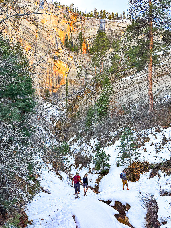
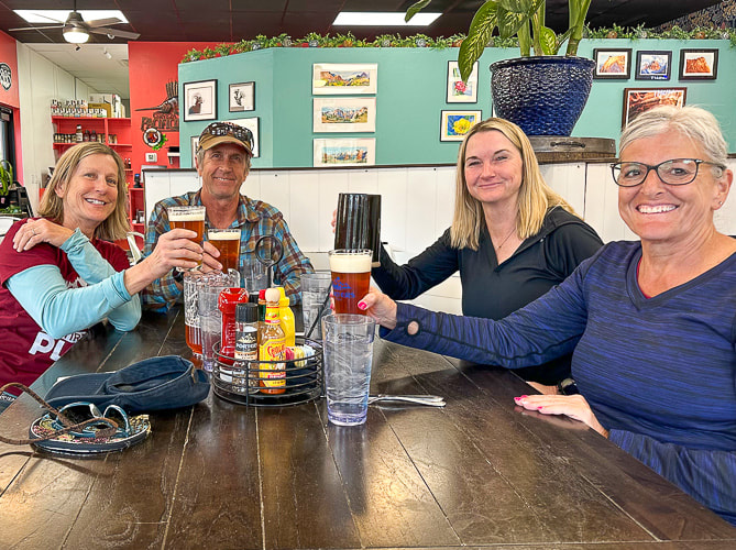
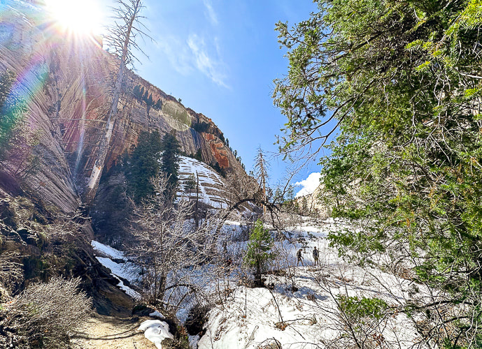
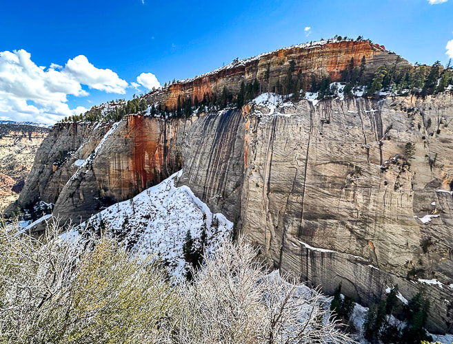
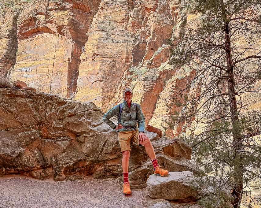
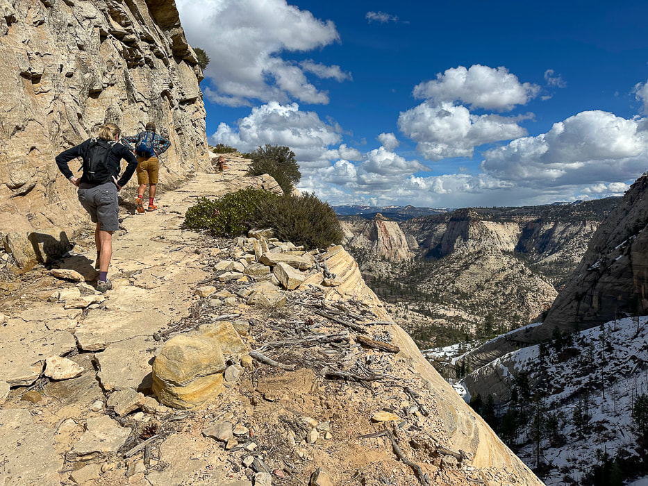
Fred climbing up cliff band on Red Mountain Trail, backside of Padre' Canyon.
Picture
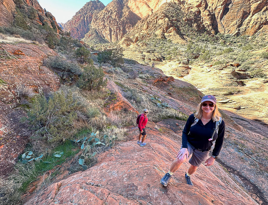
Exploring off the Padre' Canyon Trail.
Picture
Picture
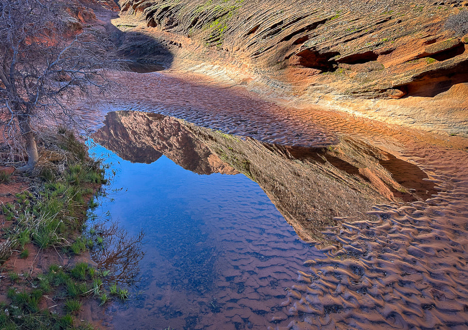
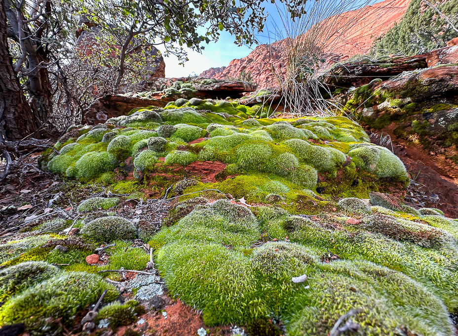
Moss after a rain near Padre' Canyon.
Picture
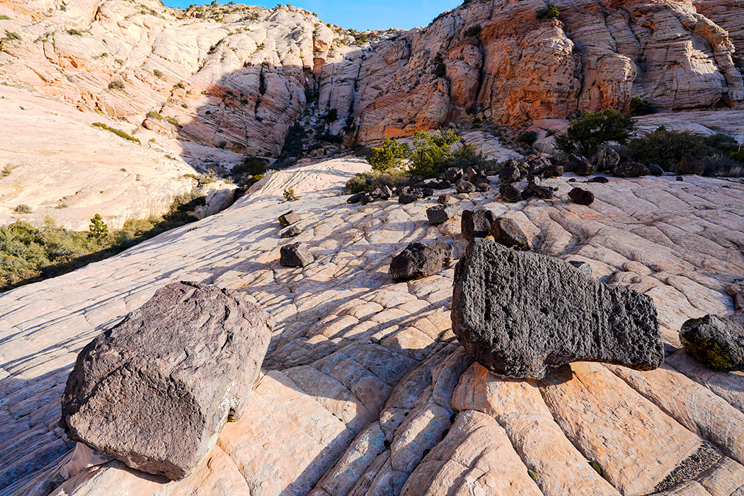
Hiking up toward Joan's Bones - basalt and sandstone.
Picture
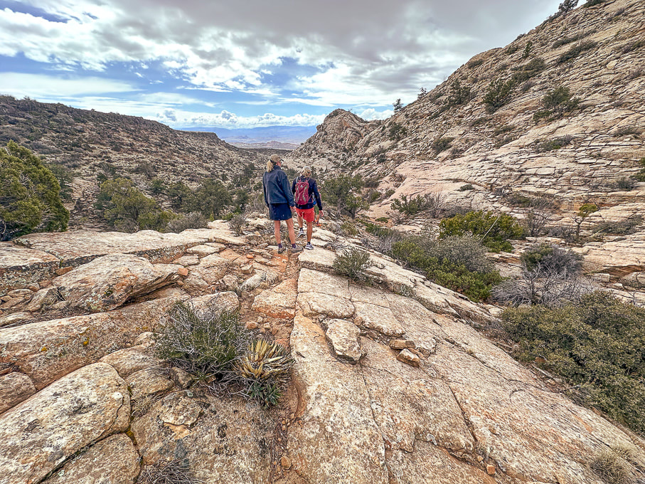
Descending Joan's Bones Trail.
Picture
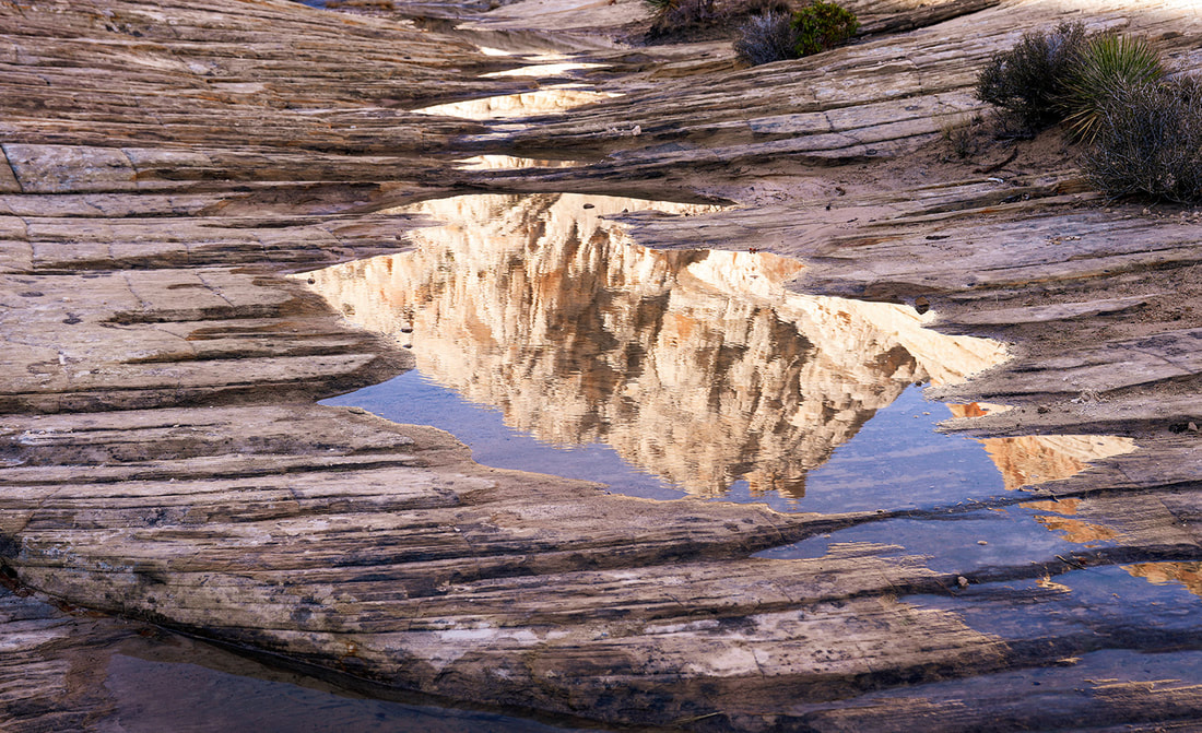
Reflection at Whiterocks Amphitheater
Picture
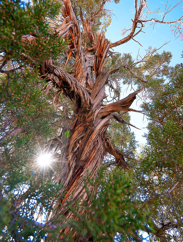
Old juniper on Butterfly Trail in Snow Canyon State Park, Utah
Picture
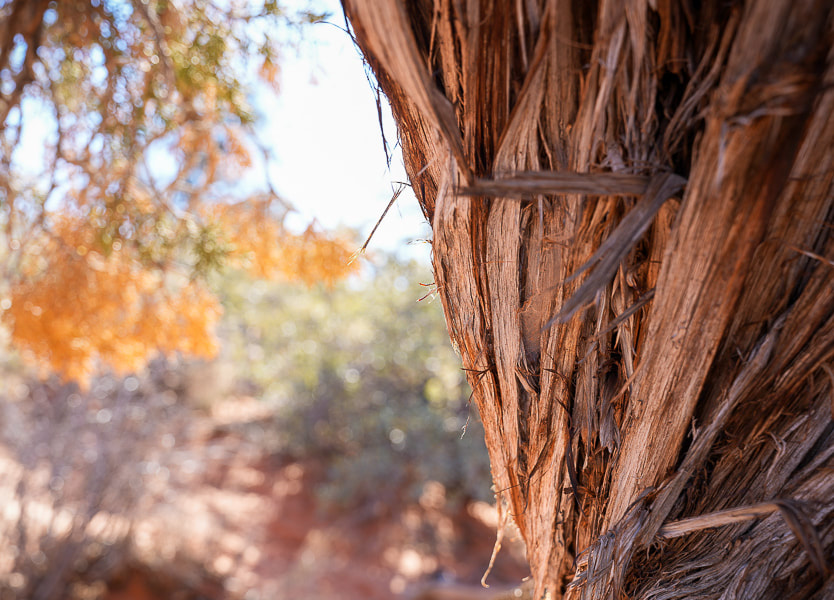
 Old juniper image shot with my new Sony mirrorless, full frame sensor camera!!
Picture
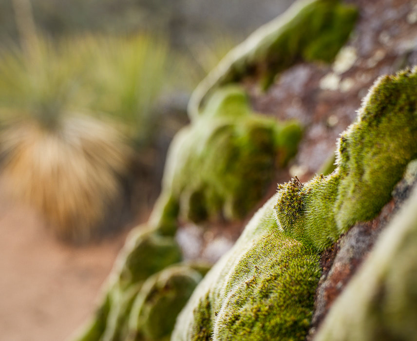
Zion National Park - West Rim Trail to Horse Pasture Plateau (10 miles, 3,000' gain).
Right after the shuttle service opened in early March, Lindy, Robin, Jeff and I headed to Zion to get some elevation training in.  Starting at the Grotto Trailhead, 4,300' elevation, we hiked up West Rim Trail, past Angels Landing to the entrance into Horse Pasture Plateau at 6,713', at the intersection with Telephone Canyon Trail.  After regaining ~ 300' of elevation loss to and from, I calculated our gain to be ~3,000 feet.  We hiked on some icy snow.  Down in the canyon and at the plateau, temperatures were a bit chilly.  Zion was not especially busy with visitors that day.  We celebrated afterwards in Springdale with beer and burgers at Porter's restaurant.
Picture
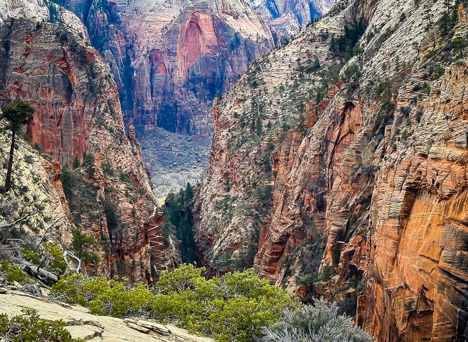
A view of Walter's Wiggles, tight switchbacks up through Refrigerator Canyon on the way to Angels Landing.
Named after Walter Ruesch, Zion National Park's first superintendent who helped construct the trail in 1926.
Picture
Sue beneath Angels Landing and walking in snow on West Rim Trail.
Picture
Picture
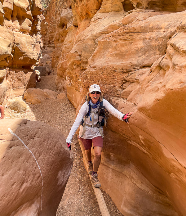
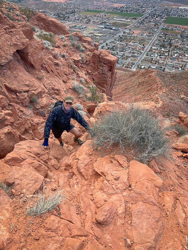
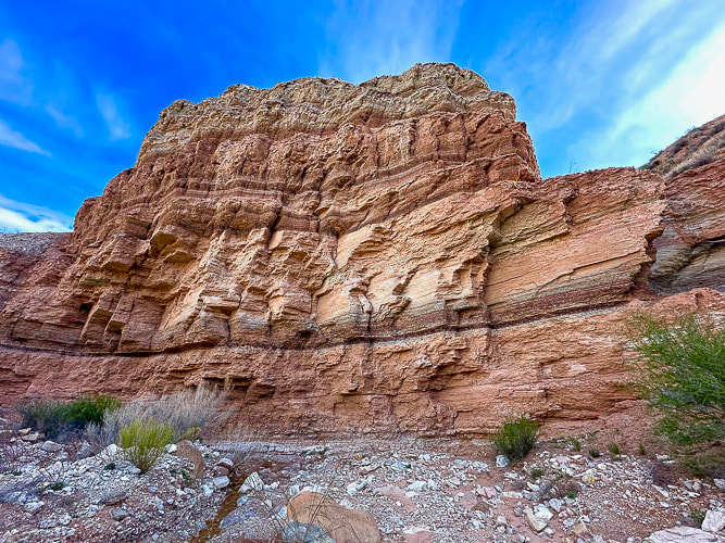
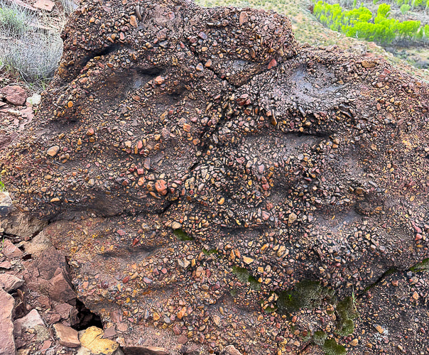
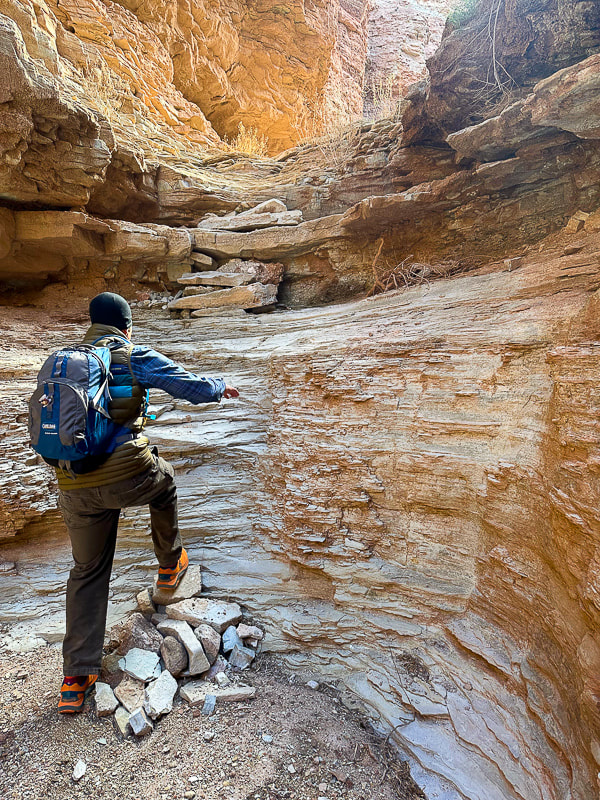
One of the last switchbacks up to intersection of West Rim Trail and Telephone Canyon Trail on Horse Pasture Plateau.
Picture
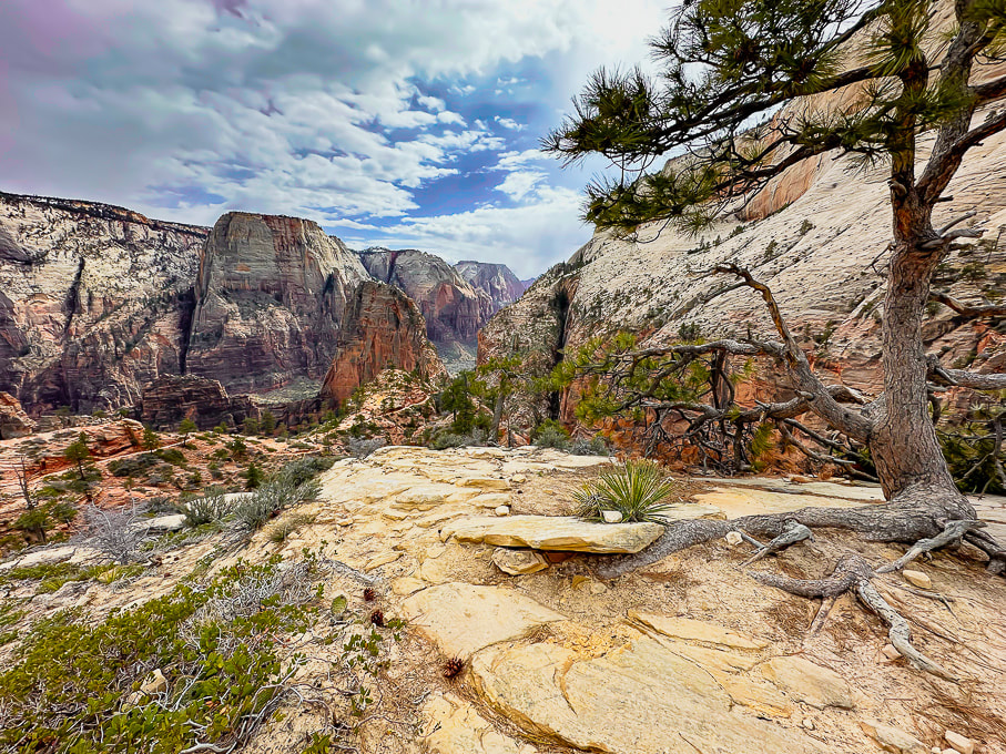
Looking at Zion's West Rim Trail and Angels Landing (orange fin beneath Great White Throne).
Aprés hike brew and burgers!  More scenes from Zion, and Jeff on Walter's Wiggles on the way to Angels Landing.
Picture
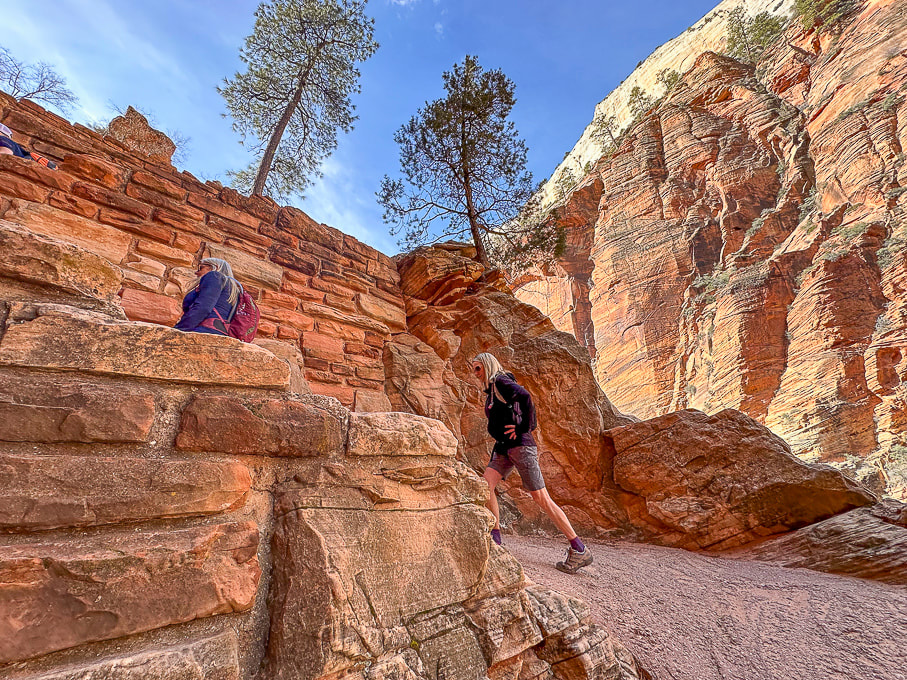
Ascending Walter's Wiggles, Refrigerator Canyon to the right.
Ivins and Santa Clara, Utah:  Suicidal Tendencies Trail and the "Badlands."
The "badlands" is my nickname for the landscape west of Land Hill in Ivins, and east of the Beaver Dam Mountains because it reminds me of South Dakota's badlands.   A spectacular view of this formidable-looking red and white striped land cracked by crooked canyons and washes and plateaus with well-established biological soils can be savored from the top of Land Hill.  We hiked Wittwer Canyon, a major tributary that washes into Santa Clara River. 
Fred and I put together a 10-mile hike that linked the petroglyph trails on Land Hill to cross the Santa Clara River, to wander through the "badlands" to find a way to link to the Barrel Roll Trail in the Cove Wash Trails.
​In just one hike, Fred and I saw all the "cool stuff on this trail," (see photos below) and then some.  A conglomerate boulder hanging on the steep wall under Land Hill looks like it has embedded dinosaur tracks.  I called the local paleontologist; stay tuned!
​
We were trying to find a route down the western cliffs along the Santa Clara River when Fred jumped backwards and yelled.  Buzzing under a tree was one of the largest rattlesnakes I've seen!  Ready to strike.  After giving it a wide berth we came upon some petroglyphs and found a passage through the cliffs to the river.  

Wittwer Canyon's walls, in the "badlands," are the Triassic-age (250 million years ago) Shnabkaib Member of the Moenkopi Formation, and the strata  have a characteristic "bacon stripe" appearance.
Picture
The "bacon stripe" pattern of Shnabkaib Member of alternating red siltstone and the lighter limestone layers in Wittwer Canyon.
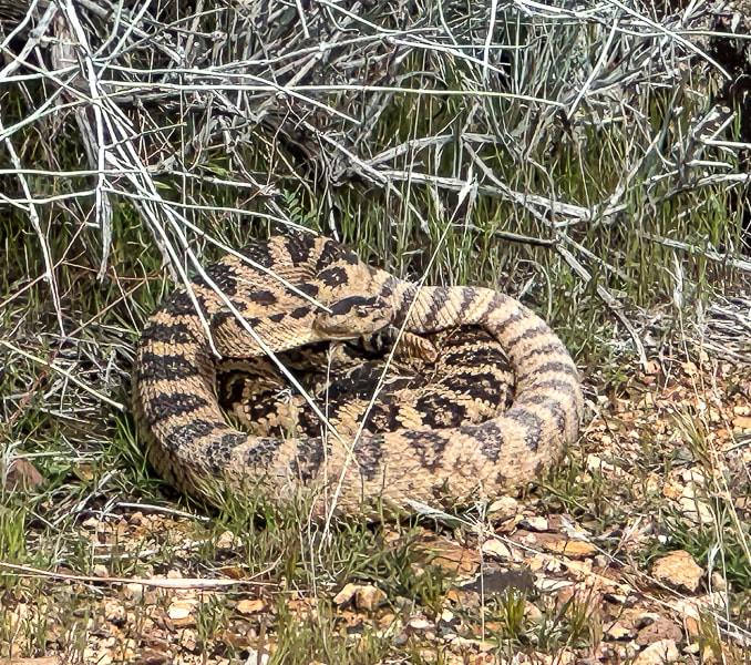
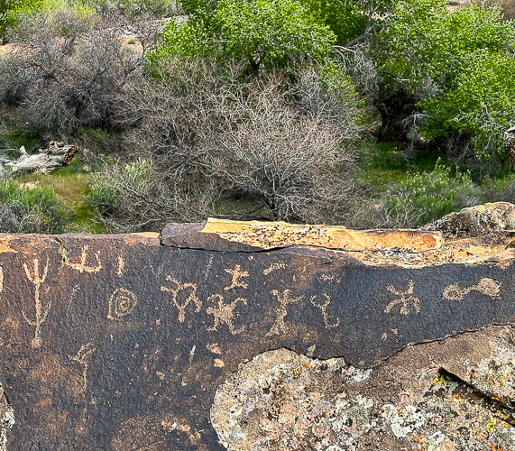
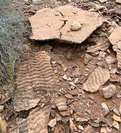
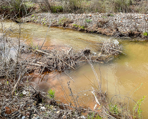
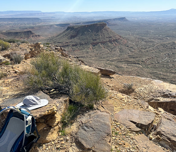
We're fortunate to have Colorado Plateau hiking to the east of us and Mojave Desert hiking to the west.  One day we hiked the 11-mile Suicidal Tendencies, a popular mountain bike trail with scary drop-offs.  The more we hike this part of Utah, the more we find to explore.  Not only are the views magnificent - black lava flows blend with red and orange cliffs, signs of past cultures and geological events adds a lot character to this part of southern Utah. My next post (rim to rim training, part 2) will highlight another Zion hike and Red Mountain Traverse.
Getting Ready for the Big Day!  Keep On Exploring!!!
Cool Stuff on the Trail
One angry rattler, Santa Clara petroglyphs, preserved ripples, beaver dam on the Santa Clara River, dinosaur tracks(?) in Shinarump Conglomerate, a well-developed biological soil crust in the "badlands."

Picture
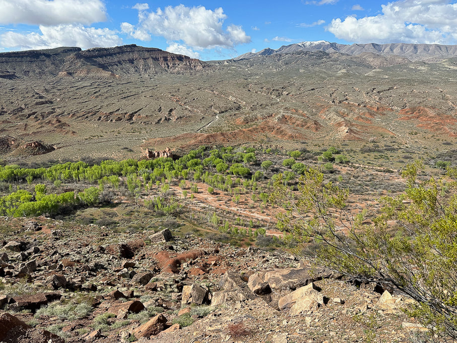
The "badlands" west of Ivins, Utah.  Top of Suicidal Tendencies is on the left butte.  Fred and I descended down to the cottonwood trees below and crossed the Santa Clara River, found a path through the badlands to the left and looped back using Cove Wash trails.
Picture
Picture
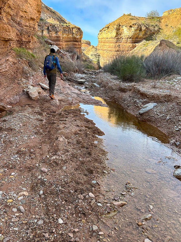
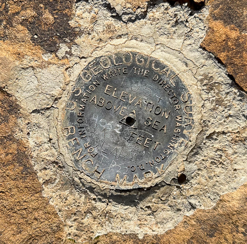
Jeff climbing a dry waterfall in Wittwer Canyon, finding our way up-canyon.
Picture
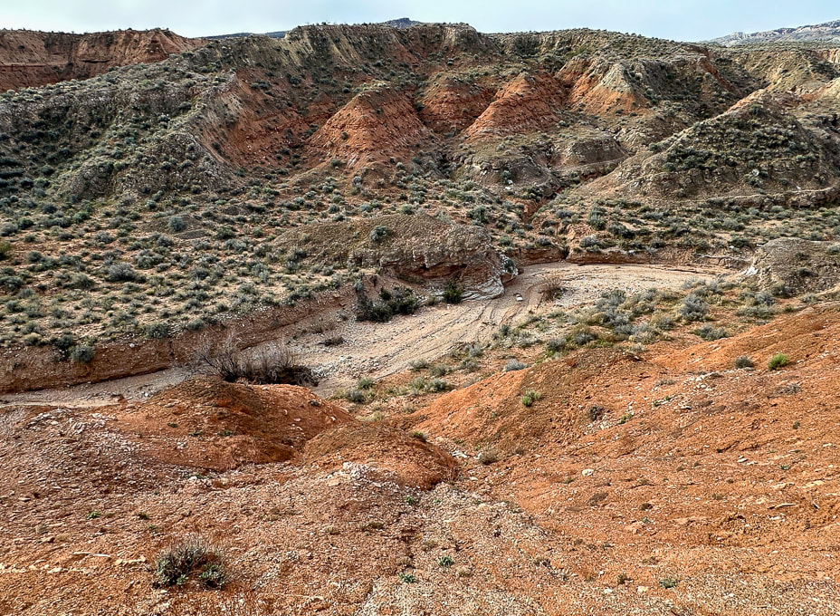
Wittwer Canyon:  upper part is located in the Shivwits Band of Paiutes Land.
Picture
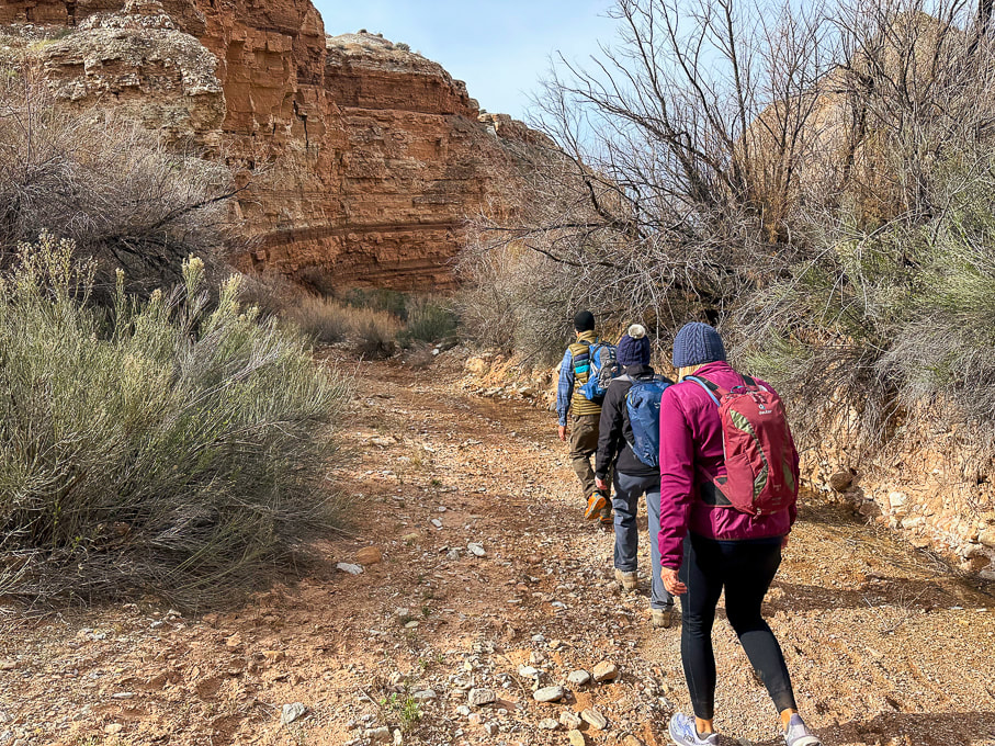
Wittwer Canyon - Santa Clara River Reserve on a cold and windy day.
Picture
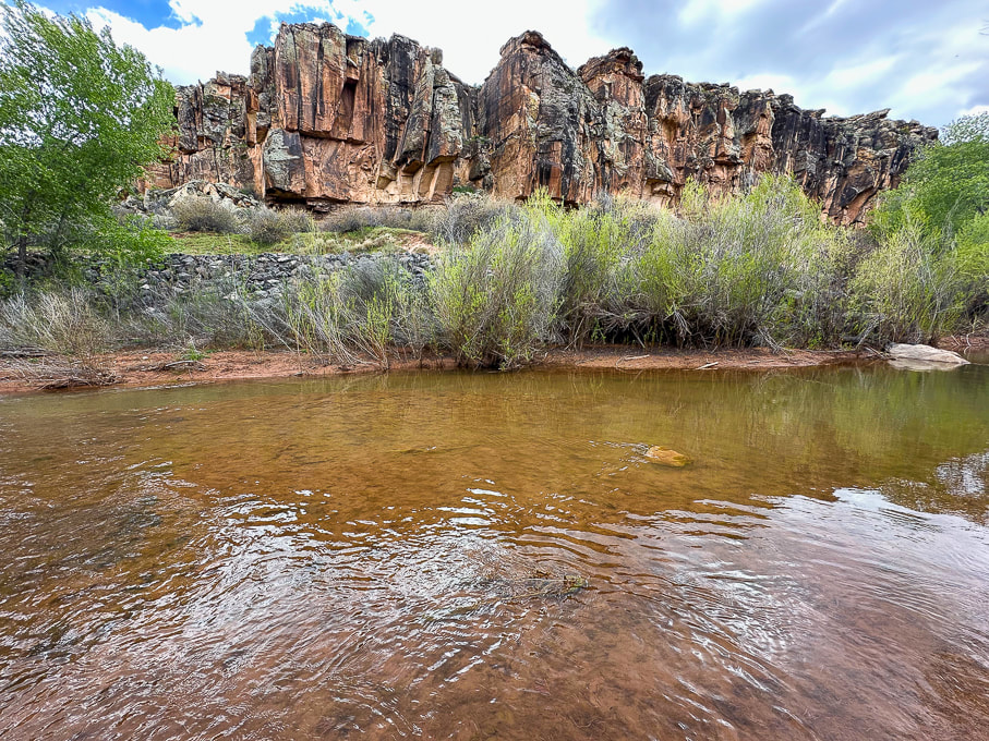
Western cliffs along the Santa Clara River - the rattlesnake is up there!
Picture
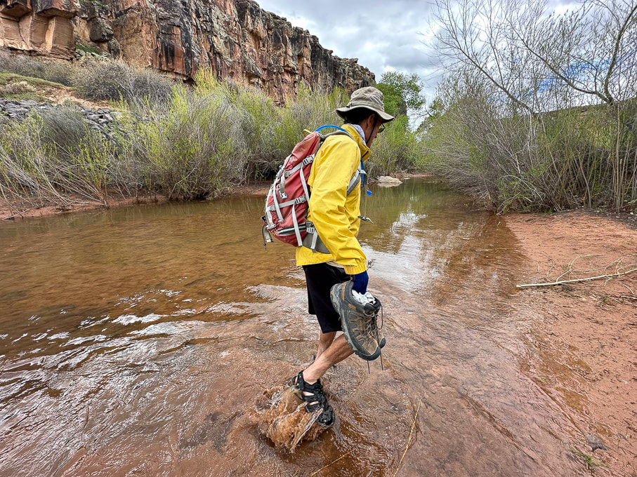
Fred and I found a shallow crossing on the Santa Clara.
Picture
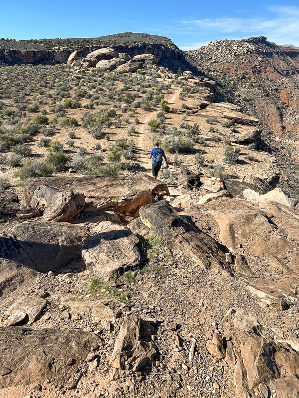
Jeff walking toward top of Suicidal Tendencies Trail (green plateau).
Picture
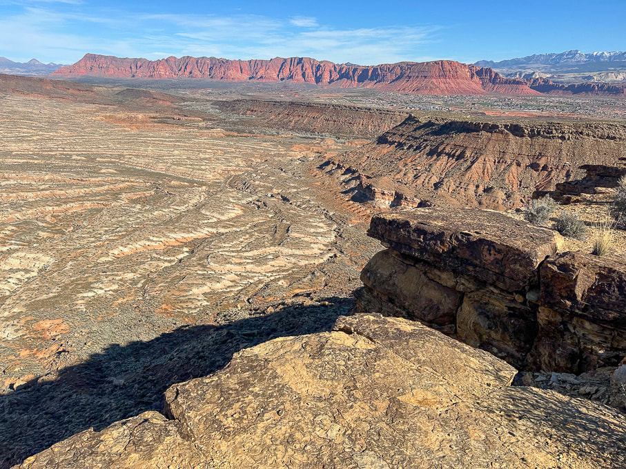
From Suicidal Tendencies Trail looking north across "badlands" to Red Mountain and Ivins, Utah.  Snow-covered Pine Valley Mountains on the right horizon.
On the top of Suicidal Tendencies - a survey marker that has "Santa Clara" and "1954" stamped onto it.
8 Comments
Robin Draper
4/16/2024 09:21:04 pm

Excellent post, Sue. I love all the detail. Just over one month to go before the big day!

Reply
Sue link
4/17/2024 06:30:14 am

Can't wait Robin! We are gonna do great! It's been fun training with you and Jeff and Lindy. Thanks for your comment!!

Reply
Linda Paul link
4/18/2024 10:06:39 am

Years ago, my orthopedic surgeon, Wade the Blade, hammered home the mantra: Get fit to play sports. Don't play sports to get fit. You embody that philosophy. Those deep walking lunges are killer. But better yet, you mix up your gym workouts with real hiking to build stamina and keep yourself engaged.

I absolutely love that moss shot!

Reply
Sue link
4/18/2024 08:45:51 pm

Hi Linda,
I've always worked out in the gym, but not so much for my legs and core, thinking that hiking was enough for my leg strength. But then I started CrossFit and realized how much weaker my legs were than my upper body. The squats, deadlifts, lunges, cleans, etc. in CrossFit have really helped my hiking strength and balance. Good advice to get fit to play sports. I will have to ruminate on that philosophy a bit. I like how you say "keep engaged". Maybe by doing strengthening exercises for a sport or activity, you do focus on it more -another good point!
I think you like the hills of moss shot - it's so cool in Padre Canyon after a rain when there's so much of it - bright green! Thanks!

Reply
Evan H
5/16/2024 11:04:57 pm

Hi Sue & Team,
On a whim I decided to search for anyone else planning a Rim To Rim on May 23rd. I will be hiking solo down North Kaibab and up Bright Angel. This will be my 4th trip into the canyon and first trip since 2015 when I was 35. I will be staying at North Kaibab Lodge and hitting the trail at 3:30am. I will be wearing a bright orange long sleeve t-shirt you won't be able to miss. If you see me out there say hello! I wish you guys a happy safe hike!

Reply
Sue link
5/17/2024 08:48:14 pm

Evan!
Excellent - well I hope we see you - will be keeping an eye out for a bright orange shirt. We are starting at 6:00 am. It's so awesome that you contacted me. Maybe we can celebrate afterwards! Safe hiking to you, too. We looked at the weather and luckily it will be cooler than we anticipated. If you get a chance, let me know how your hike went!!

Reply
Evan H
5/18/2024 10:40:42 am

Hey Sue,
The weather does seem to be cooperating for the hike! I'm traveling from Scottsdale, AZ where it will reach 100 today so it will be a welcome change. This hike is a victory lap for losing 40 LBS of unhealthy weight in the last 6 months.
I know of one other group starting down around 5:30am. Since this is my first long solo hike (albeit a heavily trafficked trail for the most part) I figured it would be a good idea to make new friends hiking the same day and direction for safety and well, just to be social with other hikers. It would be great to celebrate after!

Sue link
5/19/2024 07:18:08 am

Evan, Congrats on losing weight - that takes discipline. Perfect way to celebrate your accomplishment. Hope to see you on the trail!

Reply


Leave a Reply.

    Categories

    All
    Arizona Hikes
    California-desert-hiking
    California-desert-hiking
    Idaho Summits
    Nevada Hikes
    Petroglyphspictographs
    Snowshoe Hikes
    Southern Utah Hikesbikes

    To Subscribe to Explorumentary adventure blog and receive new posts by email:

    submit
    Picture
    Sue and Fred
    Picture

    About this blog

    Exploration documentaries          –  "explorumentaries"  list trip stats and highlights of each hike or bike ride, often with some interesting history or geology.  Years ago, I wrote these for friends and family to let them know what my husband, Fred and I were up to on weekends, and also to showcase the incredible land of the west.  
    Picture
    Happy Spring!
    Picture

    About the Author
    Sue Birnbaum

    A  trip to Jumbo Rocks Campground in Joshua Tree National Monument 40 years ago sparked my passion for hiking, exploring, and learning about desert ecosystems.  I met my husband Fred on Mt. San Jacinto.  We've explored the American West together; we love this land and I hope to inspire you to get out and explore through my photographs and trip descriptions.
    In 1992, Ray Wilson and I conceived the first Cactus to Clouds hike which climbs over 10,000 feet in one day to the summit of Mt. San Jacinto near Palm Springs, California.
    CACTUS TO CLOUDS HIKE 
    READ MORE
    ABOUT SUE
    Some of my favorite websites:
    ​

    ​Awkward Botany
    ​amateur botany for the phytocurious

    Bird and Hike

    ​"Intended to encourage people to visit, learn about, and fall in love with the desert."
    ​

    Draw and Shoot
    Beautiful Photography

    Daring Dayhikes
    "Interesting places you can visit with a daypack."  Terrific Tucson and other desert hikes and East Coast, too.


    Earthline: The American West
    Debra "writes to extol our beloved Earth." Detailed hike info, excellently written.
    ​

    Geologypics.com
    Geology and Geologic Time through Photographs

    Glenn Suokko
    Vermont artist's paintings "inspired by a place based on the land .... drawn to painting the representation and abstraction of nature."

    In the Company of Plants and Rocks
    ​A natural history blog about botany, plant ecology, and geology.


    MishMoments:  Joy of Photography
    this website is "
    about capturing that special moment in life’s journey and making the most of the time we have."

    Nature's Depths
    Walking through nature with John Palka, a neuroscientist who loves plants and ponders big questions.


    Rangewriter - What Comes Next?
    ​Linda's excellent writing brings to life her interesting adventures, "curiosities and thoughts", post-retirement.

    SeekingLost - Hiking and Backpacking Adventures.

    Stav Is Lost- Unconventional, out-of-the way hikes in the American West.


    Uprooted Magnolia
    ​Leah Yetter's beautiful "photo journal on life, love, and the spirit of Wyoming."

    Archives

    April 2025
    March 2025
    January 2025
    December 2024
    November 2024
    October 2024
    September 2024
    August 2024
    July 2024
    June 2024
    May 2024
    April 2024
    March 2024
    January 2024
    December 2023
    November 2023
    October 2023
    September 2023
    August 2023
    July 2023
    June 2023
    May 2023
    April 2023
    February 2023
    January 2023
    December 2022
    November 2022
    October 2022
    September 2022
    August 2022
    July 2022
    June 2022
    May 2022
    April 2022
    February 2022
    January 2022
    December 2021
    November 2021
    October 2021
    August 2021
    July 2021
    May 2021
    March 2021
    February 2021
    January 2021
    November 2020
    October 2020
    August 2020
    July 2020
    June 2020
    April 2020
    March 2020
    February 2020
    January 2020
    November 2019
    October 2019
    September 2019
    August 2019
    July 2019
    June 2019
    May 2019
    April 2019
    February 2019
    December 2018
    November 2018
    October 2018
    September 2018
    July 2018
    June 2018
    May 2018
    April 2018
    March 2018
    February 2018
    January 2018
    December 2017
    November 2017
    October 2017
    September 2017
    August 2017
    July 2017
    June 2017
    April 2017
    February 2017
    November 2013
    August 2013
    July 2013

HOME

Cactus to Clouds Hike
More Quotes
​
Mary Oliver Poems
Ann Zwinger Quotes
HIKES BY STATE

Idaho Hikes
Utah Hikes/Bikes
​Arizona Hikes
​California Desert Hikes
​Wyoming Hikes
​Nevada Hikes

BLOGS

Adventure Blog
Women and the Land
GEAR REVIEWS
FIT AFTER 50
Fred Birnbaum
Dave Brasuell
Bus' Little Black Book
​Mike Carlson
​Ray Wilson
​Marcia Bondy
Bryan Krouse
​Maria Keezer
​Tim Clemens
​Doug Traubel
​Brian Holgate
​
Becky Borczon Blake
​Jennifer Cera and
​Sue Birnbaum

​Vance Powell
​Boise Cross Fit Masters Ladies
​Vickie Kearney

GALLERY

Desert Plants
Nature
Earth + Sky
Urban
Water
Patriot 
​Orchids
Boise
​
  ABOUT
    Contact

​
© 2017 - 2025 by Sue Birnbaum.  Photos on this website are the sole property of Sue Birnbaum unless otherwise indicated.  Please receive permission before publishing my trip reports and photos.
I try my best to be accurate with my hike descriptions; please research your adventures, always bring a map and compass and know how to read them, be prepared!  All of these hikes can be dangerous; hike at your own risk.  ALWAYS carry the Ten Essentials with you on hikes. 
​Please feel free to contact me with comments or questions, or if you see any errors that need attention.
Thank-you for stopping by!


EXPLORUMENTARY.com
  • Home
    • Cactus to Clouds Hike
    • Grand Canyon Rim to Rim - Hikes and Training
    • More Quotes
    • Ann Zwinger Quotes
    • Mary Oliver Poems
  • Hikes by State
    • Southern Utah
    • Idaho
    • Arizona
    • California Desert
    • Nevada
    • Wyoming and New Hampshire
  • Petroglyphs and Pictographs
  • BLOG
    • Adventure Blog
  • GALLERY
    • DESERT PLANTS >
      • Beavertail cactus
      • Brittlebush
      • Christmas Cactus
      • Arizona Barrel Cactus
      • Parry's penstemon
      • Agave
      • Arizona Rainbow Hedgehog
      • Claret Cup Hedgehog
      • Desert Agave
      • Palmer's Penstemon
      • Silver Cholla
      • Cristate Saguaro
      • Indian Paintbrush
      • Ocotillo
      • Santa Rita Prickly Pear
      • Spiny Cliffbrake
      • California Barrel Cactus
      • Engelmann Prickly Pear
      • Velvet Mesquite
      • Joshua Tree
      • Buckhorn Cholla
      • Hedgehog Cactus
      • Fishhook cactus
      • Thompson's Woolly Locoweed
    • NATURE
    • BOISE
    • EARTH + SKY
    • URBAN
    • WATER
    • PATRIOT
    • ORCHIDS
  • Fit After 50
    • Brian Holgate
    • Fred Birnbaum
    • Dave Brasuell
    • Bus' Little Black Book
    • Mike Carlson
    • Ray Wilson
    • Bryan Krouse
    • Vickie Kearney
    • Maria Keezer
    • DOUG TRAUBEL
    • Boise Cross Fit Masters Ladies
    • Tim Clemens
    • Marcia Bondy
    • Becky Borczon Blake >
      • Becky B Downtown
    • Jennifer Cera and Sue Birnbaum
    • Dave Brasuell
    • Vance Powell
  • Contact