|
With a second try, we made it to the lonesome summit of Elephant Head in the sparsely traveled Santa Rita Mountains, south of Tucson. Related: 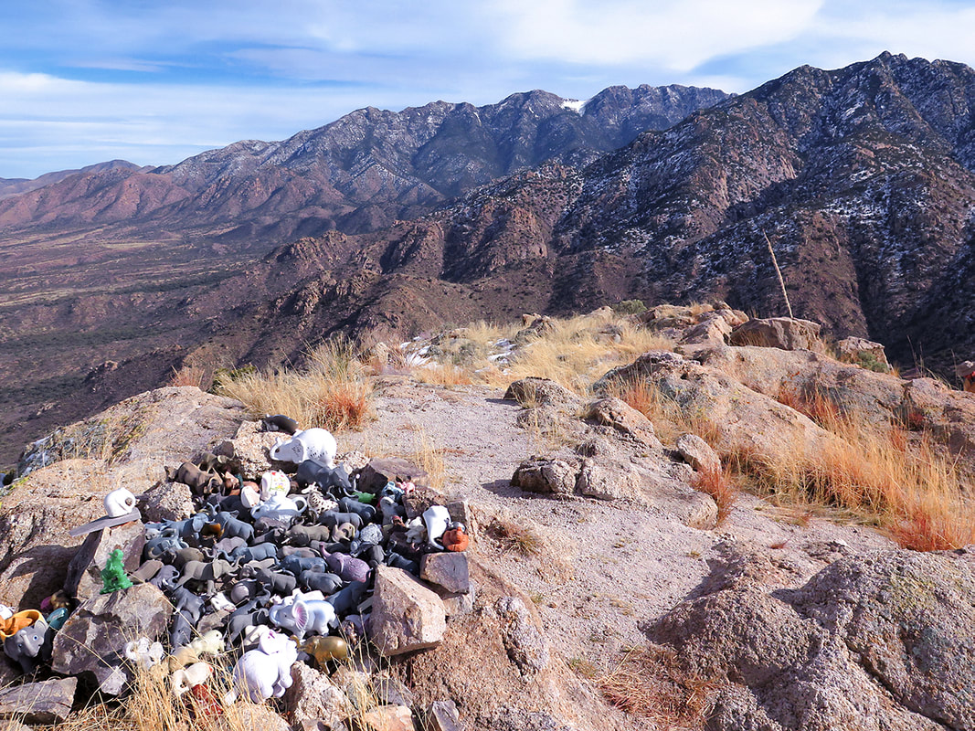 Elephant Head Peak summit - Santa Rita Mountains Trip Stats
Overview: Climb the bare-boned, steep ridge of Elephant Head Peak to witness the Shrine of the Elephant with a close backdrop of the higher forested Santa Rita Mountain range. You must first climb through old oak trees, hike out of two canyons and walk an old mining road with huge Santa Rita Prickly Pear along the way. Location: Mt. Wrightson Wilderness - Santa Rita Mountains - Coronado National Forest - Arizona Distance/Type: 6.8 miles round-trip. Elevation: Trailhead = 4,508', Elephant Head summit = 5,641'. Net elevation gain to summit = 2,000'. Difficulty: Moderate effort on defined trail, moderate-strenuous off-trail Class 2+ with one Class 3 pitch near summit. Experience with off-trail navigation necessary. Reference: We used Earthline's hike directions. Maps: Green Trails Maps Santa Rita Mountains (#2962S), our GPS tracks (below). Considerations: No permit, no trail register. Driving Directions: Trailhead. Leave Interstate 19 at the Canoa Road Exit near Green Valley. Take the east frontage road 3 miles south to Elephant Head Road and turn east 1.6 miles to the Mt. Hopkins Road. Drive 4.5 miles to FR 183. Turn north on this dirt road about 2.4 miles to a circular parking area with a large oak - just before the road crosses the streambed. Park here and travel back down the road a few paces to a sign that marks Trail #930 on right (north) side of road. Coordinates at parking: 31.6956 , -110.9288. Geology: Elephant Head Quartz Monzonite (Cretaceous ~70 Ma). Not to be mistaken for granite which contains > 20% quartz, monzonite contains 5-20% quartz. Large grains indicate slow cooling below Earth's surface. Flora: Desert grassland and oak-grassland biomes of Arizona's sky island region. *** 1/29/23: I received a comment from someone who hiked this trail last year - she saw forestry employees who told her to remove any elephants she might find on this trail in order to keep this beautiful area more pristine. Hike Summary
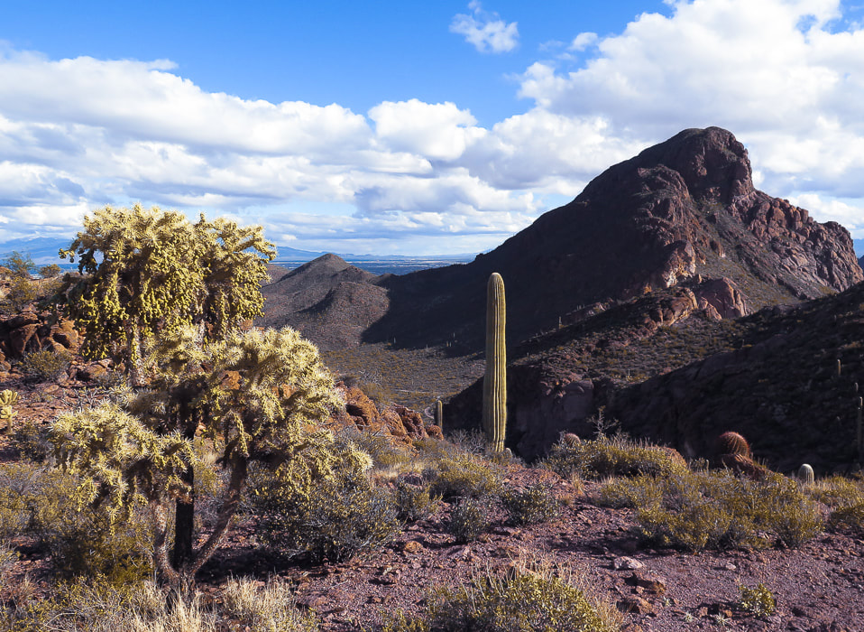
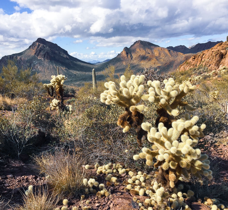
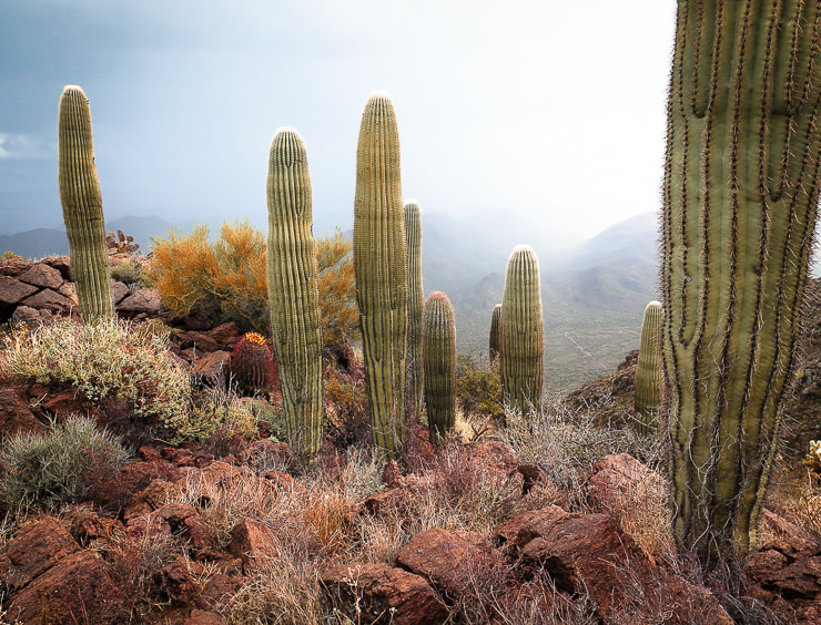
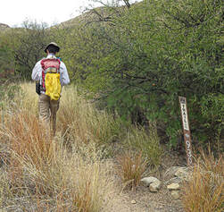
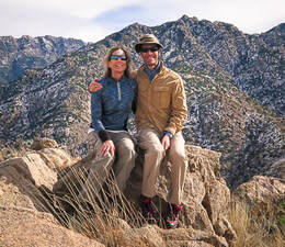
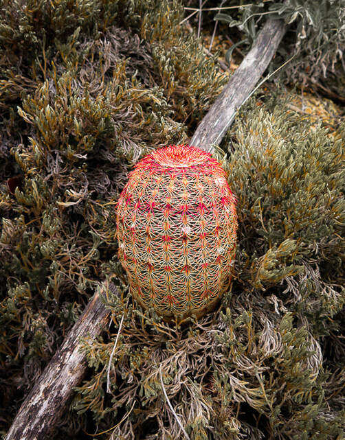
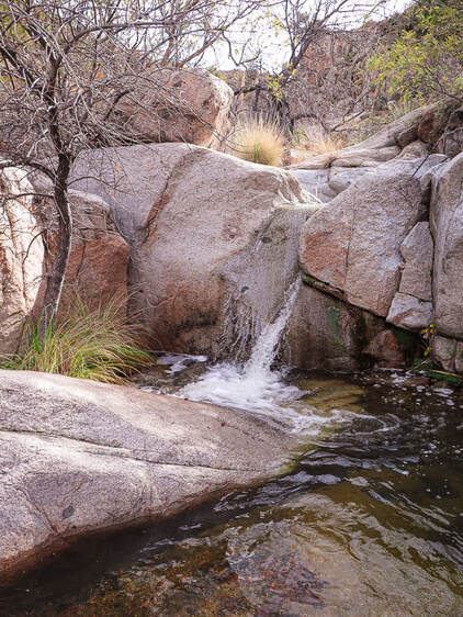
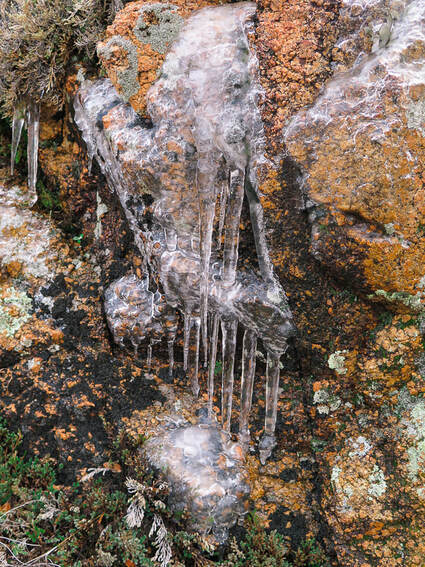
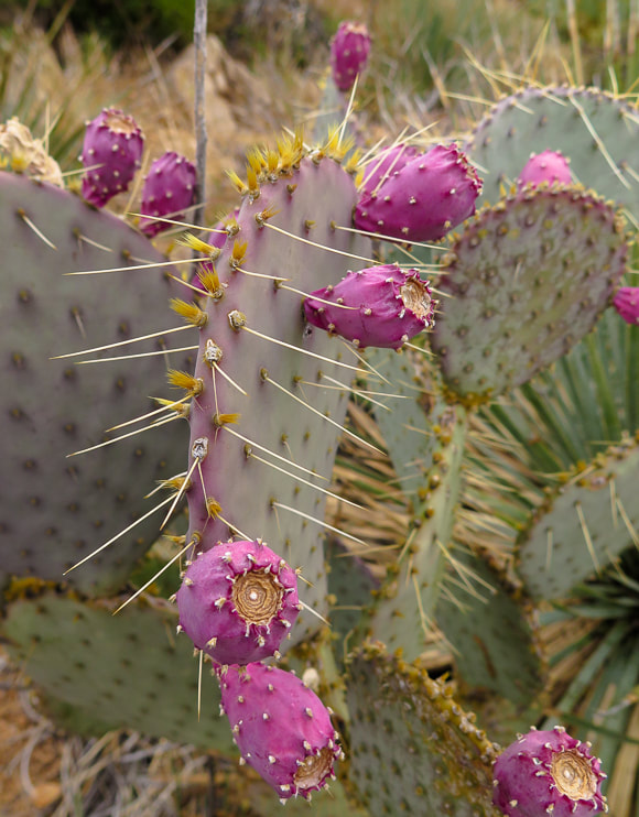
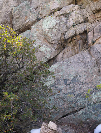
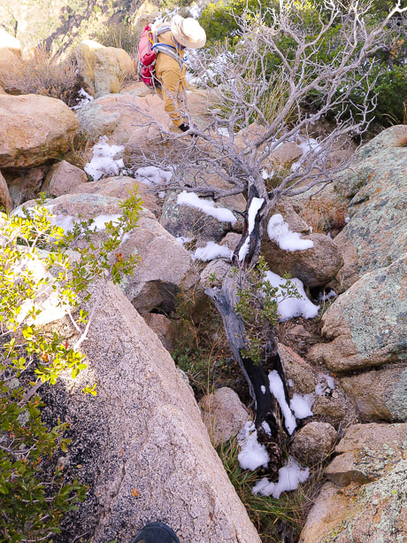
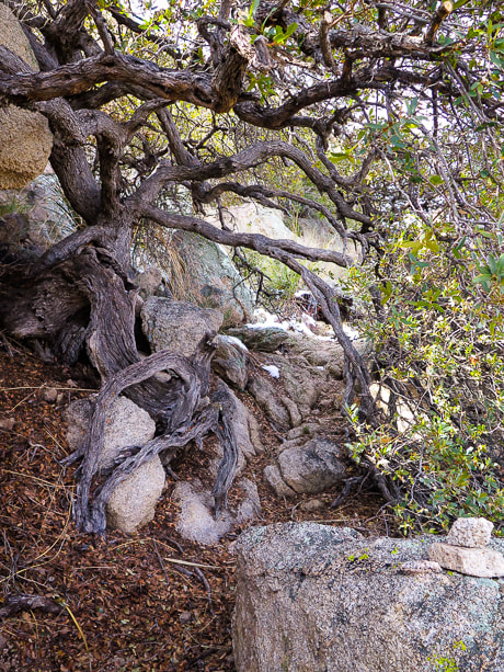
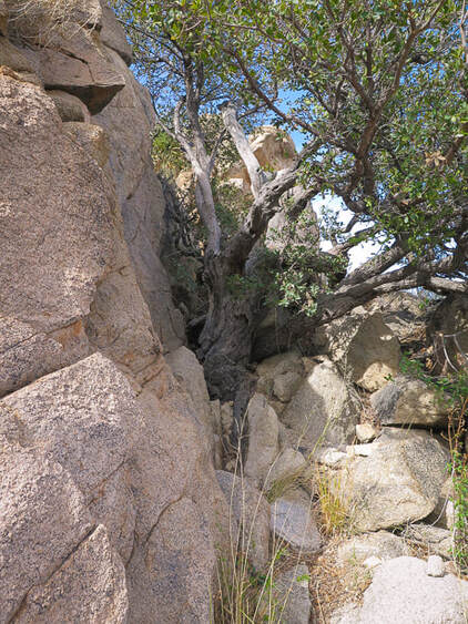
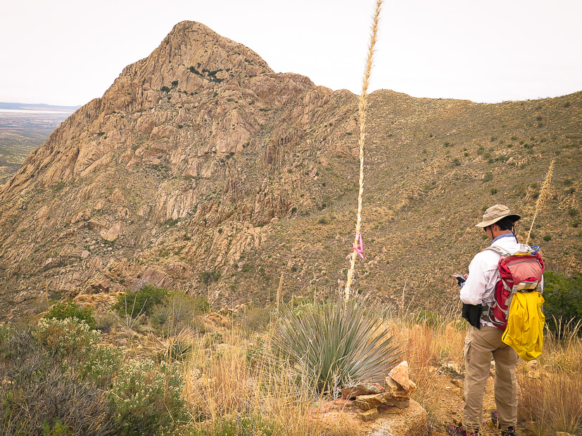
"Mountains complement desert as desert complements city, as wilderness complements and completes civilization." - Edward Abbey - from Desert Solitaire Our Hike On our first attempt at summiting Elephant Head Peak, a huge winter storm was blowing into southern Arizona, so by the time we reached the saddle just below the exposed ridge to the summit, we staggered against a roaring wind bent on toppling us over. We had to go back down. The storm produced a thick white blanket over the tops of the Santa Catalina and Rincon Mountain ranges overlooking Tucson. Six days later we reached Elephant Head summit on a warm, calm and sunny day, but the Santa Rita Mountain range behind us still held large patches of snow. The almost ghostly figure of bare Elephant Head Peak stands out in stark contrast against the base of the dark brown and green Santa Rita Mountains in the Santa Cruz Valley near the southern Arizona border. The Cretaceous-age Elephant Head formed much later than the Triassic-age Mt. Wrightson rocks at the higher elevations of these mountains. 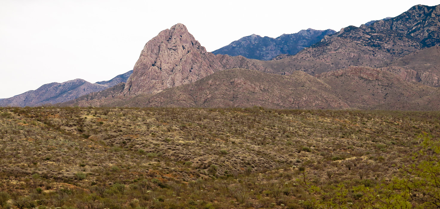 Elephant Head Peak, 5, 641' in Mt. Wrightson Wilderness in the northwest Santa Rita Mountains 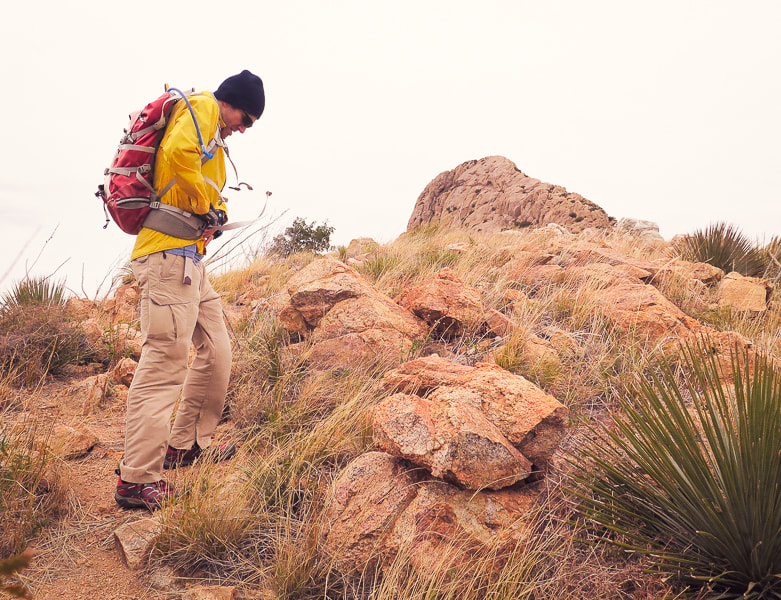 First attempt: bracing against the wind on saddle beneath Elephant Head Peak, 5,641'. 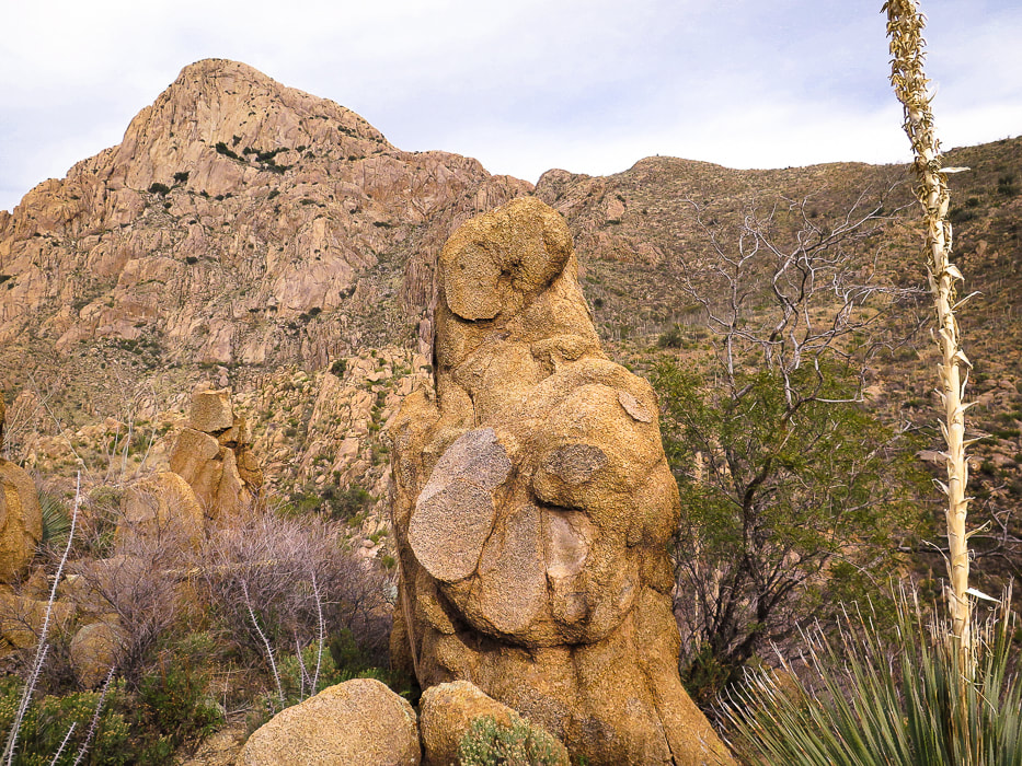 On the way to the bottom of Chino Canyon looking at Elephant Head Peak. Hike to saddle on the right following cairns. This hike packs in a wide variety of plants, views and terrain for its relatively short distance and manageable elevation gain. Begin by crossing the stream in Agua Caliente Canyon to walk through knee-high bunch grasses, then pass by the intersection for Little Elephant Head (Peak 5,139'). Catch the first glimpse of Elephant Head Peak on the horizon. Magenta and red fruits of huge Santa Rita prickly pear cacti dot the sides of the trail. Tall rock walls that support an old mining road still stand looking down Chino Canyon. Suddenly, around a corner, an enormous view of the pinkish-tan hulk of Elephant Head Peak overlooks deep Chino Canyon, its rounded rocks and southern cliffs dotted with green shrubs and a few trees. A steep drop with occasional Arizona Rainbow cacti growing in moss brings you to a soothing waterfall. The final ridge climb is the funnest part of the hike, as it requires using old oak tree branches and plenty of rock hand-holds. The rock affords great traction as the ridge drops on both sides for a huge view of all the major ranges to the north, including Baboquivari Peak, the native Tohono O'odham peoples' most sacred place. A close-up to the east of the rugged Santa Rita Mountains provides a beautiful backdrop. 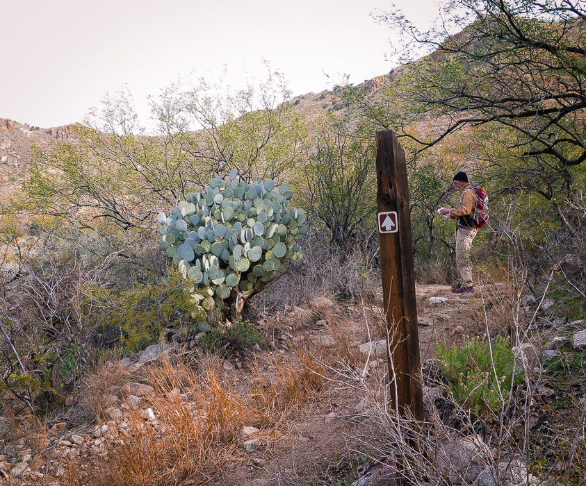 One mile into the hike, intersect with mining road built in the early 1900's and an old Santa Rita prickly pear and take a right past sign.
 Cairn marking cross-country trail that crosses Chino Canyon to ascend to saddle to the right (southeast) of Elephant Head Peak. 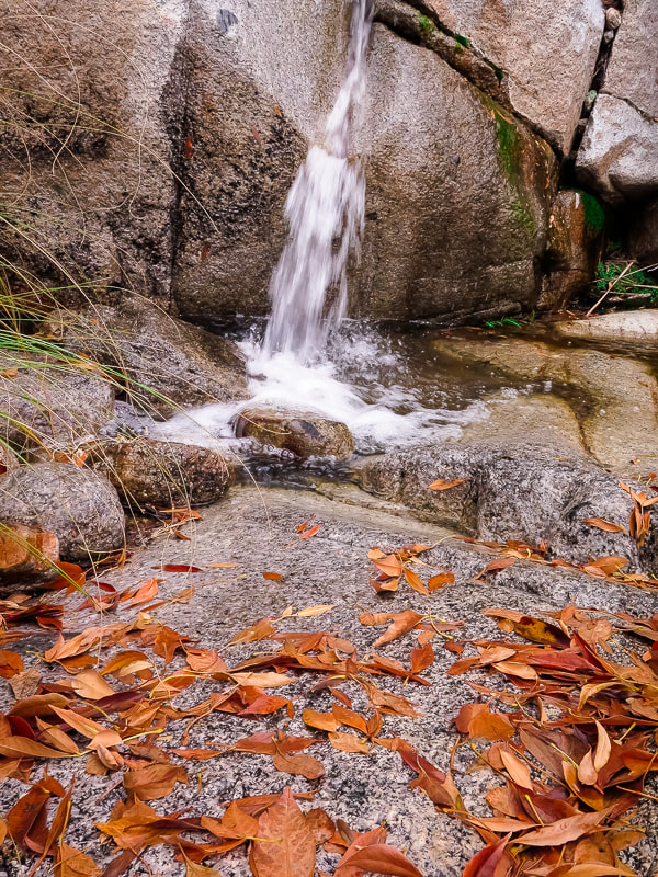 Chino Canyon at creek crossing
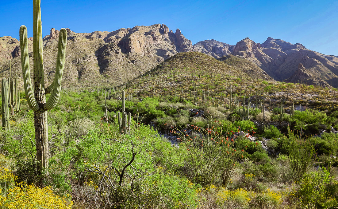
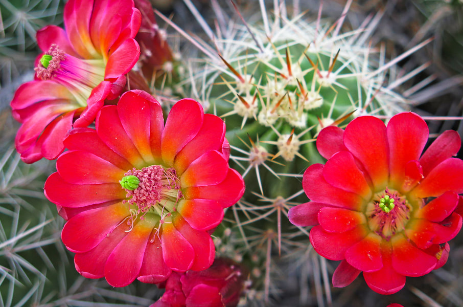
This elevation is too high and cool for saguaros to grow. This hike travels through the transition between desert grassland and oak grassland biomes of Arizona's Sky Island region. The ocotillo "forests" are remarkable and so are the mature Santa Rita Prickly Pears; they tolerate the cooler winters. Their pads can turn purple during the winter. So many things make this a repeat-hike in the future: solitude, desert wilderness, route-finding, fun Class 2-3 climbing, and views. Plans: Elephant Head Peak plus Little Elephant Head (Peak 5,149'). 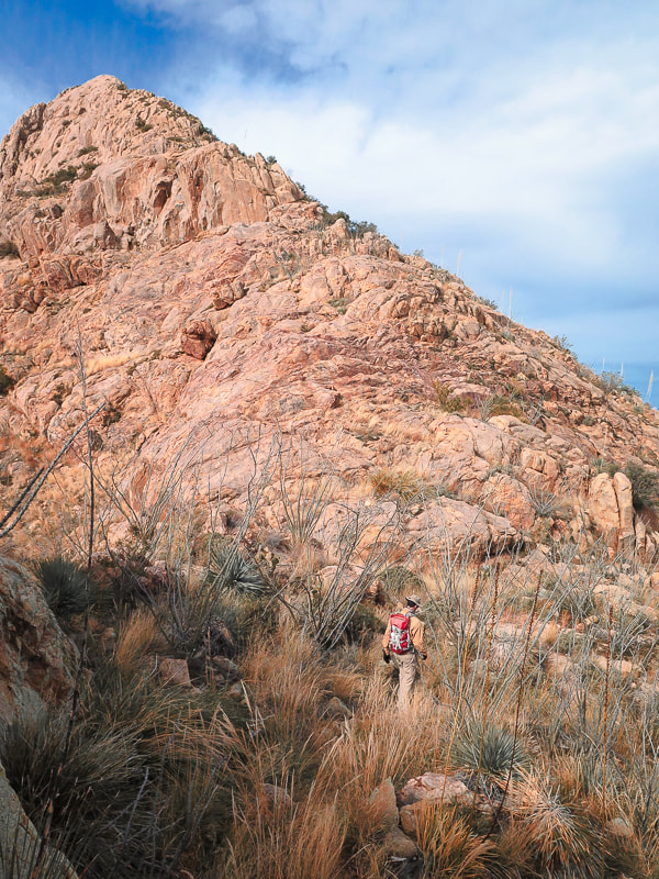 On Elephant Head's east ridge looking at the final climb: trail goes around just to the right side of ridge.
Yep! This is the trail! See the cairns...... 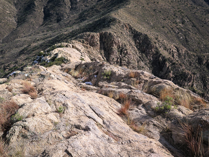 Near the summit looking down the east ridge to saddle (top of image) where trail ascends. 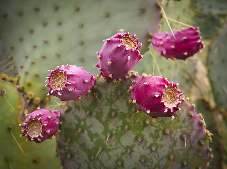 Santa Rita Prickly Pear 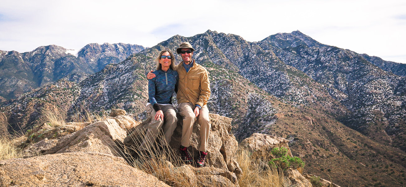 Summit of Elephant Head Peak - Santa Rita Mountains Mt. Wrightson on horizon  Devils's Cashbox - limestone butte south of Elephant Head Peak 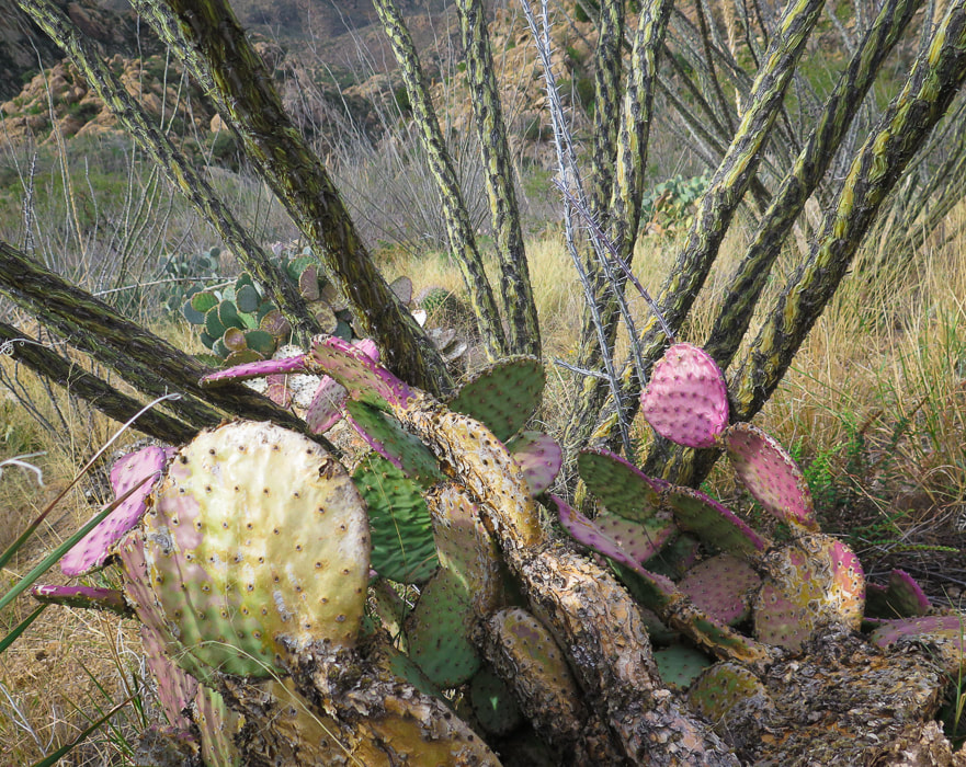 Ocotillo and Santa Rita Prickly Pear 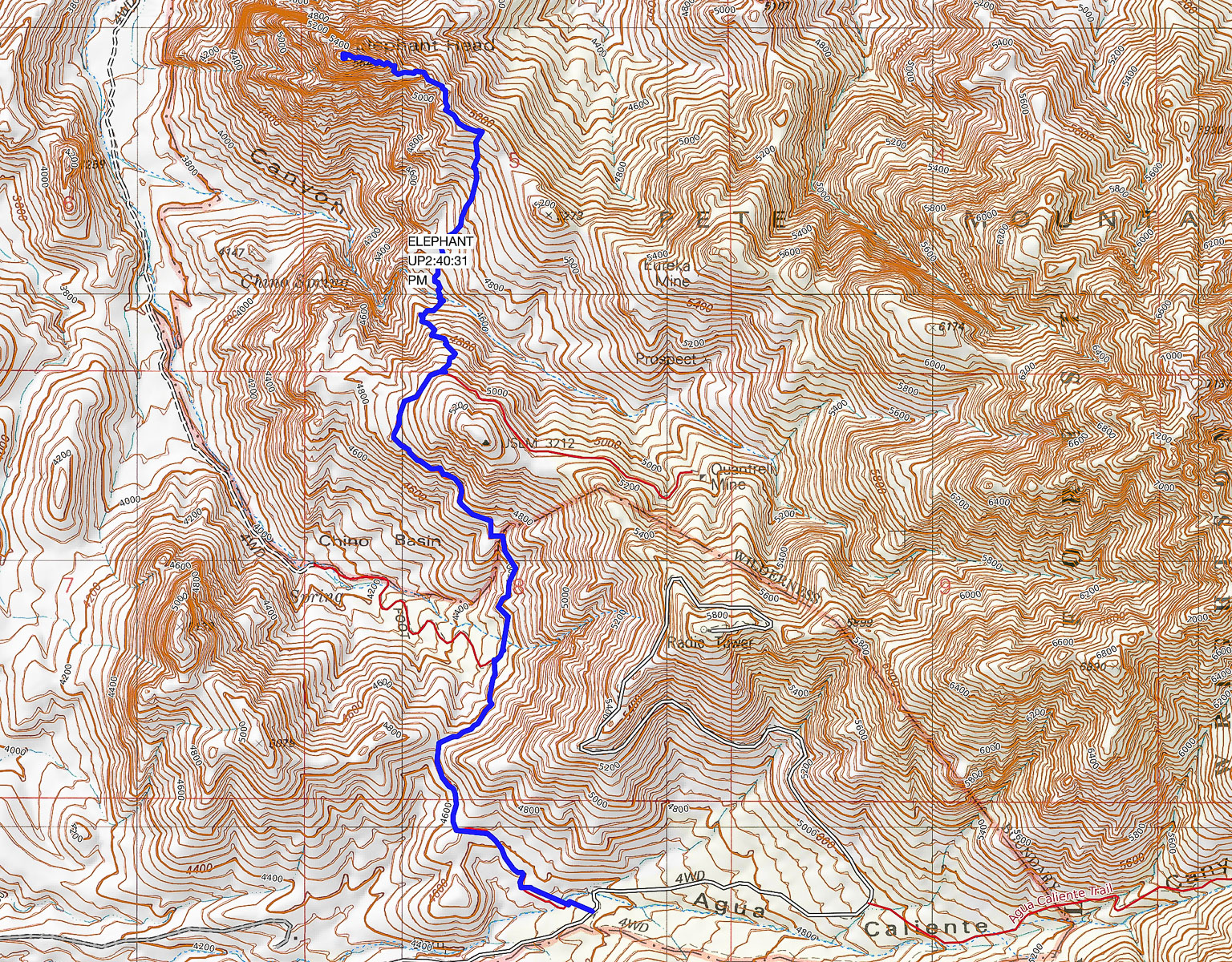 Our GPS tracks from Trail #930 Trailhead (south) to Elephant Head Peak (north) Contour intervals = 40'. click on map for larger image 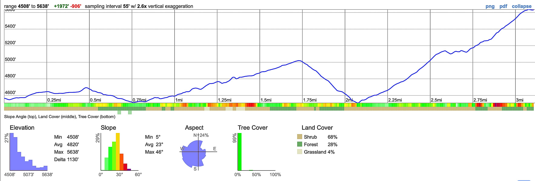 Profile for ascent: 3.4 miles with 2,000' net elevation gain 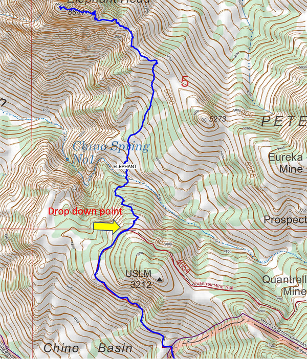 Point at which you leave Quantrell Mine Trail and descend into Chino Canyon - there may or may not be a cairn at this point. 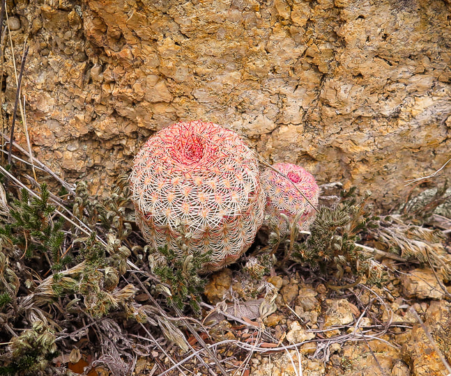 References
An Archipelago in a Cordilleran Gap - The Sky Islands of Arizona and Sonora. Brusca, R., Moore, W. https://www.rickbrusca.com/http___www.rickbrusca.com_index.html/The_Sky_Islands.html Ganesha: Hindu Diety. Doniger, W. Encyclopaedia Britannica. https://www.britannica.com/topic/Ganesha Geologic Map of the Mt. Wrightson Quadrangle. https://ngmdb.usgs.gov/Prodesc/proddesc_9405.htm Mesozoic Stratigraphy of the Santa Rita Mountains, Southeast of Tucson, Arizona. Drewes, H. 1971. https://pubs.usgs.gov/pp/0658c/report.pdf Plutonic Rocks of the Santa Rita Mountains, Southeast of Tucson, Arizona. Drewes, H. 1976. Geological Survey Professional Paper 915. https://pubs.usgs.gov/pp/0915/report.pdf Quantrell Mine Trail. Coronado National Forest. U.S. Dept. of Agriculture, Forest Service. https://www.fs.usda.gov/recarea/coronado/recreation/recarea/?recid=25770&actid=50
13 Comments
2/19/2020 07:41:17 am
Interesting hike. I wonder how many Hindus summit this mountain. lol I always feel a little uncomfortable when I encounter shrines like what you found at the top of Elephant Head Peak. I prefer that my efforts are rewarded with spectacular views and pristine surroundings. 2/19/2020 07:49:11 am
Hi Linda,
Valerie
2/19/2020 02:10:54 pm
Ohm Gum Ganapatiya! Hindu chant to the Elephant head god Ganesha! Outstanding article on your hike! Love the photos Sue! Hey Val! You will have to fill me in more about the Hindu chant and the god Ganesha! I thought that was pretty interesting, however it is weird to have the elephant statues on the top. There were a few elephants lower down before you get on that final ridge - not sure if the people who put them there gave up on the hike or just decided to put them in those lower spots. Thanks for your comments - love your skydiving videos and skiing photos!
Michael
11/7/2020 07:24:21 pm
We began this trail today, but the weather got yucky and we turned around about 4/5ths the way into it. Very nice... but we never really saw any cairns. I don't know if they've been knocked down or something. But... the wife and I found the trail to be pretty easy to follow, none-the-less.
Hi Michael, 4/22/2022 12:30:20 pm
The storm produced a thick white blanket over the tops of the Santa Catalina and Rincon Mountain ranges overlooking Tucson. I truly appreciate your great post!
Renee
1/29/2023 05:58:58 pm
We hiked this awesome trail last year and ran into some hardworking forestry department workers on the way up. They asked us to please remove any elephants we saw (there were none) because they just litter the beautiful area. There were cairns then, and for the most part it’s not bad to follow until you get closer. We pack a lunch sometimes and just take it as far as Chino basin.
Renee, 3/15/2023 02:46:52 pm
A huge winter storm was blowing into southern Arizona, so by the time we reached the saddle just below the exposed ridge to the summit, we staggered against a roaring wind bent on toppling us over. Thank you for sharing your great post! 5/6/2023 01:27:30 pm
A huge winter storm was blowing into southern Arizona, so by the time we reached the saddle just below the exposed ridge to the summit, we staggered against a roaring wind bent on toppling us over. Thank you, amazing post! Leave a Reply. |
Categories
All

Sue and Fred

About this blogExploration documentaries – "explorumentaries" list trip stats and highlights of each hike or bike ride, often with some interesting history or geology. Years ago, I wrote these for friends and family to let them know what my husband, Fred and I were up to on weekends, and also to showcase the incredible land of the west.
To Subscribe to Explorumentary adventure blog and receive new posts by email:
Happy Summer!

About the Author
|