EXPLORUMENTARY
  • Home
    • Cactus to Clouds Hike
    • More Quotes
    • Ann Zwinger Quotes
    • Mary Oliver Poems
  • Hikes by State
    • Southern Utah
    • Idaho
    • Arizona
    • California Desert
    • Nevada
    • Wyoming and New Hampshire
  • Petroglyphs and Pictographs
  • BLOG
    • Adventure Blog
  • GALLERY
    • DESERT PLANTS >
      • Beavertail cactus
      • Brittlebush
      • Christmas Cactus
      • Arizona Barrel Cactus
      • Parry's penstemon
      • Agave
      • Arizona Rainbow Hedgehog
      • Claret Cup Hedgehog
      • Desert Agave
      • Palmer's Penstemon
      • Silver Cholla
      • Cristate Saguaro
      • Indian Paintbrush
      • Ocotillo
      • Santa Rita Prickly Pear
      • Spiny Cliffbrake
      • California Barrel Cactus
      • Engelmann Prickly Pear
      • Velvet Mesquite
      • Joshua Tree
      • Buckhorn Cholla
      • Hedgehog Cactus
      • Fishhook cactus
      • Thompson's Woolly Locoweed
    • NATURE
    • BOISE
    • EARTH + SKY
    • URBAN
    • WATER
    • PATRIOT
    • ORCHIDS
  • Fit After 50
    • Brian Holgate
    • Fred Birnbaum
    • Dave Brasuell
    • Bus' Little Black Book
    • Mike Carlson
    • Ray Wilson
    • Bryan Krouse
    • Vickie Kearney
    • Maria Keezer
    • DOUG TRAUBEL
    • Boise Cross Fit Masters Ladies
    • Tim Clemens
    • Marcia Bondy
    • Becky Borczon Blake >
      • Becky B Downtown
    • Jennifer Cera and Sue Birnbaum
    • Dave Brasuell
    • Vance Powell
  • Contact

Hike Crack Canyon - San Rafael Swell, Utah

6/25/2023

6 Comments

 
Crack Canyon, with its narrows and soaring sandstone walls is a non-technical, scenic joy to hike.  It's one of the over 30 remote and hidden canyons transecting the San Rafael Reef.  Bonus:  you might have it all to yourself.
Related posts:
Utah's Red Rock Country
San Rafael Swell Pictographs
Golden Cathedral
So. Utah Hikes
Picture
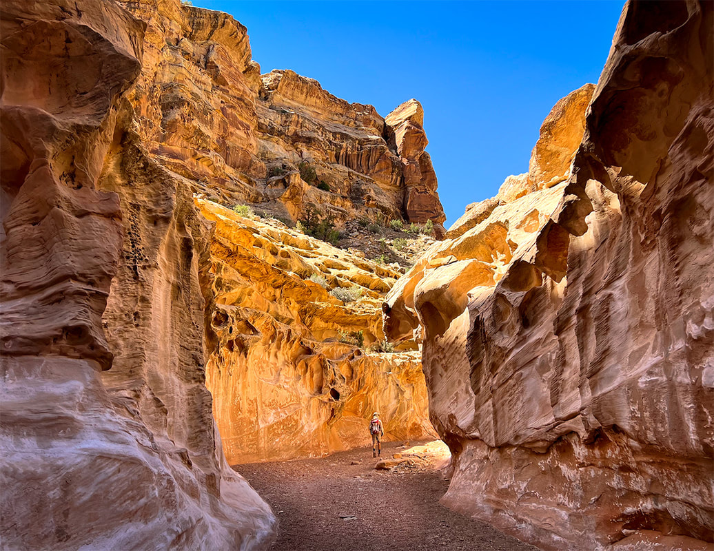
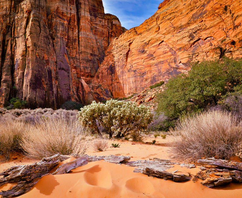
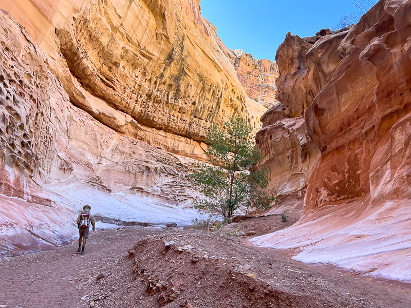
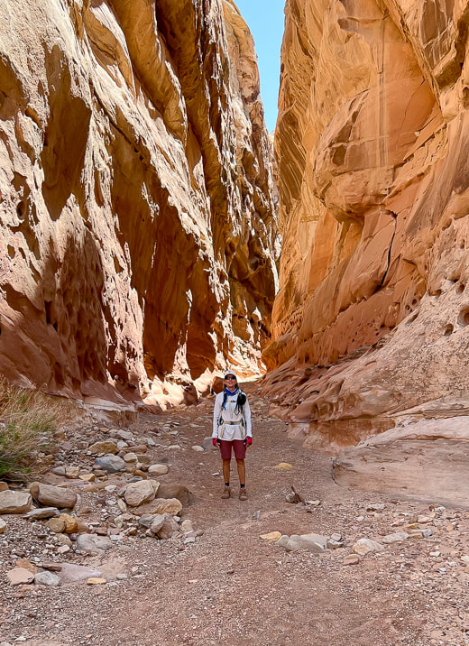
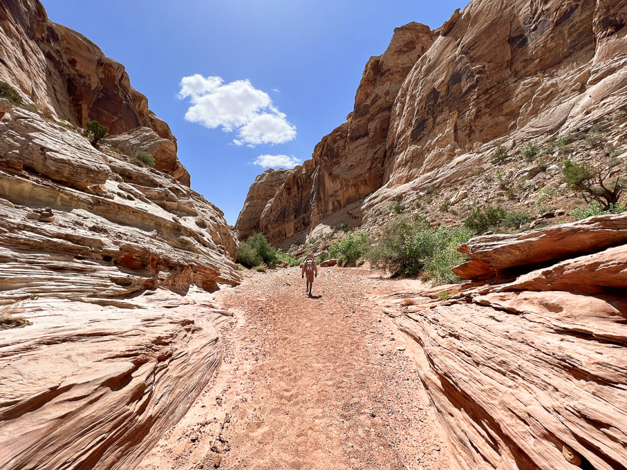
Entrance into Crack Canyon, San Rafael Reef.
Trip Stats
Location: 
Central Utah, Bureau of Land Management - Price Field Office - Southeast San Rafael Swell - Crack Canyon Wilderness Study Area.
Overview:  Penetrate the San Rafael Reef through one of its spectacular slot canyons as waters have for millions of years, with new discoveries around every corner, including a few narrows. This delightful "hands-on" hike navigates boulders, walls and slick rock.  A cool cave awaits at the mouth of Crack Canyon, if you go far enough.
Distance/Elevation gain:  We began 0.4 miles from trailhead.  Our hike = 8.0 miles round-trip.  Elevation goes from 5,600' at top to ~ 5,000' at mouth.
Difficulty:  Easy/moderate with a few Class 3 moves and one Class 3-4 on short walls and boulders (one has a bypass).
​Coordinates: Trailhead on Behind the Reef Road:  38.64315   -110.74504
Maps/Books:  Trails Illustrated #712 - San Rafael Swell - BLM - Price Field Office/Hiking and Exploring Utah's San Rafael Swell, 4th Ed., by Michael R. Kelsey.   Caltopo map of our GPS tracks at end of post.
​Directions to Trailhead:  From Green River, Utah on I-70 head west and take Hwy 24 exit toward Hanksville.  At milepost 135 on Hwy 24, follow signed road toward Goblin Valley State Park (west).  Follow this road to junction (5.1 miles); continue straight.  At 7.2 miles from Hwy 24, turn left on a good graded road (Behind the Reef Road).  Reset your odometer and travel 4.1 miles to Crack Canyon TH, passing the TH to Wild Horse Creek at 1.6 miles.  We drove the old sandy road 0.4 miles down canyon in our 4x4 truck.  High clearance 2WD ok on Behind the Reef Road.​
Date Hiked:  May 11, 2023.
Our tracks down-canyon and back, beginning in the north just off of Behind the Reef Road.
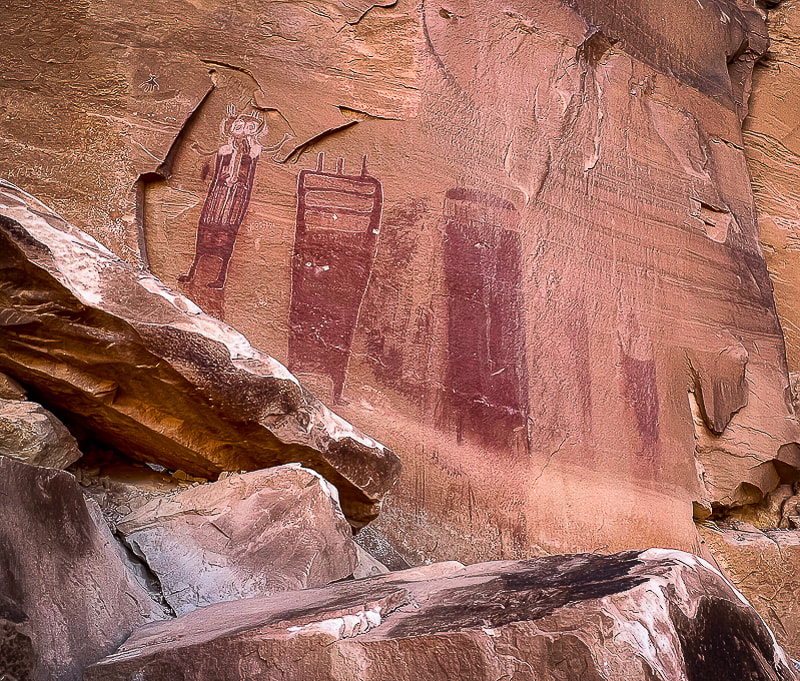
The northwest Colorado plateau's San Rafael Swell and its huge, tilted reef of sandstone has much to offer the intrepid explorer who will boldly go where not a lot of people go.  It's an extraordinary place of sublime topography and deep, dark canyons, some that contain pools to swim through.   I've heard of this area for years, especially with reference to Native American petroglyphs and pictographs.  Fred and I stayed at Goblin Valley State Park years ago to hike Canyonland National Park's remote Horseshoe Canyon to witness the amazing Great Gallery/Holy Ghost pictograph panel and dinosaur print.  Relatively unknown compared to Utah's well-visited parks like Capitol Reef, there's a lot to do and see as evidenced in Michael Kelsey's book Hiking and Exploring Utah's San Rafael Swell.

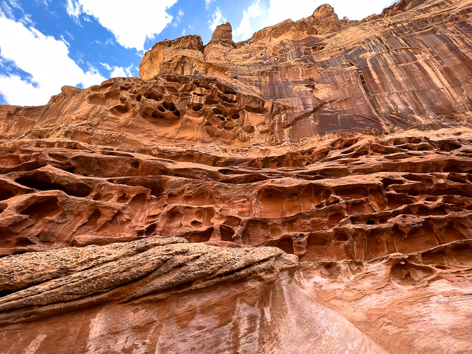
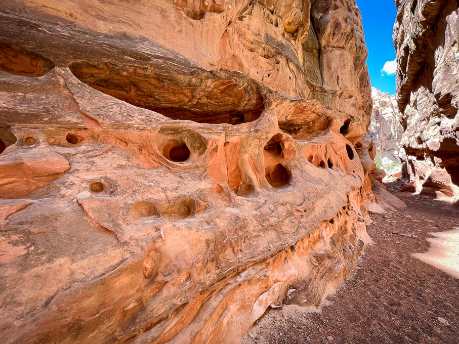
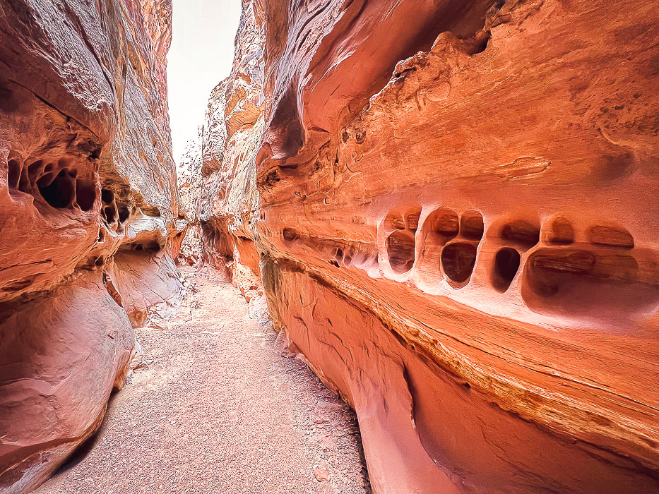
Mexican Mountain, Sids Mountain, Devils Canyon, and Muddy Creek are among the seven wilderness study areas in the San Rafael Swell.  The reef on the eastern side of San Rafael is bisected by around 30 slot canyons, many of them requiring technical climbing and navigating skills.   A few days before Crack, we went to see the amazing pictographs in Black Dragon Canyon and walked up-canyon from there past an old uranium mine.

I'm not exactly sure how Crack Canyon got its name but I can guess two reasons.  At the beginning, as the canyon begins to narrow, there is a "crack" in a tunnel ceiling, only a few feet wide.  Further down, the honeycombed walls are so tall on each side at portions there is a "crack" of sky, especially in the narrows.  What sets this canyon apart from other slots is the amount of extensive weathering in the form of honeycombs and caverns.
Features of Crack Canyon Hike
  • Minor obstacles to climb such as short walls and boulders, a log to walk to get up and down a sheer wall, and scrambling around a deep water hole. 
  • One major (in our estimation) obstacle, where a loop of webbing attached to a boulder overlooking a sheer drop of 8 feet luckily has a bypass. A portion of the webbing (see photo below) hangs down under the boulder that can be used for assistance, but you can't see that when you're standing on top of the boulder.  If you had a rope to attach, you could lower yourself down it;  it currently has a vertical Y-shaped tree limb for climbing and descending this sheer drop.  Rounding a corner, just before this obstacle, rock cairns on the left side of the canyon mark a passage up to a ledge that wraps around and above the canyon, dropping you off just down-canyon of this portion.
  • Weathered sandstone walls tower above most of the hike and the canyon squeezes you into some narrows.
  • Arrive at the intersection with trail to Chute Canyon to the west at ~ 3.0 miles (not exactly sure because my GPS had extra artifacts due to blockage of satellites) down canyon.  It's a two-mile overland hike from Crack to Chute Canyon.  I read that you need good navigational skills to do this, but the trail looked well-traveled.
  • A short steep trail at Crack's mouth ascends to a great view of the San Rafael Desert lowlands.​
​
Although there's parking at the trailhead to Crack Canyon on Behind the Reef Road, we drove our 4x4 truck ~ 0.4 miles and parked when the canyon narrowed.  It was a stellar day - azure skies with tall glowing, cavernous-weathered sandstone walls on both sides.  We encountered only eight people on this Thursday.   We ran into two older San Rafael-experienced gentlemen who recommended the Little Wildhorse Canyon/Bell Canyon loop, a bit further to the southwest.  We've got lots of plans for when we return to this unique, contorted and high-cliffed desert less-traveled.
“Standing there, gaping at this monstrous and inhumane spectacle of rock and cloud and sky and space, I feel a ridiculous greed and possessiveness come over me. I want to know it all, posess it all, embrace the entire scene intimately, deeply, totally...”
-   Edward Abbey, Desert Solitaire
Never Stop Exploring!
Picture
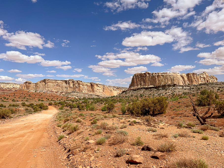
The graded Behind the Reef Road on the west side of the San Rafael Reef that takes you to Crack Canyon Trailhead.  Looking northeast toward Temple Mountain.
Picture
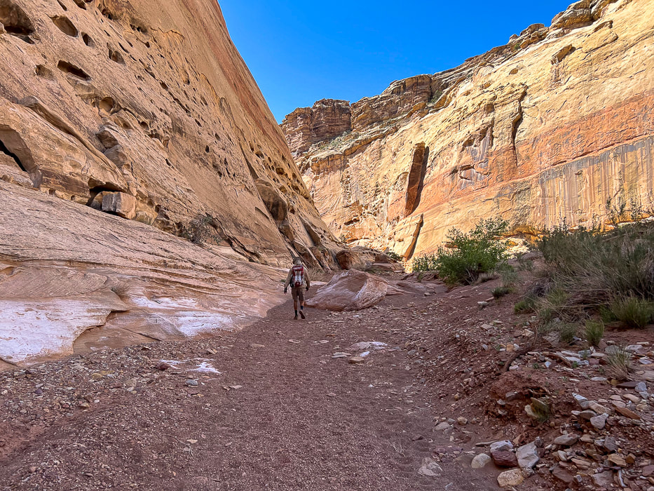
Start of hike after we drove ~0.4 miles down canyon from trailhead on Behind the Reef Road.
Picture
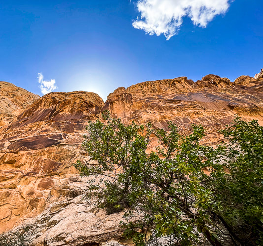
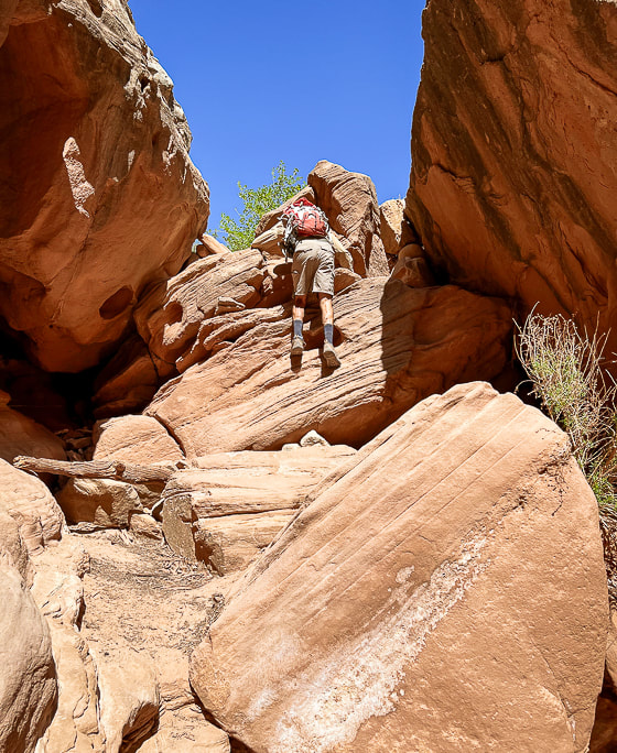
Crack Canyon's immense wall entrance.
Picture
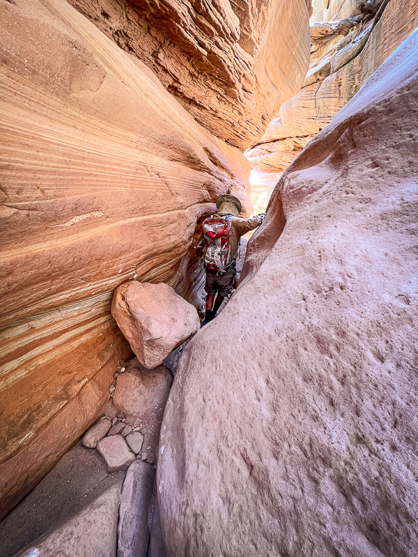
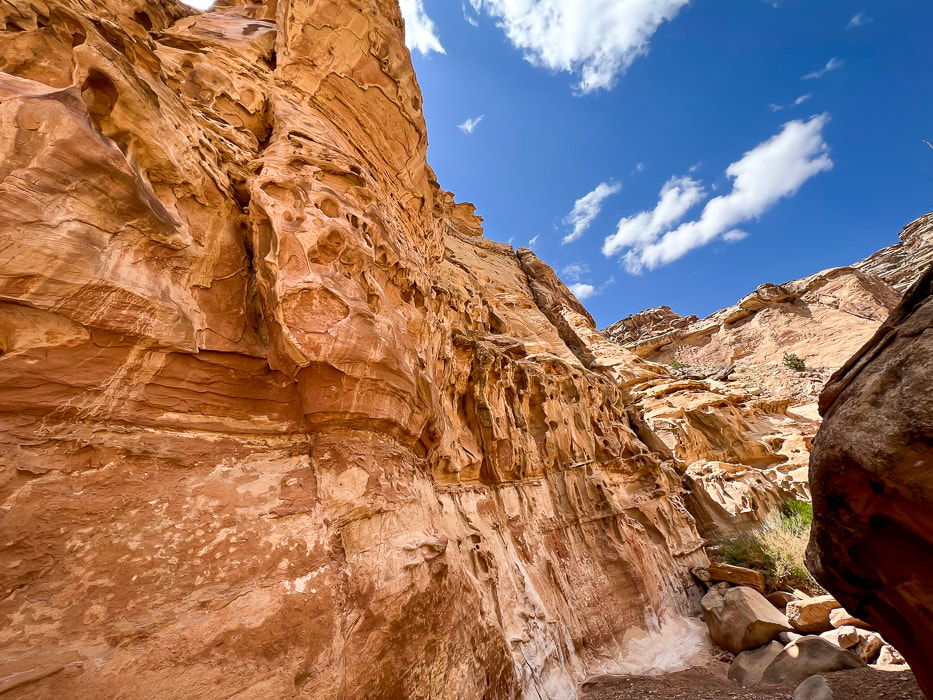
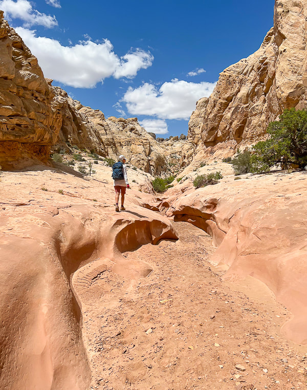
Crack Canyon starting to narrow.
Picture
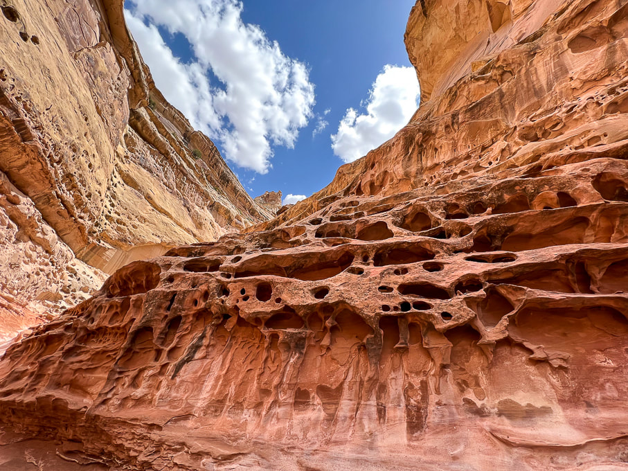
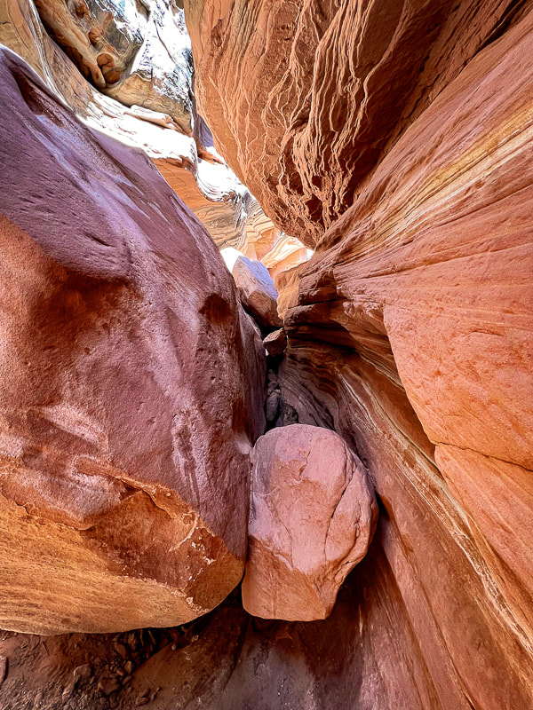
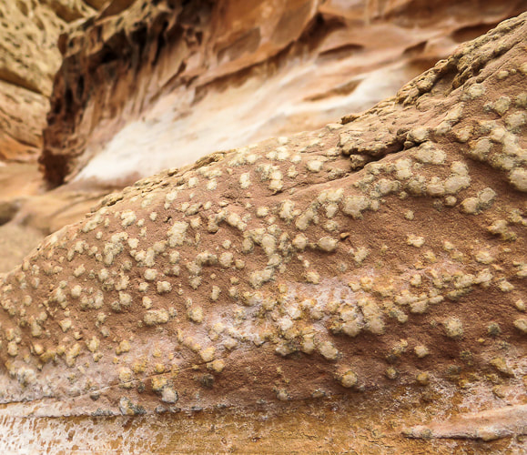
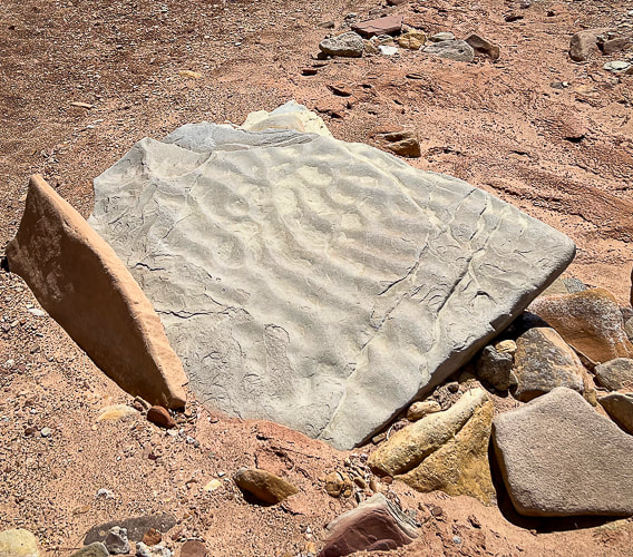
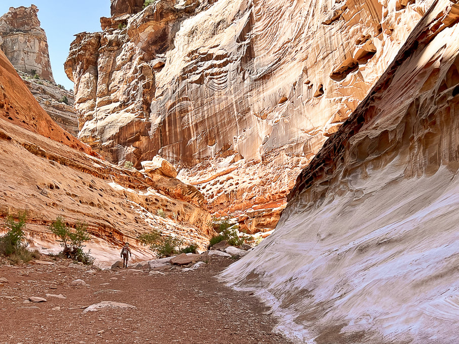
Cavernous weathering (tafoni) in sandstone caused by salt crystallization ("salt weathering") and physical processes such as wind and water weathering.  Dissolution of the calcite cement between sand grains may take place, weakening the bonds between sand grains.  The factors influencing cavernous weathering are seasonal wetting and drying, aeolian (wind-blown) salt, and water vapor.
Picture
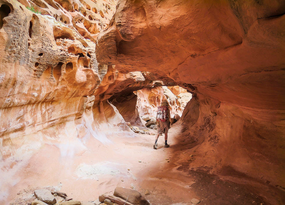
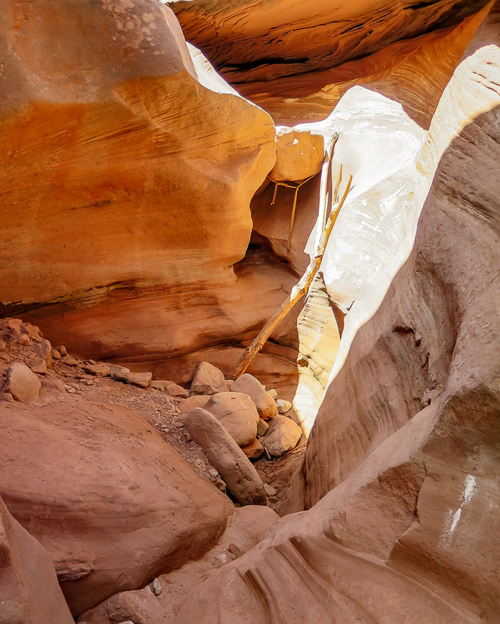
Entering "tunnel" with crack in its ceiling.
Picture
Picture
Picture
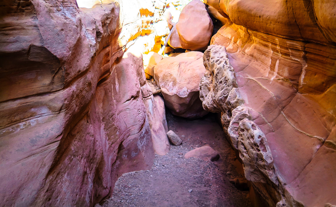
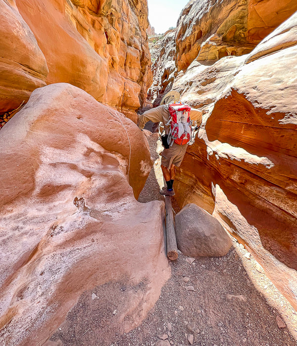
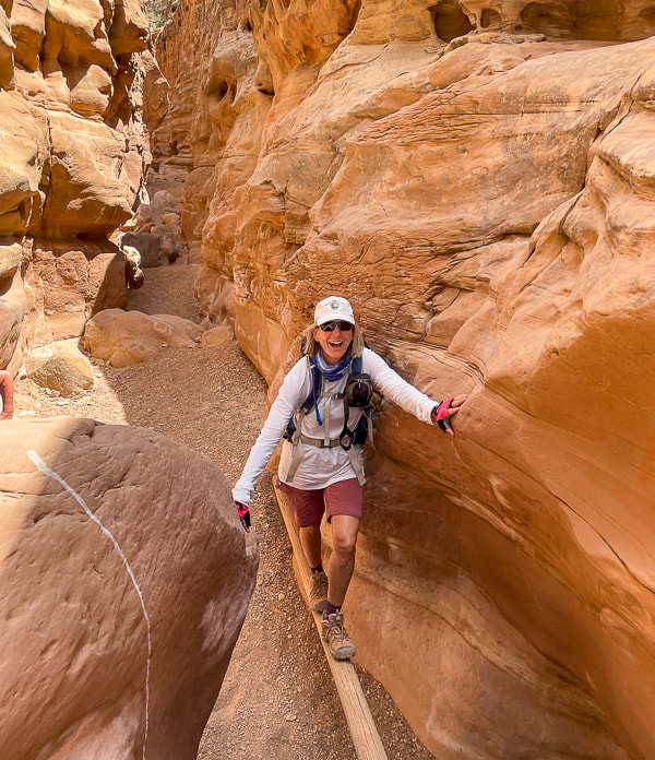
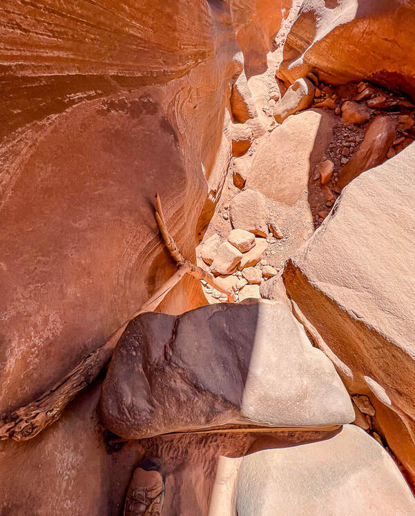
Log to ascend/descend sheer boulder wall (top of image in the sunlight).
Picture
Picture
Fun things in the canyon:  a log helps to descend a sudden drop-off.
Fred going down, Sue going up.

Picture
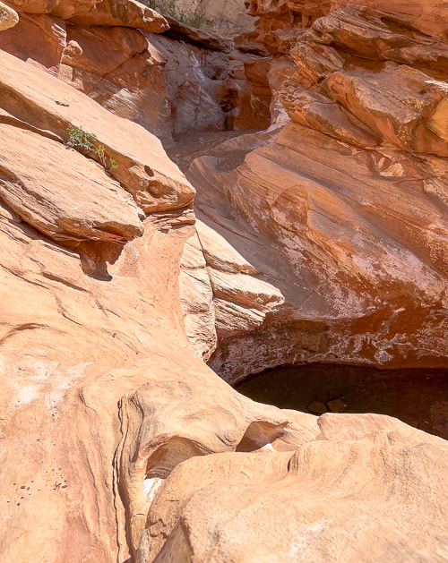
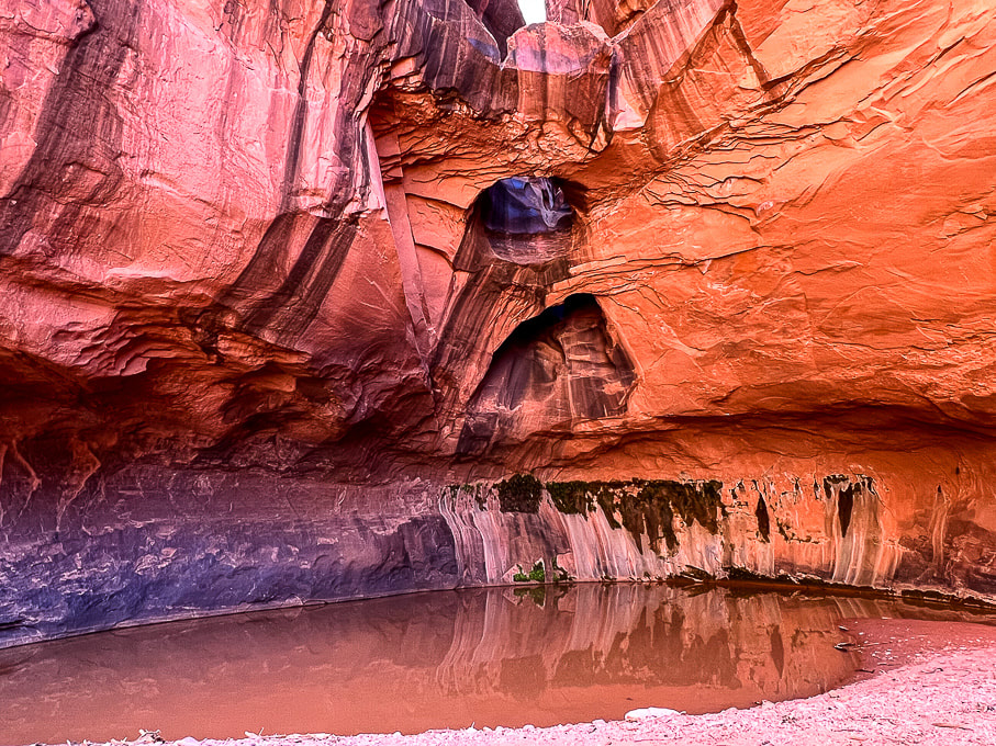
After descending a short wall above in this photo, you skirt around this pool of water walking on sandstone.
Picture
Picture
Picture
Looking at both ends of this boulder-navigating obstacle.
Picture
Climbing down short wall.
Picture
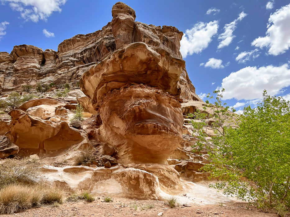
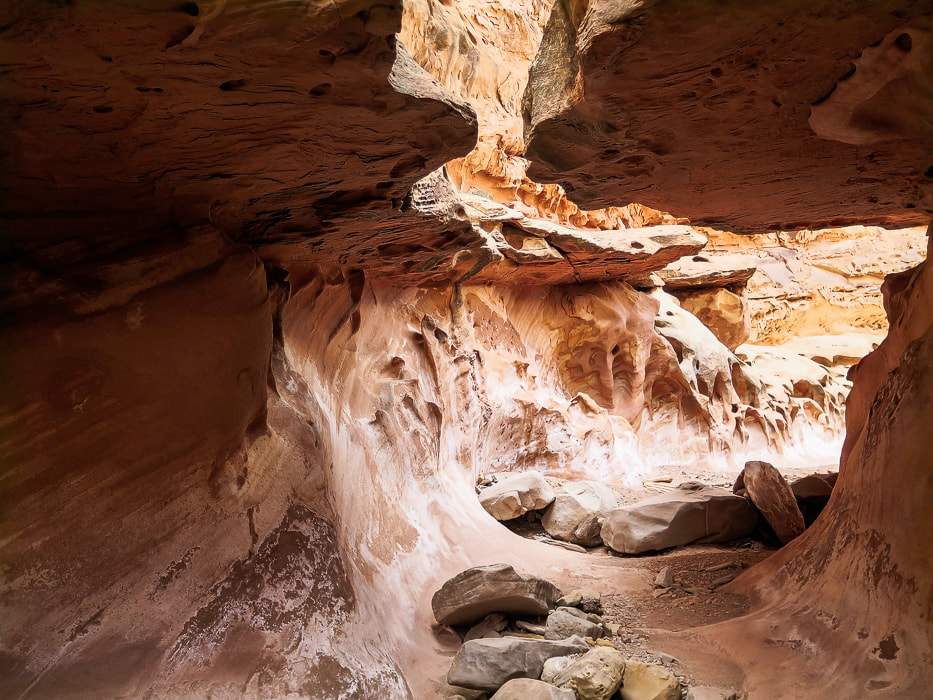
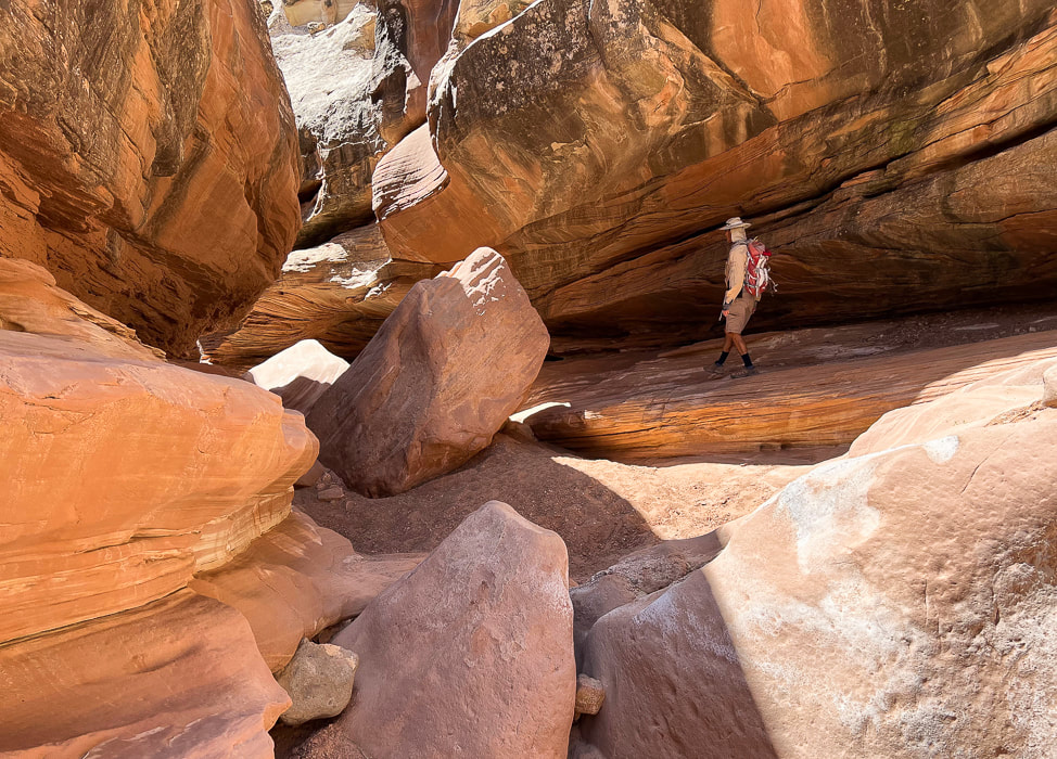
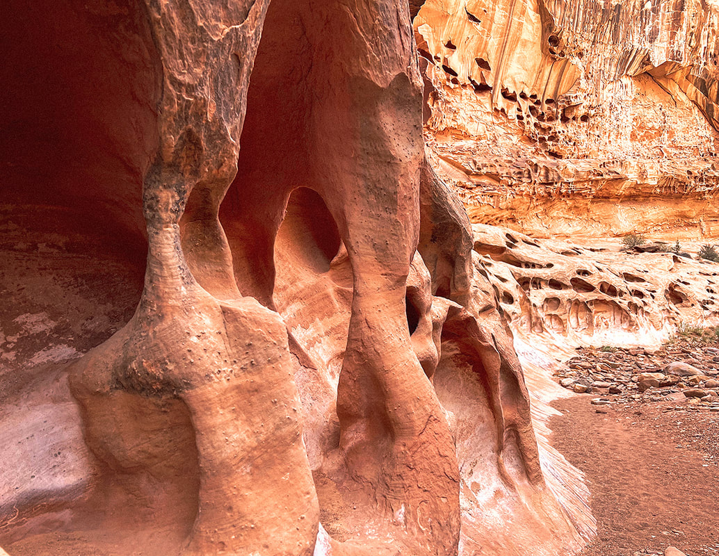
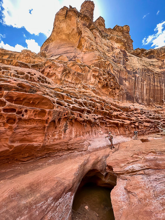
Really cool rock formations in a wide part of the canyon.
Picture
Walk by this huge alcove.
Picture
Cairned-marked up-canyon bypass around the most exposed Class 3-4 section.   The bypass is short and well-marked.
Picture
Picture
Looking down at the most difficult obstacle with tree branch to help ascend/descend and webbing around boulder (left) and view looking up-canyon of same obstacle (right).  There's a bypass around this obstacle a few hundred feet up-canyon on the east wall.  Look for cairns that lead up through a crack to a ledge.
Picture
Picture
Picture
Picture
Picture
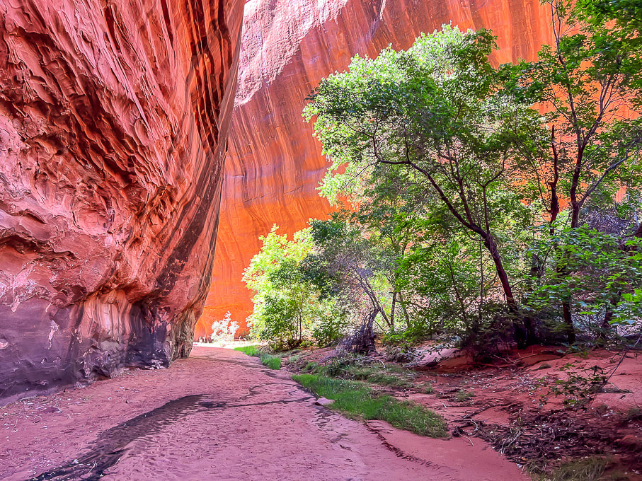
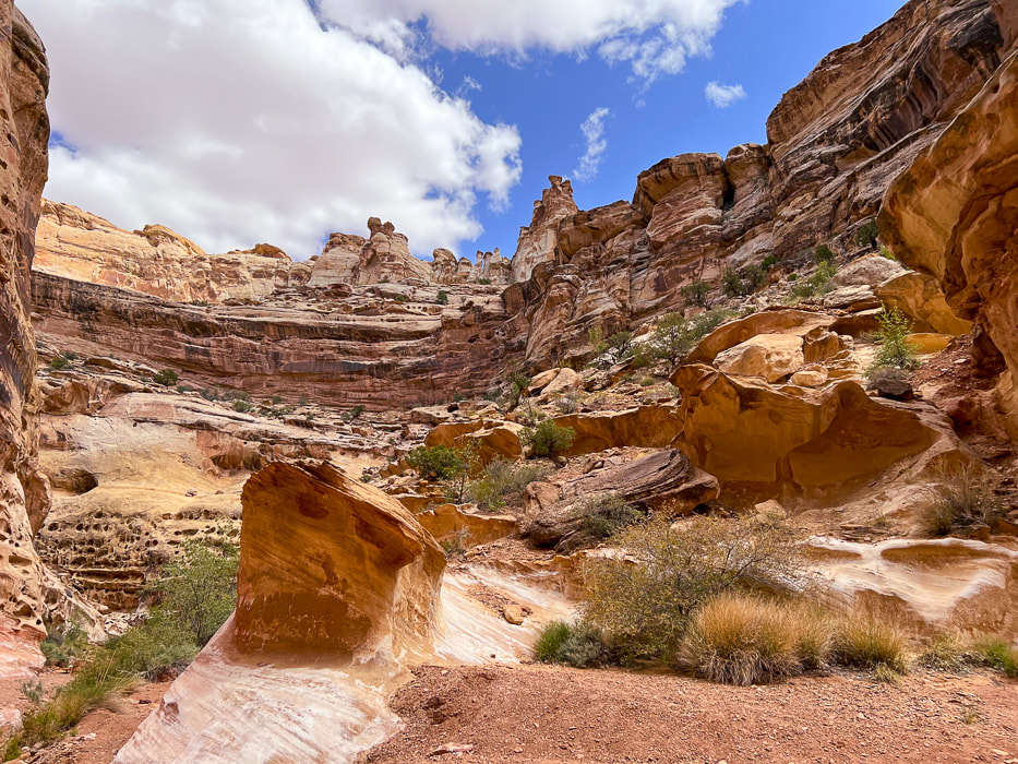
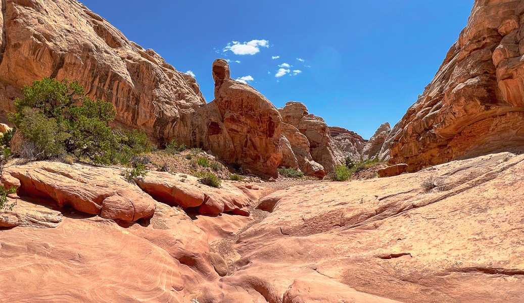
Canyon opens further down.
Picture
Picture
Picture
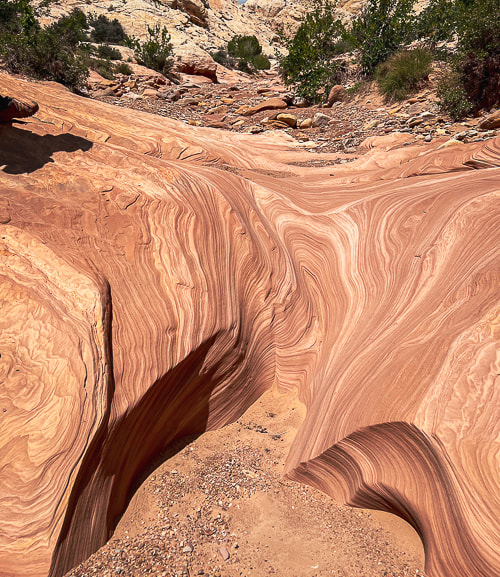
Carved slickrock at bottom of canyon.
Picture
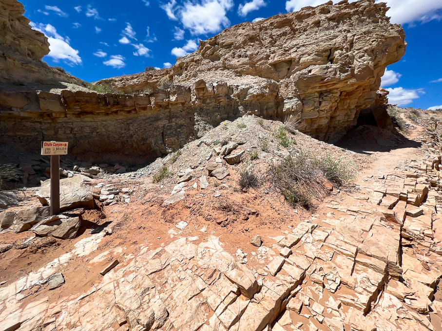
Sign at intersection of lower Crack Canyon with overland trail to lower Chute Canyon (2 miles from Crack to Chute).
Picture
Rock arrow pointing toward steep trail (above) that leads to a great lookout.  
Picture
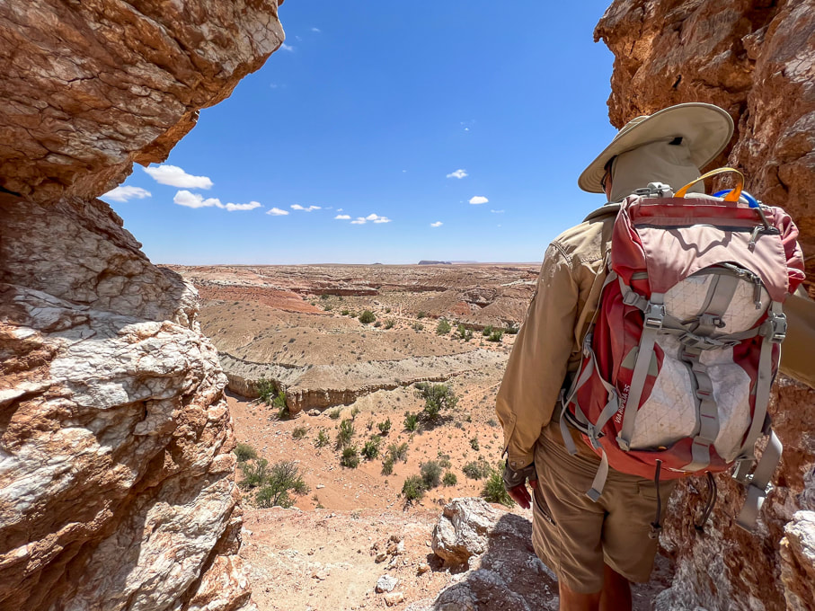
Lookout over the San Rafael Desert toward the southeast.
Picture
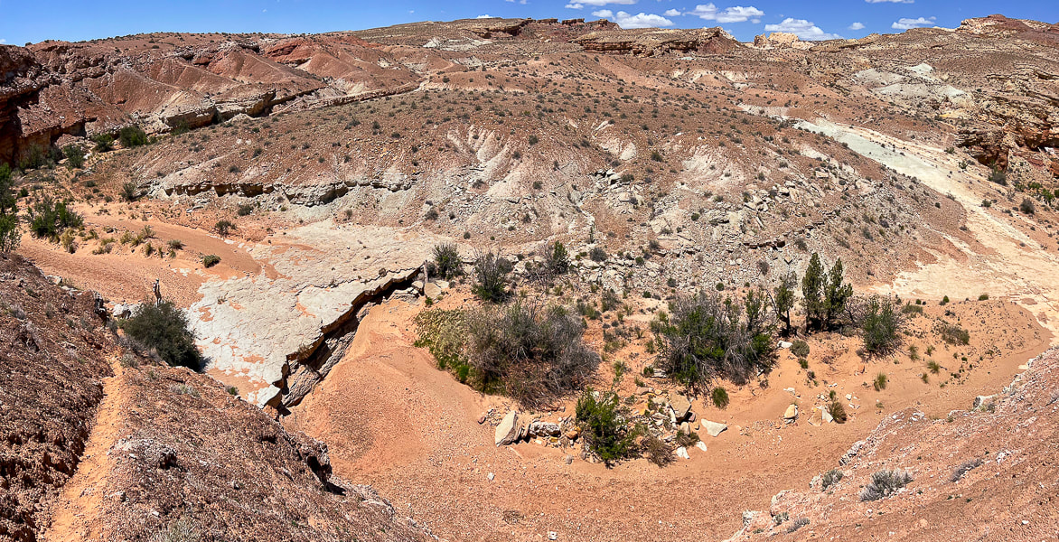
Looking down into Crack Canyon.
Picture
Heading back up-canyon.
calcite(?) concretions in sandstone
ancient ripple marks
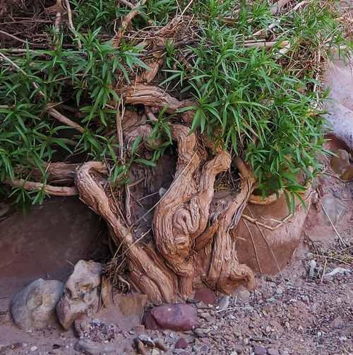
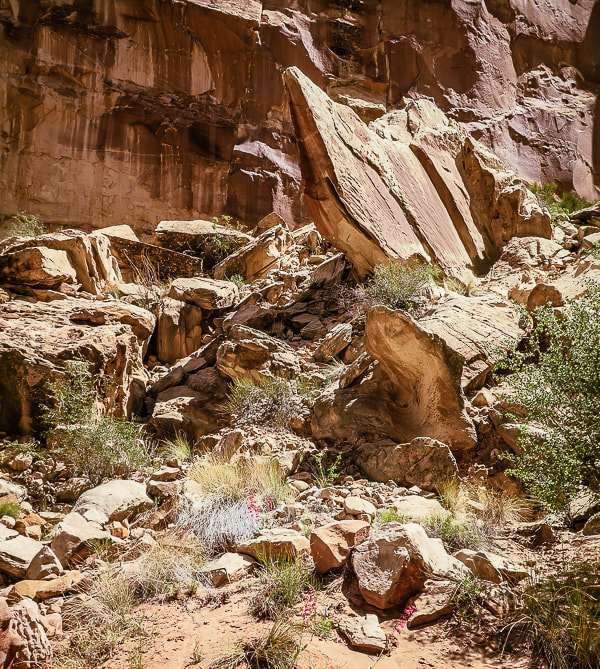
Some cool stuff on the trail.
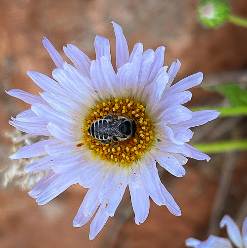
The purple flower is actually from the Red Mountain Primitive Trail near St. George, Utah.
Picture
Picture
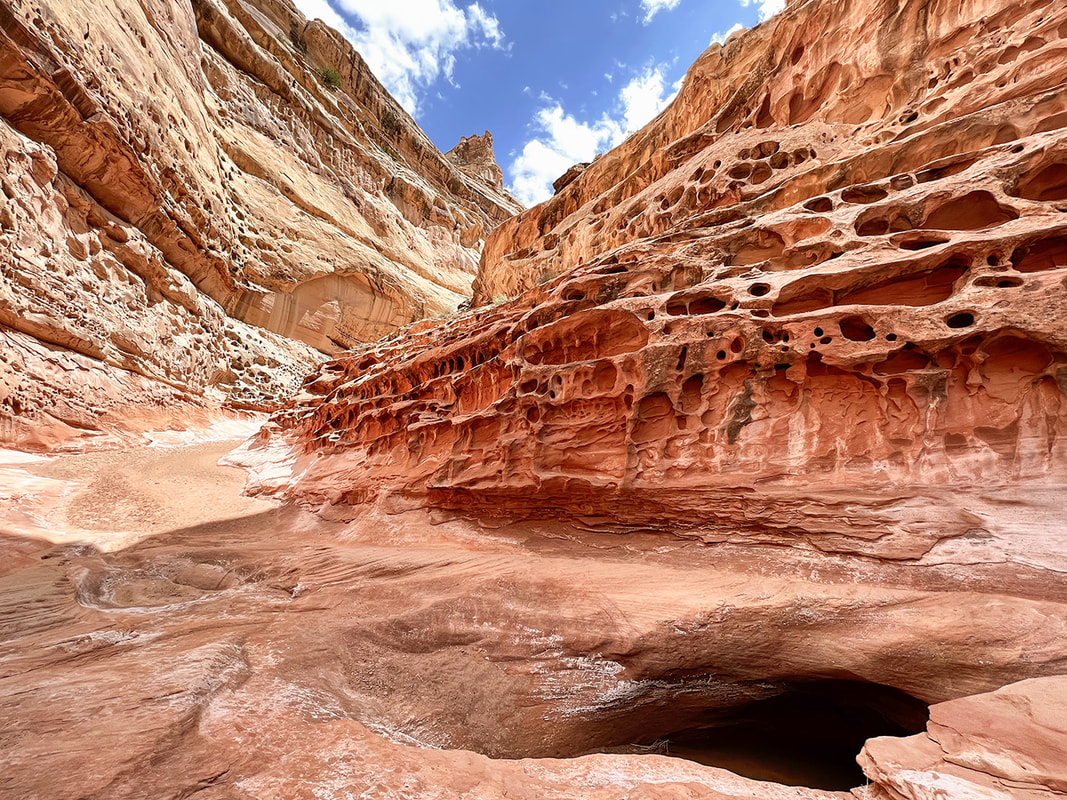
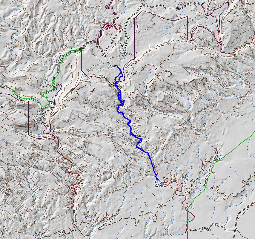
North points straight up - beginning of hike at top just south of Behind the Reef Road (CR 1016):  hike down canyon SSE direction.
We hiked to the mouth of Crack, just beyond the intersection with trail leading to Chute Canyon (next canyon on the left), so a loop could be done.
6 Comments
James Ponder
6/25/2023 09:09:25 am

Thanks again, Sue and Fred, for taking us along on your incredible adventures to the fabulous, remote rock imagery sites you visit. Your photographs and words put us front and center in the quest for adventure and inspire us to get outside and explore the Native sites near us. You and your work are very much appreciated!

Reply
Sue link
6/25/2023 10:53:37 am

Thanks James for your awesome comment! Makes me want to keep doing these posts because they might be inspirational to others so I really appreciate your enthusiastic words. By the way, I just ordered the book Ancient Footprints of the Colorado River by Figueroa! It has great ratings so I am really looking forward to reading it - thanks for your suggestion. Soon will be writing about the Fremont State Park petroglyphs in Utah....

Reply
Linda Paul link
6/25/2023 09:53:02 pm

As always, Sue, your images leap off the screen and grab my heart. And the wealth and breadth of knowledge that you convey in an organized and delightfully entertaining manner is outstanding. When reading one of your posts, I always think, she should collect these in a coffee table book. (Or a scaled down hiking guide.) But, I understand the complexities in that endeavor.

Just keep posting for your loyal followers to enjoy.

Reply
Sue link
6/26/2023 07:27:16 am

Hi Linda
Thanks for another one of your stellar comments. My favorite part of making these posts is working on the photographs, I do take a lot of time to do them. And the writing doesn't come as easily as it does to you but they are FUN to create! I really appreciate your feedback, keeps me motivated. Making a book sounds like too much work - but I'm sure you don't regret making your book! OK I will keep trying my best!

Reply
Laura Hubbard
6/28/2023 11:06:38 am

Sue -I love your posts. I pour over the details. I hope to retire in December and begin my own adventures -likely including many of your recommendations. Thanks for keeping this desk jockey inspired.
Laura

Reply
Sue link
6/28/2023 12:01:31 pm

Laura,
Wow thanks so much for your comment! It helps me to keep going on these posts. Being luckily retired, I forget how the "real" world of working is. Fred and I are lucky but we can't take the time for granted - we sometimes struggle with motivation to get out that door on a hike. I am really happy that some of our adventures inspire others. I really appreciate your feedback. Sounds like retirement is coming soon - and then you'll be off doing fun things!

Reply


Leave a Reply.

    Categories

    All
    Arizona Hikes
    California-desert-hiking
    California-desert-hiking
    Idaho Summits
    Nevada Hikes
    Petroglyphspictographs
    Snowshoe Hikes
    Southern Utah Hikesbikes

    To Subscribe to Explorumentary adventure blog and receive new posts by email:

    submit
    Picture
    Sue and Fred
    Picture

    About this blog

    Exploration documentaries          –  "explorumentaries"  list trip stats and highlights of each hike or bike ride, often with some interesting history or geology.  Years ago, I wrote these for friends and family to let them know what my husband, Fred and I were up to on weekends, and also to showcase the incredible land of the west.  
    Picture
    Happy Spring!
    Picture

    About the Author
    Sue Birnbaum

    A  trip to Jumbo Rocks Campground in Joshua Tree National Monument 40 years ago sparked my passion for hiking, exploring, and learning about desert ecosystems.  I met my husband Fred on Mt. San Jacinto.  We've explored the American West together; we love this land and I hope to inspire you to get out and explore through my photographs and trip descriptions.
    In 1992, Ray Wilson and I conceived the first Cactus to Clouds hike which climbs over 10,000 feet in one day to the summit of Mt. San Jacinto near Palm Springs, California.
    CACTUS TO CLOUDS HIKE 
    READ MORE
    ABOUT SUE
    Some of my favorite websites:
    ​

    ​Awkward Botany
    ​amateur botany for the phytocurious

    Bird and Hike

    ​"Intended to encourage people to visit, learn about, and fall in love with the desert."
    ​

    Draw and Shoot
    Beautiful Photography

    Daring Dayhikes
    "Interesting places you can visit with a daypack."  Terrific Tucson and other desert hikes and East Coast, too.


    Earthline: The American West
    Debra "writes to extol our beloved Earth." Detailed hike info, excellently written.
    ​

    Geologypics.com
    Geology and Geologic Time through Photographs

    Glenn Suokko
    Vermont artist's paintings "inspired by a place based on the land .... drawn to painting the representation and abstraction of nature."

    In the Company of Plants and Rocks
    ​A natural history blog about botany, plant ecology, and geology.


    MishMoments:  Joy of Photography
    this website is "
    about capturing that special moment in life’s journey and making the most of the time we have."

    Nature's Depths
    Walking through nature with John Palka, a neuroscientist who loves plants and ponders big questions.


    Rangewriter - What Comes Next?
    ​Linda's excellent writing brings to life her interesting adventures, "curiosities and thoughts", post-retirement.

    SeekingLost - Hiking and Backpacking Adventures.

    Stav Is Lost- Unconventional, out-of-the way hikes in the American West.


    Uprooted Magnolia
    ​Leah Yetter's beautiful "photo journal on life, love, and the spirit of Wyoming."

    Archives

    April 2025
    March 2025
    January 2025
    December 2024
    November 2024
    October 2024
    September 2024
    August 2024
    July 2024
    June 2024
    May 2024
    April 2024
    March 2024
    January 2024
    December 2023
    November 2023
    October 2023
    September 2023
    August 2023
    July 2023
    June 2023
    May 2023
    April 2023
    February 2023
    January 2023
    December 2022
    November 2022
    October 2022
    September 2022
    August 2022
    July 2022
    June 2022
    May 2022
    April 2022
    February 2022
    January 2022
    December 2021
    November 2021
    October 2021
    August 2021
    July 2021
    May 2021
    March 2021
    February 2021
    January 2021
    November 2020
    October 2020
    August 2020
    July 2020
    June 2020
    April 2020
    March 2020
    February 2020
    January 2020
    November 2019
    October 2019
    September 2019
    August 2019
    July 2019
    June 2019
    May 2019
    April 2019
    February 2019
    December 2018
    November 2018
    October 2018
    September 2018
    July 2018
    June 2018
    May 2018
    April 2018
    March 2018
    February 2018
    January 2018
    December 2017
    November 2017
    October 2017
    September 2017
    August 2017
    July 2017
    June 2017
    April 2017
    February 2017
    November 2013
    August 2013
    July 2013

HOME

Cactus to Clouds Hike
More Quotes
​
Mary Oliver Poems
Ann Zwinger Quotes
HIKES BY STATE

Idaho Hikes
Utah Hikes/Bikes
​Arizona Hikes
​California Desert Hikes
​Wyoming Hikes
​Nevada Hikes

BLOGS

Adventure Blog
Women and the Land
GEAR REVIEWS
FIT AFTER 50
Fred Birnbaum
Dave Brasuell
Bus' Little Black Book
​Mike Carlson
​Ray Wilson
​Marcia Bondy
Bryan Krouse
​Maria Keezer
​Tim Clemens
​Doug Traubel
​Brian Holgate
​
Becky Borczon Blake
​Jennifer Cera and
​Sue Birnbaum

​Vance Powell
​Boise Cross Fit Masters Ladies
​Vickie Kearney

GALLERY

Desert Plants
Nature
Earth + Sky
Urban
Water
Patriot 
​Orchids
Boise
​
  ABOUT
    Contact

​
© 2017 - 2025 by Sue Birnbaum.  Photos on this website are the sole property of Sue Birnbaum unless otherwise indicated.  Please receive permission before publishing my trip reports and photos.
I try my best to be accurate with my hike descriptions; please research your adventures, always bring a map and compass and know how to read them, be prepared!  All of these hikes can be dangerous; hike at your own risk.  ALWAYS carry the Ten Essentials with you on hikes. 
​Please feel free to contact me with comments or questions, or if you see any errors that need attention.
Thank-you for stopping by!


EXPLORUMENTARY.com
  • Home
    • Cactus to Clouds Hike
    • More Quotes
    • Ann Zwinger Quotes
    • Mary Oliver Poems
  • Hikes by State
    • Southern Utah
    • Idaho
    • Arizona
    • California Desert
    • Nevada
    • Wyoming and New Hampshire
  • Petroglyphs and Pictographs
  • BLOG
    • Adventure Blog
  • GALLERY
    • DESERT PLANTS >
      • Beavertail cactus
      • Brittlebush
      • Christmas Cactus
      • Arizona Barrel Cactus
      • Parry's penstemon
      • Agave
      • Arizona Rainbow Hedgehog
      • Claret Cup Hedgehog
      • Desert Agave
      • Palmer's Penstemon
      • Silver Cholla
      • Cristate Saguaro
      • Indian Paintbrush
      • Ocotillo
      • Santa Rita Prickly Pear
      • Spiny Cliffbrake
      • California Barrel Cactus
      • Engelmann Prickly Pear
      • Velvet Mesquite
      • Joshua Tree
      • Buckhorn Cholla
      • Hedgehog Cactus
      • Fishhook cactus
      • Thompson's Woolly Locoweed
    • NATURE
    • BOISE
    • EARTH + SKY
    • URBAN
    • WATER
    • PATRIOT
    • ORCHIDS
  • Fit After 50
    • Brian Holgate
    • Fred Birnbaum
    • Dave Brasuell
    • Bus' Little Black Book
    • Mike Carlson
    • Ray Wilson
    • Bryan Krouse
    • Vickie Kearney
    • Maria Keezer
    • DOUG TRAUBEL
    • Boise Cross Fit Masters Ladies
    • Tim Clemens
    • Marcia Bondy
    • Becky Borczon Blake >
      • Becky B Downtown
    • Jennifer Cera and Sue Birnbaum
    • Dave Brasuell
    • Vance Powell
  • Contact