EXPLORUMENTARY
  • Home
    • Cactus to Clouds Hike
    • More Quotes
    • Ann Zwinger Quotes
    • Mary Oliver Poems
  • Hikes by State
    • Idaho
    • Southern Utah
    • Arizona
    • California Desert
    • Nevada
    • Wyoming
  • BLOGS
    • Adventure Blog
    • Women and the Land
  • GALLERY
    • DESERT PLANTS >
      • Beavertail cactus
      • Brittlebush
      • Christmas Cactus
      • Arizona Barrel Cactus
      • Parry's penstemon
      • Agave
      • Arizona Rainbow Hedgehog
      • Claret Cup Hedgehog
      • Desert Agave
      • Palmer's Penstemon
      • Silver Cholla
      • Cristate Saguaro
      • Indian Paintbrush
      • Ocotillo
      • Santa Rita Prickly Pear
      • Spiny Cliffbrake
      • California Barrel Cactus
      • Engelmann Prickly Pear
      • Velvet Mesquite
      • Joshua Tree
      • Buckhorn Cholla
      • Hedgehog Cactus
      • Fishhook cactus
      • Thompson's Woolly Locoweed
    • NATURE
    • BOISE
    • EARTH + SKY
    • URBAN
    • WATER
    • PATRIOT
    • ORCHIDS
  • Fit After 50
    • Brian Holgate
    • Fred Birnbaum
    • Dave Brasuell
    • Bus' Little Black Book
    • Mike Carlson
    • Ray Wilson
    • Bryan Krouse
    • Vickie Kearney
    • Maria Keezer
    • DOUG TRAUBEL
    • Boise Cross Fit Masters Ladies
    • Tim Clemens
    • Marcia Bondy
    • Becky Borczon Blake >
      • Becky B Downtown
    • Jennifer Cera and Sue Birnbaum
    • Dave Brasuell
    • Vance Powell
  • About
    • CONTACT

Lucky Peak Hike - The Ridge Less Traveled

4/1/2019

4 Comments

 
We put our own spin on Robert Frost's sentiments in his poem, "The Road Not Taken," and hiked a ridge less traveled to summit Lucky Peak in the Boise River Wildlife Management Area, and that made all the difference.

Related - The 4 "Grand Slam Peaks" in Boise National Forest: 
Mt. Heinen:  Grand Slam Peaks Completed!
Kepros Mountain Hike
Cervidae Peak - Southeast Ridge 
​Lucky Peak Hike - Winter Ascent
Lucky Peak:  The Ridge Less Traveled II
Picture
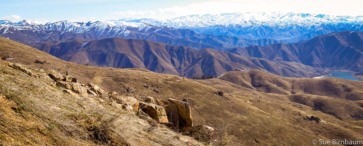
On Lucky Peak's (AKA Shaw Mountain) southeast ridge looking toward the northeast at Boise National Forest and
​Lucky Peak Lake
Picture
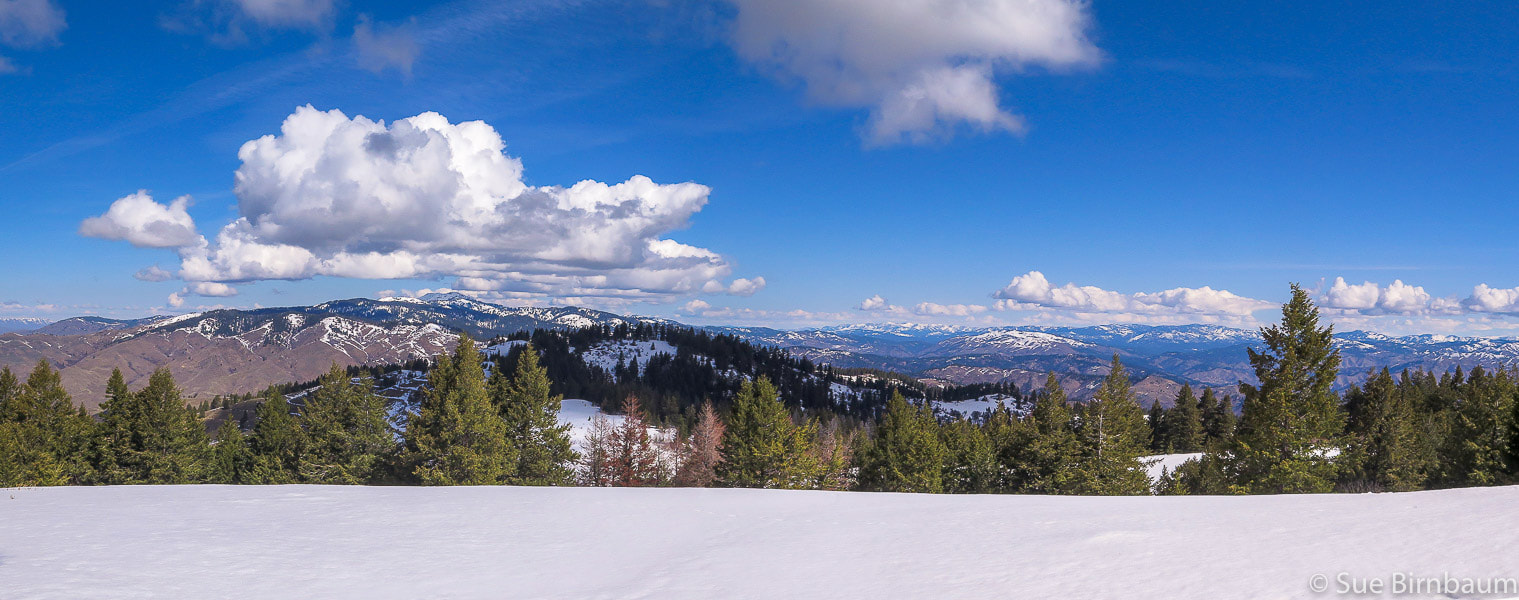
View from snow-covered Lucky Peak summit (5,904') of Shafer Butte to the northwest
I shall be telling this with a sigh
Somewhere ages and ages hence:
Two roads diverged in a wood, and I--
I took the one less traveled by,
And that has made all the difference.
         -  Robert Frost, excerpt from The Road Not Taken
Trip Stats
  • Begin at the Boise River Wildlife Management Area building just past Highland Summit on ID-21.  Hike up road along creek; at intersection with road that leads to Adelmann Mine, mount southeast ridge that eventually intersects with Shaw Mountain Road, then stay on ridge to Lucky Peak summit.
  • Overview:  This southeast approach to Lucky Peak (AKA Shaw Mountain) begins at the Boise River WMA following a dirt road that travels northwest along creek with burned vegetation from the Mile Marker 14 Fire July 2016.  It has less usage and more trees than the Homestead Trail approach from the southwest.  It passes an intersection to a road leading to Adelmann Mine, then climbs ridge to the summit.  Elk herds and deer often present.  Spectacular views of Treasure Valley and Boise National Forest close to Boise.  Side trip to Adelmann Mine with historic buildings not far from main road.
  • Difficulty:  moderate with no snow; moderate - strenuous with snow.  Route-finding skills needed if going off road and onto ridge.
  • Elevation gain:  Boise River Wilderness Management Area (trailhead) at 3,624':  Lucky Peak elevation 5,904' = ~ 2,280 feet.
  • Lucky Peak Coordinates:  43°36'18.82"N, 116°03'39.98"W.  Boise River Wilderness Management Area Coordinates:  43°34'26.7"N,  116°1'18.62"W
  • Map:  USGS Lucky Peak quad, 7.5-min series
  • Distance:  7 miles out and back.
  • Directions to trailhead:  Boise River WMA is on the west side of ID-21, 6.8 miles from E. Warm Springs Rd. and ID-21 intersection east of Boise.  It is a left hand turn to a small parking area with a gate just after Highland Valley Summit if you are heading north.
  • Geology:  Granite of Idaho Batholith, Cretaceous age 117 - 62 million years ago.
  • History:  Adelmann Mine's primary mineral was gold.​
Picture
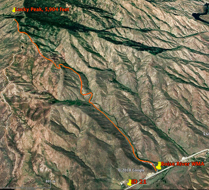
Route to Lucky Peak summit from Boise River Wildlife Management Area building on ID-21
We gain ridge just after intersection to the road to Adelmann Mine at 4,800 feet, a little less than 2/3 distance of hike,
climb on ridge 1,100 feet to summit. This route intersects with E. Shaw Mountain Rd. as seen on this map, and then follows it to Lucky Peak summit.
Many years ago, when we lived in New Hampshire, Fred would read to me Robert Frost poems in front of an old fireplace, lit with crackling orange flames burning wood collected locally.  New England winter nights were cold and damp and the thick forest outside our door mysterious, so the warmth was comforting as we settled in with pillows on a wide-planked wooden floor and The Poetry of Robert Frost, a thick volume with a cover photo of a low rock wall extending over a green field.  Our favorite poems were "After Apple Picking" and "Stopping By Woods on a Snowy Evening."  The Robert Frost Farm, where Frost wrote his early poems was just 20 minutes away in Derry, New Hampshire.  Through our explorations into the New Hampshire woods, we could directly experience the moods and scenes of Frost's poems.

Frost's most famous poem, "The Road Not Taken" is a testament to his choosing the unconventional road of writing poetry instead of farming; he put some effort into the latter career, but found passion and talent for the former.  Farmers were expected to work hard and rise early but Frost seldom fit that expectation.  He chose a different path, and grateful that he did, for we have his writings that reflect his deep connection to the nature and land of New England.

Unlike the extensive and deep, dark woods of New England, the summits near Boise are open; landmarks are easily seen to guide off-trail hiking.  With a good topo map in hand, we have taken several ridges to the summit of Lucky Peak, making our own path to see what we can discover along the way.

In winter, we like to hike Lucky Peak using the southeast ridge approach that begins at the Boise River Wilderness Management Area building on Idaho Highway 21.  Sometimes we are able to get to the summit - sometimes not because of weather.  In February, a snowshoe hike that started with sparse snow flakes quickly developed into a snowstorm with limited visibility.  The storm became worse as each minute passed, and by the time we got up to the intersection with the road to Adelmann Mine, breaking trail through 8 inches of snow, the visibility was about 60 feet. Instead of pressing on into this white void and deep snow to the summit, another 1,100-foot climb, we turned around to find our way back down, the snow working quickly to fill our snowshoe tracks.  When hiking the ridge, we use Douglas Firs that are just to the right of the ridge as a landmark.
Picture
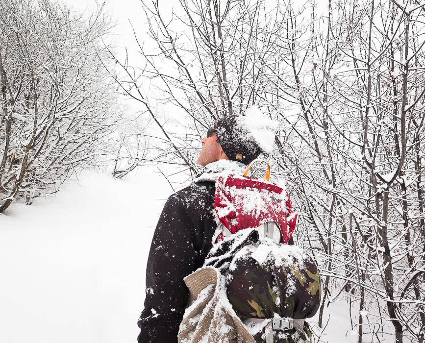
Fred at intersection of road leading from Boise River Wilderness Management Area buildings and trail to Adelmann Mine in February snowstorm
What a difference 5 weeks can make!  We hiked the same route In March and summited Lucky Peak under blue skies without snowshoes on packed snow; it was as if none of the February storm had happened.

This ridge approach begins just after the mining apparatus up the hill from the Adelmann Mine junction (see previous post, Lucky Peak Hike - Winter Ascent).  Before we get onto the ridge, we follow a dirt road from the WMA building to the junction.  It's a direct (and therefore steeper) climb to the summit up the southeast ridge that intersects with Shaw Mountain Road.  Spectacular views of Treasure Valley and the Owyhee Mountains to the south, the white-capped mountains of the Boise National Forest and the teal-colored and basalt-lined Lucky Peak Lake to the north make this ridge route more fun than continuing up road that leads up over the mine and through the north side of Lucky through the forest to the summit.
Picture
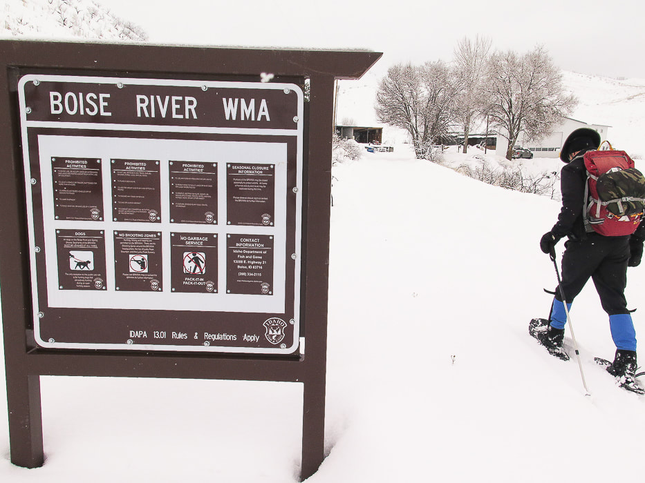
Boise River WMA on Idaho Highway 21, just past Highland Summit as you drive north from Boise
No snowfall at beginning of hike, but that quickly changed and got progressively worse

Picture
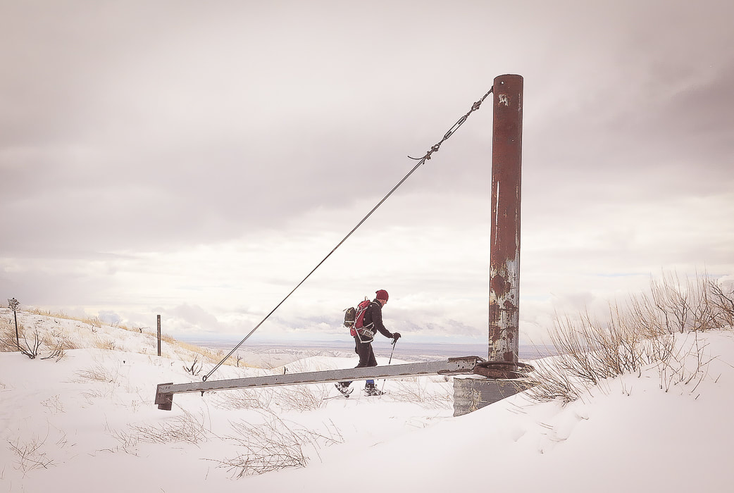
Structure on ridge between Black Hornet and Adelmann Mines, on last year's Lucky Peak winter hike
Shortly after this, we start climbing ridge to summit of Lucky Peak
Picture
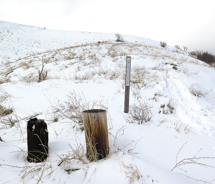
Where we leave road to ascend ridge - this hike on a day with clearing storm
Rewards for climbing the ridge instead of the road abound.  First of all, finding your own way is a challenge.  The off-trail route for this hike is not difficult - you keep going up, but you don't want to waste too much time recovering from a loss in elevation.  Also, you often see things that you wouldn't see following someone else's tracks.  Thousands of elk tracks, making deep divots in the moist, squishy soil made our steep ascent to the ridge slow and bumpy, but once onto it, we found a faint human trail.  The first wildflowers of the season were poking through last year's dead grasses - spots of bright green among thick faded brown mats.  Up higher and onto the snow, our route intersected a wide elk trail - deep hoof prints heading down a steep ravine.  ​Last year, we witnessed a huge herd of elk, led by one bull elk with enormous antlers traverse a large hillside to a ridge top while we approached Lucky Peak summit from a different ridge to the east.  For a few moments, the bull elk's silhouette stood on the ridge against the sky, and then was gone.
Once, a large, fast-moving shadow floating over a gulch and then ascending a ridge caught my eye.  In the azure blue sky a golden eagle slowly flapped its long wings, a dark and graceful presence moving effortlessly.  
Picture
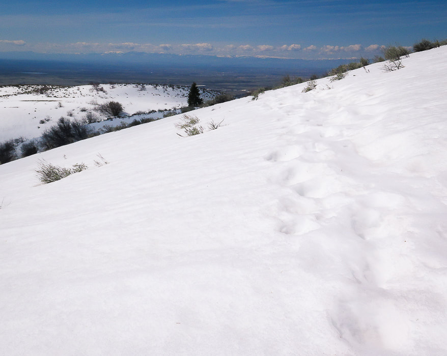
We intersected a trail of elk tracks on our March Lucky Peak summit hike
In March, we navigated over the snow easily, barely sinking but still making discernible prints on the surface as we climbed over three rises to meet with Shaw Mountain Road, a birdhouse at its intersection.  The Douglas fir trees on the right side of the ridge have become familiar now, and there is one huge Doug fir that stands out from the rest, a sentinel that looks to the rugged snow-capped mountains of the Boise National Forest.  The view from Lucky Peak summit is awe-inspiring:  Shafer Butte and Bogus Basin Ski area to the northwest, and Boise is seen in the flat darkness of the Treasure Valley.
Picture
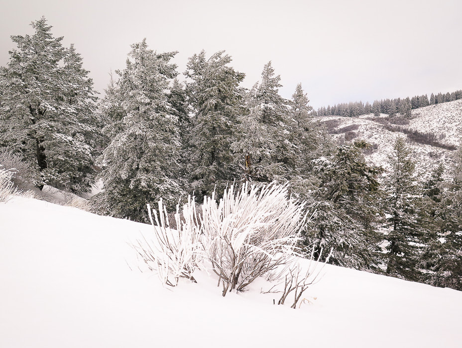
Douglas fir trees as guide to ascending southeast ridge to Lucky Peak
Picture
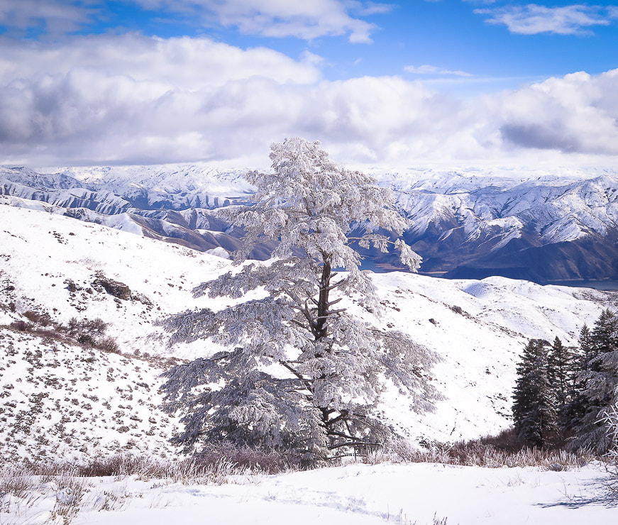
On southeast ridge to Lucky Peak looking north to Boise National Forest
Picture
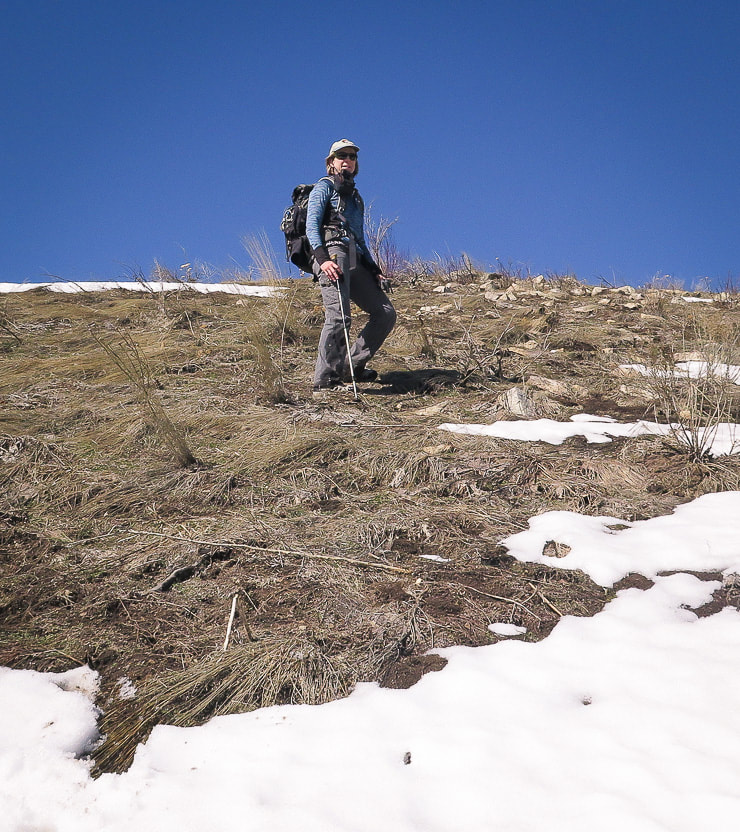
Taking the ridge less traveled
Frost heaves, elk hoof divots and last season's dead bunch grasses contribute to uneven ground off-trail
Picture
Picture
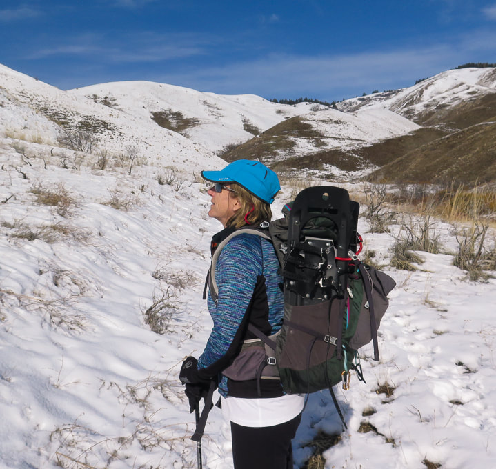
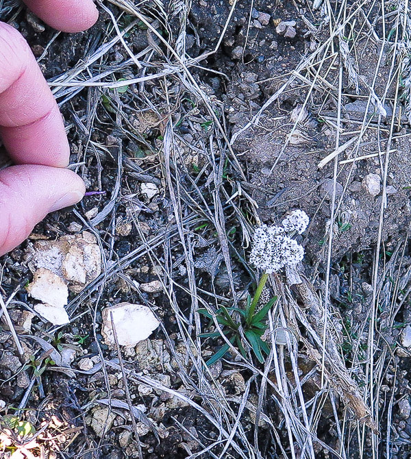
One of the first forbs of the season
Sure, getting up to the proper ridge is pretty intense work usually.  But once on top, the world drops on either side, and you follow the narrow land and wide sky up.  After intersecting with Shaw Mountain Road, Lucky Peak's summit looms with its numerous antennas.  A fun loop hike would be ascend the same ridge, and then descend Shaw Mountain Road to either East or West Highland Valley Road, necessitating a car shuttle.

We initially ascended the "wrong" ridge on our way to summit Pinto Mountain in Joshua Tree Wilderness a few months ago and found a large circle of rocks making me wonder who made this and why?  Trekking through the gulch to this spot, we found a vibrant and lush green garden spilling with vines and bright red barrel cactus, out of place in the stark and barren brown Pinto Mountains.  You find the most interesting things off the beaten path.

Many times we have hiked the standard Lucky Peak Trail to the south of the summit.  It's great to meet people along the way, but hiking Lucky's "backside" is more rewarding because it feels remote in comparison, as if we have it to ourselves.  It's a distinct feeling of fulfillment and a deeper connection to our local environment to walk the ridge less traveled; and as Robert Frost writes, "...that has made all the difference."
Picture
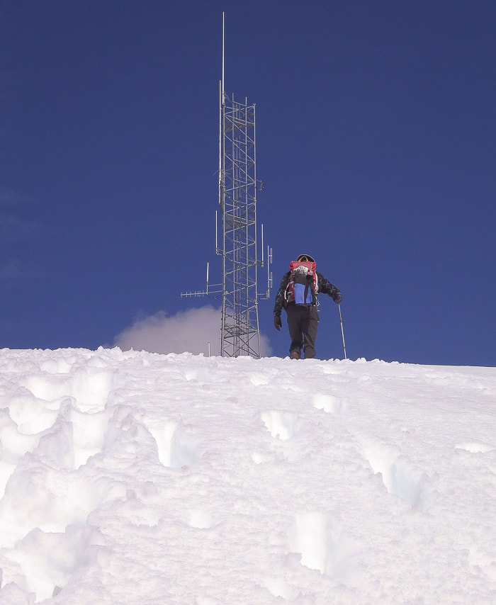
Last approach to Lucky Peak summit
Picture
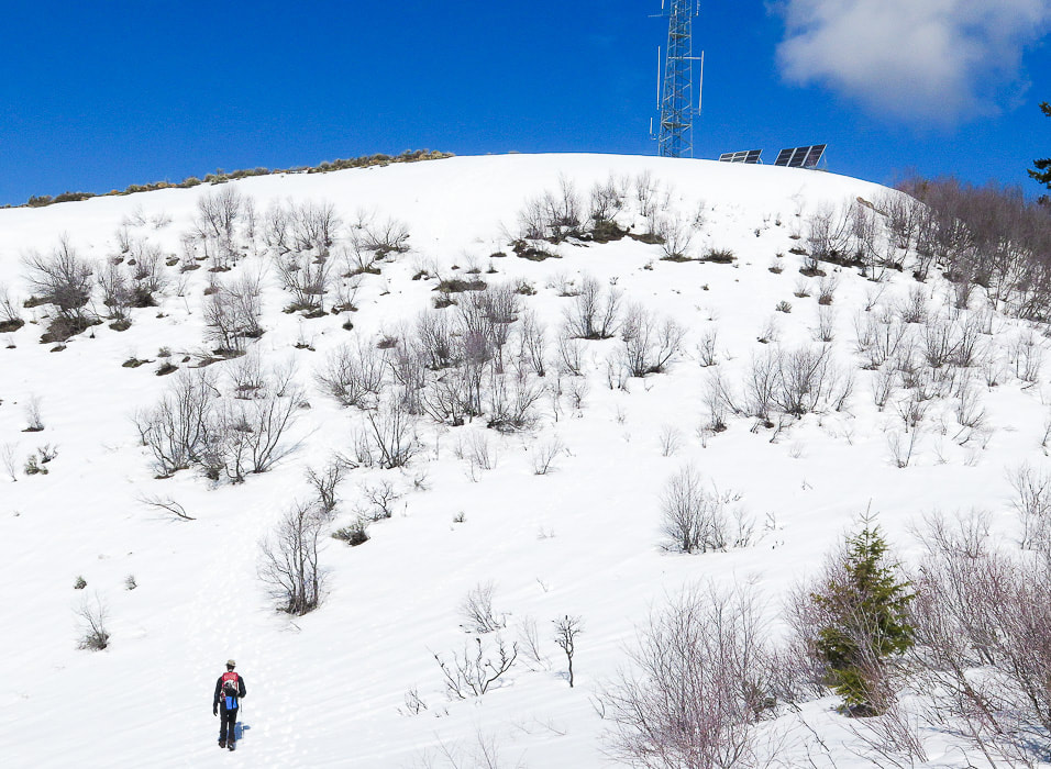
Approaching Lucky Peak summit from southeast ridge
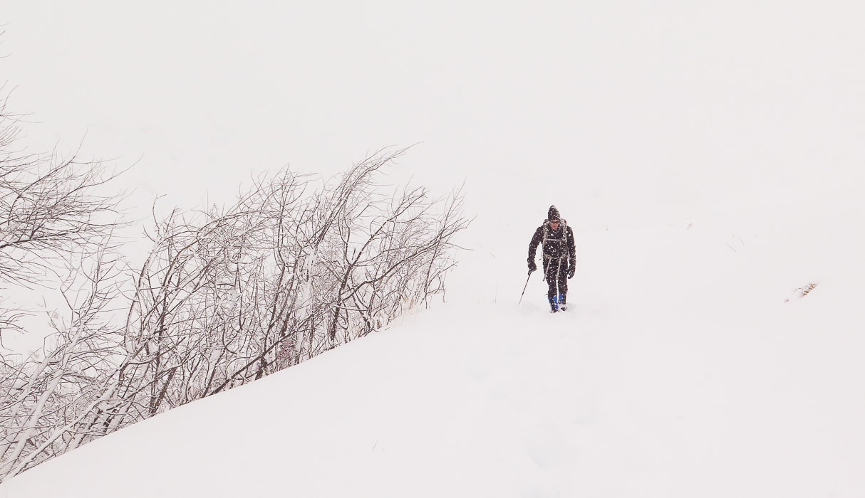
Picture
February snowstorm
Picture
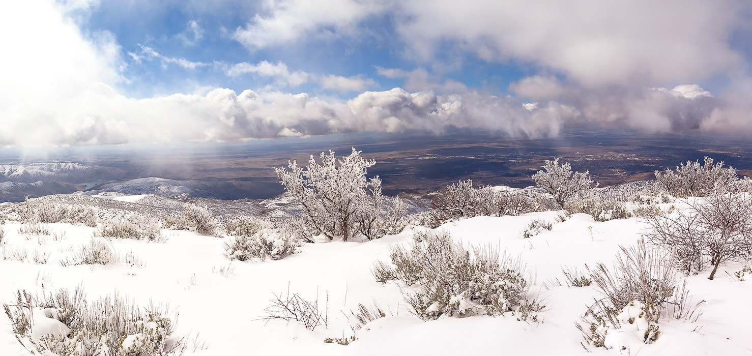
Treasure Valley from Lucky Peak's south ridge
4 Comments
Linda link
4/23/2019 08:13:30 am

Sue, reading your posts is always a treat and a delightful way to begin the day.

I love how you magically weave facts and data into a compelling narrative that carries me with you on your adventures. And your photos are works of art in themselves.

I've been meaning to explore that area and now you've reminded me. I must do so.

Reply
Sue link
4/23/2019 08:05:13 pm

Thank-you very much Linda! It is a beautiful and earthy place close to home - the area just north of Boise. It's a treat to be able to get to a "remote" place so close to home. So many areas to explore, so little time! And... I'm reminded after writing this post that I need to photograph more of what I was describing - namely the wildlife and the vegetation.
I appreciate your comments - made my day! Especially since YOUR writing is so compelling and leaves the reader in suspense!

Reply
Christie
4/26/2019 12:35:01 pm

Sue, I thoroughly enjoy your descriptive writing that accompanies your amazing pictures! You are truly inspirational and make me want to get out and explore through hiking! I’ve got to visit this one, that’s so close to home!

Reply
Sue link
4/26/2019 08:00:07 pm

Christie,
Thank-you my friend for your comments! I still want to take you and Lorie to the Adelmann Mine and on to Lucky Peak - the backside is nice and more forest than the front side. Just something I love about this area - maybe because of the contrast of being near Boise but also being in the wilderness and seeing the elk to me is a treat! And the wildflowers, and the eagle!

Reply


Leave a Reply.

    Categories

    All
    Arizona Hikes
    California Desert Hiking
    Idaho Summits
    Nevada Hikes
    Snowshoe Hikes
    Southern Utah Hikes/Bikes

    Complete list of Hikes/Bikes on HOME page
    Picture
    Sue and Fred
    Picture

    About this blog

    Exploration documentaries          –  "explorumentaries"  list trip stats and highlights of each hike or bike ride, often with some interesting history or geology.  Years ago, I wrote these for friends and family to let them know what my husband, Fred and I were up to on weekends, and also to showcase the incredible land of the west.  

    To Subscribe to Explorumentary adventure blog and receive new posts by email:

    submit
    Picture
    Happy Spring!
    Picture

    About the Author
    Sue Birnbaum

    A  trip to Jumbo Rocks Campground in Joshua Tree National Monument 38 years ago sparked my passion for hiking, exploring, and learning about desert ecosystems.  For the past 25 years, my husband Fred and I have explored the American West together; we love this land and I hope to inspire you to get out and explore through my photographs and trip descriptions.
    In 1992, Ray Wilson and I conceived the first Cactus to Clouds hike which climbs over 10,000 feet in one day to the summit of Mt. San Jacinto near Palm Springs, California.
    CACTUS TO CLOUDS HIKE 
    READ MORE
    ABOUT SUE

    Archives

    February 2023
    January 2023
    December 2022
    November 2022
    October 2022
    September 2022
    August 2022
    July 2022
    June 2022
    May 2022
    April 2022
    February 2022
    January 2022
    December 2021
    November 2021
    October 2021
    August 2021
    July 2021
    May 2021
    March 2021
    February 2021
    January 2021
    November 2020
    October 2020
    August 2020
    July 2020
    June 2020
    April 2020
    March 2020
    February 2020
    January 2020
    November 2019
    October 2019
    September 2019
    August 2019
    July 2019
    June 2019
    May 2019
    April 2019
    February 2019
    December 2018
    November 2018
    October 2018
    September 2018
    July 2018
    June 2018
    May 2018
    April 2018
    March 2018
    February 2018
    January 2018
    December 2017
    November 2017
    October 2017
    September 2017
    August 2017
    July 2017
    June 2017
    April 2017
    February 2017
    November 2013
    August 2013
    July 2013

    Some of my favorite websites:
    Awkward Botany
    ​citizen botany for the phytocurious

    Bird and Hike

    ​"Intended to encourage people to visit, learn about, and fall in love with the desert."
    ​

    Draw and Shoot
    Beautiful Photography

    Earthline: The American West
    Debra "writes to extol our beloved Earth." Detailed hike info, excellently written.
    ​

    Geologypics.com
    Geology and Geologic Time through Photographs

    Glenn Suokko
    Vermont artist's paintings "inspired by a place based on the land .... drawn to painting the representation and abstraction of nature."

    In the Company of Plants and Rocks
    ​A natural history blog about botany, plant ecology, and geology.

    Nature's Depths

    Walking through nature with John Palka, a neuroscientist who loves plants and ponders big questions

    Rangewriter - What Comes Next?
    ​With excellent writing, Linda tells the story of her unique mother's life including WWII era; with beautiful photographs.

    SeekingLost - Hiking and Backpacking Adventures.

    Stav Is Lost- Unconventional, out-of-the way hikes in the American West.


    Uprooted Magnolia
    ​Leah Yetter's beautiful "photo journal on life, love, and the spirit of Wyoming."
HOME

Cactus to Clouds Hike
More Quotes
HIKES BY STATE

Idaho Hikes
Utah Hikes/Bikes
​Arizona Hikes
​California Desert Hikes
​Wyoming Hikes
​Nevada Hikes

BLOGS

Adventure Blog
Women and the Land
GEAR REVIEWS
FIT AFTER 50
Fred Birnbaum
Dave Brasuell
Bus' Little Black Book
​Mike Carlson
​Ray Wilson
​Marcia Bondy
Bryan Krouse
​Maria Keezer
​Tim Clemens
​Doug Traubel
​Brian Holgate
​
Becky Borczon Blake
​Jennifer Cera and
​Sue Birnbaum

​Vance Powell
​Boise Cross Fit Masters Ladies
​Vickie Kearney

GALLERY

Desert Plants
Nature
Earth + Sky
Urban
Water
Patriot 
​Orchids
Boise
​
  ABOUT
    Contact

​
© 2017 - 2023 by Sue Birnbaum.  Photos on this website are the sole property of Sue Birnbaum unless otherwise indicated.  Please receive permission before publishing my trip reports and photos.
I try my best to be accurate with my hike descriptions; please research your adventures, always bring a map and compass and know how to read them, be prepared!  All of these hikes can be dangerous; hike at your own risk.  ALWAYS carry the Ten Essentials with you on hikes. 
​Please feel free to contact me with comments or questions, or if you see any errors that need attention.
Thank-you for stopping by!


EXPLORUMENTARY.com
  • Home
    • Cactus to Clouds Hike
    • More Quotes
    • Ann Zwinger Quotes
    • Mary Oliver Poems
  • Hikes by State
    • Idaho
    • Southern Utah
    • Arizona
    • California Desert
    • Nevada
    • Wyoming
  • BLOGS
    • Adventure Blog
    • Women and the Land
  • GALLERY
    • DESERT PLANTS >
      • Beavertail cactus
      • Brittlebush
      • Christmas Cactus
      • Arizona Barrel Cactus
      • Parry's penstemon
      • Agave
      • Arizona Rainbow Hedgehog
      • Claret Cup Hedgehog
      • Desert Agave
      • Palmer's Penstemon
      • Silver Cholla
      • Cristate Saguaro
      • Indian Paintbrush
      • Ocotillo
      • Santa Rita Prickly Pear
      • Spiny Cliffbrake
      • California Barrel Cactus
      • Engelmann Prickly Pear
      • Velvet Mesquite
      • Joshua Tree
      • Buckhorn Cholla
      • Hedgehog Cactus
      • Fishhook cactus
      • Thompson's Woolly Locoweed
    • NATURE
    • BOISE
    • EARTH + SKY
    • URBAN
    • WATER
    • PATRIOT
    • ORCHIDS
  • Fit After 50
    • Brian Holgate
    • Fred Birnbaum
    • Dave Brasuell
    • Bus' Little Black Book
    • Mike Carlson
    • Ray Wilson
    • Bryan Krouse
    • Vickie Kearney
    • Maria Keezer
    • DOUG TRAUBEL
    • Boise Cross Fit Masters Ladies
    • Tim Clemens
    • Marcia Bondy
    • Becky Borczon Blake >
      • Becky B Downtown
    • Jennifer Cera and Sue Birnbaum
    • Dave Brasuell
    • Vance Powell
  • About
    • CONTACT