|
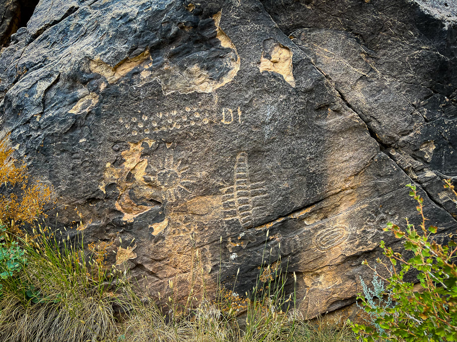
This prominent gap in the Red Hills has one of the most abundant collections of American West petroglyphs, including the most unusual of all - the Zipper Glyph.
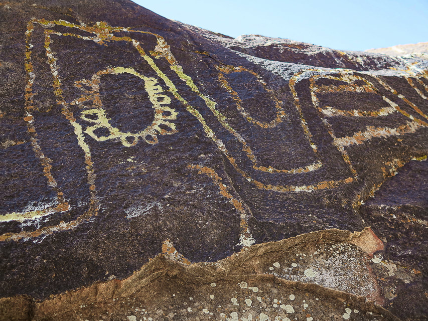
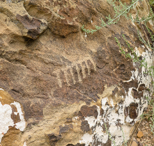
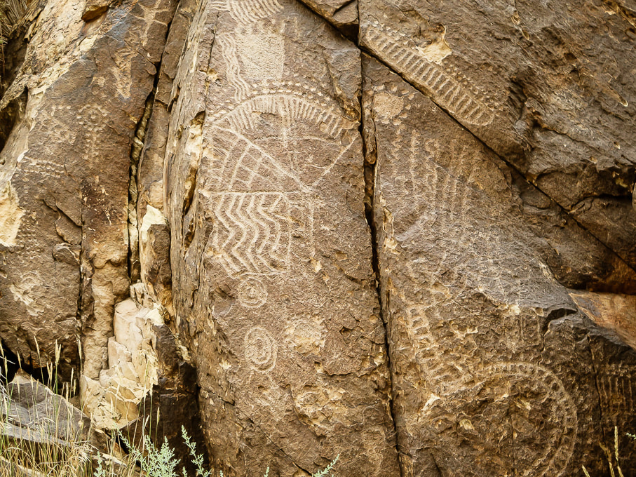
Iconic Parowan - the "Zipper Glyph"
Interpretations of this petroglyph include a solar calendar because it has 180 notches coinciding with the 180 days it takes for the sun to move between summer and winter solstices. The Paiute Indian Tribe of Utah interprets this as the story of a great Leader during a migration where many people experienced famine, drought, water crossings, cold and ice.
Trip Stats
Overview: At the western edge of the Parowan Gap, in the "Narrows", over 1,500 petroglyphs made by different indigenous cultures are carved in the Navajo sandstone. Location: Parowan, Utah, just north of Cedar City, in the Red Hills west of Little Salt Lake. Petroglyphs are in the notch at the west end of Parowan Gap. Managed by Bureau of Land Management. Petroglyph Coordinates: 37.909722 112.985556 Native Americans: Fremont culture, Paiute, Hopi. Recognition: Listed on National Register of Historic Places. Geology: the petroglyphs are pecked into Jurassic Navajo sandstone, deposited 190 million years ago.
Related Posts:
Petroglyph "Heaven"
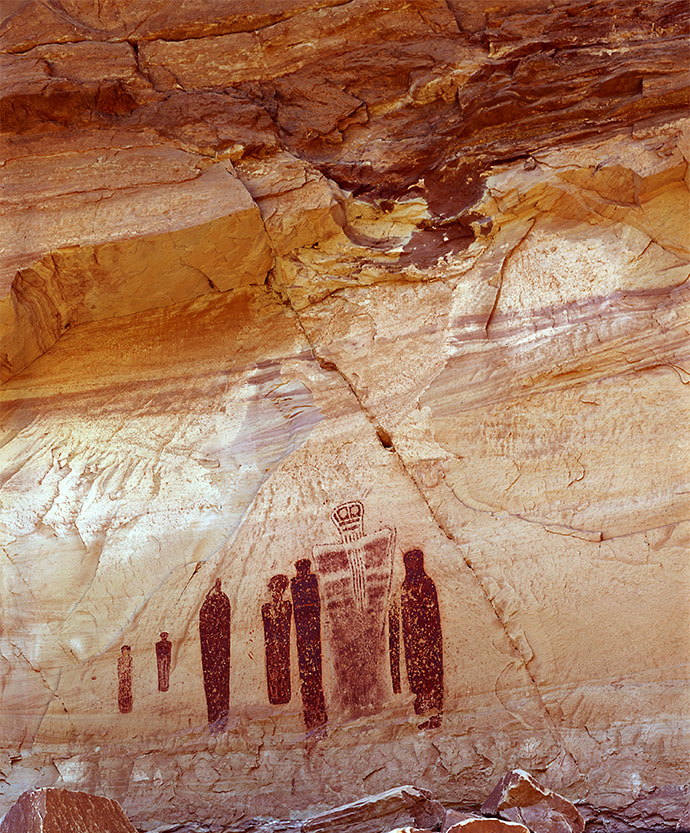
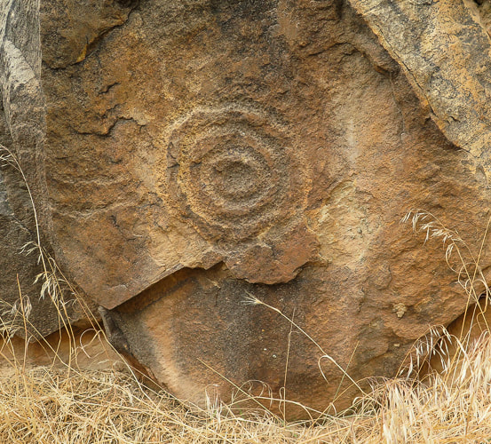
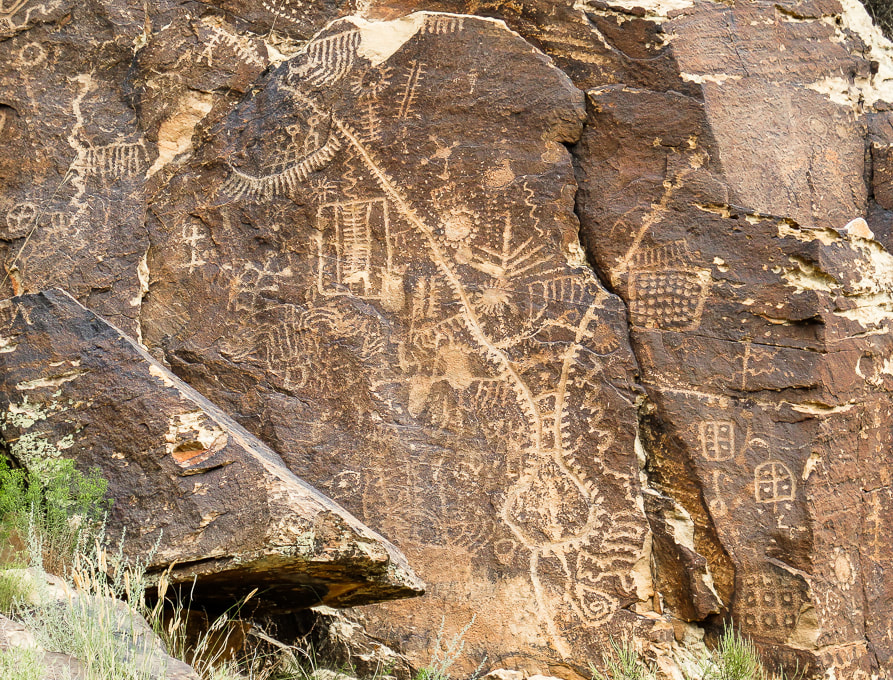
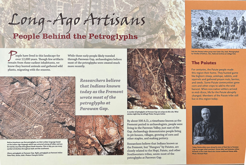
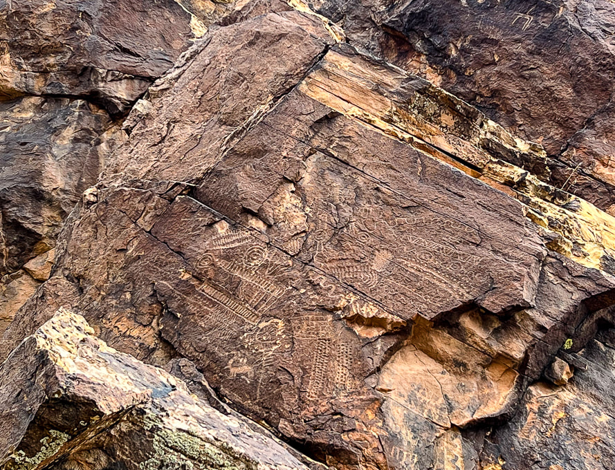
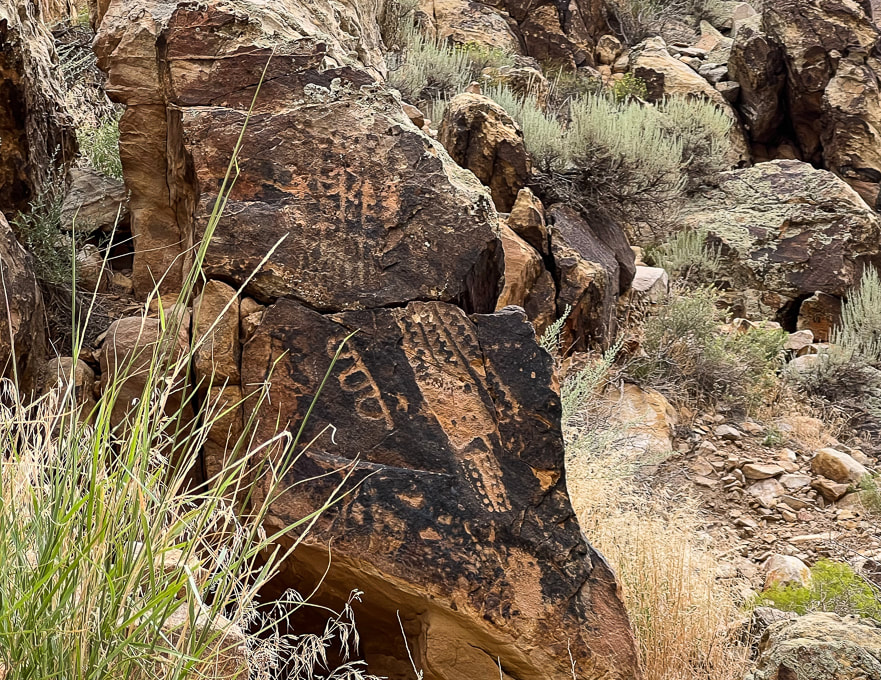
To rock art aficionados, Parowan Gap must be petroglyph heaven, not only because of its famous "Zipper Glyph", but also the amazing quality and number of petroglyphs there - rock after rock, panel after panel (90 of them!). Some believe that this site has the most concentrated petroglyph assemblage of any in the American west. Some of the rock carvings may be as old as 5,000 years, the majority of them made by the people of the Fremont culture. To today's Paiute and Hopi tribes, this is a spiritual site. The Parowan Gap is a stream-cut valley and narrows through the Red Hills, just west of Little Salt Lake, north of Cedar City, and 10 miles northwest of Parowan, Utah. The petroglyphs are located in a dramatic V-shaped notch at the western edge of this gap, a great place for indigenous peoples to carve their petroglyphs during their migrations. I was looking forward to seeing the Zipper Glyph in person. With two "arms" and 180 notches, people who believe in the astroarchaeological (AKA archaeoastronomy) interpretation see this mysterious petroglyph as a solar calendar. If you look closely at the Zipper Glyph, it resembles the notch in the Parowan Gap. It is believed that this glyph is a map with relating equinoxes and solstices. However, the modern Paiute Tribe of Utah had a different interpretation: a migration of the old world to the new. The Paiutes say that the Zipper Glyph represents a long trail of hardship in which their great Leader was killed. The two "arms" in this case are the Leader's body shown upside down with his head at the bottom. 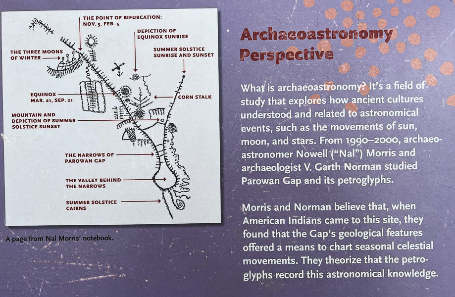
An interpretive sign illustrating the belief that the "Zipper Glyph" was used to chart celestial movements.
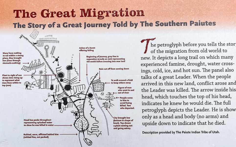
Interpretive sign that describes the Utah Paiute Tribe's interpretation of the Zipper Glyph.
Parowan is nicknamed "the Mother Town of the Southwest." It's a city that has gone through a lot of changes since it first began mining iron in the 1800's. Now its main industries are tourism and recreation, including Brian Head, a year-round resort where we like to go skiing. It was first called "City of Little Salt Lake," because of its proximity to Little Salt Lake, a now salty playa to its west. It was renamed "Parowan," a native American word meaning "evil water." This lake is a key geographic feature relating to the formation of the Parowan Gap.
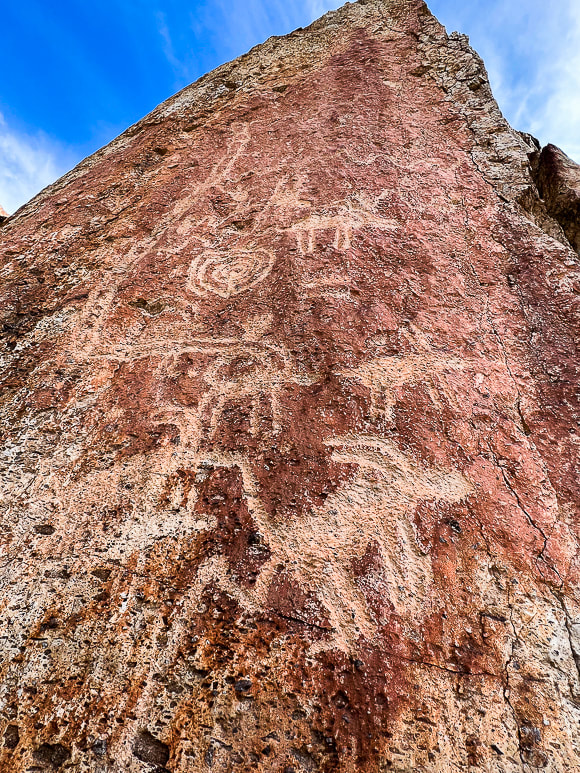
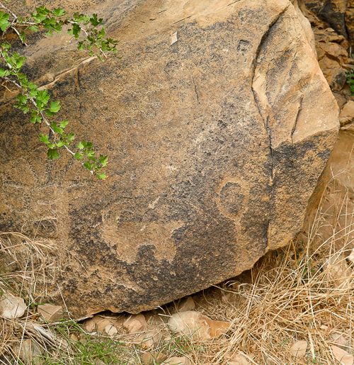
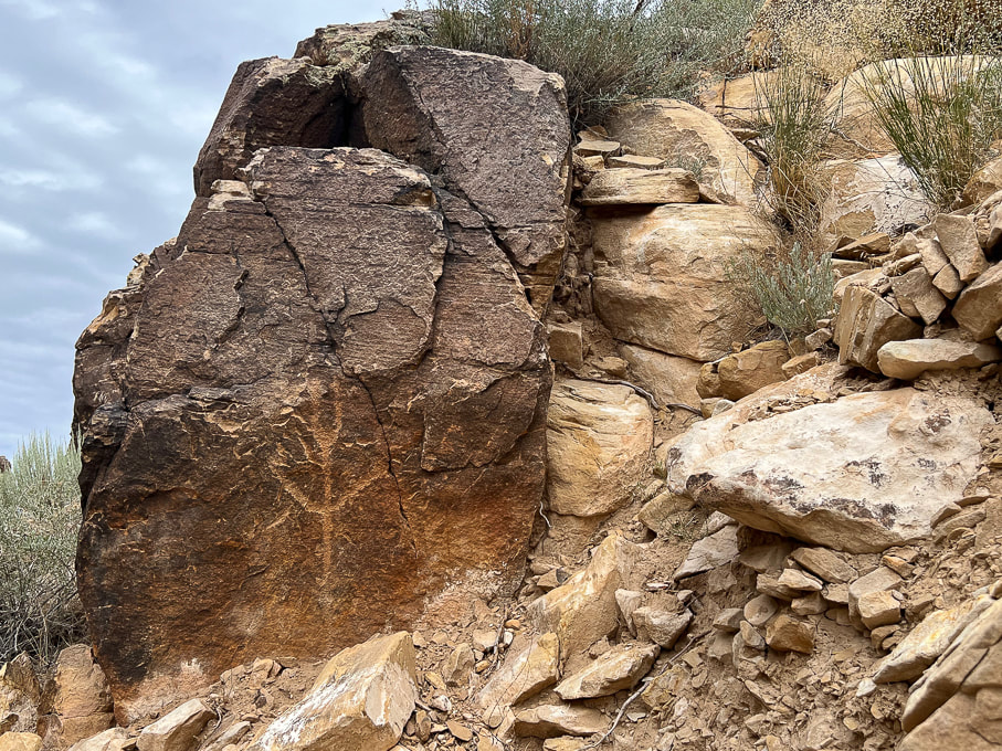
Fred and I had just hiked the astonishing Cosmic Ashtray in Grand Staircase-Escalante the day before, so we were on our way home. I had to talk him into seeing Parowan Gap; he doesn't normally want to go too far out of the way to see petroglyphs but with these he was pretty darn impressed. On the same Grand Staircase trip, we also hiked to a huge petroglyph panel along the Escalante River in Grand Staircase-Escalante National Monument, near the opening to Neon Canyon. Bear paws march up out of sight on this tall rock face, a rattlesnake slithers, and Fremont-culture warriors stand as just a few petroglyph examples. If you don't mind slogging through four miles of sand and slick rock, wading, and navigating, you can find these remote glyphs. It's believed that the Fremont culture made most of the Parowan Gap rock carvings 700-1,500 years ago, although the area has been inhabited for thousands of years before that. Typically the designs are abstract and geometric, although there are some lizards, snakes, and mountain sheep pecked into the Jurassic Navajo sandstone. Many petroglyphs are located very high, out of reach on the hillside. Check it out - you won't be disappointed! The interpretive signs make this a nice site. A great place to go afterwards if you are hungry is Centro Woodfired Pizzeria in downtown Cedar City.
Keep on Exploring!
For the Geo-curious: Creation of a Unique Land Feature
So, what created this peculiar notch in the hills — so noteworthy that ancient peoples over hundreds of years decided to engrave hundreds of petroglyphs as they migrated through the area? Two clues — the gap's rock orientation and Little Salt Lake help geologists to make sense of its creation. The ancient stream that for millions of years carved this gap through the Red Hills on its westward journey to the Great Basin became blocked by the rising Red Hills fault block. Its flow then accumulated to form Little Salt Lake, just east of the Parowan Gap. Either the fault block rose too quickly for the stream to keep incising through the rocks, or the region became drier and the stream had less volume, or both. Clues that faulting occurred are seen in the rock layers. North-south trending faults through the Red Hills caused east-dipping and west-dipping beds; some were left in their original horizontal position. The rocks here — Claron Formation (dominant Bryce Canyon rock), Navajo Sandstone (Zion's main rock), Carmel Formation, Iron Springs and Grand Castle formations first underwent mountain-building during the Sevier Orogeny 45-100 million years ago, when the Pacific tectonic plate collided and slid under the North American plate. The stream through Parowan Gap then carved a passage through the Red Hills. More recently, beginning 20 million years ago, Basin and Range extension (stretching of Earth's crust) began, which caused the Red Hills fault block to rise, blocking off the Parowan Gap stream's passage. Water collected to form Little Salt Lake, now a playa (a dried-up lake). 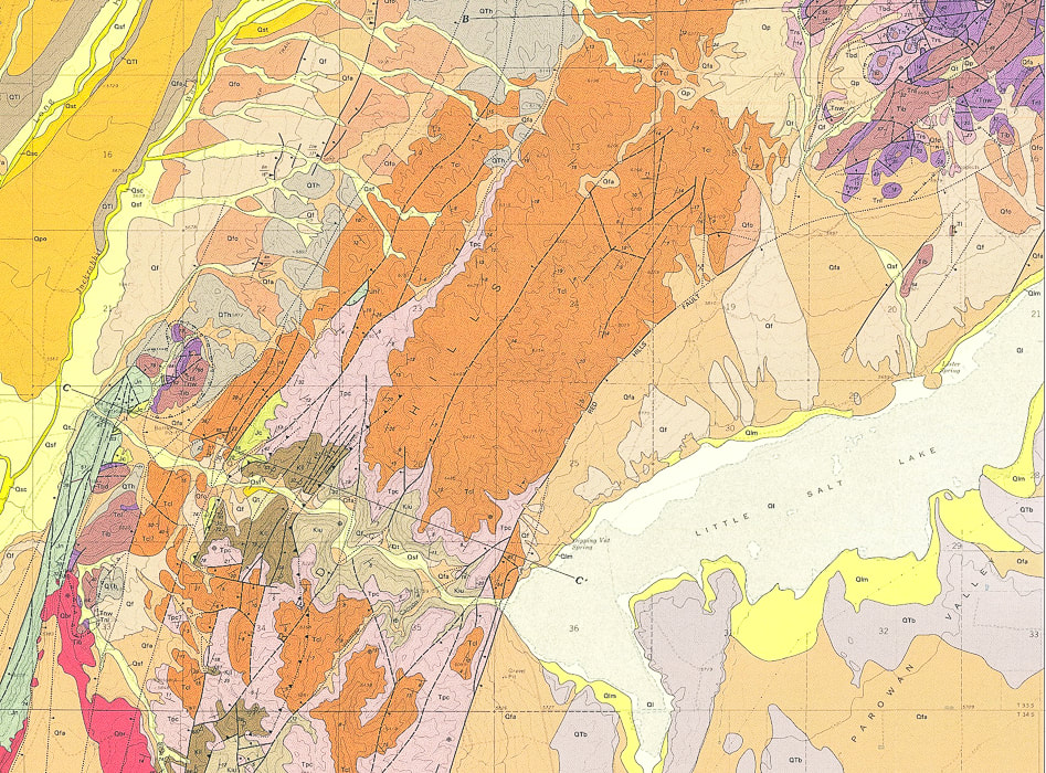
Geologic Map of Parowan Gap Quadrangle (USGS).
Little Salt Lake (lower right) was formed when the westbound stream that created the Parowan Gap (larger yellow, curving line (lower left) became blocked by the rising Red Hills. Note the parallel dark lines (faults) running mostly north-south and the long line extending from middle bottom to top right (Red Hills Fault), raising that fault block and providing a barrier to stream flow westward . 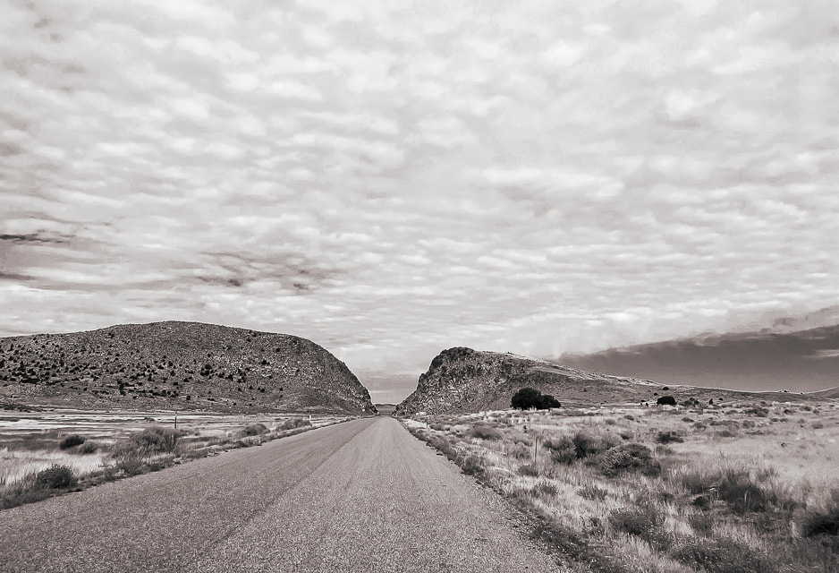
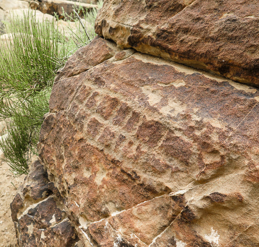
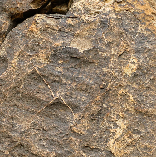
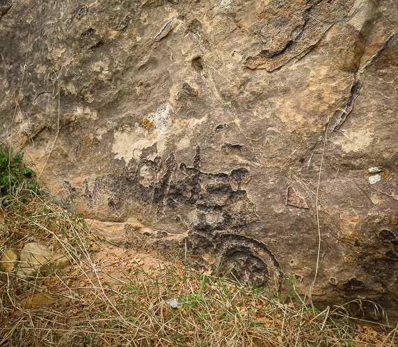
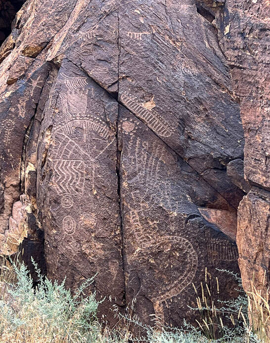
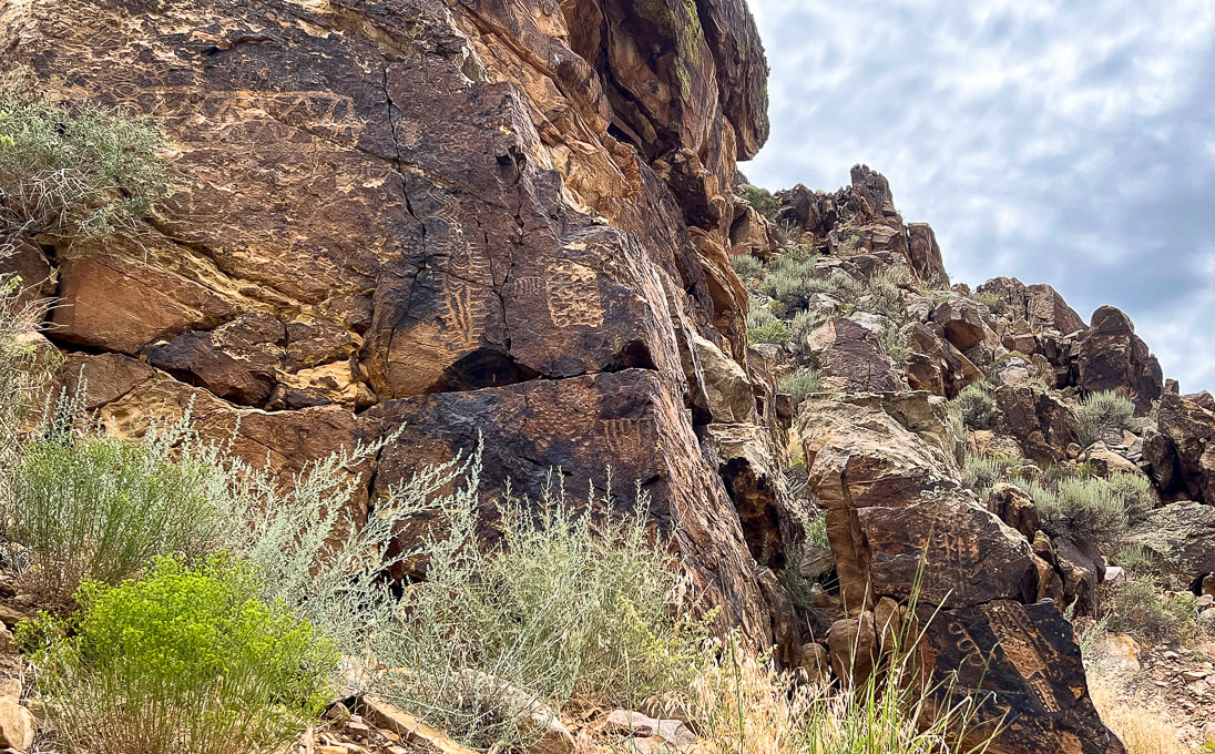
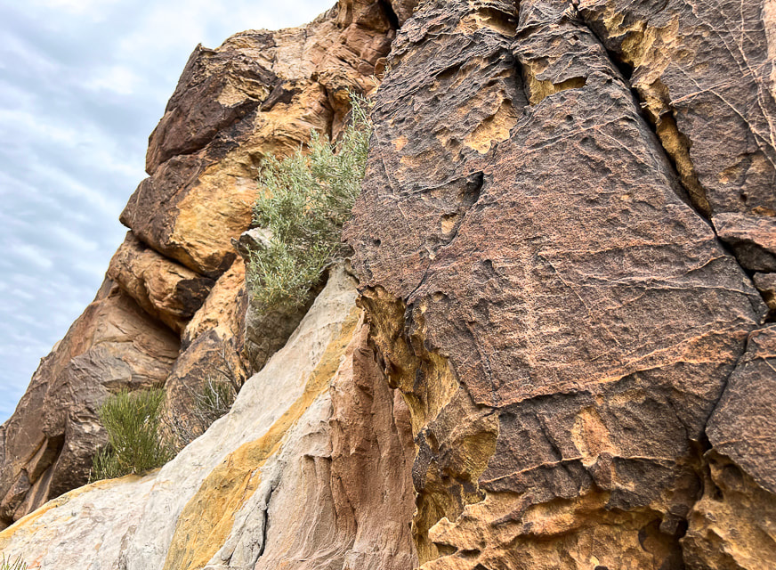
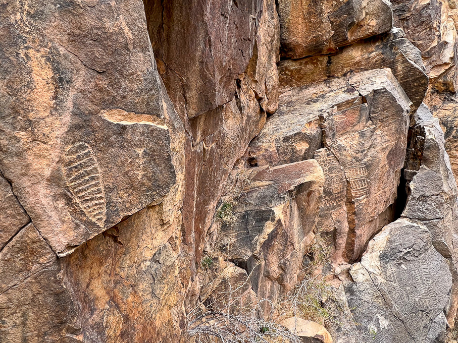
The "narrows" at the west end of the Parowan Gap. Ancient waters carved this opening in the Red Hills.
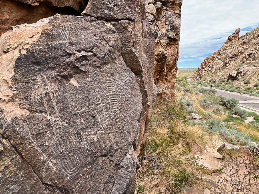
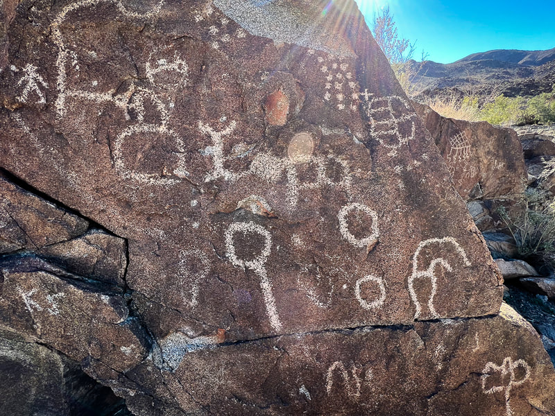
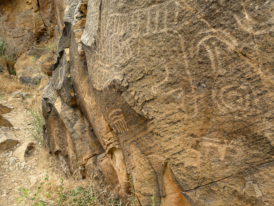
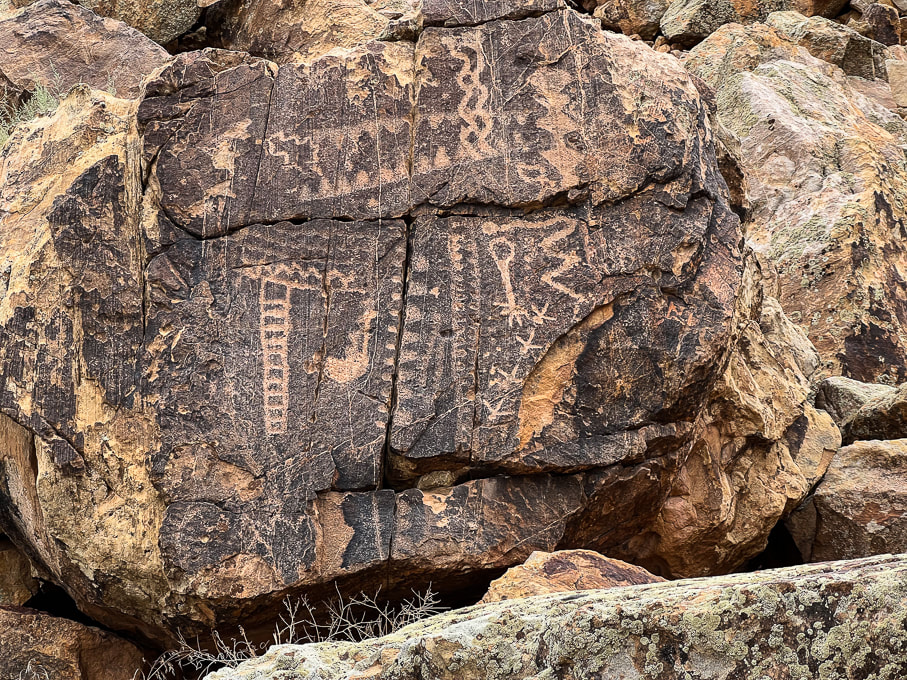
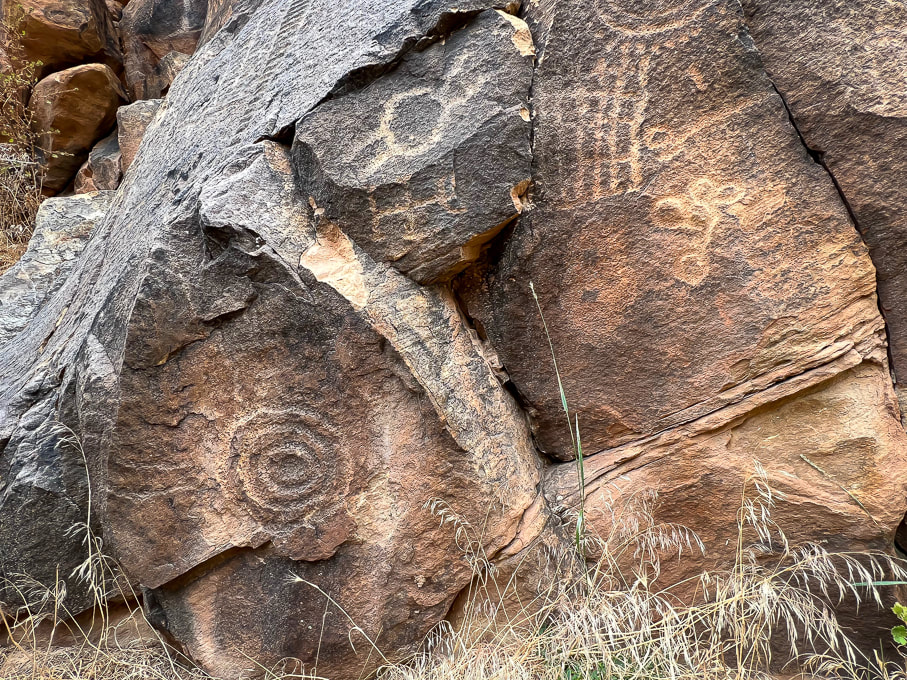
Extensive abstract petroglyphs on both sides of Gap Road, which passes through the Parowan Gap.
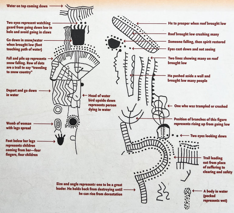
Interpretation of the panel above by Paiute Indian Tribe of Utah, from interpretive signs at the site.
Another Parowan Gap interpretive sign.
References:
Maldonado, F., et al. Geologic Map of the Parowan Gap Quadrangle, Iron County, Utah. U.S. Geological Survey. Wilkerson, C. 2018. Geosights: Parowan Gap, Iron County. Orndorff, R.L., et al. Geology Underfoot in Southern Utah. 2020. Mountain Press Publishing Company. Parowan City Corportation website. Wadsworth, Rueben. 2019. Parowan Gap day; Interpretations and Mysteries of a Petroglyph Heaven. Cedar City News Archives.
2 Comments
10/28/2023 02:04:24 pm
Oh my gosh. This reminds me of the motherload national library of the ancients. What a stunning array of communication/art. It looks like you can drive right up to the Parowan Gap carvings? That is incredible. I'm surprised they haven't been destroyed.
You describe this petroglyph site well - it is a stunning array of communication. There are fences along the road which you can drive through but there's not a lot of traffic and people are walking across the road because the glyphs are on each side. I was able to climb up a steep hillside, though and get close to them. Leave a Reply. |
Categories
All

Sue and Fred

About this blogExploration documentaries – "explorumentaries" list trip stats and highlights of each hike or bike ride, often with some interesting history or geology. Years ago, I wrote these for friends and family to let them know what my husband, Fred and I were up to on weekends, and also to showcase the incredible land of the west.
To Subscribe to Explorumentary adventure blog and receive new posts by email:
Happy Summer!

About the Author
|