|
We summited two of the highest peaks in Utah's Tushar Mountains, sharing a raging wind storm with mountain goats.
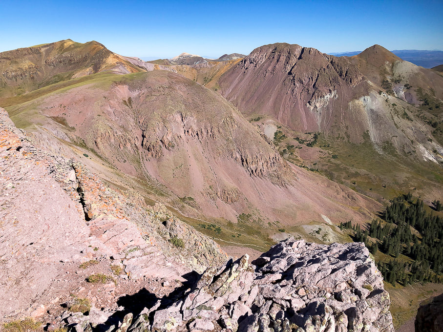
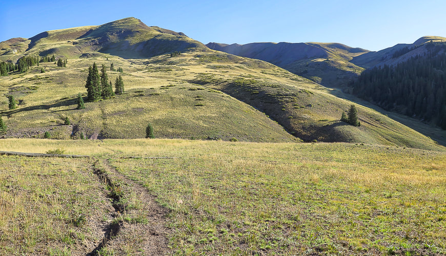
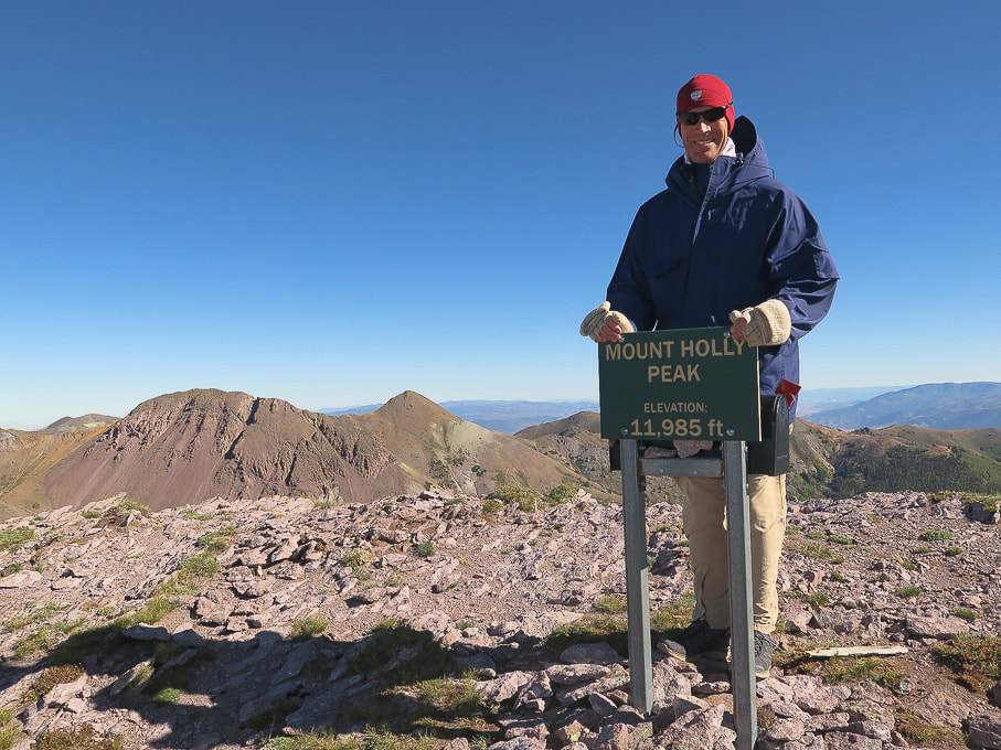
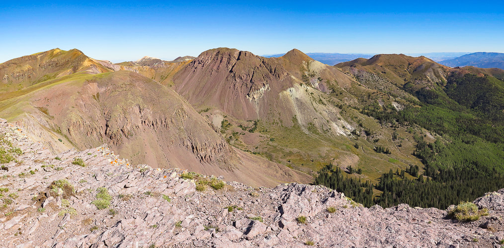
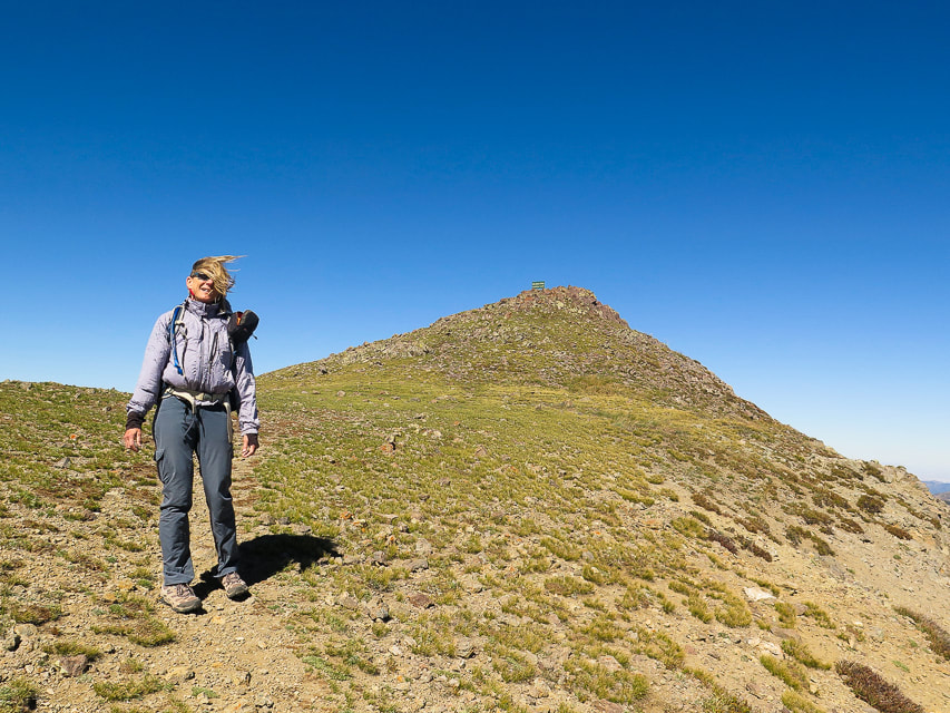
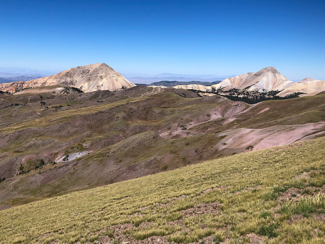
View north from Mount Holly to Delano Peak (left horizon) and the ridge to Delano Peak.
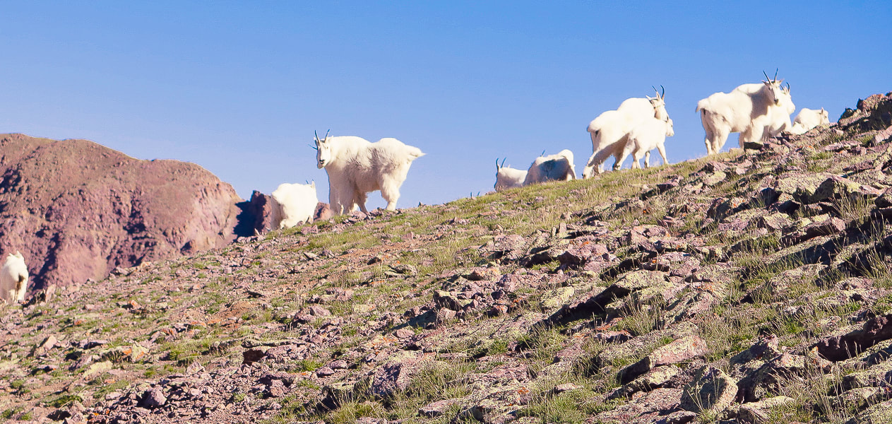
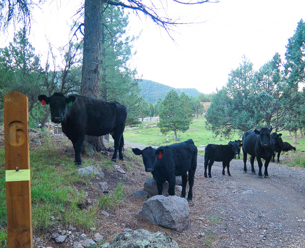
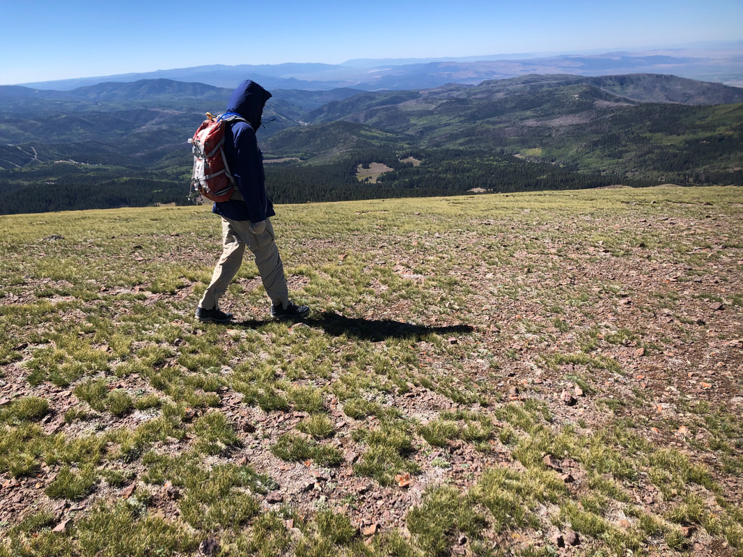
Mountain goats on Mt. Holly getting their hair blown in the strong gusts.
Trip Stats for Delano Peak/Mount Holly loop
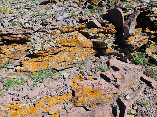
Location: Fishlake NF, Tushar Mountains, near Beaver, Utah. Fishlake National Forest - Beaver Ranger District. Distance/Elevation gain: 7.3 miles/2,500'. Trailhead = 10,400'. Delano Peak = 12,169'. Mt. Holly = 11,985'. Coordinates: Trailhead = 38.35896 -112.39289. Prominence: Delano Peak = 4,689'. Mt. Holly = 425'. Difficulty: Mostly moderate effort, Class 1. Trails: #225 (Skyline National Recreation Trail) for Holly approach, and #224 from Delano summit to road. Maps and Apps: Fishlake National Forest-Beaver and Fillmore Ranger Districts Travel Map -USDA, AllTrails tracks for Mt. Holly, route map from Stavislost.com. Date hiked: 9/19/22. Geology: The Tushar Mountains are remnants of volcanos whose first eruption period was 22-35 million years ago (Bullion Canyon Volcanics) and second eruption 21 million years ago (Mt. Belknap Volcanics). Delano Peak resides in the Bullion Canyon Volcanics. It is the highest point on the edge of Big John's Caldera, a concealed structure on Delano's west side that subsided ~ 23 million years ago during ash flow eruptions. This caldera filled and eroded over time. The second eruption created the source rock for the mined uranium of the Marysvale mining district north and east of Delano Peak. Native Peoples: Five native Paiute bands were present in Beaver County ~ 700 years ago: Tu-roon-quints band in the northeast corner of the county; the Qui-ump-uts band around Beaver and Adamsville; the Pa-moki-abs band in the vicinity of Minersville; the Toy-ehe-its band in the Milford area; and the Indian Peak band in the western part of the county and into Nevada. Evidence such as pottery, tools, weapons, and petroglyphs left by Paleo native Americans as far back as 12,000 years ago, at the end of the last ice age is present in Beaver County in which the Tushars are located. (from A History of Beaver County, by Martha Sonntag Bradley).
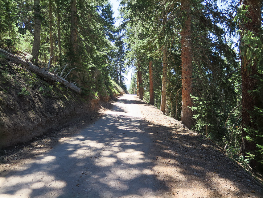
This loop hike on the highest ridge in southwestern Utah's volcanic Tushar Mountains offers magnificent vistas and solitude. Even though the Tushars are the third highest mountain range in Utah, they appear to be much less visited than Utah's higher ranges - the Uintas and La Sals. We saw more mountain goats than people. This was our second try; we previously turned back after summiting Delano Peak a few weeks ago with low visibility. This time, constant wind gales and gusts added a challenge as we staggered up Delano's summit. The trails that come from trailheads at 10,000 feet don't bother with switchbacks; they go straight to and from the summits.
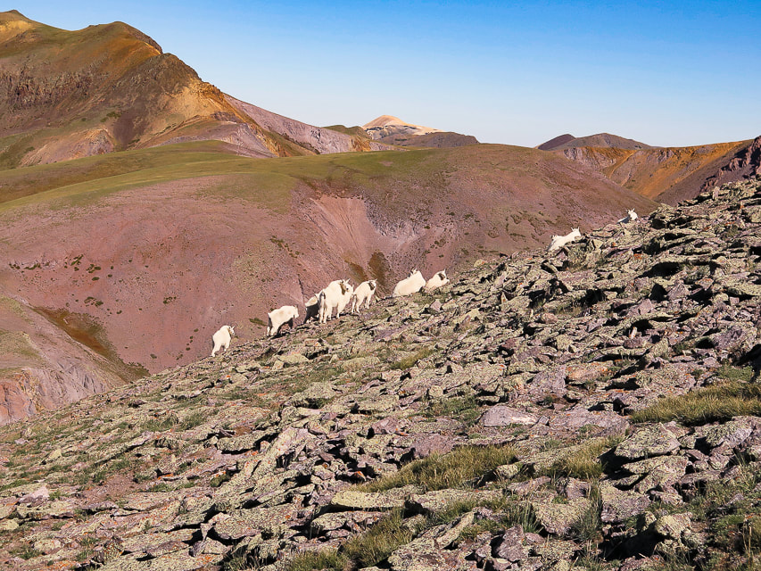
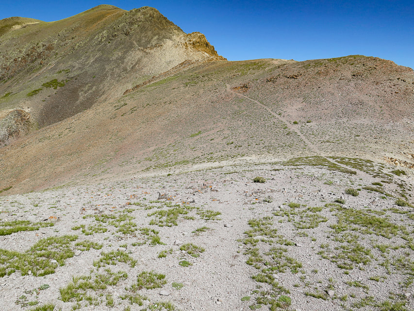
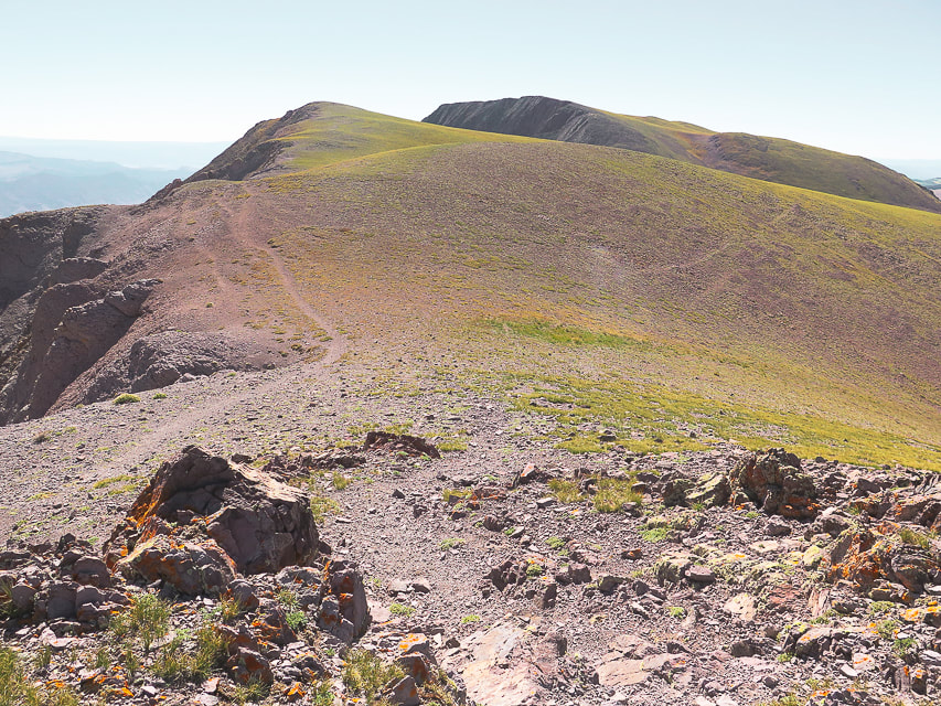
"The area possesses a very high degree of naturalness, palpable solitude, and nearly unlimited opportunities for primitive and unconfined recreation," says Wikipedia. A variety of great things are packed into this 7-mile hike: forest, sustained spectacular ridge views, goats, aspens and meadows below, and a fun steep climb between peaks. After a nice forest hike from the Skyline Trail trailhead off of graded gravel road and #123, we came to a saddle where we descended into a beautiful valley with Mt. Holly on the horizon. Our route left the Skyline Trail at Merchant Creek, walking toward Holly on the left side of a prominence covered with pines to the right. Shortly, a defined trail appears in the grasses. It becomes less-defined as you arrive on wide expanse of the tundra, just below Mt. Holly and then becomes more defined as it traverses Mt. Holly's southwest flank. The mountain goats on Mt. Holly were hunkered down enduring the wind. They reluctantly got up as I got closer to them, and when we were on the ridge hiking toward Delano Peak, we saw that some of them had sought safer places on Holly's northwestern cliffs. We stayed on Mt. Holly long enough to sign the register, then descended back down out of the summit gusts to find a way to Delano Peak. We didn't see an obvious trail linking Mount Holly to the northwest ridge leading to Delano Peak; we probably could have gotten to the top of the ridge sooner than we did (see our route). We gained the ridge at a saddle between Delano and Holly where we found the ridge trail. We took a windy break observing a spectacular view of steep Cottonwood Creek to the east. We battled the winds up a short and somewhat loose ascent to a gentler tundra ridge walk. The trail was easy to follow to Delano Peak. We didn't want to stand too long on this highest point in the Tushars for fear of being blown over the edge. The walk down Trail # 224 is a quad burner, losing 1,700' of elevation in 1.8 miles. We then walked south on road #123, where the wind was less brisk, to our car at the trailhead, a short 0.6-mile distance. The definition of "grit" is achieving goals through passion, perseverance and commitment. An important attribute for many aspects of life. An important trait to teach our kids. With some "grit" we reached the summits during the windstorm, although I have to admit, the thought of going back down after Mount Holly briefly crossed my mind. I plan on getting back to this hike with some friends. If I go in the next few weeks, the forest will be splashed with stands of yellow aspens in a sea of dark green.
Keep on Exploring!
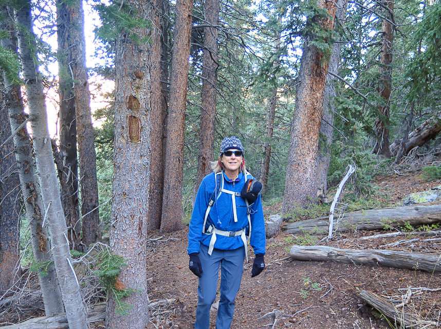
Walking southeast on Skyline National Recreation Trail whose Big John's Flat trailhead is just off of Forest Road #123.
Reach saddle on Skyline Trail to descend to valley; hike along Merchant Creek (along left side of trees) and then right to the ridge. Mount Holly is on horizon behind tree.
Approaching Merchant Creek on the right; Mt. Holly is high point on far right horizon.
Walking east along Merchant Creek.
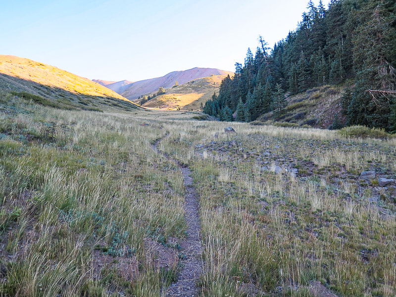
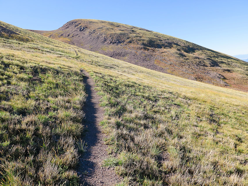
Trail breaks away from the creek and heads SSE through open tundra.
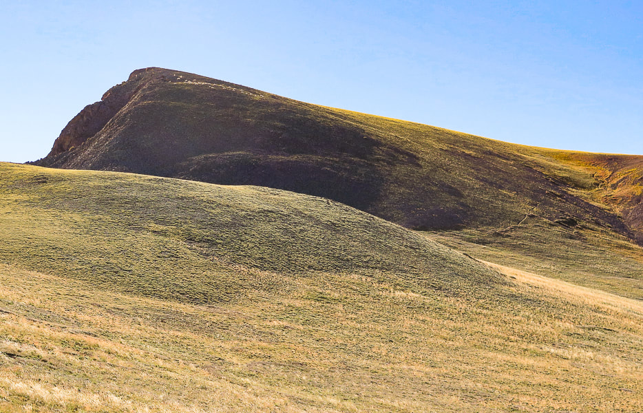
Mt. Holly and first glimpse of mountain goats near top (small white specks). The trail swings around its base to the right.
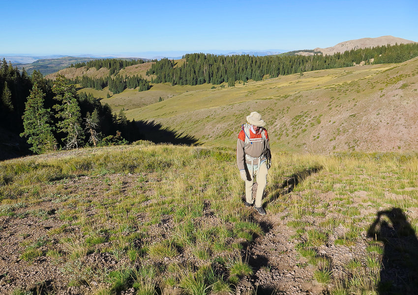
Heading southeast on Mt. Holly's southwest flank. Traverse this and trail then turns left (northeast) to make the final summit climb.
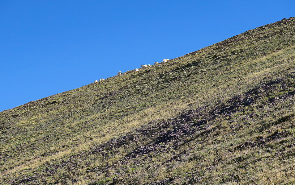
Mountain goats are wary of us. Delano Peak on upper left horizon.
From Mt. Holly summit, looking northwest to Delano Peak on left horizon.
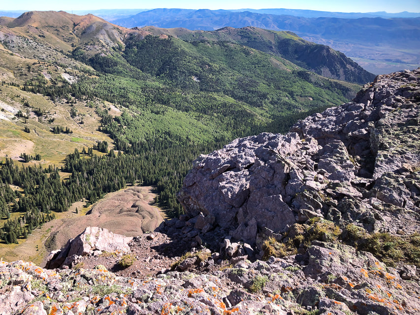
Looking down on Cottonwood Canyon from the ridge.
Ridge trail between Delano Peak and Mount Holly.
On the ridge trail - looking back at Mount Holly. We entered the trail from the animal trails on the right.
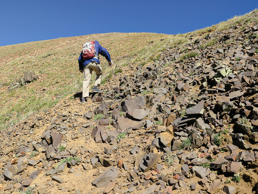
From saddle, trail climbs a rocky section to get to ridge just below Delano Peak.
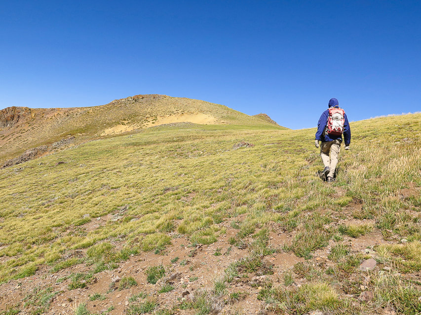
Mostly tundra the rest of the way; first view of Delano Peak on the horizon.
Catching gusts just below Delano's summit; no time for a hat!
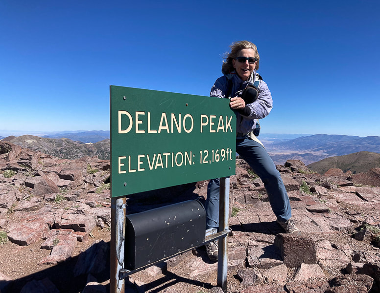
Stayed just long enough on summit to sign in to the register, a convenient mailbox.
On the way down from Delano Peak: Shelly Baldy Peak, 11,321' (left) and Mt. Baldy, 12,122' (right).
Just off Delano Peak - "get me out of this wind!"
Walking back to trailhead along Forest Road #123.
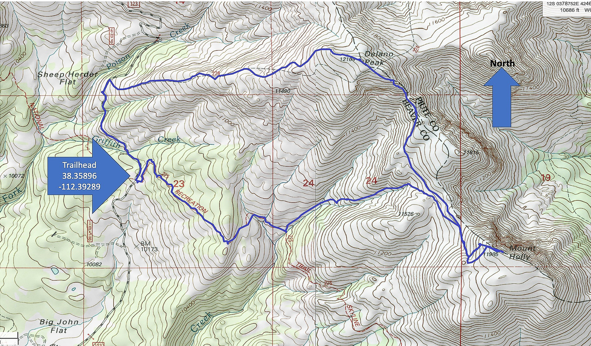
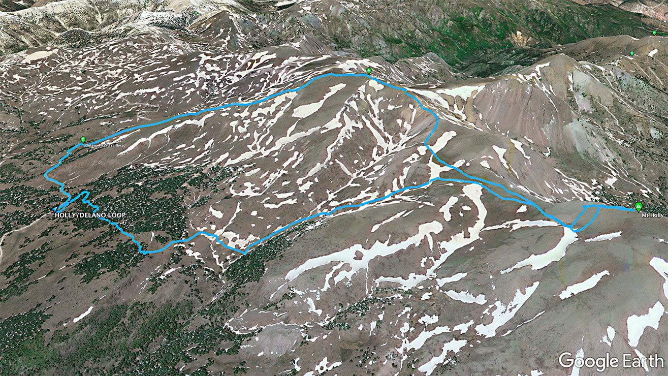
Our GPS tracks for Delano/Holly loop beginning at Road #123 at trailhead parking for Skyline National Recreation Trail
click on map for larger image 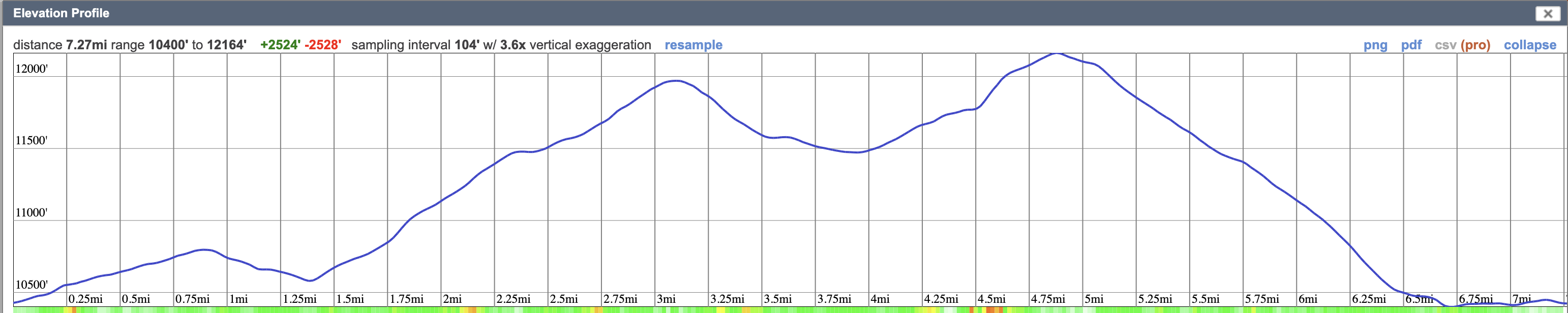
References
Sontag Bradley, M. A History of Beaver County. 1999. Utah State Historical Society Beaver County Commission.
4 Comments
Maria Keezer
10/4/2022 08:48:49 am
Enjoyed 'hiking' with you... did not care for the wind though..LOL
Would love to do this hike with you, Maria, but no, YOU WOULD NOT LIKE THE WIND! I'd have to say this was the windiest hike I've ever been on except for Wheeler Peak. 10/5/2022 12:42:43 pm
Yes Sue, you personify grit! In this case, your grit paid off with the sight of that herd of goats. A nice payoff, I think. But the photos make the roots of my hair tingle, seeing how your hair and the goat's hair flaps in the "breeze."
Well, Linda, at first I wasn't sure if I should make the wind such a big subject in this post, and I was boasting a bit with the "grit" idea. I think it extrapolates to something not having to do with hiking - that it seems we (Americans? All Earth citizens?) have generally lost our "grit" - passion and commitment for positive things. Leave a Reply. |
Categories
All

Sue and Fred

About this blogExploration documentaries – "explorumentaries" list trip stats and highlights of each hike or bike ride, often with some interesting history or geology. Years ago, I wrote these for friends and family to let them know what my husband, Fred and I were up to on weekends, and also to showcase the incredible land of the west.
To Subscribe to Explorumentary adventure blog and receive new posts by email:
Happy Summer!

About the Author
|