|
Share the summit of Scotchman Peak with mountain goats and possibly a "Friend of Scotchman Peak Wilderness." 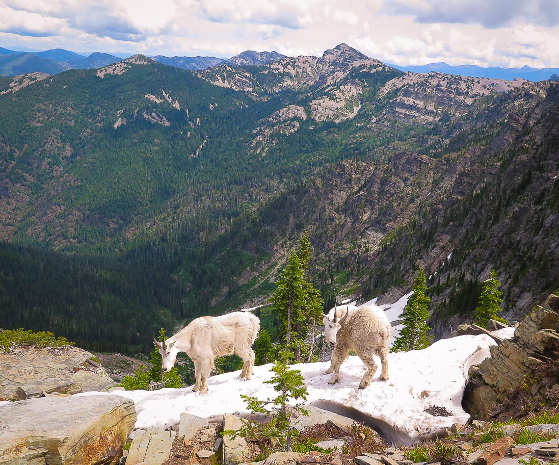 Oreamnos americanus near Scotchman Peak, Cabinet Mountains Trip Stats: Location: Kaniksu National Forest - Cabinet Mountains, Idaho Panhandle Distance: 7.4 miles Elevation Gain: 3,696 feet Lat/Long: Trailhead: 48.1644° N, 116.0984°W Scotchman Peak: 48.8888° N, 116.0818 ° WHigh Point: 7,009 feet Low Point: 3,313 feet Difficulty: Strenuous Class 1: gain roughly 1,000 feet of elevation per mile. Trail: #65 Out and back; trail easy to follow initially dirt, then talus Permit: None Maps: USGS Quad - Clark Fork, "Idaho Panhandle National Forest - Kaniksu National Forest" Date Hiked: 7/5/2019 Considerations: Dogs should be on leash due to presence of mountain goats on summit. Keep a distance from the goats and do not feed them (signs posted by USFS). Driving Directions: Distance from Sandpoint: 31.6 miles. From Sandpoint, Idaho take Hwy. 200 east 25 miles to Clark Fork; take Main Street north (Chevron station), which turns into a gravel road called Mosquito Creek Road. Continue for 2.5 miles, bearing left at a fork on the way, then turn right onto FR-2294 (it is signed for trail #65). Continue for a mile, then turn left onto FR-2294A (also signed for #65). After half a mile turn left (signed) and continue for another mile. The trailhead is to the left (signed) down a short spur road. There is plenty of parking. It is a total of 6.3 miles from Hwy. 200. Geology
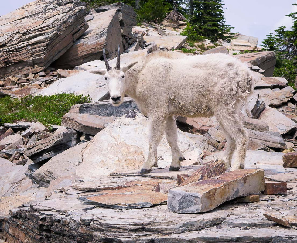 Rock near summit is siltite (altered siltstone or mudstone) and argyllite (lithified muds) - sedimentary in origin Each summer reminds me that Idaho is an extraordinary place with so much beauty to witness, so many peaks to hike, so many clear streams to walk in. And wildlife; on Scotchman Peak in North Idaho's Kaniksu National Forest. we saw a family of mountain goats including two kids in their rugged and steep habitat. This steep hike ascending about 1,000 feet every mile begins in tall pines with an understory filled with lilies and bear grass, has beautiful views of Lake Pend Oreille, the largest Idaho lake and fifth deepest in the nation, and ends in the scattered shale and rugged views of the Cabinet Mountains and remote Yaak country in northwestern Montana. After hiking a little over a mile through towering trees, views open to look upon expansive Lake Pend Oreille as the trail passes through a huge meadow gaining the ridge. Just when you thought you saw the best view of the lake, another turn of the switchback offers a better one. As expected, because of the concern and history of human and mountain goat encounters, a large yellow sign at the entrance to the open talus slopes indicates you are entering mountain goat habitat, with a rock-strewn false summit in view. As if to welcome, two goats skirted us on our entry into the open slopes. Once over the false summit, Scotchman Peak comes into view as rugged canyons drop below, at the end of the steep and layered rock ridge. More goats appeared, but kept their distance. A volunteer "greeter" from Friends of Scotchman Peak Wilderness, an organization with the goal of saving this wilderness for future generations, greeted us as we ascended the easily accessible peak. This organization has been working on getting this area designated as wilderness; voters from Bonner County in which this area resides voted against such a designation. Although the volunteer was pleasant, her "educating" us on consideration of the mountain goats was unnecessary: the signs at trailhead and mid-mountain are adequate. We go to summits to be awed, to revel in the peace and beauty that not many get to see, not to have someone tell us how to behave on a mountain top. Trust the summit seeker, they will learn from the signs and behave accordingly. Mountain goats are in the family Bovidae, which also includes antelope and cattle. Across the summit, on a tall precipice were a nanny and her two kids. She quickly gathered them and moved on as we approached the summit. The view is memorable, with the huge, deep blue Lake Pend Oreille in its Missoula Flood-scoured valley to the west, and to glacial-cut and jagged peaks to the north. The combination of the lake, goats and rows of mountain ranges make this an extraordinary hike. We continued on the ridge past Scotchman, but hiking became precarious as the ridge narrowed and drop-offs became intimidating. On our return to the trailhead, we saw a fair number of people coming up clearly working hard on the steep ascent, and clearly happy to be in that special place. One more Idaho summit climbed and the feeling that we are some of the luckiest people on this Earth to be able to explore this beautiful state. 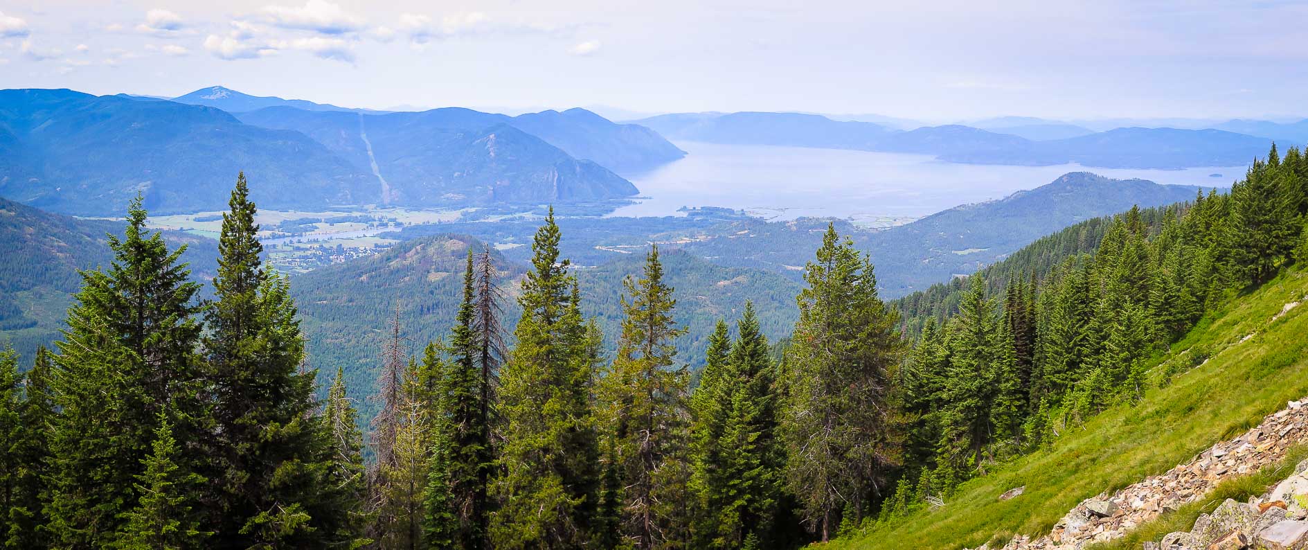 Lake Pend Oreille - west of Scotchman Peak Sandpoint on north shore, Clark Fork on east shore. Largest Idaho lake and fifth deepest in the nation.  First mile of trail to Scotchman Peak through dry forest gains ridge for ever-increasing views of Lake Pend Oreille 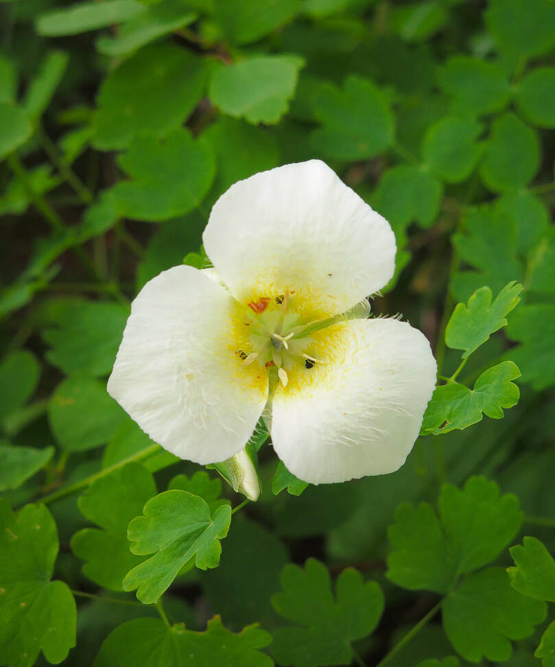 Sego Lilly - Calochortus nuttallii The bulbous roots were ground by Native Americans into a starchy meal. Mormon pioneers also used this plant as a source of food. 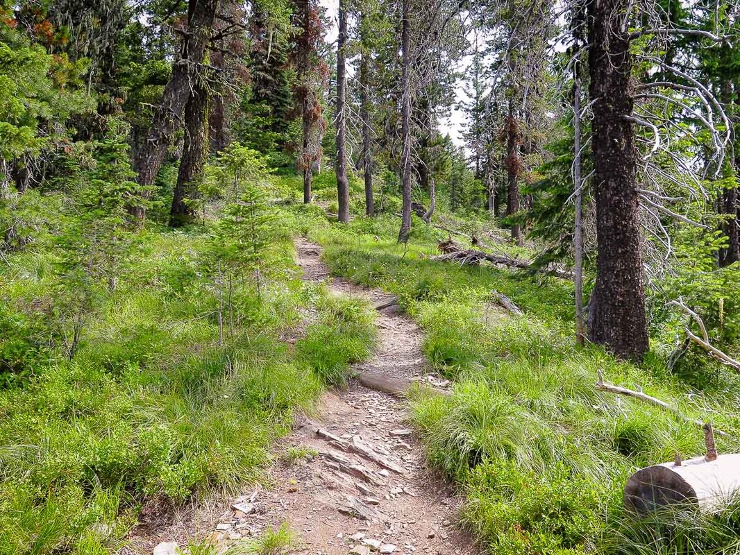 The hike is steep in parts! 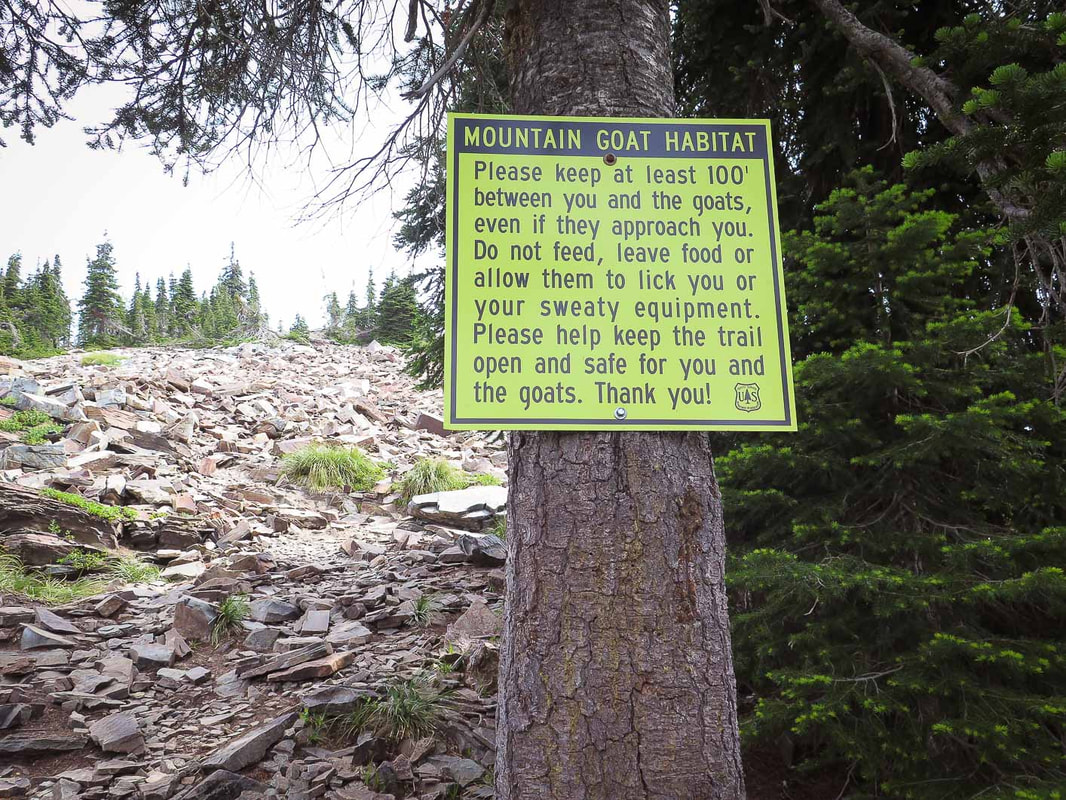 Upon entering the talus slopes of mountain goat habitat - we were greeted shortly after this sign by two goats 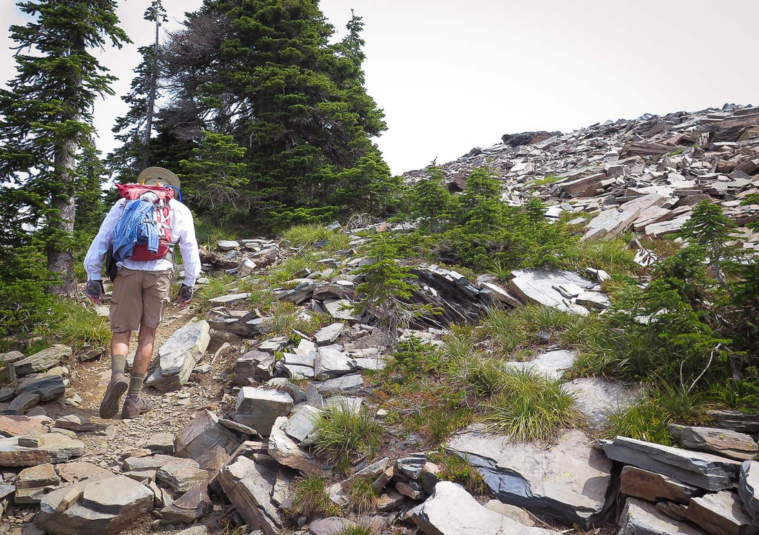 Heading toward false summit - Scotchman Peak and incredible 360-degree view seen at the top of this 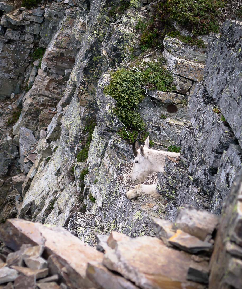 Scotchman Peak summit - 7,009 feet 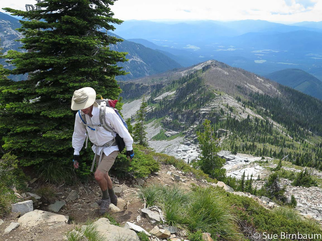 Looking southwest toward the Coeure D' Alene Forest 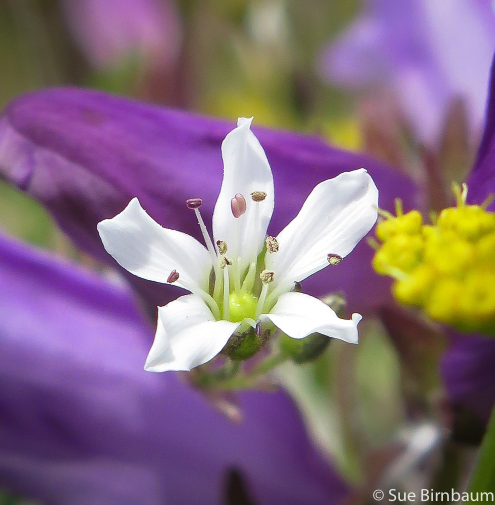 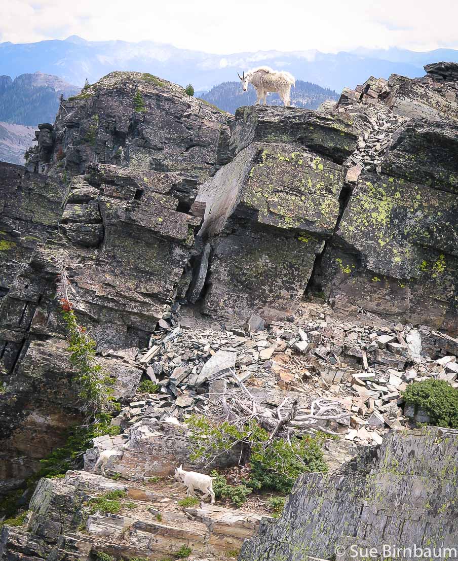 Billy watching over his two kids and waiting for them to catch up 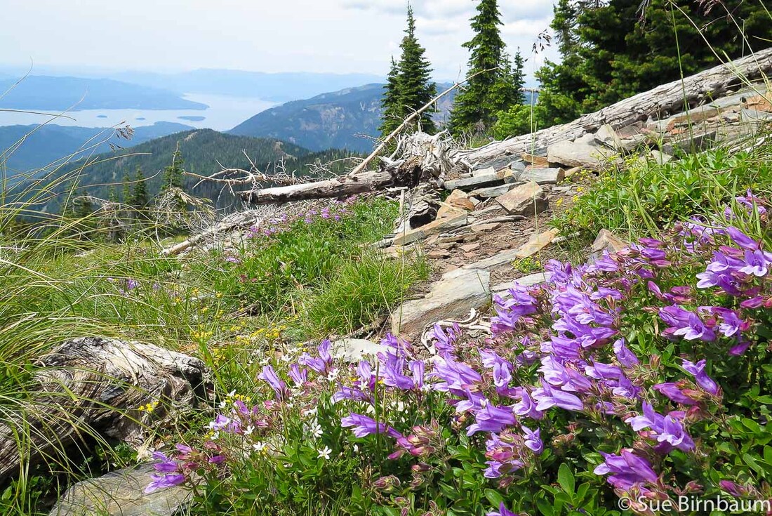 May be Rocky Ledge Penstemon - Penstemon ellipticus Near the summit of Scotchman Peak - Lake Pend Oreille to the west 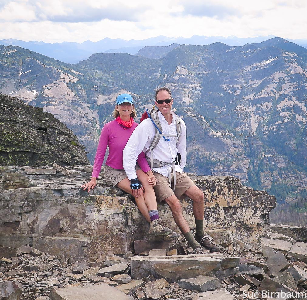 Sue and Fred - another great adventure for the books - Life is Good! Montana Cabinet Mountains on horizon 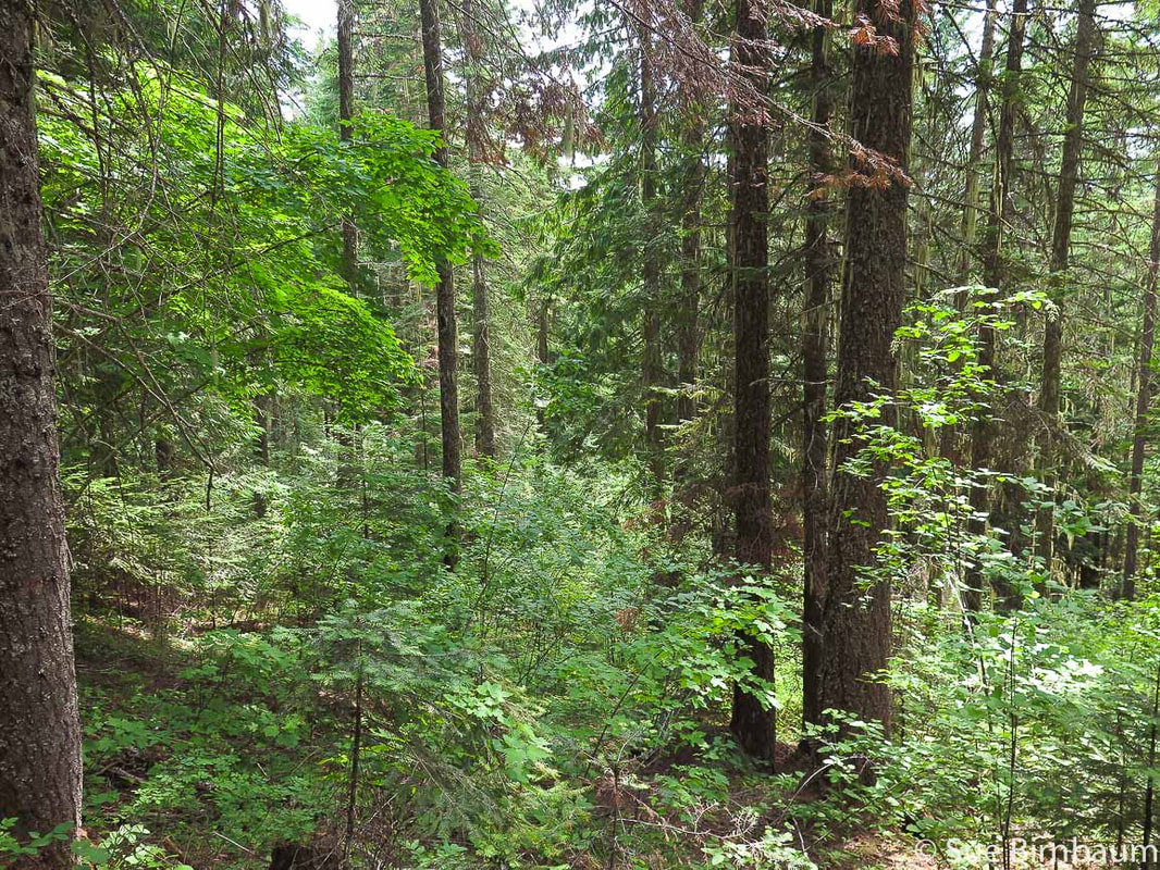 On the way down: parting shot of this beautiful forest 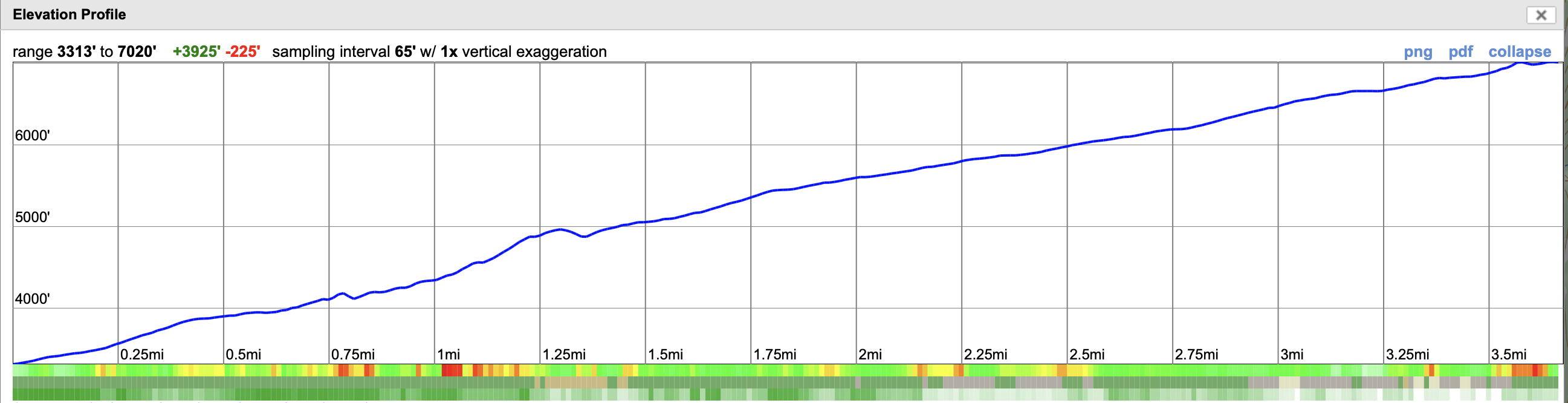 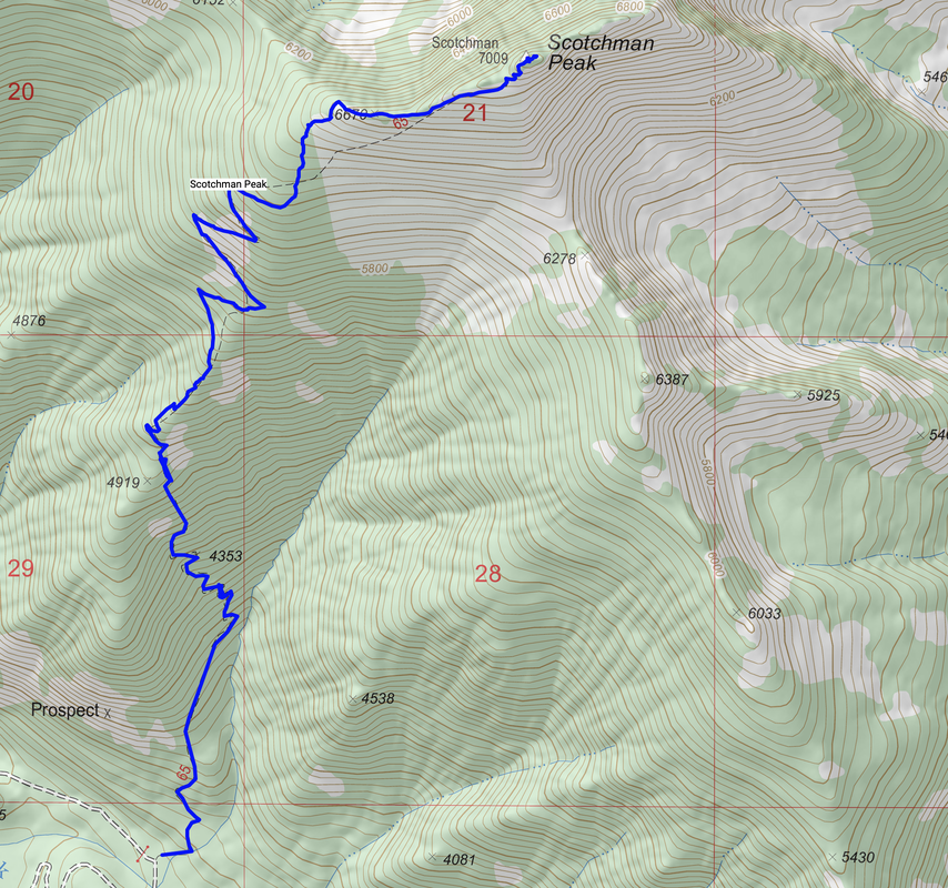 Elevation profile: Almost a 4,000-foot gain including recovering from lost elevation on the way up, over 3.7 miles Trail climbs to ridge and stays on it to the summit. References
Geologic Map of the Scotchman Peak Quadrangle, Bonner County, Idaho USDA - Idaho Panhandle National Forests - Sego Lily. https://www.fs.usda.gov/detail/ipnf/learning/?cid=fsm9_019206
4 Comments
Spectacular adventure with beautiful scenery throughout, this is a tough hike/scramble to the second highest mountain in the rugged Pioneers with a breathtaking view and steep drop-offs at your feet. 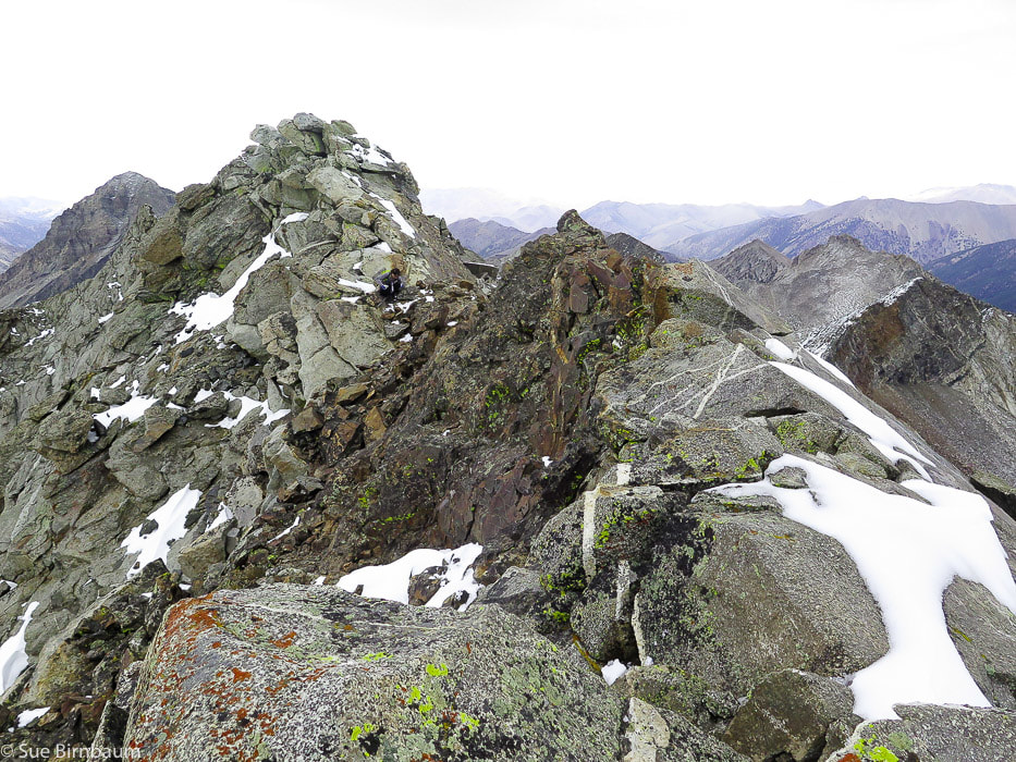 Goat Mountain - 11,913 feet - second highest peak in the Pioneer Mountain Range near Ketchum, Idaho Trip Stats: Distance: 7.7 miles one way. Elevation gain: 4,800 feet. Elevation at trailhead = ~7,100 feet, summit = 11,913 feet Location: Main crest of the Pioneer Mountain Range northeast of Ketchum, Idaho. UTM: 11T 070003 E 4850760 N Maps: USGS 7.5 min topos Phi Kappa Mountain, Hyndman Peak. Difficulty: Class 3 (Climbing using hands to propel up boulders). First 3 miles moderate hike, last 1.5 miles is a very strenuous hike/climb of 2,000 feet. Hike directions - south slopes: 1. Hike FST-165 for 3 miles north along North Fork of Hyndman Creek to intersection with trail that turns left (west) to Pioneer Cabin. The trail to Goat Mountain continues straight and had branches across its entrance. 2. View opens to a valley with pointed Handwerk Peak on the horizon, continue ~ .7 miles to confluence of N. Fork of Hyndman Creek and the unnamed creek (~8,800 feet) that flows out from basin between Handwerk Peak and Duncan Ridge. 3. At the large white cliffs, hike through the gully that separates the cliffs to a shelf above the cliffs, heading in a northeast direction to the right of Handwerk Peak. 4. Stay to the left (west) side of unnamed creek toward base of Handwerk Peak. 5. We crossed this creek when we saw open meadow to the east, then followed the meadow past the base of Handwerk Peak on its south side. 6. Head toward large granite rock fin on horizon ("Florian's Nudl"). Goat Mountain is located to the left of this. Boulder field is large but stable. When viewing boulder field, the route leading around the east side with more grassy areas may be less technical than straight up boulder wall. 7. Terrain becomes less steep; hike to the north (left) of Florian's Nudl to the steep climb of Goat Mountain. Driving directions: From ID-75 4 miles south of Ketchum, turn east onto East Fork Road. Trailhead for Goat Mountain hike is 11.2 miles from this turn. Travel 5.2 miles on paved road to Triumph: from this town it is 6 miles to trailhead. Road forks 1.3 miles after Triumph: stay on Road 203 (taking left turn) toward Hyndman campground and North Fork Hyndman Creek. At 10.1 miles, see sign "Road Closed 1 Mile". Drive ~ 1.0 more mile to parking for Hyndman Peak trailhead. Continue through this ~ 0.1 more mile to a second grassy parking area for trailhead leading to Pioneer Cabin and Goat Mountain. Geology: Pioneer Range Metamorphic Core Complex consists of a lower plate of Precambrian gneisses (2 Ga) and Cretaceous to Early Paleogene granitic rocks, and an upper plate of Paleozoic sedimentary rocks overlain by Challis Volcanics. When crustal extension started in the west (50 Ma), the Wildhorse detachment fault developed and separated these two plates and Challis Volcanics was part of this extension. Low-angle faults developed in the upper, brittle layer, removing them, exposing the lower layer of metamorphic rocks (core complex) up to 2.3 billion years old. CAUTION: Become familiar with this route using a good topo map, as there is no marked trail beyond crossing of North Fork Hyndman Creek at the white cliffs. 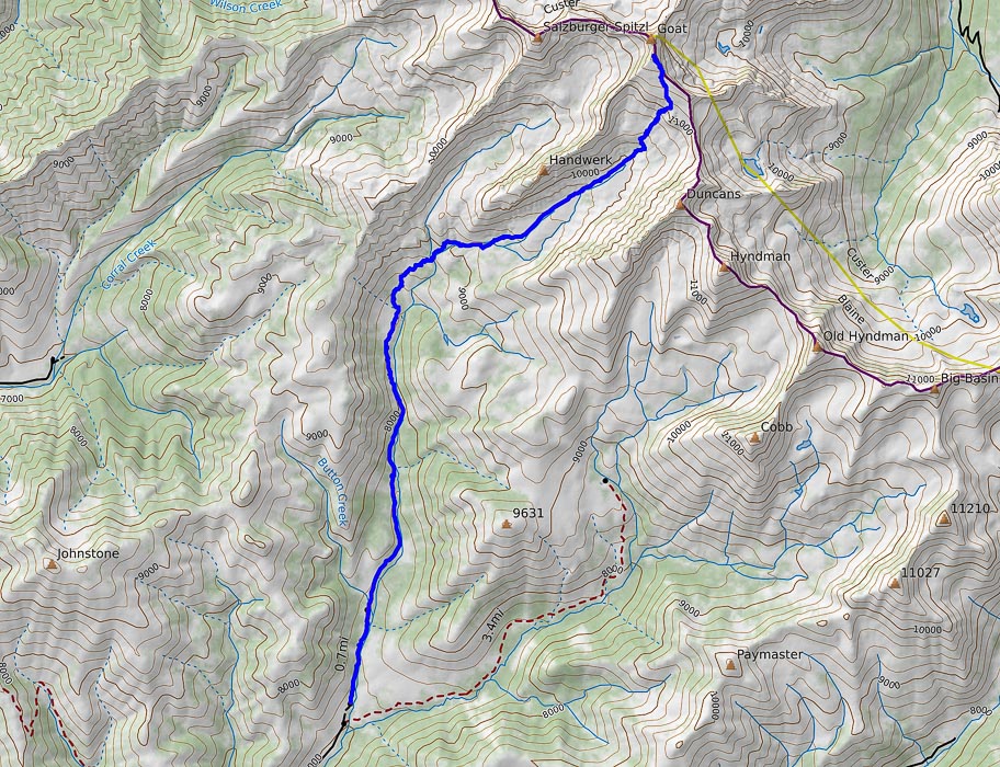 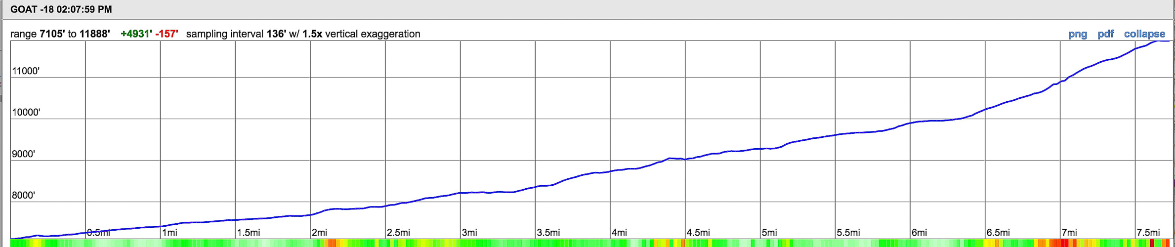 Our route (in blue) and elevation/mileage profile for Goat Mountain, Pioneer mountain range, Idaho Elevation range: from 7, 105 feet to 11, 900 feet in 7.7 miles "The love of mountains is best." - inscription carved in Greek, found on a summit rock in the Alps by a Swiss adventurer in 1558. When our friends John and Val asked us to climb Goat Mountain with them, we seized the opportunity. Fred and I usually do these adventures by ourselves, so it was that much more fun to be with fellow climbing enthusiasts, especially since they had been to Goat before, so we could be able to cover the 7.7 miles to the summit expediently. Ask anyone who has hiked and climbed in the heart of the Pioneer Mountain Range, and you may see their countenance change to a look of knowing bliss and reverence as they tell you about its sheer beauty and wildness. Granite crags, spires and domes hang raw and exposed over glaciated basins dotted with car-sized boulders and wildflowers in meadow grasses. Hike to Pioneer Cabin, built high on a bench at 9,400 feet and get a spectacular view of the main Pioneer crest to the east. The following photo of Pioneer Cabin was taken a few years ago, and now I can say that I have walked up that wide valley to the top of Goat Mountain, the peak situated on the left horizon in this photo.  Pioneer Cabin (elevation 9,400 feet), built in 1937 looks to the east at Duncan Ridge, Handwerk Peak and Goat Mountain The southern route to Goat Mountain ascends the wide basin seen in this photo  North Fork Hyndman Creek The weather forecast said it was to rain in the afternoon. John, Val, Fred and I started on the trail under blue skies and found ourselves pummeled by frigid winds and ice pellets when we got to the summit of Goat Mountain. Not a fun time to take photos, however it adds excitement to the trip and knowing that not many people get to experience the sudden advancing of fall and winter in mid-September at nearly 12,000 feet on a precipice. We got down the main crest pretty quickly. The first 3 miles of this hike treks along the west side of North Fork Hyndman Creek with its colorful quartzite boulders and crystal clear water to an intersection with the trail that leads to Pioneer Cabin at 8,200 feet. Continue straight into the valley ahead, walking over branches placed across the trail to steer Pioneer Cabin hikers to the trail that takes off to the left. The pointy, fang-like Handwerk Peak appears as you walk through a sagebrush and bunchgrass valley to a crossing of the North Fork Hyndman Creek, another 0.6 miles past the intersection. Then, climb through the white cliffs, through an obvious gulley that separates the cliffs to a shelf above. Stay to the left (west) of the creek whose water sources from the unnamed basin between Handwerk Peak and Duncan Ridge. Our party accessed this basin two different ways: Val, Fred and I hiked the west side of the creek to near the base of Handwerk Peak. John crossed the creek earlier and ended up waiting for us further up this grass-filled basin south of Handwerk.  Intersection with Pioneer Cabin Trail (to the left). Keep going straight over branches to valley ahead  Handwerk Peak Named after Ted Handwerk, who served in Italy during WWII 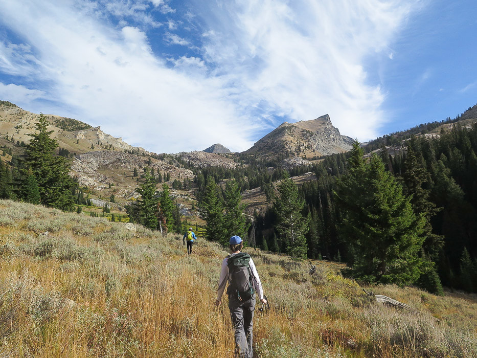 John in lead walking north toward the base of Handwerk Peak on its south side Route goes through the white cliffs just above John in the photo and turns northwest, staying to the west of drainage We crossed the narrow stream at the bottom of the basin and walked through tall bunch grasses at first, and then short grass as we neared the cirque wall at the end of the basin. Aim for Florian's Nudl, a fin-shaped dome on the ridge above the cirque. Goat Mountain is the prominence to the left on the ridgeline. The walk through this basin is a sensory experience of contrasts. Native, aromatic grasses are soft and quiet underfoot, like a huge gold carpet while the cold, ragged mess of walls and boulders looms ahead, sweeping down both sides in a U-shaped curve, typical morphology of glaciation. At the end, you run out of grass, except for a few patches distributed among the boulders. We went straight up the steep boulder wall in front of us, and came down the more circuitous route that contains more grassy areas to the right side (east) in the cirque. A huge boulder with a white "X" across its face lies at the entrance to the boulder field. Next time I do this climb, I will find this boulder and go up to the right; this route descending seemed longer but less steep. It's hands-on boulder climbing either way. 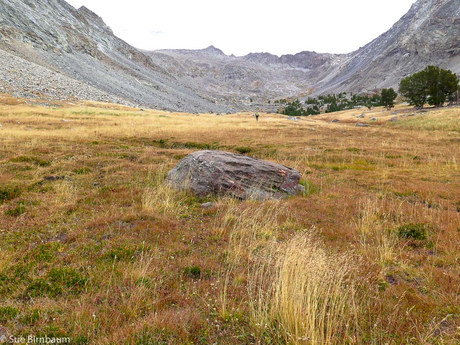 Basin between Handwerk Peak and Duncan Ridge Head toward Florian's Nudl, the fin-shaped dome toward the center of the ridge 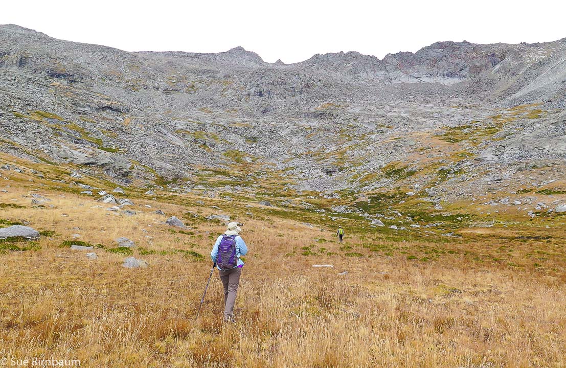 Heading towards Florian's Nudl Goat Mountain on far left of horizon 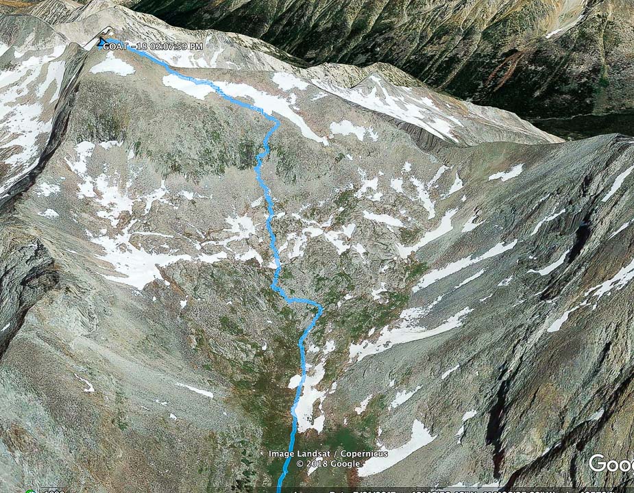 Our route up boulder field at end of basin to Goat Mountain On the hike down, we made a wide curve to the right in this photo: more distance but less steep The boulder-hopping was stable; rarely did I step onto a "tippy" rock. John practically ran up the rocks, while the three of us followed, grasping onto the granite and grass to hoist up. During the long climb, the skies became darker, and when we finally reached the top, we were assaulted by stinging ice crystals and a brisk, frigid wind. What timing! Snap a few photos, look at the squalls of rain around us, try to maintain our balance on the top of a narrow Pioneer Range ridge with 1,000-foot drops on both sides. Celebrate the breathtaking (literally!) 360-degree scene; commit to memory. And then get down. Goat Mountain has a double peak - we didn't get to the second (north) prominence which is slightly higher. 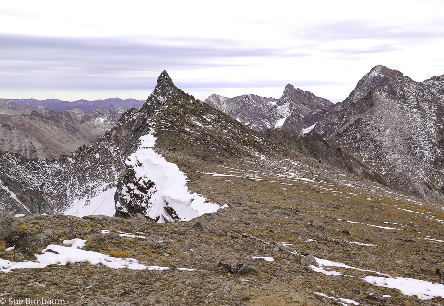 Florian's Nudl - Use this landmark for direction when climbing from basin below Named after Florian Haemmerle, an original instructor of the Alpine Touring School and the original curator of the Pioneer Cabin 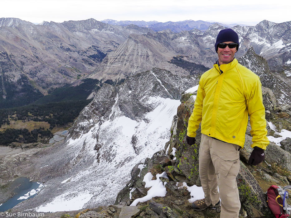 Fred near top of Goat Mountain 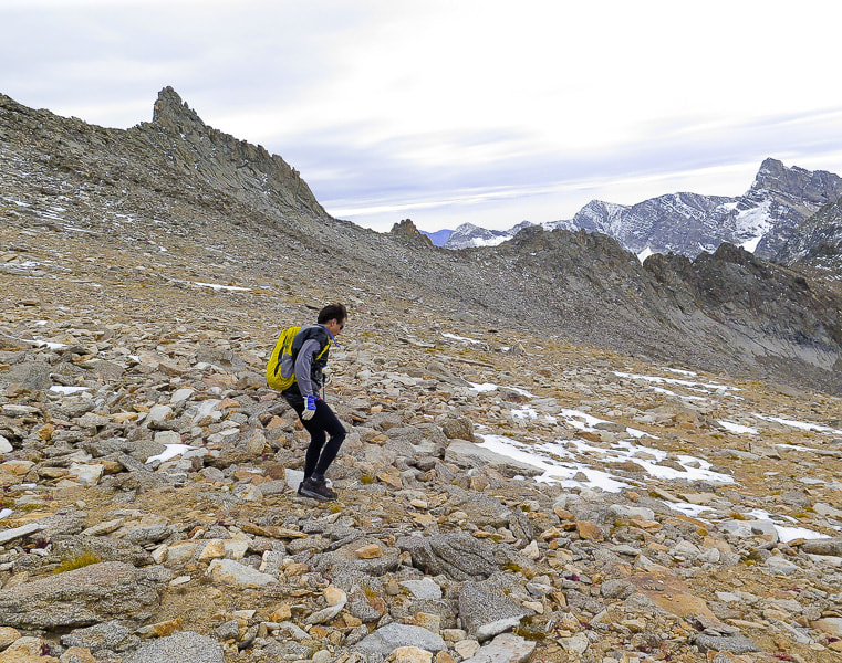 John heading down shelf above boulder field Florian's Nudl above him. 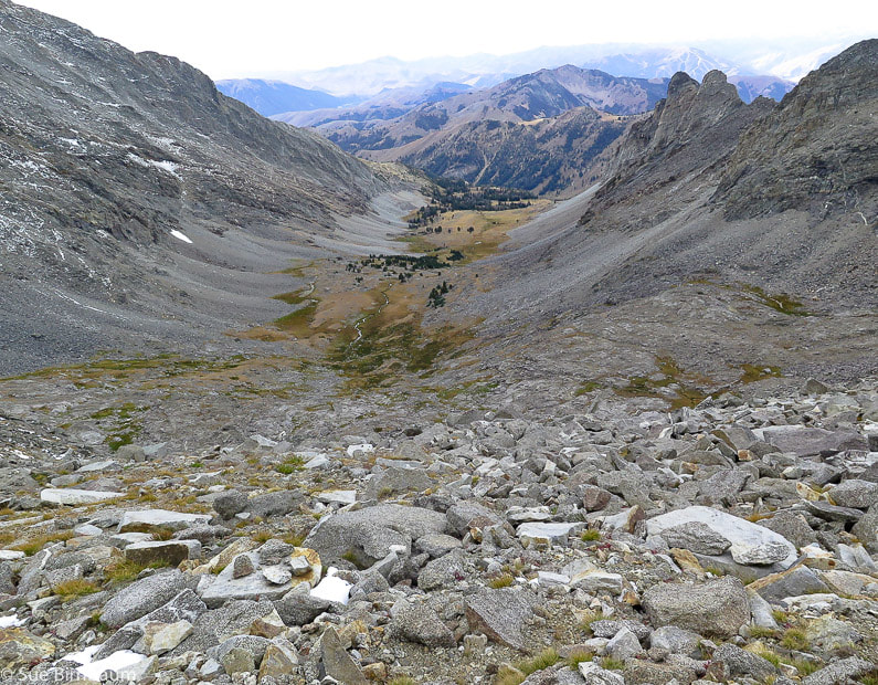 Looking down upon the basin we ascended, between Handwerk Peak and Duncan Ridge toward the southwest. John went down the direct steep face. Fred, Val, and I hiked toward the east side of the cirque. Descending down a gully near a sheer wall, we heard water rushing under rocks and I suddenly saw something white. A mountain goat stood calmly watching us at the bottom. We stopped and stared at each other. It posed for us a few minutes, then slowly ambled toward the rock wall. It looked like it was growing its winter coat. We joked that the goat was taking note of humans' relative incoordination while traversing rocks. We had seen mountain goat hair in the tundra grasses on the way up the mountain. 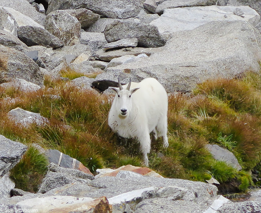 Oreamnos americanus We met up with John at the bottom of the boulder field. A refreshing, cool rain onto the bunch grasses made a clean, earthy scented air, which I breathed in deeply. Tall grey walls rose on either side. Occasional large boulders sat solitary and we took a short break on the lee side of a large one. Probably dropped out of the receding glacier. We resumed descending the basin and when I turned back to see the cirque and the ridge, curtains of rain covered most of the view. In our chatting, we didn't pay attention to staying close to the stream drainage and got too far to the west, so we took some extra time route-finding, thrashing through brush, navigating more boulders, and crossing streams to get back to the trail. A gentle rain cooled us the last two miles of the hike. In the cloud-covered dusk, we saw two bow hunters emerge from the woods in camouflage. The sky on the horizon was clearing. We raised a toast to our awesome 11-hour day with the excellent beer at the Power House in Hailey. We celebrated getting to the summit together in a spectacular mountain range where we saw no one else on the trail. We celebrated the fact that we are lucky to be able to see things that most people don't, and that our bodies are able to take us there. 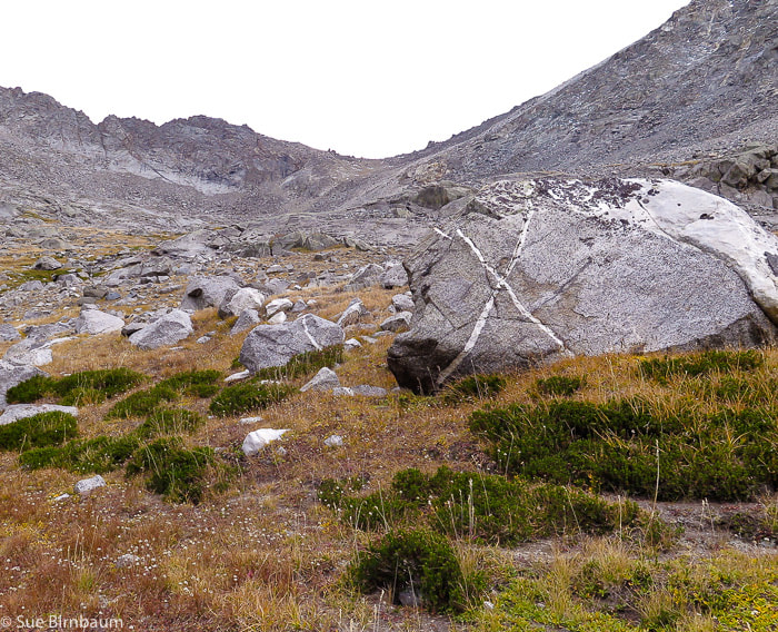 Boulder with white "X" at beginning of climb out of basin 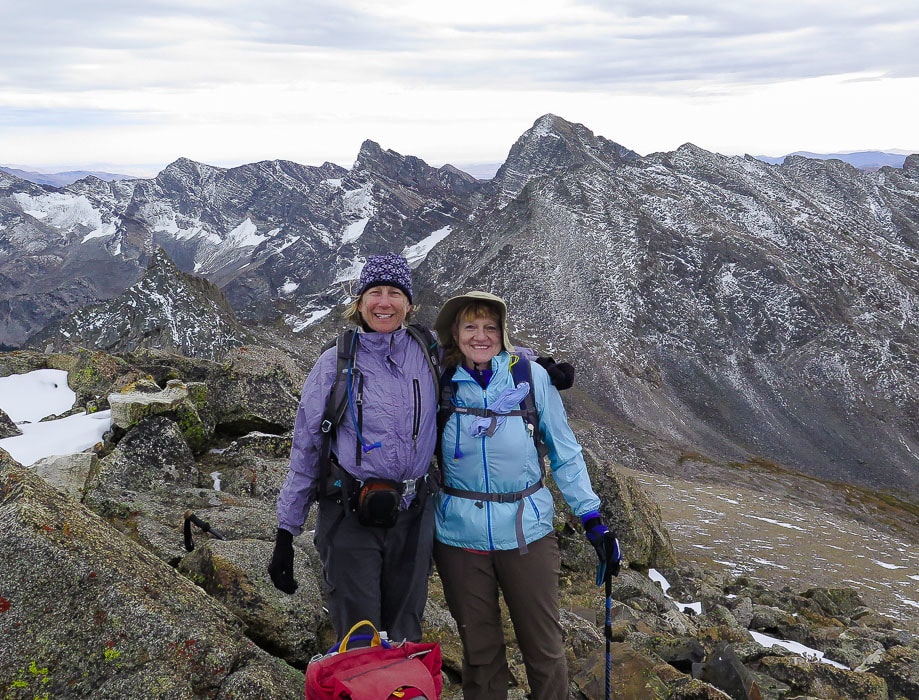 Sue and Val at the top! 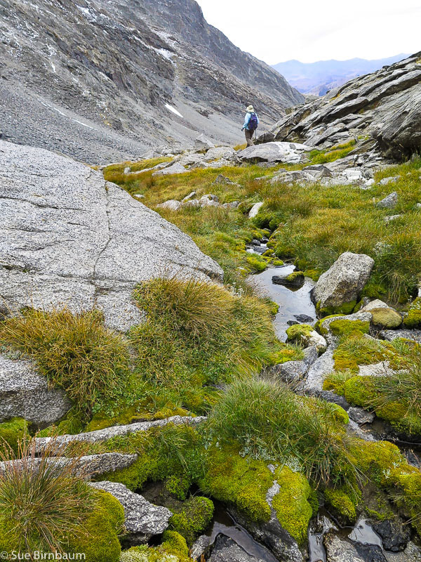 Walking down toward basin towards east side of cirque References:
Appearance of the Mountain Goat. Website by the British Columbia Mountain Goat Society, copyright Smithers BC Canada. A Brief History - Pioneer Cabin. Digital Geology of Idaho - Idaho Basement Rocks - Idaho State University. Lopez, Tom. 2000. Idaho - A Climbing Guide: Climbs, Scrambles and Hikes. The Mountaineers Books, Seattle, WA. Metamorphic Core Complexes - Idaho Museum of Mining and Geology. This superb steep ridge hike out of Arrowrock Reservoir in the Boise Mountains treks through blankets of wildflowers and provides an exhilarating view of water and mountain ranges. It's our final "Grand Slam Peak".
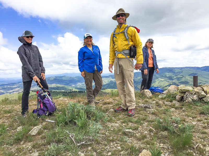 Fred and members of the Summit Sisters on summit of Mt. Heinen - 6,336 feet Trip Stats (Southeast Ridge Approach): Overview: A challenging, uncrowded hike with open views through native bunch grasses, Ponderosa Pines and wildflowers, and smooth Arrowrock Reservoir at your feet. Distance: 10 miles round-trip Elevation gain: trailhead elevation = 3,200 feet; Mt. Heinen = 6,336 feet. Add to this ~ 560 feet of re-capturing elevation lost in descents on the way up: total elevation gain to summit ~ 3,700 feet. Difficulty: Very strenuous first 3 miles - then moderate last 1-2 miles. Mostly Class 1 single- track Dates hiked: 5/26/2018, 9/30/2018 and 11/17/2018 Maps: USGS quads: Dunnigan Creek, Arrowrock Reservoir NE, and Grape Mountain Lat/Long Mt. Heinen: 43°39'43" N 115°52'33" W Directions to trailhead: from Boise, drive ID 21 north past Lucky Peak Dam, over Highland Valley Summit, then cross the bridge over Mores Creek (steep basalt cliffs). Turn immediately right after bridge with signs to Atlanta onto FR-268 and travel 14 miles on this road past Arrowrock Dam. Road becomes gravel and places are narrow. At mile marker 14, park at small lot next to Irish Creek Campground on right side. Sign on right side of road just adjacent to trailhead reads "2681C". There are a few pull-outs on this short road to Irish Spring campground. Hike directions: Trailhead (unmarked) located directly across FR-268 from Irish Creek Campground. Trail clearly ascends steeply to the northwest over sand and gravel. It levels off in 1.8 miles at Point 5402 with a gain of over 2,000 feet, then descends briefly before climbing again. Reach Point 6137 at 3.3 miles. Hike around to the west of this knob. Mt. Heinen is finally seen as the highest rise on the left of the ridge. The trail turns north around this point and ascends/descends 1.7 more miles to the summit. We found one good bypass that avoided climbing to a point on the ridge; when in doubt, stay on the ridge. (Recommend hiking poles for last 2 miles of steep descent on the way back on gravelly surface). CAUTION: Trail mostly on exposed ridge - be aware of weather forecast (thunderstorms). Geology: Granodiorite and two-mica granite - Atlanta Lobe of Idaho Batholith, Cretaceous age. "In the end you won't remember the time you spent working in your office or mowing your lawn. Climb that goddamn mountain." - Jack Kerouac 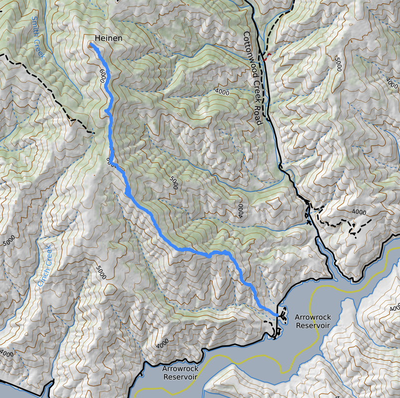 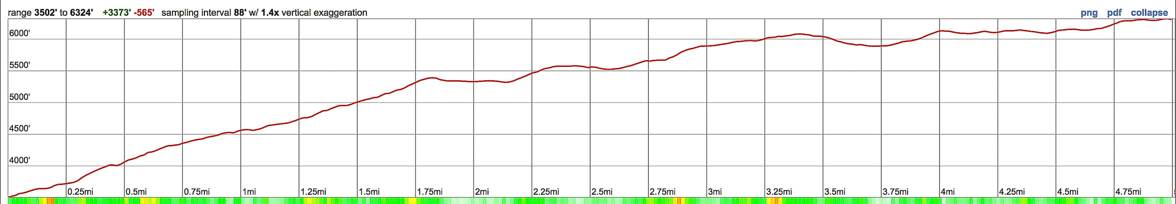 Our route and elevation profile up Mt. Heinen's southeast ridge 5 miles to summit with cumulative 3,700 feet of elevation gain Arrowrock Reservoir is lower right - hike begins adjacent to the Irish Creek Campground located 14 miles in on FR-268 from turn-off of ID 21. click on map for PDF Our Hike Stepping onto a mountain summit, no matter how high, is always cause for celebration. The top of Mt. Heinen was even sweeter because Fred and I celebrated the completion of the four "Grand Slam Peaks" with members of the Summit Sisters, a women's hiking group who were doing the same in May, 2018. Since then, we have summited Mt. Heinen two other times this year: in September we took a friend and his two boys, Deacon and Kaleb and in November we took our friends Val and John. Deacon and Kaleb were working on completing their four Grand Slam Peaks. We had recently summited Goat Mountain with Val and John, a very tough hike, and now we were on another tough hike up Mt. Heinen. Tom Lopez, author of the website Idaho: A Climbing Guide hikes four summits for spring training: Mt. Heinen is the toughest. The other Grand Slam Peaks are Lucky Peak, Cervidae Peak, and Kepros Mountain. Fred and I use Lucky Peak for training, and we will definitely be back on Heinen because it's skinny single-track, perched on a ridge most of the way is surrounded by knee-high wildflowers, peaks, and views of Arrowrock Reservoir. The green and lush vegetation reminded me a bit of Crested Butte, Colorado hikes. 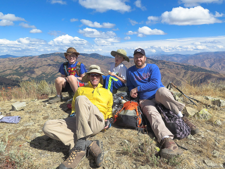 Deacon, Fred, Kaleb and Greg on summit of Mt. Heinen - September 30, 2018 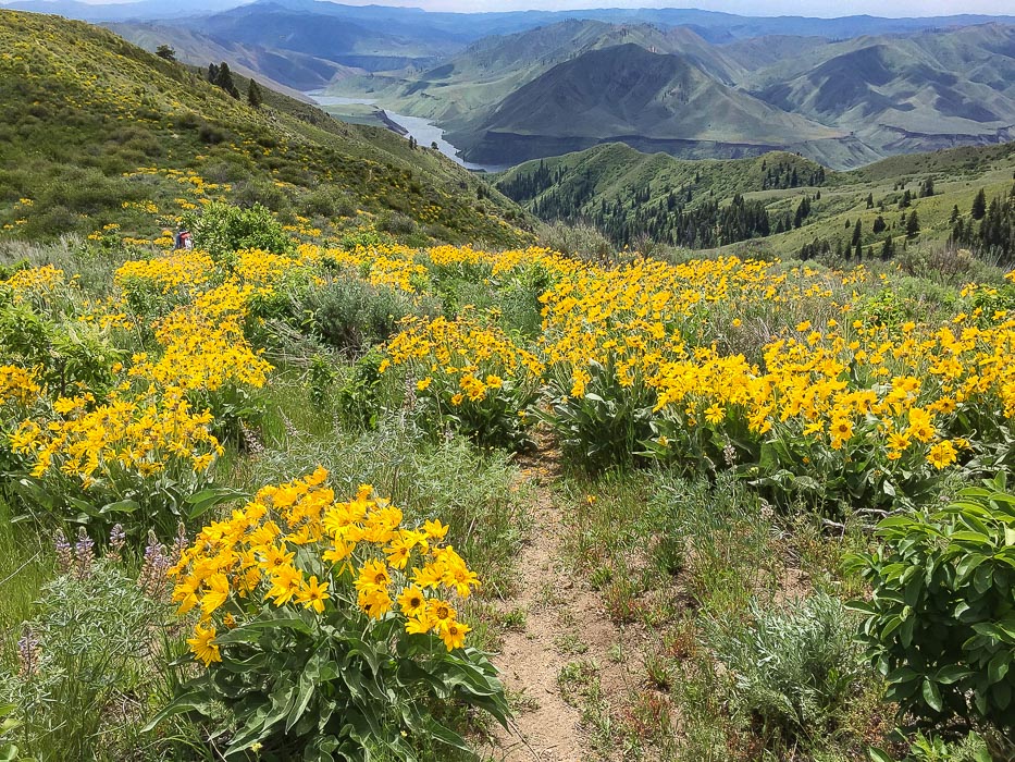 Arrowleaf Balsamroot with Arrowrock Reservoir in the distance 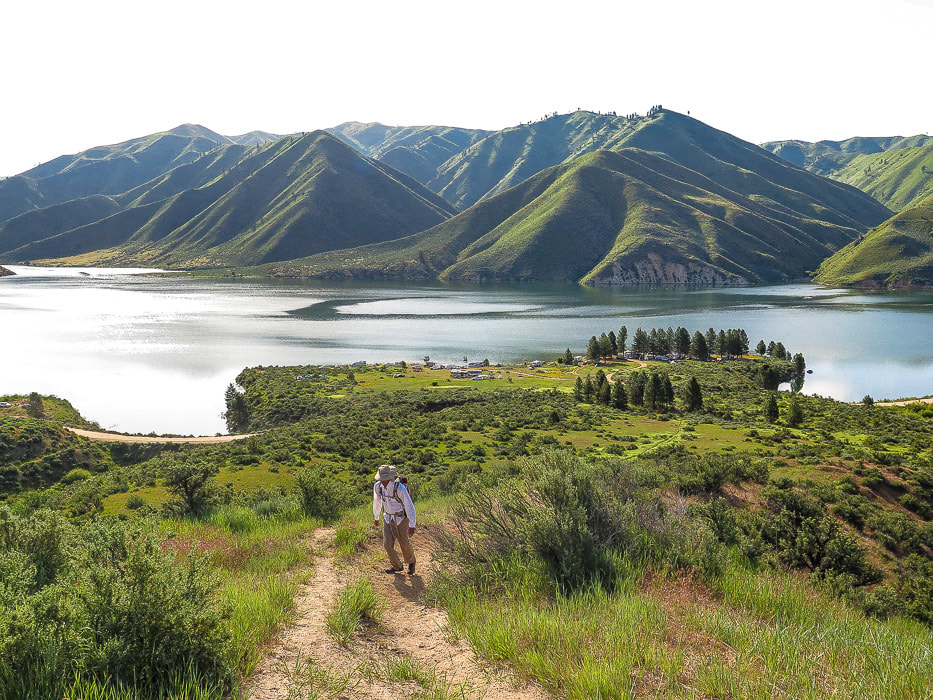 Initial steep climb out of Irish Creek Campground, on the shores of Arrowrock Reservoir The trail in sight starting at FR-268 adjacent to Irish Creek Campground on Arrowrock Reservoir is steep and straight up - it vanishes over the ridge on the horizon. To know that this is only the beginning of the climb and that there is so much more elevation gain is the fun part of the challenge. The initial climb levels off into a beautiful meadow, but only for a short distance and then it climbs unmercifully again utilizing a few short switchbacks, to finally top off at Point 5402 at 1.8 miles where perspective can be gained. Mt. Heinen still can't be seen, not for another mile or so. It is at this top-off before descending into a shallow saddle where Point 6137 comes into view as the left-most of twin points on the horizon. It has one tree on top. That is the landmark for the trail, as it contours around the left (west) side of this point and then heads almost due north. The wildflowers - mostly Arrowleaf Balsamroot - were at optimum blooming the end of May. Threadleaf phacelia and bright purple penstemon were so lush and healthy. At times the vegetation grew so abundantly over the trail that we had to pay attention to where we were going. This is a ridge hike, open and airy as you walk above the landscape as the hillsides below fall away into undulating blankets of green and yellow with distant blue-gray mountain ranges surrounding. The trail is easy to follow most of the way but it gains a few "false summits" before Mt. Heinen comes into view. Closer to the peak it becomes less wide. Like Mount Kepros, after the initial steep ascent and onto the ridge, the trail makes a series of hill climbs and saddle descents. Near the summit, the trail treks through Idaho Batholith granite. 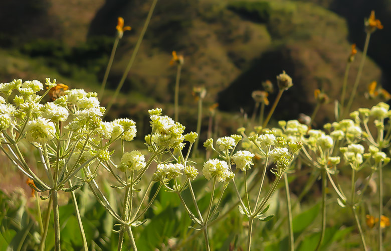 Parsnipflower Buckwheat or Whorled Buckwheat Eriogonum heracleoides 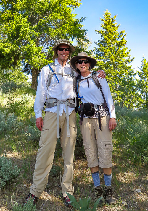 Fred and Sue on trail to Mt. Heinen 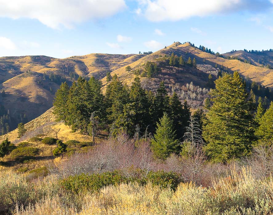 View from crest of initial climb, 1.8 miles from trailhead Point 6137 is first seen as the left point on the horizon with the single tree on it - trail goes on the left (west) flank of this point and then heads due north to summit On the way down, stay on the ridge you ascended by walking around this point to the left and staying on ridge that leads southeast 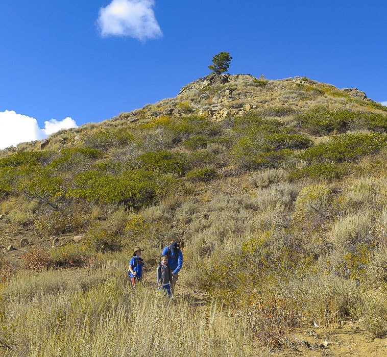 Point 6137 - trail changes direction from NW to north as the trail curves around the base of this point on its west side At Point 6137, we passed a group of three people who had decided they would turn around, except for one hiker, a member of the Summit Sisters who hiked with us for a while and then joined up with the rest of the Summit Sisters members on the trail further up. It is at this pointed rise with a single tree that Mt. Heinen can finally be seen - the furthest peak on the left/end of the ridge. It is here that the trail winds around Point 6137 to the west and then heads straight north to Mt. Heinen. On the autumn hike with Greg, Deacon and Kaleb, I became "temporarily bewildered" and walked down a small trail to the west of Point 6137. On the return hike, make sure to walk completely around Point 6137 (eastern ridge). Avoid the ridge that descends to your right (west). At the base of Point 6137, the trail continues down the east ridge, east of large drainage that separates two major ridges (see topo map above). On the spring hike, we made the 5.0-mile hike to the summit in 2 hours and 50 minutes. One by one the Summit Sisters joined us in celebration. By then, an ominous dark cloud came over us, so we all decided to descend. I recalled Lucy Jane Bledsoe’s quote: "Perhaps climbing a mountain is nothing more than an act of worship, and reaching the barren perch of a summit is to experience pure awe." - Lucy Jane Bledsoe, The Ice Cave Admittedly, some summits are more spectacular than others, but each summit is cause for celebration. Mt. Heinen is the last on the ridge that runs to the northeast of Irish Creek and there is ultimate satisfaction in getting to the end of the ridge. Most peaks are hard-won, or in other words gained by hard work and effort, overcoming obstacles that get in your way, whatever they may be (in my case, tired legs and burning quads!). I was impressed with Deacon and Kaleb on our second Mt. Heinen hike; they have been getting fit by hiking Kepros and Cervidae. They did great on this tough hike and we had a celebration at the top in the warm autumn sun surrounded by hillsides dotted with shrubs whose leaves were turning yellow. The last mile to the summit is a ridge ramble on moderately difficult terrain, at times maneuvering around or on top of granite rocks. The summit geological marker post can be seen from a distance. Grand Slam peaks are done! The May Mt Heinen summit got us in shape for a summer of summit hiking. Mt. Heinen also gave us a new perspective on the land of Southern Idaho and the vastness of the Boise National Forest. The last mile of descent was the most difficult part of the hike because it is so steep on loose gravel and rocks. A walking stick is helpful for this part. When I needed a rest, I had an awesome scene in front of me of the Arrowrock Reservoir. 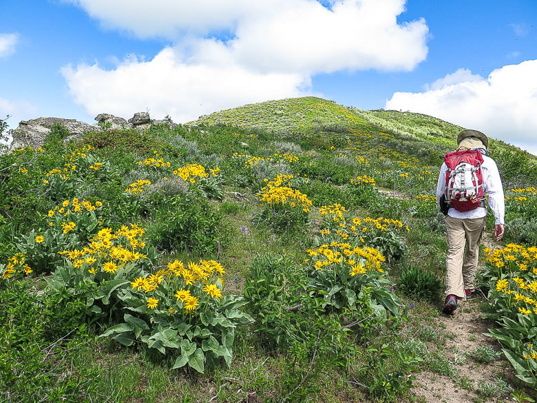 Walking toward a "false summit", or as I like to call them "pseudo summit" 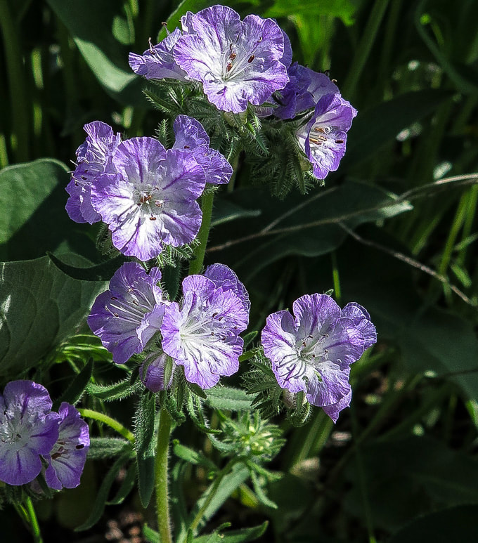 Threadleaf Phacelia Phacelia linearis 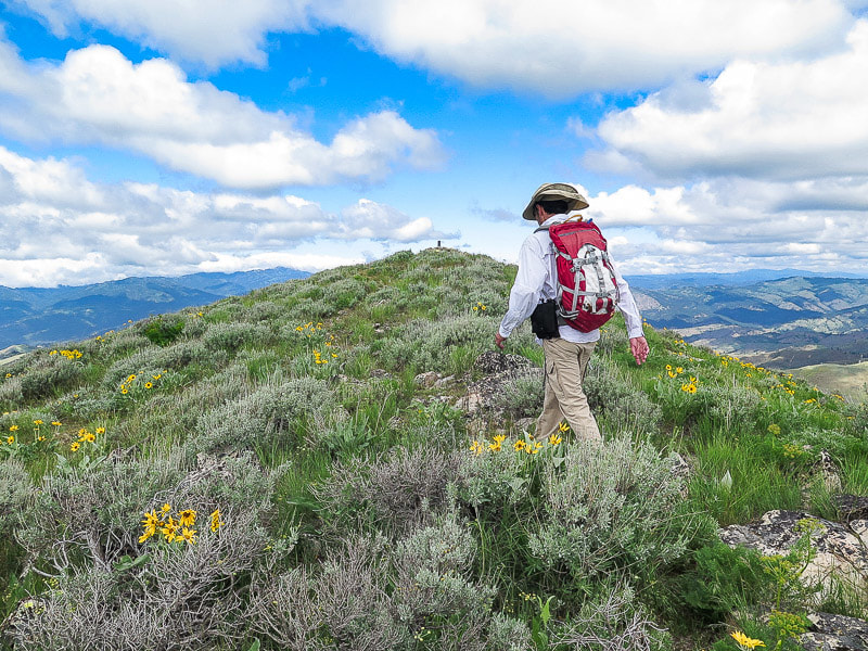 Approaching summit USDA geological marker placed in 1946 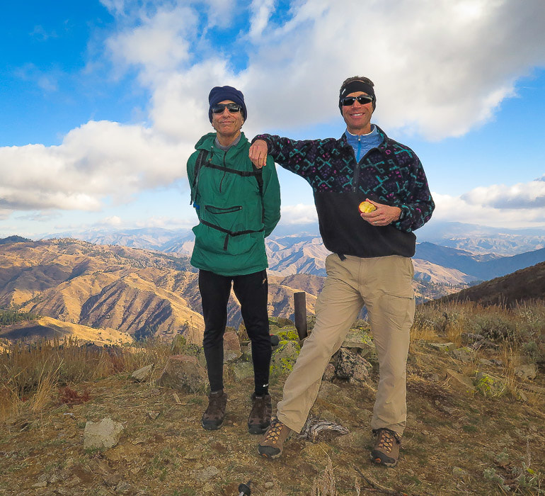 John and Fred on summit of Mt. Heinen - November 2018 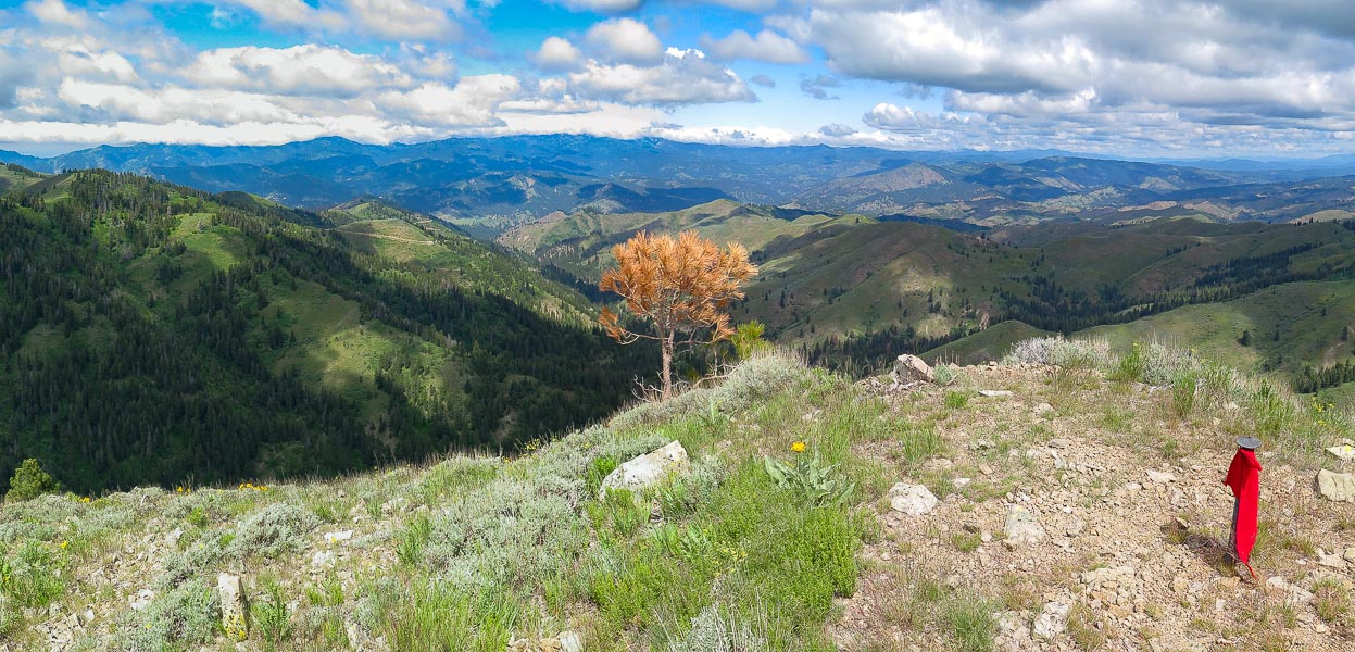 Summit of Mt. Heinen looking north with red felt flag attached to marker 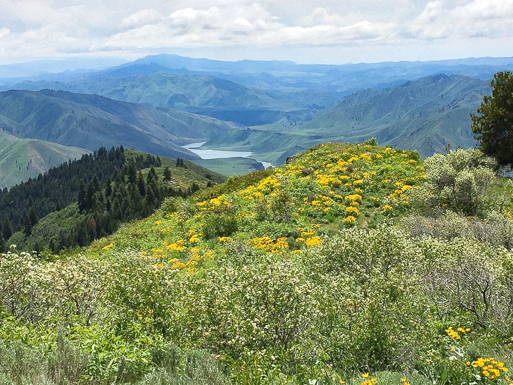 View from summit of Mt. Heinen looking east 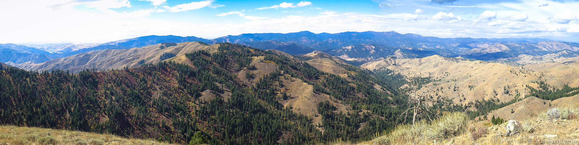 View to NW from Mt. Heinen summit 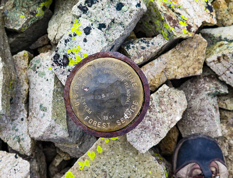 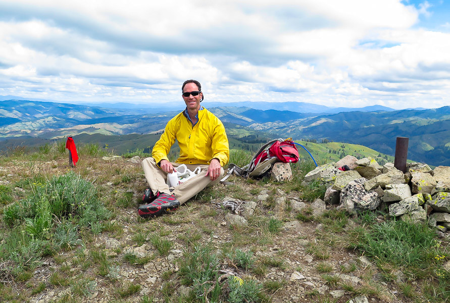 Fred on summit of Mt. Heinen 4 Grand Slam Peaks Completed! 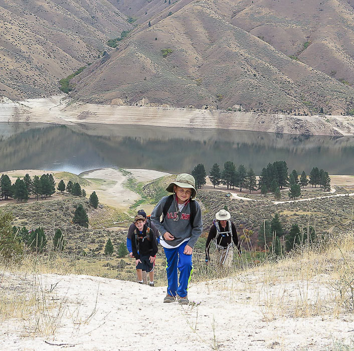 Greg, Deacon, Kaleb and Fred on initial climb to Mt. Heinen 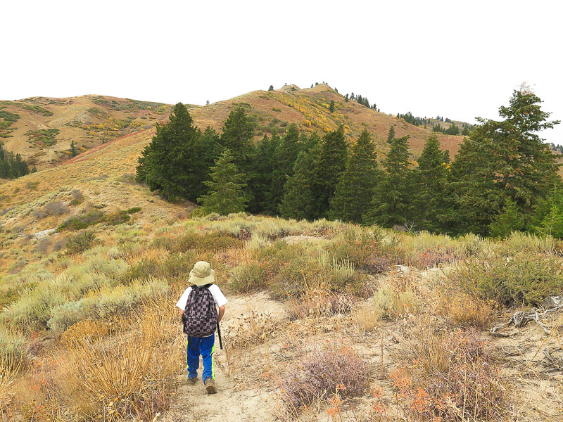 Kaleb is about 2.25 miles into the hike - headed to the rise on the horizon 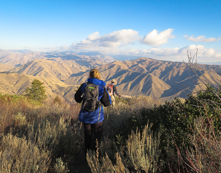 Val and Fred heading down toward Arrowrock Reservoir  Arrowrock Reservoir and Irish Spring Campground/dock on the way down the trail
A spacious ridge ramble in the Danskin Mountains with abundant wildflowers and views of snow-covered Trinity Mountains and Arrowrock Reservoir. 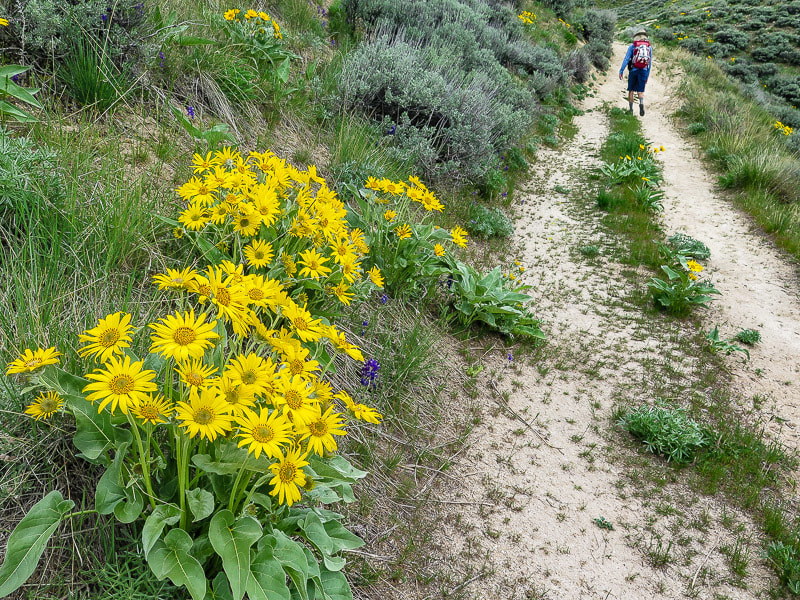 Trip Stats Overview: Take a solitary and refreshing walk along a lush and undisturbed landscape close to Boise with views of Shafer Butte, Trinity Mountains and Lucky Peak Lake. Trail begins at Blacks Creek Road summit on a steep single-track motorcycle trail with some steep ascents and descents, then meets with a jeep trail that ends at the summit of Kepros Mountain. Distance: 9.7 miles out and back (4.85 miles to Kepros Mountain). Elevation: Trailhead 4,780 feet, Kepros 5,422 feet. Net gain to summit is 1,540 feet; net loss to summit is 930 feet. Map: USGS topo - Arrowrock Dam, ID 7.5 min. Coordinates: Kepros Mountain: 43.33.33'36.06"N, -115.56'21.71"W, Trailhead: 43.49851, -115.92379 Difficulty: Moderate effort; trail is not marked but path easy to find. Compass and topo map helpful. Some short steep climbs on return from summit. Dates Hiked: May 5, 2018, April 18, 2021. Directions to trailhead: Drive I-84 east of Boise and exit Blacks Creek Road (Exit 64). Take a left (north) onto Blacks Creek Road and travel 6.4 miles to intersection with signs for Prairie, Idaho. Take a left at this intersection driving toward Prairie. Shortly, the road becomes gravel. From this intersection, travel another 4.6 miles to the summit of Blacks Creek Road and park in large lot to the right of road (you will pass a parking lot to the right 0.6 miles before this second large parking lot). This is a popular ATV trailhead with the ATV road heading to the right (east). Cross Blacks Creek Road (west) to get on Kepros Mountain trailhead. Total distance from beginning of exit ramp off I-84 to trailhead parking = 11.1 miles Geology: Granite from Atlanta Lobe of Idaho Batholith - Cretaceous age (85 - 67 Ma). 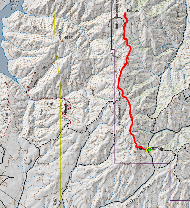 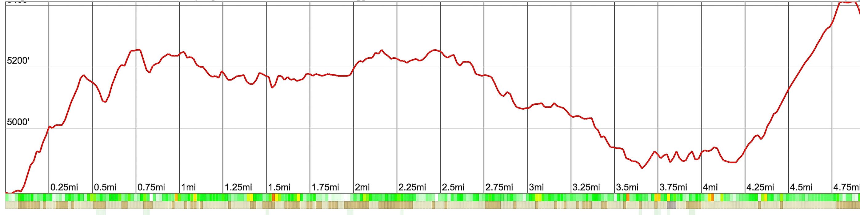 Kepros Mountain Hiking Route and Elevation Profile Trailhead (green circle) begins at summit of Blacks Creek Road from large parking lot. It initially climbs a steep motorcycle track whose tread can be seen on 3 short hills from parking lot. Trailhead at 4,780 feet, summit at 5,422 feet 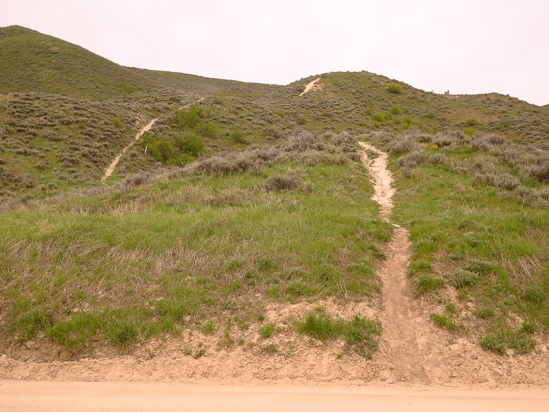 Trailhead for Kepros Mountain looking west - motorcycle trail can be seen on 3 short and steep hills Blacks Creek Road in foreground "Even though age diminishes our physical capacities, it will happen even faster if we don't test ourselves." - Mike Carlson, Five-time Race to Robie Creek Champion Three down and one to go after summiting Kepros Mountain - that is, Fred and I have completed three of the "Grand Slam Peaks" that Tom Lopez describes in his website, Idaho: A Climbing Guide. Lucky Peak, one of the Grand Slam Peaks is our frequent training hike. Cervidae Peak is another that I posted on my website. Kepros is the third. Mount Heinen is the fourth and final peak of the "Grand Slam" we will summit in the next few weeks. 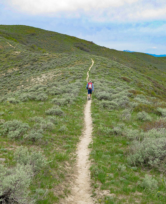 Initial single track trail Top of Shafer Butte north of Boise on distant horizon The ecology in these foothills near Blacks Creek Road may be described as "reference" - an area with mostly native plants that shows us what this land looked like in the past; an area that has not been disturbed. I didn't see many invasive plants and two species of astragalus were healthy. It was a delight to walk on a trail near Boise devoid of cheatgrass, in a landscape full of sagebrush and native grasses. This unmarked trailhead is 11 miles north from the exit ramp off I-84 on Blacks Creek Road, whereupon you reach a summit with a dirt parking area to the right, and the beginning of Kepros hike to the left (see trip stats, above). The trail to Kepros Mountain begins on a single track going straight up 3 short steep hills to the west off Blacks Creek Road. From beginning to end, this hike in late April is a wonderland of green and vivid hues of purple and yellow dotted throughout. Hiking through these sagebrush hills gave me a light feeling of air and space and a renewed appreciation for the landscapes of southern Idaho.   Top off onto ridge after initial steep climb: take a right to hike north along ridge.   Larkspur and Arrowleaf Balsamroot The initial single-track trail winds through a sea of sagebrush over rolling hills and past rusted metal signs and occasional core stones of granite. There are some bypasses around the highest elevations: we took a good one that met up with the ridge jeep trail to avoid more climbing, about 2 miles into the hike on the east (right) of the ridge. The bypass was not at this time marked with a cairn, however, the path it took was clear. At this point we saw our first view of Lucky Peak Lake and Boise to the west. Along most of the hike the snow-capped Trinity Mountains loom on the east horizon. As we climbed, vegetation became even more thick and green. The trail intersects a creek near the summit with pines lining its sloping banks that was tempting to explore. 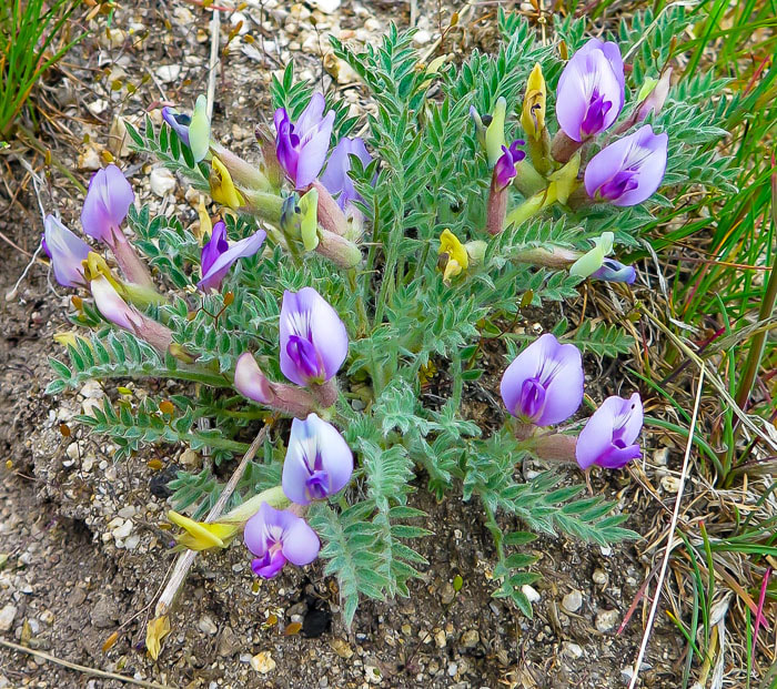 Astragalus purshii 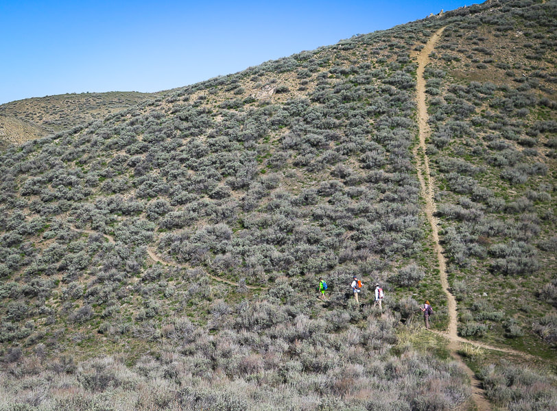 The first bypass. Previous motorcycle tracks go straight up to the top of hills, there are 3 or 4 bypasses along the way to the peak (unless you want extra training!!). 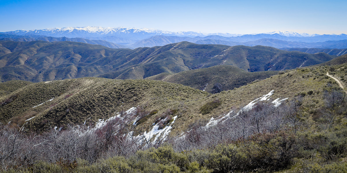 Looking east toward Trinity Mountains 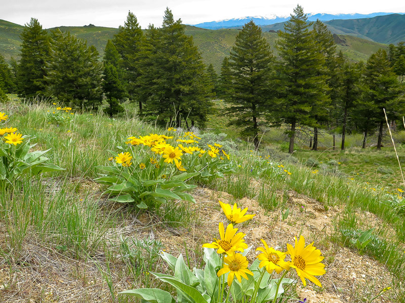 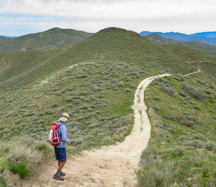 Single track trail meets with jeep trail ~ 2 miles into hike; it stays level, then winds up and down to Kepros Mountain on left-center horizon.  Arrowleaf Balsamroot Balsamorhiza sagittata 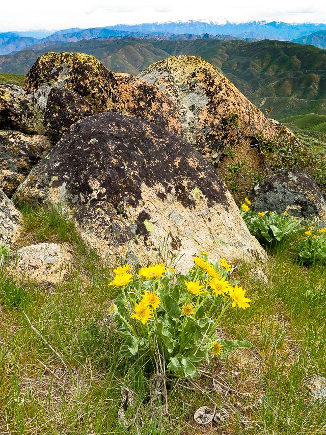 Idaho Batholith granite - Trinity Mountains on horizon 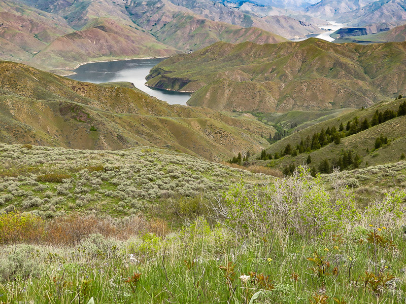 Lucky Peak Lake from summit of Kepros Mountain. 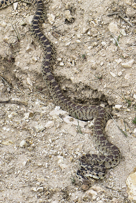 Pretty sure this is a gopher snake - looks like a rattler but this one had no rattle. 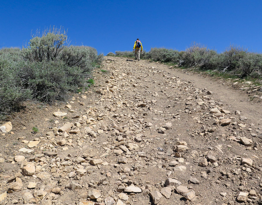 Last steep climb to the summit 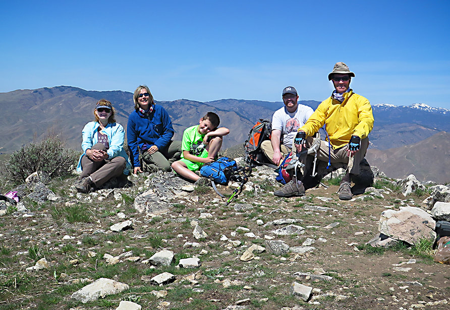 Top of Mt. Kepros - Boise National Forest - April 18, 2021. 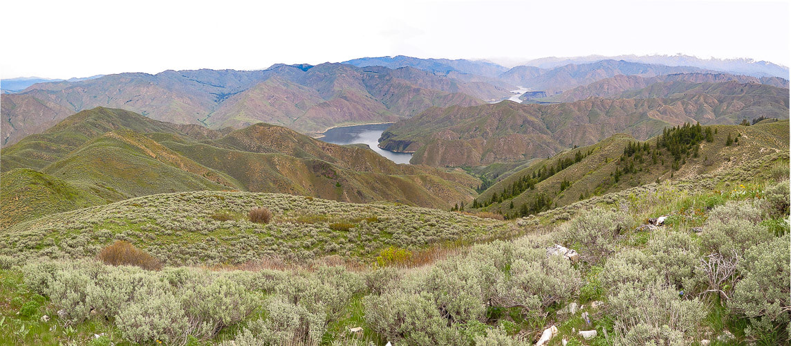 From Kepros Mountain summit looking northeast to Arrowrock Reservoir. George Kepros, according to Idaho: A Climbing Guide website, homesteaded in this area and this is how the Mountain got its name. I looked into the history of this land and found a George N. Kepros, who is buried in Boise died at age 92 in 1973. He may be the man that Kepros Mountain is named after. The final push to the summit is steep. Fred and I hit this summit on the perfect day - high clouds, expansive 360 degree views that we were unaccustomed to seeing, as we hadn't been in this "neck of the woods" before. This perspective of Lucky Peak, a summit we have been on many times, is unique because the north side is so forested - this is not seen from Boise looking at its south slopes. After signing the summit register and enjoying a peaceful break, we hiked the nearly 5-mile trek back to our truck. There's some climbing on the way back. We took the same bypass on the east side of the trail that we took earlier to the single track. So peaceful is this hike, and late April/early May probably the best time to do it. Fall hunting season probably not a good time. So far Kepros is our favorite of the four Grand Slam Peaks - but we haven't hiked Mount Heinen yet. We will let you know what we think after we summit Heinen, the last of the Grand Slam Peaks! 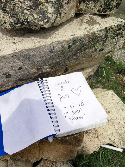 Summit register  Kepros Mountain summit looking west - Lucky Peak mid-horizon  Greg and Kaleb on bypass heading down  Mertensia (Mountain Bluebells) on top of Kepros Mountain
Snowshoe climb to Lucky Peak from Boise River Wilderness Management Area after a March snowstorm.
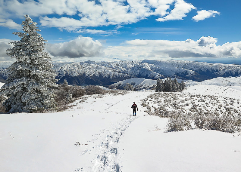 Trekking down from summit of Lucky Peak on southeast ridge Boise National Forest on horizon Trip Stats Overview: This southeast approach to Lucky Peak (AKA Shaw Mountain) begins at the Boise River WMA following a dirt road that travels northwest along creek with burned vegetation from the Mile Marker 14 Fire July 2016. It has less usage and more trees than the Homestead Trail approach from the southwest. It passes an intersection to a road leading to Adelmann Mine, then climbs ridge to the summit. Elk herds and deer often present. Spectacular views of Treasure Valley and Boise National Forest close to Boise. Side trip to Adelmann Mine with historic buildings not far from main road. Difficulty: moderate with no snow; moderate - strenuous with snow. Route-finding skills needed if going off road and onto ridge. Elevation gain: Boise River Wilderness Management Area (trailhead) at 3,624': Lucky Peak elevation 5,904' = ~ 2,280 feet. Lucky Peak Coordinates: 43°36'18.82"N, 116°03'39.98"W. Boise River Wilderness Management Area Coordinates: 43°34'26.7"N, 116°1'18.62"W Map: USGS Lucky Peak quad, 7.5-min series Distance: 7 miles out and back. Directions to trailhead: Boise River WMA is on the west side of ID-21, 6.8 miles from E. Warm Springs Rd. and ID-21 intersection east of Boise. It is a left hand turn to a small parking area with a gate just after Highland Valley Summit if you are heading north. Geology: Granite of Idaho Batholith, Cretaceous age 117 - 62 million years ago. History: Adelmann Mine's primary mineral was gold. Our Hike A good friend commented, after reading my last post on Cervidae Peak, that Fred and I were "lucky" to have Lucky Peak as a training mountain. We've hiked it many times during the 18 years that we have lived in Boise. When we hike "the front side" of Lucky via Homestead Trail, the elevation gain is 3,000 feet and we always try to improve our time. This time we snowshoed what we call the "back side" after a late winter snowstorm. Snow depths varied from a few inches at the trailhead to ~ 12 inches at the summit. A steady breeze from the northwest provided a good headwind for most of the climb. The visibility at the summit was 300 yards, and hard rime ice created by heavy fog coated fir branches and last season's blue-bunch wheatgrass. Fred and I took turns breaking trail through untracked snow. On our way down, the clouds broke revealing a spectacular winter scene with views of the Boise National Forest to the northeast, Lucky Peak Lake to the southeast, and the Owyhee Mountain range to the south. The contrast between the flat, dark Treasure Valley under shifting clouds and the bright white snow of mountains stretching to the horizon was of jaw-dropping beauty, the kind that makes you stop in your tracks. Idaho is an incredible place! 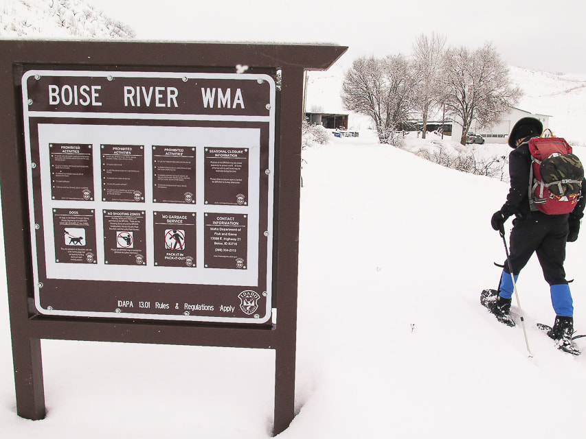 Boise River Wildlife Management Area sign at trailhead at ID Highway 21  Fred at start of ridge climb, 2 miles from trailhead, after intersection with trail to Adelmann Mine. 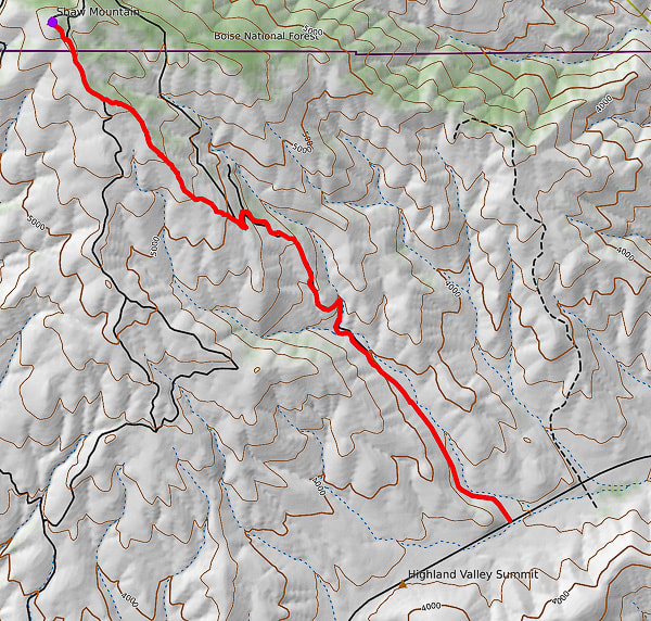 GPS tracks from WMA Headquarters trailhead on ID Hwy 21 to Lucky Peak (AKA Shaw Mountain) Follow road for 2 miles, then onto ridge to summit. 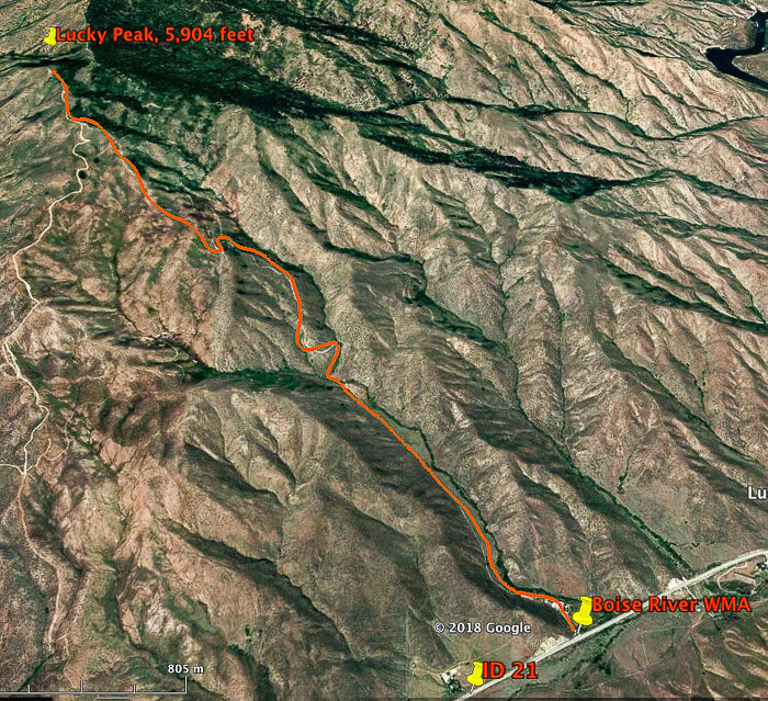 Our route to Lucky Peak (AKA Shaw Mountain) from Boise River WMA on ID Highway 21. This route intersects with Route E. Shaw Mountain Road near the summit (on left). Total hiking distance ~ 3.5 miles to summit with 2,280 feet of elevation gain. This trail begins at the Boise River WMA buildings, following an often-muddy road in a northwest direction, with the tree line of Lucky Peak coming into view in about .5 miles. It crosses a creek, then begins a steep climb for 1 mile to the intersection of the road that leads to the abandoned buildings of Adelmann mine. At this intersection, take the road to the left for a short climb to a ridge overlooking the valley to the south. The road continues to the northwest and can be followed to the summit; it's here that we get off the road and take the more direct ridge route, beginning at two log stumps and a "No Motor Vehicles" sign. We gain the ridge where the snow is wind-blown and not as deep and follow it towards the tree line on the right. Toward the top, there is an intersection with E. Shaw Mountain Road, marked by a wooden birdhouse. Our route continues on this road to an outhouse with the radio towers of Lucky Peak in view, then a short steep climb to the top. 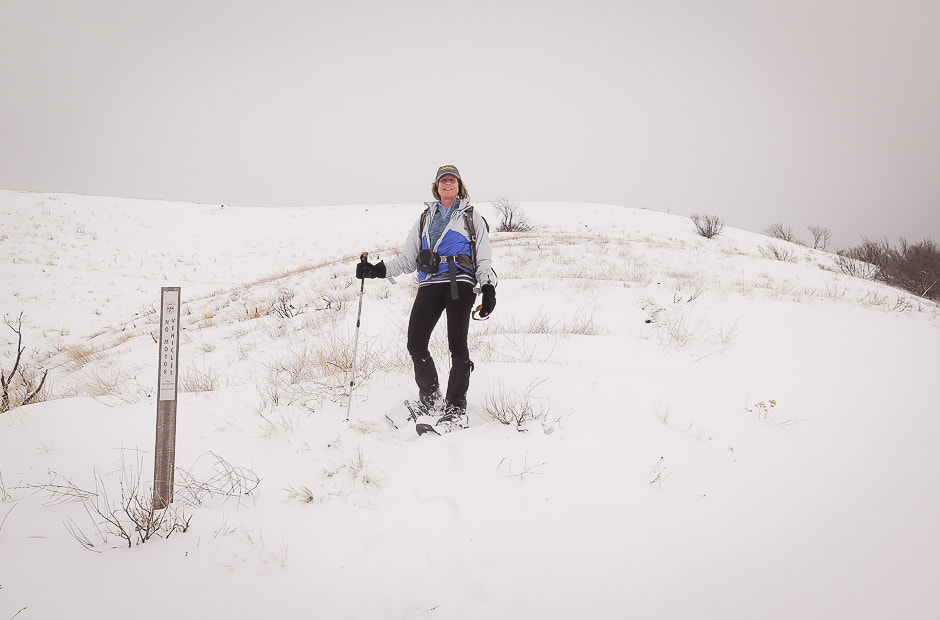 Point at which we leave the road to climb to ridge: this is on a saddle separating Adelmann Mine to the north and Black Hornet Mine to the south 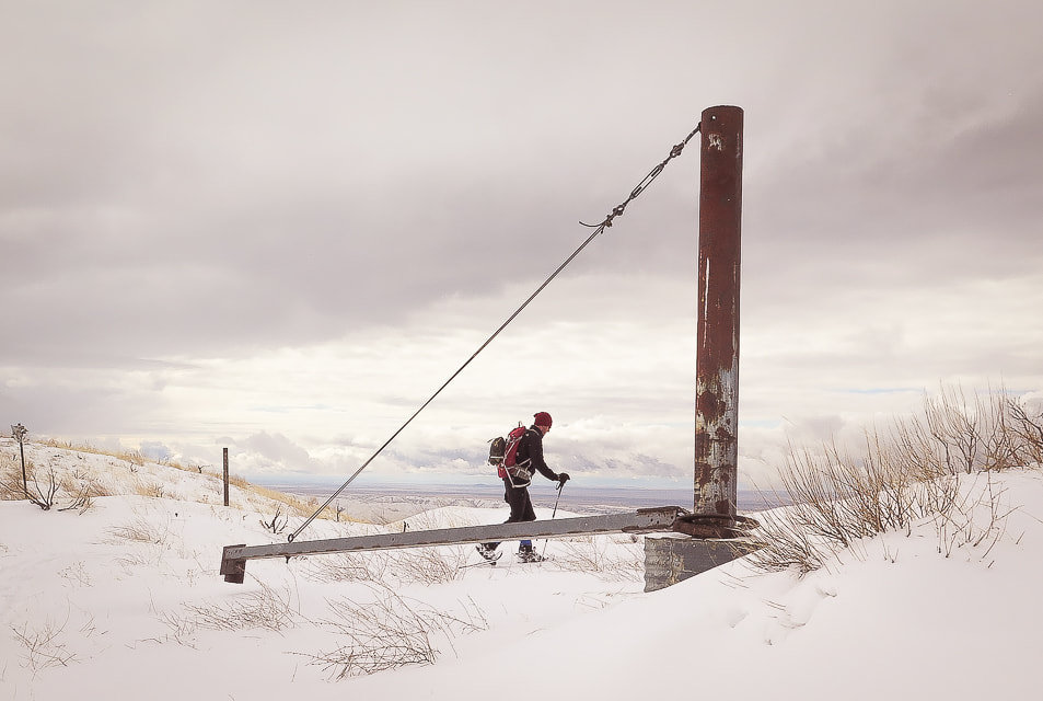 Mine apparatus (?) or gate (?) at ridge between Black Hornet Mine and Adelmann Mine, shortly after intersection of road to Adelmann Mine. This marks the point on our route where we get off the road and climb Lucky Peak's southeast ridge 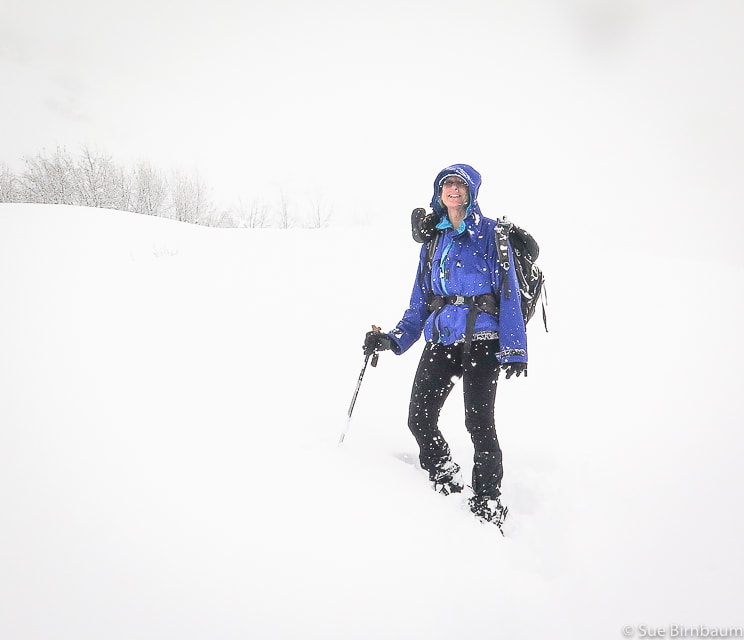 Lucky Peak hike February 2019 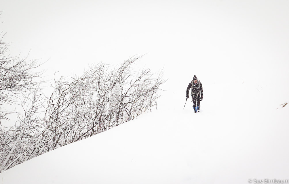 Lucky Peak hike during snowstorm - February 2019  Building at Adelmann Mine 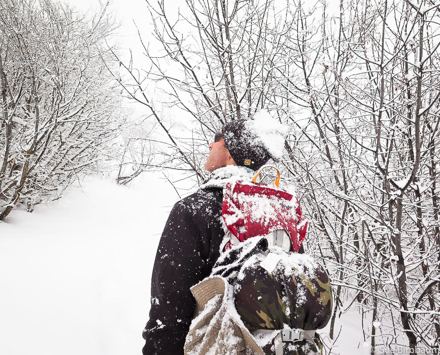 At intersection with road that leads to Adelmann Mine 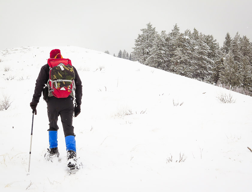 Hike up ridge toward Lucky Peak with trees to the right 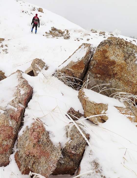 Granite of the Idaho Batholith Hard rime ice had accumulated on the windward side of everything enveloped in the fog at the top. We cleared a place in the snow, sat and ate lunch until we cooled down from the climb. As we hiked down, the clouds thinned, illuminating trees, grasses and shrubs in a golden light, and a little further down we found ourselves in bright white fresh snow, walking toward the dark blue and white peaks of the Boise National Forest. Since Lucky Peak is the highest point for miles around, it gives you the feeling that you are walking above almost everything else. 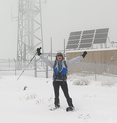 Radio Towers on summit of Lucky Peak - 5,904 feet 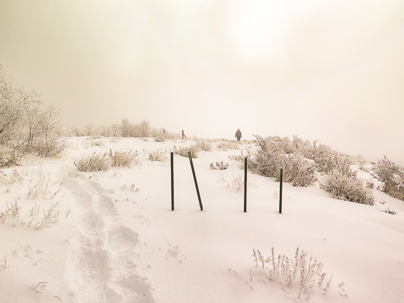 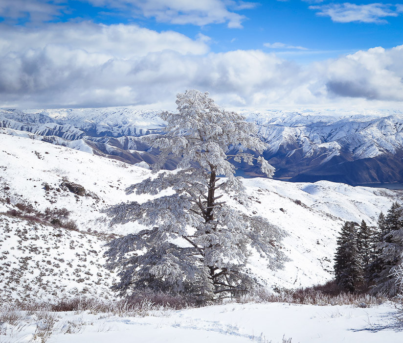 Douglas Fir with hard rime ice at higher elevations on Lucky Peak, looking northeast to Boise National Forest. 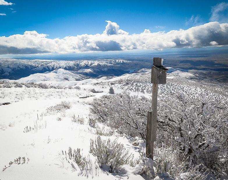 At intersection of our route and Route E. Shaw Mountain Road - follow this road to the summit of Lucky Peak 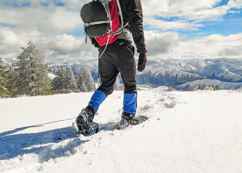 Great views of Boise National Forest and Lucky Peak Lake on the way down 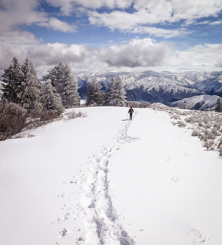 Clouds clearing on the way down- walking toward Lucky Peak Lake and Boise National Forest 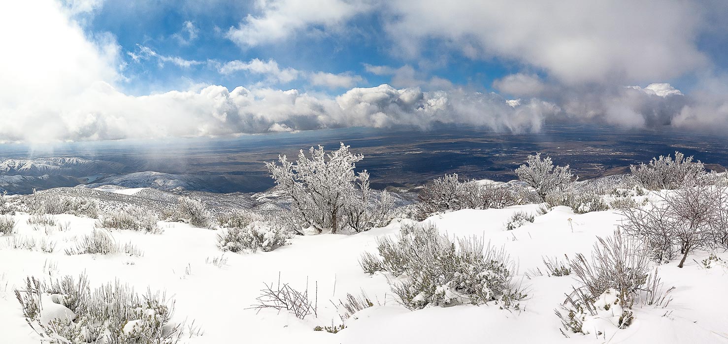 Antelope bitterbrush overlooking the Treasure Valley including Boise, Idaho. 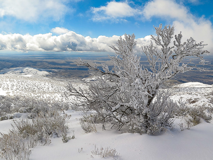  There's lots of advantages to snowshoeing vs. hiking with no snow: vegetation is not damaged, you sharpen navigational and preparation skills, and best of all, quiet and solitude. We went up into the clouds facing a steady headwind and came down in sun and breaking clouds with warmer temperatures. We are lucky in Boise to have the opportunity to experience great snowshoeing treks.
Short and steep hike along ridge overlooking Lucky Peak Reservoir with great views, Boise National Forest
Trip Stats Overview: Trail to Cervidae Peak is only 17 miles east of Boise and traverses along the ridge between Mores Creek to the west and Lucky Peak Reservoir to the south. Vegetation includes bunch grasses, rabbitbrush, antelope bitterbrush and sagebrush. Spectacular views of Spring Shores Marina and Lucky Peak Reservoir to the south, Lucky Peak to the west, and Shafer Butte to the northwest. Distance: 2.3 miles to summit (according to my GPS) Elevation Gain: Trailhead at 3,120 feet, summit at 4,987 feet = 1,867 feet. Add to this ~ 120 feet of elevation due to loss/gain on ridge - Total elevation gain ~ 2,000 feet in 2.3 miles. Coordinates: Cervidae Peak: 43°36'50.66"N, 115°58'26.75"W. Driving Directions: Drive ID-21 north from Boise past Lucky Peak Dam, over Highland Summit. Cross over the High Bridge that crosses Mores Creek with vertical basalt cliffs. Almost immediately after the bridge, turn right on FS-269 that leads to Spring Shores Marina and Atlanta. About 2 miles past the marina, park on the right in a large pull-out. Trailhead at large gate across road. Trail: After passing the gate, the trail starts to the left of a short gravel road, where it contours the bottom of the southeast ridge heading east and then turns to the northwest, gaining the ridge. The trail is well-worn and heads straight up the southeast ridge to the summit. 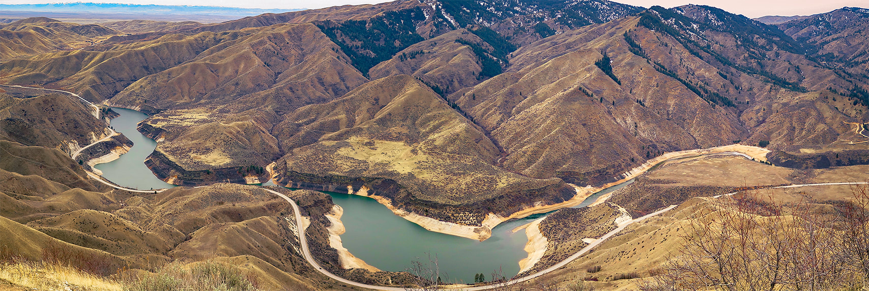 View of Lucky Peak Lake and Lucky Peak from Cervidae Mountain trail 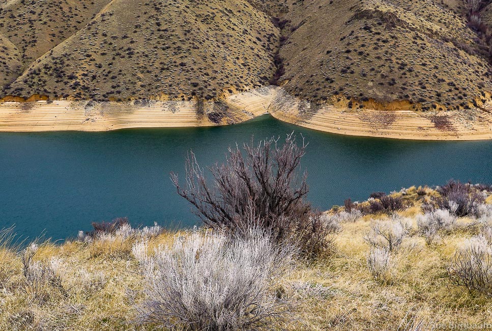 View from east side of ridge Cervidae Peak is one of the 4 "Grand Slam Peaks" that Tom Lopez, author of Idaho: A Climbing Guide describes. The other 3 peaks are Mt. Heinen, Kepros Mountain, and Lucky Peak, all close to Boise. As Tom Lopez does, Fred and I use Cervidae and Lucky Peak to train for our summer mountain summit hikes. We discovered Cervidae when we wanted to add variety to our usual Lucky Peak training. Cervidae Peak is great for a lot of reasons: it's close to Boise, the trail is steep with no switchbacks once you get on the ridge, so you can get a decent work-out in a short amount of time and see some awesome views. It's a great opportunity to get a good view of Lucky Peak Reservoir and identify landmarks at the 360 degree view at the top. The family Cervidae is a scientific classification that includes deer, elk, moose and reindeer. 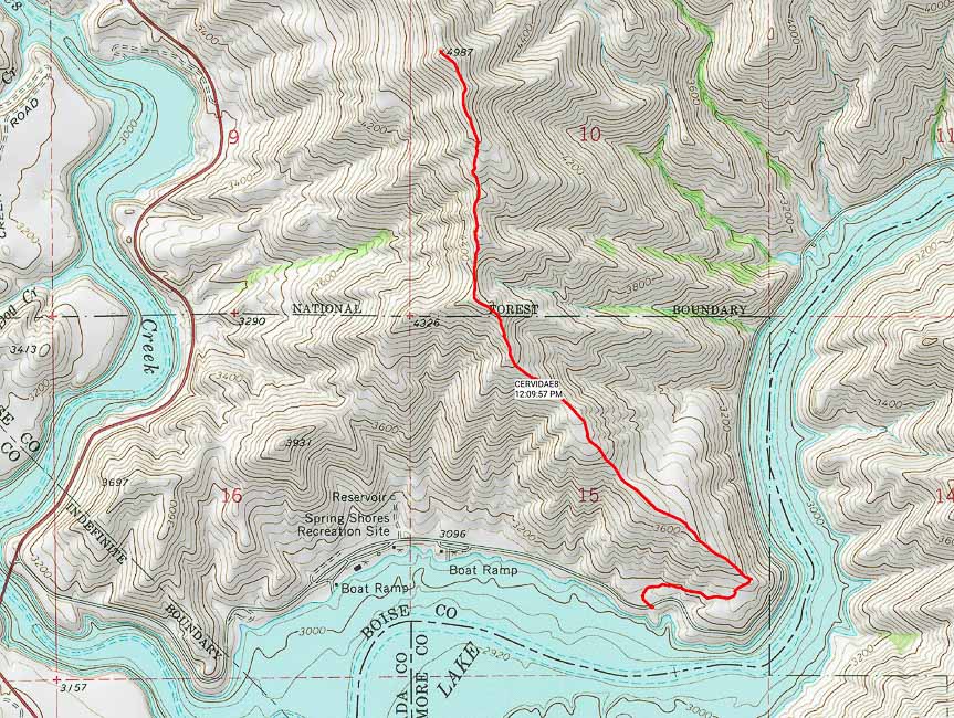 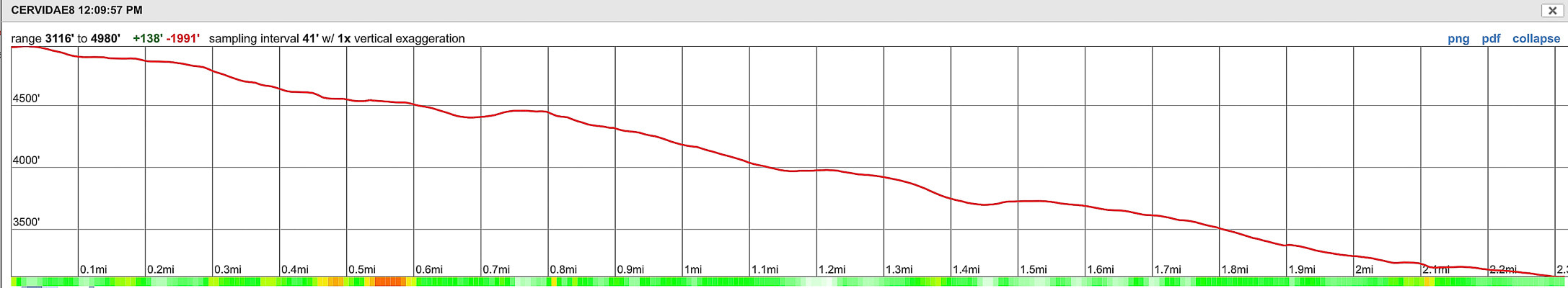 Southeast Ridge route and summit to trailhead elevation profile - Cervidae Peak (4,987 feet) Lucky Peak Lake at bottom of photo - High Bridge over Mores Creek (ID-21) lower left Distance = 2.3 miles one way with elevation gain of ~ 2,000 feet 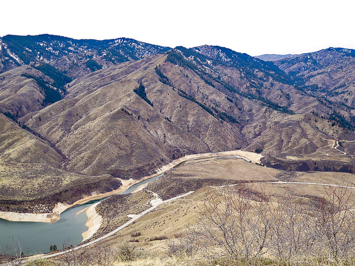 Lucky Peak Reservoir Lucky Peak (high forested peak on left)  Gate at start of Cervidae Peak hike - follow gravel road to right, in about 200 yards, the trail starts on the left side of the road History The Lucky Peak Dam was built in 1955 to be included in the system of flood control and use of irrigation water from the Boise River. This was done mainly as an assurance to water users of the Boise River system that their supply of water would be protected and the Arrowrock Dam and Anderson Ranch Dam above the Lucky Peak Dam could be drained down during flood control measures. It was a way of adding water capacity; building Anderson Ranch and Lucky Peak reservoirs were moves toward multiple-use reservoirs. The Reclamation Service, a U.S. Federal government agency started construction of Arrowrock Dam, a few miles further upstream from Cervidae's trailhead on the Boise River for the purpose of storing water for irrigation in the early 1900's. Arrowrock Dam was dedicated in 1915 by Reclamation; it was the tallest dam in the world at that time and 4,000 people gathered to witness the dedication. The report, History of Boise River Reservoir Operations gives a great history and overview of management of the Boise River. Geology Large granitic intrusions during Cretaceous time (144 - 65 mya) that formed the Idaho Batholith make up the bedrock of Cervidae and the upper Boise River drainage. Cervidae Peak can also be summited from its west ridge; it's near this access where basalt dikes that cut through the granitic basement are seen along the east side of ID 21 a few miles past the high bridge that spans vertical basalt cliffs. 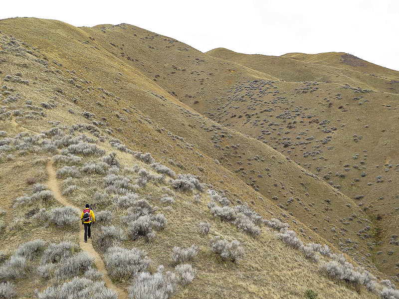 No switchbacks here - Cervidae is on right side of ridgeline 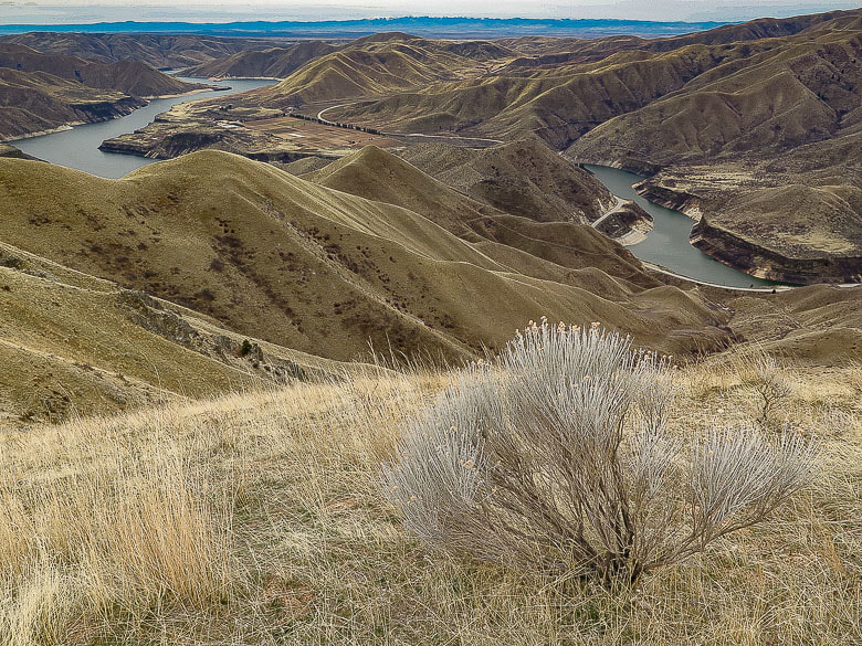 Native Grey Rabbitbrush and bunchgrass overlooking Lucky Peak Reservoir Owhyee Mountains to the south on far horizon Most of the trail is steep and it's about all that you can see in front of you at times, but then you get to a rise on the ridge and see expansive views. About 3/4 of the way up this trail, the trail from the west side of the ridge intersects. This trail is accessed from Highway 21 and provides a more direct hike to the summit. The trail loses some elevation near the summit only to regain it, followed by less steep terrain toward the top. We found a register at the summit pile of granite. A steady, bitter cold breeze had made us cold despite having climbed almost 2,000 feet. Surprisingly, the summit was calm but cold. Looking toward the northeast, we tried to identify Mount Heinen, a climb on our spring bucket list. We did this hike with 2 friends a couple of summers ago - in the afternoon! Not the best time to do this hike - it was hot and there's no shade. This is a good late winter/early spring hike. 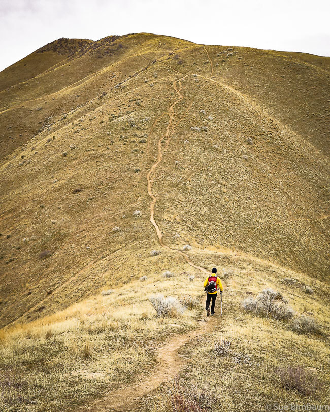 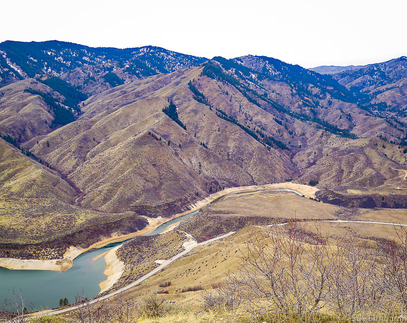 View of Lucky Peak (far left) ~ 900 feet higher in elevation than Cervidae Peak Lucky Peak elevation = 5,904 feet 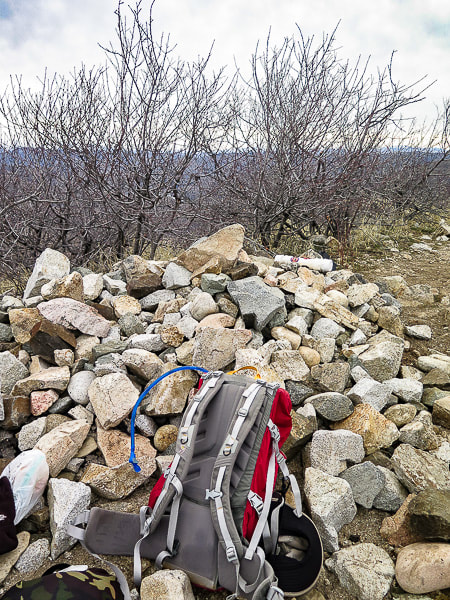 Cervidae Peak summit - 4,987 feet 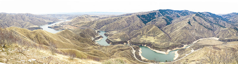 References
Bliss, James D., and Phillip R. Moyle. 2001. Assessment of the Sand and Gravel Resources of the Lower Boise River Valley Area, Idaho. U.S. Dept. of the Interior - U.S. Geological Survey, 41 pages. Idaho Batholith: Idaho's Natural History Online from Idaho Museum of Natural History/Idaho State University. Retrieved from: http://imnh.isu.edu/digitalatlas/geo/bathlith/bathdex.htm. Othberg, Kurt L. and Willis L. Burnham. 1990. Geologic Map of the Lucky Peak Quadrangle, Ada County, Idaho. Idaho Geological Survey, University of Idaho, Moscow, ID, 13 pages. Stevens, Jennifer. 2015. History of Boise River Reservoir Operations, 1912-1995. Stevens Historical Research Associates, 67 pages. This post is about a hike to Johnstone Peak near Ketchum, Idaho in October, 2016 in dedication to Henry Brown who passed away August 4, 2016. 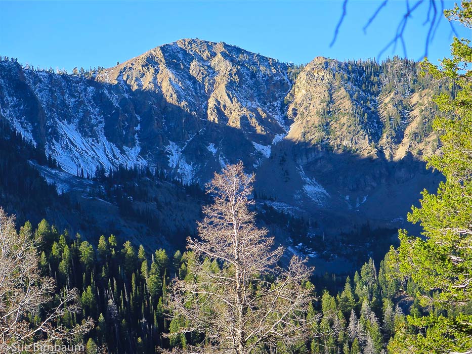 Johnstone Peak, Ketchum, Idaho - elevation 9,949 feet On our autumn hike last weekend to Johnstone Peak near Ketchum, Idaho, Fred and I were making our way through a pine and fir forest toward a summit of rocks silhouetted against an azure sky. We startled some elk that were grazing in the forest ahead of us so they quickly moved up toward the peak. Suddenly, we heard a bull elk bugle and saw what appeared to be its harem - 5 cow elk walking single-file above us on a talus slope, rocks clinking under their hooves. What an eerie sound! The bugle starts deep within the elk’s throat, quickly rises to a nasally high-pitched whistle, then ends in a grunt. We stopped on the fresh elk trail we were following to spot the bull elk, but we never saw it. 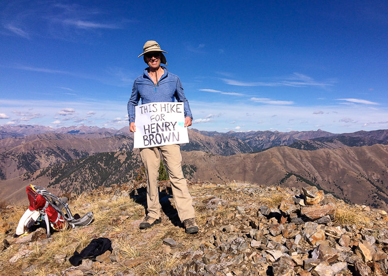 Johnstone Peak summit near Ketchum, Idaho 9,949 feet As we stood on this trail, the musky smell of elk around us, and the fresh elk tracks carved into the dark soil moist from the season’s first snow, we wished Henry Brown could have been with us, although we could feel his presence. He would have been excited about the bugle and halted with us while we whispered and waited for another bugle. Henry loved being in the wilderness and he loved elk hunting. If only he could be with us – but reality hit us swiftly and sadly. We would never get to be with him again. I unzipped my backpack and saw the folded sign Fred and I had made the evening before that read, “This Hike for Henry Brown”. 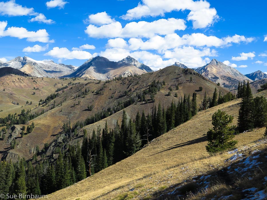 Pioneer Mountain range from summit of Johnstone Peak 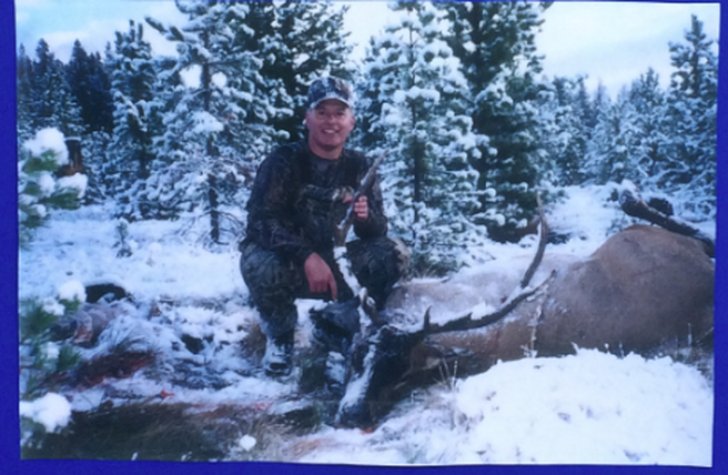 Our good friend, Henry Brown passed away in August 2016 after a fearless fight with cancer found to be in his lungs earlier that year. Henry had faced many challenges in his life. He graduated from West Point Military Academy and raised two daughters, each of whom are Army officers and attended West Point. Henry’s long career sent he and his wife, Helen Joyce to many places in the U.S., but nothing would compare to the battle and challenges he endured in 2016. Henry and Helen Joyce were thrilled to be moving back to Idaho two years ago when he accepted a human resource job in Hailey, Idaho. Fred was even more excited that Henry was coming back to Idaho, for now they could hunt together again, as they had done 12 years ago when Henry and Helen Joyce lived in Boise. Helen Joyce chronicled their struggles through this ordeal on Facebook. She told us about the good news, the bad news, the ups and downs, the surgeries, the optimism and hopefulness. And in the photos, Henry was in his usual positive get-up-and-go attitude, smiling while he was in the hospital or recovering, or walking with a therapist to rehab after a stroke he suffered after one of his surgeries. Once again, Henry worked hard and he didn’t give up. Both hunters and military men, Henry and Fred formed a quick friendship 16 years ago when they met while working at Boise Cascade in Boise. They naturally “hit it off” because each was an Army veteran and each liked to spend time in Idaho’s wilderness. Quickly, their conversations turned to deer and elk hunting, and Henry, the experienced rifle and eventually bow hunter, invited Fred along on a deer hunt in Idaho. Fred told two hunting stories at a reception that Helen Joyce had for Henry the day before our Hike for Henry Brown. In one story, Fred told a humorous account of Henry’s reaction to a burned-up Coleman camping stove. After a long hunting day, they were keen to enjoy a hot dinner cooked on the truck tailgate when propane leaked from the valve and the whole stove caught on fire. After Fred stomped it out, Henry exclaimed, “Fred, that was interesting!” In another story, they had been hunting for 2 cold and rainy days, and hadn’t seen any elk. When Fred asked Henry what the chances seeing elk in that kind of weather were, Henry replied, “Well, Fred, if we leave the forest now, we have zero chance of getting an elk!” 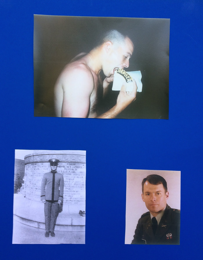 Henry celebrating completion of Ranger School (top photo), and at West Point 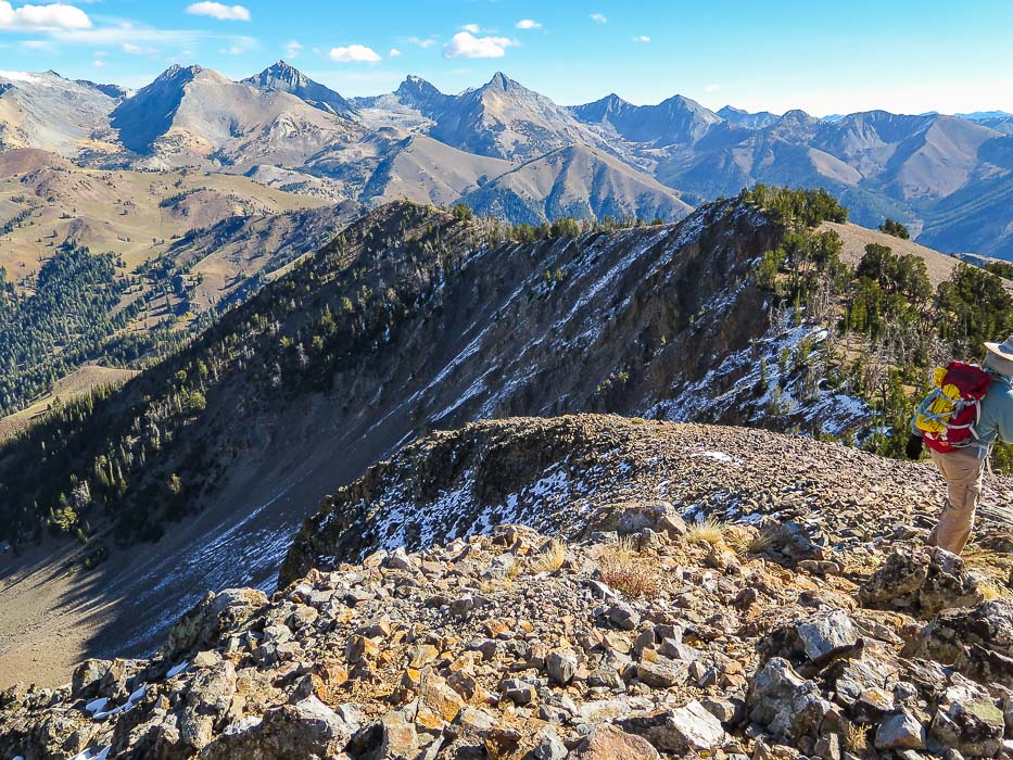 Descending Johnstone Peak - Pioneer Mountains on horizon 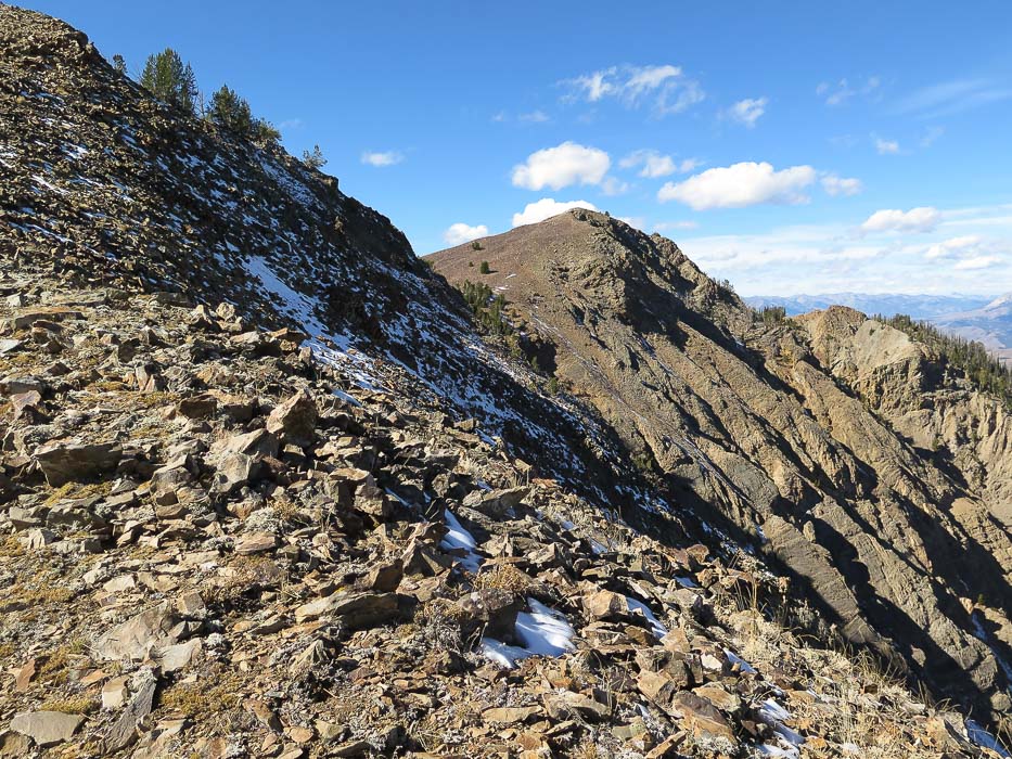 On the hike down from Johnstone Peak We waited a few more minutes on the trail to hear another bugle, but we did not, and the cow elk had moved high up the ridge, finding a place to hide from us. Once upon the summit, we took photos of each of us holding our sign, “This Hike for Henry Brown”. Now we were quiet, we felt Henry’s spirit around us, through the air, the sunshine, the trees, and the rocks. We remembered Henry, each in our own way while absorbing the incredible view that lay before us of the steep and rugged Pioneer Mountains to the northeast. The dark purple shadows in the deep, loose-rock gullies that run in jagged lines from top to bottom held white patches of snow. Sadness weighed me down from the usual jubilance and satisfaction I feel from summiting a peak. The sign I held for Henry Brown grounded me, pulled me down onto the rocks, down to reality. But I also felt happiness from having known Henry and our hikes together. I am forever grateful for his words of encouragement as I met the challenge of starting a new career, and the overhaul he gave my entire resume’. And there were those two games of ping-pong at Rickshaw restaurant in Ketchum while we waited for our table (maybe he let me win one). On top of Johnstone Peak that day, there were no bugs, no wind. The light mountain air surrounded us and gave Fred and I space and warmth to ponder memories and talk about how brief our lives are here on this beautiful Earth. We packed up our leftover food and water, our jackets and the sign, and charted a return route down the mountain. As we descended the summit pile of rocks and walked onto the grassy saddle before the next rise on the ridge, I looked up to see a golden eagle making slow wide circles against the sky. This was an unusual sight, for we often see hawks and less often eagles. Henry would have appreciated the markings under its huge wingspan and its graceful flight. We watched it circle and move on, and we moved on ourselves, the sun closer to the horizon. Time passes. I had a fleeting thought that maybe Henry’s spirit was soaring above us, and this would not surprise, for Henry seemed to have spirit that transcended. I’m sure we’ll climb Johnstone Peak again more than once, and each time we are back on its summit, we will always remember our Hike for Henry Brown. And I will always be looking for the eagle. 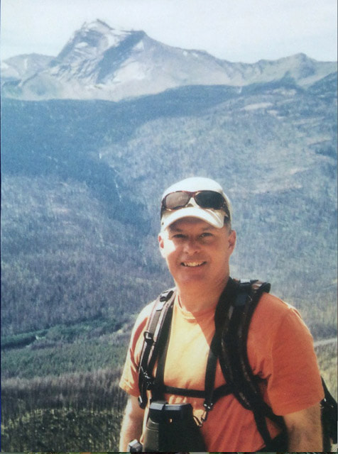 Henry Brown
11/3/1959 - 8/4/2016 The snowshoe hike to Sunset Mountain Lookout from Mores Creek Summit north of Idaho City, Idaho allows for solitude and beauty on the way to the deep snow of the summit. You will work to get there, but the spectacular view at the top is worth it. This explorumentary features photos from multiple hikes throughout the years Related: Silver City, Idaho Snowshoe 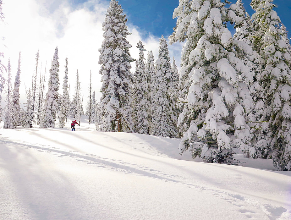 Trip stats
Hike Directions
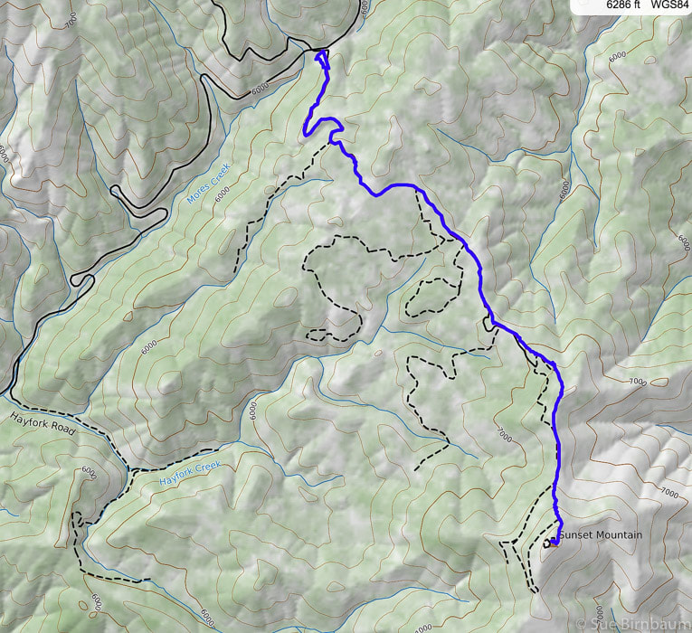 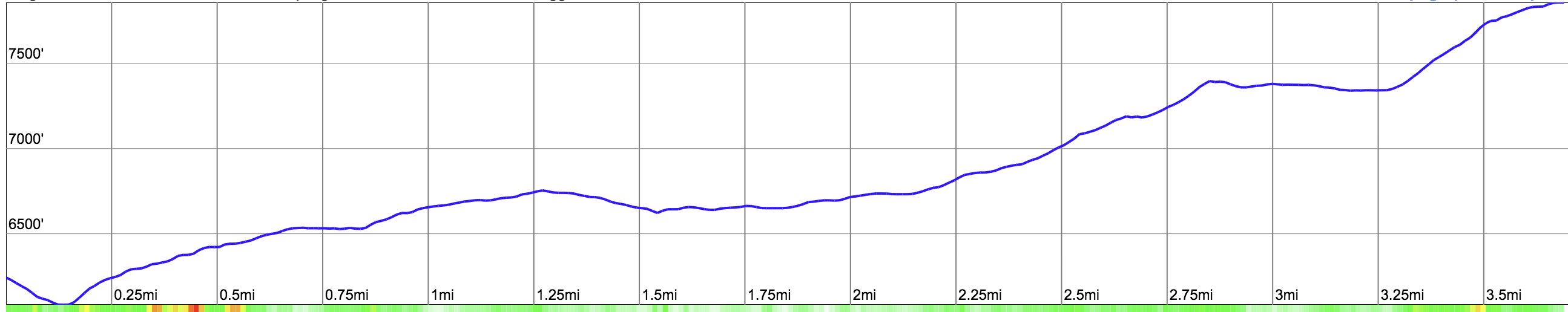 Our route and elevation profile from ID 21 parking at More's Creek Summit to the summit of Sunset Mountain Lookout (blue line). Most of hike follows Sunset Mountain Road (FR #316) We follow the forest road, then climb to ridge and go south, short-cutting the road and head straight up last approach (0.75 miles) to summit. 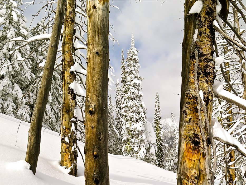 Eighteen years ago, on our first snowshoe hike to Sunset Mountain Lookout, we ran into a skier coming down from the mountain. He said, as he turned and pointed, "turn left at the tall fir tree when you get to the clearing at the top of this rise." It was a bright sunny day and one of our first snowshoe hikes in Idaho. Every time I do this hike, I remember those directions and that tree, although we know the route so well after having hiked it once or twice a year for 18 years. Over the years, the snow-filled parking lot at Mores Creek Summit, which is plowed, has more and more vehicles and trailers of snowmobilers, skiers and snowshoers. This is where two trailheads are located. The snow machines mostly run on the trail to Pilot Peak, on the north side of ID 21, as well as some skiers, while most snowshoers go up to Sunset Lookout on the south side. Getting up over the berm of snow from the parking lot and onto Forest Road #316 is a bit steep, but once you find the tracks and groove of the road, it climbs at a moderate incline. It heads south and southeastward up and then down a wide creek valley, then up to a clearing at the top of a ridge where the road then heads to the left (northeast) briefly before heading through the forest in a southeastward direction. The first view of Sunset Mountain Lookout can be seen - the building a small speck on the highest rise to the south. 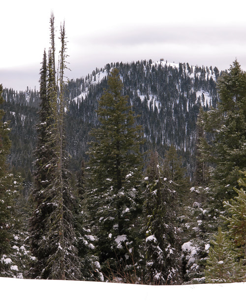 First view of Sunset Lookout to the south - building on top of mountain with clearing of trees at its base After this clearing, the trail descends briefly and is level for ~ 0.5 miles before it begins to climb again. Clearings show the immensity of the Boise National Forest to the northeast, with mountains, deep valleys and tall trees with snow-covered branches. The only sound on this hike is our snowshoes crunching through the snow; the forest is blissfully quiet. The last half of the hike is a steady climb that gets steeper as the road approaches the lookout. We short-cut the road and switchback straight up the open, steep slope just below the final rise to the lookout. Once up this steep rise, we meet with the forest road and follow it more or less the last few hundred yards to the top. This winter’s snowshoe hike to Sunset Lookout proved to be one of the most spectacular trips this season because of record snowfall in Idaho and a recent storm that provided 5 inches of new, fluffy powder over a firm base. On the last 1/2 mile to the summit, we followed a skier’s track that made small switchbacks up the steep, final face to the top, where an expansive 360-degree view of white and grey mountains surrounded us. The fir trees were white, too, with only a few inches of green showing beneath branches under thick snow cover. Grey clouds floated by us, now and then obstructing our view. It was a surreal scene that not many get to witness.  Beth and Fred on trail to Sunset Mountain Lookout 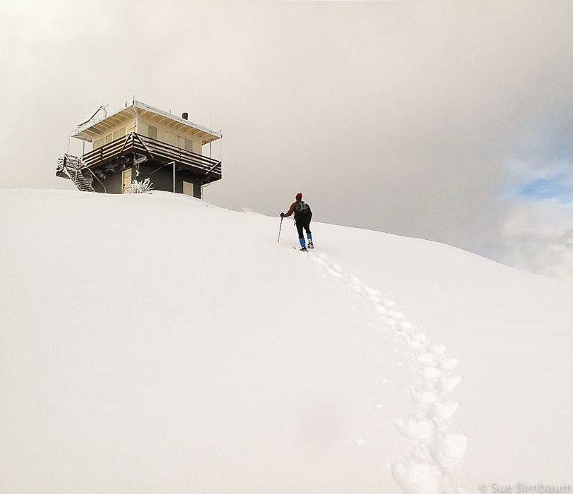 Sunset Mountain Lookout - 7,869 feet - 4 .0 miles one-way from ID 21 to lookout - 1,700-foot elevation gain Fred and I make this trek every winter. We rarely see others, except the occasional backcountry skier. Once away from the parking lot, the noise from the snow machines that run to Pilot Peak on the other side of the summit quickly dies away. Once we saw a snowmobiler, by himself near the top of Sunset Mountain years ago. We dug him out of a snow hole.  After an initial climb for 1.5 miles, the hike levels out as it traverses across a broad, flat area through a Ponderosa pine and Douglas fir forest in a southeasterly direction. A break in the forest allows a first glimpse of Sunset Mountain Fire Lookout. At about 2 miles, you find yourself on a ridge overlooking a stunning valley with the Boise National Forest at your feet. Unfortunately, much of this area was burned in the Pioneer Fire in August 2016. As the trail starts to climb again, you can choose to stay on the path the road takes leading to the right, or stay on the ridge with steeper hiking to the left (east of forest road). Further up, ridge and road meet at a small flat area where the top of Sunset Mountain finally comes back into view. This is where the real climbing begins. We hike straight up the final mountain face, instead of taking the gentler, longer road to the top. 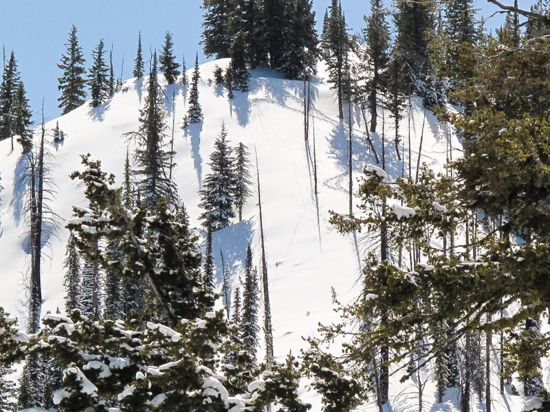 Final steep approach to return to high road near summit - switchback to the right of the face near forest This steep approach climbs 500 feet in 0.25 miles 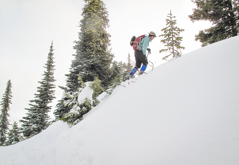 Ascending the last steep pitch just below Sunset Fire Lookout  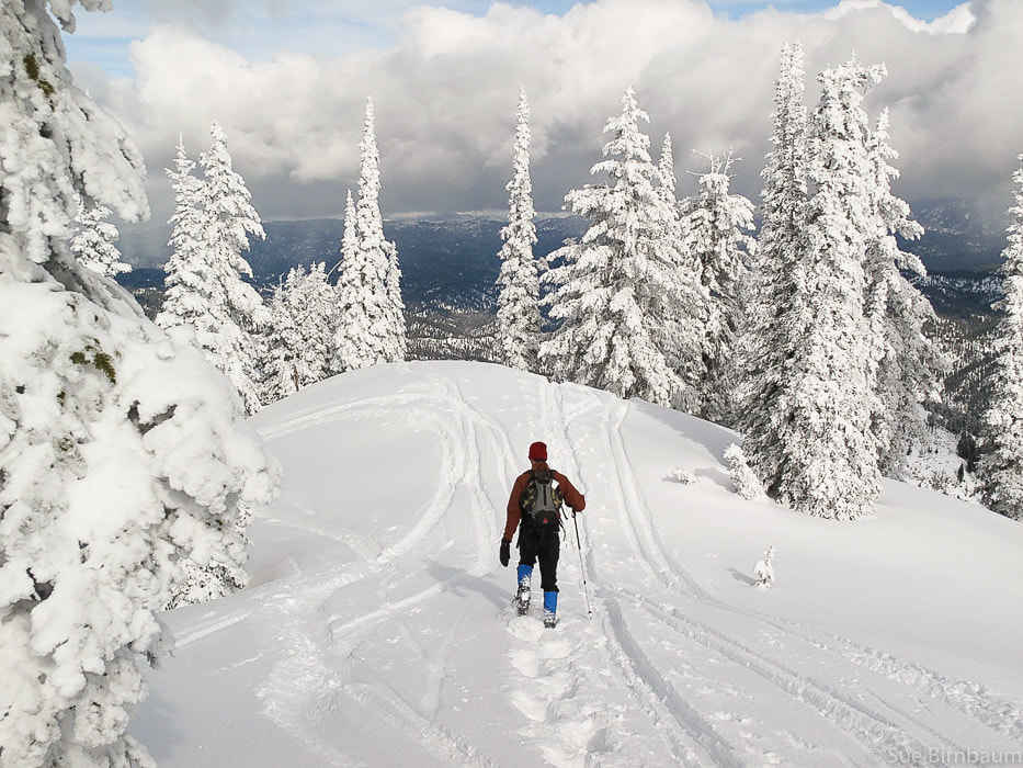 Once on top, the breeze is colder and the snow is deeper, for the elevation at the fire lookout, which is manned in the summer is 7,869 feet. The incredible view of multiple mountain ranges is worth the effort. The edge of the Sawtooth Mountains can be seen toward the northeast. We wish we could hang out at the top longer on those winter days. We decide to get some pie at Trudy’s Kitchen in Idaho City. We’ve definitely earned it. The thought of warm home made apple pie and the stinging in our hands motivates us to start descending the 1,700 feet down to the parking lot. 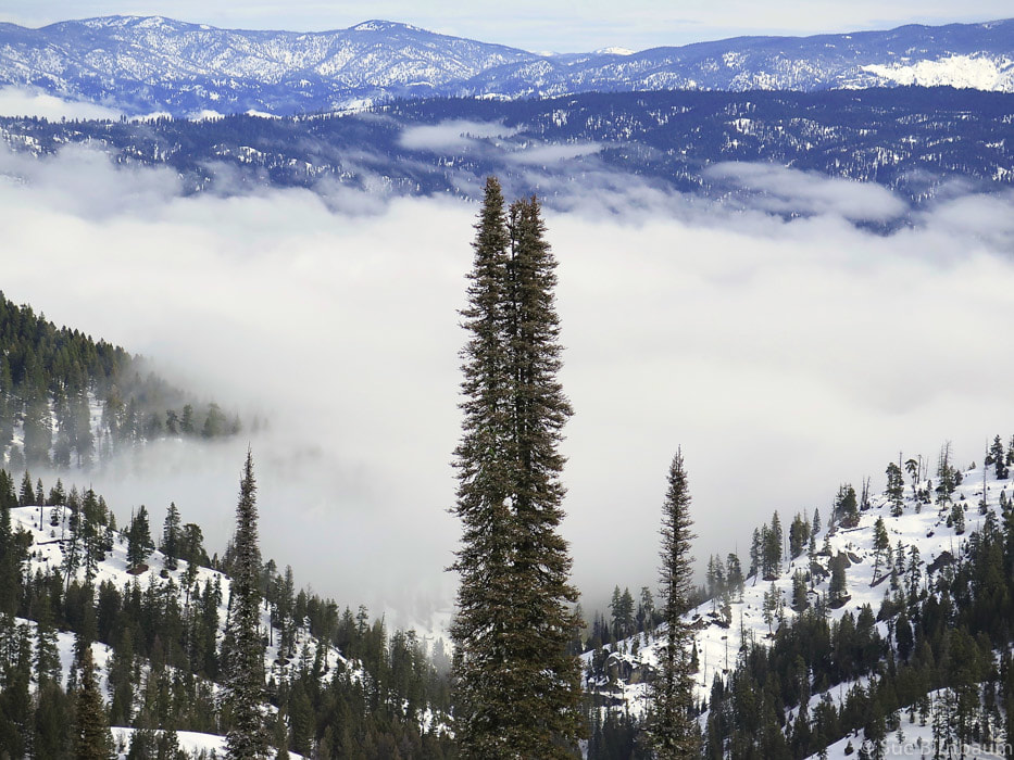 Looking east over Boise National Forest ~ 2 miles into hike 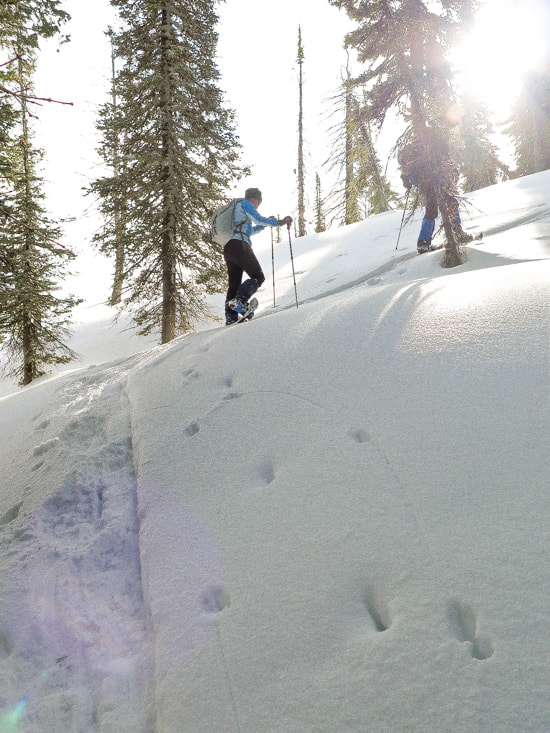 Steep final approach short-cutting road to top  Final climb to summit lookout - back on road after steep climb that bypasses road 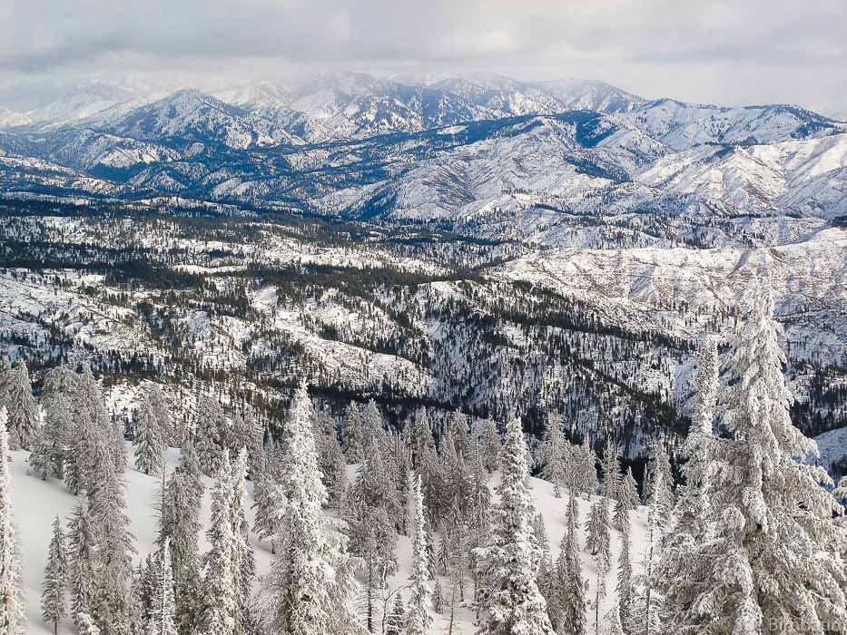 View of Sawtooth Mountains in the distance from top of Sunset Mountain Lookout 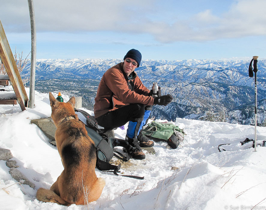 You never know who you're going to meet on the top of a mountain 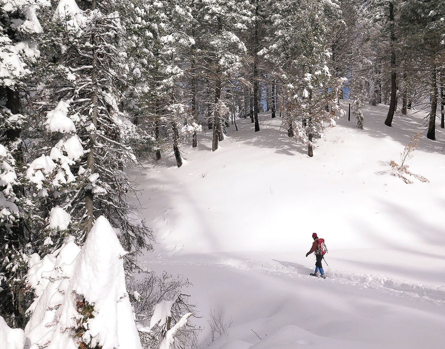 Walking back to trailhead   Hike to summit of Alpine Peak, 9,861 feet in Sawtooth Wilderness, with close-up views of Mount Regan and beautiful Sawtooth Lake. This explorumentary was written in 2013 For account of our latest summit climb of Alpine Peak August 2019, check out Alpine Peak, 9,861' - Sawtooth Wilderness - Never Stop Climbing Mountains 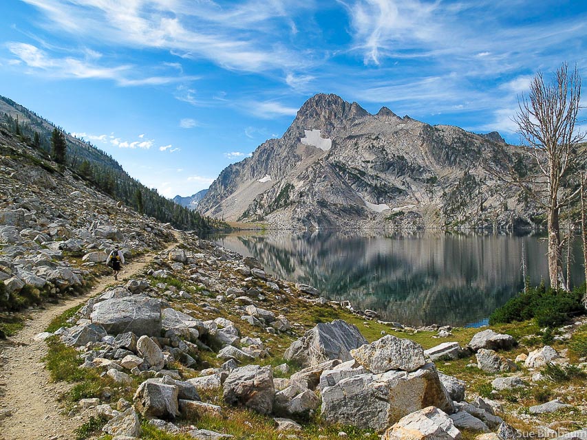 Mt. Regan and Sawtooth Lake, Sawtooth Mountain Wilderness In one of his commentaries from the TV show 60 Minutes, Andy Rooney advised listeners to “never stop climbing mountains”. In this segment, Rooney describes how he climbed Pilot Knob Mountain behind his cottage on Lake George in New York 4 or 5 times each summer during his childhood. One time, he and his friends got bored with the trails that led to the top, so they decided to make their own trail and head straight up the front of the mountain. The problem with this strategy, he said, was that they were never really sure which way was up because they had to hike up and down ridges and valleys, instead of a steady trail climb. 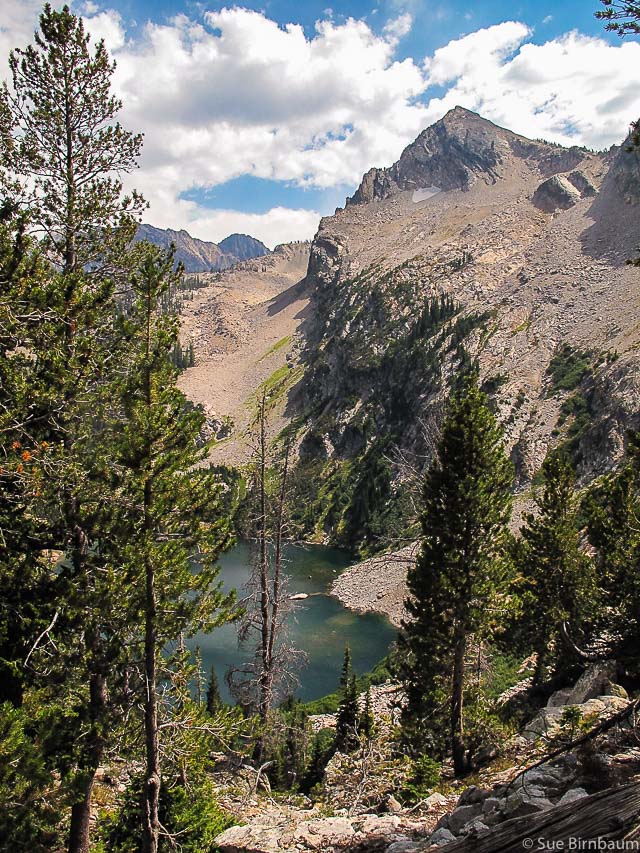 Alpine Peak, Elevation 9,861 feet, as viewed from Iron Creek Trail #640 Yesterday, Fred and I took Rooney’s advice for the fifth time this summer, and set out to climb Alpine Peak, a relatively “easy” hike up one of the major Sawtooth Mountain peaks. At an elevation of 9,861 feet, so much can be seen at the top: the large blue gorgeous Sawtooth Lake, Stanley Basin, and a great close-up view of the vertical cliffs of Mt. Regan. The approach to the foot of Alpine Peak is a 1,700 foot elevation gain, 5-mile hike to Sawtooth Lake. After hiking along the lake, you leave the trail and head straight up the granite talus slopes to the top, a gain of 1,400 feet in less than a mile. The route we took up was very steep, requiring us to grab stable rocks or trees to hoist ourselves and to not fall over backwards. 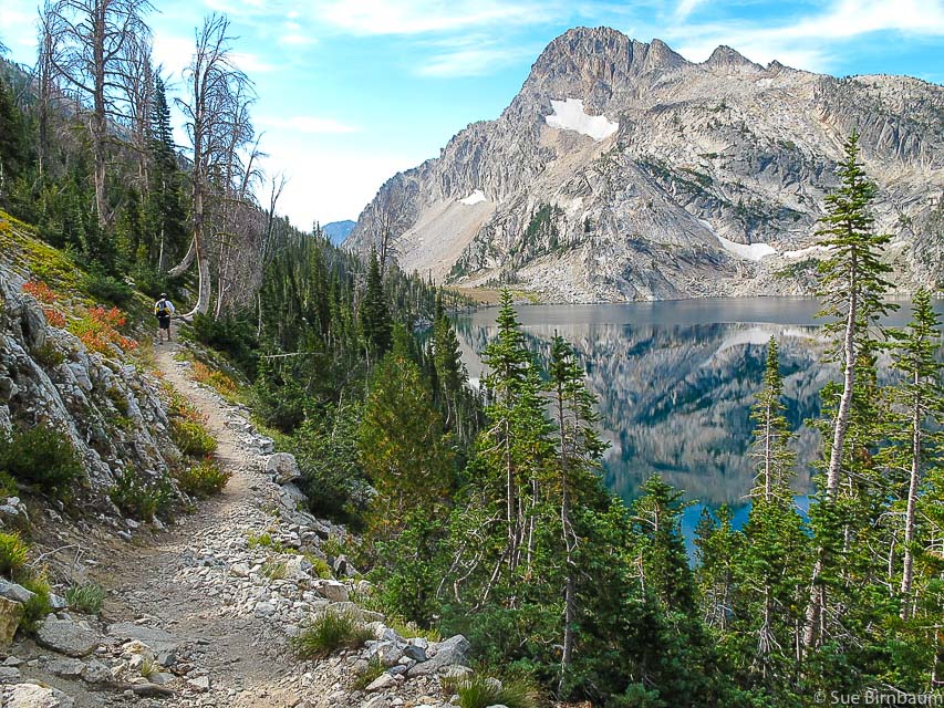 Trail # 478 on east side of Sawtooth Lake with impressive view of Mount Regan Alpine Peak is located ~ 1 mile northeast of Mount Regan 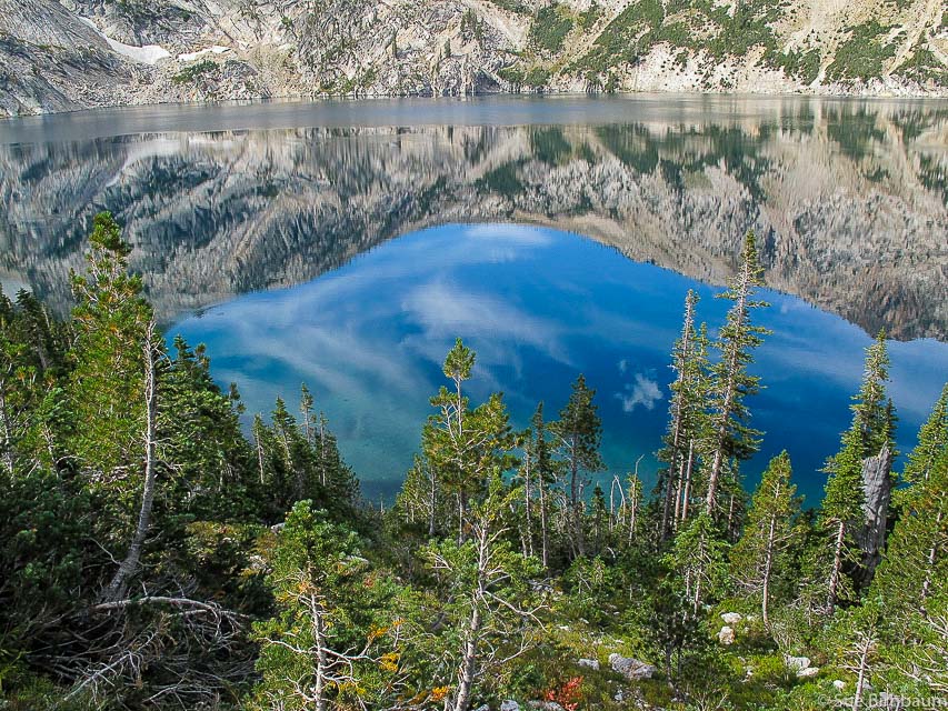 Sawtooth Lake 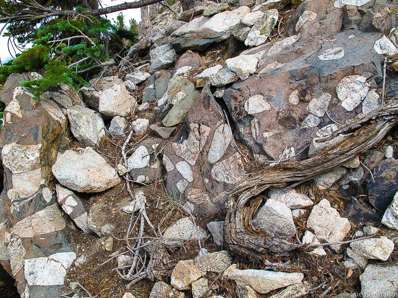 Matrix-supported conglomerate 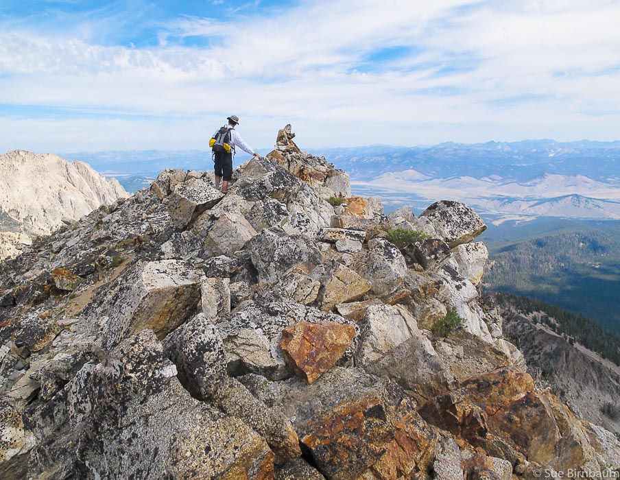 Alpine Peak summit overlooking Stanley Basin 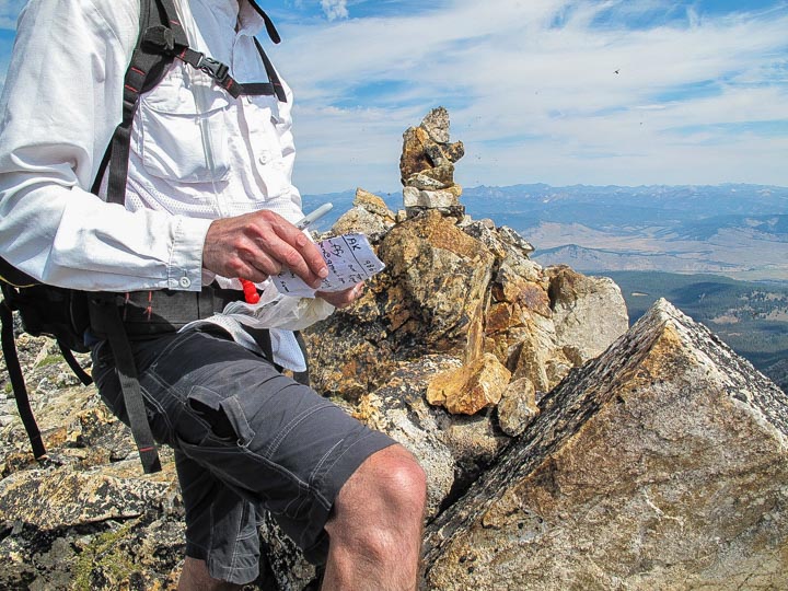 Register at top of Alpine Peak Stanley Basin in background 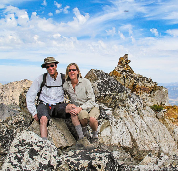 Fred and Sue on top of Alpine Peak, Sawtooth Mountains, 9,861 feet The Sawtooth Mountains were carved by glaciers during Pleistocene time, about 14,000 years ago, scraping striations in rock and carrying away huge amounts of glacial debris that formed many moraines (an accumulation of various -sized rocks that form hills) in the area. There is no easy way down these mountains, only routes that look easier than others. We decided to hike along the ridge and angle our way down a talus slope. It was less steep than our ascent, but still tedious as we did some boulder-hopping and talus-sliding. This is an exercise in patience, not to mention helping to improve our balance! 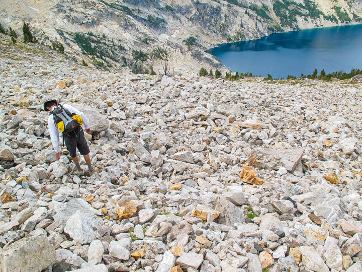 Lucky we are to be able to climb these peaks. A quote I always remember when I am hiking a mountain is an inscription carved in Greek, found on a summit rock in the Alps by a Swiss adventurer in 1558 that says, "The love of mountains is best." After a hot hike back to the truck, a chocolate ice cream sandwich, cold beer, and dinner, we slept soundly in our trailer at the campground.
|
Categories
All

Sue and Fred

About this blogExploration documentaries – "explorumentaries" list trip stats and highlights of each hike or bike ride, often with some interesting history or geology. Years ago, I wrote these for friends and family to let them know what my husband, Fred and I were up to on weekends, and also to showcase the incredible land of the west.
To Subscribe to Explorumentary adventure blog and receive new posts by email:
Happy Spring!

About the Author
|